460 entries match your criteria. Entries 201 through 300 are listed.⊲ Previous 100 — Next 100 ⊳
Former U.S. Presidents: #18 Ulysses S. Grant Historical Markers
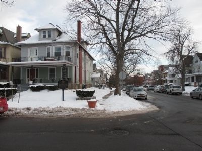
By Anton Schwarzmueller, January 17, 2015
Southward - Fargo Avenue
201 ► New York, Erie County, Buffalo, Front Park — William G. Fargo Mansion — 1867-1900 —  |
| On Jersey Street at Fargo Avenue, on the right when traveling east on Jersey Street. | |||
| 202 ► New York, Genesee County, Pembroke — General Ely Samuel Parker 1828-1895 — "Do-Ne-Ho-Ga-Wa" Grand Sachem Chief — "Keeper of the Western Door of the Long House of the Iroquois" — |
| On Akron Road (County Route 11) at Gilmore Road, on the right when traveling west on Akron Road. | |||
| 203 ► New York, Jefferson County, Fort Drum — Camp Hughes (1907) — |
| On Mt. Belvidere Boulevard south of Enduring Freedom Drive, on the right when traveling north. | |||
| 204 ► New York, Jefferson County, Heart Island — Swan Pond — |
| Near Heart Island. | |||
| 205 ► New York, Jefferson County, Sackets Harbor — Madison Barracks — 1812 - 1946 — Birthplace of Fort Drum — |
| On Pike Road at Backus Road, on the right when traveling north on Pike Road. | |||
| 206 ► New York, Kings County, Brooklyn, Greenwood Heights — Altar to Liberty — 1776 – 1919 — |
| Near Battle Avenue, on the left when traveling north. | |||
| 207 ► New York, New York County, Manhattan, Battery Park — Grant's Tomb — |
| Near State Street south of Battery Place, on the right when traveling south. | |||
| 208 ► New York, New York County, Manhattan, East Harlem — The New York Age — New York, Thursday, September 14, 1911 — Has largest circulation in Harlem — |
| On Madison Avenue just south of East 131st Street, on the left when traveling north. | |||
| 209 ► New York, New York County, Manhattan, East Village — The Cooper Union — 7 E(ast) 7(th Street) — Built 1852-1859 — |
| On Cooper Square at East 8th Street, on the right when traveling north on Cooper Square. | |||
| 210 ► New York, New York County, Manhattan, Lenox Hill — “New York of the Presidents” — Ulysses S. Grant — April 27, 1822 – July 23, 1885 — |
| On East 66th Street east of Fifth Avenue, on the right when traveling west. | |||
| 211 ► New York, New York County, Manhattan, Morningside Heights — Claremont Playground — Riverside Park — |
| Near Riverside Drive, on the left when traveling north. | |||
| 212 ► New York, New York County, Manhattan, Morningside Heights — General Grant Memorial — General Grant National Memorial, New York — National Park Service, U.S. Department of the Interior — |
| On Riverside Drive at West 122nd Street, on the left when traveling north on Riverside Drive. | |||
| 213 ► New York, New York County, Manhattan, Morningside Heights — Tomb of General U.S. Grant — |
| On Riverside Drive at W 122nd Street, on the left when traveling south on Riverside Drive. | |||
| 214 ► New York, New York County, Manhattan, West Village — General Philip Henry Sheridan |
| On Christopher Street near 7th Avenue South, on the left when traveling west. Reported permanently removed. | |||
| 215 ► New York, Orange County, Goshen — President Ulysses S. Grant — |
| On Main Street (New York State Route 207) 0.2 miles Church Street when traveling north. | |||
| 216 ► New York, Orange County, Goshen — 646 — Ulysses S. Grant — |
| On Main Street (New York State Route 207) north of Hill Street, on the right when traveling north. | |||
| 217 ► New York, Otsego County, Worcester — Worcester — |
| On Main Street (New York State Route 7) 0.6 miles west of Decatur Street (County Route 39), on the right when traveling west. | |||
| 218 ► New York, Queens County, Queens, Flushing — Flushing Town Hall — Flushing Freedom Mile — |
| On Northern Boulevard (New York State Route 25A) just east of Linden Place, on the right when traveling west. | |||
| 219 ► New York, Rensselaer County, Troy — George Henry Thomas — Major General, U.S.A. — July 31, 1816 – March 28, 1870 — |
| On Oakwood Cemetery Road, on the right when traveling south. | |||
| 220 ► New York, Saratoga County, Wilton — Grant’s Last Trip to the Eastern Outlook — |
| Near Mt. McGregor Road, on the right when traveling north. | |||
| 221 ► New York, Warren County, Johnsburg — Mathew B. Brady — Civil War Photographer — CA. 1822-1896 — |
| On New York State Route 28 4.6 miles east of Route 8, on the right when traveling east. | |||
| 222 ► New York, Warren County, Lake Luzerne — Lake Luzerne — Where Friends and Waters Meet — First Wilderness Corridor — |
| On School Street at Main Street, on the right when traveling west on School Street. | |||
| 223 ► New York, Warren County, Lake Luzerne — Site of Wayside Inn — |
| On Mill Street at Lake Avenue (State Highway 9N), on the left when traveling east on Mill Street. | |||
| 224 ► North Carolina, Cumberland County, Fayetteville, Cape Fear — II-1 — The Battle of Bentonville — March 19, 20, and 21, 1865 — |
| Near Interstate 95 at milepost 48, 1 mile south of Cedar Creek Rd (North Carolina Highway 53), on the right when traveling north. | |||
| 225 ► North Carolina, Durham County, Durham, Bennett Place — Unity — |
| On Bennett Memorial Road, on the right when traveling east. | |||
| 226 ► North Carolina, Johnston County, Four Oaks — "Uncle Billy" Comes to Bentonville — |
| On Bentonville Road 0.4 miles north of Harper House Road (Route 1008), on the right when traveling north. | |||
| 227 ► North Carolina, Johnston County, Selma — HH-1 — The Battle of Bentonville — March 19, 20, and 21, 1865 — |
| On Interstate 95 2 miles south of Pittman Road, on the right when traveling south. | |||
| 228 ► North Carolina, Johnston County, Smithfield — Sherman Receives News of Lee's Surrender in Smithfield — Johnston County Courthouse — 1843 - 1921 — |
| On East Market Street (Business U.S. 70) at South 2nd Street, on the right when traveling east on East Market Street. | |||
| 229 ► North Carolina, Wake County, Raleigh, Downtown — H-31 — General Grant — |
| On East South Street west of S Wilmington Street, on the right when traveling east. | |||
| 230 ► North Dakota, Stutsman County, Jamestown — Gazebo Park and the Presidential Visit in a Private Railroad Car — |
| On 1st Avenue North (U.S. 52/281) just north of 1st Street East, on the right when traveling north. | |||
| 231 ► North Dakota, Stutsman County, Jamestown — Northern Pacific Railroad Park Gazebo Replica — |
| On 3rd Avenue Southeast just north of 4th Street Southeast, on the right when traveling north. | |||
| 232 ► Ohio, Allen County, Lima — Appomattox Court House Pin Oak — Quercus palustris — |
| Near Ada Road (Ohio Route 81) west of Slabtown Road, on the right when traveling east. | |||
| 233 ► Ohio, Allen County, Lima — Ulysses S. Grant Sycamore — Platanus occidentalis — |
| Near Ada Road (Ohio Route 81) west of Slabtown Road, on the right when traveling east. | |||
| 234 ► Ohio, Brown County, Georgetown — Gen. U. S. Grant First School — |
| On East Grant Avenue just west of Judy Ruthven Lane, on the right when traveling east. | |||
| 235 ► Ohio, Brown County, Georgetown — 3-8 — General Thomas Lyon Hamer — 1800-1846 — Teacher-Lawyer-Congressman-Soldier — |
| On East Grant Avenue west of North Water Street, on the right when traveling west. | |||
| 236 ► Ohio, Brown County, Georgetown — Grant Schoolhouse State Memorial — |
| On Water Street south of 3rd Street, on the right when traveling south. | |||
| 237 ► Ohio, Brown County, Georgetown — School in the 1800s — Reading, 'riting, and 'rithmatic — |
| On Water Street south of 3rd Street, on the right when traveling south. | |||
| 238 ► Ohio, Brown County, Georgetown — U.S. Grant Boyhood Home — |
| On East Grant Avenue just west of North Water Street, on the left when traveling east. | |||
| 239 ► Ohio, Brown County, Georgetown — Ulysses Grant — Average Student to U.S. President — |
| On Water Street south of 3rd Street, on the right when traveling south. | |||
| 240 ► Ohio, Brown County, Georgetown — Ulysses Grant — Horse Whisperer — |
| On North Water Street just north of East Grant Avenue, on the left when traveling north. | |||
| 241 ► Ohio, Brown County, Georgetown — Ulysses S. Grant — Native Son — “...this place remained my home...” — |
| On East Grant Avenue at North Main Street, on the right when traveling east on East Grant Avenue. | |||
| 242 ► Ohio, Brown County, Georgetown — 1-8 — Ulysses S. Grant Boyhood Home — |
| On East Grant Avenue west of North Water Street, on the right when traveling west. | |||
| 243 ► Ohio, Clermont County, Batavia — Distinguished Citizens Of Clermont County Ohio — “A Bicentennial Recognition” — Clermont County Bicentennial Marker — |
| On East Main Street east of North Market Street, on the right when traveling west. | |||
| 244 ► Ohio, Clermont County, New Richmond — Dr. John G. Rogers Home & Office — Underground Railroad Site — Clermont Freedom Trail — |
| On Front Street just north of Main Street, on the left when traveling north. | |||
| 245 ► Ohio, Clermont County, Point Pleasant — Grant Birthplace — 1st President born in a "mobile home" |
| On State Highway 232 at Ohio River Scenic Byway (U.S. 52), on the right when traveling west on State Highway 232. Reported missing. | |||
| 246 ► Ohio, Clermont County, Point Pleasant — Jean DeLannoy — |
| Near Ohio Route 232 just west of Back Street, on the right when traveling west. | |||
| 247 ► Ohio, Clermont County, Point Pleasant — Point Pleasant — Corporation Limit Marker — |
| On Ohio Scenic River Byway (U.S. 52) 0.1 miles north of Indian Road, on the right when traveling north. | |||
| 248 ► Ohio, Clermont County, Point Pleasant — Point Pleasant — |
| On Ohio River Scenic Byway (U.S. 52) at Point Pleasant Spur, on the right when traveling south on Ohio River Scenic Byway. | |||
| 249 ► Ohio, Clermont County, Point Pleasant — 5-13 — U. S. Grant Birthplace — |
| On Ohio Route 232 at Ohio River Scenic Byway (U.S. 52), on the right when traveling east on Ohio Route 232. | |||
| 250 ► Ohio, Clermont County, Point Pleasant — U.S. Grant Historic District — Clermont County Bicentennial Marker — |
| On State Highway 232 at Ohio River Scenic Byway (U.S. 52), on the right when traveling west on State Highway 232. | |||
| 251 ► Ohio, Clermont County, Point Pleasant — Ulysses Simpson Grant — |
| On Ohio River Scenic Byway (U.S. 52) at Route 232, on the left when traveling east on Ohio River Scenic Byway. | |||
| 252 ► Ohio, Clermont County, Point Pleasant, Monroe Township — Ulysses Grant — Hometown hero and celebrity |
| On State Highway 232 at Ohio River Scenic Byway (U.S. 52), on the right when traveling west on State Highway 232. Reported missing. | |||
| 253 ► Ohio, Columbiana County, Wellsville — Wellsville Mural — |
| On Lisbon Street at 1st Street on Lisbon Street. | |||
| 254 ► Ohio, Greene County, Wilberforce — 24- 29 — Charles Young — |
| On U.S. 42, on the right when traveling west. | |||
| 255 ► Ohio, Licking County, Granville — 10-45 — Major General Charles Griffin — |
| On General Griffin Road, on the left when traveling east on General Griffin Road. | |||
| 256 ► Ohio, Licking County, Newark — John L. Clem — 1851-1937 — |
| On 6th Street, on the right when traveling south. | |||
| 257 ► Ohio, Lorain County, North Ridgeville — Civil War — 1861-1865 — |
| On Bainbridge Road at Avon-Beldon Road (U.S. 83), on the right when traveling east on Bainbridge Road. | |||
| 258 ► Ohio, Mahoning County, Salem — 3-50 — Maple-Dell — Built 1848 — |
| Near West Garfield Road (County Route 8) 0.3 miles east of Seacrist Road (County Route 45). | |||
| 259 ► Ohio, Meigs County, Middleport — 20-53 — Major John B. Downing — |
| On 2nd Street, on the right when traveling north. | |||
| 260 ► Ohio, Trumbull County, Warren — 1-78 — Perkins House — |
| On Mahoning Avenue 0.3 miles north of West Market Street, on the right when traveling south. | |||
| 261 ► Ohio, Warren County, Franklin — 11-83 — Lewis Davis Campbell / Robert Cumming Schenck — |
| On 254 South River Street. | |||
| 262 ► Pennsylvania, Adams County, Gettysburg, Cumberland Township — The High Water Mark — July 3, 1863 - Third Day |
| On Hancock Avenue, on the left when traveling north. Reported missing. | |||
| 263 ► Pennsylvania, Adams County, Gettysburg — Major-General Winfield Scott Hancock — United States Army — |
| On Baltimore Street (State Highway 97), on the right when traveling north. | |||
| 264 ► Pennsylvania, Carbon County, Jim Thorpe — General Charles Albright Mansion — |
| On Broadway east of Trap Alley, on the right when traveling west. | |||
| 265 ► Pennsylvania, Cumberland County, Carlisle — Old Graveyard — Walking Tour Stop 10 — |
| On South Street at Bedford Street, on the right when traveling east on South Street. | |||
| 266 ► Pennsylvania, Dauphin County, Harrisburg, Downtown Harrisburg — J. Donald Cameron — (1833 - 1918) — |
| On North Front Street at State Street, on the right when traveling south on North Front Street. | |||
| 267 ► Pennsylvania, Dauphin County, Harrisburg, Downtown Harrisburg — J. Donald Cameron Mansion — |
| On North Front Street at State Street, on the right when traveling south on North Front Street. | |||
| 268 ► Pennsylvania, Dauphin County, Harrisburg, Downtown Harrisburg — Market Square During The Civil War — |
| On North 2nd Street at Market Street, on the left when traveling west on North 2nd Street. | |||
| 269 ► Pennsylvania, Lancaster County, Lancaster — Old Center Square (Penn Square) |
| On Queen Street at King Street, on the right when traveling north on Queen Street. Reported missing. | |||
| 270 ► Pennsylvania, Philadelphia County, Philadelphia, East Germantown — Market Square — |
| On Germantown Avenue at E School House Lane, on the right when traveling north on Germantown Avenue. | |||
| 271 ► Pennsylvania, Philadelphia County, Philadelphia, Fairmount Park — 208 — The South Arch / The North Arch — Smith Memorial Arch — 1897 - 1912 — |
| On Avenue of the Republic at Lansdowne Drive, on the right when traveling west on Avenue of the Republic. | |||
| 272 ► Pennsylvania, Philadelphia County, Philadelphia, Rittenhouse Square — 22nd & Walnut — On this block in 1933 — |
| On Walnut Street at South 22nd Street, on the right when traveling west on Walnut Street. | |||
| 273 ► Pennsylvania, Philadelphia County, Philadelphia, Strawberry Mansion — Ebenezer Don Carlos Bassett — (1833-1908) — |
| On North 29th Street. | |||
| 274 ► Pennsylvania, Philadelphia County, Philadelphia, William Penn Annex East — Celebrating Independence Throughout the Years — The President's House — |
| On South 6th Street (County Road 2005) at Market Street (County Road 2004), on the left when traveling south on South 6th Street. | |||
| 275 ► Rhode Island, Newport County, Newport — Mary Ferrazzoli Park — |
| On Long Wharf at Washington Street on Long Wharf. | |||
| 276 ► South Carolina, Union County, Union — 44-20 — Union County Lynchings of 1871 — |
| On West Main Street (State Highway 49) just east of South Enterprise Street, on the right when traveling west. | |||
| 277 ► South Dakota, Marshall County, Lake City — Fort Sisseton Military Reservation, Dakota Territory — |
| Near 434th Ave. 1.5 miles south of 118th Stret. | |||
| 278 ► South Dakota, Pennington County, Rapid City, Downtown — Ulysses S. Grant — Birth ~ 1822 • Death ~ 1885 — |
| On Main Street (Business Interstate 90) at 4th Street, on the right when traveling west on Main Street. | |||
| 279 ► Tennessee, Davidson County, Nashville, North Capitol — Fort Henry and Fort Donelson — |
| On 7th Avenue North, on the left when traveling south. | |||
| 280 ► Tennessee, Dickson County, Dickson — Civil War Railroad — Mile Post 42 / Smeedsville Station — Dickson Station — |
| On Frank Clement Place west of Center Avenue (Tennessee Route 48), on the right when traveling west. | |||
| 281 ► Tennessee, Franklin County, Cowan — Tullahoma Campaign — June 24-July 4, 1863 — Philip Henry Sheridan — |
| On Front Street South at Cumberland Street West (U.S. 41A), on the left when traveling south on Front Street South. | |||
| 282 ► Tennessee, Giles County, Pulaski — Samuel “Sam” Davis — (1842 - 1863) — The Boy Hero of the Confederacy — |
| On South Sam Davis Avenue south of Cleveland Street, on the right when traveling south. | |||
| 283 ► Tennessee, Hamilton County, Chattanooga, Orchard Knob — MT-67 — Field Headquarters of the Union Armies — Major General Ulysses S. Grant. — November 25th, 1863. — |
| Near Orchard Knob Avenue north of Ivy Street, on the left when traveling north. | |||
| 284 ► Tennessee, Hamilton County, Lookout Mountain — Chattanooga and Missionary Ridge — |
| Near Point Park Road north of East Brow Road. | |||
| 285 ► Tennessee, Hamilton County, Lookout Mountain — MT-72-74 — Hooker's Column — Maj. Gen. Joseph Hooker — October 27 - November 24, 1863 — |
| Near Shingle Road 0.1 miles Military Road. | |||
| 286 ► Tennessee, Hamilton County, Lookout Mountain — Medal of Honor Heritage Trail — Lookout Mountain - November - 1863 — |
| On Scenic Highwy (Tennessee Route 148) south of Willingham Road, on the right when traveling south. | |||
| 287 ► Tennessee, Hardeman County, Pocahontas — Engagement at Davis Bridge — October 5, 1862 — |
| On Essary Springs Road 1.1 miles south of Wolf Pen Road, on the right when traveling north. | |||
| 288 ► Tennessee, Hardeman County, Pocahontas — Hell on the Hatchie — Engagement at Davis Bridge — October 5, 1862 — |
| Near Essary Springs Road 1.3 miles south of Wolf Pen Road, on the right when traveling north. | |||
| 289 ► Tennessee, Hardin County, Savannah — 4C 22 — Cherry Mansion — |
| On West Main Street (U.S. 64), on the left when traveling west. | |||
| 290 ► Tennessee, Hardin County, Savannah — Grant at Cherry Mansion — "Gentlemen, the ball is in motion" — Battle of Shiloh — |
| On West Main Street. | |||
| 291 ► Tennessee, Hardin County, Savannah — War Comes to Savannah — Shiloh National Military Park — National Park Service, U.S. Department of the Interior — |
| On Bridge Street (U.S. 64) at West Main Street, on the right when traveling west on Bridge Street. | |||
| 292 ► Tennessee, Hardin County, Shiloh — M106 — 15th Iowa Infantry — Prentiss' Divsion — Army of the Tennessee — |
| Near Cavalry Road 0.2 miles east of Sherman Road, on the left when traveling west. | |||
| 293 ► Tennessee, Hardin County, Shiloh — M107 — 16th Iowa Infantry — Miller's Brigade - Prentiss' Division — Army of the Tennessee — |
| On Cavalry Road 0.1 miles east of Sherman Road, on the left when traveling west. | |||
| 294 ► Tennessee, Hardin County, Shiloh — M088 — 32nd Indiana Infantry — Gibson's Brigade - McCook's Division — Army of the Ohio — |
| On Corinth Road 0.1 miles east of Sherman Road, on the left when traveling east. | |||
| 295 ► Tennessee, Hardin County, Shiloh — A 2 — Army of the Tennessee — Major General U.S. Grant — |
| On Corinth-Pittsburg Landing Road, on the right when traveling south. | |||
| 296 ► Tennessee, Hardin County, Shiloh — Kentucky Regiments at Battle of Shiloh — |
| On RIverside Drive (Brown's Ferry Road), on the left when traveling east. | |||
| 297 ► Tennessee, Hardin County, Shiloh — Shiloh’s Casualties — Shiloh National Military Park — |
| On Loop road to Confederate Burial Trench. | |||
| 298 ► Tennessee, Hardin County, Shiloh — Surrender of the Hornets' Nest — |
| On Eastern Corinth Road at Hornets Nest Loop, on the right when traveling south on Eastern Corinth Road. | |||
| 299 ► Tennessee, Hardin County, Shiloh, Pittsburg Landing — A 1 — Army of the Tennessee — Major General U.S. Grant — |
| On Pittsburg Landing Road, on the right when traveling west. | |||
| 300 ► Tennessee, Hardin County, Shiloh, Pittsburg Landing — Grant's Last Line — |
| On Pittsburg Landing Road, on the right when traveling east. | |||
460 entries matched your criteria. Entries 201 through 300 are listed above. ⊲ Previous 100 — Next 100 ⊳