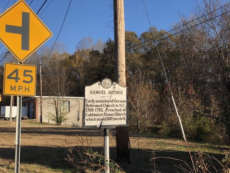
By Duane and Tracy Marsteller, November 12, 2023
Samuel Suther Marker
GEOGRAPHIC SORT Title Sort Marker Number Sort Marker Number Sort for Trails Publication Order Sort Publication Order Sort A Erected Year Sort Most Viewed Sort Most Recent-Interest Sort Most Recently Changed Sort SEE FAQ #33 FOR DESCRIPTIONS
On North Carolina 73 west of Gold Hill Road, on the right when traveling east.
On State Highway 73 at St Johns Church Road, on the right when traveling west on State Highway 73.
On Old Charlotte Road SW (State Highway 1157) at State Highway 49, on the right when traveling south on Old Charlotte Road SW.
On Union Street South at McAllister Avenue Southeast, on the right when traveling north on Union Street South.
On Church Street NE (U.S. 601) at Buffalo Street NW, on the right when traveling north on Church Street NE.
On Warren C. Coleman Boulevard (Bypass U.S. 601) at Main Street SW, on the right when traveling west on Warren C. Coleman Boulevard.
On Mooresville Road (State Highway 3) at Rankin Road (State Road 1616), on the right when traveling east on Mooresville Road.
On State Highway 49 at Morehead Road (County Highway 1300), on the right when traveling west on State Highway 49. Reported permanently removed.
On North Cannon Boulevard (U.S. 29) 0.1 miles north of Venus Street, on the right when traveling north.
On South Cannon Boulevard (U.S. 29) at Cloverleaf Plaza, on the right when traveling north on South Cannon Boulevard.
On North Carolina Route 24/27 at Reed Mine Road, on the right when traveling west on North Carolina Route 24/27.
On State Highway 49 at North Lentz Harness Shop Road (State Road 2453), on the right when traveling north on State Highway 49.
On West Franklin Street (State Highway 73) at South Main Street, on the right when traveling east on West Franklin Street.
On North Main Street at West Franklin Street ( Highway 73), on the left when traveling north on North Main Street.
On State Highway 268 0.5 miles east of Holly Lodge Place, on the left when traveling east.
Paid Advertisement
On College Avenue Southwest at Main Street Southwest, on the right when traveling east on College Avenue Southwest.
On Yadkin River Road (County Route 1560) at Highway 268, on the right when traveling north on Yadkin River Road.
On Norwood Street Southwest at Pennton Avenue Southwest, on the right when traveling south on Norwood Street Southwest.
On State Highway 343 at NC Highway 34 North (U.S. 158), on the left on State Highway 343.
On U.S. 158 at State Highway 343, on the right when traveling east on U.S. 158.
On State Highway 343 0.1 miles south of U.S. 158, on the right when traveling south.
On Highway 158 just east of Havenwood Drive (County Road 1257), on the right when traveling west.
On State Highway 343 just west of Hawkins Lane (County Road 1148), on the right when traveling west.
On State Highway 343 at Palmer Road (County Road 1121), on the right when traveling south on State Highway 343.
On State Highway 343 0.2 miles south of Nosay Road, on the right when traveling south.
On Mullen Street north of Main Street (U.S. 17), on the left when traveling north.
On State Highway 343 at Main Street (U.S. 17), on the right when traveling north on State Highway 343.
On East Fort Macon Road, in the median.
On Coral Bay Court (State Highway 58) 0.7 miles west of Atlantic Beach Causeway (County Route 1182), on the right when traveling west.
On East Fort Macon Road, on the right when traveling east.
On Front Street at Orange Street, on the right when traveling west on Front Street.
Paid Advertisement
On Front Street (County Route 1312) at Live Oak Street, on the right when traveling east on Front Street.
On State Highway 101 at Airport Road, on the right when traveling south on State Highway 101.
On Ann Street west of Craven Street, on the right when traveling west.
On Turner Street 0.1 miles south of Cedar Street (U.S. 70), on the right when traveling north.
On Turner Street 0.1 miles south of Cedar Street (U.S. 70), on the right when traveling north.
On Turner Street 0.1 miles south of Cedar Street (U.S. 70), on the right when traveling north.
On Cedar Island Road (North Carolina Route 12) north of Sound View Drive, on the left when traveling south.
On Island Road (County Route 1335) at Cape Point Drive, on the right when traveling east on Island Road. Reported missing.
On Island Road east of Cape Point Drive, on the right when traveling east.
On Arendell Street (U.S. 70) at Port Terminal Road, on the right when traveling east on Arendell Street.
On Arendell Street (U.S. 70) 0.1 miles east of North 35th Street, on the right when traveling east.
On Arendell Street (U.S. 70) at North 35th Street, on the right when traveling east on Arendell Street.
On Port Terminal Road at South 3rd Street, on the right when traveling east on Port Terminal Road.
On Arendell Street (U.S. 70) at South 26th Street, in the median on Arendell Street.
On Arendell Street (U.S. 70) at North 35th Street, on the right when traveling east on Arendell Street.
On Arendel Street (U.S. 70) at 4th Street, on the right when traveling east on Arendel Street. Reported permanently removed.
Paid Advertisement
On Arendell Street (U.S. 70) east of North 35th Street, on the right when traveling east.
On Arendel Street (U.S. 70) east of 5th Street, on the right when traveling east.
On East Chatham Street at Roberts Road, on the right when traveling north on East Chatham Street.
On Salter Path Road (State Highway 58) at Ocean Shore Lane, on the right when traveling east on Salter Path Road.
On Salter Path Road (State Highway 58) at Pine Knoll Boulevard, on the left when traveling north on Salter Path Road.
On Blanch Road (State Highway 1523) at Bertha Wilson Road (State Highway 1511), on the left when traveling north on Blanch Road.
On State Highway 62 0.3 miles north of Purple Martin Drive, on the left when traveling north.
On North Carolina Route 119 at Griers Church Road, on the left when traveling north on North Carolina Route 119.
On U.S. 158 at Olive Hill Church Road (County Route 1701), on the left when traveling east on U.S. 158.
On U.S. 158 west of Solomon Lea Road, on the right when traveling west.
On North Carolina 62 (State Highway 62), on the right when traveling north.
On Broad Street (State Highway 57) east of Palmer's Alley, on the right when traveling east.
On North Carolina 86 (State Highway 86) at Collins Road, on the right when traveling north on North Carolina 86.
On State Highway 150 at Wagon Wheel Road, on the left when traveling south on State Highway 150.
On U.S. 158 east of Highway 150, on the right when traveling east.
On U.S. 158 at Bethesda Church Road (County Road 1153), on the left when traveling west on U.S. 158.
Paid Advertisement
On State Highway 57 at State Highway 119, on the left when traveling west on State Highway 57.
On State Highway 119 at State Highway 57, on the right when traveling north on State Highway 119.
On U.S. 158 0.3 miles east of Hatchett Road, on the left when traveling west.
On Court Square at West Main Street, on the right when traveling east on Court Square.
On 1st Street East at 5th Avenue SE, on the right when traveling east on 1st Street East.
On State Highway 16 at St. John's Church Road (State Highway 16), on the right when traveling east on State Highway 16.
On U.S. 321 at Old Lenoir Road, on the right when traveling north on U.S. 321.
On 2nd Street Northeast (State Highway 127) at 3rd Avenue Northeast, on the right when traveling north on 2nd Street Northeast.
On 7th Avenue Northeast just north of 8th Street Northeast, on the right when traveling north.
On 1st Avenue Southwest at 10th Street Southwest, on the left when traveling west on 1st Avenue Southwest.
On Southwest Boulevard (Business U.S. 321) at South College Avenue, on the right when traveling north on Southwest Boulevard.
On Northwest Boulevard (Business U.S. 321) at West 9th Street, on the right when traveling north on Northwest Boulevard.
On South College Avenue 0.1 miles north of East Herman Street, on the left when traveling north.
On State Highway 16 at W A Street, on the right when traveling south on State Highway 16.
On Old Conover-Startown Road at West 7th Street, on the right when traveling north on Old Conover-Startown Road.
Paid Advertisement
On Hickory Lincolnton Highway (State Highway 10) at Hickory Lincolnton Road (County Highway 1008), on the right when traveling east on Hickory Lincolnton Highway.
On State Highway 10 0.2 miles west of Smith Road, on the right when traveling east.
On Old Lystra Road (U.S. 15/501) at Old Lystra Road (County Highway 1724), on the right when traveling north on Old Lystra Road.
On North Carolina Route 751 at O'Kelly Chapel Road ( Highway 1731), on the right on North Carolina Route 751.
On U.S. 1, on the right when traveling north.
On Old US Highway 1 (County Route 1011) 0.1 miles south of Moncure Pittsboro Road (County Route 1012), on the right when traveling south.
On Hillsboro Street (U.S. 15/501) at Hanks Street, on the right when traveling south on Hillsboro Street.
On NC-87 (State Highway 87) at East Perry Road/Chicken Bridge Road, on the right when traveling north on NC-87.
On North Masonic Street (Business U.S. 64), on the left when traveling east on North Masonic Street.
On Ellen Way (U.S. 15/501) at Mount Gilead Church Road (County Highway 1700), on the right when traveling north on Ellen Way.
On US Highway 15-501 at Thompson Street, on the left when traveling south on US Highway 15-501.
On Hillsboro Street (U.S. 15/501) north of East Salisbury Street, on the right when traveling north.
On Hillsboro Street (U.S. 15/501) at Hanks Street, on the right when traveling south on Hillsboro Street.
On Sanford Road (U.S. 15/501) when traveling north.
On U.S. 501 at Walter Bright Road, on the right when traveling south on U.S. 501.
On Staley Snow Camp Road, on the left when traveling south.
Paid Advertisement
On U.S. 19 3.8 miles south of U.S. 64, on the left when traveling south. Reported missing.
On Brasstown Road (County Highway 1564) north of Harshaw Road (County Highway 1558), on the left when traveling north.
On Peachtree Street at Hiwassee Street (Business U.S. 19), on the right when traveling south on Peachtree Street. Reported missing.
On Hiawassee Street 0.2 miles north of U.S. 64.
On Hiwassee Dam Access Road (County Highway 1314) at State Highway 294, on the right when traveling north on Hiwassee Dam Access Road.
︽
1433 entries matched your criteria. Entries 201 through 300 are listed above.
⊲ Previous 100 —
Next 100 ⊳