1392 entries match your criteria. Entries 301 through 400 are listed.⊲ Previous 100 — Next 100 ⊳
North Carolina Division of Archives and History Historical Markers
These markers can be found along the roadside in North Carolina and have been erected by the North Carolina Division of Archives and History and predecessor agencies.
Governor, 1827~28; U.S. Senator; and legislator.
Compiler of revisal of N.C. laws. His home two blocks south; grave at Hayes one mile S.E. — — Map (db m34851) HM
Julius Rosenwald and Booker T. Washington established fund in 1912 to provide grants to African American communities to improve education. In N.C. the fund assisted with 817 projects in 93 counties. The first one was Warren Grove School, a . . . — — Map (db m225206) HM
Attorney-General of Colony, 1745-1761. Leader of faction which opposed Governor Dobbs. Secretary to Lord Granville. Home was 2 blocks S. — — Map (db m56988) HM
The principal town of the Weapemeoc Indians, visited by Ralph Lane and his colonists in 1585-1586, stood near present-day Edenton. — — Map (db m56986) HM
One of the forts where General Winfield Scott's United States Forces gathered the Cherokee before moving them west, stood 3/4 mi. N. W. — — Map (db m41936) HM
Pastor First Baptist Church, Dallas, Texas, 1897-1944, president of Baptist World Alliance. His birthplace stands one mile northwest. — — Map (db m41938) HM
North Carolina. Colonized, 1585-87, by first English settlers in America; Permanently settled C.1650; First To vote readiness for Independence, Apr. 12, 1776
South Carolina. Formed in 1712 from part of Carolina, which was chartered . . . — — Map (db m16820) HM
Tory force led by Col. Ferguson camped nearby Oct. 4-5, 1780. Two days later Ferguson died in major British defeat at Kings Mountain, 5 mi. SE. — — Map (db m49964) HM
Governor, 1929-33; under Secretary of U.S. Treasury; appointed Ambassador to Great Britain, 1946. Birthplace stands here, grave 300 yds. N. — — Map (db m23533) HM
Confederate captain; legislator; member of conventions of 1868, '75; conservative leader in Reconstruction period. His home was 100 ft. S. — — Map (db m23535) HM
Constructed by Colonel John Barnwell of South Carolina in campaign against the Tuscarora Indians in April, 1712. Remains are 2 mi. N. E. — — Map (db m65699) HM
U.S. Marine Corps Air Station activated 1941 as Cunningham Field for first USMC aviator A.A. Cunningham. MCAS Cherry Point since May 1942. — — Map (db m225996) HM
Site of Fort Caswell, built by N.C., 1775-76, to protect New Bern, renamed Fort Lane by Confederacy. Taken by U.S., Mar., 1862. ½ mi. E. — — Map (db m77005) HM
The above map is self-explanatory. For a detailed account of the battle please read the large map-marker "Battle of New Bern" on U.S. Highway 17 at New Bern, 5¼ miles west of this road. The Croatan Earthwork, an extensive fortification not used . . . — — Map (db m207889) HM
Early American precedent for judicial review of legislation, was decided nearby, 1787, by Judges Samuel Ashe, Samuel Spencer, John Williams. — — Map (db m23502) HM
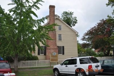
Pioneer photographer of N. C. and the South. An advocate of equal rights for women. Began career ca. 1904 in this house where she was born. — — Map (db m92394) HM
Episcopal. Craven Parish created 1715. First church erected 1750, this one in 1875. Communion service, given by George II, 1752, still in use. One block S. — — Map (db m76988) HM
The road from New England to Charleston, over which mail was first carried regularly in North Carolina, 1738-39, passed near this spot. — — Map (db m92397) HM
Secretary of the Navy, 1841; United States Senator, 1846-55; judge of the superior court; staunch nationalist. Birthplace was 80yds S. — — Map (db m76991) HM
Asst. Superintendent Public Instruction, 1868-70; a founder Livingstone College, 1885; Bishop A.M.E. Zion Church; founded St. Peters, 1864. One blk. N. — — Map (db m24053) HM
Home of Revolutionary War leader; and his son John, Congressman & state legislator. House moved and restored 1966-70 by the Tryon Palace Commission. — — Map (db m23508) HM
Brig. Gen. Gabriel Rains and Col. George Rains, graduates of West Point, inventors of explosives for Confederacy. This was their boyhood home. — — Map (db m76975) HM
Merchant, Loyalist, and Governor's Councilor. He financed construction of Tryon Palace & campaign against Regulators, 1771. House stood 2 blocks S. — — Map (db m92399) HM
Historic Capitol and Governor's residence of N.C., 1770-1794. Burned 1798, and restored in 1952-1959. Open to the public. One block south. — — Map (db m76997) HM
Justice of N.C. Supreme Court, 1833-44; lawmaker. An advocate for state's Catholics. Wrote state song. "The Old North State." Lived 1 block N. — — Map (db m76978) HM
From a point 50 yards west three batteries of artillery under Major J. A. Reynolds shelled the Confederate first line of earthworks. — — Map (db m31600) HM
The 1865 home of Wm. Smith, 100 yds E., was used as a hospital for Union troops in the Battle of Averasboro, March 15-16, 1865. — — Map (db m211814) HM
Hit his first home run in professional baseball, March, 1914, 135 yds. N.W. In this town George Herman Ruth acquired the nickname "Babe." — — Map (db m243848) HM
Bishop of Charleston. He organized Roman Catholics in N.C. at Fayetteville Convention, & consecrated St. Patrick Church, 1829. Present church 4/10 mi. E. — — Map (db m24634) HM
On March 4-5, 1825, was guest of Fayetteville (named for him 1783), staying at home of Duncan McRae, on site of present courthouse. — — Map (db m24377) HM
Presbyterian. Founded by early Scottish settlers. Graves of Alexander MacPherson and T. H. Holmes, a Confederate general, 1½ miles N. — — Map (db m121984) HM
Muslim slave & scholar. African born, he penned autobiography in Arabic. 1831. Lived in a Bladen County and worshipped with local Presbyterians. — — Map (db m94902) HM
Fayetteville was the focal point for five plank roads, chartered 1849-52. The longest was built to Bethania, 129 miles northwest. — — Map (db m24395) HM
Invading North Carolina, Sherman's army occupied Fayetteville, Mar. 11-14, 1865, destroying the Confederate Arsenal, which stood 1 mile W. — — Map (db m57295) HM
At Bentonville, General William T. Sherman's Union Army, advancing from Fayetteville toward Goldsboro, met and battled the Confederate Army of General Joseph E. Johnston. General Robert E. Lee had directed the Confederates to make a stand in . . . — — Map (db m20535) HM