417 entries match your criteria. Entries 301 through 400 are listed.⊲ Previous 100 — The final 17 ⊳
Historic Trees Historical Markers
An historic tree is one that was witness to an historic event, or maybe it was planted by, or otherwise directly associated with a famous historic figure. These have been marked with a historical marker.
The Grove of the States includes a tree representing each state in the USA and the District of Columbia. The idea for the Grove of the States was conceived by Oregon Attorney General Robert Y. Thornton to honor the passage of Lady Bird Jonson's 1965 . . . — — Map (db m127210) HM
On 7th Street south of Duane Street, on the left when traveling south.
This grove of nine trees is a part of the original landscaping planted around the historic 1886 Queen Anne style house of Captain George Flavel. The grove consists of a giant sequoia, ginko, Camperdown elm, bay laurel, pear, and four cork elms. . . . — — Map (db m168306) HM
This tree was given to Douglas County by Binger Hermann, U.S. Congressman, around the turn of the century. The occasion for the tree donation is not known positively, but research suggests that it was given at a dedication ceremony for the . . . — — Map (db m112587) HM
Pinus lambertiana
When settlers crossed on the Applegate Trail, sugar pine trees dominated this landscape. Native Americans had seasonal camps and purposefully managed the sugar pines, including using a hook-ladder to move up the tiered . . . — — Map (db m112589) HM
In 1863, on this site, Robert Vinton Beall, an Oregon Trail pioneer and relative to four Maryland governors, built one of the first frame buildings in Jackson County, a Gothic Revival house that is listed on the National Historic Register. Beall and . . . — — Map (db m129534) HM
Near Hanley Road (Oregon Route 238) 0.5 miles Rossanley Drive ( Route 238), on the right when traveling west.
In 1860, Martha Hanley planted this weeping willow to commemorate the birth of her son. The willow cutting was obtained from the pioneer Luelling Nursery in the Willamette Valley and delivered by Martha's friend Kit Kearney, an express rider, who . . . — — Map (db m244248) HM
Carya ovata
Mary Louisa Black planted this shagbark hickory near her home in 1866 from nuts she carried from Missouri on the Oregon Trail in 1865. Of the nuts she planted, two grew into trees. This tree is the lone survivor of snow, . . . — — Map (db m112564) HM
Sequoiadendron giganteum
On March 22, 1862, the day of his son Emil's birth, Peter Britt planted this giant sequoia by his home. Britt was a pioneer photographer, skilled horticulturist, and leader in Southern Oregon's lucrative fruit . . . — — Map (db m112590) HM
This small grove of Comice pear trees are the only remaining of an original planting known as Harry & David Bear Creek Orchards Block 1A. Harry & David Corporation became internationally renowned in 1932 when they began marketing their gift boxes of . . . — — Map (db m113351) HM
Pinus jeffreyi
In Oregon, Jeffrey pines are found only in the state's southwest corner. They are especially adapted to local dry, infertile, serpentine soils as seen in the surrounding flat lands and distant mountains. These trees resist . . . — — Map (db m112563) HM
When a Japanese balloon bomb exploded at
this site, Elsie Mitchell and her Sunday school
class of five children, out on an early spring
fishing outing, were killed. They were the only
World War II casualties to occur on the North
American . . . — — Map (db m112595) HM
On Liberty Street Northeast at 3rd Street Northeast, on the right when traveling north on Liberty Street Northeast.
This black walnut was planted c. 1884 by the Zimmerman family who were prominent members of the Aurora Colony. Early Aurora settlers were talented and industrious. Their products gained a wide reputation for excellence during the early days of . . . — — Map (db m244246) HM
On Court Street Northeast, on the left when traveling west.
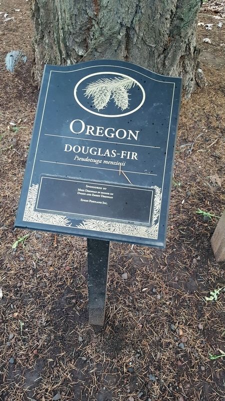
This Douglas-fir was raised from seed carried to the moon by astronaut Stuart Roosa of the Apollo 14 space mission in 1971. It was the first "Moon Tree" to be planted in Oregon and was planted here by Governor Bob Straub on Arbor Day, April 30, 1976 . . . — — Map (db m286377) HM
On Pattee Mall west of East College Avenue (Pennsylvania Route 26), on the right when traveling west.
Lining the mall are part of an early campus landscaping plan that called for trees and other plantings to be used as an arboretum for teaching and research purposes. While age and disease have taken their toll, Penn State still has one of the . . . — — Map (db m135739) HM
Near Flower Garden Walk. Reported permanently removed.
Longwood has one of the most historically significant tree collections in the region.
This land was originally owned by William Penn, and later part of a 202-acre working farm and arboretum belonging to the Peirce family. The arboretum, . . . — — Map (db m175052) HM
Under this huge Elm, July 4, 1776, resolves declaring independence were drawn, prior to news of action by Congress at Philadelphia. This was an expression of the spirit common to the frontier and led by the famous Fair Play men. — — Map (db m65556) HM
On East Governor Road (U.S. 322) at Meadow Lane on East Governor Road.
Though the Milton Hershey School campus is graced by a number of magnificent trees, one of the oldest and most meaningful to generations of HIS/MHS students might be this Chinese chestnut. Known informally as the “climbing tree) for . . . — — Map (db m84238) HM
and the International Society of Arboriculture jointly recognize this significant tree in this bicentennial year as having lived here at the time of the signing of our Constitution. — — Map (db m8280) HM
Near Main Street (U.S. 322) west of North Pickering Street, on the right when traveling west.
This tree grown from shoot taken
from original elm which stands
near Cambridge, Massachusetts and
which bears this inscription: "Under this tree Washington took command of the American army July 3, 1775" — — Map (db m306156) HM
This Avenue of Trees,
preserved by
General Thomas Mifflin Chapter
D.A.R.
in memory of soldiers
of Juniata County who
gave their lives in the
World War
Dedicated November 11, 1940 — — Map (db m53723) HM
On this sacred spot for 260 years stood the majestic white oak tree known as the Witness Tree. Despite preservation efforts, the tree succumbed to old age and was solemnly removed on June 3, 1991. Its memory symbolizes the patriotism and love of . . . — — Map (db m84446) HM
Beneath this Witness Tree a new born patriotism found notable expressionOn a Sunday morning in September 1777 an express rider came to tell the congregation of Donegal Church that the British army under Lord Howe had left New York to invade . . . — — Map (db m84483) HM
On E Cliveden Street, on the right when traveling east.
The International Society of Arboriculture and the National Arborist Association jointly recognize this significant tree in this bicentennial year as having lived here during the American Revolutionary period.
1776 - 1976 — — Map (db m69076) HM
On North Beach Street at East Columbia Avenue, on the right when traveling east on North Beach Street.
On this site in 1682 William Penn signed a treaty with the Delaware Tribe of Native Americans under the canopy of the Great American Elm Tree. The tree was destroyed during a storm on March 3, 1810. This direct descendant of the original tree was . . . — — Map (db m223974) HM
Treaty ground of William Penn, and the Indian Nations, 1682, Unbroken faith.
William Penn, Born 1644, Died 1718.
Pennsylvania, Founded, 1681, by Deeds of Peace.
Placed by the Penn Society, A.D. 1827, to mark the site of the Great . . . — — Map (db m164374) HM
On 7th Street at St. George Street, on the right when traveling south on 7th Street.
This ancient oak is today the only surviving witness tree among those that marked the survey of February 28 1769 which set apart the tract on which Lewisburg is situated and which was made for the proprietaries by William Maclay This tract of 320 . . . — — Map (db m282475) HM
Near Main Street at Broad Street, on the right when traveling east.
Site of oak tree under which
the first religious services
were held in community
by the congregation
of Three Ridges (later the
Presbyterian Church of
West Alexander) by Dr. John
Mcmillen, Rev. John Brice and
others as early as 1785. — — Map (db m263184) HM
On Flat River Road (Rhode Island Route 117) east of Brenda Drive (Walker Lane), on the right when traveling east.
This American Liberty Elm was named after "The Liberty Tree: Our Country's first Symbol of Freedom." On the morning of August 14, 1765, the people of Boston awakened to discover two effigies suspended from an elm tree in protest of the hated Stamp . . . — — Map (db m152526) HM
On Poplar Street at Thames Street, on the right when traveling east on Poplar Street.
To commemorate the repeal of the Stamp Act in March 1766, William Read deeded a small triangle of land at this site where grew the original Tree of Liberty, to William Ellery and others in trust. This tree was cut down by British occupation forces . . . — — Map (db m48095) HM
On Rose Avenue south of Green Memorial Boulevard, on the right when traveling north.
The magnificent Betsey Williams Sycamore is a beloved icon of Roger Williams Park, and the most famous tree in Rhode Island. It is estimated to be about 250 years old, planted shortly after the cottage was built in 1773.
The American . . . — — Map (db m222440) HM
On Park Lane south of Old Post Road ( Route 1A), on the right when traveling south.
This American Liberty Elm was named after "The Liberty Tree: Our Country's first Symbol of Freedom." On the morning of August 14, 1765, the people of Boston awakened to discover two effigies suspended from an elm tree in protest of the hated . . . — — Map (db m114946) HM
The Harbour Town Yacht Basin was originally designed to be round, but after discovering this magnificent, centuries-old oak, the shape was reconfigured to save the specimen tree.
It has become one of the focal points of The Sea Pines Resort. . . . — — Map (db m282574) HM
The venerable Daniel's Landing Oak has stood on the banks of the Wando since well before Columbus arrived in the New World. It has sheltered Native American coastal tribes, welcomed English Lords Proprietor, witnessed the outdoor recreation of . . . — — Map (db m266748) HM
On Alexander Street 0.1 miles north of Calhoun Street, on the right when traveling north.
Near this spot once stood the Liberty Tree where Colonial Independence was first advocated by Christopher Gadsden A.D. 1766 and where ten years later the Declaration of Independence was first heard and applauded by South Carolinians — — Map (db m31852) HM
On Main Street south of 2nd Street, on the right when traveling south.
Henry’s Centennial Tree, also known as “The Big Tree,” was planted the same year the town of Henry was established, by David & Lucenda Wiley, in from of their business, Lucenda’s Millinery Shop. The tree’s circumference was 30 ft. and its height . . . — — Map (db m213992) HM
The large tree in the draw started growing in 1717 according to a sample taken by a State Forester, which makes it over 289 years old. The United States didn't become a country until 1776. There is one oak tree in the park that is nearly 400 years . . . — — Map (db m263126) HM
On South Riverside Drive north of Hattie Avenue, on the right when traveling north.
The first republic established west of the Appalachians was the Watauga Association, which was formed in May 1772 under the shade of an old Sycamore tree, located on the banks of the Doe River. The famed tree, was cut down in 1987, after efforts to . . . — — Map (db m306554) HM
On Blythe Ferry Lane (County Route 131) 0.8 miles north of Blythe Ferry Road, on the left when traveling north.
Witnessed a young Sam Houston, who gained favor with Chief Jolly on Hiwassee Island nearby, witnessed the Indian removal and countless events that shaped Meigs County, the State of Tennessee and points westward.
Commemorated in 2016 to . . . — — Map (db m165865) HM
On U.S. 421 at Pemberton Road, on the right when traveling east on U.S. 421.
Under the massive oak 0.3 mi. SW, Col. John Pemberton assembled his command in late September, 1780 for service against the British. Joined by units from Virginia, they marched to Sycamore Shoals of the Watauga; thence the whole force, under Col. . . . — — Map (db m157949) HM
On Sparta Street (U.S. 70S) north of Vocational Technical Drive, on the left when traveling south.
Standing as a silent sentinel to the town, this enormous white oak (Quercus alba) welcomes travelers into the city of McMinnville. This tree is 85 feet tall, a crown spread of 125 feet, and a possible age of over 250 years old. It has several lower . . . — — Map (db m76028) HM
On Knox Valley Drive, on the right when traveling south.
For more than 300 years, a majestic bur oak flourished on this site. The tree stood vigil over ancient Native American burial grounds; saw the arrival of the first white settlers in Middle Tennessee, provided shade to armies of both the North and . . . — — Map (db m284263) HM
On Mission Parkway 0.4 miles south of SE Military Drive (State Highway 13), on the right when traveling south.
This thornless Moraine Honeylocust from the Kennedy estate at Hyannisport, Massachusetts was presented to the San Antonio River Authority through the efforts of Senator Edward M. Kennedy and was planted on April 24, 1966 in memory of
John . . . — — Map (db m213280) HM WM
On I-20 Frontage (North) Road 1.1 miles west of Copper Creek Road (County Road 425), on the right when traveling west. Reported missing.
The original Burkett Pecan tree, bred from a native tree, 1900, by J.H. Burkett (1861-1945), Texas pecan industry leader.
Recorded Texas Historic Landmark 1966 — — Map (db m290378) HM
On U.S. 60 4.9 miles west of Texas Highway 207, on the left when traveling west.
After serving as a teamster in the Civil War (1861-65), Thadium (Thomas) B. Cree worked for the Union Pacific Railroad. In 1888 he and his wife came to the High Plains. They acquired this land and, with no trees for lumber, they built a dugout home. . . . — — Map (db m55938) HM
In 1837 this oak sheltered Texas jurors. Courthouse was unfinished because logs coming down-river for building had swept past in strong current. R. M. Williamson, presiding, was called "Three-legged Willie" due to appearance: he had good leg, . . . — — Map (db m28804) HM
On Park Road south of W Bethel Road when traveling south.
In 1843, Sam Houston, President of the Republic of Texas, and fellow travelers camped under this and other oak trees at these springs and met with local Indian tribes, attempting to negotiate a peace treaty. The treaty, signed several months . . . — — Map (db m147427) HM
On Misty Hollow Drive 0.2 miles north of Lake Olympia Parkway, on the left when traveling north.
Missouri City, Texas
Documented in The National of Historic Trees
In January of 1860, Edward Palmer purchased 640 acres from David Bright, one of Stephen F. Austin's “Old Three Hundred”, for $6,000 to create the Palmer plantation. In October . . . — — Map (db m259432) HM
On East Donegan Street near South River Street, on the right when traveling west.
To honor Stephen Fuller Austin, the Father of Texas,
the children of Guadalupe County planned this tree
in the year of his 207th birthday, November 3, 1793.
This Live Oak tree was germinated from the huge Live Oak tree
that stands today . . . — — Map (db m232677) HM
This tree planted on April 15, 2004 was grown from an acorn harvested from the live oak tree located on the site of Stephen F. Austin's death near present-day West Columbia, Texas. Under that large tree, a Texas Historical Monument marks the place . . . — — Map (db m5778) HM
On West Washington Street at Grove Street, on the right when traveling east on West Washington Street.
In 1837 a murderer named Page
and two others were hanged on
a limb of this large post oak tree.
At the time, the tree was 96 years
old. From that day on, it has been
known as "Page's Tree". — — Map (db m96887) HM
On Baylor Street at Sayers Street, on the right when traveling north on Baylor Street.
Estimated to have been a majestic tree of about 100 years when Columbus first landed on North American shores, this live oak tree has been pronounced the most perfect specimen of a tree in North America, and its picture hangs in the Hall of Fame . . . — — Map (db m82870) HM
On South 600 East south of East Broadway / E 300 S, in the median.
The street to the north was originally Emmigration Road – the only approach from the east. Over this road the pioneers of 1847 and subsequent years entered the valley of the Great Salt Sea. They found growing near this site a lone cedar and . . . — — Map (db m35125) HM
Near County Route 677, on the left when traveling south.
The National Champion Osage orange tree is over 530 years old. The tree stands 65 feet high, is 328 inches in circumference, and has a crown spread of 93 feet when it was last measured in 2017. This tree was well over 100 years old when Patrick . . . — — Map (db m307370) HM
May this Oak Tree from "Sandy Point" Westmoreland Co. Virginia, home of Col. George Eskridge, who was guardian for Mary Ball, shelter her last resting place, as she in her early childhood was sheltered and protected by her beloved guardian. As . . . — — Map (db m9197) HM
Near Riverside Street 0.1 miles north of Rivermont Avenue.
Constitution of the United States of America signed at Philadelphia, September 17, 1787 ☆ ☆ ☆ ☆ ☆ Constitution TreeThis oak tree planted this seventeenth day of September, 1937 to perpetuate in the hearts of the people . . . — — Map (db m313000) HM
On South Hawksbill Street 0.1 miles south of West Page Street, on the left when traveling south.
Directly up the hill from this site grows the second largest Chinkapin Oak in Virginia. It is registered with the Champion Tree Program of Virginia with a circumference of 234 inches, 62 feet tall and has a crown spread of 132 feet. It is estimated . . . — — Map (db m182598) HM
Near West Court Street west of North Sheffey Street, on the right when traveling west.
Sarah Elizabeth “Sallie” Adams (1841-1913) was about five years old when she and her family were sold at a slave auction outside the Smyth County Courthouse. Thomas Thurman, whose house stood near here, bought Sallie to be a body servant for his . . . — — Map (db m209792) HM
Near Lt Billy Webb Avenue 0.1 miles north of Cook Street.
The first “Liberty Tree” was an American Elm Tree that stood on the Boston Commons in Boston, Massachusetts prior to the American Revolution. On 14 August 1765 a group of men calling themselves the “Sons of Liberty” gathered in Boston under the elm . . . — — Map (db m210064) HM
On North Forks Avenue (U.S. 101) just north of East Division Street, on the right when traveling north.
This Sitka Spruce log came from a tree which was 11’ 8” in diameter, or 37’ 1” in circumference, and 256’ tall. The tree was already 259 years old in 1776 when the Declaration of Independence was signed. Sitka Spruce is native to the fog belt of . . . — — Map (db m290489) HM
On Tongue Point Park Road north of Camp Hayden Road, on the right when traveling west.
As part of the American Elm Heritage Project celebrating America's Semiquincentennial, the 250th anniversary of America's Declaration of Independence, the Michael Trebert Chapter of the National Society Daughters of the American Revolution . . . — — Map (db m315447) HM WM
In memory of
George Washington
1732-1799
This tree is planted by
Mary Morris Chapter D.A.R.
in the Bicentennial Year
of his birth.
1932 — — Map (db m234932) HM
Near Interurban Avenue South south of 56h Avenue South.
— In memoriam —
Joseph Foster. Came to the state
of Washington from Sheboygan, Wis
arriving Vancouver, Wash. by ox team,
July 1, 1852
Arriving Alki Point and Seattle
by boat, April 4, 1853
locating here May 1, 1853
Gov. scout . . . — — Map (db m181555) HM
On Walker Street, on the right when traveling west.
It was in 1640 that the "Earl of Camperdown" in Dundee Scotland noticed a branch growing on the floor of his elm forest. He grafted it to a Scotch Elm tree and it took hold producing the first Camperdown Elm. The Scotch Elm is the only root mass the . . . — — Map (db m112959) HM
Near Interstate 5 1 mile north of Washington Route 531, on the right when traveling north.
This famous stump remains as evidence of
the giant trees which once forested this area.
Over 20 feet in diameter and 200 feet tall, the
huge "Western Redcedar" is believed to have been
more than 1000 years old. Discovered by early
settlers . . . — — Map (db m290339) HM
On Harris Street at 4th Street, on the right when traveling west on Harris Street.
With a normal lifespan of 70 years, this,
is one of the oldest Empress trees
(Paulownia tomentosa) in the United States.
The tree was presented to E.B. Deming,
President of Pacific American Fisheries,
on August 24, 1909; a gift from . . . — — Map (db m177791) HM
On South Main Street at Sodders Street, on the left when traveling south on South Main Street.
The Palmer Tree, a stately burr oak was a mere acorn in front of the Palmer Family log cabin, when Lodi was settled in 1848. Its testimony to a peaceful community continues, as it stands proudly to welcome all who enter the Lodi Valley Historical . . . — — Map (db m33882) HM
This small pine tree that seems to be growing out of solid rock has fascinated travelers since the first train rolled past on the Union Pacific Railroad. It is said that the builders of the original railroad diverted the tracks slightly to pass by . . . — — Map (db m62159) HM
Near Wellington Parade (Victoria Route 30) 0.1 kilometers north of Jolimont Road.
The wide, spreading branches of this mature tree provide welcome summer shade. A fast growing native of New South Wales and Queensland, strongly identified with the area of Moreton Bay near Brisbane, it produces round, purplish figs which attract . . . — — Map (db m300206) HM
On Wellington Parade (Victoria Route 30) 0.1 kilometers Jolimont Road.
The scar on this tree was created when Aboriginal people removed bark to make canoes, shields, food and water containers, string, baby carriers and other items.
Please respect this site.
It is important to the Wurundjeri people as traditional . . . — — Map (db m300208) HM
Guildford The Big Tree is thought to be one of the largest examples of the species in Victoria. It has been recorded as having a height of 30m, a canopy spread of 34m, and trunk circumference of 9.35m. Estimates of the age of the tree range . . . — — Map (db m45968) HM
Near Bay Street just west of Pim Street, on the left when traveling east.
In memory of the military contribution of the Métis and Indian allies at Sault Ste. Marie in the defence of Canada during the War of 1812 — — Map (db m272398) HM
On Hamilton Street North at White Oak Drive, on the left when traveling north on Hamilton Street North.
Lieutenant Leslie Howard Miller, a soldier with the Canadian Expeditionary Force (3rd Division, Signal Corps) fought at the Battle of Vimy Ridge. Originally from Ontario, Miller was a school teacher in Saskatchewan at the outbreak of war, but left . . . — — Map (db m246177) HM WM
On Main Street (County Highway 5) just east of Victoria Street, on the right when traveling east.
This oak tree is a descendant from the few acorns gathered after the Battle of Vimy Ridge by Canadian soldier Lt. Leslie Miller. Not a single oak tree remained standing in the aftermath of the shelling. This tree, a descendant of one of . . . — — Map (db m141952) HM WM
On St. Lawrence Street (Provincial Highway 15) just south of Drummond Street, on the left when traveling south.
This oak tree, planted on
May 13, 2017,
descends from acorns gathered
after the Battle of Vimy Ridge,
April 9-12, 1917.
It honours the memory of those
who served including three soldiers
from Merrickville who died during . . . — — Map (db m142269) HM WM
Near Garrison Road 0.3 kilometers east of Ridge Road North, on the right when traveling west.
As you look to the back of the Ridgeway Battlefield Park, you will see the Town's first Heritage Tree. Ostrya virginiana is the botanical name for the Ironwood Tree, which may also be called a hop hornbeam because the maturing clusters of fruit . . . — — Map (db m281928) HM
On Grand Avenue 0.1 kilometers south of Lake Street, on the right.
The stand of trees before you surrounding the Grand Old White Oak is the first natural feature designated by the Town of Grimsby to be of cultural heritage value or interest under the Ontario Heritage Act.
It can be difficult to comprehend the . . . — — Map (db m291433) HM
This maple tree contributed by the Niagara Falls Branch United Nations Association In Canada in co-operation with the Niagara Parks Commission commemorates the life and work of
Lester Bowles Pearson
C.C., O.B.E., M.A., D.C.L.,
1897 - 1972 . . . — — Map (db m277621) HM
On Lyons Creek Road at Schliser Road, on the right when traveling east on Lyons Creek Road.
White Oak - Quercus alba, approximate age: 58 years old in 1814.
Circumference: 202 inches, Diameter: 64 inches.
This White Oak stands as a living witness to the Battle of Cook's Mills - October
19, 1814. It stands guard over . . . — — Map (db m284566) HM
Near Queenston Street, on the right when traveling east.
On April 18, 1824, William Lyon MacKenzie
planted five seeds from a honey locust tree in
recognition of the publication of the first issue
of his Colonial Advocate.
Thirty years later in 1854 when Mackenzie
revisited Queenston he . . . — — Map (db m277481) HM
On Metler Road 0.4 kilometers east of Balfour Street, on the right when traveling east.
This tree believed to be Canada's oldest sugar maple (acer saccharum) was accepted for its preservation April 30 1961, by the Niagara Peninsula Conservation Authority from Miss Edna Eleanor Comfort whose family have owned this land since 1816. . . . — — Map (db m284314) HM
This tree has been donated by the Niagara Regional Literacy Council to commemorate International Literacy Year
September 8th, 1990 — — Map (db m281197) HM
On Welland Street North, on the right when traveling north.
The Williams-Daboll House 1876
Built for John Collier Williams by George and Joseph McFarland,
this house represents the hybrid Gothic Revival/Italianate style
popularized throughout much of small-town southern Ontario
in the second . . . — — Map (db m276973) HM
On Highway 24 West 0.5 kilometers west of Forestry Farm Road, on the right.
I grew from an acorn in 1723 along the bank of the Lynn River, when there were only native people in this region. Probably a friendly squirrel planted me. I was lucky those first few years: nobody stepped on me or ate me. I did have to fight for my . . . — — Map (db m262162) HM
On Sussex Drive (County Highway 93) just north of Stanley Avenue, on the left when traveling north.
This tree was planted on the occasion of the celebrations marking ten years of democracy in South Africa. May the roots of this tree be the anchor of relations between South Africa and Canada.
Cet arbre a été planté à l’occasion des . . . — — Map (db m258497) HM
Near Selkirk Street South at Ridgeway Street East, on the right when traveling south.
Tree Planted by The Honourable Lynn McLeod and Jack Adderly in 1990 to commemorate the 100 millionth tree planted by Abitibi-Price Inc. in Ontario — — Map (db m243999) HM
On Queen's Park Crescent East at Queens Park (University Avenue), on the left when traveling north on Queen's Park Crescent East.
This tree was planted by James Simpson, Esq., Mayor of Toronto, on the occasion of the celebration of the twenty-fifth anniversary of the accession of King George the Fifth to the Throne — May 6th 1935 — — — Map (db m243754) HM
Near Queen's Park Crescent East just north of Grosvenor Street, on the left when traveling north.
Representing the billionth forest tree seedling distributed from Ontario Government nurseries since 1908, was planted on November 14th, 1968, by The Honourable John P. Robarts, P.C., Q.C., Prime Minister of Ontario. — — Map (db m243777) HM
On Rue McTavish 0.2 kilometers north of Rue Sherbrooke Ouest (Québec Route 138), on the right when traveling north.
This tree was planted by the students of McGill University in memory of the fourteen women slain at École Polytechnique on December 6, 1989 Cet arbre a été plante par les étudiantes et étudiants de l’Université McGill a la . . . — — Map (db m300756) HM
Near Rue McTavish 0.2 kilometers north of Sherbrooke Street West (Québec Route 138), on the right when traveling north.
[English] This tree was planted by McGill University in memory of the six (6) Muslims slain at the Islamic Cultural Centre of Quebec City (CCIQ) on January 29th, 2017 [Français] . . . — — Map (db m300983) HM