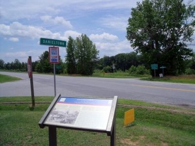
In June 1864, to deny Gen. Robert E. Lee the use of the South Side R.R. and the Richmond and Danville R.R., Gen. Ulysses S Grant sent Gen. James H. Wilson and Gen. August V. Kautz south of Petersburg on a cavalry raid to destroy track and rolling . . . — — Map (db m20168) HM
Nearby to the south stood Fort Christanna, a wooden structure built in 1714 under the auspices of Alexander Spotswood and the Virginia Indian Company. Members of the Meiponsky, Occaneechi, Saponi, Stuckenock, and Tutelo Indian tribes lived within . . . — — Map (db m20181) HM
Here the first courthouse of Brunswick County was built about 1732. In 1746, when the county was divided, the county seat was moved east near Thomasburg. In 1783, after Greensville County had been formed, the courthouse was moved to Lawrenceville. — — Map (db m20180) HM
The Virginia General Assembly established Brunswick County in 1720 to encourage English settlement between the fall line and French outposts west of the Blue Ridge Mountains. Until 1732, when Brunswick’s court was constituted, residents attended . . . — — Map (db m180055) HM
Southside Virginia Community College has two campuses: the Christanna Campus in Alberta, which opened in 1970, and the John H. Daniel campus in Keysville, which opened in 1971. The college is part of the statewide system of community colleges . . . — — Map (db m30868) HM
Southside Virginia Community College has two campuses: the Christanna Campus in Alberta, which opened in 1970, and the John H. Daniel Campus in Keysville, which opened in 1971. The college is part of the statewide system of community colleges . . . — — Map (db m180538) HM
A branch of the Nottoway, named for the huge fish once caught in it. William Byrd, returning from the expedition to survey the Virginia-North Carolina boundary line, camped on this stream in November, 1729. — — Map (db m62406) HM
According to local tradition, while Dr. Creed Haskins and several friends were on a hunting trip in Brunswick County in 1828, his camp cook, Jimmy Matthews, hunted squirrels for a stew. Matthews simmered the squirrels with butter, onions, stale . . . — — Map (db m107700) HM
While wooden trestle bridges were numerous in Brunswick County, the Meherrin River Bridge was one of a few truss bridges on the A&D between Pinners Point (at Portsmouth) and Danville. Built in 1893, the 150-feet long, through truss pin-connected . . . — — Map (db m94363) HM
A community of mills, warehouses, homes and stores sprang up with the construction of the Atlantic and Danville Railway in the 1890s. A combination freight and passenger station was located at Brodnax shown here in 1948. Bales of cotton, timber and . . . — — Map (db m94357) HM
Though many freed African Americans continued after the Civil War to work the same farms on which they had been slaves, many also left their homes in search of better opportunities elsewhere. Often the sick, elderly, and very young were left . . . — — Map (db m180524) HM
Until about 1967, the U.S. Postal Service used the railroads to handle mail on designated routes. The mail was handled in special railroad cars usually moved on passenger trains, designated as Railway Post Office (RPO) cars. The RPOs were actually . . . — — Map (db m94359) HM
The Thoroughbred is a horse breed synonymous with racing. All modem Thoroughbreds trace back to three stallions imported into England from the Middle East in the late 17th and early 18th centuries. English Thoroughbreds were imported into North . . . — — Map (db m94361) HM
Tobacco has long held a sacred and prominent role among the Indian tribes in the southeast. Well before Christopher Columbus returned with tobacco seeds from the Caribbean or Sir Walter Raleigh made smoking fashionable in Europe when he returned . . . — — Map (db m94362) HM
Did you know… A raindrop falling in the Meherrin River Watershed will travel over 200 miles before reaching the Atlantic?!
Watersheds are the collective web of tributaries and surrounding land draining to a common waterbody, such as a major . . . — — Map (db m94364) HM
According to local tradition, while Dr. Creed Haskins and several friends were on a hunting trip in Brunswick County in 1828, his camp cook, Jimmy Matthews, hunted squirrels for a stew. Matthews simmered the squirrels with butter, onions, stale . . . — — Map (db m20188) HM
Though many freed African Americans continued after the Civil War to work the same farms on which they had been slaves, many also left their homes in search of better opportunities elsewhere. Often the sick, elderly and very young were left . . . — — Map (db m30873) HM
Mecklenburg County. Formed in 1764 from Lunenburg, and named for Princess Charlotte, of Mecklenburg-Strelitz, queen of George III. A small army under the command of rebel Nathaniel Bacon destroyed the town of the Occaneechee Indians near . . . — — Map (db m30875) HM
Nellie Pratt Russell, educator, attended Howard
University and was one of six incorporators of
Alpha Kappa Alpha Sorority, the first Greek
letter organization founded by African American
women. The sorority, established in 1908, . . . — — Map (db m107412) HM
In June 1864, to deny Gen. Robert E. Lee the use of the South Side R.R. and the Richmond and Danville R.R., Gen. Ulysses S. Grant sent Gen. James H. Wilson and Gen. August V. Kautz south of Petersburg on a cavalry raid to destroy track and rolling . . . — — Map (db m289877) HM
The ordinary that stood on this site catered to travelers on the north-south stage road as early as 1750. During the American Revolution local warehouses were burned by British Colonel Tarleton, and legend says that it was from that occurrence that . . . — — Map (db m20164) HM
Late in the afternoon of May 15, 1864, Union Gen. August V. Kautz and his cavalry division rode into Lawrenceville, the Brunswick County seat. They were on the second leg of a two-part, two-week-long expedition to destroy railroad bridges and depots . . . — — Map (db m62400) HM
In 1714, at Governor Alexander Spotswood’s urging, the Virginia General Assembly funded the Virginia Indian Company, charged with building a fort on the banks of the Meherrin River in what would become Brunswick County. The fort would provide . . . — — Map (db m20197) HM
Nearby to the south stood Fort Christanna, a wooden structure built in 1714 under the auspices of Alexander Spotswood and the Virginia Indian Company. Members of the Meiponsky, Occaneechi, Saponi, Stuckenock, and Tutelo Indian tribes lived within . . . — — Map (db m20184) HM
In 1714, working through the Virginia Indian Company, Gov. Alexander Spotswood initiated the construction of First Christanna on a bank of the Meherrin River. This fort served several important purposes. The Indian Company received a monopoly . . . — — Map (db m180523) HM
A Fort Called Christ-Anna
You are standing at the site of Fort Christanna, a colonial fort laid out in 1714 by Virginia’s Governor Alexander Spotswood. The fort was built on a tract of land set aside in 1714 for a trading post, as well as a . . . — — Map (db m20199) HM
Alexander Spotswood (1676-1740) was Governor of Virginia from 1710 to 1722. Born in Africa of a Scottish family, he had distinguished himself at the Battle of Bleinheim and was wounded. He was appointed to the governor’s position in Virginia in . . . — — Map (db m20200) HM
The story of Native Americans after Jamestown's founding in 1607 is a tragic one. At that time the Siouan Indians of Virginia probably numbered 6,300 people. By 1714, when Fort Christanna was established, they were in difficult circumstances, being . . . — — Map (db m20198) HM
Oak Grove School was originally a one-room log building located here on the grounds of Oak Grove Baptist Church. Between 1923 and 1924, for the sum of $3,000, a new, three-room school was built on the same site. The school is an example of . . . — — Map (db m180530) HM
Erected in loving memory of the Rev. Jesse C. Byrd D.D. as builder of present structure and pastor of Oak Grove 1943 - 1964 by the members. — — Map (db m180531) HM
Saint Paul’s College began as a small parochial school founded by a newly ordained Episcopal deacon, the Rev. James Solomon Russell. Born into slavery, Russell attended seminary school in Petersburg. Within a year of graduation he had managed . . . — — Map (db m30870) HM
Saint Paul's College was established in 1883 by the Venerable James Solomon Russell (1857-1935) as an Episcopal mission school to serve the black community of Southside Virginia. Born into slavery in Mecklenburg County, Russell was educated at . . . — — Map (db m20187) HM
Saint Paul's College began as a small parochial school founded by a newly ordained Episcopal deacon, the Rev. James Solomon Russell. Born into slavery, Russell attended the Bishop Payne Divinity School in Petersburg. Within a year of graduation, . . . — — Map (db m180528) HM
In 1924 the National Society of the Colonial Dames of America in the Commonwealth of Virginia acquired three and three-quarters acres of land on which the fort was presumed to have been built, then erected a monument of concrete embedded with . . . — — Map (db m20202) HM
Dedicated to all the men from Brunswick County, VA. who made the supreme sacrifice while serving their country and to all who served with honor.
World War I
Wright, Thomas L. Sgt. •
Bland, Charlie Pvt. •
East, John W. Pvt. • . . . — — Map (db m180526) WM
Among the earliest of the more than a dozen
Julius Rosenwald Schools built in Brunswick
County, Saint Paul’s Chapel School was constructed
as a one-teacher standard plan in 1920 under
the initial wave of Tuskegee Institute-administered building . . . — — Map (db m107433) HM
The Brunswick Circuit, established in 1773 by Robert Williams, is likely the oldest Methodist circuit in America. It extended from Petersburg south into North Carolina, and became known as “the cradle of Methodism in the South.” By 1776, the . . . — — Map (db m60671) HM
According to local tradition, while Dr. Creed Haskins and several friends were on a hunting trip in Brunswick County in 1828, his camp cook, Jimmy Matthews, hunted squirrels for a stew. Matthews simmered the squirrels with butter, onions, stale . . . — — Map (db m60672) HM
Near here stood Mason's Chapel, one of the earliest Methodist churches in southern Virginia. The first Virginia conference, May, 1785, was held here or nearby; Bishop Asbury presided. The conference of 1801 was held here. The present Olive Branch . . . — — Map (db m60673) HM
At Birch's Bridge (very near this bridge) the second William Byrd and his party crossed the river, in September, 1733, on their way to inspect Byrd's land holdings in North Carolina. Byrd wrote an account of this trip which he called “A . . . — — Map (db m62403) HM
According to local tradition, while Dr. Creed Haskins and several friends were on a hunting trip in Brunswick County in 1828, his camp cook, Jimmy Matthews, hunted squirrels for a stew. Matthews simmered the squirrels with butter, onions, stale . . . — — Map (db m20186) HM
Dinwiddie County. Area 521 Square Miles. Formed in 1752 from Prince George, and named for Robert Dinwiddie, Governor of Virginia 1751-1756. General Winfield Scott was born in this county, and in it took place the battle of Five . . . — — Map (db m62404) HM
A few hundred yards east is the site of Ebenezer Academy, founded in 1793 by Bishop Asbury, the first Methodist school established in Virginia. It passed out of the hands of the church but remained a noted school for many years. — — Map (db m62405) HM
Just to the north stands Briery Church, organized in 1755 following the missionary work of Presbyterian minister Samuel Davies. The first church was built about 1760 and was replaced in 1824. The present Gothic Revival church was built about 1855 . . . — — Map (db m40794) HM
The Quarter Place Trail is a half mile long, culminating at the Slave & African American Cemetery. The terrain slopes at the trailhead, levels off, and then steepens as it descends to the cemetery. The one-mile round trip walk is of moderate . . . — — Map (db m128689) HM
After three decades of public service, Patrick Henry retired in 1794 to Red Hill plantation in Charlotte County, which he regarded as "one of the garden spots of the world." He purchased the 700-acre estate and simple story-and-half house in 1794 . . . — — Map (db m128698) HM
Text Box #4)
The flags of the Commonwealth Courtyard honor Patrick Henry's election as the first governor of Virginia on June 29, 1776, when the boundaries of the commonwealth extended from the Atlantic Ocean to the Mississippi River. The Grand . . . — — Map (db m128702) HM
One mile to the south is Red Hill, Patrick Henry’s last home and burial place. The marble stone covering his grave carries the simple inscription, “His fame his best epitaph.”
Henry came here in 1794 and died at his beloved Red Hill . . . — — Map (db m65398) HM
Red Hill, 2930 acres at Patrick Henry's death, was named by its previous owners after the red clay soil so common to the area. Henry reportedly referred to it as "one of the garden spots of Virginia." The view from here overlooking the Staunton . . . — — Map (db m128691) HM
Central High School opened in 1939 as Charlotte County's first African American high school. Before its construction, African American students attended the Charlotte Training School, which had been built between 1928 and 1929 with . . . — — Map (db m182502) HM
1861-1865
Gloria Victis
Confederate soldiers
Charlotte County
cherishes the memory
of her heroes
Noble deeds
are a people’s inspiration
Erected under the auspices of
H.A. Carrington Camp C.V. No. 34.
August 27, 1901. . . . — — Map (db m31017) WM
Beginning in 1937, Ambassador and Mrs. David K. E. Bruce anonymously gave money to 11 sites in Southside Virginia to build libraries. The Bruce libraries, as they were called, became the first public libraries to allow access to African . . . — — Map (db m31019) HM
Beginning in 1937, Ambassador and Mrs. David K.E. Bruce anonymously gave money to 11 sites in Southside Virginia to build libraries. The Bruce libraries, as they were called, became the first public libraries to allow access to African . . . — — Map (db m182496) HM
In June 1864, to deny Gen. Robert E. Lee the use of the South Side R.R. and the Richmond and Danville R.R., Gen. Ulysses S. Grant sent Gen. James H. Wilson and Gen. August V. Kautz south of Petersburg on a cavalry raid to destroy track and . . . — — Map (db m262877) HM
When mounted Union raiders clattered into town here late on the blisteringly hot morning of June 25, 1864, residents waited anxiously to see what destruction the invaders would bring.
The raiders were part of a Union cavalry force under Gen. . . . — — Map (db m262878) HM
The historic district, a rare example of a 19th-century rural courthouse town, is concentrated on two main streets. Begun as Dalstonburg in 1775 during the French and Indian War, and later called Marysville and Smithville, the town was named . . . — — Map (db m31022) HM
(Preface) From 1861 To 1865, Our country was torn apart by a Civil War that pitted North against South, brother against brother, father against son, neighbor against neighbor. The impact of the war and its aftermath are still felt today as . . . — — Map (db m262872) HM
Constitutional Oak
presented to
David Q. Eggleston
Delegate to the
Constitutional Convention of 1902
It was planted by
his son, John W. Eggleston
Later, Chief Justice of
the Supreme Court of Appeals
and
John R. Hutcheson . . . — — Map (db m182499) HM
Six miles south is Cub Creek Presbyterian Church, the oldest church in this section. The neighborhood was known as the Caldwell Settlement for John Caldwell, grandfather of John C. Calhoun of South Carolina. About 1738 he brought here a colony of . . . — — Map (db m66062) HM
Cub Creek Presbyterian Church, the oldest church in this area, stood four miles southwest of here. The neighborhood was known as the Caldwell Settlement for John Caldwell, great grandfather of U.S. senator and vice president John C. Calhoun, of . . . — — Map (db m182500) HM
Three miles north is Edgehill, home of Clement Carrington. He ran away from Hampden-Sydney College to join the Revolutionary army, served in Lee's Legion, 1780-81, and was wounded at Eutaw Springs, September 8, 1781. — — Map (db m31023) HM
Half a mile north is Greenfield, built in 1771 by Isaac Read. Read was a member of the House of Burgesses, 1769-1771, and of the Virginia conventions of 1774 and 1775. He served as an officer in the Revolutionary War, dying of wounds in 1777. — — Map (db m31024) HM
Early in 1799, at the urging of George Washington, Patrick Henry emerged from retirement to run for Charlotte County's seat in the Virginia House of Delegates. He gave a speech here in March in front of a large crowd. Although Henry had opposed the . . . — — Map (db m182497) HM
Here, in March, 1799, took place the noted debate between Patrick Henry and John Randolph of Roanoke on the question of States' Rights. Henry denied the right of a state to oppose oppressive Federal laws. Randolph affirmed that right. This was . . . — — Map (db m31018) HM
Joseph R. Holmes, formerly enslaved in Charlotte County, campaigned for civil rights and education after emancipation. He served as a delegate to the Virginia Republican Party conventions in 1867 and 1869 and was elected to represent Charlotte and . . . — — Map (db m262856) HM
Charlotte County. Area 496 square miles. Formed in 1764 from Lunenburg, and named for Queen Charlotte, wife of King George III. Patrick Henry and John Randolph of Roanoke lived in this county, and Henry is buried here. . . . — — Map (db m31001) HM
In June 1864, to deny Gen. Robert E. Lee the use of the South Side R.R. and the Richmond and Danville R.R., Gen. Ulysses S. Grant sent Gen. James H. Wilson and Gen. August V. Kautz south of Petersburg on a cavalry raid to destroy track and . . . — — Map (db m31006) HM
In memory and honor of Gordon P. Young from Drakes Branch, Army First Cavalry Division, Killed In Action, Ia Drang and the below listed men from Charlotte County who paid the supreme sacrifice. May their names be forever remembered. May God bless . . . — — Map (db m182494) WM
Charlotte County. Area 496 Square Miles. Formed in 1764 from Lunenburg, and named for Queen Charlotte, wife of King George III. Patrick Henry and John Randolph of Roanoke lived in this county, and Henry is buried here. . . . — — Map (db m66002) HM
Abraham Wood, a trader and militia commander, commissioned Thomas Batte and Robert Hallom to explore the Appalachian Mountains in 1671. Their objective was to search the western slopes for tidal rivers, an indication that the Pacific Ocean was . . . — — Map (db m182503) HM
Seven miles west stood Roanoke Bridge, the colonial homestead of Joseph Morton, who patented land near by in the 1740s. He was an elder of Briery Presbyterian Church on its founding in Prince Edward County in 1755, and later a trustee. He served as . . . — — Map (db m40854) HM
In June 1864, to deny Gen. Robert E. Lee the use of the South Side R.R. and the Richmond and Danville R.R., Gen. Ulysses S. Grant sent Gen. James H. Wilson and Gen. August V. Kautz south of Petersburg on a cavalry raid to destroy track and rolling . . . — — Map (db m66003) HM
(center panel)
*Luther R. Hawkins •
*Wade M. Pillow •
*Richard J. Harris •
Freddie J. Church •
Arthur R. Tharpe •
Leland Claybrook •
Leroy L. Shook •
William G. Cook. Jr. •
Wilbert L. Spence •
John J. Clements •
Leonard L. . . . — — Map (db m265823) WM
Vietnam
1964-1975
Dedicated to the 8.744,000 men and women who will not be forgotten -- Welcome home
47,369 Killed in Action
153,303 Wounded in Action
And to those who are still missing — — Map (db m267035) WM
World War II
Dec. 7, 1941
Nazi Germany Surrenders
May 7, 1945
Japan Surrenders
Aug. 14, 1945
Dedicated to the 16,353,700 American men and women who served in the name of world freedom.
292,131 Killed in Action
670,846 . . . — — Map (db m267031) WM
Southside Virginia Community College has two campuses: the Christanna Campus in Alberta, which opened in 1970, and the John H. Daniel campus in Keysville, which opened in 1971. The college is part of the statewide system of community colleges . . . — — Map (db m31025) HM
Southside Virginia Community College has two main campuses: the Christanna Campus in Alberta, which opened in 1970, and the John H. Daniel Campus in Keysville, which opened in 1971. The college is part of the statewide system of community . . . — — Map (db m180617) HM
A chapel was built here in 1765-1769 by order of the vestry of Cornwall Parrish. Following the disestablishment and a brief period of irregular use, the property passed to the Republican Methodists, a denomination then active in the South. It was . . . — — Map (db m66061) HM
The Richmond and Danville Railroad was a lifeline for Lee's army and the people in the cities of Richmond and Petersburg and the outlying countryside. The railroad crossed the Staunton River less than 500 yards east of here on a covered bridge. . . . — — Map (db m286219) HM
In late June 1864, Confederate General Robert E. Lee and the Army of Northern
Virginia were engaged in a desperate defense of the city of Petersburg. Victory for Lee depended on a steady flow of supplies from the west, brought in by rail. To force . . . — — Map (db m107583) HM
On the hot day of June 25, 1864, several southern Virginia counties sent their "old men and young boys" to war. Not a one knew if they would live to see tomorrow.
In mid 1864, Confederate General Robert E. Lee's main army was besieged in the . . . — — Map (db m289547) HM
Brigadier General James H. Wilson and his Third Division, as well as Brigadier General August V. Kautz’s small cavalry division of the Army of the James, had participated in Grant’s railroad-breaking expeditions from the beginning. The received word . . . — — Map (db m107591) HM
In late June 1864, Confederate Gen. Robert E. Lee and the Army of Northern Virginia were engaged in a desperate defense of the city of Petersburg. Victory for Lee depended on a steady flow of supplies, brought in by rail. To force Lee from . . . — — Map (db m107472) HM
Charlotte County. Area 496 square Miles. Formed in 1764 from Lunenburg, and named for Queen Charlotte, wife of King George III. Patrick Henry and John Randolph of Roanoke lived in this county, and Henry is buried in the western . . . — — Map (db m233029) HM
This old tavern was built by Martin Hancock about 1813 on the site of his earlier cabin. It was a noted stopping place and trade center on the old south road to the West. — — Map (db m66060) HM
Charlotte County. Area 496 Square Miles. Formed in 1764 from Lunenburg, and named for Queen Charlotte, wife of King George III. Patrick Henry and John Randolph of Roanoke lived in this county, and Henry is buried here. . . . — — Map (db m31876) HM
After the Civil War, in the Red Oak area of Charlotte County, many freed slaves were welcomed to worship at Antioch Baptist Church, a traditionally white church. The Antioch congregation helped raise money to build Salem Baptist Church in . . . — — Map (db m30999) HM
847 entries matched your criteria. The first 100 are listed above. Next 100 ⊳