The first courthouse of Adair County, completed on July 15, 1843, was constructed on the northwest corner at the intersection of Harrison and Elson Streets. Described as "a low brick affair," the building was said to cost $1,000, a large amount of . . . — — Map (db m144751) HM
Confederate Lieutenant Colonel Joseph C. Porter of Lewis County had been recruiting and harrying in Northeast Missouri throughout the summer of 1862. Adair County farmer Captain Mathias (Tice) Cain (Confederate), in command of irregulars from . . . — — Map (db m144750) HM
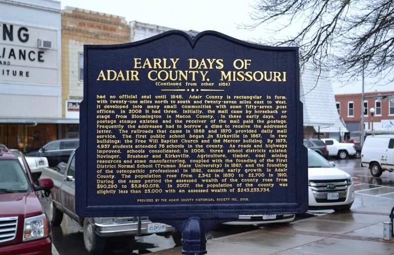
The first attempt at a settlement by Whites in this county was in 1828, twenty-five years after the Louisiana Purchase and three years after extinction of the Indian title. Settlers from Howard County decided to locate on the east side of the . . . — — Map (db m144764) HM
Kirksville, distinguished as the site of Missouri's first State teachers college and the world's first college of osteopathy, was settled by pioneers mainly from Kentucky and Tennessee about 1828. First known as Long Point, then as Hopkinsville, . . . — — Map (db m267552) HM
On April 27, 1899, at 6:20 p.m. a monstrous killer cyclone approached Kirksville from the southwest taking dead aim on the new Adair County Courthouse. Suddenly, the cyclone veered more to the northeast, making a clear path of destruction from the . . . — — Map (db m144767) HM
Andrew County, organized 1841, is one of 6 counties in the Indian Platte Purchase Territory annexed to Missouri, 1837. Named for Andrew Jackson Davis, St. Louis editor, the county was first settled in the middle 1830’s. Pioneers were from Ohio, . . . — — Map (db m39756) HM
Members of the Christian Church in Savannah have worshipped in four different buildings — all located on this half-block of land. 1. 1847 — Church organized. Members met in the Courthouse, located near Sixth Street. 2. 1852 — The first church was . . . — — Map (db m216797) HM
Formed during the Glacial Period. Weighs about a Ton. Removed from Bethel Church Road east of Highway 71 and North of 48 by County in 1941. Removed and placed here by Andrew County and Fred M Clark of Clark Construction Co. in September 1941 for . . . — — Map (db m43018) HM
This local church, a part of the American religious movement known as The Disciples of Christ, was organized in 1847 and since its beginning has been a fellowship of over 5000 members. This present location, Fifth and Market Streets, has been the . . . — — Map (db m216796) HM
Federal Emergency Administration of Public Works Franklin D. Roosevelt President of the United States Harold L. Ickes Administrator of Public Works — — Map (db m216754) HM
Atchison County Citizens
have left and will continue
to leave their footprints
around the world
Bravery • Courage
Hope • Duty
Liberty • Service
Dedicated November 11, 2008 — — Map (db m48118) WM
To the men and women
of Atchison County who
offered, and those who
gave their lives in the
cause of peace.
[Roll of Honored Dead]
[War Memorial Building Cornerstone]
To the boys of Atchison County
who gave, and offered their . . . — — Map (db m48115) WM
Here on Rock Creek in Missouri's fertile Glacial Plains, Rock Port was laid out, 1851, by Nathan Meek and succeeded Linden as seat of Atchison County, 1856. A leader in corn production, the county, organized 1845, is named for U.S. Sen. David R. . . . — — Map (db m48107) HM
July 4th Wednesday (1804)
…proceeded on, passed the mouth of a Bayeau lading from a large Lake on the S.S. which has the appearance of being once the bed of the river & reaches parrelel for several Miles…
William Clark
Traveling up the . . . — — Map (db m44569) HM
Missouri was a beginning and end for the Lewis and Clark Expedition. Planned by President Thomas Jefferson and carried out by the two captains and a large crew, the expedition is a keystone American event. When the United States took ownership of . . . — — Map (db m44590) HM
The land that would become Missouri and 14 other western states was acquired by the United States in the greatest land acquisition in American history: the Louisiana Purchase. By the stroke of a pen, President Thomas Jefferson ensured the country . . . — — Map (db m44615) HM
"Groops of Shrubs covered with the most delicious froot is to be seen in every direction, and nature appears to have exerted herself to butify the Senery by the variety of flours [flowers] Delicately and highly flavered raised above the Grass, . . . — — Map (db m44624) HM
Fire Support Specialist
71st Calvary Regiment
3rd Brigade Combat Team
10th Mountain Division
Operation Enduring Freedom in Afghanistan
The Littlest Soldier with the Biggest Heart
Greater love hath no [man] than this,
that he lay . . . — — Map (db m55835) WM
• Built July, 1937 in West Burlington,
Iowa by C.B.&Q. at a cost of $99,285.00
• Weight 288 Tons or 576,000 lbs.
• Class 0-5-B Northern Type
• Used in Passenger and Freight Service
• Later Improvements Totaled $107,525.00
• . . . — — Map (db m47491) HM
Born in St. Joseph, Missouri, Coleman Hawkins got his first saxophone at age nine and was traveling coast to coast, recording with Mamie Smith and the Jazz Hounds while still in his teens. Credited with making the sax a solo jazz instrument, . . . — — Map (db m66410) HM
Robert Washington Donnell, one of the first settlers of the Platte Purchase, was instrumental in organizing the Bank of the State of Missouri and securing St. Joseph's position as the eastern terminus of the Pony Express. — — Map (db m66385) HM
Designed by Eckel and Mann. The bank's owners were members of the German Krug family who were noted for their philanthropy.
This property has been
placed on the
National Register
of Historic Places
by the United States . . . — — Map (db m66416) HM
Outlaw Jesse James was killed here April 3, 1882 by Bob Ford. The house is now on the grounds of the Patee House Museum two blocks south. This hill has been lowered more than 50 feet.
Sponsored by
St. Joseph Convention Visitors Bureau . . . — — Map (db m253038) HM
Outlaw Jesse James was shot and killed in this house April 3, 1882. It was then at 1318 Lafayette on the hill above Patee House. It was moved here in 1977. — — Map (db m58835) HM
Upper floors were originally leased to dentists and physicians while Krumm Florist and Haefli Real Estate occupied the main floor. — — Map (db m66393) HM
Oldest building west of the Mississippi River to function continuously as a bank.
This property has been placed on the
National Register
of Historic Places
by the United States
Department of the Interior
Saint Joseph . . . — — Map (db m47475) HM
On April 1, 1846, Simeon Kemper obtained a United States government patent for one hundred sixty acres at $1.25 per acre. Four years later, Kemper took two partners, Israel Landis and Reuben Middleton, who paid him almost $200 per acre for their . . . — — Map (db m66373) HM
Too young and naïve
to think they could fail
Too full of visions
for the end of the trail
They stored their silk dresses
and donned calico
To join in the cry
of Westward Ho
Their diaries tell
of the endless hours
The . . . — — Map (db m55832) HM
The Patee House was the Pony Express Company's Eastern Headquarters from April 3, 1860 to September 13, 1861. The company's official name was "The Central Overland California and Pike's Peak Express Company."
John Patee built the hotel from . . . — — Map (db m47398) HM
Patee House – 1858
In this National Historic Landmark were located the offices of the Pony Express, founded by Russell, Majors & Waddell; the Hannibal & St. Joseph Railroad and the Civil War offices of the U.S. Provost Marshall. [sic] . . . — — Map (db m47444) HM
Patee Park Baptist Church is the second oldest Baptist Church in St. Joseph. It began as a Sunday School in 1881 under the leadership of H.G. Walker, an active leader in the First Baptist Church of St. Joseph.
It was organized as a church . . . — — Map (db m48080) HM
John Patee came to St. Joseph in 1845 and opened the city's first drugstore at the corner of of Main and Francis Streets. He purchased 320 acres, platted what was known as "Patee Town" and began selling building lots in 1849. He later built the . . . — — Map (db m22072) HM
John Patee came to St. Joseph in 1845 and opened the city's first drugstore at the corner of of Main and Francis Streets. He purchased 320 acres, platted what was known as "Patee Town" and began selling building lots in 1849. He later built the . . . — — Map (db m288287) HM
[Numerous memorials to
fallen officers, including]
Joseph H. Killion
Patrolman - SJPD
Crushed By A Train In The
Line of Duty
Died June 14, 1917
Greater Love Hath No Man Than This,
That a Man Lay Down His Life For His . . . — — Map (db m55836) HM
Sixteen years after the admission of Missouri to the Union. This territory now comprising six counties was purchased from the Sax, Fox and Ioway Indians. Negotiations for the United States were conducted by William Clark, Governor of Indian . . . — — Map (db m156350) HM
On April 3, 1860 the eastern Pony Express mail arrived by train and it was late. To save time the Pony Express Company which was located in the Patee House at 12th and Penn Streets had the mail taken directly to the post office. The post office . . . — — Map (db m47480) HM
1,996 miles in 10 days.
A daring horseback relay mail service connects the nation.
The Vision of the Pony Express
In January 1860. William H. Russell, Alexander Majors, and William B. Waddell, right, (partners in the freighting firm . . . — — Map (db m122600) HM
Inside are twelve Gustuf Dalstrom murals depicting
St. Joseph's history from its first Indian inhabitants
through the Pony Express to the turn of the century. — — Map (db m287915) HM
With the faith and courage of
their forefathers who made
possible the freedom of these
United States
The Boy Scouts of America
dedicate this copy of the
Statue of Liberty as a pledge
of everlasting fidelity and
and loyalty . . . — — Map (db m55726) HM
Renowned city of the Pony Express, St. Joseph was first settled as a trading post for the American Fur Company by Joseph Robidoux, 1826. Later he acquired the site and laid out a town in 1843.
St. Joseph became an outfitting point for . . . — — Map (db m4989) HM
Killed in Action
Operation Iraqi Freedom
United States Army
3rd Battalion,
69th Armor Regiment,
3rd Infantry Division,
Fort Stewart, Ga
“I made the ultimate sacrifice for you” — — Map (db m55833) WM
On April 3, 1860, the Pony Express started from this neighborhood on its historic run to the West. Eight months after the Pony Express joined East and West, the country split North to South when South Carolina seceded. Missouri, including St. . . . — — Map (db m48063) HM
This monument erected by the
Daughters of the American Revolution
and
The City of St. Joseph
marks the place where the first
Pony Express started on April 3, 1860 — — Map (db m47492) HM
After the 1848 discovery of gold in California, more than 100,000 sturdy Americans passed through St. Joseph on their way west in quest of wealth, opportunity and better lives. The "Gold Rush" began and those who followed the "Star of Empire" . . . — — Map (db m47479) HM
For nearly 250 years the country school was the backbone of American education. These simple buildings often served as school, chapel, town hall and community center.
One-room schoolhouses were the most common type of schools in the Midwest . . . — — Map (db m122675) HM
The Patee House
has been designated a
Registered National Historic Landmark
under the provisions of the
Historic Sites Act of August 21, 1935
This site posseses exceptional value in commemorating and illustrating the history of . . . — — Map (db m47443) HM
The Hotel Patee House opened in 1858 as St. Joseph’s finest hotel. It later served as the national Pony Express headquarters, the local Union Army headquarters, a women’s college and a factory. The building is now a National Historic Landmark. . . . — — Map (db m47441) HM
Between July 4 and October 24, 1861, a telegraph line was constructed by the Western Union Company between St. Joseph, Missouri, and Sacramento, California, thereby completing the first high-speed communications line between the Atlantic and . . . — — Map (db m47465) HM
Just south of Fort Smith hundreds of slaves escaped by crossing the frozen Missouri River during the winter of 1862-1863. Once in eastern Kansas, the slaves would move on to Iowa, Chicago, and other points north.
Slavery in Missouri generally . . . — — Map (db m79287) HM
Born in Phil. Pa. Dec. 6, 1808,
Died in St. Joseph Mo.
Apr. 28, 1898
Aged 89 years.
United with the M. E. Church
in 1834.
A member of the I.O.O.F.
from 1850 till death.
In June 1827, became a professional undertaker and funeral . . . — — Map (db m66453) HM
Fort Smith was erected in September 1861 as a Union fortification. St. Joseph was of great importance to preservation of the United States and the security of the goldfields of California for the war effort.
A military presence in St. Joseph . . . — — Map (db m79280) HM
Near this site the French fur trader Joseph Robidoux established a trading post in 1826 while it was still Indian territory. Robidoux and his family oversaw a far-ranging fur trading empire.
The Platte Purchase of 1837 added the six county . . . — — Map (db m47468) HM
Joseph Robidoux, founder of St. Joseph, was the leader of a French-Canadian fur trading family which sent men out to trade with the Indians along the Missouri River and as far west as today's Wyoming, Colorado, and New Mexico. From his first trip . . . — — Map (db m91000) HM
Lynching in America
Racial terror lynchings between 1865 and 1950 claimed the lives of at least 6,500 Black people and terrorized millions more who were denied equal protection under the law. After the Civil War, white people around the . . . — — Map (db m284946) HM
On this site, April 3, 1860, a ferry carrying a horse and rider crossed the Missouri River to start a 10 day journey of 1,966 miles to deliver mail to Sacramento, California.
The race against time, elements and a hostile land captured the spirit . . . — — Map (db m47470) HM
In 1860, the United States stood on the brink of Civil War. Following the election of Abraham Lincoln as America's 16th President, states began seceding from the United States to form a new nation, the Confederate States of America.
In April . . . — — Map (db m79274) HM
St. Michael's Prairie
St. Michael’s Prairie, the site where St. Joseph would be established, was identified on maps at least as early as 1792. French explorers and trappers had been traveling up and down the Missouri River since the early . . . — — Map (db m47472) HM
Each spring thousands of emigrants camped in these hills and meadows waiting for new grass to support their teams along the trail. Wagons lined St. Joseph streets to the east waiting for two to three days to be ferried from this point. The settlers . . . — — Map (db m47467) HM
In 1804-06, Captains Meriwether Lewis and William Clark led about 40 soldiers and boatmen on an epic journey. President Thomas Jefferson commissioned this "Corps of Discovery" to find a route to the Pacific Ocean through the newly acquired . . . — — Map (db m89212) HM
The Men of the Corps of Discovery
During the winter of 1803, Lewis and Clark set up camp opposite the mouth of the Missouri River. Here they drilled and trained their men to prepare them for the task ahead. All of the men had been selected . . . — — Map (db m79291) HM
The National Significance of the Pony Express
The Pony Express ran from April 3, 1860, until the transcontinental telegraph was completed in October, 1861. The Pony Express proved that the Central Route to California could be traveled all . . . — — Map (db m79289) HM
In December 1835, Church member Jacob Haun acquired this tract of land and hired the construction of a gristmill. By 1838 an 18-foot square blacksmith shop had also been built and 10 to 15 families lived in the community. Cultural differences . . . — — Map (db m153436) HM
Mill Stone believed to be from Haun's Mill (1836- ca. 1845)
This relic represents a tragic episode in American Religious history. A testament to an enduring need for greater understanding and tolerance between peoples of differing ideologies, . . . — — Map (db m22564) HM
These lots were once occupied by brick buildings built in 1884,
by Charles B. Franke. Going from South to North there was a
hotel and double-fronted retail store. The hotel was first the
Franke Hotel, then Rhodes House, Hotel de Porter and . . . — — Map (db m287171) HM
Founded in 1855 and named for Alexander Hamilton and Joseph Hamilton. First incorporated in 1868. Ten miles southwest the Mormons in 1836 established the town of Far West, the county seat from 1836 to 1843. — — Map (db m66996) HM
Hamilton was built around the Hannibal & St. Joseph Railroad, which was completed on Valentine's Day, 1859. In the fall of the same year, the Hamilton Depot was built. In 1885 a spur line to the Hamilton Coal Mine was added and later extended to . . . — — Map (db m156949) HM
Born September 16, 1875 in Hamilton, Missouri.
Lived in Hamilton 1875 - 1897.
————————————————
Founded the J.C. Penney Company on April 14, 1902
in Kemmerer, Wyoming.
Retail Visionary, Entrepreneur, Philanthropist,
Philosopher, and . . . — — Map (db m287161) HM
J.C. Penney 1875-1971 • 500th J.C. Penney Store opened in 1924 • Frank Clark's Mill 1867 • Sam McBrayer's Livery Stable 1898 • Caldwell County Courthouse in Kingston Built 1898 • J.C. Penney Farms • Far West Memorial • Hamilton Holiday Street . . . — — Map (db m66988) HM
J. C. Penney's Boyhood Home
Zach Wheat · Baseball Hall of Fame
Home of Northwest Mo. Steam & Gas Engine Show
Missouri Star [symbol of the quilt company]
Penney [High School] Hornets — — Map (db m156954) HM
Caldwell County
Courthouse
Erected 1898
Caldwell County became a county
December 26, 1836
This building is on the National
Register of Historic Places . . . — — Map (db m157003) HM WM
The fertile Shoal Creek Valley, Kingston was laid out in 1843 to replace Far West as seat of Caldwell County. Organized in 1836, the county was to be for Latter Day Saints (Mormons), ejected from Jackson County in 1833 and asked to leave Clay . . . — — Map (db m144715) HM
[Front]
This memorial is erected on the farm of
Zachariah Wheat. His home on this farm was
completed in 1924. Zach left this farm in the
mid 1930's.
He was unanimously elected into the
Baseball Hall of Fame in 1959,
"The only player . . . — — Map (db m157006) HM
Presented and placed atop the
Carroll County Courthouse
when building was erected 1902-1903
Removed in 1953 -- Erected this location
as a historical landmark in 1970
by the County Court. — — Map (db m90892) HM
Born in County Tyrone · Ireland
May 10-1810
Died in Ottumwa · Iowa
June 1-1879
Soldier · Jurist · Statesman
United States Senator from
Illinois · Minnesota and Missouri
Cerro Gordo · Chapultepec
Winchester · Port Republic
Erected by . . . — — Map (db m90874) HM WM
Born in County Tyrone, Ireland
May 10, 1810
Died June 1, 1879
Rests in St. Mary's Cemetery near
Carrollton, Missouri
Soldier · Statesman
Jurist · Patriot
Brigadier General
Mexican War · Civil War
Cerro Gordo · Winchester . . . — — Map (db m90890) HM WM
On Oct. 24, 1838 about 800 Potawatomi Indians camped near Carrollton on forced emigration from Indiana to Kansas. Cold was intense on the prairie. — — Map (db m198474) HM