On The Peth (England Route B6341) at Bailiffgate, on the left when traveling south on The Peth.
Castle Quarters
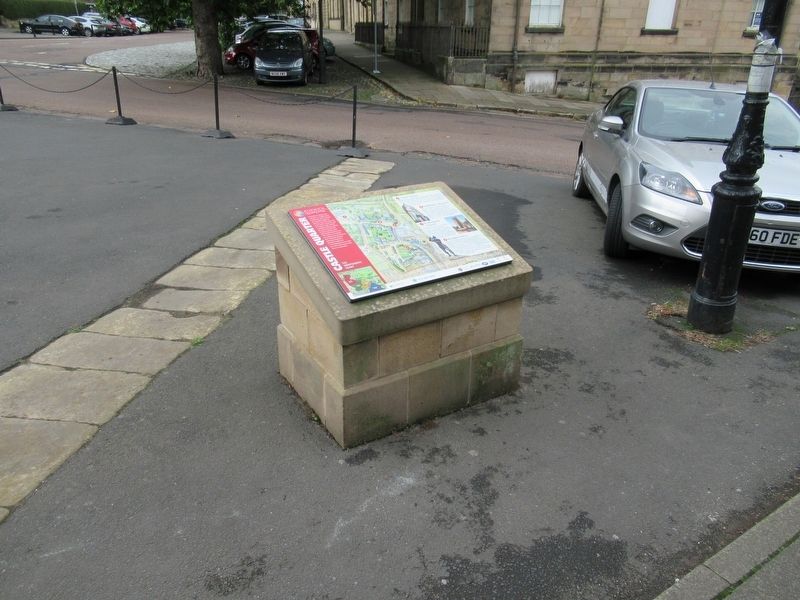
Alnwick Quarters
Aln, Celtic for bright river, and wick, an Anglo-Saxon settlement, point towards the possible origins of Alnwick. From the Normans to the Tudors, Alnwick, with its mighty castle, offered a strategic defence . . . — — Map (db m125983) HM
On Bondgate Within (Route B6346) at England Route B1340, on the left when traveling east on Bondgate Within.
This Column of Remembrance
Is Dedicated to the Men of
Alnwick Who Gave Their Lives
In The Wars Of
1914 — 1918 & 1939 — 1945
We will remember them
( upper small plaque )
Korea War 1950 – 53
Flis. A. . . . — — Map (db m126057) WM
Near The Peth (Route B6341) at Bailiffgate, on the left when traveling south.
Fusiliers Museum of Northumberland
Bosnian Croat Army 76mm Artillery Gun
Regimental Sergeant Major Mac Leyland and Corporal Mac McGuiness, 1st Battalion Royal Regiment of Fusiliers took possession of this gun when on peace-keeping duties in . . . — — Map (db m126054) HM
On Market Street (England Route B6341) at Bondgate Within, on the right when traveling east on Market Street.
Restored 1986
Presented by
Adam Robertson to
His Native Town
1890
Opened by Earl Percy June 8th 1891
Robertson’s Pant
This fountain
or pant was erected
in 1890 by Adam Robertson
local freeman and
benefactor as a
gift to his . . . — — Map (db m126056) HM
On Pottergate at Narrowgate, on the right when traveling east on Pottergate.
Sir Henry Percy 'Harry Hotspur' c1364 – 1403
“...and by his light did all the chivalry of England move to do brave acts.”
William Shakespeare - Henry IV, Part II
This statue was commissioned by Alnwick Community Development . . . — — Map (db m126055) HM
Near The Peth (England Route B6341) at Bailiffgate, on the left when traveling south.
Sir Henry Percy Hotspur
Harry Hotspur was born at Alnwick Castle in 1364 or 1366 and was knighted in 1377 at the time when his father was created 1st Earl of Northumberland. He was supremely powerful in combat on land and sea, though sometimes his . . . — — Map (db m125984) HM
Near Links Road at Front Street, on the right when traveling north.
Early 19th Century Iron Mortar
Fitted to a wooden gun carriage this mortar is fitted with a cascabel. This ring at the breech or back of the cannon was used to attach lifting tackle when mounting or un-mounting it from its carriage. The mortar's . . . — — Map (db m125930) HM
Near Links Road at Front Street, on the right when traveling north.
It is believed that the castle acquired these two 24 pounder cannons when Napoleon was threatening to invade England in 1798. The stylised 'N' located on the left hand side of the breech is a naval service mark. This tells us that the cannons were . . . — — Map (db m125934) HM
Near Links Road at Front Street, on the right when traveling north.
This gun was purchased for £34.1.0. with an additional 74 barrels of gunpowder & a carriage bringing the total cost to £36.14.0. On 29th March 1784 Mr Cookson arranged to transport the 32 Pounder Gun on his sloop bound for Wareham, just outside . . . — — Map (db m125936) HM
Near Links Road at Front Street, on the right when traveling north.
This bell was originally in a cap house on top of the clock tower known also as the Belle Tower! As an integral part of the mechanism it sounded out at regular intervals. It was moved to its current site here in the apse of the chapel as its . . . — — Map (db m125982) HM
Near Links Road at Front Street, on the right when traveling north.
Bamburgh Castle Coastguard Station
In 1771 The Crewe Trustees published an:
“Account of the Signals made use of at Bamburgh Castle in the County of Northumberland in case Ships or Vessels are perceived in Distress, and of the charitable . . . — — Map (db m125937) HM
Near Links Road at Front Street, on the right when traveling north.
547 Bamburgh’s Recorded History Begins
Noted in the Anglo-Saxon chronicles, Ida the flamebearer conquers Din Guayrdi, Bamburgh, making it the capital of his kingdom of Bernicia.
607 – 634 Aethelfrith the Ravening Wolf
Added . . . — — Map (db m125927) HM
Near Links Road at Front Street, on the right when traveling north.
Once home to the Kings of Northumbria, from King Ida in the mid 6 Century, through toLord Armstrong, a ‘King’ of Industry, Bamburgh Castle has dominated this coastline from wooden palisade to sandstone fortress.
The story of Bamburgh goes . . . — — Map (db m125923) HM
Near Links Road at Front Street, on the right when traveling north.
This vaulted room is the middle floor of three built into the easterly of two towers on the inner curtain wall. The tops of the towers were removed during re-modelling in the late 1800s and now form seating areas The lower room is identifiable . . . — — Map (db m125978) HM
Near Links Road at Front Street, on the right when traveling north.
Originally discovered in the 19th century and thought to be a piece of a standing cross this piece of stone was later identified as belonging to a stone chair. It is currently on display in the Archaeology Room. It has been dated to around 800AD . . . — — Map (db m125941) HM
Near Links Road at Front Street, on the right when traveling north.
History
Often confused with the pillory, stocks were only designed to hold the legs and occasionally arms, whereas the pillory held the head as well. Perhaps the most famous person placed in the stocks was Cardinal Wolsey after he got drunk at . . . — — Map (db m125939) HM
Near Links Road at Front Street, on the right when traveling north.
Dating from the late 1600s this cannon was affectionately named the Armada Gun as it was believed to have come from a Spanish Armada vessel after the fleet was driven up the North Sea Coast. It was later confirmed as a Dutch trading vessel that . . . — — Map (db m125977) HM
Near Links Road at Front Street, on the right when traveling north.
The islands before you are the Farne Islands between 15 and over 20 depending on the state of the tide.
The islands were a renowned hazard to shipping and in the 18th Century, Dr Sharp, working for the Trustees of Lord Crewe, created one of . . . — — Map (db m125925) HM
Hadrian's Wall formed the north-west frontier of the Roman empire for most of the period AD 122-410. The empire's frontiers extended over 5,000 km from the Atlantic coast of Britain through Europe, the Middle East and across North Africa to the . . . — — Map (db m85985) HM
Where National Park meets World Heritage Site
Your visit
You have come to a very special place. The landscape is full of clues to our past, but it is also important for our future.
Not just a pretty place
The inspirational landscape . . . — — Map (db m86361) HM
On Middle Street at Market Place, on the right when traveling north on Middle Street.
Corbridge
The scene of stormy events in the past.
In 796 Ethelred, King of Northumbria was slain here.
In 918 King Regnald the Dane defeated the English and Scots armies here.
In 1138 King David I of Scotland occupied the town.
In 1201 it . . . — — Map (db m125635) HM
Near Corchester Lane, 0.8 kilometers west of Stagshaw Road, on the left when traveling west.
Corbridge Roman Site
The first Roman fort at Corbridge was built about a kilometre to the west of here. It was built as a supply base for the Roman advance into Scotland in about AD 80. Five years after the fort was abandoned, the first of a series . . . — — Map (db m125529) HM
On Middle Street at Market Place, on the right when traveling north on Middle Street.
To the Greater Glory of God
And in Never Fading Memory of All
Who the Noble Sons of This Parish
Who Laid Down Their Lives
For God King and Country in the
Great War 1914 – 1918
This Lychgate was Erected 1920
“A People That . . . — — Map (db m125634) WM
Near Corchester Lane, 0.8 kilometers west of Stagshaw Road, on the left when traveling west.
The Courtyard Building
About AD 165 a new layout for Corbridge was planned. The earlier fort buildings were mostly demolished and a little later work began on this large courtyard building. We do not know with certainty the original function of the . . . — — Map (db m125540) HM
Near Corchester Lane, 0.8 kilometers west of Stagshaw Road, on the left when traveling west.
The Early Forts
The earliest forts at Corbridge were built largely of timber. It was not until the middle of the second Century, when the last fort was built, that extensive use was made of stone.
The remains which you can see here belong to . . . — — Map (db m125541) HM
Near Corchester Lane, 0.8 kilometers west of Stagshaw Road, on the left when traveling west.
The East Military Compound
You are now standing in the east military compound, some of which lies buried in the field behind you. The most substantial remains within the compound belong to a pair of residential houses to your left, in the . . . — — Map (db m125542) HM
Near Corchester Lane, 0.8 kilometers west of Stagshaw Road, on the left when traveling west.
The Fountain House
An aqueduct brought water into the site from the north to feed a fountain here. The water flowed through an ornamental fountain-head into a large basin surrounded with decorated stone screens and from there into the stone trough . . . — — Map (db m125539) HM
On Hill Street at Princes Street, on the left when traveling east on Hill Street.
The Golden Lion was built from stones from Dilston Hall, demolished in 1768 during the break up and sale of the property after Lord Derwent-Waters execution for his part in the Jacobite Rebellion. The stone originally came from the Roman bath . . . — — Map (db m125631) HM
On Corchester Lane, 0.8 kilometers west of Stagshaw Road, on the left when traveling west.
The Granaries
In front of you are the remains of two large granaries. They were designed to store grain to make bread, an important part of a Roman soldier's diet.
Inside the buildings the stone floors rest on low stone walls with channels . . . — — Map (db m125538) HM
Near Corchester Lane, 0.8 kilometers west of Stagshaw Road, on the left when traveling west.
The Main Street
This was the main street of the town. It formed part of an important Roman road known as the Stanegate which ran all the way from Corbridge to Carlisle. To your left are the remains of shops, a fountain, and two granaries. On its . . . — — Map (db m125531) HM
Near Middle Street close to Market Place, on the right when traveling north.
The Old Market Cross
Which, mounted on a Roman altar from Corstopitum, stood for some 6oo years in the market place it was removed in 1807, and restored and re-erected on its present site in 1975. — — Map (db m125639) HM
Near Corchester Lane at Stagshaw Road, on the left when traveling west.
The Side Street
This is the side street which divides the two military compounds. Originally it joined the Stanegate (the main street), but sometime in the third or fourth centuries a wall was built which closed off the far end and also linked the . . . — — Map (db m125543) HM
Near Corchester Lane, 0.8 kilometers west of Stagshaw Road, on the left when traveling west.
The West Headquarters Building
This building is thought to have been the administrative headquarters of the west compound. It was divided internally into six rooms probably with arched openings between them. The room in the centre at the back of . . . — — Map (db m125546) HM
Near Corchester Lane, 0.8 kilometers west of Stagshaw Road, on the left when traveling west.
The West Military Compound
You are now standing in the west military compound some of which lies buried in the field behind you. To your left. opposite the main gate, is the Headquarters building. There is a small underground chamber which is . . . — — Map (db m125544) HM
On Middle Street at Market Place, on the right when traveling north on Middle Street.
Vicar’s Pele
This tower, the finest of its kind, was built about AD 1300 for a Vicar of Corbridge and was lived in as a fortified vicarage until the early seventeenth century. — — Map (db m125637) HM
Near England Route B6319, 2.9 kilometers west of North Road, on the right when traveling west.
16th Century Bastle House Ruined buildings were adapted and new ones built at Housesteads in the centuries after the Romans left, when the land around became an upland farm. In the 16th century a local family built a fortified house onto the . . . — — Map (db m126423) HM
Near England Route B6319, 4.7 kilometers west of North Road, on the right when traveling west.
A Changing Fort
During its 280-year life, many changes were made in the fort, no more so than to building XV. Over the years, it served as a workshop, a barracks, a stable, and a storehouse before a small bathhouse (balneae) was placed . . . — — Map (db m126449) HM
Near road 68, 4 kilometers north of England Route A69, on the left when traveling north.
A military community Villages like Vindolanda were a vital part of the military occupation of Hadrian's Wall, and were planned extensions of the forts themselves. They provided extra space for facilities such as shops, workshops, additional . . . — — Map (db m126419) HM
On England Route B6295 at an unnamed road to Rockhope, on the right when traveling north on State Route B6295.
To the Glory of God
And in Proud and Loving Memory
Of the Men of This Parish, Who
Gave Their Lives in the Great War
1914 — 1918
William Frederick Pearson.
Gilbert Graham.
William Vickers.
George Sparke.
“Greater love . . . — — Map (db m126414) WM
Near Route B6319, 4.7 kilometers west of North Road, on the right when traveling west.
Barracks: the Last Hundred Years at Housesteads
Archaeology has revealed radical changes to the fort beginning around AD 300. One of the most important was the reconstruction of the barracks from single long buildings into smaller individual . . . — — Map (db m126447) HM
Near road 68, 4 kilometers north of England Route A69, on the left when traveling north.
The remains of the stone buildings that you see around you are but a fraction of what was once here at Vindolanda in ancient times. Before the last stone fort was built around AD213, eight forts had preceded it. Most of the earlier forts were . . . — — Map (db m126354) HM
Near road 68, 4 kilometers England Route A69, on the left when traveling north.
Vindolanda Charitable Trust
Chesterholm Museum
In 1831, Vindolanda's first excavator, Rev. Anthony Hedley, removed the remains of the derelict Scotsholm fulling mill, and built an ornate cottage for his family, calling it Chesterholm. Designed by . . . — — Map (db m126356) HM
On Stanegate, 5.2 kilometers west of North Road, on the right when traveling west.
Crindledykes
Limekiln
This is one of several limekilns built in this area in the nineteenth century to convert local limestone to quicklime for use in farming and building.
Limestone and coal were hauled up the ramp and tipped into the pot for . . . — — Map (db m126420) HM
Near road 68, 4 kilometers north of Route A69, on the left when traveling north.
Dolichenum — Temple to Jupiter Dolichenus
fanum livi Dolicheno dedicatum
This was an extremely rare temple dedicated to the god Jupiter Dolichenus, built around AD220 inside the walls of the fort, probably by a commanding officer of . . . — — Map (db m126416) HM
Near Route B6319, 2.9 kilometers Route A69, on the right when traveling west.
Mediterranean Style in Northern Climes
All Roman forts included a large prestigious house (praetorium) for the commanding officer (praefectus), his family and servants.
The praetorium was the largest building in the fort. The design came . . . — — Map (db m126424) HM
Near road 68, 4 kilometers north of Route A69, on the left when traveling north.
North West Quadrant barracks — excavated 2009-2011
These standard Roman Army barracks were constructed in cAD213 by the 4th cohort of Gauls and remained in use until the end of the 3rd century, after which they were demolished and replaced . . . — — Map (db m126362) HM
Near road 68, 4 kilometers north of England Route A69, on the left when traveling north.
Vindolanda Charitable Trust
Roman Pottery Kiln
This fully functional replica of a Roman up-draft pottery kiln, is based on information gained from the excavation of such kilns at archaeological sites across the North of England. The body of the . . . — — Map (db m126355) HM
Near road 68, 4 kilometers north of Route A69, on the left when traveling north.
S.P.Q.R.
In Memory of the Soldiers
Who Served Rome on the
Frontier at Vindolanda.
A.D. 85 — 400
Cohorts:
I Tungrorvm
III Batavorvm
VIII Batavorvm
II Nerviorvm
III Nerviorvm
IV Gallorvm
And Detachments . . . — — Map (db m126358) HM WM
Near road 68, 4 kilometers north of Route A69, on the left when traveling north.
Severan Circular Huts
Below the NW quadrant of the fort the remains of a series of circalar huts dated to cAD208-212 have been uncovered. These huts appear to have been living accommodation for an unknown group of people during a time of . . . — — Map (db m126415) HM
Near England Route B6319, 4.7 kilometers west of North Road, on the right when traveling west.
The Comanding Officer and his House
Each commanding officer (praefectus) of the fort was a nobleman of the equestrian class (equites), who might have been in charge of the soldiers at Housesteads for as little as three years before . . . — — Map (db m126431) HM
Near England Route B6319, 4.7 kilometers west of North Road, on the right when traveling west.
The Fort and its Design
Roman soldiers began to build Housesteads around AD 124 to a design used for forts across the Roman Empire. This fort is one of the best surviving examples, anywhere.
Housesteads follows a text-book template, . . . — — Map (db m126422) HM
Near Route B6319, 2.9 kilometers west of North Road, on the right when traveling west.
The Fort Food Supply
Roman forts had granaries to store the huge quantities of food required by hundreds of soldiers. The food supply had to be safe, dry and constantly replenished.
The granary (horreum) was essential for storing foods of . . . — — Map (db m126439) HM
Near road 68, 2.5 kilometers north of England Route A69, on the left when traveling north.
Three buildings dominated a Roman military settlement and these were all placed in the middle of the fort. The principia, praetorium and the horrea formed a central range of imposing buildings which could easily have been identified and located by . . . — — Map (db m126360) HM
Near England Route B6319, 2.9 kilometers west of North Road, on the right when traveling west.
The Heart of the Fort
The headquarters building (principia) was the administrative, ceremonial and symbolic heart of the fort – where regimental organisation and the imperial state religion were focussed. The building was in the . . . — — Map (db m126450) HM
Near road 68, 4 kilometers north of England Route A69, on the left when traveling north.
The Milestone
Three hundred yards to the north of this place, at the side of the Stanegate road, stands the only Roman milestone from Britain to survive intact in its original position (although without an inscription).
This replica milestone . . . — — Map (db m126357) HM
Near Route B6319, 4.7 kilometers west of North Road, on the right when traveling west.
The North Gate
The north gate (porta principalis sinistra) is the only one of the original four which opened onto land beyond the Wall. However, the approach from the north was steep and the gate was eventually reduced to a minor . . . — — Map (db m126444) HM
Near road 68, 4 kilometers north of Route A69, on the left when traveling north.
The Severan fort
Castellum Severianum
These buildings belonged to an earlier fort, used between AD208 – 211, during the reign of the African emperor Septimius Severus. The series of long rectangular buildings now on display were . . . — — Map (db m126417) HM
Near B6319, 4.7 kilometers west of North Road, on the right when traveling west.
The Vicus
Life Outside the Fort
Soldiers and civilians mixed in the vicus, a settlement outside the fort. It was a lively community of people from many places in the Empire, engaged in trade, leisure and worship. Soldiers' sweethearts and . . . — — Map (db m126421) HM
Near road 68, 4 kilometers north of England Route A69, on the left when traveling north.
You are approaching the edge of the village (vicus), looking east towards the heart of the settlement where the vicus met the walls of the fort. Where you are standing today was the main temple precinct in the 3rd century. Temple buildings . . . — — Map (db m126345) HM
Near England Route B6319, 2.9 kilometers west of North Road, on the right when traveling west.
The Wall Arrives
In AD 122, the Emperor Hadrian's decision to build the Wall was transformed into action all along the frontier. The foundation for the Wall and a lookout tower were begun here at Housesteads, before everything changed... . . . — — Map (db m126438) HM
Near road 68, 4 kilometers north of Route A69, on the left when traveling north.
Exact Replicas of Vindolanda Inscriptions
The three great altars and the tombstones were found built Anthony Hedley at Vindolanda in the early nineteenth century, and they are now in Chesters Museum.
RIB 1685
Translation:
Sacred to the . . . — — Map (db m126359) HM
Near England Route B6319, 2.9 kilometers west of North Road, on the right when traveling west.
Where the Soldiers Lived
Most of the space within the fort was occupied by barracks where the soldiers and their officers lived.
In front of you are the wall foundations of building XIII, one of ten identical fort barracks completed under . . . — — Map (db m126446) HM
Near road 68, 4 kilometers north of Route A69, on the left when traveling north.
Workshops fabricae vel officinae
These buildings, flanking a major roadway through the village (vicus), were 3rd century industrial workshops. Excavated in 2004, they appear to have been used in the initial stages of iron production. A number of . . . — — Map (db m126344) HM
Near Castle Street at Wellfield, on the left when traveling north.
This private chapel was once the most ornate room in the keep. It had a gallery above, warmed by a fireplace, for the Earl and his family. This lower level was used by servants.
In the illustration the chaplain is saying daily prayers before . . . — — Map (db m126118) HM
Near Castle Street at Wellfield, on the left when traveling north.
This is the largest room in the keep, rising to its full height. It was used not only for state banquets but also for holding court and the reception of important visitors, who might also be invited to dine with the Earl.
The illustration . . . — — Map (db m126101) HM
On Front Street at Church Street, on the left when traveling west on Front Street.
This monument was erected in the year 1902, on the site of the ancient market cross by the inhabitants of Rothbury and other friends in admiration and grateful remembrance of the long and useful lives of William George Baron Armstrong of Cragside . . . — — Map (db m126651) HM
On Front Street at Church Street, on the right on Front Street.
To the Memory of
Those of This Parish Who Gave
Their Lives for Their Country.
William J. Atkinson · Reginald G. Agery · Jacob C. Bell · Norman E. Charlton · Thomas Cowans · William Dawson · John Dawson · Thomas Davison · Samuel T. Donkin · . . . — — Map (db m126650) WM
On Grange Road at Percy Road, on the right when traveling west on Grange Road.
World War I
Robert Baxter · George W. Buglass · Thomas H. Charlton · William Darling · Joseph J. Dunn · Robert Green · Joseph R. Hall · John Hindhaugh · George Slater · John Smails · William Smails · James J. Thompson · Alexander J. Tweedy · Thomas . . . — — Map (db m126100) WM