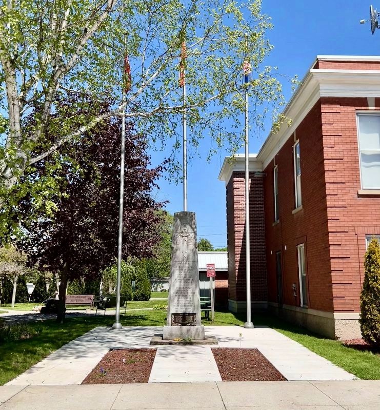
By Tim Boyd, May 11, 2025
Bothwell Cenotaph
GEOGRAPHIC SORT Title Sort Marker Number Sort Marker Number Sort for Trails Publication Order Sort Publication Order Sort A Erected Year Sort Most Viewed Sort Most Recent-Interest Sort Most Recently Changed Sort SEE FAQ #33 FOR DESCRIPTIONS
On Main Street at Elm Street East on Main Street.
On Main Street North (Chatham-Kent County Road 22) at Elm Street East on Main Street North (Chatham-Kent County Road 22).
On Riverview Line just west of Bloomfield Road, on the left when traveling east.
Near William Street North at Murray Street, on the left when traveling north. Reported missing.
On River Line (County Route 39) just east of Communication Road (Ontario Highway 40), on the left when traveling east.
On Queen Street south of Cross Street, on the right when traveling south.
Near William Street North at Murray Street, on the left when traveling north.
Near William Street North just north of Colborne Street (County Route 39), on the left when traveling north.
Near William Street North at Murray Street, on the left when traveling north.
On Riverview Line (County Route 36) 2 kilometers west of Bloomfield Road, on the left when traveling east.
On King Street East just east of Prince Street South, on the left when traveling east.
On Stanley Avenue at 7th Street, on the left when traveling east on Stanley Avenue.
Near William Street North.
On King Street West at 2nd Street, on the right when traveling south on King Street West.
On Riverview Line (County Route 36) close to County Route 36, on the left when traveling east.
Paid Advertisement
Near William Street North at Murray Street, on the left when traveling north.
Near William Street North at Murray Street, on the left when traveling north. Reported missing.
Near William Street North at Murray Street, on the left when traveling north.
On King Street East just east of Prince Street South, on the left when traveling east.
Near William Street North just west of Murray Street, on the left when traveling north.
On River Line (Route 39) just east of Communication Road (Ontario Highway 40), on the left when traveling east.
On King Street West west of 3rd Street, on the right when traveling west.
On King Street West west of 3rd Street, on the right when traveling south.
On Riverview Line (County Route 36) 2 kilometers west of Bloomfield Road, on the left when traveling east. Reported missing.
Near Uncle Tom's Road (County Route 40) close to Park Street, on the right when traveling north.
Near Uncle Tom's Road close to Park Street, on the right when traveling north.
On Uncle Tom's Road at Park Street, on the right when traveling north on Uncle Tom's Road.
Near Uncle Tom's Road (County Route 40) close to Park Street, on the right when traveling west.
Near Uncle Tom's Road close to Park Street, on the right when traveling north.
On Uncle Tom's Road at Park Street, on the right when traveling west on Uncle Tom's Road.
On Main Street at St. George Street, on the left when traveling east on Main Street.
Paid Advertisement
On Gardiner Avenue at Lakeshore Road, on the left when traveling east on Gardiner Avenue.
Near Longwoods Road (Provincial Highway 2) 4.2 kilometers east of Victoria Road (Provincial Highway 21), on the right when traveling east.
On Longwoods Road (County Route 2), on the right when traveling east.
On Longwoods Road (Provincial Highway 2) east of Victoria Road (Provincial Highway 21), on the right when traveling east.
On Longwoods Road south of County Highway 18, on the right when traveling east.
Near Longwoods Road (Provincial Highway 2) 4.2 kilometers east of Victoria Road (Provincial Highway 21), on the right when traveling east.
Near Longwoods Road (Provincial Highway 2) 4.2 kilometers east of Victoria Road (Provincial Highway 21), on the right when traveling east.
Near Longwoods Road (Provincial Highway 2) 4.2 kilometers east of Victoria Road (Provincial Highway 21), on the right when traveling east.
Near Longwoods Road (Provincial Highway 2) 4.2 kilometers east of Victoria Road (Provincial Highway 21), on the right when traveling east.
Near Longwoods Road (Provincial Highway 2) 4.2 kilometers east of Victoria Road (Provincial Highway 21), on the right when traveling east.
Near Longwoods Road (Provincial Highway 2) 4.2 kilometers east of Victoria Road (Provincial Highway 21), on the right when traveling east. Reported missing.
Near Longwoods Road (Provincial Highway 2) 4.2 kilometers east of Victoria Road (Provincial Highway 21), on the right when traveling east.
On Longwoods Road (Provincial Highway 2) 4.2 kilometers east of Victoria Road (Provincial Highway 21), on the right when traveling east.
Near Longwoods Road (Provincial Highway 2) 4.2 kilometers east of Victoria Road (Provincial Highway 21), on the right when traveling east.
On Longwoods Road (Provincial Highway 2) east of Victoria Road (Provincial Highway 21), on the right when traveling east.
Near Longwoods Road (Provincial Highway 2) 4.2 kilometers east of Victoria Road (Provincial Highway 21), on the right when traveling east.
Paid Advertisement
Near Longwoods Road 4.2 kilometers east of Victoria Road, on the right when traveling east.
On Old Glass Road at Garnet Street, on the right when traveling north on Old Glass Road.
On Dufferin Avenue 0.1 kilometers east of McNaughton Avenue, on the right when traveling east.
On James Street at Fork Street, on the right when traveling east on James Street.
On Saint Clair Parkway at Langstaff Line, on the left when traveling north on Saint Clair Parkway.
On Saint Clair Parkway at Langstaff Line, on the left when traveling north on Saint Clair Parkway.
︽