42 entries match your criteria.
Entries Containing All of the Phrases «st charles county» AND «missouri»
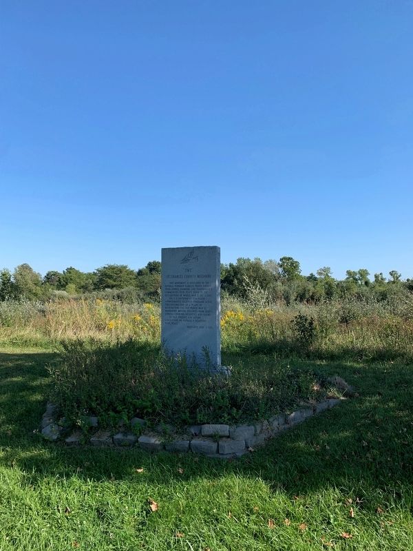
By Thomas Smith, September 26, 2002
"TNT" Marker
RANKED BY RELEVANCE
1 ► Missouri, St. Charles County, Weldon Spring — "TNT" — St. Charles County Missouri —  |
| On State Highway 94 0.2 miles east of Miller School Road, on the left when traveling west. | |||
| 2 ► Missouri, St. Charles County, St. Charles — St. Louis, St. Charles and Spain During the American Revolution — |
| On South Main Street north of Water Street, on the right when traveling north. | |||
| 3 ► Missouri, St. Charles County, Weldon Spring — 1 — The Hamburg Trail — |
| Near Missouri Route D. | |||
| 4 ► Missouri, Montgomery County, Danville — The Historic Boonslick Region — Missouri's Civil War — |
| On Missouri Route 161 at Boonslick Road, on the right when traveling east on Missouri Route 161. | |||
| 5 ► Missouri, St. Louis County, Wildwood — Historic Westland Acres — c.1879 — Wildwood — |
| On Strecker Road at Church Road, on the right when traveling west on Strecker Road. | |||
| 6 ► Missouri, St. Charles County, St. Charles — Missouri's Origin — |
| Near North 3rd Street. | |||
| 7 ► Missouri, St. Charles County, O'Fallon — Early O'Fallon — the James H. Audrain Settlement — City of O'Fallon, Missouri: Founded in 1856 — |
| On Dames Park Drive at State Highway P, on the right when traveling north on Dames Park Drive. | |||
| 8 ► Missouri, St. Charles County, St. Charles — Missouri River floods — |
| Near Olive Street 0.1 miles east of North 2nd Street (State Highway 94), on the left when traveling east. | |||
| 9 ► Texas, Kerr County, Kerrville — 12322 — James Kerr — (1790-1850) — |
| On Main Street north of Earl Garrett Street, on the right when traveling north. | |||
| 10 ► Missouri, St. Charles County, Augusta — August Sehrt House — |
| On Webster Street just north of High Street, on the right when traveling south. | |||
| 11 ► Missouri, St. Charles County, St. Charles — Saint Charles — |
| On South Riverside Drive. | |||
| 12 ► Missouri, Warren County, Warrenton — Daniel Boone — |
| On Market Street near Main Street, on the right when traveling south. | |||
| 13 ► Missouri, St. Charles County, Matson — Daniel Boone Judgment Tree Memorial — |
| On State Highway 94 north of Lucille Avenue, on the right when traveling north. | |||
| 14 ► Missouri, St. Charles County, Matson — Matson to Augusta — Points of Interest — |
| On Lucille Avenue west of Highway 94, on the right when traveling west. | |||
| 15 ► Missouri, St. Louis County, Normandy, University of Missouri-St. Louis — St. Vincent Greenway Trail - 3.5 Miles — |
| On West Drive at Lucas Road, on the right when traveling south on West Drive. | |||
| 16 ► Missouri, Howard County, New Franklin — City of Trails — |
| On Broadway, in the median. | |||
| 17 ► Missouri, St. Charles County, Augusta — Augusta — (Mt. Pleasant) — |
| On Walnut Street at Ferry Street, on the right when traveling east on Walnut Street. | |||
| 18 ► Missouri, Montgomery County, Danville — Danville Female Academy — Missouri's Civil War — |
| On Missouri Route 161 at Boonslick Road, on the right when traveling east on Missouri Route 161. | |||
| 19 ► Missouri, St. Charles County, Augusta — Augusta to Matson — Points of Interest — |
| On Public Street south of Water Street, on the right when traveling south. | |||
| 20 ► Missouri, St. Charles County, Defiance — A Defiant Tale — |
| On State Highway 94 at Darst Bottom Road, on the right when traveling north on State Highway 94. | |||
| 21 ► Missouri, St. Charles County, Defiance — Baseball in Defiance — |
| On Missouri Avenue (State Highway 94) at Walnut Springs Drive, on the right when traveling north on Missouri Avenue. | |||
| 22 ► Missouri, St. Charles County, New Melle — New Melle — |
| On Mill Street (State Highway F) just south of State Highway D, on the right when traveling north. | |||
| 23 ► Missouri, St. Charles County, Wentzville, Wentzville Township — Historic Wentzville Tobacco Factory — |
| On North Linn Avenue at East Allen Street, on the right when traveling north on North Linn Avenue. | |||
| 24 ► Missouri, St. Louis County, Crestwood — Grant's Trail: Sappington House and Father Dickson Cemetery — |
| On Grant's Trail just west of Sappington Road, on the right when traveling west. | |||
| 25 ► Missouri, St. Charles County, St. Charles — Greens Bottom to St. Charles — Points of Interest — |
| Near Greens Bottom Road 1.3 miles west of Jungs Station Road, on the right when traveling west. | |||
| 26 ► Missouri, Howard County, Petersburg — Settlement History of the Spring — |
| Near Missouri Route 187. | |||
| 27 ► Missouri, St. Charles County, St. Charles — Centennial Greenway - Katy Trail State Park |
| Near South River Road east of Hemsath Road. Reported unreadable. | |||
| 28 ► Missouri, St. Charles County, St. Charles — St. Charles Points of Interest — |
| On South Riverside Drive at Madison Street, on the right when traveling north on South Riverside Drive. | |||
| 29 ► Missouri, St. Louis County, Florissant — Sunset Greenway |
| Near Rue St. Francois 0.1 miles west of North St. Charles Street, on the right when traveling west. Reported unreadable. | |||
| 30 ► Missouri, St. Louis County, Oakville — Meramec Greenway - Lower Meramec Park — |
| On Krumm Road 0.2 miles south of Meramec Bottom Road. | |||
| 31 ► Missouri, St. Charles County, O'Fallon — Fort Zumwalt Park — A slice of American History — City of O'Fallon, Missouri: Founded in 1856 — |
| On Jessup Drive West just south of Fort Drive, on the left when traveling north. | |||
| 32 ► Missouri, St. Charles County, St. Peters — Centennial Greenway - Heritage Crossing — |
| On Heritage Landing south of South St. Peters Parkway, on the right when traveling north. | |||
| 33 ► Missouri, St. Louis, Near North Riverfront — Biddle Street Trailhead — |
| On North Leonor K Sullivan Boulevard at Biddle Street, on the right when traveling north on North Leonor K Sullivan Boulevard. | |||
| 34 ► Missouri, St. Louis, Near North Riverfront — Coast Guard Rest Stop |
| Near East Grand Avenue. Reported permanently removed. | |||
| 35 ► Missouri, St. Louis, Riverview — North Riverfront Park |
| On Riverview Drive south of Scranton Avenue. Reported permanently removed. | |||
| 36 ► Missouri, St. Louis, West End — Ruth Porter Mall Park |
| Near Delmar Boulevard near DeBaliviere Avenue, on the right when traveling west. Reported permanently removed. | |||
| 37 ► Missouri, St. Louis County, Fenton — Meramec River Greenway - Unger Park — |
| On 2nd Street west of Club Road, on the right when traveling east. | |||
| 38 ► Missouri, St. Charles County, Augusta — Dortmund — |
| On Schell Road at Augusta Bottom Road, on the right when traveling north on Schell Road. | |||
| 39 ► Missouri, St. Charles County, Wentzville — History of Wentzville — City of Wentzville Village Center, Inc. 1872 — |
| On East Main Street at South Talley Street, on the left when traveling east on East Main Street. | |||
| 40 ► Missouri, St. Louis County, Eureka — Meramec Greenway - Flat Creek Trail at Lions Park — |
| On Bald Hill Road 0.1 miles north of Weber Drive, on the right when traveling north. | |||
| 41 ► Missouri, St. Charles County, St. Charles — St. Charles to Greens Bottom — Points of Interest — |
| Near South Riverside Drive at Madison Street, on the right when traveling north. | |||
| 42 ► Missouri, St. Charles County, St. Peters — Korean War Memorial — |
| On Jungermann Road at Willott Road, on the right when traveling south on Jungermann Road. | |||
Thin black lines indicate changes in relevance. Between each pair of lines entries are ordered geographically but all have the same relevance.
* Inflectional forms of words are their plurals, singulars, and possessives as well as gramatical tenses and similar variations.
Nov. 12, 2026