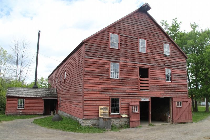
Asseltine’s Woolen Factory
The Asselstine Woollen Factory was erected in 1828 on Mill
Creek in Ernesttown Township, close to Kingston and 174 kilometers west from here. It was one of the earliest water-powered
textile mills to . . . — — Map (db m302376) HM
English:
The St. Lawrence Parks Commission gratefully acknowledges the Save the Train Committee’s contribution of time and effort to fundraise and assist with the joint restoration project of the Aultsville Train Station.
Aultsville . . . — — Map (db m82244) HM
The Bakery
The Bakery was added to Upper Canada Village in
1962 as a representation of the 19th century commercial bakeries that produced bread in large quantities to sustain railway, canal, and other itinerant workers who were . . . — — Map (db m302214) HM
English:
Here, on the farm of John Crysler, was fought one of the decisive battles of the War of 1812. On 11 November 1813 Lieutenant-Colonel Joseph Morrison, with 800 British and Canadian regulars, militia and Indians, engaged an . . . — — Map (db m82184) HM
In November, 1813, an American army of some 8000 men, commanded by Major-General James Wilkinson, moved down the St. Lawrence en route to Montreal. Wilkinson was followed and harassed by a British “corp of observation” consisting of . . . — — Map (db m82180) HM
These plaques are found in the British Court of Honour and the Canadian Court of Honour at the Crysler's Farm Battlefield visitors center.
Battlefield
of Chrysler’s Farm
Pro Patria
In Memory of
Captain Thomas Nairne . . . — — Map (db m82182) WM
Beach’s Sawmill
This sawmill was built in 1846 by Alvin and William Beach
outside of Heckston, towards Kemptville and 35 kilometers
northwest of here. This simple, frame structure was re-located to Upper Canada Village in 1960. . . . — — Map (db m302212) HM
Bellamy's Grist Mill
This stone mill was built in 1821 by the Bellamy brothers, in North Augusta, Grenville County. In 1863, its interior was completely destroyed by fire. The mill was quickly brought back into operation with two . . . — — Map (db m301819) HM
Blacksmith Shop
This Blacksmith Shop came from Lancaster Township in
Glengarry County, approximately 70 kilometers northeast from here.
While the exact date of construction is unknown, this shop was operated by blacksmith Ozias . . . — — Map (db m302014) HM
Broom-maker's House
The Mellraith family were Scottish emigrants who, in 1846,
settled on farm land about 135 kilometers northwest from
here, near Perth in Lanark County. They found this small-
log house already built on their . . . — — Map (db m301850) HM
Cabinetmaker's Shop
This building, which today is the Cabinetmaker's Shop,
originally stood on the farm property of Captain John
Loucks along the riverfront of Williamsburg Township.
Probably built in the 1850s, its original use . . . — — Map (db m301880) HM
Known as "The Little Iron Horse," the Canadian Horse, Canada's National Horse since 2002, is the essence of power,
dignity and grace. This breed, a steady and unfailing partner, once commonplace on Canadian farms during the 1800s, is . . . — — Map (db m283993) HM
Christ Church
Many of the early settlers of this area were members of the Church of England, which established a parish in Cornwall in 1784. Regular travel over long distances was difficult, and Adam Dixson, a wealthy miller from . . . — — Map (db m302100) HM
Top Row — left, small Pres built 1831 purchased by Catholics 1845 present Catholic cen. left 1968 — — old & present Presbyterian 1873 located in Dunbar — — United Church in Williamsburg former Presbyterian 1866 — . . . — — Map (db m150218) HM
Cook’s Tavern
In the early 1800s, Loyalist Michael Cook ran a small inn and
tavern from his riverfront home in Dundas County. Such businesses supported the stagecoach lines that ran between Montreal
and Kingston by providing . . . — — Map (db m302883) HM
Cook's Tavern Barn
Many taverns offered livery services and had an adjoining
barn to stable horses and store hay, as well as a driveshed for
horse-drawn vehicles. This 19th century barn was restored
in 1958 using timbers from . . . — — Map (db m302361) HM
This building was moved to Upper Canada Village in 1958
from the Crysler property about four kilometers west of
here. It stood to the rear of Crysler Hall, and was probably
built sometime in the 1840s. Its original purpose is
unknown, . . . — — Map (db m311564) HM
Dressmaker's Shop
This small stone house was originally built on the Crysler
property, four kilometers west of here. It was owned by Geronimus Crysler, brother of Colonel John Crysler. The exact date of construction in the . . . — — Map (db m304561) HM
Family Activity Centre
Large warehouses were a common sight all along the St. Lawrence River in the 19th century. They provided storage for goods shipped up and down the river and into the Great Lakes. This building began as an . . . — — Map (db m302119) HM
”Farran’s Point”
The early beginnings of Farran's Point were typical of the many small Loyalist villages along the St. Lawrence River. The area was first settled when Jacob Farrand, an officer in the King's Royal Regiment of New . . . — — Map (db m302979) HM
Fire Engine House
The Engine House was built by Village artisans in 1992 to house and display our antique fire engine. The Queen is a hand pumper built in 1851 by George Perry
& Bros. of Montreal. It came to Upper Canada . . . — — Map (db m301872) HM
Gazette Printing Office
This commercial building, originally a general store in
Sandringham, a small village in Roxborough Township,
north of Cornwall, dates from the mid 1850s. It was
moved a distance of 50 kilometers to Upper . . . — — Map (db m302202) HM
In honour of George H. Challies who was responsible for the creation and development of the St. Lawrence Parks and Upper Canada Village. At the age of 73, in conjunction with the Seaway and Power Development of the St. Lawrence River, a project . . . — — Map (db m150231) HM
Hired Man's House
This house was originally owned by the McDougal family who settled on the riverfront of Charlottenburgh Township in Glengarry County, 45 kilometers east of here. This two-story log home was built around 1825. It . . . — — Map (db m302706) HM
Loucks Farm House
This large stone house was built by Captain John Loucks on the edge of the St. Lawrence River, five kilometers west of here towards Morrisburg. Its architectural style and details suggest it was built in the . . . — — Map (db m302728) HM
Lutheran Pastor's House
Many of the Loyalist settlers of Dundas County were German Lutherans from the Mohawk River valley in central New York State. The congregation of St. John's Evangelical Lutheran Church in Riverside built a . . . — — Map (db m302368) HM
Masonic Lodge
This building was moved here in early 2008 and was a gift from the Masonic Association Eastern District to Upper Canada Village. Built in 1863, it was originally located in
the village of Kars, 85 kilometers . . . — — Map (db m302563) HM
McDiarmid House
This two-story log house was built in 1864 by John
McDiarmid, a late settler on Crown land in Roxborough
Township, in the north end of Stormont County. Log
homes remained popular where land was still being . . . — — Map (db m302359) HM
“The Moccasin”
In the early days, The Moccasin train was so named by the Mohawks of Akwesasne who traveled upon it for trade and work. It became an important social, commerce, and transportation vehicle for passengers, mail, and . . . — — Map (db m303039) HM
This attractive brick house, built in the 1840s, was located
in the west end of the village of Aultsville, on a large farm
just three kilometers east of where it stands today. In the
1880s, this home was occupied by Michael Urias . . . — — Map (db m303678) HM
Providence Chapel
This small log church comes from Kitley Township, north of Brockville, a distance of 80 kilometers north-west of here. It was built in the 1850s and served as a shared facility for several Protestant denominations . . . — — Map (db m301876) HM
The first Lutheran minister to settle in this province, Schwerdtfeger was born in Burgbernheim, Bavaria, and studied theology at the University of Erlangen. Emigrating to America in 1753, he served as pastor of congregations in Pennsylvania, . . . — — Map (db m86847) HM
Robertson House
United Empire Loyalist Jeremiah French settled his family west
of Cornwall on land beside the St. Lawrence River. Sometime
after 1784, he constructed a small timber framed home which he
sold in 1812 to his . . . — — Map (db m307245) HM
Robertson Stable
This small barn includes a stable for horses on one end,
space for vehicles in the middle, and simple living quarters
on the other end of the ground floor which could have been
used by a hired man, or rented . . . — — Map (db m302566) HM
Ross Farm House
This substantial log house was built by Thomas Ross, on land overlooking the St. Lawrence River in Lancaster Township, Glengarry County. Its simple plank door, small windows, and large stone fireplace suggest . . . — — Map (db m302700) HM
Schoharie Barns
Many of the barns in the St. Lawrence River Valley have an
unusual frame and design that originated in the Schoharie
Valley of New York State. These two barns, probably built
in the early 1800s, show evidence of . . . — — Map (db m303182) HM
Schoolhouse
This small log school house is a representation of a one
room school described in author Ralph Connor's
Glengarry School Days. In Upper Canada, many rural
common schools built during the 19th century up to
the 1860s . . . — — Map (db m302023) HM
This small log house was built by Loyalist John Grant who
was granted farm land south of Martintown in Glengarry
County. With one room below and a loft above, this cabin
is typical of many settlers' first homes in the early 1800s. . . . — — Map (db m302558) HM
Signal Tower
This timber structure is based on an 1830's sketch of a
signal tower that was part of the British Fort (Fort Henry) in
Kingston during the War of 1812. The Signal Tower at
Upper Canada Village was constructed in . . . — — Map (db m302113) HM
Born in Williamsburg and educated at the Cornwall Grammar School, Whitney was called to the Bar in 1876. He was elected to the legislative assembly as Conservative member for Dundas in 1888. A noted orator, he was leader of the opposition . . . — — Map (db m82248) HM
Tenant Farm Hose
This house represents one that stood at 306 Queen Street in Kingston, 138 kilometers west of here. This 19th century house survived from the 1820s until it was taken apart and stored in 1935. Upper Canada Village . . . — — Map (db m303052) HM
Tinsmith Shop
The Tinsmith Shop was constructed on site by Village artisans in 1994. Based on a small commercial building which still stands in Merrickville, it features a false front façade, typical of main street shops in the . . . — — Map (db m304558) HM
Union Cheese Factory
This small working cheese factory represents the hun-
dreds of rural cheese factories found throughout-
Ontario during the latter part of the 19th century. This
project was a gift to Upper Canada Village in . . . — — Map (db m302021) HM
Willard’s Hotel
The original owner of Willard's Hotel, Jacob Myers, built this inn on the Front concession of Dundas County facing the St. Lawrence. This large white frame house dates from the 1790s and served various stage coach lines as a . . . — — Map (db m301888) HM
The canals at Farran's Point, Rapide Plat and Galops were known collectively as the Williamsburg Canals. All three were built in the period 1844-56 on the north side of the St. Lawrence to form part of the Great Lakes navigation system. Farran's . . . — — Map (db m86848) HM
The Royal Canadian Legion and Ladies Auxiliary of Branch 48 Morrisburg commemorates the gallant men of this community who paid the supreme sacrifice in World War II 1939 — 1945 Donald Casselman, W.O. II Air Force • Willis Coons, P.O. . . . — — Map (db m269491) WM
Jubilant & relieved family members & friends greeted soldiers returning home after the Second World War. Over 250 Morrisburg citizens served in W.W. II. Morrisburg’s train station stood at this site until 1958 when it was demolished and relocated to . . . — — Map (db m150215) HM WM