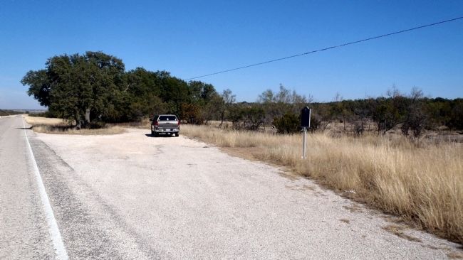
Flagstone ruins nearby mark site of early 1900s stage stand, first stop on passenger and mail line connecting Ozona with Southern Pacific railhead at Comstock — 80 miles distant.
When stage pulled in about 8:30 A.M. (having left Ozona at . . . — — Map (db m79331) HM
First known to civilized men in the 18th century, when, according to legend, Franciscan Padre Alvarez prayed for water to ease his thirst, put down his staff, and saw a spring gush forth from the ground. This landmark of western travel was named for . . . — — Map (db m85005) HM
Route of march and troop supply on Texas frontier. Followed in part pre-Columbian Indian trails and "Old Chihuahua Trail" that ran from San Antonio to El Paso and Mexico. In 1840s this was extended to Gulf Coast Port of Indianola where imported . . . — — Map (db m126683) HM
Established in 1855 by the United States Government as a protection to travelers and mail on the overland route from San Antonio to San Diego. Abandoned in 1861. Reoccupied in 1868 for a short time. — — Map (db m126687) HM
The Chihuahua Trail was opened by segments, but was not called by this name until the 19th century. A small part of the route, along the nearby Pecos River, was followed by the Spaniard Gaspar Castano de Sosa in 1590, during an expedition to New . . . — — Map (db m126681) HM
Only dependable water supply in miles of arid terrain. Used by Indians for centuries. Named for either Maj. Jefferson Van Horne (who passed here en route to establish fort at El Paso, in 1849), or for Lt. J.J. Van Horn (stationed here to fight . . . — — Map (db m73296) HM
The Butterfield Overland Mail was a mail and passenger stagecoach service that linked the Western and Eastern states. John Butterfield, president of the Overland Mail Company, won a federal government contact in 1857 to take and deliver mail twice . . . — — Map (db m68170) HM
This structure was built about 1850 of adobe bricks (sundried mud and reeds) and cottonwood logs around steel cell blocks. It served as official county jail 1850-66 and 1868-73, when San Elizario was the first and then third El Paso County seat. It . . . — — Map (db m118272) HM
Department Commander
Brigadier General D.S. Stanley, U.S.A.
Planned by
Major J.G.C. Lee, Chief Quartermaster.
Post Commander
Captain T.A. Baldwin, 10th Cav’y.
Officer in charge of Construction
Lieut. E.B. Ives, 19th Inft’y. . . . — — Map (db m79374) HM
One of the many fearless stage drivers who traveled on the Ben Ficklin Overland Mail Line from San Antonio to El Paso. On this dangerous route, threatened by wild Apaches, Fransal regularly drove his mule-drawn stage.
He served as a Texas . . . — — Map (db m60760) HM
Site 16 miles southwest on Rio Grande on old military and stage road from San Antonio to El Paso. When U.S. posts were surrendered at outbreak of civil war, designated part confederate far western frontier defense line. Occupied by unit of Texas . . . — — Map (db m118230) HM
Held each year since 1890. Founded by Rev. W.B. Bloys, a Presbyterian. His camp pulpit was an Arbuckle Coffee crate. First campers, 48 people from remote ranches and towns, slept in tents, wagons. Family groups had chuck-box meals, sharing with . . . — — Map (db m79373) HM
Established by Lieut. Col. Washington Seawell with six companies of the Eighth U.S. Infantry in October 1854 for protecting travelers on the San Antonio-El Paso Road.
Named in honor of the then Secretary of War, Jefferson Davis, it was . . . — — Map (db m26357) HM
The community of Fort Davis grew up around the military post of the same name, established by the U.S. Army in 1854 to protect travelers on the San Antonio–El Paso Road. Fort Davis was designated as the Presidio county seat when the county was . . . — — Map (db m61191) HM
Confederate supply point and frontier outpost on great military road from San Antonio to El Paso 1861-62. After surrendered by U. S. Army, occupied by detachment 2nd Texas Mounted Rifles. Apaches ambushed patrol from fort under Lt. Mays in Big Bend . . . — — Map (db m73299) HM
Westward expeditions opened trails from San Antonio to El Paso in the late 1840s. Two routes, called the upper and lower roads, converged at the Pecos River to traverse the Davis Mountains.
Henry Skillman (1814-1864) began a courier service . . . — — Map (db m61196) HM
In early days the Indian trail through these mountains followed the gorge below known as Limpia Canyon. To avoid the floods travelers over the San Antonio - El Paso Road, emigrants, U.S. troops and supply trains, and the mail chose this higher pass . . . — — Map (db m239563) HM
Only settlement founded in John Charles Beales' ill-fated Rio Grande colony of 1834-1836. Beales (1804-1878) -- empresario of 70,000,000 acres in present Southern and Western Texas and New Mexico -- was Texas' largest known land king. In 1833 he . . . — — Map (db m82532) HM
A strategic installation in the U.S. Army's line of forts along the military road stretching from San Antonio to El Paso, Fort Clark was established in June 1852. Located near natural springs and Las Moras Creek, its site was considered a point of . . . — — Map (db m234646) HM
Fort Clark Historic District has been placed on the National Register of Historic Places by the United States Department of the Interior listed December 6, 1979 — — Map (db m55547) HM
As the ninth largest springs in Texas and the largest springs in Kinney County, Las Moras Spring is significant due to its location and invaluable natural resources. Moras, meaning “mulberries” in one Spanish translation, refer to the . . . — — Map (db m186813) HM
The routes that moved troops in early Texas often followed old Indian trails, usually were little more than deep wagon ruts. This one, the Chihuahua Road—joining Ft. Clark with other southwest posts—was widely used, 1850-1880. The Comanche War . . . — — Map (db m234647) HM
In 1842, Empresario Henry Castro brought his first colonists to Texas to settle land west of the Medina River. Most of the immigrants were from the Rhine River area of Europe. Many claimed the province of Alsace, on the border of France and Germany, . . . — — Map (db m79054) HM
J.M. and Mary Ann Koch owned and operated a hotel in D'Hanis beginning in 1898. They purchased the land on this site in July 1902, and built this hotel in 1906. Reportedly constructed by Chinese railroad laborers, it is built of early bricks from . . . — — Map (db m64488) HM
In 1842 the Mexican Army launched three invasions into Texas to reclaim territory lost during the Texas Revolution. Col. Rafael Vasquez's Army briefly occupied San Antonio in March, and in July Texans fought with Col. Antonio Canales' forces near . . . — — Map (db m81867) HM
Located on the banks of Verde Creek (Arroyo Verde), Vandenburg, founded in 1846, was one of the colonies established by Empresario Henri Castro. Immigrants settled nearby and began farming. They dug a trench eight feet wide by six feet deep to . . . — — Map (db m79257) HM
Surveyed in October, 1844
by
Henri Castro
1781---1861
Distinguished pioneer and colonizer
of Texas
Established in March, 1845 by ten
families in charge of Louis Huth,
agent for Castro
Many settlers were killed by . . . — — Map (db m64185) HM
Founded in 1859, Fort Stockton was abandoned during the Civil War and reestablished in 1867, when this guard house was built. Stone for the structure was quarried locally. The lumber was hauled from Indianola by oxcart. The Guard House consisted of . . . — — Map (db m56547) HM
When Fort Stockton was rebuilt in 1867 to protect the route to El Paso, seven homes were erected for officers' families. Built with rock foundations and thick adobe walls, the structures faced the parade ground. Nearby were located corrals, carriage . . . — — Map (db m81871) HM
Burial ground for soldiers stationed at Fort Stockton and for civilians in the little town that grew up around the post. The fort was established 1859; temporarily closed 1861-1867.
Troops here protected the San Antonio-San Diego mail line and . . . — — Map (db m82348) HM
Used as a watering place and camping ground by Indians since pre-Columbian times, the springs were possibly visited about 1536 by Spaniard Cabeza de Vaca on his wanderings through Texas. The expedition of Juan de Mendoza, with his party of . . . — — Map (db m201800) HM
Established on the Comanche Trail, March 23, 1859, as a protection to the San Antonio-San Diego mail route. Named in honor of Commodore Robert Field Stockton, 1795-1866, who captured California for the United States. A stage stand on the San Diego . . . — — Map (db m84320) HM
Replica of San Antonio and San Diego overland stage coach stop. This building was constructed of the stone from the original site which is ½ mile south-east of this location near Tunis Springs. The remains of a large Comanche Indian camp still . . . — — Map (db m73308) HM
Maintained from 1858 to outbreak of the Civil War in 1861 as a stage stop on the Butterfield Overland Mail route, which was the first mail and passenger line to link the east and west coasts of the United States. In 1870's this was a stop for . . . — — Map (db m77765) HM
First settler, Celeste Pingenot came to this area in 1870. He built first house on south bank of Turkey Creek, 1871. Established stagecoach stand, store and inn; named it Wallace. He was first postmaster, commissioned, 1878.
Community protected . . . — — Map (db m79256) HM
Served by the Texas & New Orleans Railroad since 1882, this area was settled in 1887 by George Knippa. A freighter who worked between East Texas and Mexico, Knippa also encouraged many friends to move to the fertile land of this county. In 1899 . . . — — Map (db m90162) HM
Named by Spanish for Rio Sabina and Cypress trees along river.
Town founded in 1854 by Thomas B. Hammer who operated a stage shop and was first postmaster.
Despite Indian depredations, town thrived as settlers built homes, and a railroad . . . — — Map (db m94690) HM
This church began in 1876 as part of the Sabinal circuit assigned to the Rev. Henry T. Hill. Circuit ministers served the fellowship until 1900, when it became an organized congregation. Services were held in the Christian and Baptist church . . . — — Map (db m94689) HM
Established July 12, 1856 by Captain Albert G. Brackett, Second U.S. Cavalry, as a protection to the San Antonio - El Paso Road and frontier settlers • Occupied by Federal troops until November, 1856 • Later served as a Ranger camp — — Map (db m64460) HM
Places of shelter for drivers, teams and wagons. Here travelers could cook bacon, eggs, beans, coffee; talk with friends and strangers. For people from the country, a wagon yard was both a hotel and a social center. Usually it was an open area . . . — — Map (db m64461) HM
A major road west from San Antonio forked in the area of these forts. One road went toward El Paso, the other to the Rio Grande at Eagle Pass. Travelers heading west put on their guns in this region, the start of hostile Indian country, troops . . . — — Map (db m52683) HM
Staged outstanding musicals, dramas. Built 1891 by local men for professional troupes. Also scene of home talent plays, some directed by Ben K. Franklin, a former actor who settled here. Programs created social stir, with lavish dress and parties. . . . — — Map (db m64462) HM
On this site stood home and trading post of Reading Wood Black. Native of New Jersey, he settled in Texas, 1853, near Leona River where he was successful in many business ventures. Founded town of Uvalde; gave land for public school. Elected County . . . — — Map (db m234648) HM
Established by Captain Sidney Burbank, First U.S. Infantry, on March 13, 1849. Named in honor of Lieutenant Zebulon M.P. Inge, who fell at Resaca de la Palma May 9, 1846. Protected the Southern Overland Stage mail route from Indian raids. Federal . . . — — Map (db m221559) HM
Completed in 1928, this structure replaced Uvalde County's 1890 Courthouse. The Commissioner's Court hired architect Henry T. Phelps, who had designed several other Texas courthouses, and prominent local builder M. H. Ryland to manage the . . . — — Map (db m64564) HM
In the early 1880s, Comstock developed as a station on the Galveston, Harrisburg and San Antonio railway because of the natural lake and water supply. The former townsite of Soto or Sotol City was replaced with Comstock, named after John B. . . . — — Map (db m79326) HM
This narrow canyon marks a remote and perilous section of a road traveled from San Antonio to El Paso and on to California following the Gold Rush of the 1840s. Adding to the hardships of a journey that took several weeks, this particular area was . . . — — Map (db m79325) HM
The proposal to use camels for commerce and transportation in the arid Southwest came about in the 1830s, but it was under U.S. Secretary of War Jefferson Davis that the idea became a reality. The first shipment of camels arrived on the Texas Gulf . . . — — Map (db m36889) HM
The men of Company G, a small unit of the U.S. 2nd Cavalry, left Fort Mason on July 5, 1857, under the command of Lt. John Bell Hood (1831-1879), in pursuit of Comanche Indians in the vicinity. Traveling northwest, they discovered a fresh Indian . . . — — Map (db m79328) HM
Established by the United States Army, June 7, 1857, as a means of protecting the road from San Antonio to El Paso against hostile Indians. Named in honor of 2nd Lieutenant Walter W. Hudson who died April 19, 1850, of wounds received in action with . . . — — Map (db m79327) HM