By William F Haenn, November 30, 2014
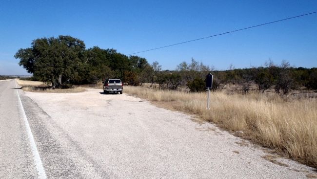
Comstock-Ozona Stage Stand Marker site
| On State Highway 163, 18.1 miles south of Interstate 10, on the right when traveling north. |
| On State Highway 290, 8.8 miles south of Interstate 10, on the left when traveling west. |
| On State Highway 290, 8.8 miles south of Interstate 10, on the left when traveling west. |
| Near Fort Lancaster Road at State Highway 290, on the left when traveling north. |
| On State Highway 290, 8.8 miles south of Interstate 10, on the left when traveling west. |
| On U.S. 90, 10.5 miles south of Interstate 10, on the right when traveling south. |
| Near Cottonwoods Drive, 0.8 miles north of Global Reach Drive. |
| On Main Street at Alarcon Road, on the left when traveling east on Main Street. |
| On State Highway 20 west of Knox Avenue (State Highway 148), on the left when traveling north. |
| Near East Brown Street, 0.3 miles east of Sierra Blanca Avenue (Ranch to Market Road 1111). |
| On Millican Street, on the right when traveling west. |
| On State Highway 166, 13.8 miles west of State Highway 17, on the left when traveling west. |
| Near Lt. Henry Flipper Drive. |
| On Woodward Avenue at State Street (Texas Highway 17), on the left when traveling west on Woodward Avenue. |
| On State Street (State Highway 17/118) at Court Avenue, on the left when traveling south on State Street. |
| On Fort Street at 3rd Street, on the right when traveling south on Fort Street. |
| On Wild Rose Pass (State Highway 17) 1.3 miles south of Powell Ranch Road, on the left when traveling south. |
| On U.S. 90, on the right when traveling west. |
| On Bowie Street east of Main Street. |
| On Fort Clark Road at Mackenzie Road, on the right when traveling south on Fort Clark Road. |
| Near Swim Park Lane west of Fort Clark Road, on the right when traveling north. |
| On East Military Highway (U.S. 90) at South Fort Street, on the right when traveling east on East Military Highway. |
| On Angelo Street at Paris Street, on the right when traveling north on Angelo Street. |
| On Sacarosa Avenue (County Road 525) east of Blanco Avenue (State Highway 1796), on the left when traveling east. |
| On Farm to Market Road 462, 6.5 miles north of U.S. 90, on the right when traveling north. |
| On State Highway 173, 0.8 miles north of County Route 441, on the right when traveling north. |
| On County Road 4517 at County Road 4520, on the left when traveling south on County Road 4517. |
| Near North Rooney Street at East 3rd Street, on the right when traveling north. |
| Near North Williams Street north of East 4th Street, on the right when traveling south. |
| On North Water Street at East 8th Street, on the left when traveling north on North Water Street. |
| On Spring Drive near East 1st Street. |
| On South Main Street at West James Street, on the right when traveling south on South Main Street. |
| On Interstate 10, 2 miles east of Farm to Market Road 2023, on the right when traveling east. |
| On County Road 351, 0.2 miles south of County Road 350, on the left when traveling south. |
| On U.S. 90 at County Route 212, on the left when traveling west on U.S. 90. |
| On U.S. 90, on the right when traveling east. |
| On Fisher Ave East (U.S. 90) 0.3 miles east of Austin Street, on the right when traveling east. |
| On Fisher Avenue West (U.S. 90) at South San Antonio Street, on the right when traveling west on Fisher Avenue West. |
| On U.S. 90, 0.4 miles east of Lower Sabinal Road (County Road 310), on the right when traveling east. |
| On North Park Street at West Leona Street, on the right when traveling north on North Park Street. |
| On West Main Street (U.S. 90) at Noth Getty Street (U.S. 83), on the right when traveling west on West Main Street. |
| On West Main Street (U.S. 90) at North Getty Street (U.S. 83), on the left when traveling east on West Main Street. |
| On North Getty Street (U.S. 83) at West North Street, on the right when traveling south on North Getty Street. |
| On East Main Street (U.S. 90) at South East Street, on the right when traveling east on East Main Street. |
| On County Road 375, 0.5 miles south of Pearsall Road (Farm to Market Road 140), on the right when traveling south. |
| On Getty Street (U.S. 83) at Main Street (U.S. 90), on the right when traveling north on Getty Street. |
| On U.S. 90 at Texas Highway 163, on the left when traveling east on U.S. 90. Reported missing. |
| On State Highway 163, 9 miles north of U.S. 90, on the right when traveling north. |
| On State Highway 163 at County Road 189, on the right when traveling north on State Highway 163. |
| On State Highway 163, 20.3 miles north of U.S. 90, on the left when traveling north. |