157 entries match your criteria. Entries 101 through 157 are listed.⊲ Previous 100
The Colonial Dames of America, National Society of Historical Markers
Markers placed or sponsored by any Chapter of the National Society of The Colonial Dames of America, founded in Philadelphia and headquartered in Washington DC. The NSCDA promotes appreciation for the people, places and events that led to the formation and development of our country.
Erected by Captain John Russell, Commander of His Britannic Majesty's Sloop of War Scorpion, who gave his name to this residence and tract of fifty-five acres of land adjacent to the town of Brunswick. Subsequently owned and occupied by the . . . — — Map (db m22372) HM
This tablet was erected May, 1911 by the North Carolina Society of Colonial Dames of America to mark the site of Fort Johnston, the first fort in the Province of North Carolina, built under Act of Assembly of 1745 and completed 1764, and named in . . . — — Map (db m4754) HM
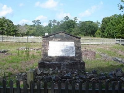
A memorial to Colonel Maurice Moore, gentleman and soldier of the King, who in the year of our lord 1725 founded in a wilderness The Town of Brunswick reserving for the glory of God the tract of land on which was built this parish church . . . — — Map (db m6510) HM
Near and West of this spot at Gum Spring The County of Buncombe
was organized on April 16, 1792
under act of the
General Assembly of North Carolina
Erected by The National Society of the Colonial Dames Of America
In the State of . . . — — Map (db m12831) HM
Organized about 1751
Cabarrus County
formerly Mecklenburg
Alexander Craighead called as regular pastor April 1758, he instilled principles of civil and religious liberty in the people he served and in 1771-1775 they announced to the world . . . — — Map (db m237988) HM
Hopewell Presbyterian Church organized 1762 by Rev. Alexander McWhorter for the Synod of Philadelphia, Pa. First permanent Pastor Rev. Samuel C. Caldwell ( Second Marker : ) Hopewell Presbyterian Church has been placed on the National . . . — — Map (db m63388) HM
Georgian style house built on top of an abandoned jail for John Burgwin (1731-1803), merchant and lawyer, Clerk of Court in Bladen and New Hanover counties, Clerk of NC Provincial Assembly, Secretary to Royal Governor Dobbs and Treasurer of . . . — — Map (db m225799) HM
Near this spot lies
Thomas Godfrey
Born in Philadelphia Pa. 1736
Died in Wilmington N.C. 1763
Author of
The Prince of Parthia
The first drama written
by an American and
produced upon the
professional stage in
the Colonies . . . — — Map (db m28759) HM
August 24, 1835
One mile northwest the Camp Holmes Treaty was signed to guarantee peace, friendship, good hunting, safe travel, as far as the western borders of the U.S.A. To negotiate their first treaty with our government and the Civilized . . . — — Map (db m144841) HM
September 11, 1893
Thousands of Americans gathered in this township preparing to make the run for homesteads in the Cherokee Strip, a tract of land 58 miles wide, opening 6,500,000 acres for White settlement bought from the Cherokee . . . — — Map (db m60480) HM
Honoring the centuries-old presence and contribution of
Native Americans to Oklahoma
State Capitol Rotunda Sunday, June 4, 1989
Master of Ceremonies
State Senator Enoch Kelly Haney, Seminole Creek
Program Participants
Allan Houser . . . — — Map (db m60269) HM
This tablet marks the site of a giant oak which stood on the northerly side of the road built in 1758 by Brigadier-General John Forbes on his military expedition against the French and Indians at Fort Duquesne (now Pittsburgh).
On November 25, . . . — — Map (db m71947) HM
was located
to the south in the vale
by the run and springs.
The Chief
Tammany
of the Unami Group
• their totem • the tortoise •
of the Lenni Lenape or Delawares
sold to
William Penn
the land between
Neshaminy and . . . — — Map (db m31193) HM
Settled about 1733
Laid out by and named for Edward Shippen
•1703-1781•
Merchant
Mayor of Philadelphia
Later a resident of Lancaster
Paymaster in the Forbes Expedition
A founder and trustee of Princeton University
Grandson of Edward . . . — — Map (db m92623) HM
This stone marks
the first permanent settlement
in Wyoming Valley
in the summer of 1762 by a
company of pioneers from Connecticut. — — Map (db m151681) HM
On this site was the home 1766-1771 of John Penn 1726–1795, last colonial governor of Pennsylvania, son of Richard Penn and grandson of William Penn, the founder. Also the home 1771–1810 of Benjamin Chew 1722–1810, last . . . — — Map (db m31068) HM
John Birks "Dizzy" Gillespie was born in a house on this site on Oct. 21, 1917. His family lived here until they moved to Philadelphia in 1935. A founder of modern jazz, Gillespie was an innovative trumpeter and bandleader known for his bent . . . — — Map (db m28273) HM
This Episcopal church, located about 800 ft. N., was incorporated 1833. Early members associated with the church are said to have been from the Dewitt, Edwards, Evans, Hanford, Hawes, McCollough, Williams and Witherspoon families. In 1834 the . . . — — Map (db m41415) HM
Marker front:
First organized as a chapel in 1843 by the Rev. N.P. Tillinghast of Trinity Church, Society Hill, this church was formally established as Christ Church, Mars Bluff, in 1856. The Rev. Augustus Moore, who took over the chapel in . . . — — Map (db m20488) HM
William R. Johnson HouseThis Greek Revival house was built ca. 1854 for William R. Johnson, (1813-1893), physician, planter, and legislator in what was then Marion District. Johnson, an 1838 graduate of the Medical College of S.C., later served . . . — — Map (db m37330) HM
Prince George Winyah Parish (1721). Early settlement in this area near the Black River, based primarily on the Indian trade and the production of naval stores, prompted the creation of Prince George Winyah Parish in 1721. When the first Anglican . . . — — Map (db m17008) HM
This plantation, with its origins in several grants to John Allson in 1732, 1734, and later, was in the hands of his grandson Benjamin, Jr., of Brookgreen, by 1806. The property passed first to Benjamin's widow Charlotte and then after her death in . . . — — Map (db m27546) HM
(Front) The first church on this site, known as Prince Frederick's Chapel, Pee Dee, was built in 1848 on a site donated by the Rev. Hugh Fraser in 1834. Most of its parishioners were rice planters along the Pee Dee River. These ruins are of . . . — — Map (db m27717) HM
This building, the first public school in Marion County, was built in 1886 by the Marion Academy Society, chartered in 1811. The Society, which had operated a private school here for almost seventy-years, then turned the school over to the Marion . . . — — Map (db m25083) HM
D. D. McColl House 1826 This house, built in 1826 on Darlington St. (now Main St.), was first owned by H.H. Covington. It was sold in 1871 to Duncan Donald McColl (1842 1911), prominent Marlboro County lawyer and businessman; the McColls lived . . . — — Map (db m38060) HM
(Front text)
This house, listed in the National Register of Historic Places and probably built during the last decade of the 18th century, is one of the few remaining houses from this era in Columbia. It was purchased prior to 1860 by the . . . — — Map (db m30419) HM
The North-South Streets in The City Of Columbia
The north-south streets, laid out in the two mile square of the orininal city of Columbia in 1786, were named (except for Assembly) for generals and officers who fought in the American Revolution. . . . — — Map (db m7476) HM
At Old Saluda Town, about ten
miles north of here, July 2, 1755,
Governor Glen obtained from
Old Hop and other chiefs of the
Cherokee Nation the cession of
the territory embraced by the
present counties of Spartanburg,
Cherokee west . . . — — Map (db m13085) HM
Gift of land on 16 February 1877 from J.W. Hutton to the trustees of the Methodist Protestant Church in the annual conference of the Tennessee district. Designed in the carpenter vernacular style, contractor Thomas Slate built the frame building for . . . — — Map (db m152142) HM
During the Civil War, the house was commandeered by General Ulysses Grant as his Memphis Headquarters; Jefferson Davis, President of the Confederacy, and a friend of the Hunt Family, also spent time in the house. Later, it was used as a Federal . . . — — Map (db m55514) HM
Approximately four rods from the west wall of this armory stood the "OLD STATE HOUSE" demolished in 1912, in which Vermont legislative sessions were held at intervals from 1784 to 1804 inclusive, county court from 1784 to 1793 and in 1791 the first . . . — — Map (db m77992) HM
This tablet placed here by the Colonial Dames of America in the State of Virginia in the year 1930, commemorates the founding of the First Buck Mountain Church established under the authority of The Church of England and builded one mile west of . . . — — Map (db m21690) HM
(North Side):
This monument marks the trail taken by the army of General Braddock which left Alexandria on April 20, 1755 to defend the western frontier against the French and Indians.
Erected by the Society of Colonial Dames of . . . — — Map (db m7567) HM
To the soldiers and sailors of the United States who gave their lives for their country in the War of 1898-99 with Spain, this monument is dedicated with sorrow, gratitude and pride by the National Society of the Colonial Dames of America in the . . . — — Map (db m11836) WM
The Colonial Dames
Of America in the
State of Virginia
A.D. 1910
Erect this monument on the site
Of the Town of Henricopolis
To commemorate the college
And university which on
May 26, 1619.
The Virginia Company of
London decreed . . . — — Map (db m16149) HM
(front)
Near this monument
disembarked on February 19, 1755
Edward Braddock
Major General and Commander-in-Chief
of all the British forces in America.
His coming marked the beginning
of an important stage in the war
which . . . — — Map (db m33892) HM
To the glory of God and in memory of the Reverend Robert Hunt, Presbyter. appointed by the Church of England, minister of the colony which established the English Church and English civilization at Jamestown, Virginia in 1607, his people, members of . . . — — Map (db m17023) HM
On this spot stood
New Monmouth Church
Organized 1746
by the first settlers
the Scotch-Irish Presbyterians.
The first building of logs
was erected in 1748 and was known as
"Forks of James"
The second building of hewn timber
was . . . — — Map (db m240311) HM
In October, 1786, the General Assembly approved that 45 acres of land belonging to John Lynch be laid off in half-acre lots to establish a town by the name of Lynchburg. The original trustees Charles Brooks, Jesse Burton, John Callaway, John Clarke, . . . — — Map (db m46483) HM
In memory of Eleanor Custis Lewis Carter 1800-1845 wife of Henry Brown Jr. and wife of John H. Patteson M.D. great-niece of George Washington — — Map (db m156590) HM
This tablet records the charter dates of
The Village of Gainesborough 1835
The Town of Big Lick, 1874
which lay within the present boundaries of
The City of Roanoke 1884
And commemorates
The Great Path, an Indian Trail, . . . — — Map (db m134688) HM
In honor of Governor Alexander Spotswood and the Knights of the Horseshoe:
John Fontaine •
Robert Beverley •
William Robertson •
Dr. Robinson Todd •
James Taylor •
Robert Brooke •
George Mason •
Captain Smith •
Jeremiah Clouder
and other . . . — — Map (db m1844) HM
CAPT Adam Thorowgood (1604-1640) Founder
COL Thomas Walke I (1642-1694) Colonial War
COL Edward Moseley (1661-1736) Colonial War
COL Anthony Walke I (1692-1768) Colonial War
COL Edward Hack Moseley (1717-1783) Colonial War
Lt COL . . . — — Map (db m135219) HM WM
(Left Side): This monument marks the trail taken by the army of General Braddock, which left Alexandria April 9, 1755 to defend the western frontier against the French and Indians. Erected by the Society of Colonial Dames of America in the . . . — — Map (db m2649) HM
Erected in 1860 on land donated by Thomas Coleman, who donated half of building cost. Family and community members donated the balance. Service June 22, 1860. Deeded to Methodist Episcopal Church South. During the Civil War, Union Home Guard . . . — — Map (db m189754) HM
Original French Version: Lan 1749 du règne de Louis XV Roy de France
nous Céloron commandant d’un détachement
envoie par monsieur le Mis de la Galissoniere
commandant général de la Nouvelle France
pour rétablir la tranquillité dans . . . — — Map (db m42653) HM