(preface)
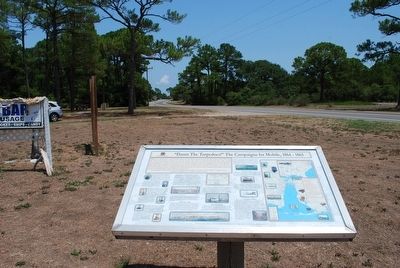
"Damn the Torpedoes!" is a familiar battle cry, but there's more to the story! The Mobile Civil War Trail is your guide to military movements and the way of life on and around Mobile Bay in the closing two years of the Civil . . . — — Map (db m87247) HM
“Damn The Torpedoes!” is the familiar battle cry, but there’s much more to the story! The Mobile Bay Civil War Trail is your guide to military movements and the way of life on and around Mobile Bay in the closing two years of the Civil . . . — — Map (db m81853) HM
This Italianate style cottage was built in 1859 by C. B. and Martha Todd White. Mrs. White, half sister of Mrs. Abraham Lincoln, was an outspoken Southern patriot, who subjected the Lincolns to severe criticism, when the Northern press accused her . . . — — Map (db m38274) HM
On May 2, 1862, Union troops of the 19th and 24th Illinois and the 37th Indiana Regiments commanded by Col. John Basil Turchin went on a rampage through the town. They looted and plundered stores and homes, stealing clothing, jewelry and anything of . . . — — Map (db m85387) HM
(preface)
"Damn the Torpedoes!" is a familiar battle cry, but there's more to the story! The Mobile Civil War Trail is your guide to military movements and the way of life on and around Mobile Bay in the closing two years of the Civil . . . — — Map (db m87288) HM
Four score and seven years ago our fathers brought forth on this continent, a new nation, conceived in liberty, and dedicated to the proposition that all men are created equal.
Now we are engaged in a great civil war, testing whether that nation, . . . — — Map (db m120002) WM
The line separating the territories of New Mexico and Arizona was established as 32 degrees of longitude west of the Washington Meridian by Congressional Act of February 24, 1863, signed by President Abraham Lincoln.
The Washington Meridian . . . — — Map (db m36625) HM
Charles Debrille Poston, 1825-1902, often referred to as the "Father of Arizona", promoted territorial status for Arizona during President Lincoln's administration. Poston, motivated by silver mining interests lobbied for federal legislation to . . . — — Map (db m26661) HM
Prescott, Yavapai County Seat, founded 1864 on Granite Creek, source of Placer gold. Named for William Hickling Prescott, Historian, first Gov. JN. N. Goodwin, Appointee of Abraham Lincoln. Established first territorial capital of Arizona here. At . . . — — Map (db m18805) HM
[Written on the initial marker, provided for context]
Our Constitution names the President of the United States the Commander in Chief of all the Armed Forces. Presidents who have served in our military are displayed on the following . . . — — Map (db m92389) HM WM
Judge George H. Joslyn was born near Ithaca, New York on August 19, 1840. He came to Arkansas in 1868 and secured land in this area where he became a planter. His plantation was comprised of 5,000 acres. As a member of the Arkansas state . . . — — Map (db m238161) HM
Lorenzo Thomas at Fort Curtis
Adjutant General Lorenzo Thomas spoke in Helena on
April 6, 1863. About 4,000 soldiers stood in formation in
Fort Curtis. They heard Thomas, their commanding
officer, the district . . . — — Map (db m108013) HM
Four score and seven years ago our fathers brought forth on this continent, a new nation, conceived in Liberty, and dedicated to the proposition that all men are created equal.
Now we are engaged in a great civil war, testing whether that . . . — — Map (db m114215) HM
The Thomas Starr King Bell was donated to the town of Volcano by Unitarian preacher Thomas Starr King in 1862, who was greatful to the town for its support for the Union and the election of Abraham Lincoln. The bell was originally located at the . . . — — Map (db m101341) HM
Built in 1901 by Colonel J. W. Eddy, lawyer, engineer, and friend of President Lincoln, Angel's Flight is said to be the world's shortest incorporated railway. The counterbalanced cars, controlled by cables, travel a 33 percent grade for 315 . . . — — Map (db m160015) HM
The Pony Express was an ultra-fast but short-lived mail service that ran between the East and West from 1860 to 1861. The roughly 1,900-mile route began in Missouri and passed through Wyoming and Utah before crossing the Sierra Nevada mountain . . . — — Map (db m76323) HM
Presented the Medal of Honor on September 16, 1863 for gallantry in the Seven Day Battle and Peninsula Campaign.
“Willie” was a five foot tall, eleven year-old drummer boy in Company D, Third Vermont Volunteers Infantry of the Union Army, . . . — — Map (db m150914) HM WM
Trees Worthy of a Nation's Protection, June 30,1864 In the midst of the Civil War President Abraham Lincoln signed the Yosemite Grant Act. This established Yosemite Valley and the Mariposa Grove as the first federally protected wild places in . . . — — Map (db m160408) HM
In 1849, a group of Mormons established a tent encampment near here while searching for land to farm. After an influx of gold miners the Mormons moved on. Next came thousands of Chinese miners, merchants and farmers. Mormon Bar became the largest . . . — — Map (db m46408) HM
From the crest of the ridge of a few hundred feet behind this point members of the Mariposa Battalion under the leadership of Major James D. Savage looked into Yosemite Valley on March 27, 1851.
Alarmed by the encroaching tide of California Gold . . . — — Map (db m47417) HM
On June 30, 1864 the United States granted the Yosemite Valley and the Mariposa Big Tree Grove to the State of California to "be held for public use, resort and recreation...inalienable for all time." This act, signed by President Abraham Lincoln, . . . — — Map (db m81941) HM
Founded in 1776 by Padre Junipero Serra. The seventeenth in the chain of twenty-one missions established in Alta California to Christianize and civilize the Indians. Stone church destroyed in 1812 earthquake. Expropriated during Mexican rule. . . . — — Map (db m50226) HM
Schuyler Colfax, Speaker of the House of Representatives, was asked by President Abraham Lincoln on April 14 to take a message to the miners of the west, that their prosperity is the prosperity of the Nation. These may have been Lincoln’s last words . . . — — Map (db m10976) HM
To honor the men and women who have fought, and those that have died in the War on Iraq. To remember their courage and especially their sacrifice while doing their duty.
In memoriam Private First Class Jason Poindexter, 2nd Platoon, Echo Company, . . . — — Map (db m66161) WM
On January 12, 1864, President Abraham Lincoln decreed that where the Central Pacific Railroad crossed Arden Creek the western base of the Sierra Nevada began. The hardships of railroad construction through mountains resulted in increased government . . . — — Map (db m18854) HM
Display 1 Before 1848, the Sacramento River waterfront, behind you, was quiet and occupied by few people. New arrivals during the Gold Rush transformed the waterfront rapidly, turning it into a chaotic transportation hub crowded with goods . . . — — Map (db m201276) HM
A graduate of West Point, his gallantry on the fields of battle earned him commendations; from the Seminole War in Florida, to the Mexican War, to the Indian Campaign in the Pacific Northwest. His unwavering loyalty to the Union would prompt . . . — — Map (db m10766) HM
As did their friends the Smiley brothers, Robert and Alma
Watchorn contributed greatly to Redlands’ cultural life. A
labor organizer, Commissioner of Immigration at Ellis Island,
and oilman who experienced the American dream, Robert as
a . . . — — Map (db m135263) HM
The Abraham Lincoln Brigade Memorial is part historical marker, part veterans memorial and entirely a work of art. It consists of a number of panels. The panels are in 15 columns of three rows each. Not all panels contain text, and some panels of . . . — — Map (db m72028) HM WM
This marker is one of a series intended to commemorate the 150 years of the Port of San Francisco. It is composed of a captioned photograph and text entitled Did you know... mounted on a cylindrical metal pylon.
During World War II, . . . — — Map (db m200514) HM
Today the cow barn is the visitor center for the Marine Education Center, the horse barn serves as a theater and classroom, and the smaller, two-story creamery building is the volunteer headquarters and park office.
Coastal Dairy
The . . . — — Map (db m92639) HM
In March 1863 the Supreme Court adjudged that the original Castillero claim to the New Almaden Mine was fraudulent and invalid. President Abraham Lincoln, acting on this judgment, sent a writ to U.S. Marshall C.W. Rand in San Francisco.
“I, . . . — — Map (db m12916) HM
"It is for us the living, rather, to
be dedicated here...
to the great task remaining
before us...
that from these honored dead we
take increased devotion to that
cause for which they gave the last
full measure of devotion, . . . — — Map (db m75613) WM
Fourscore and seven years ago our fathers brought forth on this continent a new nation, conceived in liberty, and dedicated to the proposition that all men are created equal. Now we are engaged in a great Civil War, testing whether that nation, . . . — — Map (db m87645) HM
On November 29, 1864, U.S. Colonel John Chivington and 700 volunteer troops attacked an encampment of Cheyenne and Arapaho along Sand Creek. The thunderous approach of horses galloping toward camp at dawn sent hundreds fleeing from their tipis. Many . . . — — Map (db m180927) HM
Abraham Lincoln visited this city Saturday evening March 10, 1860, and delivered a political address before a large audience of citizens in Washington Hall, which was then a portion of this building. — — Map (db m170212) HM
In Honor of the Citizens of The Town of Sherman Who Served Their Country in the World War 1914 1918
Alfredson David • Atkins Charles S. • * Blantin Ernest • Blantin John Jr. • Boo Axel • Burch Elvin H. • Cussler Edward • Gentles Robert B. • . . . — — Map (db m24434) HM
Formerly part of Wethersfield, the town was named for Glastonbury in England. Its thirty four original farms, running from the River three miles east “into the wilderness,” were the first officially surveyed by Connecticut Colony, . . . — — Map (db m98863) HM
[ On the North plaque ]
1912 The Gift of
Edward Williams Marsh Captain of Company –M-Second Connecticut Volunteers Heavy Artillery To the Town of New Milford In Loving Memory of the Soldiers and Sailors Of the Union Army . . . — — Map (db m23071) HM
Settled in 1695 as Wallingford “West Farms”, this area obtained status as the village of New Cheshire in 1723. It was incorporated as a town in 1780. Cheshire became famous for its agricultural productivity and light manufacturing. . . . — — Map (db m22371) HM
Abraham Lincoln in search of the nomination for the presidence addressed a ralley in the Town Hall of Meriden - March 7, 1860
" – and that government of the people, by the people and for the people, shall not perish from the earth." . . . — — Map (db m27288) HM WM
David Ruggles Freedom Courtyard
dedicated on the 19th day of October in the year 2013
and to honor the 150th anniversary of
The Emancipation Proclamation
signed by Abraham Lincoln on January 1, 1863
Whereas, on the twenty-second day of . . . — — Map (db m101879) HM
President Abraham Lincoln delivered the Gettysburg Address on November 19, 1863, at the dedication of the Soldiers' National Cemetery in Gettysburg, Pennsylvania, an early national cemetery for the Civil War dead. Starting in 1909, a date . . . — — Map (db m184904) HM WM
On June 10, 1848, Congressman Abraham Lincoln traveled to Wilmington, Delaware, for the purpose of addressing a meeting of members of the Whig political party. He was accompanied by Delaware Representative John W. Houston and two other members of . . . — — Map (db m94199) HM
This monument sheds light on the facts that citizens here felt so strongly during the Civil War that they left their state, farms, businesses and families to head south to enlist. Delaware men served in units from Virginia to Texas. The journey . . . — — Map (db m199250) HM
In grateful memory of Abraham Lincoln. This monument was erected by the Western Sanitary Commission of Saint Louis, Mo., with funds contributed solely by emancipated Citizens of the United States declared free by his Proclamation, January 1st . . . — — Map (db m41617) HM
Hearing those words, President Abraham Lincoln ducked down from the Fort Stevens parapet during the Civil War battle that stopped the Confederates from taking Washington. On July 9, 1864, some 15,000 Rebels led by General Jubal A. Early . . . — — Map (db m72829) HM
Elizabeth Proctor Thomas (1821-1917), a free Black woman whose image appears on each Brightwood Heritage Trail sign, once owned 11 acres in this area. Known, respectfully in her old age as "Aunt Betty," Thomas and her husband James farmed and . . . — — Map (db m72830) HM
Civil War Defenses of Washington 1861-1865 The partial reconstruction of Fort Stevens that you see today was done by the Civilian Conservation Corps in 1937. No visible evidence of the original fort remains. Battle of Fort Stevens July . . . — — Map (db m3028) HM
Welcome to downtown Washington, DC — an area rich in history, culture, and places to see. You will enjoy visiting the following sites located in the vicinity of this sign.
Ford's Theatre
Ford's Theatre National Historic Site, . . . — — Map (db m113106) HM
With these legendary words, naval officer David G. Farragut led the Union fleet past Confederate mines (then called torpedoes) and to victory at the Battle of Mobile Bay on August 5, 1864. From the rigging of his flagship, USS Hartford, . . . — — Map (db m4104) HM
On this site Commodore John Rodgers built an elegant house in 1831. In it on April 14, 1865 an attempt was made to assassinate W.H. Seward, Secretary of State by one of the conspirators who murdered Abraham Lincoln the same night. The Hon. James . . . — — Map (db m195420) HM
This urban oasis exists because President Andrew Jackson needed water. The site of excellent springs (a rare commodity in the early city when everyone was dependent on private wells), . . . — — Map (db m29594) HM
This urban oasis exists because President Andrew Jackson needed water. The site of excellent springs (a rare commodity in the early city, when everyone was dependent on private wells), . . . — — Map (db m211818) HM
This church, one of the Nation’s most historic, traces its beginnings to a small group of Scottish stonemasons meeting in a carpenter’s shop on the grounds of the White House during its construction in 1793. Many prominent Americans, including . . . — — Map (db m122257) HM
This church started on Capitol Hill in 1821 as Israel Bethel, was founded by African Americans denouncing White racism at Ebenezer Methodist Episcopal Church. Later, Pastor Henry McNeal Turner helped persuade President Lincoln to accept Black . . . — — Map (db m30056) HM
"The churches are needed as never before for divine services.
So said President Lincoln from his pew in New York Avenue Presbyterian Church. While other churches were occupied by the federal government and . . . — — Map (db m211822) HM
National Historical Marker The Blair House Purchased in 1836 by Francis P. Blair, Sr., friend of Andrew Jackson, publisher of the Washington "Globe" and the "Congressional Globe." Inherited by his son, Montgomery Blair, Attorney for Dred Scott, . . . — — Map (db m23493) HM
1836 home of Francis Preston Blair Editor of Globe, also of Montgomery Blair Attorney for Dred Scott, Postmaster General in the Cabinet of Abraham Lincoln. Occupied by George Bancroft, Historian. General Robert E. Lee was here offered command . . . — — Map (db m113099) HM
Formed by the merger in 1859 of the F Street Church, founded in 1803, and the Second Presbyterian Church, founded in 1819. Present building, dedicated December 20, 1951, is an enlargement of, but a reproduction in design of the building erected . . . — — Map (db m211820) HM
Billions for the war,
and a bunker
for the president
The grand, pillared United States Treasury building that stands before you, its first section designed by Robert Mills in 1836, was the financial command center for the Union. It . . . — — Map (db m130407) HM
Billions for the war
and a bunker
for the president
The grand, pillared United States Treasury building that stands before you was the financial command center for the Union during the Civil War. It was here between 1861 and 1865 . . . — — Map (db m130491) HM
”. . . Now I shall plant, if at all, more for the public than for myself.”
John Quincy Adams, diary entry for July 5, 1826, shortly before beginning the first major planting program at the White House. Massachusetts . . . — — Map (db m61677) HM
While only Congress — the people's elected representatives — can impose taxes and decide how they are spent, the Internal Revenue Service, a bureau of the U.S. Treasury, ensures those taxes are collected fairly and efficiently. The IRS . . . — — Map (db m57212) HM
During the Civil War this building was Headquarters of the United States Army. Major General Winfield Scott, Major General Halleck and later Lieutenant General U.S. Grant had their offices here. It also housed the Bureau of Military Justice, . . . — — Map (db m133739) HM
Almost a miniature Gothic cathedral, Christ Church behind you was built in 1885. It is the third building to occupy the spot since a group of Georgetown Episcopalians founded the parish in 1817. Among the founders were Francis Scott Key, author of . . . — — Map (db m113421) HM
First organized in a cooper's shop in 1772. Bishop Asbury preached here. This church was built in 1849 and renovated tin 1898. It served as a Civil War Hospital in 1862. President Lincoln attended this church on March 8, 1863 to hear Bishop Simpson . . . — — Map (db m113904) HM
Third son of Abraham and Mary Lincoln rested here from 2/24/1862, until his remains accompanied his father's to their final resting place in Springfield, Illinois, on 4/21/1865. William Thomas Carroll, Supreme Court Clerk and family friend offered . . . — — Map (db m223392) HM
A historical landmark
“Surratt Boarding House”
604 H Street N.W. (then 541) is said to have been where the conspirators plotted the abduction of U.S. President Abraham Lincoln in 1865. — — Map (db m7046) HM
Welcome to downtown Washington DC—an area rich in history, culture and places to see.
You will enjoy visiting the following sites located in the vicinity of this sign.
The Courts on Judiciary Square
Judiciary Square is one of the . . . — — Map (db m18439) HM
Welcome to downtown Washington DC - an area rich in history, culture and places to see. You will enjoy visiting the following sites located in the vicinity of this sign.
Clockwise from top:
"Lone Sailor" at the US Navy . . . — — Map (db m110214) HM
witness
to the end of slavery
in the nation’s capital.
This imposing Greek Revival building was Washington’s first city hall, designed by George Hadfield and built between 1820 and 1850. It house the city court and an elected mayor . . . — — Map (db m29655) HM
This imposing, Greek Revival style structure was designed by George Hadfield as Washington's first City Hall/Courthouse. Throughout its history, the building has housed the local and federal courts for DC, presided over by judges appointed by . . . — — Map (db m58366) HM
Pierre L'Enfant's 1791 design for the Nation's capital featured a prominent triangle formed by the "President's House" and two intersections: Pacific Circle, located to the northwest of the presidential residence, and Iowa Circle, to the northeast. . . . — — Map (db m153986) HM
In November 1860, Abraham Lincoln's election as the nation's first Republican President ignited Southern fears that the country's new balance of political power threatened the institution of slavery in America. Within months, eleven Southern states . . . — — Map (db m153987) HM
By the late 17th century, English colonial settlements and tobacco plantations had reached what is now Washington, DC. By the 1750s the ports of Alexandria and Georgetown were built, and soon afterward a series of mills expanded along Rock Creek . . . — — Map (db m112586) HM
President Lincoln and his family lived in this country home for over a quarter of his presidency. Escorted by his cavalry guard, Lincoln rode to the White House every morning either on horseback or by carriage, and returned here each evening to . . . — — Map (db m52838) HM
U.S. Soldiers' Home has been designated a National Historic Landmark This site possesses national significance in commemorating the history of the United States of America
1974 National Park Service United States Department of the . . . — — Map (db m52839) HM
On this site in 1814, "The Star-Spangled Banner" was first sung in public. The most famous of several hotels on this block was Brown's Marble Hotel (1851-1935), an innovative Greek Revival landmark, where John Tyler and Abraham Lincoln were guests. . . . — — Map (db m66714) HM
"Tonight,
beautiful women,
perfumes, and the violins’ sweetness…
At 10:30 p.m. on March 4, 1865, a tired and gaunt President Lincoln arrived at this site, his wife Mary in white lace and silk with purple and . . . — — Map (db m204444) HM
"Tonight,
beautiful women,
perfumes, and the violins' sweetness…
At 10:30 PM on March 4, 1865, a tired and gaunt President Lincoln arrived at this site, his wife Mary in white lace and silk with purple and . . . — — Map (db m211838) HM
Welcome to downtown Washington, DC — an area rich in history, culture, and places to see. You will enjoy visiting the following sites located in the vicinity of this sign.
Sites described clockwise from top left
Old Post . . . — — Map (db m113218) HM
Welcome to downtown Washington, DC — an area rich in history, culture, and places to see. You will enjoy visiting the following sites located in the vicinity of this sign.
Chinatown Arch
Chinatown, centered on Seventh and H . . . — — Map (db m113226) HM
Welcome to downtown Washington, DC — an area rich in history, culture, and places to see. You will enjoy visiting the following sites in the vicinity of this sign.
[Clockwise from top left:]
Old Post Office Pavilion
The . . . — — Map (db m114658) HM
Welcome to downtown Washington, DC — an area rich in history, culture, and places to see. You will enjoy visiting the following sites located in the vicinity of this sign.
[Clockwise from top left:]
Old Post Office Pavilion . . . — — Map (db m226269) HM
To your right at the end of Indiana Avenue is Washington's first City Hall/Courthouse. Across Sixth Street is the H. Carl Moultrie I Courthouse, a successor to the original courthouse. The Old City Hall/Courthouse opened in 1822, with . . . — — Map (db m56124) HM
“I have a dream.”
Martin Luther King, Jr. August 1963
The block-long plaza at 13th and Pennsylvania Avenue just ahead to your left honors civil rights leader Martin Luther King with the . . . — — Map (db m28528) HM
The Fraternal Order Knights of Pythias was founded on this site 914 E Street, N.W. on February 19, 1864 Charter granted by Abraham Lincoln — — Map (db m129409) HM
Just a few steps ahead is Pennsylvania Avenue the inaugural parade route for every president since Thomas Jefferson and “Main Street” for local Washington since the . . . — — Map (db m29651) HM