Near South Capitol Boulevard near West Fulton Street, on the right when traveling north.
Since opening in 1937, this building has been the center of Boise's art community.
In 1933, with financing from the federal Public Works Administration (PWA), the City of Boise broke ground for construction of the new Boise Gallery of Art. . . . — — Map (db m119194) HM
On River Parkway, 0.5 miles north of West Broadway Street, on the right when traveling north.
The Idaho Falls Temple, visible across the Snake River, was the first temple constructed by The Church of Jesus Christ of Latter-day Saints in Idaho.
Construction began in 1939 and was completed in 1945.
The temple’s soaring tower draws the eye . . . — — Map (db m110540) HM
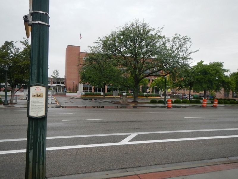
On D Street at 3rd Street, on the right when traveling west on D Street.
A two-story commercial building built of concrete with massive timber framing with orange and buff brick veneer. In its classical entryway and its use of classical symmetry and balance the building is suggestive of Renaissance Revival style. . . . — — Map (db m121911) HM
This outstanding Art Deco-style skyscraper helps define one of the city's finest urban spaces. Its prominence is further heightened by the jog in Michigan Avenue, where it crosses the Chicago River. The base of the building is sheathed in polished . . . — — Map (db m99920) HM
On East Wacker Place at North Michigan Avenue, on the right when traveling east on East Wacker Place.
According to popular legend, the architects chose this building’s dark green and gold colors based on a gold-foiled champagne bottle seen at an office holiday party. Whether true of not, the building is one of the most-distinctive features on . . . — — Map (db m51698) HM
On North Wacker Drive at West Madison Street, on the right when traveling south on North Wacker Drive.
This structure combines a 45 story, Art Deco-style office tower with a 3,650-seat opera theater. The lower part of the Wacker Drive facade was designed in an ornate French Renaissance Revival style to resemble the Paris Opera House. The dramatic . . . — — Map (db m236406) HM
On West Jackson Boulevard near South LaSalle Street, on the right when traveling east.
These two statues, one symbolizing agriculture and the other industry, once stood over the main entrance of the Board of Trade Building built in 1885. The statues greeted commodity traders and the public for 45 years. Thought lost forever when the . . . — — Map (db m47760) HM
On West Main Street (Illinois Route 13) east of South Illinois Avenue (U.S. 51), on the left when traveling west.
In 1868, the city passed an ordinance forbidding frame construction on the Square. The photo to the left (ca. 1900) depicts the New Brush Building at 100 South Illinois Avenue. The store was built in 1895 to replace the city's first commercial . . . — — Map (db m161975) HM
On Galena Boulevard east of Stolp Avenue, on the left when traveling east.
Theatres designed in the early 20th century featured deep stages for vaudeville and other live entertainment. When silent movies became popular, vaudeville acts frequently preceded the movie, so the deep stages were still necessary. With the . . . — — Map (db m94216) HM
On North Ottawa Street (Illinois Route 53) at U.S. 30, on the left when traveling west on North Ottawa Street.
The Art Deco style structure was designed by architect H.V. Van Hoist, and built in 1930. The building exterior is Bedford limestone with a granite base. The Art Deco style is exemplified in the building massing and the cut decorative tiles visible . . . — — Map (db m157568) HM
On Walnut Street south of West Tate Street, on the right when traveling south.
The Art Deco style Klausing Building from the 1930's was a Packard dealership until the late 1950's. It was later converted into a bowling alley. Walnut Bowl was a twelve-lane bowling alley until the 1960's. — — Map (db m226658) HM
On Wayne Street at Gordon M. Buehrig Place, on the left when traveling south on Wayne Street.
Auburn Automobile Company (1900-1937) Art Deco Style Administration building, built 1929-1930. Housed departments of Cord Corporation, manufacturer of Auburn, Cord, and Duesenberg automobiles. Became Auburn-Cord-Duesenberg Museum, 1974; listed in . . . — — Map (db m53934) HM
On North Buckeye Street north of West Sycamore Street, on the right when traveling north.
Howard County's original Second Empire style courthouse was built in 1868 and once stood at this location. An unfortunate and devastating fire led to its demolition in 1927, scattering county offices throughout downtown Kokomo. As a result, . . . — — Map (db m200491) HM
On East Washington Street west of North Scioto Street, on the right when traveling west.
1. Indiana State House
100 N. Capitol Ave.
Built: 1878-88
Italian Renaissance style
2. Indiana Theatre
134 W. Washington St.
Built: 1927-28
Spanish Baroque style
3. Indianapolis News Building
30 . . . — — Map (db m132774) HM
A 1948 Art Deco facade updated the front of a nineteenth-century commercial building located at 25 North Illinois Street for the Rost Jewelry Company. The facade, which features three clocks, is composed of limestone, polished metal, marble and . . . — — Map (db m125520) HM
This circular park plays off the musical significance of the neighboring Surf Ballroom and honors the legacies and final performance of Buddy Holly, Ritchie Valens and J.P. "The Big Bopper" Richardson on February 2, 1959. The monument was built and . . . — — Map (db m133139) HM
On Main Street near 2nd Street, on the left when traveling south.
Built by William T. Pickrell, this building was originally used to sell agricultural implements. Other early businesses at this address included a millinery, barber shop, photography studio, billiard hall, restaurant, confectionary, jeweler and . . . — — Map (db m50754) HM
On 19th Street at N Street, on the left when traveling east on 19th Street.
After the stock market crash of 1929, millions of Americans lost their jobs and those still working saw their wages reduced. Drought and dust storms in the Great Plains left many farm families in despair. Congress quickly drafted new federal . . . — — Map (db m79902) HM
On Line Avenue at Margaret Place, on the right when traveling west on Line Avenue.
Built 1938 for Agudath Achim Orthodox Jewish Congregation which occupied it from 1939 to 1980. Art Deco in style, the building was designed by Seymor Van Os. — — Map (db m142132) HM
On North 3rd Street north of State Capitol Drive, on the right when traveling north.
Dedicated in 1932, the Louisiana State Capitol was commissioned by Governor Huey P. Long and was meant to symbolize the state's progress and modernity. At 34 stories, it is the highest state capitol in America and its Art Deco-inspired lines, . . . — — Map (db m96604) HM
On East Main Street (Highway 182) north of Julia Street, on the right when traveling north.
After the Great Fire of 1870, the Dreyfus Building was partitioned in 1929, with this portion becoming one of the city's early movie houses, The Evangeline Theater., Opened on April 19, 1930, by the Theodore Sliman Family, the building was . . . — — Map (db m104442) HM
On South Iberia Street west of East Washington Street, on the right when traveling west.
Iberia Parish, created in 1868, conducted the business of government in rented space until 1884 with the building of the first permanent courthouse at present day Bouligny Plaza on Main Street. With the help of Public Works Administration funds, . . . — — Map (db m99724) HM
On East Main Street at Bridge Street (State Route 86), on the right when traveling south on East Main Street.
Constructed after the Great Fire of 1899, these buildings once housed Jake Weil's clothing store named The Hub and Schwing and Carsten's Department Store. In 1932, Justin Wormser established Wormser's Department Store in the westernmost building. . . . — — Map (db m104449) HM
On Rosedale Road (State Road 986) at North Jefferson Avenue, on the right when traveling west on Rosedale Road.
High school opportunities in the parish date to at least 1897, when Eureka Central School in Brusly offered classes to white students in the ninth, tenth, and later eleventh grades. In 1899, the West Baton Rouge School Board made plans for three . . . — — Map (db m111837) HM
On Water Street at Oak Street, on the left when traveling north on Water Street.
Holiday shoppers on Water Street in 1932 had a brand new store to shop! That year, the S.S. Kresge five and dime store opened in a modern Art Deco building unique in downtown Augusta. The new building replaced an Italianate block . . . — — Map (db m111199) HM
On High Street east of Market Street, on the right when traveling south.
The burgeoning appeal of the silver screen led to the construction of the Colonial Theatre which opened the night the Titanic set sail from England in April 1912. A fire in 1923 following a showing of the film "Way Down East" . . . — — Map (db m59500) HM
On West Lexington Street east of North Eutaw Street, on the right when traveling west. Reported unreadable.
The Westside of Downtown Baltimore boasts an astonishing variety of architectural styles from early 19th century Federal townhouses to Reconstruction-era cast-iron facades to Art Deco storefronts. The one-time heart of the City, the Westside's . . . — — Map (db m115207) HM
The striking architecture of Baltimore’s original Dunbar High School complements the school’s role in community empowerment and educational equality. Dunbar’s educators, students, and alumni worked to achieve the “equal” in the “separate but equal” . . . — — Map (db m101610) HM
On East Pratt Street at Light Street (Maryland Route 2), on the left when traveling east on East Pratt Street.
Just north of the Inner Harbor is Downtown's municipal, business and financial district, also referred to as City Center, a prime east coast location for corporate headquarters and financial institutions.
City Center's most pervasive . . . — — Map (db m115210) HM
The building's on the south side of this block have changed dramatically to meet the needs of an ever-changing city. First built a private homes, since the late 19th century they have housed community institution devoted to the spiritual, cultural, . . . — — Map (db m97356) HM
On South Market Street (Maryland Route 355) at West Patrick Street (Maryland Route 144), on the right when traveling south on South Market Street.
Learn to paint at the Delaplaine Visual Arts Education Center or catch outrageous improve and other stage productions at the Maryland Ensemble Theatre. Dance on your toes at the Cultural Arts Center or ponder the trompe l'oeil elements of the . . . — — Map (db m129735) HM
Known in the 1920’s as The Skooter and in the 1930’s as the Dodgem, Glen Echo Park’s bumper car ride was one of the first in any amusement park in the world.
The Art Deco facade was added in the 1930’s.
Today’s rehabilitated Bumper Car . . . — — Map (db m3230) HM
In the midst of the Great Depression, the Crystal Pool provided a haven. It was big enough for 3,000 swimmers and featured a sand beach. The Art Deco style of the pool became Glen Echo’s new look. — — Map (db m3229) HM
The entrance to Glen Echo Park has undergone many changes. The 1940 art deco design has been restored, but prior entrances included a stone entrance in the 1890's with the early trolley lines in front and the 1911 entrance, which featured numerous . . . — — Map (db m5754) HM
Beginning in 1940, a new Art Deco arcade was added to Glen Echo park. Designed by the firm of Edward Schoeppe of Philadelphia, also the chief architect of the Crystal Pool and Spanish Ballroom, the arcade was constructed in stages from 1940 to . . . — — Map (db m3231) HM
When Montgomery County was created in 1776, the village today known as Rockville was selected as the seat of local government. Since that time, five court houses have been built in Courthouse Square. § Postal Service began in Montgomery . . . — — Map (db m102844) HM
On Colesville Road (U.S. 29) at Fentron Street, on the right when traveling south on Colesville Road.
"Shop Along the Silver Strip, Suburban Washington's Newest and Finest Shopping Community," proclaimed the January 8, 1942 Silver Spring Standard newspaper upon its opening. Businesses residing in these storefronts offered a variety of . . . — — Map (db m68578) HM
On Colesville Road (U.S. 29) at Fenton Street, on the right when traveling south on Colesville Road.
The commercial Vitality of this block sprang to life in the late 1930s. Across the street, where homes with front porches once stood, the 1938 construction of the Silver Spring Shopping Center served as the "Magnet" attracting future . . . — — Map (db m69171) HM
The 1938 Silver Spring Shopping Center is a superb example of moderne architecture with art deco elements. Designed by noted architect John Eberson, it is a rare example of an early planned shopping center with parking forming Montgomery County's . . . — — Map (db m75065) HM
On Georgia Avenue (U.S. 29) at Ripley Street when traveling south on Georgia Avenue.
"Buy 'em by the Bag," the motto urged. For more than half a century, hamburger-hungry customers came to Maryland's first Little Tavern to do just that.
Harry F. Duncan founded Little Tavern Shops, Inc., which specialized in 5¢ little . . . — — Map (db m75468) HM
Near Georgia Avenue (U.S. 29) south of Colesville Road (U.S. 29), on the right when traveling north.
The 1938 Silver Theatre and Silver Spring Shopping Center complex is a landmark of early 20th-century commercial architecture. It profoundly affected the development of suburban Silver Spring as well as helped shape the growth of the region. It . . . — — Map (db m113018) HM
Near Georgia Avenue (U.S. 29) south of Colesville Road (U.S. 29), on the right when traveling north.
Just around the corner, on Colesville Road, is the American Film Institute (AFI) Silver Theatre and Cultural Center — an architectural treasure and state-of-the-art movie theater saved from the wrecker's ball by the citizens of Silver Spring and . . . — — Map (db m113010) HM
On Knox Road at Baltimore Avenue (U.S. 1), on the right when traveling west on Knox Road.
College Park was incorporated by referendum in 1945. However, the city’s origin goes back much further. During the nineteenth and early twentieth centuries, College Park began to emerge from farmland both as a transportation hub and as a center . . . — — Map (db m71860) HM
The Greenbelt Community Center, originally the Greenbelt Center Elementary School and Community Building, was completed in the autumn of 1937, just in time for Greenbelt’s first occupants. From the beginning, residents also used the buildings for . . . — — Map (db m2475) HM
On Campground Road west of Park Central Road, on the right when traveling west.
The City of Greenbelt was conceived, built, and for a long time owned by the Federal government. Greenbelt was one of three “green cities” built during the Great Depression. The theory of “green cities” was revolutionary: . . . — — Map (db m41275) HM
Near Greenbelt Road (Maryland Route 193) 0.7 miles west of Southway, on the left when traveling west.
The City of Greenbelt was conceived, built, and for a long time owned by the Federal government. Greenbelt was one of three “green cities” built during the Great Depression. The theory of “green cities” was revolutionary: . . . — — Map (db m68569) HM
Greenbelt's 1937 Roosevelt Center Mall is one of the first planned shopping areas in the country—a precursor to the modern shopping mall. Greenbelt's planners positioned the mall to be within easy and safe walking distance from all the . . . — — Map (db m195) HM
On Walnut Street (Maryland Route 19) just east of Main Street (Maryland Route 19), on the left when traveling east.
The Church Hill Theatre was built by Elwood F. Coleman in 1929 for use as a town hall. Movies came to the town in 1935 when motion picture equipment was installed in the building. The structure was severely damaged by fire in 1944, and repairs . . . — — Map (db m138251) HM
On Merrimack Street at John Street, on the right when traveling west on Merrimack Street.
One of several large department stores historically downtown, Cherry and Webb was located here since 1889 and in 1924, extensively reconstructed the building in early Art Deco style with polychromatic terra cotta. This building actually . . . — — Map (db m117859) HM
On Broad Street at Custom House Street, on the right when traveling east on Broad Street.
Hailed as Boston's first Art Deco skyscraper, the Batterymarch Building was the city's tallest downtown structure when it opened in 1928. Designed by Harold Field Kellogg, it features 30 different colors of brick and ornamental motifs indicative . . . — — Map (db m215574) HM
On West Chisholm Street (U.S. 23) south of South Ninth Street, on the right when traveling south.
"Alpena has blazed a new trail in construction," architect William H. Kuni of Detroit declared at the opening of the Alpena County Courthouse on October 21, 1935. Calling it "the first monolithic building erected in a cold climate," Kuni designed . . . — — Map (db m66795) HM
On East 13 Mile Road west of Dell Lane, on the left when traveling west.
This Federal Style home, built by Alexander and Helen Cutrubes, remained in the family until 1978 when it was sold to Walter and Sarah Fuelberth and restored to its original glory.
The home features 9' ceilings, plaster crown moldings, 15" . . . — — Map (db m146827) HM
On West Liberty Street, 0.1 miles east of Cabinet Street, on the right when traveling east.
This landmark building commands attention
as the Pettibone Creek Hydroelectric Station. It was built in 1938-39 to harness the precious power of water for Ford's Carburetor Plant, now gone. It remains as a reminder of Milford's "village . . . — — Map (db m125348) HM
On West Liberty Street, 0.1 miles east of Cabinet Street, on the right when traveling east.
The Pettibone Creek Hydroelectric Station was designed by renowned architect Albert Kahn and built by Henry Ford in 1939. Over time the station became known as "The Ford Powerhouse." Decommissioned in 1953 and in declining condition, the iconic . . . — — Map (db m125362) HM
On East 8th Street west of College Avenue, on the right when traveling west.
Built in 1930, this building was originally the site of Montgomery Ward Company. It also housed Vogelzang Hardware from 1960 through 1982 until the Outpost moved here in 1983. The structure’s exterior architectural detailing and terra-cotta facade . . . — — Map (db m153219) HM
On North 3rd Street (Alternate U.S. 23) south of West Michigan Avenue, on the right when traveling north.
Rogers City's art deco-style Post Office was built in 1940 at a cost of $60,365. The photo shows the building shortly after it opened in 1940. Both the exterior and interior have changed little during the intervening years.
One of the highlights . . . — — Map (db m123754) HM
On North State Street (State Highway 81) at East Sherman Street, on the right when traveling east on North State Street.
Peter DeWitt Bush (1818-1913), the second permanent resident of the village of Caro, donated this site for the county courthouse square in 1866. Then he, along with two other pioneer settlers, moved an old frame church to the site to serve as the . . . — — Map (db m101635) HM
On East Washington Street west of Fletcher Street, on the right when traveling west.
Horace H. and Mary A. Rackham, generous donors to the University of Michigan, established the Rackham Fund in 1933 “for the benefit of humanity.” Feeling that the graduate school offered possibilities of the most far-reaching benefits, the Rackham . . . — — Map (db m65357) HM
On Main Street at Avenue D, on the right when traveling north on Main Street.
The Greenwood Underpass was constructed in 1938 by the Mississippi State Highway Department with funding from the Federal Aid
Highway Program. In accordance with WPA goals the Greenwood Underpass was designed to improve the Y. & M.V. railroad . . . — — Map (db m77189) HM
On Cherry Street at Jackson Street, on the right when traveling north on Cherry Street.
A Different Point of View
Vicksburg was pretty bare in the early days. The original townspeople cleared the land and used the trees to construct buildings and open space for farming. When Vicksburg was under siege by the Union Army, the . . . — — Map (db m115508) HM
On Main Street at Monroe Street, on the left when traveling west on Main Street.
Planters Bank of Mississippi
Built in 1834 Planters Hall housed Vicksburg's first bank. During early banking in Mississippi, state law required the bank president and his family to live on the second story of the bank. When the bank . . . — — Map (db m115477) HM
On Main Street west of Cottonwood, on the right when traveling west. Reported damaged.
Originally a wood yard and steamboat stop along the Missouri River called Miller's Landing, the City of New Haven was first platted in 1856. Today, New Haven is home to over 2,000 residents, an award-winning school, artist community, and thriving . . . — — Map (db m132880) HM
Want to find a little culture in Kansas City? Just look up. Our city is filled with extraordinary examples of architectural styles, from beaux-arts to modern. But our assortment of Art Deco-style buildings is our real claim to architectural fame. . . . — — Map (db m43182) HM
On South Main Street south of Jefferson Street, on the right when traveling north.
Behind this 1914 Art Deco tile and marble facade is one of the oldest buildings on the street, the Masonic Hall. The lodge held its last meeting on July 17, 1861. "About this time [1861], we came under the dark Cloud of War between the North and . . . — — Map (db m124830) HM
On North Main Street south of Monroe Street, on the left.
Ahmann's Newsstand and the Quality Hat Shop shared this double-front building in 1903. The Craftsman/Art Deco yellow glazed brick facade was added in 1934 when the newsstand expanded. The building may date to 1865. — — Map (db m124865) HM
On Cherokee Street east of Oregon Avenue, on the right when traveling east.
On December 6, 1935, Edward A. Vanderventer was granted a permit to demolish a one-story brick residence on this lot. The razed building was one of five identical single story brick residences constructed by John B. Westermeyer in 1892. These . . . — — Map (db m124452) HM
On Iowa Avenue north of Cherokee Street, on the right when traveling north.
The northeast corner of Cherokee Street and Iowa Avenue was the location of the Cinderella Airdome, which opened in 1921. The Airdome, which was an outdoor theater, was operated by Harry and Eugene Freund. The Freunds had built the Cinderella . . . — — Map (db m124458) HM
On Wells Drive just east of McKinley Drive, on the right when traveling west.
When the Jewel Box was dedicated in 1936, crowds flocked to experience its magnificent Art Deco design. The structure's unique construction of cantilevered glass supported by arched steel beams also proved a ground-breaking (but not . . . — — Map (db m139732) HM
On Lynch Street at South 12th Street, on the right when traveling north on Lynch Street.
Originally this land contained a bottling shed for Arsenal Brewery. In 1937, city architect Albert Osberg (who also designed Soulard Market) designed a series of Art Deco police stations for the St. Louis Metropolitan Police Department. This . . . — — Map (db m159009) HM
On South 12th Street south of Gravois Avenue (State Highway 30), on the right when traveling south.
In the late 1920s the City of St. Louis extended Gravois Ave to connect to 12th St, creating a path for the world-famous Route 66. Part of the City Beautiful Movement to create garden and green space for the city, the triangle became a Sinclair . . . — — Map (db m160372) HM
On Delmar Boulevard east of Kingsland Avenue, on the right when traveling west.
Unhappy with the prison-like schools of his youth, St. Louis-born architect William B. Ittner devoted his life to improving education through better school design. Appointed St. Louis School Board Commissioner in 1897, he designed open buildings . . . — — Map (db m124543) HM
On 1st Avenue North near 9th Street North, on the right when traveling west.
A shortage of steel and limited purchases of nonessential goods during World War II caused the automobile industry to skyrocket after the war ended. As the troops came home and the economy recovered, Montana experienced this boom as well. By the . . . — — Map (db m143772) HM
On Park Drive South at Central Avenue, on the right when traveling south on Park Drive South.
Clean lines, formal monumental openings, and restrained revival details mark the 1939 Great Falls Civic Center as a municipal Art Deco style building. The Works Projects Administration provided most of the funding for the building. The . . . — — Map (db m143680) HM
Helena architect George Carsley and New York architect Cass Gilbert designed the campus master plan implemented between 1918 and 1927. Although Carsley continued as consultant on other buildings erected under the plan, this 1922 gymnasium is the . . . — — Map (db m144118) HM
On East Spruce Street near North Pattee Street, on the right when traveling east.
In 1915, Nettie and Joseph Hagen expanded their Model Laundry Company by purchasing the Missoula Laundry Company and moving their business into the newly completed west section of this building. That original structure and its later additions . . . — — Map (db m144761) HM
The placement of this women’s residence hall prohibited further development of a women’s U-shaped dormitory complex as outlined by the Carsley-Gilbert campus master plan of the previous decade. Architects H. E. Kirkemo of Missoula and J. Van . . . — — Map (db m144181) HM
Missoula architect C. J. Forbis ushered in a new campus building phase in 1935 with the construction of this student union. The building’s placement and modern Art Deco façade broke ranks with the Renaissance Revival style called for in the old . . . — — Map (db m144207) HM
On West Broadway Street at Ryman Street, on the left when traveling west on West Broadway Street.
Missoula’s first commercial district developed southwest of the Northern Pacific Railroad depot in the 1880s and 1890s. But as the town blossomed, a new central business district began to take shape. The Palace Hotel, constructed at what was then . . . — — Map (db m144460) HM
Architects designing campus buildings between 1935 and 1939 were faced with a dilemma. Should they choose the Renaissance Revival style of most previous campus buildings or opt for the modern designs prevailing throughout the nation? In a . . . — — Map (db m144155) HM
On 10th Street near Leavenworth Street, on the left when traveling south.
No other improvement...can
equal in utility the railroad.
Abraham Lincoln
March 9, 1832
Dedicated by the railways of Omaha
to the service, comfort and
convenience of the people — — Map (db m35264) HM
An etching of Ogallala appeared in an 1878 issue of American Agriculturalist magazine, depicting the town as the terminus of Texas cattle drives. It shows cattle being driven up the trail, across the South Platte River, and into Union Pacific cattle . . . — — Map (db m50784) HM
On South 7th Street, on the right when traveling north.
This is a two sided marker
Side A:
Las Vegas High School
As the population of Las Vegas increased throughout the 1920s and the construction of Hoover Dam was assured, many saw the need for a new high school. Principal Maude Frazier . . . — — Map (db m47886) HM
"This here timeline was originally conceived and written by Mansonian chief Joe Oliver aka EXACT LEE. It was rewritten and gagged up and redrawn by David Silverman aka TUBATRON aka That Flaming Tuba Guy."
Year of the Man 1 . . . — — Map (db m97566) HM
Penn Station, designed by the architectural firm of McKim, Mead and White, opened in 1935 and is an outstanding example of Art Deco exterior and interior design. Penn Station replaced the Pennsylvania Railroad's old Market Street station which had . . . — — Map (db m527) HM
Don't let the sloping lawn and park-like setting deceive you. A natural stream, Petty's Run, flowed in a steep ravine at this spot, joining the Delaware River just beyond where the War Memorial sits today. Native Americans camped along the bluffs . . . — — Map (db m79530) HM
On 8th Street Southwest at Central Avenue Southwest (U.S. 66), on the right when traveling north on 8th Street Southwest.
Designed by architect A. W. Boehning, Sr., this Art Deco style building was completed in 1931.
Site No. 784
A Registered Cultural Property
State of New Mexico — — Map (db m235917) HM
Near Niagara Square at Court Street, in the median.
The vista along Court Street from Niagara Square to Lafayette Square embraces a continuum of human struggle for freedom and justice. In the center of the vista stands a monument to the soldiers and sailors who perished in the war to preserve the . . . — — Map (db m92834) HM
From Frontier to Major City
In the early 1800s, Buffalo was a sleepy village known as New Amsterdam, on the edge of America's then western frontier. Holland Land Company surveyor Joseph Ellicott, inspired by Pierre L'Enfant's radial . . . — — Map (db m92798) HM
On Buffalo Street (U.S. 62) 0.1 miles north of Main Street (U.S. 62), on the right when traveling south.
The village of Hamburg has many historic buildings, both public and private. Some of the buildings are highlighted here. Follow the map below to see more of the village's historic buildings.
1) First Baptist Church 116 Main Street. . . . — — Map (db m82549) HM
Attributed to Harry Lowe
(American, dates unknown)
Four Pairs of Pegasus Figures, 1934
From the New York City Fire Service Pumping Station, Neptune Avenue at West 23rd Street, Coney Island, Brooklyn, designed by Irwin. S. Chanin . . . — — Map (db m109508) HM
On 7th Avenue just south of 42nd Street, on the right when traveling south.
What was here before?
The dramatic bluff at Sunset Park is part of a massive rock outcropping and ridge across Brooklyn and Queens created through glacial deposits during the last Ice Age. Facing west towards New York harbor and beyond, the . . . — — Map (db m228638) HM
On Stutson Street at River Street, on the right when traveling east on Stutson Street.
Mark Twain is reported to have said that Rochester was noted for having a village six miles to its north that was named "CHAR-lotte," but the inhabitants call it Char-LOTT. However it is pronounced, the importance of Charlotte has been interwined . . . — — Map (db m90536) HM
Near Bradhurst Avenue just north of West 145th Street, on the left when traveling north.
What was here before?
Before the pool and play center were introduced to the park, the rugged terrain of glacial rock outcroppings and mature shade trees served the Harlem Heights community as a place of respite and passive recreation. . . . — — Map (db m228707) HM
This striking gateway, designed by Edward Coe Embury (1906-1990) with sculpture by Paul Manship (1885-1966), was created as part of Central Park’s children’s zoo which opened in 1961. The zoo was first known as the Lehman Zoo for Children, as . . . — — Map (db m108320) HM
On 5th Avenue at West 142nd Street on 5th Avenue. Reported permanently removed.
This monument honors the legendary 369th Infantry Regiment known as the Harlem Hellfighters. The black granite obelisk is a replica of a 1997 memorial that stands in Sechault in Northern France, where the 369th soldiers distinguished themselves . . . — — Map (db m18993) HM
345 entries matched your criteria. Entries 101 through 200 are listed above. ⊲ Previous 100 — Next 100 ⊳