261 entries match your criteria. Entries 101 through 200 are listed.⊲ Previous 100 — The final 61 ⊳
Santa Fe Trail Historical Markers
This is an important trade route from New Franklin, Missouri (and parts west as the railroad moved west) to Santa Fe, New Mexico. The trail was in use from 1822 until the late 1880s.
By Kcahta, 2006
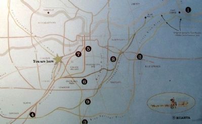
Map on The Development of the Kansas City area Frontier Trails Network Marker
The Santa Fe Trail went through two decades of change in the Kansas City area before evolving into it's final form by about 1840. In the early years of that decade it also became the route of the Oregon Trail and California Trail.
1821 - . . . — — Map (db m50679) HM
Richard Williams was born in Tennessee in 1830, son of Judge Arthur Williams. As a young man, Richard came to Johnson County in the 1850s, employed as a surveyor by the U.S. government. During the 1850s and early 1860s, Dick Williams was a . . . — — Map (db m50691) HM
In the spring of 1816 Auguste P. Chouteau's hunting party traveling east with a winter's catch of furs was attacked near the Arkansas river by 200 Pawnees. Retreating to what was once an island five miles southwest of this marker the hunters . . . — — Map (db m65747) HM
Looking east, up and over the bank of the ditch, one can see the wagon ruts of the Santa Fe Trail. You will notice a difference in the color and texture of the grass in the ruts. This is characteristic of the ruts along the trail. Between Pawnee . . . — — Map (db m65755) HM
This cut is part of the old Santa Fe Trail. Many years ago the Missouri River came near this site and thousands of early settlers were ferried here. Their wagons and teams climbed this hill and headed west toward Santa Fe and the Oregon . . . — — Map (db m66712) HM
The stone monuments to the west mark the trace of the original road leading up from the river. For many pioneers, traders, settlers and soldiers, this was the beginning of the Oregon and Santa Fe Trails leading to the Far West. The steamboat and . . . — — Map (db m66713) HM
In 1825 President James Monroe approved a bill providing for the survey of the Santa Fe Trail from Missouri to New Mexico and the making of treaties to insure friendly relations with Indians along the route. A mile west of this sign, on Dry Turkey . . . — — Map (db m53059) HM
"Those who have occassion to stop at Council Grove, on the Santa Fe Road, will do well to 'put up' with Charles A. Gilkey [Hays' hotel clerk]…[?] host of the Hayes House. [They]…cannot but help feeling quite at home.
- Kansas Press, July . . . — — Map (db m45123) HM
This hardwood tree was part of the original grove that provided shelter, and wood for wagon repairs for travelers on the Santa Fe Trail.
The grove was a continuous strip of timber near one mile in width with a rich variety of trees. The town of . . . — — Map (db m44824) HM
This hardwood tree was part of the original grove that provided shelter, and wood for wagon repairs for travelers on the Santa Fe Trail.
The grove was a continuous strip of timber near one mile in width with a rich variety of trees. The town of . . . — — Map (db m44964) HM
This hardwood tree was part of the original grove that provided shelter, and wood for wagon repairs for travelers on the Santa Fe Trail.
The grove was a continuous strip of timber near one mile in width with a rich variety of trees. The town of . . . — — Map (db m44966) HM
"In his stock were found every known variety of goods for use on the frontier, from ox yokes and repairs to cambric needles, from small boxes of pills to barrels of whiskey."
- Conn Store Clerk William Shamleffer
For traders on the Santa Fe . . . — — Map (db m45088) HM
The hunting grounds of the Kaw (Kansa) and Osage Indians were located here when Americans and Mexicans began hauling trade goods over the Santa Fe Trail in 1821.
In 1825, in response to traders and merchants who eagerly sought trade with . . . — — Map (db m44981) HM
This picture of Custer Elm was taken in 1928 and at that time the tree was estimated to be 300 years old. Dutch elm disease caused it to die in the early 1970's.
General George Armstrong Custer and his 7th Calvary [sic] regiment camped beneath . . . — — Map (db m44938) HM WM
In commemoration of the
home coming to Council Grove
June 27 - July 2
celebrating the
one hundredth anniversary
of the first pack train to pass
over the Santa Fe Trail,
led by Wm. Becknell — — Map (db m45078) HM
Built in 1857 by Seth Hays on the site of the first permanent building (1848) in Council Grove. The original log cabin was also known as the Hays House. Used continuously as a restaurant, this building was also used for church services, court . . . — — Map (db m45133) HM
"He appears rather an intelligent man, speaks nine different languages. He has lived a Hermit some thirty five years... Last winter he lived five months in a hollow tree near Westport, Mo. He refuses to eat bread or meat; his food consists of corn . . . — — Map (db m45206) HM
"Great father, you white people treat us like a flock of turkeys. You chase us from one steam and then chase us to another stream and then to another stream. Soon you will chase us over the mountains and into the ocean
- Al-le-ga-wa-ho, . . . — — Map (db m45053) HM
"Last chance for beans, bacon and whiskey."
During the 1857 trading season, this building housed a store on the edge of Council Grove. Here was the last opportunity for the trader bound for Santa Fe to purchase supplies before venturing into the . . . — — Map (db m45396) HM
N.S.D.A.R. Memorial
to the
Pioneer Mothers
of the
Covered Wagon Days
The National
Old Trails Road
Here East met West
when the Old Santa Fe Trail
was established August 10, 1825
at a council between the
United . . . — — Map (db m44822) HM
Built by Malcolm Conn for mercantile business, it was the second pioneer business erected in the present business district.
First known as "Stone Store", later as "Pioneer Store."
Travelers traveling the Santa Fe Trail were welcome to sleep . . . — — Map (db m45144) HM
"The creek bank, which is short and steep, made of some little detention in the crossing of the wagons, they had to double teams several times. It is amusing here to hear the shouting of the wagoners to their animals, whooping and hallowing; the . . . — — Map (db m44941) HM
"Only jail in early days on the Santa Fe Trail. Within its walls desperados, border ruffians, and robbers were held. During the Indian Raid of 1859 two Indians were taken out and hanged by a mob. A bad man, Jack McDowell, was hanged from the Neosho . . . — — Map (db m44992) HM
The stump before you is all that is left of a grand old oak tree that was about 270 years old when it died in 1990. The tree, which once stood 80 feet high, was located in the campground used by Santa Fe Trail travelers. It is said to have been . . . — — Map (db m44960) HM
This was once a place of early morning racket, dust, and confusion, as wagons bound for Santa Fe rattled and jockeyed for position to form a train. Wagonmasters shouted, "Catch up!" to the teamsters - then "Stretch out!" as the wagons began to . . . — — Map (db m44942) HM
Santa Fe Trail
Marked by the
Daughters of the
American Revolution
and the State of Kansas
Council Grove
On this spot August 10, 1825
the treaty was made with the
Osage Indians
for the right of way of the
Santa Fe . . . — — Map (db m44967) HM
Seth M. Hays was a shrewd, colorful, and successful trader, rancher, tavern owner, and publisher.
He built this house in 1867; it was elaborate for Council Grove at that time. Though he was a life-long bachelor, Hays adopted five-year-old Kittie . . . — — Map (db m45142) HM
Built by Seth Hays [b. 1811]. The first white settler in Council Grove. He lived here with his adopted daughter Kitty & his slave Sally until his death in 1873. — — Map (db m45143) HM
With its foundation in Kansas Territory, this house was established here, along the Santa Fe Trail as Kansas became the thirty fourth state.
History Comes Alive Here! — — Map (db m45450) HM
The Mormon Battalion camped here for five days beginning 27 August 1846. The battalion's more than 500 volunteers and officers had been recruited from the Mormon pioneers (members of The Church of Jesus Christ of Latter-day Saints) at Council . . . — — Map (db m45056) HM WM
For travelers arriving on the Santa Fe Trail, Fort Larned must have looked more like a small town than a fortified place. In the early years, about 150 soldiers lived here in the summers. During the Indian Wars, as many as 400 troops called Fort . . . — — Map (db m95839) HM
The cavalry company are used entirely for escorting the mails between this post and Fort Dodge 55 miles west and Fort Zarah 33 miles east. The mails come and depart twice a week.
William Forwood, captain, Fort Larned post surgeon, . . . — — Map (db m95846) HM
It all started over trade that promised great profits. Once Mexico won independence from Spain in 1821 Americans were welcomed and encouraged to trade. Trade quickly flourished, creating opportunities and profits linking the economies of Missouri . . . — — Map (db m40127) HM
The Kanza Indians left their homelands east of the Mississippi River during the 1600s. They settled into what is today the northeast part of Kansas. Waterways provided sustenance for their people and were part of the tribe's culture. The success . . . — — Map (db m95883) HM
One mile south is the hand-dug well that served the U.S. Cavalry and Santa Fe Trail travelers in the 1860s.
For five days in July, 1864, 600 Indians besieged a trading post near the well and a wagon train nearby. When the attackers tried to . . . — — Map (db m53319) HM
Look to your left. In the early 1800s, this was the western edge of the American frontier. American Indians controlled lands "out there." Spanish territory was 440 miles farther, south of the Arkansas River.
Settlers were drawn to the Boone's . . . — — Map (db m247231) HM
Rivers were once America's super highways. Westbound riverboats churned by here, hauling American goods - cloth, hardware, paper, mirrors - from St. Louis to the frontier town of (Old) Franklin, once located across the river near the railroad . . . — — Map (db m247232) HM
This Trail
One of the Great Highways of the World
Stretched nearly one thousand miles from
Franklin, Missouri to Santa Fe, New Mexico
"From Civilization to Sundown"
[Relief Caption]
Captain William Becknell of Franklin
"Father of . . . — — Map (db m44292) HM
Father of the Santa Fe Trail
William Becknell led a small group out of Franklin in 1821 on the first trip along what would be known as the Santa Fe Trail. If his trip across the Great Plains was successful, the group would make money trading . . . — — Map (db m46932) HM
In March 1909, the Daughters of the American Revolution marked the Boonslick and Santa Fe Trails across the state of Missouri. This monument in New Franklin marks the end of the Boonslick Trail traversed by Daniel Boone and the beginning of William . . . — — Map (db m46505) HM
Government Reservation 1808
Marked by the Daughters of the American Revolution of Fort Osage Township 1918
Cross State Highway Buckner 1876 Jackson Co. Mo. — — Map (db m131967) HM
Hiram Young came to Missouri as an enslaved African American. He earned his freedom step by step. First he purchased his wife Matilda's freedom in the early 1840s. For children to be free, they had to be born to a free mother. The Youngs welcomed . . . — — Map (db m208243) HM
Being at leisure one day, I rode over to Independence [from Westport, in May 1846]. The town was crowded. A multitude of shops had sprang up to furnish the emigrants and Santa Fe traders with necessaries for the journey; and there was an . . . — — Map (db m208146) HM
Side A:
Independence, famed "City of the Trails," was for two decades the starting point of the great western trade and travel routes to Santa Fe, Oregon, and California. Settled mainly by Southerners on land ceded the U.S. by the Osage . . . — — Map (db m44323) HM
The entire country had railroad fever in the 1830s, with the dream that one day a railroad might span the continent! In Independence merchants needed to move goods between the town square and the Wayne City steamboat landing on the Missouri River - . . . — — Map (db m208135) HM
People on steamboats loaded with goods traveled upstream on the Missouri River "highway" to Independence, where the overland journey on the Santa Fe, Oregon, and California trails began. Between March and November, steamboats passed by or stopped . . . — — Map (db m208241) HM
The Santa Fe Trail began in 1821 when William Becknell took trade items west and found a ready market in Mexico. He passed through this area before the village of Independence was platted in 1827 as the county seat for newly formed Jackson County. . . . — — Map (db m208242) HM
Built in 1855 by John and Henrietta Harris this Greek revival style all brick house was located on a slightly five acre tract on the ridge just east of Westport, MO. This site was on the southwest corner of Westport Rd. (Santa Fe Trail) and Main . . . — — Map (db m44411) HM
Near this point John McCoy built a log trading post in 1833 which launched the settlement of Westport, with the town becoming the westernmost point of American civilization. From Westport, the Santa Fe, California, and Oregon Trails reached out as . . . — — Map (db m21064) HM
(Main Marker)
Originally used as an outfitting store for wagon trains, this building was completed in 1850 by Indian traders George and William Ewing and was sold in 1854 to Albert Gallatin Boone for $7,000. Boone operated the store . . . — — Map (db m20921) HM
The Santa Fe Trail extended nearly 1,000 miles overall from the Missouri River ports Southwest to Taos and Santa Fe. The first exploration and trading on the direct overland trail was conducted by the colonial French. The 1680 pueblo revolt in New . . . — — Map (db m86227) HM
Thousands of wagon wheels, animal hooves, and human feet once passed this way – creating the deep depression in front of you. The swale, now worn by erosion, is grassed-over evidence of three trails once connecting frontier Missouri to . . . — — Map (db m87293) HM
From the late 1830s and into the 1860s, thousands of traders, emigrants, and gold prospectors passed this way. After crossing the Big Blue River, covered wagons struggled up this hill due to the mud left behind from torrential spring downpours. Over . . . — — Map (db m199357) HM
(This marker has two panels. From the left panel:)
Key Map
Traveling across this bridge, the fourth Red Bridge near this location since 1859, you may notice art panels attached to each of the large pillars that rise at both . . . — — Map (db m210568) HM
Public/private partnerships preserve three National Historic Trails in south Kansas City, highlighting 19th century exploration and migration that shaped the nation. In the heart of the historic 3-Trails Corridor, the Trailside Center at East 99th . . . — — Map (db m199522) HM
Visiting the Trails Today
The Santa Fe, Oregon and California Trails had a significant role in the history of the United States and have been designated by Congress as National Historic Trails. The National Park Service partners with site . . . — — Map (db m199379) HM
Why Did The Historic Trails Go Where They Went?
When Mexico won its independence from Spain in 1821, trade with the United States soon followed. William Becknell and five companions from the Franklin, Missouri area were the first to use . . . — — Map (db m199377) HM
New Santa Fe, also known as Little Santa Fe, was not much more than an Indian settlement when the first wagon trains passed through on the Santa Fe Trail in the early 1820's. A popular stopping place because of its grass, water and room for . . . — — Map (db m20724) HM
(limestone marker)
"A Highway Between Nations"
Sen. Thomas Hart Benton, 1825
(red granite marker)
Santa Fe Trail
1821 - 1872
Marked by the
Daugters of the
American Revolution
and the
State of Missouri
1909 . . . — — Map (db m20610) HM
Early Santa Fe trading expeditions used this watering stop after leaving Franklin and crossing the Missouri River. Burton Lawless donated it to the town in 1829. The WPA started improvements in 1934. — — Map (db m246753) HM
You are visiting Arrow Rock's signature building, the J. Huston Tavern, sometimes known as the "old tavern" or "Arrow Rock Tavern."
Joseph Huston of Virginia settled in the area in 1819 and was one of the town commissioners. In November of . . . — — Map (db m246752) HM
When William Becknell's pioneer trading expedition crossed the Missouri River at the Arrow Rock Ferry on September 1, 1821, the site emerged as the gateway for western travel and commerce on what's known as the Santa Fe National Historic Trail. . . . — — Map (db m246740) HM
Side A:
The difficulty of bringing caravans over rocky and mountainous Raton Pass kept most wagon traffic on the Cimarron Cutoff of the Santa Fe Trail until the 1840's. Afterwards, the Mountain Branch, which here approaches Raton Pass, . . . — — Map (db m45821) HM
The Saint James Hotel
Has been placed on the
National Register
Of Historic Places
By the United States
Department of the Interior
1872 — — Map (db m45779) HM
Santa Fe Trail
(Via Bent's Fort) 1822-1879 Marked by the Daughters of the American Revolution and the Territory of New Mexico 1910 — — Map (db m227255) HM
Women of the Santa Fe Trail
The Women of the Santa Fe Trail endured untold hardships traveling across the Great Plains. In 1829, six Hispanic women were the first known female travelers going east on the trail. In 1832, Mary Donoho was . . . — — Map (db m107280) HM
Three-quarters of a mile west of here at the Canadian River crossing was the popular overnight stage stop on the Old Santa Fe Trail. Clifton House Site was built in 1867 by rancher Tom Stockton, with materials brought overland from Dodge City. For . . . — — Map (db m107281) HM
Opened by William Becknell in 1812, the Santa Fe Trail became the major trade route to Santa Fe from Missouri River towns. The two main branches, the Cimarron Cutoff and the Mountain Branch, joined at Watrous. Travel over the Trail ceased with . . . — — Map (db m202790) HM
Point of Rocks
Point of Rocks was a major landmark along the Santa Fe Trail. Located in Jicarilla Apache country, it was near here that the party of Santa Fe merchant J.W. White was attacked in 1849. Kit Carson was a member of the military . . . — — Map (db m55207) HM
Point of Rocks was a convenient camping spot for Santa Fe Trail travelers going in both directions. When the caravans camped here going west they knew they were two weeks from the end of their 900-mile journey. Here they would have their first . . . — — Map (db m156696) HM