After filtering for Massachusetts, 363 entries match your criteria. The first 100 are listed. ⊳
Settlements & Settlers Topic
By Brandon D Cross, September 21, 2019
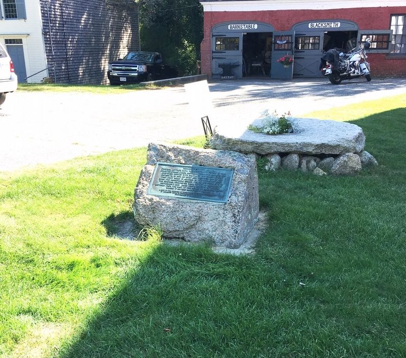
Abraham Blish Marker
| 1 ► Massachusetts, Barnstable County, Barnstable — Abraham Blish — |
| On Main St (Local Route 6A) 0.1 miles east of Hyannis - Barnstable Rd, on the right when traveling east. | |||
| 2 ► Massachusetts, Barnstable County, Barnstable — Sandwich Meeting of Friends — |
| Near Quaker Road, 0.1 miles north of Spring Hill Rd. | |||
| 3 ► Massachusetts, Barnstable County, Barnstable — Thomas Hinckley — |
| On Main St (Massachusetts Route 6A) 0.1 miles west of Crocker Lane, on the left when traveling east. | |||
| 4 ► Massachusetts, Barnstable County, Bourne, Bournedale — Bournedale's Yesterdays |
| On Scenic Highway (U.S. 6), on the right when traveling north. Reported missing. | |||
| 5 ► Massachusetts, Barnstable County, Bourne, Buzzards Bay — Comassakumakanit |
| Near Scenic Highway (U.S. 6), on the right when traveling north. Reported missing. | |||
| 6 ► Massachusetts, Barnstable County, Chatham — Chatham Packet Wharf — |
| Near Water Street, 0.1 miles east of Main Street. | |||
| 7 ► Massachusetts, Barnstable County, Chatham — 11 — Chatham’s Wampanoag History — |
| Near Orleans Road (Massachusetts Route 28) 0.1 miles west of Seapine Road. | |||
| 8 ► Massachusetts, Barnstable County, Chatham — Dr. Samuel Lord — |
| On Training Field Road, 0.2 miles north of Old Comers Road, on the right when traveling north. | |||
| 9 ► Massachusetts, Barnstable County, Chatham — History of Chatham — |
| On Main Street at Blackberry Lane, on the left when traveling north on Main Street. | |||
| 10 ► Massachusetts, Barnstable County, Chatham — In Memory of the Pioneers of Chatham — William Nickerson — |
| On Main Street, on the right when traveling west. | |||
| 11 ► Massachusetts, Barnstable County, Chatham — Site of First Settlers Home — |
| On Orleans Road (Massachusetts Route 28) at Crows Pond Road, on the right when traveling east on Orleans Road. | |||
| 12 ► Massachusetts, Barnstable County, Chatham — Squanto, Indian Guide — |
| On Orleans Road (Massachusetts Route 28) 0.1 miles west of Seapine Road, on the left when traveling west. | |||
| 13 ► Massachusetts, Barnstable County, Chatham — The Josiah Mayo House — c. 1820 — Chatham Conservation Foundation, Inc. — |
| On Main Street at Blackberry Lane, on the right when traveling west on Main Street. | |||
| 14 ► Massachusetts, Barnstable County, Chatham — 8 — The Mayflower Story — |
| On Main Street. | |||
| 15 ► Massachusetts, Barnstable County, Chatham — The Tisquantum (Squanto) Story — |
| On Orleans Road (Massachusetts Route 28) 0.1 miles west of Seapine Road, on the left when traveling west. | |||
| 16 ► Massachusetts, Barnstable County, Eastham — First Encounter — |
| On State Highway (U.S. 6) at Somoset Rd, on the left when traveling south on State Highway. | |||
| 17 ► Massachusetts, Barnstable County, Eastham — First Encounter Monument — Commemorating the Pilgrims' first encounter with Native Americans |
| Near Samoset Road. Reported missing. | |||
| 18 ► Massachusetts, Barnstable County, Eastham — First Encounter Plaque — Commemorating the Pilgrims' first encounter with Native Americans — |
| On Samoset Road south of First Encounter Beach parking lot, on the right. | |||
| 19 ► Massachusetts, Barnstable County, Eastham — Indian Rock — |
| Near Hemenway Road. | |||
| 20 ► Massachusetts, Barnstable County, Eastham — Journey of the Mayflower — |
| Near Ocean View Drive, 0.1 miles south of Doane Road. | |||
| 21 ► Massachusetts, Barnstable County, Harwich — Brooks Grinding Stone — |
| Near Sisson Road (Massachusetts Route 39) at Parallel Street, on the left when traveling north. | |||
| 22 ► Massachusetts, Barnstable County, Hyannis — HyArts Artist Shanties — Bismore Park — |
| On Ocean Street at Bay Street, on the right when traveling north on Ocean Street. | |||
| 23 ► Massachusetts, Barnstable County, Hyannis — 2 — Main St. Hyannis — Hyannis Kennedy Legacy Trail — |
| On Main St at Pearl St, on the left when traveling south on Main St. | |||
| 24 ► Massachusetts, Barnstable County, Orleans — Origins of Orleans — |
| On Main Street at South Orleans Road (Massachusetts Route 28), on the left when traveling west on Main Street. | |||
| 25 ► Massachusetts, Barnstable County, Provincetown — Mayflowers Passengers Memorial — |
| On Bradford Street (Massachusetts Route 6A) at Rydaer Street, on the right when traveling north on Bradford Street. | |||
| 26 ► Massachusetts, Barnstable County, Provincetown — Pilgrim Memorial Stone — |
| On Bradford Street (Massachusetts Route 6A) at Ryder Street, on the right when traveling south on Bradford Street. | |||
| 27 ► Massachusetts, Barnstable County, Provincetown — Provincetown — |
| Near Race Point Road. | |||
| 28 ► Massachusetts, Barnstable County, Provincetown — The First Landing Place of the Pilgrims, Nov. 11, 1620, O.S. — |
| On Province Lands Rd at Commercial St, on the left when traveling south on Province Lands Rd. | |||
| 29 ► Massachusetts, Barnstable County, Sandwich — Dexter’s Grist Mill — |
| On Water St at Main St, on the left when traveling east on Water St. | |||
| 30 ► Massachusetts, Barnstable County, Sandwich — Edmund Freeman Saddle & Pillion Burial Ground — |
| On Wilson Road. | |||
| 31 ► Massachusetts, Barnstable County, Truro — Sixteen Pilgrims — Corn Hill — |
| On Corn Hill Road, 0.7 miles west of Castle Road, on the left when traveling north. | |||
| 32 ► Massachusetts, Barnstable County, West Dennis — Old South Dennis Cemetery — Ancient Cemetery — |
| On Main Street north of Highbank Road, on the left when traveling north. | |||
| 33 ► Massachusetts, Berkshire County, Great Barrington — Great Barrington Bi-Centennial — |
| On S Main Street at Dresser Avenue, on the right when traveling north on S Main Street. | |||
| 34 ► Massachusetts, Berkshire County, Lee — Lee First Town Meeting — |
| On Main Street (Massachusetts Route 20) at Franklin Street, on the right when traveling north on Main Street. | |||
| 35 ► Massachusetts, Berkshire County, New Marlborough — Historic Town Meeting — |
| On New Marlborough-Monterey Road north of Hartsville-New Marlborough Road (Massachusetts Route 57), on the left when traveling north. | |||
| 36 ► Massachusetts, Berkshire County, Pittsfield — Hancock Shaker Village — |
| 37 ► Massachusetts, Berkshire County, Pittsfield — Hancock Shaker Village: Powered by the Sun for Over 200 Years — |
| 38 ► Massachusetts, Berkshire County, Pittsfield — Shaker Color — |
| 39 ► Massachusetts, Berkshire County, Sandisfield — New Boston — |
| On S. Main Street (Massachusetts Route 8) at Tolland Road (Massachusetts Route 57), on the left when traveling north on S. Main Street. | |||
| 40 ► Massachusetts, Berkshire County, South Williamstown — South Williamstown Five Corners — |
| On Cold Spring Road/New Ashford Road (U.S. 7) at Green River Road/Hancock Road (Massachusetts Route 43), on the left when traveling south on Cold Spring Road/New Ashford Road. | |||
| 41 ► Massachusetts, Berkshire County, Williamstown — Early Williamstown House — |
| On Water Street (Massachusetts Route 43) at Latham Street, on the left when traveling north on Water Street. | |||
| 42 ► Massachusetts, Berkshire County, Williamstown — Here Stood the West Hoosac Blockhouse — |
| On Main Street (U.S. 7) west of North Street, on the right when traveling west. | |||
| 43 ► Massachusetts, Berkshire County, Williamstown — Site of First Meeting House — |
| On South Street at Main Street (U.S. 7), on the left when traveling north on South Street. | |||
| 44 ► Massachusetts, Bristol County, Attleboro — In Memory of Anthony Perry — Died-A.D. 1683 — |
| Near County Street (Massachusetts Route 123). | |||
| 45 ► Massachusetts, Bristol County, Attleboro — The First Attleborough Towne House — |
| On Clifton St at West St on Clifton St. | |||
| 46 ► Massachusetts, Bristol County, New Bedford — Captain Paul Cuffe's Atlantic World — |
| On Pleasant Street south of Union Street, on the left when traveling north. | |||
| 47 ► Massachusetts, Bristol County, New Bedford — Centre Street — Utility over Elegance — |
| On North Water Street, on the right when traveling south. | |||
| 48 ► Massachusetts, Bristol County, New Bedford — New Bedford Historic District — |
| On Williams Street, on the left when traveling east. | |||
| 49 ► Massachusetts, Bristol County, North Attleboro — Draper Farm Historic Site — |
| On Draper Ave, on the left when traveling east. | |||
| 50 ► Massachusetts, Bristol County, North Attleboro — Woodcock-Hatch-Maxcy House — |
| On North Washington Street. | |||
| 51 ► Massachusetts, Bristol County, Norton — Stony Brook — Chartley Pond Area — |
| On West Main Street (Massachusetts Route 123), on the right when traveling west. | |||
| 52 ► Massachusetts, Bristol County, Norton — The Site of the First House in Norton — |
| On Bay Road close to Turkey Farm Road, on the right when traveling north. | |||
| 53 ► Massachusetts, Bristol County, Norton — Winneccunnett Pond Area — |
| On Bay Road, on the right when traveling north. | |||
| 54 ► Massachusetts, Bristol County, Rehoboth — Anawan House — |
| On Anawan St, on the right when traveling south. | |||
| 55 ► Massachusetts, Bristol County, Rehoboth — Anawan House-Inn — |
| On Anawan Street near Massachusetts Route 44, on the right when traveling south. | |||
| 56 ► Massachusetts, Bristol County, Rehoboth — Bliss-Carpenter Saw & Shingle Mill — 1729-1870 — |
| On Williams Street, on the left when traveling east. | |||
| 57 ► Massachusetts, Bristol County, Rehoboth — Cole-Perry Turning Mill — 1780-1830 — |
| On Ash Street, on the right when traveling west. | |||
| 58 ► Massachusetts, Bristol County, Rehoboth — Daniel Bullock- Samuel Baker Sawmill site 1750-1850 — |
| On Plain St., on the right when traveling south. | |||
| 59 ► Massachusetts, Bristol County, Rehoboth — Horton Signal — 1777 - 1779 — |
| On Chestnut Street north of Brook Street, on the right when traveling north. | |||
| 60 ► Massachusetts, Bristol County, Rehoboth — Indian Oven Rock — |
| On Homestead Ave., on the left when traveling west. | |||
| 61 ► Massachusetts, Bristol County, Rehoboth — Leonard Iron Mine — 1696 - 1802 — |
| On Tremont St, on the right when traveling west. | |||
| 62 ► Massachusetts, Bristol County, Rehoboth — Liberty Tree — |
| On Brook Street, on the left when traveling west. | |||
| 63 ► Massachusetts, Bristol County, Rehoboth — Old Yellow Meeting House — |
| On Bay State Road. | |||
| 64 ► Massachusetts, Bristol County, Rehoboth — Palmer River Pound — "Old Pot Ash Neighborhood" — Circa 1750 — |
| On Brook Street east of School Street, on the right when traveling west. | |||
| 65 ► Massachusetts, Bristol County, Rehoboth — Perryville Dam — 1740 - 1935 — |
| On Danforth st near Perryville Rd. | |||
| 66 ► Massachusetts, Bristol County, Rehoboth — Redway Plain — |
| On Bay State Road at Winthrop Street, on the right when traveling west on Bay State Road. | |||
| 67 ► Massachusetts, Bristol County, Rehoboth — Sabin Sawmill — |
| On Pond St., on the right when traveling north. | |||
| 68 ► Massachusetts, Bristol County, Rehoboth — Samual Baker Grist & Sawmill Site — 1810-1870 — |
| On Brook Street north of Pleasant Street, on the left when traveling south. | |||
| 69 ► Massachusetts, Bristol County, Rehoboth — Site of Original Oak Swamp Church — (Baptist) — Circa 1750 — |
| On Pleasant Street at Chestnut Street, on the right when traveling south on Pleasant Street. | |||
| 70 ► Massachusetts, Bristol County, Rehoboth — The Palmer's River Meeting House — |
| On Lake St.. | |||
| 71 ► Massachusetts, Bristol County, Swansea — King's Rock — Native American Ceremonial Site — Sachem's Knoll — |
| On Market Street (Massachusetts Route 136) south of Stoney Hill Road, on the right when traveling south. | |||
| 72 ► Massachusetts, Bristol County, Swansea — Myles Garrison House Site — |
| On Old Providence Road at Barneyville Road, on the left when traveling east on Old Providence Road. | |||
| 73 ► Massachusetts, Bristol County, Taunton — Winslow and Hopkins — |
| On Broadway at Pleasant Street, on the right when traveling north on Broadway. | |||
| 74 ► Massachusetts, Essex County, Beverly — Balch House — 1630 - 1930 — |
| On Cabot Street (Massachusetts Route 1A) at Balch Street, on the right when traveling south on Cabot Street. | |||
| 75 ► Massachusetts, Essex County, Beverly — Conant House — 1630 - 1930 — |
| On Cabot Street, on the right when traveling south. | |||
| 76 ► Massachusetts, Essex County, Beverly — Hale Farm — 1630 - 1930 — |
| On Hale Street when traveling west. | |||
| 77 ► Massachusetts, Essex County, Beverly — Planters Path to their Landing Place — 1630 - 1930 — |
| On McKay Street. | |||
| 78 ► Massachusetts, Essex County, Beverly — Roger Conant — |
| On Cabot Street (Massachusetts Route 1A) at Roosevelt Avenue, on the right when traveling south on Cabot Street. | |||
| 79 ► Massachusetts, Essex County, Danvers — Danversport — |
| On Water Street, on the left when traveling north. | |||
| 80 ► Massachusetts, Essex County, Danvers — Salem Village Parsonage — 1681 — |
| Near Centre St. | |||
| 81 ► Massachusetts, Essex County, Danvers — Samuel Parris Archaeological Site — |
| On Centre Street, on the right when traveling north. | |||
| 82 ► Massachusetts, Essex County, Danvers — Site of Israel Hutchinson's Home / Israel Hutchinson — |
| On Water Street, on the left when traveling north. | |||
| 83 ► Massachusetts, Essex County, Danvers — The 1681 Salem Village Parsonage — |
| Near Centre Street. | |||
| 84 ► Massachusetts, Essex County, Danvers — The 1734 Addition — |
| Near Centre Street. | |||
| 85 ► Massachusetts, Essex County, Danvers — The Endecott Pear Tree |
| Near Water Street at Endecott Street. Reported missing. | |||
| 86 ► Massachusetts, Essex County, Danvers — The Plains — |
| On Maple Street near Central Ave, on the right when traveling north. | |||
| 87 ► Massachusetts, Essex County, Essex — Free School — 1630 - 1930 — |
| On John Wise Avenue (Massachusetts Route 133). | |||
| 88 ► Massachusetts, Essex County, Essex — John Wise House — 1630 - 1930 — |
| On John Wise Avenue (Massachusetts Route 133), on the right when traveling north. | |||
| 89 ► Massachusetts, Essex County, Essex — Shipyard of 1668 — 1630 - 1930 — |
| On Main Street (Massachusetts Route 133), on the right when traveling north. | |||
| 90 ► Massachusetts, Essex County, Georgetown — Goodrich Massacre — 1630 - 1930 — |
| On North Street, 0.2 miles north of Meadowview Road when traveling north. | |||
| 91 ► Massachusetts, Essex County, Gloucester — Cape Ann Settlement — Massachusetts Bay Colony Tercentenary — |
| Near Hough Street. | |||
| 92 ► Massachusetts, Essex County, Gloucester — James Babson Farm — |
| On Eastern Avenue (Massachusetts Route 127) 0.5 miles south of Sheehan Terrace, on the right when traveling south. | |||
| 93 ► Massachusetts, Essex County, Hamilton — The Covered Wagon — 1630 - 1930 — |
| On Bay Road (Alternate Massachusetts Route 1), on the right when traveling south. | |||
| 94 ► Massachusetts, Essex County, Haverhill — Pentucket-Haverhill — 1630 - 1930 — |
| On Mill Street, 0.1 miles south of Hope Street, on the right when traveling south. | |||
| 95 ► Massachusetts, Essex County, Ipswich — Agawam - Ipswich — 1630 - 1930 — |
| On Country Road (Massachusetts Route 133) at Ward Street, on the right when traveling north on Country Road. | |||
| 96 ► Massachusetts, Essex County, Ipswich — Ipswich Massachusetts Village Green Memorial — |
| On S. Main Street at S. Village Green, in the median on S. Main Street. | |||
| 97 ► Massachusetts, Essex County, Ipswich — Masconomet Sagamore of the Agawams — |
| Near Sagamore Hill, on the right when traveling east. | |||
| 98 ► Massachusetts, Essex County, Ipswich — Pillow Lace — 1630 - 1930 — |
| On High Street, on the right when traveling west. | |||
| 99 ► Massachusetts, Essex County, Ipswich — Revolution of 1689 — 1630 - 1930 — |
| On North Main Street. | |||
| 100 ► Massachusetts, Essex County, Marblehead — Old Burial Hill — 1630 - 1930 — |
| On Orne Street at Pond Street, on the left when traveling north on Orne Street. | |||
363 entries matched your criteria. The first 100 are listed above. Next 100 ⊳