Near Old Post Road at Beach Road, on the right when traveling north.
Welcome to Fairfield’s Historic Town Green
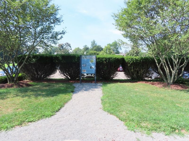
How Did This Green Come to Be? Most New England towns began with a central common "green." Where you are standing is Fairfield's historic center and is as old as the town itself. In 1639 Roger . . . — — Map (db m204367) HM
On Bronson Avenue, 0.1 miles north of Verna Hill Road, on the right when traveling north.
In Memory Of The
Men Of Greenfield Hill
Who Fought In
The American Revolution
John Alvord • Benjamin Banks 4th • Daniel Banks • David Banks • Ebenezer Banks Esq. • Ebenezer Banks • Elijah Banks • Eliphalet Banks • Gershom Banks • Gershom . . . — — Map (db m27420) HM
On Bronson Avenue, 0.1 miles Verna Hill Road, on the right when traveling north.
Site of "Verna"
Home of Timothy Dwight
Chaplain in Continental Army
Pastor of Greenfield
Founder of Academy
Poet of "Greenfield Hill"
President of Yale 1795 - 1815 — — Map (db m27421) HM
On East Putnam Avenue (U.S. 1) at Maple Avenue, on the left when traveling north on East Putnam Avenue.
George Washington
Paused here on the Post Road near this church, on October 16, 1789 and afterward wrote in his diary, "the superb landscape which is to be seen from the meeting house is a rich regalia".
In Commemoration
Of this . . . — — Map (db m38428) HM
On East Putnam Avenue (U.S. 1) at Old Church Road, on the left when traveling north on East Putnam Avenue.
This Marks The Spot
Where On February 26, 1779
General Israel Putnam,
Cut Off From His Soldiers And
Pursued By British Cavalry,
Galloped Down This Rocky Steep
And Escaped, Daring To Lead Where Not
One Of Many Hundred Foes Dared To . . . — — Map (db m38607) HM
On Monroe Turnpike (Route 111) at Moose Hill Road, on the right when traveling north on Monroe Turnpike.
The
Rochambeau
Route
1781 – 82
In the Vicinity
French Troops Under
Duc De Lauzun
Enroute From Newport
To Yorktown
Encamped During
June 29 Through
July 1st 1781
Erected by The
Sons of the American Revolution
Gen. Gold . . . — — Map (db m190233) HM
On Church Hill Road (U.S. 6) at Queen Street, on the right when traveling east on Church Hill Road.
1732 ---- 1932
In Commemoration Of
The Two Hundredth Birthday Of
George Washington
----
Rochambeau
Established a Camp Here
June 28 To July 1, 1781
----
Soldiers Commanded By
Lafayette
Camped At This Spot
Placed by Mary . . . — — Map (db m26914) HM
On Church Hill Road (U.S. 6) at Queen Street, on the right when traveling west on Church Hill Road.
French General Jean Baptiste Donatien de Vimeur, comte de Rochambeau, and thousands of French ground and naval forces arrived in Newport in July of 1780 to assist the Americans in the War for Independence. After wintering in Newport, Rochambeau’s . . . — — Map (db m26915) HM
On France Street at Adams Avenue, on the left when traveling north on France Street.
On this historic ground the American Patriots bravely sustained the cause of Liberty against the British Invaders July 12, 1779 ---------- Erected by the D.A.R. of Norwalk 1894. — — Map (db m53435) HM
On East Avenue, on the right when traveling north.
From the summit of this hill Maj. Gen. William Tryon witnessed the Burning of Norwalk by the British troops under his command during the engagement of July 11 & 12, 1779. --------------- Erected by Norwalk Chapter Daughters of the American . . . — — Map (db m53434) HM
On Sunset Hill Avenue near East Avenue, on the right when traveling east.
This American Liberty Elm was named after “The Liberty Tree: Our Country’s first Symbol of Freedom.” On the morning of August 14, 1765, the people of Boston awakened to discover two effigies suspended from an elm tree in protest of the . . . — — Map (db m53918) HM
On St. Paul’s Place, on the right when traveling west.
This Parish of St. Paul’s was founded in 1737 by a missionary priest sent to the colonies from London. The present church building is the fifth erected on this site. The second structure was destroyed by the British on July 11, 1779, when General . . . — — Map (db m53460) HM
On Calf Pasture Beach Road, on the right when traveling east.
In early July 1779, British General William Tryon led 2,600 British and Hessian soldiers on raids down the Connecticut shoreline to punish residents for their “ungenerous and wanton insurrection” against the Crown. They destroyed homes, provisions . . . — — Map (db m53442) HM
Near Putnam Park Road (Connecticut Route 58) at Connecticut Route 107, on the right when traveling south.
The chimney remains mark the site of a company officer’s hut. The hut was a replica built in 1890 on the original site.
The company-level officer’s huts were located behind the enlisted hut line. There are several other firebacks of these junior . . . — — Map (db m26899) HM
Near Putnam Park Road (Connecticut Route 58) at Connecticut Route 107, on the right when traveling south.
This structure was reconstructed in 1890 on the foundations of the original 1778 building. Long thought to be an officer’s barracks, recent information is now leading archaeologists to believe that it was actually the camp magazine which held the . . . — — Map (db m26901) HM
Near Putnam Park Road (Connecticut Route 58) near Connecticut Route 107, on the right when traveling south.
Local legend says a shallow cave in this rock outcrop was used by one Mr. Philips. Philips was a soldier who returned after the war to live in this cave.
He led the life of a lonely hermit, including liberating an occasional chicken, or produce . . . — — Map (db m26900) HM
On Putnam Park Road (Connecticut Route 107) at Black Rock Turnpike (Connecticut Route 58), on the right when traveling west on Putnam Park Road.
This bronze statue was sculpted by renowned local artist Anna Hyatt Huntington. She was 94 when she completed the statue for its 1969 dedication. The bronze depicts General Israel Putnam’s legendary ride down the stone steps in Greenwich (then . . . — — Map (db m69914) HM
Near Putnam Park Road (Connecticut Route 58) near Connecticut Route 107, on the right when traveling south.
With the exception of the Bake Oven, which produced bread for camp, the identity and locations of numerous other buildings on the upper level is uncertain. We know that the Bake Oven was located in this ravine. It needed water from the stream . . . — — Map (db m26903) HM
Near Putnam Park Road (Connecticut Route 58) near Connecticut Route 107, on the right when traveling south.
A resident of Redding, Joel Barlow graduated from Yale in 1778. An accomplished poet and writer, Barlow was thought to have visited the Redding army camps during the winter of 1778-89. He was a chaplain for three years in the Continental Army. — — Map (db m26902) HM
Near Putnam Park Road (Route 58) at Connecticut Route 107, on the right when traveling south.
Camp Guardhouse
A log hut which was reconstructed about 1890 on the remains of a hut from 1778. The actual purpose of the original structure is in question, although local lore said it was the Guardhouse. The construction and size of the hut . . . — — Map (db m26893) HM
Near Putnam Park Road (Connecticut Route 58) at Connecticut Route 107, on the right when traveling south.
The two mounds of stones inside the square formed by the granite posts, were thought to be the camp cemetery. Accordingly, a memorial marker was erected to mark the site in 1902.
Archaeology work has proven this site to be that of a . . . — — Map (db m26909) HM
Near Putnam Park Road (Connecticut Route 58) at Connecticut Route 107, on the right when traveling south.
The enlisted men’s encampment consisted of 116 log huts set in a double row for almost a quarter mile down the company street. The only above ground remains of those huts today are the piles of collapsed stone chimneys. Each stone pile of . . . — — Map (db m26896) HM
On Putnam Park Road (Connecticut Route 107) at Black Rock Turnpike (Connecticut Route 58), on the right when traveling west on Putnam Park Road.
Donated A.D. 1969 by sculptress Anna Hyatt Huntington in her 93rd year in timeless memorial to Israel Putnam Senior Major General in the Continental Army who at Greenwich, Connecticut, in February of 1779, made good a dramatic mounted escape . . . — — Map (db m11994) HM
Near Putnam Park Road (Connecticut Route 58) at Connecticut Route 107, on the right when traveling south.
The stone dam which makes this pond was installed at the time of the park’s creation. But the stream was in existence during the 1778-79 army encampment. It is one of two main streams, one at either end of the camp, which provided water for the . . . — — Map (db m26910) HM
Near Putnam Park Road (Connecticut Route 58) at Connecticut Route 107, on the right when traveling south.
Memorial Monument
Constructed in 1888, one year after the commissioning of the park, this monument honors the three different camps in Redding during the winter of 1778 – 79. This monument is the very first structure erected at the park. . . . — — Map (db m26895) HM
Near Putnam Park Road (Connecticut Route 58) near Connecticut Route 107, on the right when traveling south.
This building contains exhibits and historical materials including artifacts unearthed at the campsite during archaeological excavations.
The museum was built in 1921. The structure was a repository for the artifacts found in the park. . . . — — Map (db m26897) HM
Near Putnam Park Road (Connecticut Route 58) at Connecticut Route 107, on the right when traveling south.
Putnam Memorial State Park
This park commemorates the three winter encampments in 1778 – 79 of Major General Isreal Putnam’s division of Continental Army troops during the Revolutionary War. The memorial park was created on the actual site . . . — — Map (db m26890) HM
On Black Rock Turnpike (Connecticut Route 58) at Cross Highway, on the left when traveling north on Black Rock Turnpike.
In memory of the Redding citizens captured nearby April 26, 1777 & imprisoned in New York for ransom by British General William Tryon & his invading army. Russell Bartlett • Stephen Betts + • Daniel Chapman * • Thomas Couch • David Fairchild • . . . — — Map (db m69916) HM
Near Putnam Park Road (Connecticut Route 58), on the right when traveling south.
Visitor Center
(1893 Pavilion)
This building was originally built in 1893 as the park pavilion. It was used as a shelter for park visitors during inclement weather, for dances and picnics.
The upstairs was used as the original park museum. . . . — — Map (db m26891) HM
Near Pocahontas Road, on the right when traveling west.
Front of Monument: Erected to commemorate the Winter Quarters of Putnam’s Division of the Continental Army. Nov. 7th 1778. May 25th 1779. Right of Monument: Putnam McDougal Poor Parsons Huntington Back of Monument: The men of ‘76 . . . — — Map (db m11997) HM
On Main Street at Prospect Street, on the right when traveling south on Main Street.
Philip Burr Bradley was one of the earliest owners of the property. Bradley, a cousin of Aaron Burr, was placed in command of the Fifth CT Regt. in the Revolutionary War, and commanded a battalion at the Battle of Ridgefield. He also served in . . . — — Map (db m24808) HM
On Main Street, on the right when traveling north.
In defense of American Independence at the Battle of Ridgefield April 27, 1777 died Eight Patriots who were laid in this ground companioned by Sixteen British Soldiers Living, their enemies, Dying their guests, in honor of service and sacrifice this . . . — — Map (db m23396) HM
On Main Street (Connecticut Route 35) at King Lane, on the right when traveling north on Main Street.
On September 23, 1780, on his way through American lines to New York City, Major John Andre of the British Army was captured, taken prisoner and brought to American headquarters in South Salem, N.Y. Andre had plotted with General Benedict . . . — — Map (db m32002) HM
On Main Street (Connecticut Route 35) 0.1 miles West Lane, on the right when traveling north.
The Keeler Tavern served as headquarters for the Patriots during the Battle of Ridgefield, April 27, 1777. It is now owned by the Keeler Tavern Preservation Society and maintained as an historical building. — — Map (db m23410) HM
On Ridgebury Road at George Washington Highway, on the right when traveling south on Ridgebury Road.
Ridgebury, "The New Patent," was one of the last land purchases made by the Proprietors. Tradition says that the First Congregational Church in Ridgebury had its beginnings in the "New Patent Meeting House" as early as 1738. In 1768 the . . . — — Map (db m32052) HM
On Ridgebury Road at George Washington Hwy., on the right when traveling south on Ridgebury Road.
Gathered Built 1760 1851 This property is listed in the National Register of Historic Places by the United States Department of the Interior < Second Plaque: > Connecticut Washington – Rochambeau Revolutionary . . . — — Map (db m23423) HM
On Main Street (Connecticut Route 35) at Branchville Road (Connecticut Route 102), on the left when traveling north on Main Street.
[ west side ]
To the Memory of The
Citizens of Ridgefield
Who Served Their Country
In the Wars of the Republic
1775 – 1918
Erected by the People of Ridgefield MCMXXIV
[ east side ]
War of the . . . — — Map (db m31972) WM
The chief engagement of Connecticut’s only inland battle during the War for Independence was fought approximately 100 yards from this site. Several hundred hastily-mustered militia joined a handful of Continental troops under Generals Benedict . . . — — Map (db m23400) HM
On Main Street, on the right when traveling north.
British General Tryon’s Raid on Danbury occurred on April 26, 1777. The beginning of the 1777 campaign was the first British invasion and the only pitched battle in Connecticut. Following the burning of Danbury the British troops marched . . . — — Map (db m23412) HM
On Main Street (Connecticut Route 35) at Gilbert Street, on the right when traveling north on Main Street.
In 1799, Thomas Rockwell opened a small carpentry shop which later became part of the Elms Inn. It was also a shoemaker’s shop and later, a tin shop operated by Francis Rockwell. Francis was also a vintner whose vineyard was across the street . . . — — Map (db m23435) HM
On Main Street (Connecticut Route 35) 0.1 miles north of Gilbert Street, on the left when traveling south.
Built by Benjamin Stebbins for his daughter Sarah and her husband Amos Baker, a Revolutionary War Hero, the first surgeon in Ridgefield and the originator of the famous Baker Apple. — — Map (db m23602) HM
On Main Street (Connecticut Route 33/35) just north of Market Street, on the right when traveling north. Reported damaged.
On these grounds in 1786 the Town Proprietors built the Independent School House from materials taken from the razed old town house that stood on the Village Green. In 1896 Governor Phineas Lounsbury built his estate, Grovelawn, on this site. . . . — — Map (db m230125) HM
On Main Street (Connecticut Route 35) at Governor Street, on the right when traveling south on Main Street.
Here stood the original
Episcopal Church
erected in 1740
partly burned by
British soldiers
during the battle
of Ridgefield
April 27, 1777 — — Map (db m31964) HM
On Ridgebury Road at Old Stagecoach Road, on the left when traveling south on Ridgebury Road.
French General Jean-Baptiste Donatien de Vimeur, Comte de Rochambeau, and thousands of French ground and naval forces arrived in Newport in July of 1780 to assist the Americans in the War for Independence. After wintering in Newport, Rochambeau’s . . . — — Map (db m23416) HM
On Atlantic Street at Main Street, on the right when traveling north on Atlantic Street.
[ central pedestal ]
Lest We Forget
Within this pedestal is placed a time
capsule recording for all time
those residents of Stamford who responded
to the call, some giving their lives
while serving in our past wars.
In future . . . — — Map (db m38754) HM
On Grove Street at Main Street, on the right when traveling north on Grove Street.
[ inscription around the top ]
In Everlasting Memory of Stamford's Patriots 1641 – 1918
[ battle names inscribed in the panel between the fluted columns ]
1689 – 1763
Port Royal • Schenectady • Haverhill • . . . — — Map (db m38430) HM
On Westover Road, on the right when traveling south.
To mark the site near by of Fort Stamford Built and garrisoned for the defense of the people in these parts in the War for American Independence Erected by Stamford Chapter Daughters of the American Revolution Sept. 14, A.D. 1926 < Lower . . . — — Map (db m53431) HM
On Westover Road, on the right when traveling south.
1776 1976 In August, 1781 Gov. Jonathan Trumbull and the Council of Safety ordered construction of fortifications near Stamford to prevent a surprise attack from the enemy. Designed by Col. Rufus Putnam, and erected and garrisoned by . . . — — Map (db m53433) HM
On Westover Road, on the right when traveling south.
This American Liberty Elm was named after “The Liberty Tree: Our Country’s first Symbol of Freedom.” On the morning of August 14, 1765, the people of Boston awakened to discover two effigies suspended from an elm tree in protest of the . . . — — Map (db m53765) HM
[Left Plaque]
In honor of
the men and women
who planted in the wilderness
the early homes of Stratford,
who fought bravely and suffered patiently
in the War of the American Revolution,
and who left to their descendents
a . . . — — Map (db m26099) HM
On Academy Hill, 0.1 miles east of Main Street (Connecticut Route 113), on the left when traveling east.
American
Revolutionary War
1775 –– 1783
Dedicated to the brave Patriots
from Stratford who participated
in the struggle to achieve our
Independence
Killed in battle
Zachariah Blakeman
William Thompson
David Wooster . . . — — Map (db m25773) HM
On White Plains Road (Connecticut Route 127) at Unity Road, on the right when traveling north on White Plains Road.
The northwest farmers of Stratford formed the Village of Unity in October, 1725. They united in 1744 with the Long Hill parish of the Stratfield section of Stratford to become the Society of North Stratford. The Society controlled its own religious . . . — — Map (db m88049) HM
Near Compo Beach Road, 0.3 miles south of Soundview Drive, on the left.
To commemorate the battle fought on and
near this point between the British forces
and the American Patriots, April 28, 1777.
Ordnance presented by U.S. Government and erected July 4, 1901 — — Map (db m22556) HM
On South Compo Road (Connecticut Route 136) at Post Road East (U.S. 1), on the left when traveling north on South Compo Road.
Here occurred the first engagement between the Continentals and the British Troops when they invaded Connecticut, April - 25 - 1777 — — Map (db m21360) HM
On Compos Road South at Compos Beach Road, in the median on Compos Road South.
To Commemorate the
heroism of the Patriots
who defended their
country when the British
invaded this State April 25-
1777. General David Wooster
Colonel Abraham Gould
and more than one hundred
Continentals fell in the
engagements . . . — — Map (db m21538) HM
Near Myrtle Avenue, 0.1 miles north of Avery Place, on the right when traveling north.
Indigenous people frequented this area for thousands of years before the arrival of Europeans in the 17th century. In 1637, native Paugussets were driven away after the Great Swamp Fight between the larger Pequot tribe and European colonizers. In . . . — — Map (db m226768) HM
Near Ridgefield Road (Connecticut Route 33) 0.2 miles north of Belden Hill Road, on the left when traveling north.
In Memory Of
Major Samuel Comstock
1739 --- 1824
A Private
In The French and Indian War
A Captain In The Revolutionary War
July 1776 --- June 1783
Serving At
White Plains Germantown Fort Mifflin
Valley Forge Monmouth Yorktown . . . — — Map (db m30471) HM
On Old Ridgefield Road at Glen Side Road, on the left when traveling north on Old Ridgefield Road.
Wilton Veterans Memorial
Honoring
Those who served
Revolutionary War 1775 – 1784
War of 1812 1812 – 1814
Mexican War 1846 – 1848
Civil War 1861 1865
Spanish – American War 1989 – 1902 . . . — — Map (db m32254) WM
On Memorial Boulevard, 0.2 miles east of East Street, on the right when traveling west.
In Memory Of The
Revolutionary War Patriots
Who Sacrificed Their Lives
And Fortune For Their Country
Placed By
Katherine Gaylord Chapter
Daughters Of The American Revolution
1964 — — Map (db m221637) HM
On Bellevue Avenue at Queen Street, on the left when traveling north on Bellevue Avenue.
[ east side ]
Nathan Hale
1755 – 1776
The Connecticut Patriot
Whose Last Words Were
I Only Regret That I
Have But One Life To Lose
For My Country
[ south side ]
Erected in Memory Of
Henry G. Bartley . . . — — Map (db m34243) HM
On Albany Turnpike (U.S. 44), on the right when traveling west.
On this site, in 1778, Phoebe Humphrey protected
her home from Hessian soldiers who were part of
Burgoyne’s captured army headed for Boston.
Because of her bravery, she became the namesake
of the Collinsville Chapter of the National Society
of . . . — — Map (db m94480) HM
On Enfield Street (U.S. 5) at S. Road, on the left when traveling south on Enfield Street.
Thomas Abbey Born April 11, 1731. Died June 3, 1811.
A soldier in the French and Indian Wars. Took part in the capture of Fort Ticonderoga, 1758, and the conquest of Canada, 1761. Corporal First Regiment, Connecticut Troops, May 25 to . . . — — Map (db m113925) HM WM
On Farmington Avenue (Connecticut Route 4) at Main Street (Connecticut Route 10), on the left when traveling east on Farmington Avenue.
Lest We Forget
In honor and grateful remembrance of our French Allies in the Revolution, whose army, under the command of General Count de Rochambeau, marched past this spot enroute from Newport and Providence, R.I., to join General Washington on . . . — — Map (db m190186) HM
On Trinity Street south of Jewell Street, on the left when traveling north.
Israel Putnam (1718-1790), the legendary general of the French and Indian and Revolutionary Wars, is considered Connecticut's first authentic folk hero. At the outbreak of the Revolutionary War in 1775, at 57 years old, he is famous for riding 18 . . . — — Map (db m230347) HM
Near Main Street at Gold Street, on the right when traveling south.
[ east side ]
Deming In Memory Of
Capt. Pownal Deming
Son Of
David Deming & Mehitable Champion
Born Sept. 30, 1749
Died April 9, 1795
[ west side ]
An earnest patriot, he enlisted
in the Continental Army at the . . . — — Map (db m44066) HM
On Capitol Avenue at Trinity Street, on the right when traveling west on Capitol Avenue.
In Memory Of
Col. Thomas Knowlton
Of Ashford Conn.
Who as a boy served in several campaigns in the French and Indian Wars
Shared in the siege and capture of Havana in 1762
Was in immediate command of Connecticut troops at the Battle of . . . — — Map (db m52189) HM
On Main Street at Capitol Avenue, on the right when traveling north on Main Street.
Pulaski
"I came here, where freedom is being defended, to serve it, and to live or die for it . . ."
General Casimir Pulaski
was born in Poland in 1748. He led the unsuccessful revolt of Polish Patriots against Russia. Upon arrival in America . . . — — Map (db m52343) HM
Near Main Street near Central Row, on the right when traveling north.
Where You Are Standing
On September 20, 1780
Waits General George Washington,
Commander-in-Chief of the American Armies
During the American Colonies' Revolution
Against Great Britain.
He has come with Governor Trumbull and . . . — — Map (db m52783) HM
On Main Street at Gold Street, on the right when traveling north on Main Street.
George Washington
was entertained by
Colonel Jeremiah Wadsworth in his home on this site on June 30, 1775 when on his way to Cambridge to assume command of the Army.
On September 21, 22, 23, 1780 with Lafayette, General Knox and Governor . . . — — Map (db m151930) HM
Near Main Street at Atheneum Square, on the right when traveling north.
Col. Jeremiah Wadsworth
SAR Branch Connecticut
Erected MCMXIII
Here stood the home of Col. Jeremiah Wadsworth Commissary General of the American forces in the War for Independence and a trusted friend of George Washington and "Brother Jonathan . . . — — Map (db m52427) HM
Near Main Street near Central Row, on the right when traveling north.
Jonathan Trumbull
Where You Are Standing
From 1768 to 1784
Jonathan Trumbull guides the people of Connecticut
to independence as the colony's Royal Governor.
Governor Trumbull is the only colonial governor
to stand with the patriots . . . — — Map (db m52782) HM
On Central Row at Main Street, on the right when traveling west on Central Row.
Marquis de La Fayette
Where You Are Standing
On September, 1824
Arrives the Marquis de La Fayette in Daniel Wadsworth's carriage drawn by four white horses. Hartford's citizens shout hurrahs, wave banners and throw garlands of flowers at the . . . — — Map (db m43767) HM
Near Main Street at Central Row, on the right when traveling north.
This tablet commemorates the historic first meeting of General George Washington and General Comte de Rochambeau, commander-in-chief of the French army in America, which took place September 20, 1780.
On that occasion and in a subsequent meeting . . . — — Map (db m52914) HM
On Tower Square just west of Prospect Street, on the right when traveling west.
Jeremiah Wadsworth was Commissary-General in the Continental Army. His house which stood at the present site of the Wadsworth Atheneum was the meeting place for many leaders of the American Revolution, among them Washington, Lafayette, and . . . — — Map (db m151929) HM
On American Row at Main Street, on the right when traveling west on American Row.
Washington – Rochambeau Revolutionary Route
Hartford
French General Jean Baptiste Donatien de Vimeur, comte de Rochambeau, and thousands of French ground and naval forces arrived in Newport in July of 1780 to assist the Americans . . . — — Map (db m43739) HM
On Capitol Avenue at Washington and Lafayette Streets, in the median on Capitol Avenue.
To the
Marquis De La Fayette,
born September 6, 1757,
died May 20, 1834.
A true friend of Liberty, who served as
a Major General in the Continental Army with
“all possible zeal, without any special pay
or allowances” until the American . . . — — Map (db m3888) HM
On Columbus Boulevard at Arch Street, on the right when traveling south on Columbus Boulevard.
This plaque and the renaming of this bridge honor the Revolutionary War hero and distinguished citizen of Connecticut, Thomas Y. Seymour. Seymour, who later rose to the rank of Major in the Continental Army, was born June 19, 1757, the eldest . . . — — Map (db m52560) HM