By Courtesy:: Marilyn S. Wolf, April 8, 2012
Full View - - Adams County Veterans Memorial Marker
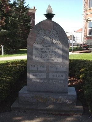
| On South 2nd Street at Madison Street, on the right when traveling south on South 2nd Street. |
| On Leo Road (State Road 1) 0.3 miles north of Amstutz Road, on the right when traveling south. |
| On East South Street (Indiana Route 101) east of Mulberry Street, on the right when traveling east. |
| On Middle Rd at Grissom Ave, on the left when traveling north on Middle Rd. |
| On East 5th Street at South Van Buren Avenue, on the right when traveling east on East 5th Street. |
| On North High Street at West Main Street, on the right when traveling north on North High Street. |
| On Meridian Street at Main Street, on the right when traveling south on Meridian Street. |
| On South Market Street at West Franklin Street, on the right when traveling south on South Market Street. |
| On East Main Street east of Park Row (a.k.a.: 3rd Street), on the left when traveling east. |
| Near Mulberry Street south of West Maple Street, on the left when traveling south. |
| Near Mulberry Street south of West Maple Street, on the left when traveling south. |
| On North New Albany Avenue north of East Utica Street, on the left when traveling north. |
| On East Clinton Street east of South Main Street, on the left when traveling east. |
| On North Main Street at East Washinton Street, on the right when traveling north on North Main Street. |
| On West High Street west of Mary Street, on the right when traveling west. |
| Near Route 11A east of County Road 56, on the right when traveling west. |
| On South Broadway Street south of West State Street (Indiana Route 28), on the left when traveling south. |
| On Macedonia Avenue, on the right when traveling north. |
| Near West Kilgore Avenue (Indiana Route 32) east of West 2nd Street, on the left when traveling east. |
| On Main Street (State Road 13) at Bristol Avenue, on the right when traveling south on Main Street. |
| On W. Lincoln Street at S. Nappanee Street, on the right when traveling west on W. Lincoln Street. |
| On Clinton Street south of Market Street (County Road 46), on the right when traveling north. |
| On North Central Avenue north of West 4th Street, on the left when traveling north. |
| On East Market Street east of East 10th Street, on the left when traveling east. |
| On Ekin Avenue, on the left when traveling east. |
| Near North Park Street north of East Hayes Street. |
| On West Broadway Street (State Road 64) west of North Main Street, on the right when traveling west. |
| On West Broadway Street (Indiana Route 65) at North West Street, on the left when traveling east on West Broadway Street. |
| On South Main Street at Henley Avenue (County Route S100E), in the median on South Main Street. |
| On Henley Avenue (Route S100E) at South Main Street, on the right when traveling north on Henley Avenue. |
| On East Main Street (Route 35) at South 2nd Street, on the left when traveling east on East Main Street. |
| On East Main Street (U.S. 35) just east of South 2nd Street, on the left when traveling east. |
| On South Western Avenue (Indiana Route 9/15) at West 26th Street, on the right when traveling south on South Western Avenue. |
| On South Adams Street north of East 4th Street (State Road 18), on the left when traveling north. |
| Near 4th Street at Main Street, on the left when traveling north. |
| On East Main Street east of South Franklin Street, on the right when traveling east. |
| On Monument Street, 0.5 miles west of Kings Lane, on the right when traveling west. |
| On North 8th Street north of Conner Street, on the right when traveling north. |
| Near North Memorial Drive south of East Waycross Drive. |
| On South Main Street south of Broad Street (State Road 38), on the right when traveling south. |
| On North Memorial Drive at Second Entrance to Memorial Park, on the left when traveling north on North Memorial Drive. |
| On North Memorial Drive south of County Road 100 N, on the right when traveling south. |
| On South Apperson Way south of East Superior Street, on the right when traveling north. |
| Near West Sycamore Street (Indiana Route 22) just west of Kingston Road, on the right when traveling west. |
| On State Road 105 at E. Madison Street, on the right when traveling north on State Road 105. |
| On Jefferson St. at E. Franklin St. on Jefferson St.. |
| On West Park Drive (Business U.S. 24) 0.1 miles west of Dimond Street, on the right when traveling west. |
| On West Park Drive (Business U.S. 24) 0.1 miles west of Dimond Street, on the right when traveling west. |
| On E. Sparks Street at N. Clark Street (State Road 3), on the right when traveling east on E. Sparks Street. |
| On South Main Street (U.S. 50) north of East Cross Street, on the right when traveling north. |
| On A Avenue, 0.1 miles west of 1st Avenue East, on the right when traveling west. |
| On South Walnut Avenue (State Road 11) at B. Avenue East, on the right when traveling south on South Walnut Avenue. |
| On West Tipton Street (U.S. 50) at South Airport Road, on the left when traveling east on West Tipton Street. |
| On South Meridian Street (U.S. 27) at River Road, on the left when traveling south on South Meridian Street. |
| On West Walnut Street west of North Commercial Street, on the left when traveling west. |
| On West High Street, on the right when traveling east. |
| Near College Avenue, 0.2 miles east of East Main Street, on the left when traveling east. |
| On East Main Street east of Jefferson Street, on the right when traveling east. Reported permanently removed. |
| On Jefferson Street south of East Main Street, on the right when traveling north. |
| On N. Yandes St south of E. Adams St, on the right when traveling south. |
| On West Lyndale Avenue west of Short Street, on the right when traveling west. |
| Near South 6th Street west of Willow Street (Business U.S. 41). |
| Near South 6th Street west of Willow Street (Business U.S. 41). |
| Near South 6th Street Road west of Willow Street (Business U.S. 41). |
| Near South 6th Street Road west of Willow Street (Business U.S. 41). Reported unreadable. |
| Near South 6th Street Road west of Willow Street (Business U.S. 41). |
| Near South 6th Street Road west of Willow Street (Business U.S. 41). |
| Near South 6th Street Road west of Willow Street (Business U.S. 41). |
| Near South 6th Street Road west of Willow Street (Business U.S. 41). |
| Near South 6th Street Road west of Willow Street (Business U.S. 41). |
| Near South 6th Street Road west of Willow Street (Business U.S. 41). |
| On Vigo Street (State Road 441) at 2nd Street, on the right when traveling west on Vigo Street. |
| Near South 6th Street west of Willow Street (Business U.S. 41). |
| On Main Street, on the right when traveling south. |
| On Center Street at Lake Street, on the left when traveling east on Center Street. |
| On Main Street at Lake Street, on the right when traveling east on Main Street. |
| On North Detroit Street south of Michigan Street, on the right when traveling south. |
| On North Main Street at East Goldsborough Street, on the right when traveling north on North Main Street. |
| On South Main Street, on the right when traveling north. |
| On Harrison Street, on the right when traveling north. |
| On Oak Avenue, 0.2 miles west of Montgomery Street, on the right when traveling west. |
| On Lincoln Street at Main Street, on the right when traveling north on Lincoln Street. |
| Near Lake Shore Drive west of Pine Lake Avenue (U.S. 35), on the left when traveling west. |
| Near Lake Shore Drive west of Pine Lake Avenue (U.S. 35), on the left when traveling west. |
| Near Tilden Avenue at Decatur Street. |
| Near Greenwood Avenue at Wrobel Avenue, on the right when traveling east. |
| On J Street south of 15th Street (U.S. 50), on the left when traveling south. |
| On East 8th Street at Main Street, on the left when traveling east on East 8th Street. |
| Near North 19th Street at North J Street. |
| On West 49th Street at Sunset Avenue, on the right when traveling west on West 49th Street. |
| Near North West Street north of Downtown Canal Walk, on the right when traveling south. |
| On West Walnut Street east of North Capital Avenue, in the median. |
| Near North Blackford Street north of Indianapolis Cultural Trail, on the right when traveling north. |
| Near North Blackford Street north of Indianapolis Cultural Trail, on the right when traveling north. |
| On Alabama Street just north of East North Street, on the right when traveling north. |
| Near North Blackford Street north of Indianapolis Cultural Trail, on the right when traveling north. |
| Near Blackford Street north of Indianapolis Cultural Trail, on the right when traveling north. |
| Near North Delaware Street south of East 13th Street, on the left when traveling north. |
167 entries matched your criteria. The first 100 are listed above.
The final 67 ⊳