By William Fischer, Jr., December 28, 2008
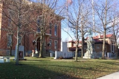
Delaware County World War II Memorial
GEOGRAPHIC SORT Title Sort Marker Number Sort Marker Number Sort N Marker Number Sort T Publication Order Sort Publication Order Sort A Erected Year Sort Most Viewed Sort Most Recent-Interest Sort Most Recently Changed Sort SEE FAQ #33 FOR DESCRIPTIONS
On Sandusky Street, on the left when traveling north.
On Park Street at Middle Street, on the right when traveling west on Park Street.
Near Columbus Pike (U.S. 23).
On 3rd Street, on the left when traveling north.
On Ohio Street near Cleveland Road West (Old U.S. 6), on the right when traveling south.
On Central Avenue at Jackson Street, on the left when traveling north on Central Avenue.
On East Washington Row (U.S. 6) west of Wayne Street, on the left when traveling east.
On Columbus Avenue (County Road 120) south of Dewitt Avenue (County Road 92), on the right when traveling north.
Near East Strub Road (County Road 7) west of Milan Road (U.S. 250), on the right when traveling west.
On Broad Street (Ohio Route 664) at Walnut Street, on the left when traveling north on Broad Street.
On Center Street, on the right when traveling east.
On Main Street (U.S. 22), on the left when traveling east.
On Main Street (U.S. 22) at Pearl Avenue, on the right when traveling west on Main Street. Reported missing.
On Columbus Street (Ohio Route 39) at Market Street, on the left when traveling east on Columbus Street.
On Canal Drive, on the right when traveling east.
Paid Advertisement
On Main Street (Ohio Route 38) near Cross Street, on the right when traveling west.
Near Cemetery Road (County Route 203).
On Court Street (U.S. 22/62) at Main Street, on the left when traveling east on Court Street.
On Court / Columbus Street (U.S. 22/62) at Washington Avenue (U.S. 22), on the right when traveling north on Court / Columbus Street.
On East Broad Street (Ohio Route 16) at South Stanwood Road, on the right when traveling east on East Broad Street.
On Broad Street (U.S. 40) at Drexel Avenue, on the right when traveling west on Broad Street.
On Winchester Southern Road near Elder Road, on the right when traveling south.
On East Broad Street (U.S. 40) at Washington Avenue, on the right when traveling west on East Broad Street. Reported permanently removed.
Near Flint Road (County Route 85), on the left when traveling north.
On Sullivant Avenue, on the left when traveling east.
On West North Broadway, on the right when traveling east.
On North High Street at Aston Row Lane, on the right when traveling north on North High Street.
On John Circle Drive, on the left when traveling east.
On West Woodruff Avenue west of North High Street, on the left when traveling west.
On East State Street west of South 3rd Street, on the right when traveling west.
On East State Street east of South High Street, on the left when traveling east.
Paid Advertisement
On North High Street (Ohio Route 745), on the left when traveling north.
Near West Bridge Street (U.S. 33) at Monterey Drive, on the right when traveling east.
On Broadway (U.S. 62) at Grove City Road, on the right when traveling south on Broadway.
On Main Street at Wirt Road, on the right when traveling east on Main Street.
On Waggoner Road, on the left when traveling south.
On Tremont Road at Kenny Road, on the right when traveling north on Tremont Road.
On Tremont Road south of Kenny Road, on the right when traveling north.
On Tremont Road south of Kenny Road, on the right when traveling north.
On Tremont Road south of Kenny Road, on the right when traveling north.
On Westerville Rd (Ohio Route 3) at West Plum Street, on the right when traveling north on Westerville Rd.
On Broad Street (Ohio Route 16), on the right when traveling west.
On Broad Street, on the right when traveling east.
On High Street, on the right when traveling south.
On South Pleasant Street, on the left when traveling north.
Paid Advertisement
On Adrian Street just north of Maplewood Street, on the left when traveling north.
On West Morenci Street (Ohio Route 120), on the right when traveling west.
On South Main Street (County Route 1-1) at Academy Drive, on the right when traveling south on South Main Street.
On South Fulton Street just south of West Chestnut Street, on the right when traveling south.
On South Fulton Street just south of West Chestnut Street, on the right when traveling south.
On Ohio Route 108, 0.2 miles south of County Road J, on the left when traveling north.
On Main Street north of Short Court Street, on the left when traveling south.
On Old North Fairfield Road near Fairwood Dr., on the left when traveling north.
On Detroit Street (U.S. 68) at Main Street (U.S. 35/42), on the right when traveling north on Detroit Street.
On Wheeing Avenue (U.S. 40), on the right when traveling west.
On Old Twenty-One Road (County Route 35) at Toland Drive and Eckleberry Road (County Route 633), on the left when traveling north on Old Twenty-One Road.
On Main Street (Ohio Route 285) at Great Guernsey Rail-Trail, on the left when traveling south on Main Street.
On Main Street west of Dinning Lane, on the right when traveling west.
On West McMicken Avenue at Ravine Street, on the right when traveling east on West McMicken Avenue.
Paid Advertisement
On Ezzard Charles Drive at Cutter Street, on the right when traveling east on Ezzard Charles Drive.
On Harrison Avenue near Montana Avenue, on the right when traveling south.
On South Miami Avenue, on the right when traveling north.
On Harrison Avenue at Walnut Street, on the right when traveling east on Harrison Avenue.
On Main Cross Street (Ohio Route 12) at Dorney Plaza, on the right when traveling south on Main Cross Street.
On County Route 236, 0.1 miles north of Carey Road (Ohio Route 568), on the left when traveling north.
Near West Main Cross Street east of Interstate 75, on the right when traveling west.
On North Main Street (Business Interstate 75) just north of Center Street (U.S. 224), on the left when traveling north.
Near West Main Cross Street (Ohio Route 12) west of Glessner Avenue, on the right when traveling west.
On Independence Avenue at Herbert Court, on the right when traveling north on Independence Avenue.
On Independence Avenue (County Road 23) 0.3 miles north of County Road 218.
On West Main Str. (Ohio Route 613), on the right when traveling west.
Near South Simon Street at East Dobbins Avenue, on the right when traveling north.
On County Route 40 at South Main Street (U.S. 68), on the left when traveling west on County Route 40.
Near Jacob Parrot Road (County Route 171) at Ohio Route 309, on the right when traveling north.
On Main Street, 0.1 miles west of Wood Street, on the right when traveling east.
Paid Advertisement
Near Ohio Route 151 west of Local Highway 62, on the right when traveling west.
On Concord Street at Ohio Route 647, in the median on Concord Street.
On South Damascus Street (Ohio Route 109) at West Young Street, on the left when traveling north on South Damascus Street.
On North Turkey Foot Avenue (Ohio Route 109) 0.1 miles south of Center Street, on the right when traveling north.
On Frease Street, 0.1 miles east of Henry Street, on the right when traveling east.
On South Perry Street (Ohio Route 108) just north of West Maumee Avenue, on the left when traveling north.
Near Glenwood Avenue, 0.1 miles north of West Riverview Avenue (Ohio Route 424), on the left when traveling north.
On East Washington Street at Monroe Street, on the right when traveling east on East Washington Street.
On Washington Street south of Jefferson Street (Ohio Route 28/138), on the right when traveling south.
On Main Street (Ohio Route 28/72) west of New Lexington Avenue, on the left when traveling west.
On South Market Street south of West Main Street, on the right when traveling south.
Near Ohio 664, on the left when traveling east.
On Jackson Street (County Route 192) just east of West Market Street, on the left when traveling east.
On Southwest Street, on the right when traveling north.
On Ohio 113 (Ohio Route 113), on the left when traveling north.
On Brown Street just south of West Broad Street, on the right when traveling south.
Paid Advertisement
On Brown Street at West Broad Street, on the right when traveling south on Brown Street.
On Brown Street at West Broad Street, on the right when traveling south on Brown Street.
On Main Street (Ohio Route 93) at Portsmouth Street, on the right when traveling south on Main Street.
On North Front Street (Ohio Route 93) at Madison Street (Ohio Route 279), on the left when traveling north on North Front Street.
On South Main Street (Ohio Route 43) 0.1 miles south of Liberty Street, on the right when traveling north.
849 entries matched your criteria. Entries 101 through 200 are listed above.
⊲ Previous 100 —
Next 100 ⊳