After filtering for Kansas, 226 entries match your criteria. The first 100 are listed. ⊳
Native Americans Topic
By William Fischer, Jr., December 9, 2011
"Grand Village des Canzes" Marker
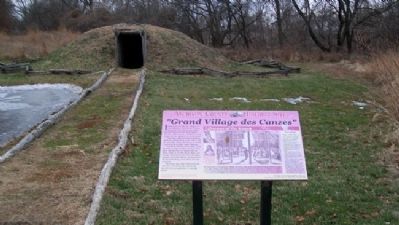
| 1 ► Kansas, Atchison County, Atchison — "Grand Village des Canzes" — Atchison County Historic Site — Lifeways of the Kanza — |
| 2 ► Kansas, Atchison County, Atchison — Homeland of the Kanza Indians — |
| On Commercial Street at River Road, on the right when traveling east on Commercial Street. | |||
| 3 ► Kansas, Atchison County, Atchison — The Lewis and Clark Expedition — |
| On River Road at Commercial Street, on the right when traveling north on River Road. | |||
| 4 ► Kansas, Barber County, Medicine Lodge — 69 — Medicine Lodge Peace Treaties — |
| On U.S. 160 at the entrance to Memorial Peace Park, on the right when traveling east on U.S. 160. | |||
| 5 ► Kansas, Barber County, Medicine Lodge — Peace Treaty Memorial — |
| On Main Street at 1st Avenue, on the right when traveling north on Main Street. | |||
| 6 ► Kansas, Barton County, Claflin — Prey and Play — Hunting and Wildlife Watching Along the Byway — |
| On State Highway 4, 0.2 miles east of NE 80th Avenue, on the right when traveling east. | |||
| 7 ► Kansas, Barton County, Pawnee Rock — "A Rallying Point for the Indians" — |
| 8 ► Kansas, Barton County, Pawnee Rock — Santa Fe Trail Monument — |
| 9 ► Kansas, Bourbon County, Fort Scott — "Hardy, Dashing Looking Fellows" — |
| Near Old Fort Boulevard. | |||
| 10 ► Kansas, Bourbon County, Fort Scott — Fort Scott — From military outpost to thriving city — |
| On Old Fort Boulevard at Main Street, in the median on Old Fort Boulevard. | |||
| 11 ► Kansas, Bourbon County, Fort Scott — Sutler Store — |
| On Old Fort Boulevard north of Wall Street, on the right when traveling north. | |||
| 12 ► Kansas, Chase County, Tallgrass Prairie National Preserve — Welcome to the Prairie — |
| 13 ► Kansas, Cherokee County, Baxter Springs — Black Dog Trail — Commemorating — |
| On East Avenue at 7th Street, on the left when traveling south on East Avenue. | |||
| 14 ► Kansas, Cherokee County, Baxter Springs — The Earliest Residents — Native Americans find healthy spring waters — |
| On West 2nd Street near Willow Avenue (Old U.S. 66), on the right when traveling east. | |||
| 15 ► Kansas, Cherokee County, Columbus — The History of Columbus — |
| On U.S. 69/160 at North East Avenue (U.S. 69), on the right when traveling east on U.S. 69/160. | |||
| 16 ► Kansas, Cherokee County, Galena — Galena Growth And Change — From Mining Trucks To Classic Cars Along Route 66 — |
| On South Main Street just south of West 5th Street, on the right when traveling south. | |||
| 17 ► Kansas, Cherokee County, Riverton — Baxter Springs Massacre and Today — A battle spread across the Plains — |
| On U.S. 400 near State Highway 66, on the right when traveling south. | |||
| 18 ► Kansas, Cherokee County, Riverton — Cosmopolitan Corner — Kansas Historic Route 66 Byway — |
| On U.S. 400 at State Highway 66, on the right when traveling south on U.S. 400. | |||
| 19 ► Kansas, Cherokee County, Riverton — Crossroads of Kansas — Kansas Historic Route 66 Byway — |
| On U.S. 400 at State Highway 66, on the right when traveling south on U.S. 400. | |||
| 20 ► Kansas, Cherokee County, Riverton — Where Two Roads Converge — Military roads to cruising roadsters — |
| On U.S. 400 at State Highway 66, on the right when traveling south on U.S. 400. | |||
| 21 ► Kansas, Cheyenne County, St. Francis — Cherry Creek Encampment, 1864-65 — Last Buffalo — |
| On State Highway 27 near U.S. 36, on the left when traveling north. | |||
| 22 ► Kansas, Coffey County, LeRoy — History of LeRoy, Kansas — |
| On 6th Street (State Highway 58) at Main Street, on the left when traveling west on 6th Street. | |||
| 23 ► Kansas, Coffey County, LeRoy — Opothleyahola — |
| On Main Street north of Kansas Avenue, on the right when traveling north. | |||
| 24 ► Kansas, Cowley County, Arkansas City — The Cherokee Strip — |
| On 312th Street at U.S. 77, on the left when traveling west on 312th Street. | |||
| 25 ► Kansas, Decatur County, Oberlin — 425 — Flight of the Cheyennes — |
| On East Frontier Parkway (U.S. 36) east of Martin Avenue, on the right when traveling east. | |||
| 26 ► Kansas, Dickinson County, Herington — Father Juan de Padilla & Quivira |
| On U.S. 56/77, 0.1 miles south of Wind Road, on the right when traveling south. Reported permanently removed. | |||
| 27 ► Kansas, Dickinson County, Herington — Juan de Padilla Memorial — |
| 28 ► Kansas, Doniphan County, Highland — 6 — A Dangerous Coexistence — |
| 29 ► Kansas, Doniphan County, Highland — 5 — A Manual Training School — |
| 30 ► Kansas, Doniphan County, Highland — 3 — An Agricultural Mission — |
| 31 ► Kansas, Doniphan County, Highland — Cooperation and Conflict on the Trail — |
| 32 ► Kansas, Doniphan County, Highland — 1 — Emigrant Indians In Kansas — |
| 33 ► Kansas, Doniphan County, Highland — Rubeti Memorial — |
| On Main Street, on the right when traveling west. | |||
| 34 ► Kansas, Doniphan County, Highland — 7 — The Closing of the Mission — |
| 35 ► Kansas, Doniphan County, Highland — 4 — The Highland Presbyterian Mission — |
| 36 ► Kansas, Doniphan County, Highland — 17 — The Iowa, Sac and Fox Mission — American Presbyterian and Reformed Historical Site — |
| 37 ► Kansas, Doniphan County, Highland — 2 — The Missionary Movement — |
| 38 ► Kansas, Doniphan County, Highland — The Oregon-California Trail — |
| 39 ► Kansas, Doniphan County, Highland — The Wolf River Crossing — |
| 40 ► Kansas, Doniphan County, Troy — "Tall Oak" — To the American Indian — By Peter Wolf Toth — |
| On Chestnut Street near Main Street, on the left when traveling east. | |||
| 41 ► Kansas, Doniphan County, White Cloud — Homeland of the Kanza Indians — |
| On State Highway 7 near Main Street, on the right when traveling north. | |||
| 42 ► Kansas, Doniphan County, White Cloud — The Lewis and Clark Expedition — |
| On State Highway 7 near Main Street, on the right when traveling north. | |||
| 43 ► Kansas, Douglas County, Eudora — 4 East 7th Street — Eudora City Hall — |
| On 7th Street at Main Street, on the left when traveling east on 7th Street. | |||
| 44 ► Kansas, Douglas County, Eudora — 806 Main Street — |
| On Main Street north of 9th Street, on the right when traveling north. | |||
| 45 ► Kansas, Douglas County, Eudora — City of Eudora - The Early Years — |
| On Main Street at 9th Street, on the left when traveling north on Main Street. | |||
| 46 ► Kansas, Douglas County, Eudora — Shawnee Tribal Leader Paschal Fish and his Daughter, Eudora — |
| On Main Street at 9th Street, on the left when traveling north on Main Street. | |||
| 47 ► Kansas, Douglas County, Lawrence — Coffin Sports Complex, Tahoma, and Teacher's Quarters — |
| On Indian Avenue west of East Perimeter Road, on the left when traveling west. | |||
| 48 ► Kansas, Douglas County, Lawrence — Haskell Bandstand/Gazebo — |
| 49 ► Kansas, Douglas County, Lawrence — Haskell Celebration 1926 — |
| On Indian Avenue east of Barker Avenue, on the left when traveling east. | |||
| 50 ► Kansas, Douglas County, Lawrence — Haskell Indian Nations University — |
| On Barker Avenue south of Pawnee Avenue, on the left when traveling south. | |||
| 51 ► Kansas, Douglas County, Lawrence — Haskell Indian Nations University — |
| On Barker Avenue, on the left when traveling south. | |||
| 52 ► Kansas, Douglas County, Lawrence — Haskell Indian Nations University — |
| 53 ► Kansas, Douglas County, Lawrence — Haskell Indian Nations University Timeline — |
| On Barker Avenue, on the left when traveling south. | |||
| 54 ► Kansas, Douglas County, Lawrence — Haskell Stadium Memorial Arch — |
| 55 ► Kansas, Douglas County, Lawrence — Hiawatha Hall — |
| 56 ► Kansas, Douglas County, Lawrence — 9 — Lawrence and the Old Trails — |
| On Interstate 70 at milepost 209, in the median. | |||
| 57 ► Kansas, Douglas County, Lawrence — Tecumseh Hall — |
| 58 ► Kansas, Douglas County, Lawrence — The Haskell Cemetery — |
| 59 ► Kansas, Douglas County, Lawrence — The Original Bandstand — |
| 60 ► Kansas, Douglas County, Lawrence — War Mothers Memorial — |
| On Barker Avenue south of Pawnee Avenue, on the right when traveling south. | |||
| 61 ► Kansas, Ellis County, Hays — Fort Hays — |
| 62 ► Kansas, Ellis County, Hays — Monarch of the Plains — |
| On Bypass U.S. 183, on the right when traveling south. | |||
| 63 ► Kansas, Ellsworth County, Ellsworth — 101 — Historic Kansas — |
| Near Interstate 70 at milepost 224,, 1.3 miles west of State Highway 156. | |||
| 64 ► Kansas, Finney County, Garden City — 80 — American Indians and the Buffalo — |
| Near East Fulton Street (Business U.S. 50) just east of Campus Drive, on the right when traveling east. | |||
| 65 ► Kansas, Ford County, Howell — A Fine Country… — |
| 66 ► Kansas, Ford County, Howell — Santa Fe Trail, 1821 - 1880 — |
| 67 ► Kansas, Grant County, Hugoton — Jedediah Strong Smith — |
| On State Highway 25, 14.4 miles north of U.S. 56, on the left when traveling north. | |||
| 68 ► Kansas, Grant County, Hugoton — 83 — Wagon Bed Springs — |
| On State Highway 25, 14.4 miles north of U.S. 56, on the left when traveling north. | |||
| 69 ► Kansas, Jefferson County, Williamstown — 95 — Kansa Indians — |
| On U.S. 24, 0.8 miles west of U.S. 59, on the right when traveling west. | |||
| 70 ► Kansas, Jewell County, Jewell — Fort Jewell — Built May 13-14, 1870 — |
| On Delaware Street (Kansas Route 28) just east of South Custer Street, on the right when traveling west. | |||
| 71 ► Kansas, Johnson County, Gardner — A Look Back in Time — The Oregon and California trails were pathways for the greatest mass migration in American history — |
| Near U.S. 56 at West 183rd Street, on the right when traveling west. | |||
| 72 ► Kansas, Johnson County, Gardner — Apprehension and Conflict — |
| Near U.S. 56 at West 183rd Street, on the right when traveling west. | |||
| 73 ► Kansas, Johnson County, Gardner — Following Their Dreams — |
| Near U.S. 56 at West 183rd Street, on the right when traveling west. | |||
| 74 ► Kansas, Johnson County, Gardner — From Prairie Schooners to Locomotives — |
| Near U.S. 56 at West 183rd Street, on the right when traveling west. | |||
| 75 ► Kansas, Johnson County, Merriam — 02 — Shawnee Friends Mission — Merriam Historic Plaza Walking Path — |
| 76 ► Kansas, Johnson County, Merriam — 1 — Shawnee Friends Mission — |
| On 63rd Terrace, 0.1 miles west of Carter Avenue, on the right when traveling west. | |||
| 77 ► Kansas, Johnson County, Merriam — 01 — The People of the South Wind & the Coming of the Shawnee — Merriam Historic Plaza Walking Path — |
| 78 ► Kansas, Johnson County, Olathe — "Indian Jim" and the Building of Kansas City Road — World's Champion Lays 46,664 Bricks in Under Eight Hours — |
| On East Poplar Street at North Kansas City Road, on the right when traveling west on East Poplar Street. | |||
| 79 ► Kansas, Johnson County, Olathe — Check that Cornfield — |
| 80 ► Kansas, Johnson County, Overland Park — A Day on the Santa Fe Trail — 1822 - 1872 — |
| On 80th Street at Santa Fe Drive, on the right when traveling west on 80th Street. | |||
| 81 ► Kansas, Johnson County, Overland Park, Fairview Manor — Heritage of Johnson County, Kansas — |
| On Metcalf Avenue (Road 8788), on the right when traveling south. | |||
| 82 ► Kansas, Kearny County, Lakin — 82 — Chouteau's Island — |
| On U.S. 50/400, 0.1 miles west of Country Heights Road, on the left when traveling west. | |||
| 83 ► Kansas, Kingman County, Kingman — Land of the Buffalo — |
| 84 ► Kansas, Labette County, Oswego — Historic Riverside Park — |
| On the park's north perimeter road west of Oregon Street, on the right when traveling west. | |||
| 85 ► Kansas, Labette County, Oswego — John A. Mathews Park — A Kansas Landmark — |
| On Union Street at 4th Street, on the right when traveling north on Union Street. | |||
| 86 ► Kansas, Labette County, Oswego — Osage Indian Village — Circa 1841 — |
| On 4th Street near Commercial Street, on the right when traveling east. | |||
| 87 ► Kansas, Labette County, Oswego — Riverside Park — |
| On the park's north perimeter road west of Oregon Street, on the left when traveling west. | |||
| 88 ► Kansas, Labette County, Oswego — The Little Town Well — |
| On Union Street at 4th Street, on the right when traveling north on Union Street. | |||
| 89 ► Kansas, Leavenworth County, Fort Leavenworth — BG Benjamin H. Grierson — 08 Jul 1826 - 31 Aug 1911 — |
| On Grant Avenue south of Smith Lake, on the right when traveling north. | |||
| 90 ► Kansas, Linn County, Centerville — "Quah-Kah-Ka-Num-Ad" — Rose Philippine Duchesne — |
| 91 ► Kansas, Linn County, Centerville — [Potawatomi] Trail of Death — Indiana to Kansas — |
| 92 ► Kansas, Linn County, Centerville — [Potawatomi] Trail of Death — |
| 93 ► Kansas, Linn County, Centerville — Daily Offering — |
| 94 ► Kansas, Linn County, Centerville — Father Petit and the Potawatomi 'Trail of Death' — (Indiana to Kansas, September 4 - November 4, 1838) — |
| 95 ► Kansas, Linn County, Centerville — Father Petit and the Trail of Death — |
| 96 ► Kansas, Linn County, Centerville — Kanza Indian Site? — |
| 97 ► Kansas, Linn County, Centerville — Log Cabin School — October 9, 1841 — |
| 98 ► Kansas, Linn County, Centerville — Log Convent — |
| 99 ► Kansas, Linn County, Centerville — Potawatomi "Trail of Death" march & death of Fr. Petit — |
| 100 ► Kansas, Linn County, Centerville — Potawatomi Burial Ground — Memorial — |
226 entries matched your criteria. The first 100 are listed above. Next 100 ⊳