On Clarence Street west of Queenston Street, on the left when traveling west.
Warriors of the Six Nations of Iroquois (Mohawks, Oniedas Onondagos, Cayugas, Senecas, Tuscaroras), mainly from the Grand River, fought as allies of the British in this historic battle with the Americans. Speaking distinctive dialects and with . . . — — Map (db m49168) HM
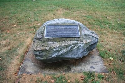
The Battle of Queenston Heights
The village below you and the heights on which you are standing were the stage for the famous Battle of Queenston Heights.
It took place during the Anglo-American conflict 1812-1815 known as the . . . — — Map (db m51682) HM
On the plateau before you, the British and Americans met for battle. The British formed a line to your right, the Americans to your left. General Sheaffe formed a British counter-offensive force of nine hundred men in a line shoulder to shoulder. . . . — — Map (db m55028) HM
On Niagara Parkway just north of Portage Road, on the right when traveling north.
"An unguarded trail up this steep cliff was the only route which the Americans had to the heights of Queenston. The trail was to your right but does not exist any longer. Trapped on the river shore by unrelenting gunfire, the Americans contemplated . . . — — Map (db m55030) HM
On King Street (Road 68) at East Main Street (Road 27), on the right when traveling south on King Street.
[English] This bridge was built in 1927-1930 during the construction of the Fourth Welland Canal (1913-1933). It was one of the three largest vertical lift bridges on the canal and is unique because its towers are set at an angle to the . . . — — Map (db m196324) HM
Near Memorial Drive, 0.6 kilometers south of Main Street West, on the right when traveling south.
The rivers and lakes of northern Ontario have been highways for travel and commerce for hundreds of years. Used extensively by first nations and European explorers, Lake Nipissing became a major highway with half the furs shipped to . . . — — Map (db m215897) HM
On Memorial Drive at Colgan Avenue, on the right when traveling north on Memorial Drive.
Born in France about 1598, this explorer, fur trader and interpreter came to Canada in 1608. Under orders from Samuel de Champlain, he spent the following two years with the Algonquins of Allumette Island. He was then sent to the Nipissing Indians . . . — — Map (db m107579) HM
Near Memorial Drive, 0.8 kilometers south of Main Street West, on the right when traveling south.
The vast body of water before you is a shining Northern gem. Known as Lake Nipissing, the name being derived from an Aboriginal term meaning "little water", it is one of the ten largest lakes in Ontario at roughly 65 km by 25 km. When . . . — — Map (db m215993) HM
Diamond Jenness was born in New Zealand and educated there and at Oxford. After field work in New Guinea he joined the 1913
Canadian Arctic Expedition, embarking on the career that made him the dean of Canadian anthropologists. Although . . . — — Map (db m218240) HM
On Wellington Street close to Elgin Street, on the left when traveling west.
English: A notable Mohawk warrior and statesman, and principal war chief of the Six Nations, he led his people in support of the British. After the war, he brought his people to Canada to settle near where Brantford now stands. American . . . — — Map (db m83315) HM
On Alexandra Bridge (Saint Patrick Street), 0.4 kilometers west of Mackenzie Avenue (Route 93), on the left when traveling west.
English: Canada’s Capital is young — but the land is old, and the people have lived here for a long, long time. After the glaciers melted and the waters of the Champlain Sea retreated from this valley (10,000 to 13,000 years . . . — — Map (db m150699) HM
For generations, the Inuit have been creating impressive stone markers on the Arctic landscape. Inuksuk means "acting in the capacity of a human." They serve many functions, including guiding travellers, warning of danger, assisting hunters and . . . — — Map (db m39750) HM
In 1826, the government built a village for the Mississaugas on their traditional lands on what is now the upper portion of the golf club property overlooking the Credit River Valley. The village began as 20 dressed-log houses including a . . . — — Map (db m243009) HM
On Lakeshore Road West at Front Street North, on the right when traveling west on Lakeshore Road West.
Near this site on the Credit River's eastern bank, the
government of Upper Canada built a "post-house" or inn in
1798, for the use of persons travelling between York and such settlements as Niagara and Detroit. Constructed of dressed timber, it . . . — — Map (db m242984) HM
On Lake Road at Idylwild, on the right when traveling north on Lake Road.
In 1869, after the Louis Riel uprising of the breed, the Calders migrated east from the Red River settlement in Manitoba. Their heritage was the mixed blood of Orkney men and Indian maidens. As employees of the Hudson’s Bay Trading Company, William . . . — — Map (db m203492) HM
On Lake Road at Idylwild, on the right when traveling north on Lake Road.
Robert J. N. Pither
1824 – 1918
Born in Montreal, Pither joined the Hudson’s Bay Company in 1846. While in charge at Ft. Frances, 1853-56 and 1858-64, he lived in this vicinity (now Pither’s Point). On his retirement from the company in 1869, . . . — — Map (db m203422) HM
Near Trans-Canada Highway (Provincial Highway 17) 0.3 kilometers west of Main Street.
The Father of New France, Samuel de Champlain, made the first of two voyages into what is now Ontario in 1613. He travelled up the Ottawa River seeking the northern sea (Hudson Bay) which one of his five companions, Nicolas de Vignau, claimed to . . . — — Map (db m105539) HM
An understanding between Mohawk Chief, Thayendanegea (Joseph Brant) and Sir John Johnson led to the settlement of Cornwall and Stormont, Dundas & Glengarry.
On June 6th, 1784, Loyalists camped on this plateau before traveling to . . . — — Map (db m197142) HM
On Mission Road just north of Back Street, on the right when traveling north.
In 1849 two priests of the Society of Jesus, Father Jean-Pierre Choné and Father Nicholas Frémiot, established the Mission of the Immaculate Conception on the Kaministiquia River. From there the Jesuits travelled the north shore of Lake Superior on . . . — — Map (db m199599) HM
This chain of rivers, lakes and portages linking the St. Lawrence system with the waterways of the prairies had been known to the Indians for centuries when Jacques de Noyon first travelled it in 1688. After 1800, when the boundary settlement had . . . — — Map (db m106543) HM
On Railway Street just north of 9th Street, on the right when traveling north.
[English] A solitary path The Nipigon River is the traditional gateway from Lake Superior to the fur rich Arctic watershed. By 1885, the area was dramatically altered when the Canadian Pacific Railway finished the "Nipigon gap" . . . — — Map (db m244764) HM
On Trans-Canada Highway (Provincial Highway 17) 37.6 kilometers north of Trans-Canada Highway/Shabaqua Corners (Provincial Highway 11), on the left when traveling west.
In the early days lakes and rivers took the place of roads. The dotted green line shows part of the first Highway across Canada. This was a very renowned canoe route used by the Indians, celebrated explorers, traders, and missionaries. It was first . . . — — Map (db m237391) HM
On Sleeping Giant Parkway just north of Pearl Street, on the right when traveling north.
Origin Stories The rock, the water, the oral traditions of the First Nations: Each tells its own tale about the origins of this shoreline site, but all speak of a place that is ancient. Geologists talk in terms of glaciers. The first . . . — — Map (db m227996) HM
On Colonel Keene Drive at High Street South, on the right when traveling east on Colonel Keene Drive.
At least 9,000 years old, the Cummins site is one of the most significant of several Palaeo-Indian archaeological sites that form the Lakehead Complex. Many of these early seasonal camps were located on the shoreline of ancient Lake Minong, at a . . . — — Map (db m106858) HM
Near Sleeping Giant Parkway just north of Pearl Street, on the right when traveling north.
Paddling to the Depot Bark peeled from a birch tree felled in spring. Cedar branches, tamarack roots, spruce pitch, and charcoal. From those materials, the first mariners of Lake Superior — the ancestors of the present-day First . . . — — Map (db m227995) HM
On Sleeping Giant Parkway, 0.4 kilometers north of Pearl Street, on the left when traveling north.
The First Highway to the West Continents and oceans, geography and history, the Great Lakes and the inland waterways: they all meet here, on this waterfront, at the mouth of a river called the Kaministiquia. The name has been . . . — — Map (db m227997) HM
On Riverside Drive, 0.2 kilometers east of May Street South.
English: The Little Clay Belt, the rich agricultural belt extending north from New Liskeard, was originally inhabited by the Algonquin First Nations, including Joachim "Clear Sky" Wabigijic and Angela Lapointe who lived by the mouth . . . — — Map (db m199224) HM
Near Trans-Canada Highway (Provincial Highway 11) 0.8 kilometers north of Route 570, on the right when traveling north.
The height of land known as the Artic Watershed crosses Highway 11 at this point.North of here, water drains into Hudson Bay; rivers, lakes and streams to the south flow into the Great Lakes. As the northern wilderness came under development, the . . . — — Map (db m195924) HM
Near Trans-Canada Highway (Provincial Highway 11 at milepost 595), 0.7 kilometers north of Provincial Highway 570, on the right when traveling north.
[English] The height of land known as the Artic Watershed crosses Highway 11 at this point. North of here, water drains into Hudson Bay; rivers, lakes and streams to the south flow into the Great Lakes. As the northern wilderness . . . — — Map (db m217881) HM
On Water Street North at Park Hill Road West, on the right when traveling south on Water Street North.
Grand River
The Grand River, flowing 290 kilometres from the Dundalk Highlands to Lake Erie, is aptly named, for its valley is the largest in Southern Ontario. A mosaic of Aboriginal
and European cultures combined to shape the . . . — — Map (db m231798) HM
130 entries matched your criteria. Entries 101 through 130 are listed above. ⊲ Previous 100