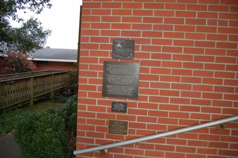
On Church Street (State Highway 1) north of Meriam Street, on the right when traveling north.
Methodist circuit riders came out of Mississippi into this area
soon after the Louisiana Purchase of 1803. A Union church building was erected in 1841 on what is now the parking lot of the present Methodist Church. This church served Methodists, . . . — — Map (db m127884) HM
Near State Highway 75, 0.2 miles south of Route 74, on the left when traveling south.
Eglise de la côte d'Iberville construite en 1769 par les exilés acadiens. En 1773 elle était sur le Manchac espagnol offert par ce gouvernement. Des colons allemands arrivèrent du Maryland en 1784. English . . . — — Map (db m85716) HM
On State Highway 75, 0.2 miles south of State Highway 74, on the left when traveling south.
Acadian exiles arrived from Maryland in 1767 and were given Spanish land grants as was the church. The church was built by Louis LeConte a builder from Lafourche between November 1774 and July 1776 aided by the settlers. The Acadians brought and . . . — — Map (db m127916) HM
Near State Highway 75, 0.2 miles south of State Highway 74, on the left when traveling south.
In 1699 Pierre Lemoyne, Sieur D'Iberville, father of Louisiana, explored the Mississippi and its distributary the Ascantia, later called Bayou Manchac. By 1758 exiled Acadians had settled at Manchac. They soon built upstream this cypress church, . . . — — Map (db m127915) HM
On Beech Springs Road (State Highway 542) 0.3 miles south of Parish Road 432, on the right when traveling south.
Built in 1964 by friends of Governor Jimmie H. Davis. These friends are of many faiths, people who believe in the church and who are dedicated to the promotion of Christian living and to the songs of Christian inspiration.It was here on these . . . — — Map (db m150032) HM
On 6th Street at Lavoisier Street, on the right when traveling east on 6th Street.
Father T. Anwander, C.SS.R., with a group of laymen, organized the mother church of West Jefferson in 1857. Previously Redemptorists crossing the Mississippi from the city of Lafayette had served the German, Irish, French and . . . — — Map (db m81135) HM
On River Road (State Road 611-1) at Central Avenue, on the right when traveling north on River Road.
Built in 1857 for François Pascalis de Labarre IV. Occupied by Union Troops during the Civil War. After 1892 was a gambling casino, Jesuit retreat house and St. Agnes Church. Magnolia School since 1935. — — Map (db m125236) HM
On West Main Street, on the right when traveling west.
Dedicated August 25, 1909, by Fr. Arthur Drossaerts, Pastor of Sacred Heart church in Broussard, and opened on September 15, 1909 with an enrollment of seventy students. Accredited as an elementary and secondary school by the State Department of . . . — — Map (db m49294) HM
One of the earliest schools
for African-American children
in this rural area
staffed by
Blessed Mother Katharine Drexel's
Sisters of the Blessed Sacrament — — Map (db m236354) HM
Attkapas Chapel: The Church in a Catholic Region This chapel is a reproduction based on St. Francis Catholic Church in Point Coupee (1760) and St
Martin de Tours Catholic Church in St. Martinville (1773). Both churches had a double pitch . . . — — Map (db m130028) HM
On St. John Street, on the right when traveling south.
Established in 1846. A combination of Mount Carmel Academy and Cathedral School. Operated by The Cathedral of St. John the Evangelist Parish in the Diocese of Lafayette. Affiliated with the Sisters of Our Lady of Mt. Carmel and the De La Salle . . . — — Map (db m49062) HM
On Marie Antoinette Street west of Johnston Street (U.S. 167), on the left when traveling west.
In April 1955, Emmanuel Baptist Church held its first meetings, thus becoming the earliest Southern Baptist Church to minister to Lafayette's southside neighborhoods. — — Map (db m114490) HM
On Carmel Drive (State Road 94) 0.3 miles east of Louisiana Avenue, on the left when traveling east.
On July 9, 1913, Father Keller purchased farm land once owned
by the sister of the King of
France, from Louis Domengeaux to
establish Holy Rosary Institute in Lafayette, Louisiana.
The Institute opened September 1913 as an industrial . . . — — Map (db m120896) HM
On St. John Street, on the left when traveling north.
First church in Lafayette Parish was "l'Eglise St. Jean du Vermilion." Built on a gift of this site by Jean Mouton, 1821. In 1824 he donated land for a court house and founded Vermilionville (Lafayette).
(Reverse) French: La Cathedrale . . . — — Map (db m49293) HM
Near Fisher Road south of Surrey Street (State Road 728-8), on the right when traveling north.
THE PRESBYTERY:
A Simple Residence from the early 1800s
This small home represents the simple but functional structures in which priests could have lived in
the early 1800s. The building was originally located
property . . . — — Map (db m135886) HM
On West Main Street (State Highway 1) at West 79th Street, on the right when traveling south on West Main Street.
After the hurricane of Cheniere Caminada in 1893, a group of refugees settled in this area. Because many of them painted their homes white, the settlement became known as "La Cote Blanche," a village of white houses. On this site in 1899, the . . . — — Map (db m85055) HM
On East Main Street. (State Highway 657) east of East 2nd Street, on the right when traveling west.
This church was founded in the mid-1800's when a small chapel was built at the juncture of Canal Harang and Bayou Lafourche. In 1873 a second church, which would serve the surrounding community of Larose and all of South Lafourche, was erected on . . . — — Map (db m85423) HM
On State Highway 1 at Trahan Street, on the right when traveling south on State Highway 1.
This cemetery was established circa 1797. Its presence preceded the church parish. Many of the early graves were ground burials, which were marked with wrought iron crosses. The St. Mary Pamela Corporation was later formed by the local congregation . . . — — Map (db m85757) HM
Near Nies Street at Strassel Street, on the right when traveling east.
The Congregation of the Roman Catholic church of St. Mary Pamela was organized in 1840 to administer a cemetery established here about 1820. Father Charles Menard dedicated the first church under the title of The Nativity of The Blessed Virgin Mary . . . — — Map (db m85764) HM
On Lagarde Street at East 11th Street, on the right when traveling north on Lagarde Street.
This first Negro church in Thibodaux was established in 1865 on Coulon Plantation and lated located on Green St. In 1942 the church building was moved to the present site. The first pastor was Rev. F. James. The church was responsible for the . . . — — Map (db m85037) HM
Near Jackson Street south of Seventh Street, on the right when traveling south.
Born on Prince Edward Isl., Canada, Mackenzie graduated Queen's College, Kingston, Ontario, with two degrees. He then earned a doctorate with high honors in Divinity and Philosophy at Glasgow University, Scotland. After ordination in the Church of . . . — — Map (db m114104) HM
On President Street near East Seventh Street, on the right when traveling south.
This church was established in 1867 with the
help of the Freedman's Aid Society, an organization that provided for the spiritual needs of
freed Black slaves. The Society's representatives
purchased the land for the church from a
Black woman . . . — — Map (db m232194) HM
Near Jackson Street south of Seventh Street, on the right when traveling south.
After his migration to Thibodaux from Kentucky in the early 1840s, Ewing practiced medicine with one of the founders of St. John's Episcopal Church, Dr. Thomas Williams. He took over Williams's practice upon the latter's death in 1849. In 1852, . . . — — Map (db m113361) HM
On Jackson Street south of Seventh Street, on the right when traveling south.
Born in Terrebonne Parish, Felix Grundy Winder was a member of a family originally from Tennessee. His mother, Martha Grundy, was a daughter of Felix Grundy, the distinguished Tennessee friend and political advisor of Andrew Jackson and Attorney . . . — — Map (db m114170) HM
Near Jackson Street south of Seventh Street, on the right when traveling south.
Mississippi natives George Seth Guion and Caroline Lucretia Winder Guion moved to Thibodaux in 1831. Their Ridgefield Plantation included the land given to St. John,s Episcopal Church and Cemetery and the Guion Academy, two blocks away on Jackson . . . — — Map (db m114082) HM
Near Jackson Street south of Seventh Street, on the right when traveling south.
Born in 1850 in Assumption Parish to the Englishman Lucius Suthon and Assumption Parish native Manette Blanchard, Georgiana Suthon became an Episcopal missionary to Japan. Although she initially taught the bible in Tokyo, her eventual mastery of . . . — — Map (db m114083) HM
Near Jackson Street south of Seventh Street, on the right when traveling south.
From Uniontown, Pennsylvania, Frost migrated to Thibodaux in 1840, at the age of 26. He became one of the town's foremost building contractors and property owners. In 1842, Frost married Almira Ragan, a daughter of New York natives. In partnership . . . — — Map (db m113374) HM
Near Jackson Street south of Seventh Street, on the right when traveling south.
James Mcallister was born in 1809 in Kentucky and practiced law in New Orleans until moving to Thibodaux in 1838. He was elected as the city's first mayor, serving for one year, after which Mcallister became Parish Judge. In that capacity, he . . . — — Map (db m112645) HM
Near Jackson Street south of Seventh Street, on the right when traveling south.
John A. Lovell worked initially on railroads and in the timber industry before entering into surveying. As a surveyor and engineer in Lafourche Parish during the first half of the 20th century, Lovell gained fame for his knowledge of the region's . . . — — Map (db m114081) HM
Near Jackson Street south of Seventh Street, on the right when traveling south.
Born in 1808 in Mason County, Kentucky, Beatty and his first wife, Charlotte Reid, moved to Lafourche Parish early in life. He initially practiced medicine but became an attorney and politician, was one of the first Trustees of Thibodaux, and . . . — — Map (db m112646) HM
Near Jackson Street south of Seventh Street, on the right when traveling south.
Born in North Carolina in 1793, John Nelson was a veteran of the War of 1812 who moved to Tennessee and married Nancy Edwards of Davidson County in 1824. After her death, he migrated to Mississippi and married Maria Ann Robinson of Tennessee. He . . . — — Map (db m114169) HM
On Jackson Street at West 7th Street, on the right when traveling south on Jackson Street.
Born April 10, 1806
in Raleigh
North Carolina
Died June 14, 1864
at Pine Mountain
Georgia
First Bishop of
Louisiana
1841——1864
Organized Saint
John's Church — — Map (db m81142) HM
Near Jackson Street south of Seventh Street, on the right when traveling south.
Born in Raleigh, North Carolina, in 1806, Polk attended the University of North Carolina before receiving an appointment to West Point, from which he graduated in 1827. He soon resigned his commission, however, was ordained an Episcopal priest, and . . . — — Map (db m113542) HM
Near Jackson Street south of Seventh Street, on the right when traveling south.
During the renovation of St. John's Episcopal Church in 1856, a bell was installed in the new steeple which was built upon the church front. Made in Troy,New York, at Meneelys Foundry, and paid for by funds left by Marcus P. Zills, the bell is . . . — — Map (db m112711) HM
On Jackson Street south of Seventh Street, on the right when traveling south.
Mary King Fulford was a childhood sweetheart of U.S. Grant in Georgetown, Ohio. After her marriage to John D. Fulford, they moved to Memphis, then in 1845 to Thibodaux. She cared for seven children, of whom several died in childhood, and played a . . . — — Map (db m113377) HM
On East 12th Street at Goode Street, on the left when traveling east on East 12th Street.
Established in 1880, this is one of the earliest African-American cemeteries in Thibodaux. It serves three church congregations: Moses Baptist Church, Allen Chapel AME Church , Calvary Methodist Church. — — Map (db m92135) HM
Near Jackson Street south of Seventh Street, on the right when traveling south.
A son of a prominent Thibodaux merchant and a founder of St. John's Episcopal Church, Charles Armitage, Philip Armitage lived at the family home of the same name, om the Terrebonne Road south of Thibodaux. Possibly designed by one of Louisiana's . . . — — Map (db m114105) HM
Near Jackson Street south of Seventh Street, on the right when traveling south.
Reverend Daniel McNair founded the Presbyterian Church of Thibodaux on June 6, 1847. It was the first Presbyterian congregation established west of the Mississippi River. A North Carolina native born in 1806, he was assigned to preach in the . . . — — Map (db m112695) HM
Near Jackson Street south of Seventh Street, on the right when traveling south.
Richard Henry Allen was born in 1807, in Wilkes County, North Carolina. Following a career as a merchant in Yazoo City, Mississippi, in 1840 he moved to New Orleans and became a cotton factor. In 1859, Allen retired to Thibodaux, entered sugar cane . . . — — Map (db m114080) HM
On Canal Boulevard (State Highway 20) north of East 8th Street, on the right when traveling north.
The mother church of Parishes in Lafourche, Terrebonne, St. Mary and lower Assumption was incorporated in 1817. Priests served the area from Assumption Church, Plattenville, until 1822 when Fr. Antoine Potini (1822-1827) became first resident . . . — — Map (db m97064) HM
Near Jackson Street south of Seventh Street, on the right when traveling south.
Silas Grisamore arrived by steamboat from his native southern Indiana in the mid 1840s. He taught school in Assumption Parish, sold goods from flatboats on Bayou Lafourche, and eventually became a merchant in Thibodaux. During the Civil War, . . . — — Map (db m114078) HM
On East 1st Street (State Highway `) at St. Charles Street, on the right when traveling east on East 1st Street.
In 1855, Father Charles M. Menard,
venerable pastor of St. Joseph Church,
foreseeing the need for Catholic education
of Thibodaux youth, purchased land and built
a school for girls on this site.
The Sisters of Mt. Carmel bought the . . . — — Map (db m81069) HM
On State Highway 308, 0.1 miles east of Bushgrove Road, on the left when traveling east.
In 1874 Fr. Charles Menard purchased land from Vasseur Bourgeois on the Hwy 1 side of the bayou to establish a church-school mission for the Community of St. Charles. The Sisters of Mt. Carmel staffed the school offering classes in French and . . . — — Map (db m81068) HM
On Jackson Street (State Highway 20) at West 7th Street, on the right when traveling south on Jackson Street.
One of the oldest Episcopal churches in the Mississippi Valley. Parish organized in 1843. Cornerstone laid in January 1844. Consecrated in March of same year by Bishop Leonoidas Polk, Bishop of Louisiana. — — Map (db m81077) HM
On East 1st Street (State Highway 1) 0.1 miles east of Jones Lane, on the right when traveling east.
This cemetery was established in circa 1817 on the site of the original St. Joseph Church, a mission of Assumption. The Calvary - Grotto Shrine to Our Lady of Lourdes, erected in 1883 still stands near the Menard Street entrance. Several historic . . . — — Map (db m81070) HM
On Canal Boulevard (State Highway 20) south of East 7th Street, in the median.
St. Joseph Church Parish was founded in 1817 as a mission. In 1819 a church was erected on Bayou LaFourche adjacent to the present cemetery. A brick church was built in 1849 under the direction of Fr. Charles Menard. This structure stood until 1916 . . . — — Map (db m85468) HM
Near Menard Street at St. Joseph Street, on the right when traveling west.
Dating back to 1883, the Calvary-Grotto Shrine of Our Lady of Lourdes is one of the Historic Places in Thibodaux that remain in constant use to this day.
In 1865, with the Grotto in mind, Rev. Charles Menard, Pastor of St. Joseph Catholic . . . — — Map (db m85765) HM
Near Jackson Street south of Seventh Street, on the right when traveling south.
Whitmell Martin, a native of Assumption Parish, was initially a chemist who studied and practiced law. After he served as superintendent of Lafourche Parish schools from 1894-1900, he was a District Attorney and eventually Judge for the 20th . . . — — Map (db m114135) HM
Near Jackson Street south of Seventh Street, on the right when traveling south.
William Alexander Shaffer was born in Winnsboro, South Carolina, in 1796. His father migrated to the United States from Prussia. Shaffer settled in Louisiana, on Little Bayou Black, Terrebonne Parish, in 1835. He obtained a United States land . . . — — Map (db m114084) HM
On Bennett Road at W Martin Luther King Jr Avenue (State Highway 150), on the right when traveling north on Bennett Road.
In 1882 sixteen churches met at Liberty Hill Baptist Church in Knowles, Louisiana about three miles north of Grambling to establish the Liberty Hill Baptist Association, an organization of churches in north-central Louisiana. The Association brought . . . — — Map (db m234403) HM
On North Bonner Street at East Alabama Avenue, on the right when traveling north on North Bonner Street.
The Ruston church was organized in 1884 by the Rev. Mr. J. A. McLees, pastor for the Vienna, Alabama and Vernon churches. The Gothic Revival style building was erected in 1923 by Mr. C. C. Davis during the pastorate of the Rev. Dr. S. E. McFadden. — — Map (db m196870) HM
On Louisiana Route 818, 0.5 miles south of Beatty Road, on the right when traveling south.
A Louisiana Methodist Historic Site. Wesley Chapel's origins began as a brush arbor meeting site. The site was established soon after circuit rider Rev. Abraham Pipes moved to the area in 1811. The first church was built in the 1840s. The first . . . — — Map (db m195485) HM
Near Walnut Creek Road at Parish Road 3, on the left when traveling north.
Organized 1846 on Old Wire Road (Lincoln Parish Road No. 232) and relocated to this site c. 1858. Present building dates from c. 1870. Church land donated by Allen Causey in 1876. Existing cemetery land purchased from J. W. Williams in 1884. — — Map (db m196866) HM
On U.S. Highway 167 at Rabb Road, on the right when traveling north on U.S. Highway 167.
First church in the North Louisiana hill country was formed nearby in 1821 by Rev. James Brinson and allied families who came from Tennessee. This group led early Baptist missionary efforts in north Louisiana. — — Map (db m225350) HM
On State Highway 16, 0.3 miles north of Griffin Lane, on the left when traveling north.
Oldest in Livingston Parish. Organized in April 1837. First church was log cabin about 3 miles south of here. Frame church built at this site in 1859 on 4 acres of land. 1918 and 1955 larger churches built. Thomas M. Bond first pastor. — — Map (db m85155) HM
On State Highway 1036, 1 mile south of Durbin Lane, on the right when traveling south.
Organized in 1856. Existing building constructed in 1898. Oldest Baptist church building in Livingston Parish. Drinking water furnished by ground water spring. Surrounding area settled by Anglo-Saxon Protestants in 1800's. — — Map (db m88223) HM
On Weiss Road (State Highway 63) 0.7 miles east of Walker Road North (State Highway 447), on the left when traveling east.
Organized September 11, 1854, by elders J.L. Simpson and George H. Washington. Oldest church in the old 8th Ward. Church was a public school in early 1900's. Destroyed by storms in 1908-1909. Served by Old Fields P.O. 1856-1935. — — Map (db m85061) HM
On Davenport Avenue (U.S. 165) east of South 22nd Street, on the right when traveling east.
Like Esau, Jacob's brother of Bible times, Ben Lilly was the ultimate hunter...but
never on Sunday. Not one to focus on acquiring "things" and money, Ben acquired
knowledge, knowledge about the outdoors and the four-legged challenges he found . . . — — Map (db m110174) HM
Near Louisiana Route 484, 0.3 miles south of Parish Road (Louisiana Route 493), on the right when traveling south.
"Grandpère" Nicolas Augustin Metoyer, the oldest son of Claude Thomas Pierre Metoyer
and Marie Thérèse Coincoin, was born a twin on January 22, 1768 Grandpere, a
visionary and spiritual leader, is the Founder of St. Augustine Catholic Church and . . . — — Map (db m227367) HM
On 2nd Street at Church Street, on the right when traveling north on 2nd Street.
Begun in 1852 and completed in 1889, this is the fifth Catholic Church in Natchitoches. The first was associated with the French colonial Fort St. Jean Baptiste. Proclaimed a minor basilica by apostolic decree from his holiness Benedict XVI in . . . — — Map (db m109539) HM
On Church Street (State Highway 1) at 2nd Street, on the right when traveling west on Church Street.
“The first recorded, formal Christian religious service conducted in Nathchitoches was a holy Mass celebrated in 1716 in the open air beneath a large wooden cross. The celebrant, a native of Valencia, Spain, was Venerable Antonio Margil de . . . — — Map (db m109538) HM
On Church Street at Front Street (State Highway 6), on the right when traveling west on Church Street.
Beneath this building, former site of the Church of Saint Francis, the first Catholic Church in Natchitoches, lie the remains of The Chevalier Louis Juchereau de Saint Denis.
Born at Quebec September 17, 1676, died at Natchitoches June 11, . . . — — Map (db m109435) HM
On 2nd Street at Church Street (State Highway 1), on the right when traveling north on 2nd Street.
Catholicism has played a central role throughout the history of the Cane River region, with its emergence rooted in French and Spanish Colonial-era claims to the territory. Although many other religions have flourished in the area over the years, . . . — — Map (db m106172) HM
On State Street near Benjamin Street, on the right when traveling north.
Purchased in 1965 by The Saint Charles Avenue Presbyterian Church And named in honor of its first pastor and Pastor Emeritus The Rev. Dr. John Samuel Land (1893-1993)Dr. Land was born in York County, South Carolina and graduated in 1914 from . . . — — Map (db m156464) HM
On State Street, 0.2 miles south of South Claiborne Avenue (U.S. 90), on the left when traveling south.
On January 7, 1815, the eve of the Battle of New Orleans, Ursulines and townsfolk prayed for victory, before the Virgin's statue, now in this National Shrine of Our Lady of Prompt Succor. Ever after, first St. Louis Cathedral and since 1851 in the . . . — — Map (db m104776) HM
On St. Charles Avenue at State Street, on the right when traveling east on St. Charles Avenue.
Erected 1928-1930. W.W Van Meter, Architect and Builder. A gift to the congregation from Alice Affleck Bloomfield in memory of her husband William B. Bloomfield John Samuel Land, Pastor, 1917-1959 Stained glass windows by Oidtmann . . . — — Map (db m114224) HM
On Moss Street north of Grande Rte. Saint John Street, on the right when traveling north.
About 1834, Évariste Blanc had this Greek Revival mansion built on his Bayou St. John estate. His widow, Marie Fannie Labatut Blanc, planned to give the property to the Archdiocese of New Orleans for a parish church as early as 1855 .Fifty years . . . — — Map (db m104705) HM
On Chartres Street north of France Street, on the right when traveling north.
Located on this site from ca. 1820 to 1949 stood
the original David Olivier creole-style plantation
house. It was purchased by The New Orleans Catholic
Association for the Relief of Male Orphans in 1840 in
order to relocate from Bayou St. John . . . — — Map (db m204829) HM
On Dauphine Street east of Montegut Street, on the left when traveling east.
In 1838, Bishop Antoine Blanc established the first parish for the Creole Faubourgs or suburbs comprising the Third Municipal District of New Orleans. He named the new parish after the secondary patron of the Diocese, St. Vincent De Paul. The . . . — — Map (db m104932) HM
Near Canal Street at Carondolet Street, on the right when traveling east.
Since the founding of New Orleans by Bienville in 1718, Canal Street has been an integral part of our city. The up river limits of the old city, defined by earth and store ramparts, ran along the present route of Canal Street. A cleared area . . . — — Map (db m239614) HM
On Baronne Street west of Canal Street, on the left when traveling west.
1700Fr. Paul Du Ru, S.J., Missionary Reconnoiters Future City of New Orleans 1722Fr. Pierre F.X. De Charlevoix,S.J., inspects region for French Crown 1723Fr. Joseph François De Kereben, S.J., First Superior of local Jesuit Mission. 1763Society . . . — — Map (db m105942) HM
On Camp Street, on the right when traveling north.
Established 1833
by Bishop Leo De Neckere, C.M.
This church, completed in 1840
during the pastorate of
Father James I. Mullon,
is the oldest parish church
outside the French Quarter.
In 1850
St. Patrick's served
as . . . — — Map (db m55702) HM
Parish was the second
established in New Orleans
The first church on this
site was dedicated April 21,
1833 The cornerstone of the
present edifice was laid
July 1, 1838, by Bishop Antoine
Blanc. During the pastorate
of Father James . . . — — Map (db m55572) HM
On Camp Street, on the right when traveling north.
St. Patrick's Church has been designated a National Historic Landmark. This site possesses national significance in commemorating the history of the United States of America. — — Map (db m55149) HM
On Saint Charles Avenue near Sixth Street, on the right.
This congregation was founded in 1805, the first Episcopal church established in the former Spanish colony after the Louisiana Purchase. In its first service was held in the Cabildo on November 17, 1805. An octagonal Gothic church designed by . . . — — Map (db m104918) HM
On General Pershing Street south of Magazine Street, on the left when traveling south.
The Vincentian Fathers of
the parent parish of St. Stephen
initiated St. Henry's to meet
the spiritual needs of
the growing German population
of the city of Jefferson.
During reconstruction days,
the first United States Convent
of The . . . — — Map (db m206311) HM
On Third Street south of Lasalle Street, on the left when traveling south.
Founded in 1921 by R.C. Matthews and 45 members, New Zion Baptist Church moved to 2319 Third Street in 1949. Here, under the leadership of Rev. A.L. Davis, Jr., the Southern Christian Leadership Conference (SCLC) became a permanent organization . . . — — Map (db m95835) HM
On Chartres Street at Ursuline Street on Chartres Street.
This memorial is a complex of private property of the Catholic Church of New Orleans.
Located on the grounds are several buildings of which the most notable is the OLD URSULINE CONVENT – ARCHIEPISCOPAL RESIDENCE erected by order of King . . . — — Map (db m51313) HM
On North Rampart Street west of Barracks Street, on the right when traveling east.
James Freret, Architect Ferdinand Reusch, Jr., Builder Dedicated on November 12, 1895, as the Chapel of Reparations and Monastery of the Discalced Nuns. The cornerstone was laid in 1891 by Archbishop Francis Janssens. The Carmelites, a Catholic . . . — — Map (db m102860) HM
On Place John Paul II (Chartres Street), on the left when traveling north.
[Cast at the top of the marker is a rendering of the church]Church of St. Louis, 1727-1788
Cathedral of St. Louis, King of France
The first church on this site designed by Adrien de Pauger was erected 1724-1727 . . . — — Map (db m21552) HM
This Greek revival tomb is reputed burial place of this notorious "Voodoo Queen". A mystic cult, Voodooism, of African origin, was brought to this city from Santo Domingo and flourished in 19th century. Marie Laveau was the most widely known of many . . . — — Map (db m13699) HM
Site of the first permanent Jewish house of worship in the State of Louisiana, Gates of Mercy Synagogue, 1845; located at 410-420 N. Rampart St. Gates of Mercy, chartered by the State in 1827, confirmed the abolition of the Code Noir, which had . . . — — Map (db m13167) HM
On Chartres Street at Bienville Street on Chartres Street.
Jean-Daniel Kolly, banking councillor to the Elector of Bavaria and large investor in the Company of the Indies, had a townhouse built on this site shortly after the founding of New Orleans in 1718. The Sainte-Reyne, concession upriver, controlled . . . — — Map (db m51381) HM
On North Rampart Street at Conti Street, in the median on North Rampart Street.
Built in 1826 as a burial church for victims of yellow fever, the chapel is the oldest surviving church in the city. Now Our Lady of Guadalupe, the chapel is the official chapel of the New Orleans Police and Fire Departments. — — Map (db m21456) HM
On Chartres Street at Saint Ann Street on Chartres Street.
Logo of the New Orleans Landmarks Commission
1964
The Presbytère
Designed in 1791 by Gilberto Guillemard, architect, as the rectory of the Church of St. Louis. Construction, begun through the generosity of Don Andres Almonester y Roxas, . . . — — Map (db m51544) HM
On St. Peter Street south of Chartres Street, on the left when traveling north.
[Panel 1:]Logo of the Orleans Parish Landmarks Commission
Erected 1849-50
by Michela Almonester, Baroness Pontabla,
working first with James Gallier, architect
and then with Henry Howard, architect
Samuel Stewart, builder. . . . — — Map (db m21499) HM
Malcolm Woldenberg, one of Louisiana’s greatest philanthropists of the 20th century, dedicated his wealth to helping local, national, and international charities in aid of the elderly, children’s health, education, the worldwide Jewish community, . . . — — Map (db m51288) HM
Erected 1859 for Hannah Killingley Walford, widow of Edmund W. Briggs, agent for London Unity Insurance Company, William A. Freret, architect.
Purchased 1871 by the Prytania Street Presbyterian Church for use as the minister’s residence. The bay . . . — — Map (db m51520) HM
On Elysian Fields Avenue at Stephen Girard Street, in the median on Elysian Fields Avenue.
Since 1869 the Brothers and their colleagues have touched the hearts and shaped the lives of the City's youth. As St. Aloysius in the Vieux Carre, Cor Jesu on this site and, since merging in 1969 into Brother Martin High School, belief in God, love . . . — — Map (db m97461) HM
On Chef Menteur Highway (U.S. 90) near Providence Place.
First envisioned by the Southern Baptist
Convention at its formation in 1845,
Baptist Bible Institute was created in
1917 by direct vote of the Convention to
train ministers and missionaries to carry
out the Great Commission (Mt. . . . — — Map (db m213115) HM
On St. Maurice Avenue north of Chartres Street, on the left when traveling south.
In 1852, Most Rev. Antoine Blanc, newly raised to the rank of first Archbishop of New Orleans, founded St. Maurice Parish to serve Fabourg La Course below the Ursuline Convent, then on Jourdan Ave. L'Abbé Napoleon
J. Perché, convent chaplain and . . . — — Map (db m99226) HM
Near North Claiborne Avenue just north of Iberville Street, on the right when traveling north.
"My name is Marie Justine Cirnaire. I was born in Guinea.
When I was
perhaps seven years of age I was carried to St. Dominique. I am as a result
not aware of the name of my father nor of my mother, nor do I know my age.
I was . . . — — Map (db m161741) HM
Near North Claiborne Avenue just north of Iberville Street, on the right when traveling north.
Pioneers in education and in the care of orphans and the
elderly among the colored people, this society of colored
sisters was founded in New Orleans on November 21, 1842 by
misses Henriette Delille and Juliette Gaudin who became the first and . . . — — Map (db m161740) HM
On South Carrollton Avenue near Plum Street, on the right when traveling west.
This church came into being in 1899, when the Church of the Nativity of the Blessed Virgin, established in the Town of Carrollton in 1848, and the Mater Dolorosa German Church, which dated from 1871, were united into a single parish. With the . . . — — Map (db m103547) HM
On Coliseum Street at Erato Street on Coliseum Street.
When the Faubourgs of uptown New Orleans were subdivided in 1838, Bishop Antoine Blanc accepted a donation from the estate of Mrs. Theresa Perie Saulet, of a square in Faubourg Saulet "for charitable purposes." It was her wish that a church bear . . . — — Map (db m104904) HM
326 entries matched your criteria. Entries 101 through 200 are listed above. ⊲ Previous 100 — Next 100 ⊳