After filtering for Utah, 79 entries match your criteria.
Exploration Topic
By Tyler Thorsted
In Honor of James Bridger Marker
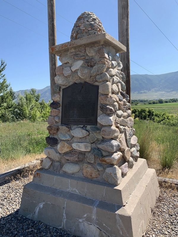
| 1 ► Utah, Box Elder County, Honeyville — 10 — In Honor of James Bridger — 1804 - 1881 — Early Western Fur Trapper, Frontiersman, Scout and Guide — |
| On 5200 West, on the right when traveling north. | |||
| 2 ► Utah, Box Elder County, Snowville — 435 — Curlew Valley — |
| On North Stone Road, on the left when traveling south. | |||
| 3 ► Utah, Cache County, Hyrum — 55 — The Great Fur Cache — |
| On West Main Street (Utah Route 101) west of South Center Street, on the left when traveling west. | |||
| 4 ► Utah, Daggett County, Dutch John — Flaming Gorge Dam: The Good, the Bad & the Beautiful — |
| Near U.S. 191, 7 miles north of State Route 44, on the left when traveling north. | |||
| 5 ► Utah, Davis County, Syracuse — Antelope Island — |
| Near West 1700 South. | |||
| 6 ► Utah, Davis County, Syracuse — Great Salt Lake — |
| Near West 1700 South. | |||
| 7 ► Utah, Duchesne County, Duchesne — 16 — Father Escalante — |
| On U.S. 40, 0.1 miles east of East Third Avenue, on the right when traveling east. | |||
| 8 ► Utah, Duchesne County, Duchesne — Over Almost Impassable Terrain — Dominguez Escalante Expedition 1776 1976 — |
| On Highway 40 (U.S. 40), on the right when traveling west. | |||
| 9 ► Utah, Emery County, Emery — A Place Nobody Wanted — |
| Near Interstate 70 at milepost 106, on the right when traveling west. | |||
| 10 ► Utah, Emery County, Emery — Early Castle Valley — |
| Near Interstate 70 at milepost 105, on the right when traveling east. | |||
| 11 ► Utah, Emery County, Green River — John C. Fremont Expedition of 1853-54 — |
| On Goblin Valley Road. | |||
| 12 ► Utah, Emery County, Green River — Major Powell, Colorado River Explorer — |
| On East Main Street, 0.1 miles west of Holiday River Street, on the right when traveling east. | |||
| 13 ► Utah, Emery County, Hanksville — Henry Mountains — Goblin Valley State Park — |
| Near Goblin Valley Road. | |||
| 14 ► Utah, Garfield County, Escalante — View from Head of the Rocks — Lay of the Land — |
| On Utah Route 12 at milepost 69, on the left when traveling east. | |||
| 15 ► Utah, Garfield County, Henrieville — Second Powell Expedition — Charting New Territory — Last Blank Spot on the Map — |
| On Utah Route 12 at milepost 41, on the right when traveling west. | |||
| 16 ► Utah, Grand County, Moab — 65 — Elk Mountain Mission — |
| On North 200 West south of East 100 North, on the right when traveling south. | |||
| 17 ► Utah, Grand County, Moab — John Wesley Powell on the Green River — What Shall We Find? — |
| Near Green River Overlook Road, 1.4 miles west of Upheaval Dome Road. | |||
| 18 ► Utah, Grand County, Moab — Tracks in the Canyon — |
| Near Grand View Point Road, on the left when traveling south. | |||
| 19 ► Utah, Iron County, Cedar City — Escalante Trail |
| On Main Street at 200 North on Main Street. Reported missing. | |||
| 20 ► Utah, Iron County, Cedar City — The Casting of the Lots — |
| On Utah Route 56 at milepost 57, on the right when traveling west. | |||
| 21 ► Utah, Iron County, Newcastle — Jefferson Hunt — Official Site of Iron County Utah Centennial Circle — |
| On South Spanish Trail Road. | |||
| 22 ► Utah, Iron County, Newcastle — Site of Blacksmith Shop — |
| On 600 East, on the left when traveling south. | |||
| 23 ► Utah, Iron County, Paragonah — Paragonah Town Square — |
| On Main Street at Center Street, on the right when traveling south on Main Street. | |||
| 24 ► Utah, Iron County, Parowan — Birthplace of Southern Utah — |
| Near South Main Street. | |||
| 25 ► Utah, Iron County, Parowan — John C. Freemont Memorial — |
| On Main Street at 100 South, on the right when traveling north on Main Street. | |||
| 26 ► Utah, Iron County, Parowan — Parley P. Pratt — 1807–1857 — |
| Near Old Highway 91. | |||
| 27 ► Utah, Iron County, Parowan — Southern Utah Expedition of 1849 — Parley P Pratt — |
| Near South Main Street. | |||
| 28 ► Utah, Iron County, Parowan — The Spanish Trail — |
| Near South Main Street. | |||
| 29 ► Utah, Juab County, Eureka — N-236-1 — The Bullion Beck & Champion Mining Company Headframe — |
| On West Main Street, 0.3 miles west of Church Street, on the right when traveling west. | |||
| 30 ► Utah, Kane County, Kanab — 208 — Powell Survey — |
| On North 100 West at West 100 North, on the right when traveling north on North 100 West. | |||
| 31 ► Utah, Kane County, Mount Carmel — Isaac Behunin — Meribah Morton Behunin and Elmina Tyler Behunin — |
| On State Street (U.S. 89) at the road to Mount Carmel Cemetery, on the left when traveling north on State Street. | |||
| 32 ► Utah, Kane County, Mount Carmel — 485 — Settlement of Long Valley and Mt. Carmel / Dr. Priddy Meeks — |
| On State Street (U.S. 89) at Muddy Creek Road, on the left when traveling north on State Street. | |||
| 33 ► Utah, Kane County, Mount Carmel Junction — 120 — The Historic Dixie-Long Valley, Utah Pioneer Trail — |
| On U.S. 89, 0.6 miles south of Utah Route 9, on the left when traveling south. | |||
| 34 ► Utah, Kane County, Paria — Grand Staircase-Escalante National Monument — |
| On U.S. 89 at milepost 30.7, on the right when traveling west. | |||
| 35 ► Utah, Millard County, Delta — 218 — Escalante Trail — |
| On Main Street. | |||
| 36 ► Utah, Millard County, Delta — 447 — Gunnison Massacre Site — |
| 37 ► Utah, Millard County, Fillmore — Dominguez - Escalante Trail — |
| On North Main Street, on the right when traveling north. | |||
| 38 ► Utah, Rich County, Garden City — 74 — Fur Traders Rendezvous — |
| Near Utah Route 30, 0.2 miles south of N. Meadowville Drive. | |||
| 39 ► Utah, Salt Lake County, Salt Lake City — Site #3 — Big Mountain — |
| On Big Mountain Pass (Utah Route 65), on the right when traveling east. | |||
| 40 ► Utah, Salt Lake County, Salt Lake City — Donner Hill — |
| On Emigration Canyon Road / Burrs Lane. | |||
| 41 ► Utah, Salt Lake County, Salt Lake City, Capitol Hill — 23 — Ensign Peak — |
| On Columbus Street at 300 North, on the right when traveling north on Columbus Street. | |||
| 42 ► Utah, Salt Lake County, Salt Lake City, Capitol Hill — Fur Trappers and Traders — |
| On Beck Street (U.S. 89), on the right when traveling north. | |||
| 43 ► Utah, Salt Lake County, Salt Lake City, Capitol Hill — The Explorers — |
| Near Ensign Vista Drive west of East Greenstroke Drive. | |||
| 44 ► Utah, Salt Lake County, Salt Lake City, Capitol Hill — The View — |
| Near Ensign Vista Drive west of East Greenstroke Drive. | |||
| 45 ► Utah, Salt Lake County, Salt Lake City, Fairpark — 7 — Donner Trail 1846 — |
| On North Temple Street, on the right when traveling west. | |||
| 46 ► Utah, Salt Lake County, Salt Lake City, Rio Grande — The Flag of the United States of America — |
| On 300 West, on the right when traveling south. | |||
| 47 ► Utah, Salt Lake County, Salt Lake City, University — The Spanish Explorers — |
| Near East Sunnyside Avenue. | |||
| 48 ► Utah, Salt Lake County, South Salt Lake — HU-5 — Hastings Cutoff - Utah Outlet (Jordan River) — |
| 49 ► Utah, San Juan County, Blanding — Salvation Knoll — |
| On Utah Route 95 at milepost 97, on the left when traveling west. | |||
| 50 ► Utah, San Juan County, Bluff — Comb Ridge — |
| On U.S. 163 at milepost 38.3, on the right when traveling east. | |||
| 51 ► Utah, San Juan County, Bluff — Hobbs Wash — |
| On U.S. 163 at milepost 39.6, on the left when traveling east. | |||
| 52 ► Utah, San Juan County, Bluff — Parley R. & Ency Camilla (Bayles) Butt — |
| 53 ► Utah, San Juan County, Bluff — The San Juan Mission — |
| On Navajo Twins Drive west of U.S. 191, on the right when traveling west. | |||
| 54 ► Utah, San Juan County, Monticello — Newspaper Rock — State Historical Monument — |
| On Utah Route 211, on the left when traveling west. | |||
| 55 ► Utah, San Juan County, Monticello — 487 — The Spanish Trail — |
| Near U.S. 191 at milepost 110.4, on the right when traveling north. | |||
| 56 ► Utah, Sevier County, Burrville — 254 — Indian Peace Treaty — |
| On Utah Route 24, 0.3 miles north of Utah Route 62, on the left when traveling north. | |||
| 57 ► Utah, Sevier County, Central Valley — Trader and Explorer Trails — |
| On South Central Boulevard at Center Street, on the right when traveling north on South Central Boulevard. | |||
| 58 ► Utah, Sevier County, Richfield — The Fish Lake Cut-off on the Old Spanish Trail — Pathway to Grassy Meadows and Water — |
| Near Utah Route 25 at Doctor Creek Road. | |||
| 59 ► Utah, Summit County, Coalville — The Road to Zion — |
| Near Interstate 80 at milepost 171, on the right when traveling east. | |||
| 60 ► Utah, Utah County, Payson — Dominguez y Escalante Expedition — 1776 - 1976 — |
| On South Main Street, on the right when traveling north. | |||
| 61 ► Utah, Utah County, Provo, Maeser — 1 — Escalante Trail — |
| Near South University Avenue (U.S. 189) at 100 South, on the right when traveling north. | |||
| 62 ► Utah, Utah County, Santaquin — Southern Utah Valley — |
| On West 100 South Street at South 100 West Street, on the right when traveling east on West 100 South Street. | |||
| 63 ► Utah, Utah County, Spanish Fork — Dominguez y Escalante Expedition — 1776 – 1976 — Utah Valley viewed from Dominguez Hill — |
| On U.S. 6 north of Powerhouse Road, on the right when traveling east. | |||
| 64 ► Utah, Utah County, Spanish Fork — Escalante — |
| On South Main Street at East Center Street, on the right when traveling north on South Main Street. | |||
| 65 ► Utah, Utah County, Spanish Fork — The Lush Valley of the Timpanogotzis — Dominguez y Escalante Expedition — 1776 – 1976 — |
| On East Center Street, on the right when traveling east. | |||
| 66 ► Utah, Utah County, Springville — 140 — Springville's First Camp Site — |
| On North 200 West at West 200 North, on the right when traveling north on North 200 West. | |||
| 67 ► Utah, Washington County, Central — The Old Spanish Trail and The California Road — |
| Near Utah Route 18 at milepost 30.5. | |||
| 68 ► Utah, Washington County, Hurricane — 134 — Southern Exploring Company - 1849 — Parley P. Pratt — Southern Utah Expedition — |
| On North Main Street, 1.3 miles north of Utah Route 9, on the right when traveling north. | |||
| 69 ► Utah, Washington County, La Verkin — 135 — Southern Exploring Company – 1849 — Parley P. Pratt — Southern Utah Expedition — |
| On Center Street, 0.6 miles west of Utah Route 9, in the median. | |||
| 70 ► Utah, Washington County, New Harmony — 159 — Snowfield Monument — "Franciscan Fathers" — |
| On Interstate 15 at milepost 33, on the right when traveling north. | |||
| 71 ► Utah, Washington County, Springdale — 42 — Discovery of Zion Canyon — |
| On Zion Park Boulevard, on the left when traveling east. | |||
| 72 ► Utah, Washington County, St. George — Erastus Fairbanks Snow — Missionary, Founder of St. George, President of the Cotton Mission. — |
| On Main Street, on the right when traveling south. | |||
| 73 ► Utah, Washington County, St. George — 176 — Jedediah Strong Smith — |
| Near South Convention Center Drive. | |||
| 74 ► Utah, Washington County, St. George — Old Spanish Trail — |
| Near South Convention Center Drive. | |||
| 75 ► Utah, Washington County, St. George — The Confluence of the Santa Clara and Virgin Rivers — |
| On Crosby Family Park Parking Lot. | |||
| 76 ► Utah, Washington County, St. George — 175 — The Southern Exploring Company — |
| Near South Convention Center Drive. | |||
| 77 ► Utah, Washington County, Zion National Park — Westward Expansion — |
| 78 ► Utah, Wayne County, Lyman — 393 — Fremont Park — |
| On West Center Street east of South 300 West Street, on the right when traveling east. | |||
| 79 ► Utah, Weber County, Ogden — 3 — Jedediah Strong Smith — |
| Near Washington Boulevard south of 25th Street when traveling west. | |||