Edward S. Cheatham was the Tennessee Senate Speaker when Cheatham County was created. Mound Bottom l, a State Archeological Area, is one of the largest prehistoric Mississippian Indian sites in the southeast. In 1818 Montgomery Bell’s slaves . . . — — Map (db m200233) HM
First named Wisdom, Chester County is named for Colonel Robert I. Chester, United States Marshal of the Western District in 1862. General Joe Wheeler’s cavalry surprised Federal troops in Henderson, overran their defenses, burned the supply depot . . . — — Map (db m199708) HM
Citizen's Savings Bank and Trust Company, the oldest continuously operating, African- American-owned bank in the United States,
opened its Nashville doors in 1904. — — Map (db m216161) HM
On the Wilderness Road blazed by Daniel Boone is the famous Cumberland Gap, a gateway where the great western road passed through the mountains. This crucial passageway, also an earthquake epicenter enabled immigration from Virginia into Middle . . . — — Map (db m201295) HM
Celina was a busy place at the beginning of the twentieth century as forests were felled and floated down the Obey River. Now the Obey adjoins the U.S. Army Corps of Engineer’s Dale Hollow Lake, a fishing Mecca. Free Hills is an African-American . . . — — Map (db m201163) HM
Coach Ed Temple is a Nashville and American legend, the embodiment of perseverance, determination and success.
As women's track coach at Tennessee State University from 1953 to 1994 and coach of the U.S. women's Olympic track team in 1960, 1964 . . . — — Map (db m165436) HM
In 1899, Benjamin Franklin Thomas, Joseph Brown Whitehead, and John Thomas Lupton began bottling Coca-Cola in Chattanooga and
revolutionized the soft drink industry — — Map (db m216150) HM
The southeastern border of Cocke lies in the crest of the Smokey Mountains. William Cocke, one of the most distinguished pioneers of Tennessee, was one of the first unites States senators. Tennessee’s first pioneer settlements in 1783 were along . . . — — Map (db m201312) HM
Major General, John Coffee was a close friend of Andrew Jackson,
surveyor and a commander at the Battle of New Orleans. Within
his namesake county is Old Stone Fort, a stone and earth
enclosure probably built as a sacred site by . . . — — Map (db m201124) HM
Mobilization for the onslaught of a truly worldwide conflict pulled the United
States out of a depression and forced the American economy into an unprecedented
era of industrial production, scientific and technological advances, and . . . — — Map (db m206480) HM
Unable to develop forces strong enough to assault Hitler's "Fortress Europe” before the summer of 1944, the Allies attacked Sicily and Italy from North Africa in 1943 and struck at Germany through strategic bombing. Beginning in the fall of 1942, US . . . — — Map (db m206479) HM
Crockett County was created in honor of and to perpetuate the
memory of David Crockett, one of Tennessee's distinguished
sons. Situated between forks of the Forked Deer River, the area
was settled about 1824. The face of the county, when . . . — — Map (db m199692) HM
According to legend, Dr. Thomas Walker of Virginia named the Cumberland Plateau for the Duke of Cumberland in about 1748 and the county is named for the mountains. Cumberland is situated centrally upon the plateau at an altitude of nearly 2,000 . . . — — Map (db m201287) HM
The North Carolina legislature created Davidson County, named for Valley Forge veteran Brigadier General William Lee Davidson was a small fraction of its original size, the county first embraced most of Middle Tennessee. Cumberland River curves . . . — — Map (db m200235) HM
Bounded on the east by the Tennessee River, Decatur is named for Commodore Stephen Decatur. He won fame in the War with Tripoli when he recaptured and destroyed the frigate Philadelphia, and then went on to distinguished service in the War of 1812. . . . — — Map (db m199709) HM
Bavarian Baron Johann DeKalb accompanied Lafayette to
America in 1777 and DeKalb County, honors this major general
of the Continental Army. The county was first settled in 1797
by miller Adam Dale. During the Civil War, allegiance was
divided . . . — — Map (db m201158) HM
Dickson County honors Dr. William Dickson, physician, Tennessee Speaker of the House, and member of Congress. County seat, Charlotte, is named for James Robertson’s wife. Dickson’s industrial heritage dates to iron manufacturing propagated by . . . — — Map (db m200223) HM
Colonel Robert Henry Dyer served under Andrew Jackson in the
Natchez Expedition, the Creek War, War of 1812 (Including the
decisive Battle of New Orleans), and the Seminole War in 1818.
Watered by the Obion and Forked Deer Rivers, most of . . . — — Map (db m199688) HM
In 1915, Edward H. "Boss" Crump was ousted as Memphis mayor for refusal to enforce prohibition laws, but he and his political machine greatly influenced Tennessee politics for the next 40 years. — — Map (db m216208) HM
In 1908, orator, senator, prohibitionist, and newspaperman Edward Ward Carmack was killed in a gun battle on a Nashville street by Robin Cooper,
son of Carmack's political enemy Duncan B. Cooper. — — Map (db m216169) HM
In 1873, eleven blast furnaces on the Western Hand Rim produced iron at the rate of about 50,000 tons per year. To operate indefinitely these furnaces would have required 375 square miles of timber for fuel. — — Map (db m215721) HM
Sulphur Dell was the home of Nashville baseball for almost 100 years. Though for much of that time Nashville Vols fans filled the bleachers, dozens of teams, both black and white, played games at the
park. By the 1950s, however, attendance began . . . — — Map (db m175197) HM
The level land of Fayette, drained by the Wolf and Loosahatchie,
Rivers, honors the French friend of the American Revolution
Marquis de Lafayette. Since antebellum plantation years,
Fayette, with its neighboring county Haywood has had a
majority . . . — — Map (db m199694) HM
Rugged, stately, isolated beauty characterizes Fentress, seated mostly in the Cumberland Plateau. It shares Big South Fork National River and Recreation Area with neighboring Scott County. Mark Twain was conceived in Jamestown where his father . . . — — Map (db m201283) HM
First major Tennessee labor strike called in 1891-1892 by the Briceville coal miners. After farming, coal mining was the second largest occupation in the state. — — Map (db m216108) HM
In February, 1862, Fort Henry and Fort Donelson fell to Federal troops under General Ulysses Grant, opening Nashville and most of Tennessee to Union occupation. — — Map (db m215618) HM
Throughout 1944 and early 1945, US and Allied amphibious assaults, supported by massive American air and naval power, breached the offshore defenses of Japan's home islands. In the summer of 1944, US forces seized the Mariana Islands of Guam, . . . — — Map (db m206465) HM
United Daughters of the Confederacy
10 September 1894 10 September 1969
This memorial commemorates
the seventy-fifth anniversary of
the foundation of
The United Daughters of the Confederacy
by
Caroline Meriwether Goodlett
in . . . — — Map (db m85486) HM WM
Four Tennesseans won prizes at the London World's Fair of 1851. Mark Cockrill's sheep's wool won first prize, and Col. John Pope won "for the best cotton known in the world." — — Map (db m215540) HM
This county commemorates patriot, diplomat, and inventor
Benjamin Franklin. The university of the South at Sewanee “has
had marked influence on the religious thought and general
culture of the entire South.”James Agee, author of Let Us
Now . . . — — Map (db m201123) HM
The name French Lick Creek, the course of which is traced approximately
by the greenway leading east, recognizes the presence of the French traders
Charles Charleville and Timothy Demonbreun. They lived here in the 1700s
and traded European goods . . . — — Map (db m199679) HM
Agriculturally diverse and level, Gibson County was named for Colonel John Gibson who fought in the Creek Wars under Andrew Jackson. Especially strong crops have included cotton, soybeans, and strawberries. Gibson County was the last home in . . . — — Map (db m199691) HM
Created from Indian lands, the hills and valleys of Giles honor Virginia Senator William B. Giles, a staunch advocate for Tennessee’s admission to the Union. Pulaski honors Revolutionary War hero, Polish Count Kazimierez Pulaski. It was the site of . . . — — Map (db m200227) HM
Governor Isham Harris issued a proclamation dissolving all connection with the Federal Union on June 24, 1861, and Tennessee, the last state to join the Confederacy, entered the Civil War which began on April 12. — — Map (db m215615) HM
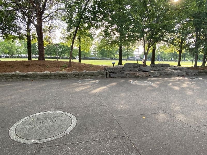
One county honors a Tennessee woman, Mary Grainger Blount, First Lady of the Southwest Territory from 1791-1796. Clinch Mountain diagonally divides the county bordered on the north by the Clinch River and on the south by Cherokee Lake and the . . . — — Map (db m201308) HM
On May 8, 1945, V-E Day, Nazi Germany surrendered. Japan would follow in September. The Allied victory, however, brought an uncertain future.
The end of hostilities led to economic recovery and strengthened democracy in the West. Nevertheless, . . . — — Map (db m206469) HM
Nathaniel Greene, a Major General in the Revolutionary Army, helped to end the war as commander of the Army of the South. Tobacco farming is still robust in these rolling miles picturesquely framed by the Bald and Bays Mountains. David Crockett was . . . — — Map (db m201313) HM
President Van Buren's attorney general Tennessean Felix Grundy
died four months before this county was formed. The stony
Cumberland Pleau refuge holds Savage Gulf, Beersheba
Springs, Monteagle Assembly retreat, Swiss-founded Gruelti,
and Tracy . . . — — Map (db m201167) HM
Hall Moody Institute (later replaced
by the University of Tennessee Junior College, now University of Tennessee
at Martin) founded in 1900. — — Map (db m216156) HM
Hamblen was formed from Grainger, Jefferson, and Hawkins counties, and named for Hawkins resident, Hezekiah Hamblen. Morristown was named after the Morris family, Watauga Association pioneers who settled on the Nolichucky River. Morristown’s . . . — — Map (db m201311) HM
Created from Cherokee Indian lands and Rhea County, Hamilton is named for Alexander Hamilton, first U.S. Treasurer. Chattanooga began as a river landing and became a model tourism center as the “Environmental City” in the 1980s-90s. More than 10 . . . — — Map (db m201290) HM
Hancock County is bordered on the north by Virginia and traversed diagonally by the Clinch and a Powell rivers and Copper Ridge. Named for the first signer of the Declaration of Independence, John Hancock, this rough and mountainous terrain was . . . — — Map (db m201309) HM
Colonel Thomas Jones Hardeman served with Andrew Jackson at n the War of 1812 and he helped to establish Bolivar, named for Venezuelan liberator Simon Bolivar. Bolivar was previously named Hatcher, as is the free-flowing River that drifts diagonally . . . — — Map (db m199695) HM
For his Revolutionary War Service, Colonel Joseph Hardin was given 2,000 acres of land where eventually a county would bear his name. On April 6-7, 1862, nearly 20,000 Union and Confederate soldiers died or were wounded under the peach blossoms of a . . . — — Map (db m199706) HM
County namesake Benjamin Hawkins signed the Deed of Cession that made the Southwest Territory (Tennessee) federal land. The Holston River snakes centrally through the county, banded on the sides by Bays Mountain and Clinch Mountain. Carter’s Valley . . . — — Map (db m201310) HM
Haywood, known for its fertility, is named for state Supreme Court
Justice John Haywood, the Father of Tennessee History.
Brownsville, one of the oldest West Tennessee towns, is on
a ridge 344 feet above sea level between the Hatchie and
Forked . . . — — Map (db m199693) HM
North and west of the State Capitol was an area city reformers called "Hell's Half Acre." Home to immigrants and free and enslaved Blacks, it was a part of a red-light district before, during and after the Civil War. Line St. (now Jo Johnston Ave.) . . . — — Map (db m160543) HM
Named for Colonel James Henderson, commander of Tennessee troops in the War of 1812. The greater part of the 48,000 acres of Natchez Trace State Park and Forest lie in the county’s north-eastern section. In the mid-1930s heavily eroded wastelands . . . — — Map (db m199705) HM
Bounded on the east by Kentucky Lake, Henry County honors the
Revolutionary War patriot and statesman – Patrick Henry.
Tennessee's “Volunteer County”, is the home of the “World’s
Biggest Fish Fry” and governors Isham G. Harris, James D.
Porter, . . . — — Map (db m199701) HM
In 1791 surveyor Edwin Hickman was killed by Indians at
Defeated Creek in the territory that would bear his name. Native
American treaties of 1805, 1806, and 1818 opened the area to
pioneer settlement. Andrew Jackson marched through here on
the . . . — — Map (db m200224) HM
Near here in 1820 the first Catholic Church in Tennessee was built by Irish Catholic workers then building a bridge over Cumberland River. In 1830 a brick structure known as Holy Rosary Cathedral succeeded the frame building. Here Bishop R. P. . . . — — Map (db m36240) HM
With Tennessee's transition from frontier's edge to national prominence, its homegrown heroes-Jackson, Crockett, Houston, and Polk-moved into important positions of state and national leadership. Andrew Jackson's two presidential elections reflected . . . — — Map (db m215420) HM
The Tennessee Ridge is a watershed diverting rainfall northeast to the Cumberland River and west to Kentucky a lake in this county named for Sam Houston, a Tennessee Congressman and Governor before moving to Texas. Houston became the first President . . . — — Map (db m200219) HM
The Tennessee River forms the western boundary of Humphreys County honoring Superior Court Judge Parry W. Humphreys. The county seat is named for the Sir Walter Scott Waverly novels and is situated typically close to the center of the county’s . . . — — Map (db m200218) HM
During the last major Ice Age — 12,000 to 25,000 years ago — Middle Tennessee was home to many animals that are extinct today, including the saber-tooth tiger, the mammoth, and the mastodon. In 1885, the tusk of a mastodon, an Ice Age ancestor of . . . — — Map (db m173819) HM
After Memphis African American newspaper owner and feminist Ida B. Wells demanded justice for lynchings in 1892 editorials, a mob threatened her life and destroyed the Free Speech building. — — Map (db m216112) HM
From 1810 to 1860, the number of slaves in Tennessee increased from 44,734 to 275,719, and the number of free blacks grew from 1,318 to 7,300. — — Map (db m215612) HM
Jackson County commemorates Andrew Jackson, the first of three Tennesseans to become President of the United States. Straddling two major geographic divisions, the Highland Rim and the Central Basin, terrain varies with sharp escarpments and rolling . . . — — Map (db m201164) HM