On Jefferson Street at Van Buren Street, on the right when traveling west on Jefferson Street.
Built about 1830 for merchant Joseph Trotter, this house was purchased in 1838 by John J. McMahon, a Virginia-born cotton factor who divided his time between Courtland and New Orleans. The house remained the home of McMahon's descendants for nearly . . . — — Map (db m84307) HM
The Red Rovers Volunteer military company organized at Courtland 1835 to aid Texas in struggle for independence.
Commanded by Dr. Jack Shackelford, local physician, company derived its name from color of home spun uniforms, made by citizens . . . — — Map (db m84308) HM
Any discussion of the Battle of the Alamo must begin with the Siege of Bexar, named after San Antonio de Bexar which ocurred [sic] in December 1835. In early December, Bexar was controlled by the Mexicans. On December 5th, a group of Texas . . . — — Map (db m91496) HM WM
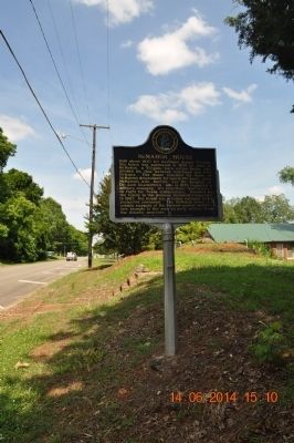
On East Cruselle Street (U.S. 80) at Fairplay Hill Road, on the right when traveling east on East Cruselle Street.
This County created by Acts of the Legislature Dec. 9 & 23, 1822, is named for William H. Crawford, Georgia statesman who was Secretary of the Treasury at the time the County was established. At the County Site, Knoxville, lived Joanna E. Troutman . . . — — Map (db m21435) HM
On East Crusselle Street (U.S. 80) at Fair Play Hill Road, on the right when traveling east on East Crusselle Street.
On this site in 1835 Joanna Troutman gave to a company of Georgia soldiers on their way to fight for the independence of Texas, a “Lone Star” flag, which she had made and which was later adopted as the Texas emblem. — — Map (db m28024) HM
Near North Perry Street (Georgia Route 20) at West Pike Street (U.S. 29), on the left when traveling south.
In memory of
Gwinnett Company of Mounted
Volunteers, under the command
of Capt. Hammond Garmany who
were slain by Creek Indians
9 June 1836 in a Battle at
Shepherd's Plantation in
Stewart County:
Ens. Isaac Lacy
Sgt. James E. . . . — — Map (db m85721) HM WM
On Pulaski Street, 0.1 miles east of Randolph Street, on the right when traveling west.
Brig. Gen. Alfred Iverson, C.S.A., son of Senator Alfred Iverson, also a Brig. Gen., and Caroline Goode Holt, was born here Feb. 14, 1829. He served with the U. S. Cavalry in the Mexican War and Mormon campaign and fought the Comanches and Kiowas. . . . — — Map (db m24994) HM
On North Grove Street NE (U.S. 19) 0 miles Hawkins Street, on the left when traveling north.
During the War Between the States nine companies were organized on this site; five were mustered here in 1861, two in 1862 and two in 1864. Men from other north Georgia counties came to Dahlonega to be mustered here in the companies of Lumpkin . . . — — Map (db m21035) HM
On 2nd Avenue north of 11th Street, on the left when traveling north.
Organized October 9, 1828, Columbian Lodge was chartered by the Grand Lodge of Georgia in December 1828, as No. 28. In 1849 it became No. 7. It is the oldest Lodge in western Georgia. First Worshipful Master was Luther Blake. The Lodge was organized . . . — — Map (db m23053) HM
The Creek Indian War of 1835-1836,
which centered on Columbus, began when
a group of Indians revolted rather
than move from East Alabama to
Oklahoma they attacked travelers and
settlers and threatened Columbus.
State militia . . . — — Map (db m101487) HM
On Road 144 at Yellow Creek Park, on the right when traveling east on Road 144.
Col. Algernon S. Thruston
Lawyer, soldier and farmer. Born in Louisville 1801, died 1864 at Thruston. Went to Texas with company of volunteers in 1836. Commissary General of Purchases (1837) and Quartermaster General (1838) for the Republic . . . — — Map (db m160173) HM
On East Main Street, on the right when traveling east.
Kentuckians explored the western frontier after the War of 1812. When Texas
rebelled against Mexican rule in 1836, many Kentuckians had friends or relatives
there and took an interest in the fate of the new Texas Republic.
500 Kentuckians . . . — — Map (db m206460) HM
On West 4th Street (Business U.S. 68) at Winter Street, on the right when traveling west on West 4th Street.
James Bowie, Col. of Texas Rangers and co-commander at the Alamo, was native of Logan Co. With 187 others-P. J. Bailey, D. W. Cloud, W. Fountleroy of Logan Co. among them-he chose death rather than surrender. "Remember the Alamo" was battle cry of . . . — — Map (db m123373) HM
On North 6th Street just south of Park Avenue (Business U.S. 60), on the left when traveling south.
Liberty of Texas 1836
From here 18 “Paducah Volunteers” led by Capt. Amon B. King embarked for Texas in 1835 in response to Sam Houston's appeal for aid in fight for freedom from Mexico. Two weeks after The Alamo, in battle at . . . — — Map (db m158792) HM
On Steele Road, 0.1 miles south of Nashville Road (U.S. 31W), on the left when traveling south.
Born near here were two famous men. Jim Bowie invented the Bowie knife. He died at the battle of the Alamo in Texas. Alexander Majors was co-founder of the Pony Express and hauled freight all over the West for the U.S. Cavalry. — — Map (db m83905) HM
Near West Stephens Street, 0.1 miles west of Circle Drive, on the right when traveling east.
N. Adams, POW • W.C. Arnett • Milton Barlow • John Bell • James Blackburn • Joseph C.S. Blackburn • Charles Boler • Abraham “Abe” Buford • John Buford • Andrew J. Cogar • N. Maffett Crutcher • James Davis • John C. Davis • John W. Davis • Lewis . . . — — Map (db m202984) WM
On South Main Street at Macey Avenue, on the right when traveling south on South Main Street.
Randall Lee Gibson
Confederate brig. gen. Born in
Woodford home of his grandfather.
Parents lived Louisiana. Graduate
Yale Univ., 1853. Distinguished
for leadership at Shiloh, in 1862
Kentucky campaign, Chickamauga,
Atlanta and Hood's . . . — — Map (db m170008) HM
On East 1st. Street (State Highway 1) 0.1 miles south of Bowie Street, on the right when traveling south.
Originally named Acadie, the name was changed to Acadia in the 1830's. Once owned by Jim Bowie, the hero of the Alamo, whose family owned it from 1827 to 1831. The house was consolidated into one building from two Creole cottages and a shotgun . . . — — Map (db m102046) HM
On West Landry Street (U.S. 190) east of South Court Street, on the left when traveling west.
This giant live oak tree is over 350 years old and
is named in honor of legendary adventurer and
hero of the Battle of the Alamo, Colonel
James "Jim” Bowie, who lived in Opelousas
for part of his life.
The Jim Bowie Oak is a charter . . . — — Map (db m145660) HM
On South Union Street (State Highway 182) at East Andrus Avenue, on the right when traveling north on South Union Street.
James Bowie lived here with his family from 1815 to 1824. The Bowies operated several sawmills along the bayous of St. Landry Parish. The famous Bowie knife became a legend in Opelousas prior to his heroic death at the Alamo. — — Map (db m85968) HM
David Crockett was a celebrated 19th-century American folk hero, frontiersman, soldier, and politician. He represented Tennessee in the U.S. House of Representatives, served in the Texas Revolution, and died as a result of the Battle of the Alamo. . . . — — Map (db m228053) HM
On Front Street (Business U.S. 67) at Sycamore Street, on the right when traveling south on Front Street.
Welcome to the Grenville Bike Trail
The Grenville Bike Trail (blue) is a three mile hard-surface trail that connects the City of Greenville with the historic town site of Old Greenville. The trail is accessible for bicycles and . . . — — Map (db m189723) HM
On Broad Street at Camp Street, on the right when traveling south on Broad Street.
Here stood the house of Dr. William Burnet, noted patriot-surgeon. Son, David, was the first president of the Republic of Texas. — — Map (db m159242) HM
Near Ridge Avenue, 0.1 miles south of West Clearfield Street.
On April 7, 1836, Lieutenant Joseph Bonnell, West Point Class of 1825, 3rd Infantry Regiment, U.S. Army, Fort Jesup, Louisiana, was sent alone into Texas by U.S. General Gaines to quell an uprising of 1,700 hostile Indians which threatened the small . . . — — Map (db m40778) HM
On South Main Street, on the left when traveling south.
Memorial
Colonel William Barrett Travis
Born near Saluda, S.C. August 9, 1809.
Gave his life for liberty and freedom
at the Alamo March 6, 1836.
His last message for reinforcements ended thus:
"I have held this place against . . . — — Map (db m13112) HM
On Salem Road south of Lambert Road, on the right when traveling south.
In 1807, Sam Houston arrived at this 419-acre site with his widowed mother and eight brothers and sisters. The homesite was located just above the spring on the hill. Sam Houston served as general, President of Texas, Governor of Tennessee and . . . — — Map (db m150793) HM
March 2, 1793 – July 26, 1863
Born In Rockbridge County VA
Moved To TN in 1807
Taught At This Schoolhouse In 1812
Attended Porter Academy In 1813
Joined Army In 1813 In Maryville, TN
Studied Law In Nashville, TN In 1818
U.S. . . . — — Map (db m1733) HM
On Court Street just south of Ellis Avenue, on the right when traveling south.
Citizen of Blount County 1806-1818
Enlisted at Maryville in War 1812
Congressman from Tennessee 1823-1827
Governor of Tennessee 1827-1829
Liberator of Texas San Jacinto April 21,1836
President Republic of Texas 1836-1838, 1841-1844 . . . — — Map (db m150794) HM
On Broadway Ave. at Cusick St., on the right when traveling west on Broadway Ave..
Here, where Blount County's first courthouse stood, Sam Houston "took a dollar from the drum", thus marking his first enlistment in the United States Army, March 24, 1813. This culminated in his command of the Army of Texas, which decisively . . . — — Map (db m28579) HM
On Eaton Street (Tennessee Route 104, 77) at South College Street (Tennessee Route 367), on the left when traveling east on Eaton Street.
Pioneer — Statesman — Hero
Born August 17, 1786 • Died March 6, 1836
Served three terms in the Congress of the
United States while a resident of this county.
Emigrated to Texas in 1835, and was killed
at the Alamo fighting . . . — — Map (db m55211) HM
On Morningside Drive at Ridgelawn Avenue, on the left when traveling west on Morningside Drive.
Here stood the Crockett Tavern, established and operated by John and Rebecca Crockett. It was the boyhood home of David Crockett (1786-1836), pioneer and political leader in Tennessee, and a victim of the Alamo Massacre at San Antonio, Texas. — — Map (db m43711) HM
In the 49 years that David Crockett called Tennessee his home he migrated from one end of the Volunteer state to the other. From his birthplace near Limestone on the banks of the Nolichucky River to his last home in present day Rutherford (Gibson . . . — — Map (db m107422) HM
“Be always sure you are right, then go ahead!”
• Raised in frontier poverty without any education until he is a teenager, David is often hired out to others for additional income while still a child; once held against his will until . . . — — Map (db m108201) HM
On Public Square at South Military Street, on the left when traveling north on Public Square.
(front)
Erected by gift of
the people and
the Legislature of Tennessee,
to the memory of
Col. David Crockett.
Born in East Tennessee
Aug. 17th, 1786.
And gave his life for
Texas liberty amid
the smoking walls
of the . . . — — Map (db m82214) HM
Native Tennessean
David Crockett was born in 1786 in Greene County,
Tennessee. In 1811, he moved his wife, Polly, and two sons
to Lincoln County, and in 1813 to Franklin County. When
the Creek War started Crockett mustered into the . . . — — Map (db m207976) HM
Black Raven
Soon after Sam Houston's father died, his mother moved
the family from Virginia to Maryville, Tennessee. Unhappy
with life on the farm, fourteen-year-old Sam ran away from
home to live with a Cherokee tribe. Black Raven, as . . . — — Map (db m207975) HM
On Musket Lane, on the right when traveling south.
• Raised in frontier poverty without any education until he is a teenager, David is often hired out to others for additional income while still a child; once held against his will until he escapes under the cover of a winter storm. • To avoid . . . — — Map (db m58421) HM
On 1245 Davy Crockett Park Road, on the right when traveling south.
Davy Crockett Pioneer Patriot Soldier Trapper Explorer State Legislator Congressman Martyred at the Alamo 1786 – 1836 [ Back of Monument : ]Original monument placed by Davy Crockett Historical Society . . . — — Map (db m58400) HM
Near Hagy Drive, 0.1 miles east of Charlotte Avenue, on the left when traveling east.
Irish immigrant James W. Byrne (1787 – 1865), a veteran of the Texas Revolution, was an early settler of this area. He established the town of Lamar and with his wife Harriet, sold land on Aransas Bay to the Catholic Church for a chapel site. . . . — — Map (db m53717) HM
On U.S. 82 Frontage Road at Business U.S. 277, on the right when traveling east on U.S. 82.
Born Hollidaysburg, Pennsylvania; came to Texas about 1835, joined Texian Army, and was one of 24 survivors of the Goliad Massacre, March 27, 1836. Joined Texian-Santa Fe Expedition, and en route to New Mexico, Aug. 4, 1841, carved his name on a . . . — — Map (db m187196) HM
On Farm to Market Road 1333 at Curvier Road, on the left when traveling south on Route 1333.
This land had once been allocated in the 1700s as a ranch for Mission San Jose in San Antonio (20 mi. N), but in the 1820s was left unsettled. In 1828 prominent San Antonio resident Jose Antonio Navarro (1795-1871) beseeched the Governor of the . . . — — Map (db m111187) HM
On West Main Street (State Highway 36) at Nelsonville Road (State Highway 159), in the median on West Main Street.
A part of the grant to
Stephen F. Austin in 1821
Created a municipality under the
Mexican government in 1828
Became a county of the
Republic of Texas, March 17, 1836
Named in honor of
Stephen Fuller Austin, 1793-1836
Pioneer . . . — — Map (db m125601) HM
On South Masonic Street at West Lewis Street, on the left when traveling north on South Masonic Street.
The heritage of Bellville Methodist Church dates to 1822, when Thomas B. Bell came to Texas from Florida with Stephen F. Austin's Old Three Hundred colonists. He settled in an area west of the Brazos River, and donated fifty acres of land . . . — — Map (db m157592) HM
On Farm to Market Road 1094 at Swearingen Road, on the right when traveling west on Highway 1094.
Austin County pioneer and Texas War for Independence veteran, Elemelech Swearingen, was born in Shepherdsville Kentucky (Bullitt Co.) in 1805. He married Angelina Weeks (1811-1883) in 1827 and in 1831, moved with his family to Texas. The Swearingens . . . — — Map (db m202526) HM
On SH 159 (State Highway 159) at Hofheinz Road, on the left when traveling west on SH 159.
In Jan. 1831 Charles Fordtran, a German of Huguenot descent, joined the colony of Stephen F. Austin. His first work was to survey land for Austin's partner, Samuel May Williams. He was given a league (4,428.4 acres) as his fee. Soon he brought in . . . — — Map (db m146168) HM
On Schroeder Road, 0.2 miles Ernst Parkway (Farm to Market Road 109), on the right when traveling west.
Christian Friedrich Ernst (Dirks) was born in Germany in 1796. Friedrich Ernst was inducted into the German Army in 1814 and served for five years. He married Louise Gesine Auguste Weber in 1819. They became the parents of Caroline, John . . . — — Map (db m165425) HM
On Schroeder Road, 0.2 miles west of Ernst Parkway (Farm to Market Road 109), on the left when traveling west.
A native of Oldenburg, Germany, John Friedrich Ernst (1820-1863) emigrated to the United States with his family at the age of nine. In 1831, they traveled from New York City to Texas, finally arriving in what is now the town of Industry. The . . . — — Map (db m165424) HM
On Dandelion Lane, 0.1 miles west of Hall Road, on the right when traveling west.
Founded by the Concord Christian Church in 1870, Concord Cemetery (also known as the Concord Church Cemetery) sits on 3.4 acres of land in northern Austin County and is part of the Concord Christian Church. The earliest known grave is that of Dr. . . . — — Map (db m202580) HM
On Old Highway 36 at Albert Road, on the left when traveling south on Old Highway 36.
A native of Circleville Ohio, J.B. Pier came to Texas in 1835 with his wife Lucy (Merry). The Piers settled in this area near the site of the early Texas town of Travis. Pier served as a member of the Texas Army during the War for Independence. He . . . — — Map (db m202586) HM
On Hall Road at Daylily Street, on the left when traveling west on Hall Road.
One of great pioneer Methodist ministers of Texas. Pennsylvania - born. He began preaching at age 19. In 1833 he came to Texas and soon settled in this county. Unkempt in appearance, Kenney redeemed his eccentricity with an eloquent style of . . . — — Map (db m202581) HM
Ideally Situated Close to Commerce Square and the Brazos River, these two lots were near the center of town. Like many San Felipe lots, the property changed hands several times. First developed by the Calvit family, its last owner was Almyra . . . — — Map (db m206287) HM
Near Farm to Market 1458, 0.2 miles 2nd Street, on the left when traveling north.
Near this site stood
A Town Hall
Built about 1830
in which were held
the First and Second Conventions
of Texas, 1832 and 1833,
and the Consultation of 1835
the provisional government functioned
here until March 2, 1836, when . . . — — Map (db m43759) HM
Stephen F. Austin hoped his colony in Texas would help his family prosper. But the business of
being an empresario proved financially disappointing. Hoping a family business - like a store - would generate income, Austin encouraged his . . . — — Map (db m206267) HM
Near Farm to Market Road 1458, 0.1 miles north of Park Road 38.
Austin's land office and its agents set about carving civilization out of the untamed Texas wilderness. Mapping and surveying land at a whirlwind pace, Austin's office issued nearly 1500 land grants to settlers in Mexican Texas between 1823 and . . . — — Map (db m201786) HM
Downtown San Felipe was the center of the colony, but its farms and ranches fed settlers and generated profits that helped the colony thrive. Farm plots, or labors, measuring 177 acres each spread outward from town - many along waterways, which . . . — — Map (db m206323) HM
San Felipe's First Townsfolk Arrived to find the "town" yet to be built. Many raised their houses, kitchens and stables with their own hands.
Austin also enlisted skilled housewrights (house builders), sawyers, teamsters and blacksmiths to . . . — — Map (db m206316) HM
As the Number of Permanent Residents in San Felipe grew, a business district developed west of Commerce Square. Merchants, including Nathaniel Townsend and George Huff, supplied shoppers with goods from around the world. Tailors cut clothes to . . . — — Map (db m206271) HM
Stocked With Goods From Cincinnati, Nicholas Clopper's store in San Felipe opened in 1826. Clopper faced the challenges of all merchants on the frontier. The town was "in a state of infancy" and home to only nine families of resident customers. . . . — — Map (db m206272) HM
Godwin B. Cotten tried printing in Alabama, Louisiana and Tamaulipas, Mexico, before setting out The Texas Gazette and the first book published in Texas: Translation of the Laws, Orders, and Contracts, on Colonization.
Cotten . . . — — Map (db m206260) HM
On Farm to Market 1458, 0.2 miles north of 2nd Street, on the left when traveling north.
During the mid-1820's, When Stephen F. Austin was founding this town, the only roads in the area were wagon ruts or beaten trails marked by notched trees. Within a decade, however, the village of San Felipe, one of the first Anglo settlements in . . . — — Map (db m43718) HM
With his Empresario contract in hand, Stephen F. Austin searched out a suitable location for the "capital" of his colony. Together with surveyors and guides, Austin selected a site where a ferry crossed the Brazos River. By late October . . . — — Map (db m206331) HM
In the Town's Early Years, Empresario Stephen F. Austin filled many roles. Administrator of land grants and court judge, Austin also coordinated with Mexican government officials. He managed the growing town, and as colonel of the . . . — — Map (db m206275) HM
On Park Road 38, 0.1 miles east of Antonio Martinez Street, on the right when traveling west.
The first known person to occupy the land where the Hill House is located was Judge Robert M. "Three Legged Willie" Williamson. During his ownership, the community of San Felipe de Austin was burned to the ground by order of Moseley Baker, a . . . — — Map (db m202605) HM
Near Farm to Market 1458, 0.2 miles north of 2nd Street, on the left when traveling north.
Built by John Crutcher in 1847 on the Plaza de Commercio in San Felipe, this was the last store built in the town after its 1836 burning by military order. Purchased in 1867 by Dr. J.J. Josey, it was in continuous operation as a store until 1942. . . . — — Map (db m43760) HM
Jane Wilkins and her family were among the Colony's earliest immigrants and the first to
settle what is now the City of Houston. By 1827, Wilkins and her two daughters, Jane and Mary, had made a home in San Felipe. They also received a league . . . — — Map (db m206262) HM
Near Farm to Market 1458, 0.2 miles north of 2nd Street, on the left when traveling north.
In memory of
John Bricker
a private in Captain Mosley Baker’s
company, who was killed just
across the river from this site
April 7th 1836 by a shot from a
Mexican cannon, and was buried
where he fell. He was born in
Cumberland . . . — — Map (db m43758) HM
Near Farm to Market Road 1458, 0.1 miles north of Park Road 38.
Beginning in the 1920s local leaders looked for ways to commemorate this important colonial Texas history site. After 15 years planning and developing the property for its transition to the State in 1940, local supporters created a Friends . . . — — Map (db m201789) HM
Empresario Stephen F. Austin Considered several sites for his colony's headquarters, but this location on the Brazos River had a convenient advantage. A ferry, operated by an early settler named John McFarland, took travelers on the . . . — — Map (db m206274) HM
On Farm to Market Road 1458, 0.2 miles north of Interstate 10, on the right when traveling north.
First Anglo-American capital of Texas. Came into being on July 26, 1828, as capital of the Austin Colony, by decree of the Mexican government. Father of Texas Stephen F. Austin had begun under the 1821 grant from Mexico the settlement of more than . . . — — Map (db m116924) HM
On Farm to Market Road 1458, 0.1 miles north of Park Road 38, on the left when traveling north.
[Side 1] San Felipe de Austin Town Site laid off by Stephen F. Austin as the Capital of his Colony in 1824 Here was held the only Federal District Court ever convened in Texas under Mexican rule
[Side 2]
Events leading to Revolution, First . . . — — Map (db m163048) HM
A neighborhood on the east edge of town was home to a number of Tejanos, or native born Texans. The cluster of families was referred to as Spanish Town.
Some families had been driven from their homes during Mexico's war for independence . . . — — Map (db m206325) HM
Near Farm to Market Road 1458, 0.1 miles north of Park Road 38.
Between 1821 and 1835, Austin shaped the course of colonial Texas. Here, he built his only home in Texas. His log cabin also served as the colony's land office, and became the center of San Felipe commerce.
Following a plan begun by his . . . — — Map (db m201785) HM
On Farm to Market 1458, 0.2 miles 2nd Street, on the left when traveling north. Reported missing.
Replica of
Stephen F. Austin's Cabin
This structure is a replica of the only Texas home of Stephen F. Austin, “Father of Texas.” The chimney contains bricks from original (1828) cabin. Other materials were made as . . . — — Map (db m156552) HM
Near Farm to Market Road 1458, 0.1 miles north of Park Road 38.
After the fall of the Alamo on March 6th, 1836 General Sam Houston and his Texian volunteers retreated to the east from Gonzales. Colonists evacuated and abandoned their homes and property in what became known as the Runaway Scrape.
Local . . . — — Map (db m201788) HM
Near Farm to Market Road 1458, 0.1 miles north of Park Road 38.
The Convention of 1833, followed by the Consultation in 1835, reflected the growing tension between the colonists and the Mexican government. The fateful military and political events of late 1835, would sway Austin to the war movement. . . . — — Map (db m201787) HM
William Barret Travis is remembered as a revolutionary patriot and martyr of the Alamo. Before he gave his life for Texas' independence, he was a young attorney in San Felipe who ran a law office located on lot 50.
Travis represented his . . . — — Map (db m206178) HM
Near Farm to Market Road 1458, 0.1 miles north of Park Road 38.
Between 1823 and 1836, San Felipe de Austin was the focal point for issues related to the immigration and settlement of American colonists in Mexican-controlled Texas.
This site marks the central business district of San Felipe de Austin . . . — — Map (db m201784) HM
On 36th Division Memorial Highway (State Highway 36) at Johnston Road, on the right when traveling south on 36th Division Memorial Highway.
As a young man Martin Allen assisted his father, Benjamin, in surveying roads in their native state of Kentucky. He married Elizabeth Vice in 1804 and by 1810 they and their three children were living in Louisiana.
Martin joined the . . . — — Map (db m61299) HM
On Old Medina Highway, 0.1 miles west of Houston Street, on the right when traveling west.
Freedman and soldier Hendrick Arnold (1804-1849) was awarded land following the Texas Revolution for his participation in the Siege of Bexar and the Battle of San Jacinto. He received six surveys in what was then Bexar county, including this . . . — — Map (db m201897) HM
On Pecan Street north of Walnut Street, on the right when traveling south.
Chosen commissary by
General Andrew Jackson, War of 1812
Edward Burleson, his son,
accompanied him as book-keeper
Participated in
the Battle of New Orleans
January 8, 1815
Served under
his son, Edward, Army of Texas,
in the Grass . . . — — Map (db m111111) HM
On Loop State Highway 150 at Park Road 1, on the right when traveling west on State Highway 150.
Long before white men arrived, this region was inhabited by Tonkawa and Comanche Indians. In 1691 the first Spanish explorers crossed this territory en route to east Texas. From their route, parts of “El Camino Real” (the King's . . . — — Map (db m126751) HM
On Park Road 1-A, 0.6 miles east of Loop Texas Highway 150 when traveling east.
Erected in recognition of the
distinguished service to Texas of
Felipe Entrique Neri,
Baron De Bastrop
1770 - 1829
Pioneer Red River empresario. Land commissioner of Austin's colony. Member of the Congress of Coahuila and Texas. In . . . — — Map (db m111113) HM
Near State Highway 95, 0.1 miles north of Farm Street.
Army of Texas • Participated in the Capture of Goliad October 9, 1835 • Signer of the Goliad Declaration of Independence • Born in Tennessee, 1810 • Died 1849 — — Map (db m195970) HM
On Farm to Market Road 20, 0.1 miles north of Humble Lane (County Highway 232), on the right when traveling north.
Early land grantee in this area. Of Dutch descent, he was born in Virginia. Came to Texas (then part of Mexico) in 1831 as a colonist of Stephen F. Austin, the "Father of Texas."
Received a Spanish league of land (4,444 acres) here. Active in . . . — — Map (db m118406) HM
On Walnut Street at Hill Street, on the right when traveling west on Walnut Street.
Thomas H. Mays was born in 1802 in Virginia and emigrated to Texas from Tennessee in 1830. In 1834, he became Bastrop's first municipal surveyor and platted the city's new streets. Two years later, he was wounded in the leg at the Battle of San . . . — — Map (db m65221) HM
On Farm to Market Road 969, 0.2 miles west of Upper Elgin River Road (County Route 127), on the right when traveling east.
Signer of the Texas
Declaration of Independence
Aide-de-camp to Gen. Houston at
San Jacinto
Commander of a regiment of Rangers
1836-37
Here his widow
Mrs. Elizabeth Coleman
and son, Albert V. Coleman
were killed by Indians
and . . . — — Map (db m82688) HM
Near Jeddo Road (County Highway 297) 0.2 miles north of Farm to Market Road 713.
Born April 24, 1806 Came to Texas in 1835. A soldier in the Texas War for Independence before and during the Siege of Bexar 1835 and participated in the Battle of San Jacinto 1836 Died April 6, 1870 His wife Louranie Darling Born June 10, 1810 . . . — — Map (db m180695) HM
On Waco Street at Old Highway 20 (Farm to Market Road 333), on the left when traveling east on Waco Street.
Born in Tennessee, friend of David Crockett, Jesse Billingsley came to Texas in 1834. Known as a fearless Indian fighter, Billingsley was elected captain of the Mina Volunteers, Company C, of the Republic of Texas Army. At the Battle of San Jacinto, . . . — — Map (db m205479) HM