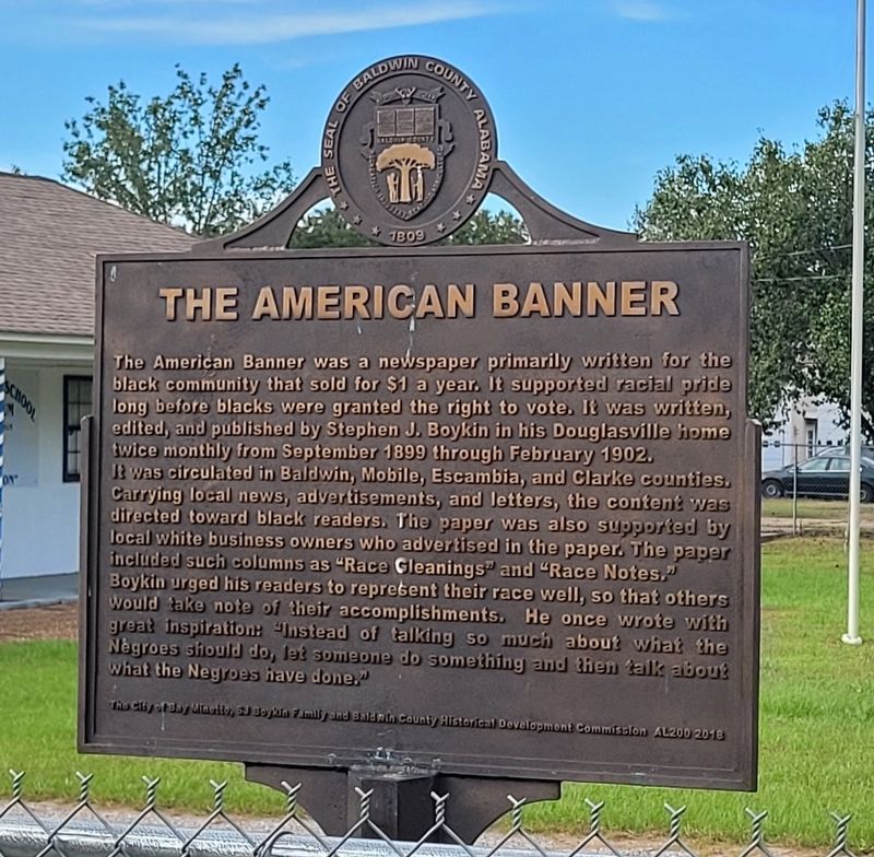
Stephen J. Boykin was born in an unincorporated area in Wilcox County, Alabama around 1859. He was a self-educated man and worked early in his life as a laborer at a lumber mill. He married Carrie Taylor in 1906 and they raised eight children.
Mr. . . . — — Map (db m234961) HM
The Charles Swift Family
Charles Swift came to Alabama in 1880 and married Susan Roberts in 1885. He developed a successful lumber business, including a sawmill here on the Bon Secour River. The Swifts raised their eleven children in this . . . — — Map (db m122465) HM
Sonora Community
The community of Sonora was named in 1901 by the wife of the first postmaster, G.L. Sharretts. Situated near Red Hill Ford on Baker Branch and the intersection of travel routes between Silverhill, Magnolia Springs, Marlow . . . — — Map (db m130878) HM
This special heritage mural marks the southern starting point of the Barbour County Governors' Trail in the birthplace and childhood home of four-term Alabama Governor George C. Wallace, who lived in Clio from his birth on August 25, 1919 until . . . — — Map (db m308076) HM
William Thomas "Tom" Mann
1932-2005
Family man, entrepreneur and bass angler legend, Tom Mann, achieved fame as a fishing lure designer/manufacturer and helped put Lake Eufaula on the map with his popular television shows. With an . . . — — Map (db m113682) HM
On May 11, 2011, 40 students who were retracing the route of the original Freedom Ride, arrived in Anniston. The student Freedom Ride was part of a promotion organized by WGBH/Boston, a member of the Public Broadcasting system. The goal was to . . . — — Map (db m217423) HM
Block 148, the block on which you are standing, was first developed in 1880 when three identical brick houses were constructed at the southeast corner of the block as rental properties for workers at the nearby factories. This 1888 Bird's Eye View . . . — — Map (db m217433) HM
The most famous photograph of the Freedom Rides and one of the most iconic of the Civil Rights movement was taken by a freelance photographer for The Anniston Star. Joe Postiglione, called “Little Joe” by his friends, was tipped off by the . . . — — Map (db m217422) HM
In 1904, 18 year old Tyrus Raymond Cobb lived in a boarding house on this site while playing minor league baseball for the Anniston Steelers. From nearby Scarbrough Drug Store on Noble Street he wrote letters, using fictitious names, to sports . . . — — Map (db m106606) HM
Postoffice established July 20, 1833 as Drayton, Benton County, Alabama. Name changed to Jacksonville Aug. 6, 1834 and county changed to Calhoun Jan. 29, 1858. Office maintained by Confederate Government 1861-1865.
Postmasters and dates of . . . — — Map (db m36449) HM
Inventor of the early typewriter—the pterotye. Born in 1831, Union Dist., S.C., died in 1905, grave 2 miles west. While registered in chancery and later editor of the National Democrat near this siteabout 1860, developed his first writing . . . — — Map (db m115571) HM
Fulton, first known as Wade's Station, developed in the 1880s along the Mobile to Birmingham Railroad. With the railroad came an influx of lumbermen from the North. Marcus Behrman was the first of the lumbermen who came to establish a lumber mill . . . — — Map (db m203704) HM
Here, near the bubbling waters of Buzzard Roost Spring, Levi Colbert (Itawamba Minko, “Bench Chief”) built one of the many inns—called stands—along the Natchez Trace.
But it was Colbert’s negotiating and language skills . . . — — Map (db m107265) HM
Born in Tennessee on October 22, 1818, Charles Womble was the son of Amos and Sarah (Jarman) Womble. By 1850, Womble owned a farm near the town of Frankfort, which he helped select as the new seat of government for Franklin County, Alabama. Involved . . . — — Map (db m192076) HM
This Italianate brick commercial structure with a cast-iron storefront on the first floor is significant for its 24 year association with Gadsden’s principal newspaper. It was constructed in 1904 to house The Gadsden Times-News, which was . . . — — Map (db m300897) HM
On Loyalty Day this 30th day of April, 1967, we do pay honor and tribute to a great American
- Paul Harvey -
a man who has contributed much toward making this nation and especially Gadsden a better place to live. We salute a true champion of . . . — — Map (db m83737) HM
People living along the Byler Road came to
Fayette to watch movies at the Roxy Theatre,
located on this street. Originally called the
New Richards Theatre, the Roxy opened in 1935.
Lucille Cobb - a member of the family that founded
Cobb . . . — — Map (db m302619) HM
Church organized in 1848
by Rev. Thomas Chilton.
(See other side for charter members)
Sanctuary stands as built in 1849
with original columns of solid poplar.
Education building added in 1959.
Baptist . . . — — Map (db m203652) HM
Planter, tavern operator, newspaper editor, legislator, and land developer, he sought in vain to have the Jackson County seat moved from Bellefont to the settlement that bore his name. After his death in 1863, his widow reached an agreement in 1868 . . . — — Map (db m22260) HM
From 1820 until 1878 this bell hung in the
belfry of the old Elyton courthouse, one-half mile northeast of this spot. In 1861
Jefferson County boys were mustered in
there and the bell tolled them off to war.
John Felix McLaughlin was one of . . . — — Map (db m216063) HM
Emory Overton Jackson was born on September 8, 1908 in Buena Vista, Georgia to Will Burt and Lovie Jones Jackson. E. O. Jackson and his seven siblings were raised in the middle-class Birmingham enclave of Enon Ridge, located on the west side of town . . . — — Map (db m64736) HM
Businesses that occupied this building between 1908 - 1970
1908 - 1913 Southern Bell Telephone Company Stockroom
1915 - 1926 OK French Dry Cleaning Company
1927 - 1938 George Kanelis Billiards
1940 - 1945 Alex’s Steak House
1946 - . . . — — Map (db m27521) HM
Recipient in 1989 of the first Kodak Award for Photojournalism, Charles Moore chronicled such major events as the Civil Rights Movement in the 1960's South, political violence in Haiti, and the air war in Vietnam. — — Map (db m219326) HM
Winner of international awards such as the 1982 Wildlife Photographer of the Year through the Overseas Press Club, Michael Nichols was named Photography Editor-at-Large for National Geographic Magazine in 2008. — — Map (db m219296) HM
The Council of Fashion Designers of America
recognized Billy Reid as the Best New Menswear
Designer in 2001, followed by the Gentleman's
Quarterly, the Vogue Fashion Fund and the Best
Menswear Designer Awards. — — Map (db m219329) HM
Clay Bennett received both the Pulitzer Prize for Editorial Cartooning and the National Journalism Award in 2002, followed by the Robert F. Kennedy Journalism Award in 2007 and multiple awards from the Society of Professional Journalists in . . . — — Map (db m273871) HM
A print journalist from 1928 to 1970, including many years has a newspaper editor,
Louis Eckl was honored by Presidents Harry Truman and John Kennedy for his courageous defense of civil rights for all people. — — Map (db m285813) HM
Serving as a radio engineer for the England-to-Australia airplane race in 1934, Reeder Nichols later commanded the US Air Force's radio group for Australia and the SW Pacific. A mountain in Australia is named in his honor.
Inducted 2019
City of . . . — — Map (db m219315) HM
Robert Bruninga's invention of the Automatic Packet Reporting System (APRL) for amateur radio in 1993 was adopted worldwide. He was inducted into the CQ Amateur Radio Hall of Fame in 2002 and received the Navy Meritorious Civilian Award in 2014.
. . . — — Map (db m219320) HM
Born 11 June 1769, in Maryland and married 18 Nov 1797, Anne Royall became a wealthy widow upon her Revolutionary War Veteran husband's death in 1813. However, her husband's family filed an ultimately successful suit for his estate. While she waited . . . — — Map (db m84309) HM
01: Looking south on Railroad Street.
02: McWilliams Store, June 1913.
03: Drugstore interior, 1940s.
04: Citizens' Bank, early 1900s.
05: Elkmont Post Office, circa 1900s.
06: Telephone switchboard, early 1900s.
07: Elkmont Post . . . — — Map (db m93856) HM
Post office contains original call boxes
Old tavern, 1817 used as stagecoach stop
Red Brick Methodist church 1817
U.S. Gen. James A Garfield was stationed here 1862
White frame church is more than a century old
Andrew Johnson was . . . — — Map (db m256323) HM
The light beacon and fog bell in Big Springs International Park were presented as a gift from Norway in 1973.
The light beacon served as one of the guiding lights to the mariner from 1903 to 1966 being situated on the west coast of Norway at . . . — — Map (db m85545) HM
Born January 5, 1861 - Died June 28, 1948
Marengo Co. Surveyor, Historian, and Journalist
Author of Democrat Reporter Newspaper Column “Old Times”
"He was a Baptist, A Mason, A Surveyor, an Old-Timer" . . . — — Map (db m73005) HM
The City of Albertville is named for Thomas Albert, buried here with his wife Sarah Sappington Albert and daughter Sarah. They had three other daughters -- Martha, who married James C. Miller,the city's first postmaster, Elizabeth, and Mary. Albert . . . — — Map (db m143214) HM
Andrew N. Johnson, born 1865 in Marion, Alabama, graduated from Talladega College in 1886, and taught in rural Alabama. On this site in 1894, he established the Mobile Weekly Press, a voice for African-Americans, "A.N.", a powerful member of the . . . — — Map (db m111347) HM
A postal worker, a community leader, a state legislator, a journalist, and a civil rights activist, Mobile native John L. LeFlore spent 50 years working to peacefully transform the character of the city and create opportunities to enhance citizens' . . . — — Map (db m111413) HM
In 1952, W.O. Pape, owner of the WALA-AM radio station, received a television license from the Federal Communications Commission. The WALA acronym stood for "We Are Loyal Alabamians." On January 14, 1953, WALA-TV, Channel 10, began broadcasting from . . . — — Map (db m149325) HM
Citation to Accompany the Award of The Air Force Cross
to
Richard L. Etchberger
Chief Master Sergeant Richard L. Etchberger distinguished himself by extraordinary heroism in connection with military . . . — — Map (db m95529) WM
The "Stars and Bars," designed by Nicola Marshall of Marion, Alabama, was adopted by the flag selection committee of the Provisional Confederate Congress at Montgomery and raised over the capitol building on March 4, 1861. Its similarity to the . . . — — Map (db m69314) HM
A native of Tuscumbia, he was the son of Reverend Marvin R. Heflin and Louise D. Strudwick Heflin. He was a graduate of Colbert County High School, Birmingham Southern College, and the University of Alabama School of Law. He was a past President of . . . — — Map (db m69336) HM
The intensity of the war caused the desire for a new national flag that was in no way similar to the U.S. flag. The "Stainless Banner" was adopted by the Confederate Congress on May 1, 1863. The cross of St. Andrew, depicted on the flag, has been . . . — — Map (db m86423) HM
MG J.H.Wilson’s Cavalry Corps raised U.S. flag over Alabama’s and the Confederacy’s first Capitol on 4/12/65, three days after Lee’s surrender at Appomattox. Wilson had defeated LTG N.B. Forrest’s depleted and vastly outnumbered troops at the . . . — — Map (db m86471) HM
For several critical years during the 1960s, a biracial group of young
journalists published a newspaper dedicated to covering the civil rights
movement, War on Poverty initiatives, other issues of concern to
Black and poor communities, and to . . . — — Map (db m279830) HM
A Century of Service
The Decatur Daily newspaper began publication in the basement of a building on the northeast corner of Moulton Street and Second Avenue on Feb. 26, 1912 to serve the adjacent towns of Decatur and New Decatur. Its web . . . — — Map (db m127338) HM
Born in Henderson, Alabama in 1850, Fletcher Jackson Cowart began his working career as a public school teacher. He later served superintendencies for both the Pike County and the Troy City schools. He was editor of the Troy Messenger and a . . . — — Map (db m38934) HM
Post office established as Diana 1834
Name changed to Cropwell 1837
Masonic Lodge chartered 1857
In 1887 Birmingham & Atlantic R.R.
came to Cropwell — — Map (db m217724) HM
Established in 1905, the Gantts Quarry Post Office
served the Gantts Quarry community, the location
of a marble quarry known for producing a pure white
marble rivaling Italian marble. A tornado destroyed
the building in 1932, and Alec Chappell . . . — — Map (db m295009) HM
The distinguished Joiner family lived here in an imposing mansion, demolished in 1970.
James H. Joiner: Pioneer in Talladega's progress while publisher, 1844-73, of one of Alabama's most influential newspapers - The Democratic Watchtower. . . . — — Map (db m37220) HM
First Presbyterian Church was organized March 2, 1893. The church was made up of 17 members at the home of Robert Clinton Sandlin, who was installed as the First Ruling Elder. The church constructed their 1st building on this site in 1895. The . . . — — Map (db m28548) HM
After the devastation of the Civil War and nearly 20 years of decline, Mayor William Carlos Jemison and other civic leaders energetically promoted a “New South” vision of a community that would prosper through hard work, trade, industrial . . . — — Map (db m217187) HM
Covering the Byler Road and all of Walker County, the Mountain Eagle began as a weekly newspaper in 1872, shortly after Rev. John Anthony hired James M.
Williams to haul a printing press by wagon from Tuscaloosa to Jasper. Williams said that with . . . — — Map (db m301594) HM
The first issue of The Alabama Baptist was published in Marion, Alabama. General Edwin D. King, a Judson trustee, offered his office for use in printing and distributing the paper from 1843-1852. The building was owned by Milo P. Jewett, . . . — — Map (db m274881) HM
Office established May 27, 1891;
discontinued July 31, 1902.
First postmaster
Thomas M. Wadsworth
Homestead established here with letters patent signed by President Benjamin Harrison on May 21, 1890. Far-sighted and courageous pioneer, . . . — — Map (db m201365) HM
Here was located the switchboard known as “Central”, of Winston Telephone, Arley’s Grand Old Party Line. Built about 1909 by Mimm Wright, with an estimated maximum of 25 phones, she was the pulse of the community. When one phone rang, . . . — — Map (db m42857) HM
Ark Post Office
Winston County
Established on November 11, 1881, the Ark Post Office
served this area along the Byler Road and operated
for less than 10 years, when the Haleysville Post
Office took over mail service on March 5, . . . — — Map (db m309085) HM
The first 9-1-1 emergency services telephone call
was made from the office of the mayor on
February 16, 1968. Earlier in the year, AT&T,
which had a near monopoly in the telephone
industry at the time, had announced its plans
for launching the . . . — — Map (db m153209) HM
Situated along the Byler Road and designed by
Strickland, Roberts, & Cooper of Gadsden, the
Northwest Alabamian newspaper moved into its new
building in 1974. One of the first Haleyville papers,
the paper was originally known as The Square . . . — — Map (db m284747) HM
The oldest house in Anchorage was originally built in Knik, Alaska, in 1913. Oscar Gill moved his home to Anchorage in 1916. An Iditarod Trail mail musher and three term mayor of Anchorage, Gill was speaker of the territorial House of . . . — — Map (db m173886) HM
For generations the Inuit people of Northern Canada, Greenland, and Alaska have constructed these rock monuments for hunting and navigational purposes. Our inuksuk is a giant version based on similar monuments found throughout the Arctic. . . . — — Map (db m287075) HM
Miners in 1897 built the Valdez-Eagle Trail. In Klondike Gold Rush, it was used for telegraph lines to Fairbanks. 1910 upgrade, called the Valdez-Fairbanks Wagon Road, under Gen. Wiles P. Richardson, improved for wagon use in the Keystone Canyon . . . — — Map (db m257002) HM
Soldiers constructed the first telegraph in Alaska, known as the Washington-Alaska Military Cable and Telegraph System. Built to assist communication between U. S. Army posts, WAMCATS carried civilian messages during the Gold Rush era. . . . — — Map (db m255502) HM
The Alaska Road Commission served a multitude of purposes
including Road Work for over 50 years - starting in 1905.
Its work involved Ferries, Harbors, Canals, Flood Control,
Navigational Aids, Trails, Radio, Wireless and Telephone . . . — — Map (db m255513) HM
Alaska Native place names have echoed from the hills since time immemorial and hold key elements for maintaining Alaska native connection to sacred sites, traditional resources, and cultural practices.
The Alaska Native people who live and . . . — — Map (db m284333) HM
Nearly every village along the rivers of Alaska had a post office. They were only open when mail was delivered. Often the postmaster would start a fire in the post office stove to warm up the cabin, meet the airplane, dog team or riverboat that . . . — — Map (db m257599) HM
This corner reflector, owned by the Alaska Satellite Facility of UAF's Geophysical Institute, is named for its simple shape. Corner reflectors bounce the radar signal back to the sensor,
creating a bright, identifiable pattern easily seen as a . . . — — Map (db m256387) HM
Alaska's Pioneer Aviator Noel Wien, learned to fly in Minnesota in 1921. In eight hours, he learned to fly and soloed in a Curtiss JN-4 at the Curtiss Company Flying School. He then spent the next two years with the Federated Flying Circus doing . . . — — Map (db m256947) HM
Image captured from 16mm film of the 1941 annual spring float test of the Wien Fairchild 71 at Pike's Landing. According to Noel Wien's son Richard, the plane was towed from Weeks Field to Pike's Landing for the test run. He also said that Pike's . . . — — Map (db m257016) HM
July 20, 1897 · Born in Hatton, North Dakota.
1922-23 · Principal of high school, Fairbanks, Alaska.
February 21, 1924 · Flew first airmail to McGrath.
March 3, 1924 · Honorary Member Pioneers of Alaska.
April 1928 · Flew over top of . . . — — Map (db m255962) HM
From the first communications project- an ill-fated attempt to string a trans-Siberian telegraph cable linking America with Europe in the 1860s to the satellite technology of today. Alaska has been a rugged proving
ground for the . . . — — Map (db m257333) HM
In 1913 Fairbanks merchants invited Lilly and James V. Martin to bring their airplane to Fairbanks. The Martins shipped their crated airplane from Seattle. When it reached Fairbanks, Martin and his wife, who was England's first woman aviator, . . . — — Map (db m256495) HM
Riverboats have plied the rivers of Alaska and the Yukon for more than 100 years. They were the primary mode of transportation to the gold fields of Interior Alaska, bringing prospectors and supplies to the growing boom towns along . . . — — Map (db m257436) HM
The flag of Northern Commercial Company-a white and red banner initialed NC Co-was once as well known to Alaskans as the state flag is today.
For many years the main store of the company did business from the Fairbanks waterfront. The story of . . . — — Map (db m256552) HM
Fairbanks was a lively gold rush town-population 1,000-when its first newspaper began publication. It was just two years after E.T. Barrette cached his goods along the Chena River that printer George M. Hill hauled a printing plant from Dawson to . . . — — Map (db m257358) HM
No one knows for certain when the idea was first conceived to harness dogs for pulling sleds, although it is probable that dog traction has been around for at least a
thousand years. From the writings of the earliest European and . . . — — Map (db m257435) HM
Construction of an overland route from Valdez on Prince William Sound to Eagle on the Yukon River near the Canadian border started in 1899. Events in the Tanana Valley soon necessitated a trail from Fairbanks to Valdez. Between 1905 and 1906, the . . . — — Map (db m256556) HM
Natives of Southeast Alaska have made totem poles such as this one for thousands of years.
This pole depicts four Haida clan stories. It was carved in 1940 by master carver John Wallace of Hydaburg. Described as "the last of the professional . . . — — Map (db m181736) HM
The Cape Decision lighthouse was the last one built in Alaska. Need for it grew as ship traffic and the size of the ships increased. Southeast Alaska was booming with many salmon canneries, herring salteries and whale oil reduction plants. Large . . . — — Map (db m181646) HM
Perched high on a cliff, Cape Hinchinbrook lighthouse marks the entrance to the sheltered waters of Prince William Sound. The wreck of the steamer Oregon on Hinchinbrook Island in 1906 prompted the light's installation. Foul weather during . . . — — Map (db m181634) HM
Facing the open Gulf of Alaska, Cape Saint Elias lighthouse stands on Kayak Island, where in 1741, Russian voyagers first set foot on North American soil. The Cape's bald pinnacle serves as a key landmark in daylight. The light provides guidance at . . . — — Map (db m181632) HM
Scotch Cap and Cape Sarichef lighthouses mark the north and south entrances to Unimak Pass in the Aleutian Islands. Both sites were declared to be too isolated for family life.
Scotch Cap was the first light on Alaska's outside coast and is the . . . — — Map (db m181636) HM
Cape Spencer lighthouse stands on a barren, isolated rock at the entrance to Cross Sound, where the sheltered Inside Passage meets the open Gulf of Alaska. The original lighthouse still stands. It is a single-story, reinforced concrete building . . . — — Map (db m181631) HM
Eldred Rock is the oldest original lighthouse still standing in Alaska. It is a two-story building topped by a light tower. The ground floor was built of reinforced concrete, the first time that material was used for a lighthouse facing Alaska's . . . — — Map (db m181635) HM
Southeast Five Finger was the first name given this lighthouse site due to its location on the southeastern-most island of the Five Finger Islands group. The original, wood boathouse and carpenter shop remain.
A keeper thawing frozen water pipes . . . — — Map (db m181645) HM
A square, white wooden tower housed the Guard Islands light, with a separate keeper's house nearby. When a reinforced concrete building replaced the old light tower in 1922, a second house was built so two keepers could live there with their . . . — — Map (db m181640) HM
This totem pole tells the story of the harnessing of the atom. The pole was carved in 1967 by Tlingit carver Amos Wallace of Juneau. His Tlingit name was Jeet Yaaw Dustaa of the T'akdeintaan Clan of the X'áakw Hít Tlingit (Freshwater-marked Coho . . . — — Map (db m181737) HM
For more than 100 years, lighthouses have guided mariners through Alaskan waters.
Lighthouses capture our imagination as lonely sentinels of the sea. They played a vital role in Alaska's development because for more than 70 years, ships . . . — — Map (db m181647) HM
Widely spaced along Alaska's Inside Passage, these three lighthouses were among the first built, and the first discontinued.
The lighthouse on Lincoln Rock, near Ketchikan, was unusually difficult to build. The small, rocky pinnacle on which it . . . — — Map (db m181637) HM
The lighthouse on Mary Island is the second one seen by ships heading up Alaska's Inside Passage. The beacon guides mariners into Revillagigedo Channel leading to Ketchikan. Like most of Alaska's lighthouses, it was built soon after the Klondike . . . — — Map (db m181642) HM
The red-roofed, white buildings at Point Retreat are a familiar sight to local boaters and passengers on cruise ships sailing between Juneau and Glacier Bay. The original, wooden light tower at Point Retreat was only 6 feet tall, but it stood 19 . . . — — Map (db m181638) HM
Sentinel Island Lighthouse guards the entrance to Favorite Channel, linking Lynn Canal to Juneau's Auke Bay. The original, wood frame structures included a keeper's house with an attached light tower and out-buildings, including a wharf and . . . — — Map (db m181644) HM
Carved by Tlingit carvers:
Charlic Tagook — Klukwan
William Brown — Saxman
Carving began in 1939 / Carving was completed in 1940
Featured on this totem pole, from top to bottom, are Raven, a man, a giant cannibal (Guteel), . . . — — Map (db m181740) HM
Tree Point is Alaska's most southerly of the Southeast lighthouses. It marks the first landfall for northbound ships crossing Queen Charlotte Sound, 30 miles of coastal water open to the Pacific. Mariners used Tree Point Lighthouse to guide them . . . — — Map (db m181641) HM
The cultural traditions and stylistic glories of Northwest Coast Native artists go back centuries. But the historical period of (obscured) and curating — mainly by non-Natives — is relatively short. Totem poles by tradition were private . . . — — Map (db m182030) HM
Shipments of iced halibut from Ketchikan to outside markets was pioneered by F.J. Hunt and H.C. Strong, following similar successful methods with salmon, and a thriving business was built through the construction of two large cold storage . . . — — Map (db m181914) HM
For thousands of years, water has been the common highway for all Northwest Coast Natives. Living at the edge of dense rain forests of great cedar, spruce, and hemlock along one of the world's richest sea coasts, their dependence upon seafood . . . — — Map (db m181977) HM
A city arose at the mouth of Ketchikan Creek early in the 20th century, where Native people had camped for uncountable centuries to fish and hunt, houses, stores, hotels and sawmills uprooted the rainforest skyline in a sort of land-rush flurry of . . . — — Map (db m182027) HM
500 yr. old cedar from Ketchikan, Alaska
carved after ancient Tsimshian culture
By David K. Fison (Nadáam 'Nłomsk)
of the Tsimshian Killer Whale Clan
Anchorage, Alaska April 28, 2001
—————————————————————
Completed in 2001
The . . . — — Map (db m258207) HM
5254 entries matched your criteria. The first 100 are listed above. Next 100 ⊳