After filtering for New Jersey, 920 entries match your criteria. Entries 101 through 200 are listed.⊲ Previous 100 — Next 100 ⊳
US Revolutionary War Topic
By Bill Coughlin, October 10, 2008
Hendrik Van Allen House Marker
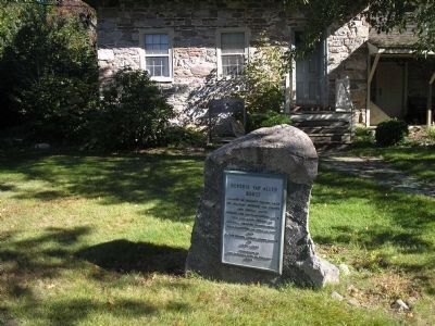
| 101 ► New Jersey, Bergen County, Oakland — Hendrik Van Allen House — |
| On Franklin Avenue at Ramapo Valley Road (U.S. 202), on the right when traveling west on Franklin Avenue. | |||
| 102 ► New Jersey, Bergen County, Oakland — 95 — Jacobus S. Demarest House — |
| On Dogwood Drive at Ramapo Valley Road (U.S. 202), on the right when traveling west on Dogwood Drive. | |||
| 103 ► New Jersey, Bergen County, Oakland — Oakland — Incorporated 1902 — |
| On Ramapo Valley Road (New Jersey Route 202) at Veteran Drive, on the right when traveling south on Ramapo Valley Road. | |||
| 104 ► New Jersey, Bergen County, Oradell — 31 — Soldier Hill — Lafayette Encampment — |
| On Kinderkamack Road (County Route 503) at Soldier Hill Road, on the left when traveling north on Kinderkamack Road. | |||
| 105 ► New Jersey, Bergen County, Paramus — 35 — Old Spring Valley Burial Ground — |
| On Spring Valley Road at Viola Way, on the left when traveling south on Spring Valley Road. | |||
| 106 ► New Jersey, Bergen County, Paramus — 32 — Paramus — |
| On North Farview Avenue at Sweetbriar Avenue, on the right when traveling south on North Farview Avenue. | |||
| 107 ► New Jersey, Bergen County, Paramus — Red Mill – Paramus — |
| On Red Mill Road at Saddle River Road, on the right when traveling west on Red Mill Road. | |||
| 108 ► New Jersey, Bergen County, Paramus — 37 — Terhune-Gardner House — |
| On Paramus Road at Century Road, on the right when traveling north on Paramus Road. | |||
| 109 ► New Jersey, Bergen County, Paramus — Washington Spring — 1780 — |
| On Forest Avenue, on the left when traveling north. | |||
| 110 ► New Jersey, Bergen County, Paramus — 1 — Washington Spring — |
| On Forest Avenue, on the left when traveling north. | |||
| 111 ► New Jersey, Bergen County, Ridgefield Park — 106 — Paulison – Christie House — |
| On Homestead Pl, on the left when traveling north. | |||
| 112 ► New Jersey, Bergen County, Ridgewood — Abraham Godwin — |
| On E. Ridgewood Avenue at Van Neste Square, on the right when traveling south on E. Ridgewood Avenue. | |||
| 113 ► New Jersey, Bergen County, Ridgewood — Near this House of God — Nisi Dominus Frustra — |
| On E Glen Avenue, on the right when traveling east. | |||
| 114 ► New Jersey, Bergen County, Ridgewood — 43 — Old Paramus Reformed Church — |
| On E Glen Avenue, on the right when traveling east. | |||
| 115 ► New Jersey, Bergen County, River Edge — Borough of River Edge — |
| On Tenney Avenue at Kindermkerack, on the right when traveling west on Tenney Avenue. | |||
| 116 ► New Jersey, Bergen County, River Edge — Camp Kitchen — |
| On Main Street, on the left when traveling east. | |||
| 117 ► New Jersey, Bergen County, River Edge — Historic New Bridge Landing — |
| On Old New Bridge Avenue, on the left when traveling east. | |||
| 118 ► New Jersey, Bergen County, River Edge — Historic New Bridge Landing — |
| On Main Street at Hackensack Avenue (County Route 503), on the right when traveling west on Main Street. | |||
| 119 ► New Jersey, Bergen County, River Edge — Historic New Bridge Landing — |
| On Main Street at Hackensack Avenue (County Route 503), on the right when traveling west on Main Street. | |||
| 120 ► New Jersey, Bergen County, River Edge — Historic New Bridge Landing — |
| On Main Street, on the left when traveling east. | |||
| 121 ► New Jersey, Bergen County, River Edge — New Bridge — |
| On Main Street, on the right when traveling east. | |||
| 122 ► New Jersey, Bergen County, River Edge — New Bridge — |
| Near Main Street, on the left when traveling east. | |||
| 123 ► New Jersey, Bergen County, River Edge — New Bridge Landing — |
| On Main Street, on the right when traveling east. | |||
| 124 ► New Jersey, Bergen County, River Edge — The (Von) Steuben House — |
| Near Main Street, on the left when traveling east. | |||
| 125 ► New Jersey, Bergen County, River Edge — The Campbell – Christie House — |
| On Main Street, on the left when traveling east. | |||
| 126 ► New Jersey, Bergen County, River Edge — The Zabriskie House — |
| On Old New Bridge Avenue. | |||
| 127 ► New Jersey, Bergen County, River Edge — Timeline of Events at New Bridge in the American Revolution — 11 Engagements Throughout the War — |
| On Main Street, on the left when traveling east. | |||
| 128 ► New Jersey, Bergen County, River Vale — “The Baylor Massacre” — September 28, 1778 — |
| On Red Oak Drive at Rivervale Road, on the right when traveling east on Red Oak Drive. | |||
| 129 ► New Jersey, Bergen County, River Vale — 200 Years Later — |
| Near Red Oak Drive at Rivervale Road, on the right when traveling east. | |||
| 130 ► New Jersey, Bergen County, River Vale — A Night of “Savage Cruelty” — September 28, 1778 — |
| On Red Oak Drive, on the right when traveling east. | |||
| 131 ► New Jersey, Bergen County, River Vale — Baylor Massacre Millstone — |
| On Red Oak Drive at Rivervale Road, on the right when traveling east on Red Oak Drive. | |||
| 132 ► New Jersey, Bergen County, River Vale — 47 — Baylor Massacre Park — |
| On Red Oak Drive at Rivervale Road, on the right when traveling east on Red Oak Drive. | |||
| 133 ► New Jersey, Bergen County, River Vale — Gravesite — |
| On Red Oak Drive at Rivervale Road, on the right when traveling east on Red Oak Drive. | |||
| 134 ► New Jersey, Bergen County, River Vale — Propaganda: The Mighty Pen — |
| On Red Oak Drive at Rivervale Road, on the right when traveling east on Red Oak Drive. | |||
| 135 ► New Jersey, Bergen County, River Vale — The Baylor Massacre — |
| On Rivervale Road. | |||
| 136 ► New Jersey, Bergen County, River Vale — The British General — |
| On Red Oak Drive at Rivervale Road, on the right when traveling east on Red Oak Drive. | |||
| 137 ► New Jersey, Bergen County, River Vale — The Price of Freedom: A Patriot’s Grave — |
| On Red Oak Drive at Rivervale Road, on the right when traveling east on Red Oak Drive. | |||
| 138 ► New Jersey, Bergen County, River Vale — The Third Continental Light Dragoons — |
| On Red Oak Drive at Rivervale Road, on the right when traveling east on Red Oak Drive. | |||
| 139 ► New Jersey, Bergen County, Rockleigh — 50 — Abraham A. Haring House — Built c. 1758 — |
| On Piermont Road (County Route 501), on the right when traveling south. | |||
| 140 ► New Jersey, Bergen County, Rockleigh — 51 — John A. Haring House — Built c. 1805 — |
| On Piermont Road (County Route 501), on the right when traveling south. | |||
| 141 ► New Jersey, Bergen County, Rockleigh — 48 — Rockleigh Road — |
| On Rockleigh Road at Piermont Road (County Route 501), on the right when traveling north on Rockleigh Road. | |||
| 142 ► New Jersey, Bergen County, Teaneck — Brett Park / New Bridge Area — Hackensack River Greenway through Teaneck — Hackensack River Stories — |
| On Main Street (Old New Bridge Road), on the left when traveling west. | |||
| 143 ► New Jersey, Bergen County, Teaneck — 53 — Revolutionary War Encampment – 1780 — |
| On Teaneck Road at Cedar Lane, on the right when traveling south on Teaneck Road. | |||
| 144 ► New Jersey, Bergen County, Tenafly — British & Hessian Invasion — |
| On Tenafly Road north of Westervelt Avenue, on the right when traveling south. | |||
| 145 ► New Jersey, Bergen County, Tenafly — 56 — Roelof Westervelt House — |
| On Westervelt Ave east of Tenafly Road, on the right when traveling east. | |||
| 146 ► New Jersey, Bergen County, Wallington — Acquacknonk Bridge — |
| On Main Ave at Paterson Ave, on the right when traveling west on Main Ave. | |||
| 147 ► New Jersey, Bergen County, Wallington — General Casimir Pulaski — 1747 – 1779 — Father of the American Cavalry — |
| On Main Avenue, on the left when traveling east. | |||
| 148 ► New Jersey, Bergen County, Westwood — 118 — Site of Bogert’s Mill — |
| On First Avenue at Mill Street, on the right when traveling north on First Avenue. | |||
| 149 ► New Jersey, Bergen County, Wyckoff — 61 — Stagg Homestead — |
| On Sicomac Avenue, on the right when traveling west. | |||
| 150 ► New Jersey, Bergen County, Wyckoff — 122 — Van Voorhees – Quackenbush – Zabriskie House — |
| On Franklin Avenue at Maple Avenue, on the right when traveling west on Franklin Avenue. | |||
| 151 ► New Jersey, Burlington County, Beverly — Dunk’s Ferry Bicentennial Memorial — 1776 * 1976 — |
| On Broad Street at Bank Road, on the right when traveling north on Broad Street. | |||
| 152 ► New Jersey, Burlington County, Bordentown — Borden's Towne — Settled 1682 — |
| On Crosswicks Street (County Route 528) at Hopkinson Street, on the left when traveling west on Crosswicks Street. | |||
| 153 ► New Jersey, Burlington County, Bordentown — British Raid on Crosswicks Creek — |
| On Prince Street near Courtland Street. | |||
| 154 ► New Jersey, Burlington County, Bordentown — Francis Hopkinson — 1737 - 1791 — |
| On Farnsworth Avenue (County Route 545) at Park Street (County Route 662), on the right when traveling north on Farnsworth Avenue. | |||
| 155 ► New Jersey, Burlington County, Bordentown — Home of Col. Joseph Borden 2nd — 1719-1791 — |
| On Farnsworth Ave at W, Park Avenue on Farnsworth Ave. | |||
| 156 ► New Jersey, Burlington County, Bordentown — Home of Patience Lovell Wright — 1725 - 1786 — |
| On Farnsworth Avenue (County Road 545) at West Park Street, on the right when traveling south on Farnsworth Avenue. | |||
| 157 ► New Jersey, Burlington County, Bordentown — Notable Bordentown Residents — Delaware River Heritage Trail — |
| On County Road 662 at Farnsworth Avenue, on the left when traveling east on County Road 662. | |||
| 158 ► New Jersey, Burlington County, Bordentown — Patience Lovell Wright — Women's Heritage Trail — |
| On West Park Avenue at Farnsworth Avenue on West Park Avenue. | |||
| 159 ► New Jersey, Burlington County, Bordentown — Thomas Paine — |
| On Farnsworth Avenue (New Jersey Route 545) at West Church Street, on the left when traveling north on Farnsworth Avenue. | |||
| 160 ► New Jersey, Burlington County, Bordentown — Thomas Paine Monument — |
| On Prince Street at Courtland Street, in the median on Prince Street. | |||
| 161 ► New Jersey, Burlington County, Burlington — St. Mary's Churchyard — |
| On W Broad Street west of Wood Street, on the right when traveling west. | |||
| 162 ► New Jersey, Burlington County, Columbus — On a Tree South of this Spot — |
| On Columbus Road (County Route 543) 0.3 miles east of Petticoat Bridge Road, on the right when traveling east. | |||
| 163 ► New Jersey, Burlington County, Columbus — The Keeler Oak — |
| On Petticoat Bridge Road at Columbus Road (County Route 656), on the left when traveling north on Petticoat Bridge Road. | |||
| 164 ► New Jersey, Burlington County, Columbus — The Keeler Oak — |
| On Columbus Road at Petticoat Bridge Road on Columbus Road. | |||
| 165 ► New Jersey, Burlington County, Crosswicks — Crosswicks — |
| On Main Street. | |||
| 166 ► New Jersey, Burlington County, Crosswicks — Crosswicks Quaker Meeting — Religious Society of Friends — |
| Near Front Street at Church Street. | |||
| 167 ► New Jersey, Burlington County, Crosswicks — Friends Meeting — |
| On Church Street at Front Street on Church Street. | |||
| 168 ► New Jersey, Burlington County, Fieldsboro — Borough of Fieldsboro — Delaware River Heritage Trail — |
| On 4th Street (County Road 622) at Washington Street, on the right when traveling west on 4th Street. | |||
| 169 ► New Jersey, Burlington County, Fieldsboro — White Hill Mansion — Delaware River Heritage Trail — |
| On 4th Street (County Road 662) at White Hill Mansion Road, on the right when traveling south on 4th Street. | |||
| 170 ► New Jersey, Burlington County, Medford — 16 — Peacock Cemetery — |
| On Chairville Road at Marlton Pike (Route 70), on the right when traveling north on Chairville Road. | |||
| 171 ► New Jersey, Burlington County, Medford — 6 — Powder Explosion — |
| On Branin Road south of Chapel Avenue, on the left when traveling south. | |||
| 172 ► New Jersey, Burlington County, Moorestown — “Hessian House” — |
| On E Main Street at Schooley Street, on the left when traveling east on E Main Street. | |||
| 173 ► New Jersey, Burlington County, Moorestown — Smith-Cadbury Mansion — |
| On High Street, on the left when traveling north. | |||
| 174 ► New Jersey, Burlington County, Mount Holly — Battle of Ironworks Hill — |
| On Pine Street, on the right when traveling south. | |||
| 175 ► New Jersey, Burlington County, Mount Holly — Cannon Made in Mount Holly — |
| On High Street at Union Street, on the right when traveling south on High Street. | |||
| 176 ► New Jersey, Burlington County, Mount Holly — Girard House |
| On Mill Street (County Route 537), on the right when traveling west. Reported missing. | |||
| 177 ► New Jersey, Burlington County, Mount Holly — The Battle of Iron Works Hill — December 23, 1776 — |
| On Pine Street, on the right when traveling south. | |||
| 178 ► New Jersey, Burlington County, Mount Holly, Springfield Township — Petticoat Bridge Skirmish — December 23, 1776 — |
| On Petticoat Bridge Road, on the right when traveling north. | |||
| 179 ► New Jersey, Burlington County, Mount Holly, Springfield Township — Revolutionary War Hospital — December 23, 1776 — |
| On Jacksonville Jobstown Road, on the right when traveling east. | |||
| 180 ► New Jersey, Burlington County, Mount Laurel — 1778 — |
| Near Creek Road. | |||
| 181 ► New Jersey, Burlington County, Mount Laurel — Evesham Friends Meeting House — |
| On Moorestown - Mount Laurel Road at Hainesport Road, on the left when traveling east on Moorestown - Mount Laurel Road. | |||
| 182 ► New Jersey, Burlington County, Mount Laurel — Gen. Clinton House — |
| On Hainesport-Mount Laurel Road, on the right when traveling south. | |||
| 183 ► New Jersey, Burlington County, Willingboro — Site of Governor William Franklin’s Home — |
| On Beverly Rancocas Road at John F. Kennedy Way on Beverly Rancocas Road. | |||
| 184 ► New Jersey, Camden County, Berlin — Historic Berlin Cemetery — Founded 1766 — |
| On Clementon Road (County Road 534) just west of Franklin, on the right when traveling west. | |||
| 185 ► New Jersey, Camden County, Blackwood — The Chew Powell House — Historical Site — |
| On Good Intent Road. | |||
| 186 ► New Jersey, Camden County, Camden, Downtown — Washington at Valley Forge — |
| On South 5th Street just north of Dr. Martin Luther King Boulevard, on the right when traveling south. | |||
| 187 ► New Jersey, Camden County, Cherry Hill — Cherry Hill Monument — |
| On Kaigns Avenue (NJ 38). | |||
| 188 ► New Jersey, Camden County, Cherry Hill — Old Salem Road — |
| On Brace Road (County Route 154), on the left when traveling south. | |||
| 189 ► New Jersey, Camden County, Collingswood — General Thaddeus Kosciuszko — |
| On N. Park Dr., 0.2 miles U.S. 30/130, on the right when traveling east. | |||
| 190 ► New Jersey, Camden County, Glendora — Ashbrook's Burial Ground — |
| On Station Avenue at Melvin Avenue on Station Avenue. | |||
| 191 ► New Jersey, Camden County, Glendora — Gabreil Daveis Tavern — |
| On 3rd Avenue. | |||
| 192 ► New Jersey, Camden County, Haddon Heights — Glover Fulling Mill & Kings Run — 17th & 18th Century Transportation and Manufacturing in Haddon Heights — |
| On South Park Avenue. | |||
| 193 ► New Jersey, Camden County, Haddonfield — Guard House — |
| On Kings Highway (New Jersey Route 41), on the left when traveling south. | |||
| 194 ► New Jersey, Camden County, Haddonfield — Hessian Army during the Revolutionary War — |
| On Kings Highway E. | |||
| 195 ► New Jersey, Camden County, Haddonfield — Historic Haddonfield — |
| On Kings Highway (New Jersey Route 41) at Kings Lane, on the right when traveling south on Kings Highway. | |||
| 196 ► New Jersey, Camden County, Haddonfield — Indian King Tavern — 1750 - 1990 — |
| On Kings Highway (New Jersey Route 41), on the right when traveling south. | |||
| 197 ► New Jersey, Camden County, Haddonfield — Indian King Tavern State Historic Site (NR) — Crossroads of the American Revolution National Heritage Area — |
| On Kings Highway (New Jersey Route 41), on the right when traveling south. | |||
| 198 ► New Jersey, Camden County, Haddonfield — Jonas Cattell — 1758 1849 — |
| On Kings Highway (New Jersey Route 41) at Mechanic Street, on the right when traveling south on Kings Highway. | |||
| 199 ► New Jersey, Cape May County, Cape May — Lt. Richard Wickes — |
| On Jackson Street at Lafayette Street (County Route 633), on the right when traveling north on Jackson Street. | |||
| 200 ► New Jersey, Cape May County, Lower Township — Dedicated to Lt. Richard Wickes — |
| Near Seashore Road (U.S. 9). | |||
920 entries matched your criteria. Entries 101 through 200 are listed above. ⊲ Previous 100 — Next 100 ⊳