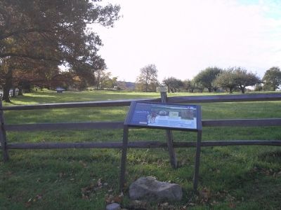
French General Jean-Baptiste Donatien de Vimeur, Comte de Rochambeau, and thousands of French ground and naval forces arrived in Newport in July of 1780 to assist the Americans in the War for Independence. After wintering in Newport, Rochambeau’s . . . — — Map (db m23416) HM
[ central pedestal ]
Lest We Forget
Within this pedestal is placed a time
capsule recording for all time
those residents of Stamford who responded
to the call, some giving their lives
while serving in our past wars.
In future . . . — — Map (db m38754) WM
[ inscription around the top ]
In Everlasting Memory of Stamford's Patriots 1641 – 1918
[ battle names inscribed in the panel between the fluted columns ]
1689 – 1763
Port Royal • Schenectady • Haverhill • . . . — — Map (db m38430) HM
To mark the site near by of Fort Stamford Built and garrisoned for the defense of the people in these parts in the War for American Independence Erected by Stamford Chapter Daughters of the American Revolution Sept. 14, A.D. 1926 < Lower . . . — — Map (db m53431) HM
1776 1976 In August, 1781 Gov. Jonathan Trumbull and the Council of Safety ordered construction of fortifications near Stamford to prevent a surprise attack from the enemy. Designed by Col. Rufus Putnam, and erected and garrisoned by . . . — — Map (db m53433) HM
This American Liberty Elm was named after “The Liberty Tree: Our Country’s first Symbol of Freedom.” On the morning of August 14, 1765, the people of Boston awakened to discover two effigies suspended from an elm tree in protest of the . . . — — Map (db m53765) HM
To commemorate the battle fought on and
near this point between the British forces
and the American Patriots, April 28, 1777.
Ordnance presented by U.S. Government and erected July 4, 1901 — — Map (db m22556) HM
To Commemorate the
heroism of the Patriots
who defended their
country when the British
invaded this State April 25-
1777. General David Wooster
Colonel Abraham Gould
and more than one hundred
Continentals fell in the
engagements . . . — — Map (db m21538) HM
Here occurred the first engagement between the Continentals and the British Troops when they invaded Connecticut, April - 25 - 1777 — — Map (db m21360) HM
Indigenous people frequented this area for thousands of years before the arrival of Europeans in the 17th century. In 1637, native Paugussets were driven away after the Great Swamp Fight between the larger Pequot tribe and European colonizers. In . . . — — Map (db m226768) HM
In Memory Of
Major Samuel Comstock
1739 --- 1824
A Private
In The French and Indian War
A Captain In The Revolutionary War
July 1776 --- June 1783
Serving At
White Plains Germantown Fort Mifflin
Valley Forge Monmouth Yorktown . . . — — Map (db m30471) HM
Commemorating Captain Clapp Raymond of the Wilton Militia who resided in this house and all officers and men who served during the War for Independence from the Parish of Wilton, Conn. — — Map (db m30643) HM WM
Wilton Veterans Memorial
Honoring
Those who served
Revolutionary War 1775 – 1784
War of 1812 1812 – 1814
Mexican War 1846 – 1848
Civil War 1861 1865
Spanish – American War 1989 – 1902 . . . — — Map (db m32254) WM
Caesar Rodney-Born on October 7, 1728 on a farm east of Dover, Caesar Rodney was one of Delaware's most distinguished statesmen. Entering public life at an early age, Rodney held numerous local offices. He was a member of the Colonial State . . . — — Map (db m141257) HM
Battles around New York City and Environs, 1776-1779
1. Long Island, August 27, 1776
2. Throg's Neck, October 12-18, 1776
3. Mamaroneck Raid, October 22, 1776
4. White Plains, October 28, 1776
5. Retreat across New Jersey, . . . — — Map (db m39713) HM
Richard Allen founded and became the first Bishop of the African Methodist Episcopal Church in 1816. Born into slavery in Philadelphia, Pennsylvania, on February 14, 1760, Allen and his family were sold to a family near Dover in 1772. While there, . . . — — Map (db m39093) HM
Near this site stood the boyhood home of Caesar Rodney, signer of the Declaration of Independence, Brigadier General of the State's militia (1775-1778), and President (Governor) of Delaware (1778-1781). Byfield was originally settled in the early . . . — — Map (db m75835) HM
Presbyterian minister, later practiced medicine, Member of Colonial Assembly, Member of Council of Safety, 1775. Commanded First Delaware Militia Regiment. This regiment, reviewed in Dover, later joined Washington’s army and fought in Battles of . . . — — Map (db m4716) HM
These two words say a great deal about Dover. It is a modern and growing city entering the 21st century on a foundation of achievement built over more than 300 years of American history.
And a rich history it is. Founded by William Penn in . . . — — Map (db m142501) HM
The Old State House
Fact: After the capital was moved from New Castle to Dover in 1777, the State House was built as the first permanent capitol building in 1787 and finished in 1791.
Information: This Georgian . . . — — Map (db m227860) HM
The Light Infantry Company of Dover, a part of the 1st Battalion of Kent County, mustered in on 2 April 1776. Each militia volunteer was uniformly armed, equipped, and wore a standard military coat of green faced with red lapels, cuffs, and . . . — — Map (db m39576) HM
"The Penman of the Revolution." Member of Delaware colonial and state assemblies. Member of Continental Congress, Annapolis Convention, and Philadelphia Federal Constitutional Convention. Signer for Delaware of Articles of Confederation and Federal . . . — — Map (db m39583) HM
Dedicated to you, a free citizen in a free land, this reproduction of the Liberty Bell was presented to the people of Delaware by direction of The Honorable John W. Snyder, Secretary of the Treasury.
As the inspirational symbol of the United . . . — — Map (db m42759) HM
Born in 1740 in Dover, Kent Co., DE
Died Feb, 15, 1791 in Dover, Kent Co., DE
Justice of the Peace
Member of Joint Committee of Accounts, Committee of Correspondence, Council of Safety, and General Assembly. — — Map (db m42754) HM
This marker commemorates the men and women who achieved American independence. These Patriots, believing in the noble cause of liberty, fought valiantly to found a new nation.
1775 - 1783 — — Map (db m273445) WM
From 1724 known as King George’s Tavern. On its sign was painted King George’s portrait, supplanted during the revolution, by the portrait of George Washington. For many years the old hostelry was the meeting place for political rallies and used . . . — — Map (db m3764) HM
The Delaware Regiment fought in nearly every campaign of the American Revolution.
For a small state, Delaware's soldiers played a large role in the Revolution. Answering Congress' call, Delaware raised a regiment of 500-600 men by the summer of . . . — — Map (db m39712) HM
To commemorate and also preserve to posterity the undying fame of the patriotism and valor of the officers and soldiers of the Delaware Line who, in May 1780 were reviewed on this green for the last time immediately prior to marching on their . . . — — Map (db m3684) HM
On December 9, 1775, the Continental Congress resolved that a body of troops be raised in Delaware "for the defense of American liberty." Commanded by Colonel John Haslet, the Delaware Regiment consisted of more than 500 battle-ready troops when . . . — — Map (db m67456) HM WM
William Penn established the town of Dover in 1683. As surveyed in 1717, the town featured three public squares including The Green. Surrounded by government buildings, shops, homes, and taverns, The Green became the heart of Dover. During the . . . — — Map (db m131997) HM
An extremely rare example of a one-and-a-half-story 18th century timber-frame building, the John Bell House has stood on the historic Dover Green witnessing many key events of Dover, the State of Delaware, and the United States. . . . — — Map (db m307062) HM
This farm, formerly known as Burberry's Berry, was home of Captain Jonathan Caldwell of Colonel Haslet's Regiment in Revolution. Tradition says Delaware soldiers received name "Blue Hen's Chickens" from Caldwell's men having with them game chickens, . . . — — Map (db m286202) HM
Near this site stood the home of Judge Thomas White, member of the Colonial Maryland legislature and Delaware House of Assembly, Chief Justice of the Kent County Court of Common Pleas, and delegate to the Delaware Constitutional Conventions of 1776 . . . — — Map (db m142642) HM
During the American Revolution many Delawareans remained loyal to the British Crown. In 1778 a group of Loyalists under the leadership of local resident Cheney Clow constructed a fort near this location. Concerned that they would march on Dover, a . . . — — Map (db m39715) HM
In this cemetary are the remains of at least 150 souls including those of Dr. Nathaniel Luff, battalion surgeon with Geo. Washington at the crossing of the Delaware for the Battle at Trenton & Warner Mifflin the first abolitionist in America. — — Map (db m315335) HM
A native of Virginia's Eastern Shore, Mifflin came to Delaware as a young man. Born into a slaveholding Quaker family, he manumitted his own slaves in 1774-75 and later became one of America's foremost abolitionists of the 18th century. As an . . . — — Map (db m39456) HM
Born into a slaveholding Quaker family in Virginia and later becoming an abolitionist. Warner Mifflin came to Delaware as a young man. An elder of the Religious Society of Friends, he traveled extensively to convince others to free their slaves, . . . — — Map (db m282793) HM
Colonel John Haslet-A native of Ulster, Ireland, John Haslet was born circa 1728 and emigrated to America about 1757. After playing an active role in the Pennsylvania militia during the French and Indian War, Haslet eventually settled in the Milford . . . — — Map (db m142542) HM
This American Liberty Elm was named after “The Liberty Tree", our country’s first symbol of freedom. On the morning of August 14, 1765, the people of Boston awakened to discover their stamp collector hung in effigy suspended from a giant elm. A few . . . — — Map (db m227857) HM
For many years this home was the property of Colonel Allen McLane, statesman and hero of the American Revolution.
Born in Philadelphia August 8, 1746, McLane had moved to Delaware by 1769. His military career began when he was . . . — — Map (db m39028) HM
Major Allen McLane of the village of Duck Creek Crossroads, now known as Smyrna, Delaware, was one of Delaware's most significant heroes of the American Revolution.
McLane volunteered for service in Virginia at the start of the revolution, . . . — — Map (db m174546) HM WM
In 1677, John Grubb (1652-1708) came from Stoke Climsland, Cornwall and settled on the Delaware River at "Grubb's Landing." He was one of the first Englishmen in Delaware.
John and his wife Frances raised nine children: Emanuel Grubb . . . — — Map (db m144195) HM
General Lafayette enroute to Virginia, to command expedition against Benedict Arnold, landed 1500 troops here, with cannon, stores, and ammunition, March 2, 1781. Council of Maryland issued warrant to impress carriages, teams and drivers for his . . . — — Map (db m145051) HM
An Act of the Second Continental Congress established the Delaware Regiment on December 9, 1775. Delawareans were eager to fight for independence from Great Britain, and the regiment quickly grew to over 700 men in 1776. The regiment was initially . . . — — Map (db m145050) HM
Operated flour mill one-fourth mile south. Was captain in French and Indian War. In American Revolution was member of Boston Relief Committee, colonel of Delaware battalion of famous "Flying Camp," Brigadier General of Delaware militia and first . . . — — Map (db m67210) HM
On December 9, 1775, the Continental Congress resolved that a body of troops be raised in Delaware "for the defense of American liberty." Commanded by Colonel John Haslet, the Delaware Regiment consisted of more than 500 battle-ready troops when . . . — — Map (db m258866) HM
The federal government recognized the need for a militia. It is mentioned in the Constitution and the Bill of Rights. The 2nd Amendment states “A well-regulated Militia, being necessary to the security of a free State, the right of the people to . . . — — Map (db m140181) WM
The great debt we owe the French people was repaid 136 years later during the First World War when the American Expeditionary Force arrived in France. On July 4, 1917, American troops marched through Paris, ending at the grave of Lafayette. At . . . — — Map (db m268169) HM
On 3 September 1777, approximately 800 Americans forming the “Special Corps” of Brigadier General William Maxwell engaged several thousand Hessian and Anspach “Jägers” (light infantry) and British light infantry in the vicinity of Cooch’s Bridge. . . . — — Map (db m238428) HM
Philadelphia Campaign
Troop Maneuvers
in Delaware and Maryland
August 25-September 10, 1777 (as shown on the map)
(Inscription in the lower right) The Philadelphia Campaign was so-named since the city was the British . . . — — Map (db m153862) HM
The Philadelphia Campaign was so-named since the city was the British destination when they sailed from New York, landing 17,000 troops near Elkton, Maryland. Colonial sharpshooters engaged the British in a delaying action at the Battle of . . . — — Map (db m238427) HM
The Hockessin Friends Meeting has operated with an active membership and regular services, known as Meetings for Worship, since its founding. The Meeting is part of the larger Philadelphia Yearly Meeting faith community.
The expansion of the . . . — — Map (db m92144) HM
British General Sir William Howe embarked on a campaign to capture the city of Philadelphia during the Revolutionary War in 1777. While marching from Cooch’s Bridge to Kennett Square onward to the Battle of Brandywine Howe and his army passed . . . — — Map (db m168292) HM WM
This home was once the residence of Joshua Clayton (1744-1798), an eminent physician and distinguished government leader in post-Revolutionary Delaware. After attending the University of Pennsylvania he established a successful local practice and . . . — — Map (db m160786) HM
Built about 1760. Home of Gunning Bedford, eleventh governor of Delaware, born 1742. Lieut-Col. in Haslet's Delaware Regiment. Wounded in Battle of White Plains 1776. Presidential Elector 1788. Also home of Caleb P. Bennett, twenty-ninth governor of . . . — — Map (db m25558) HM
Site of home of George Read. Born September 18, 1733. Died September 21, 1798. Member of The Congress of the Revolution. The convention that framed The Constitution of The United States, and of the first senate under it. Judge of Admiralty, . . . — — Map (db m25560) HM
John Aicken • Archibald Alexander • Gov. Gunning Bedford •
John Bird • James Booth, Sr. • James Carter •
The Rev. Robert Clay • Thomas Clay • William Clay •
Dr. Mark Elliot • Stephen Gilbert • Isaac Grantham •
John Hall • William Hazlett . . . — — Map (db m102564) HM WM
First chartered by the Grand Lodge of Pennsylvania as Lodge No. 33 on April 3, 1781. Early meetings were held alternately at Christiana Bridge and New Castle. This was one of four Lodges whose representatives gathered in Wilmington on June 6 and 7, . . . — — Map (db m156139) HM
On September 3, 1777, an American Light Infantry Corps composed of Continental soldiers from New Jersey, North Carolina, Pennsylvania, and Virginia, with militia from Pennsylvania and Delaware, was stationed west of Christina Creek between Aikentown . . . — — Map (db m156783) HM
American light infantry and cavalry under General William Maxwell encountered advance guard of British and Hessian troops under Generals Howe, Cornwallis and Knyphausen in this vicinity September 3, 1777. American troops were expert marksmen drafted . . . — — Map (db m147686) HM
On the morning of September 3, 1777, soldiers of the Hessian Field Jaeger Corps encountered American light infantry positioned in the woods and fields along this road, which led from Aikentown (Glasgow) to Cooch's Bridge. The Americans attacked the . . . — — Map (db m57931) HM
The federal government recognized the need for a militia. It is mentioned in the Constitution and the Bill of Rights. The 2nd Amendment states “A well-regulated Militia, being necessary to the security of a free State, the right of the people to . . . — — Map (db m140138) HM
On 3 September 1777 an American light infantry corps under the command of Brigadier General William Maxwell engaged British and Hessian forces here in the Battle of Cooch's Bridge. Maxwell's Corps was composed of soldiers from New Jersey, North . . . — — Map (db m156785) HM
(Center Plaque) “The memorial is dedicated to the memory of French General Comte de Rochambeau and the French Army who camped on the Cooch Farm in 1781. The combined French and American Armies were traveling to Yorktown, Virginia, for their final . . . — — Map (db m139915) WM
German-Americans Fight for Independence
John Adams’ letter of 6 July 1775 to James Warren provides a most vivid image of one of thousands of German-Americans willing and anxious to fight for American independence: A . . . — — Map (db m154644) HM
(Left plaque) This plaque is dedicated to the approximately 20 Hessian Soldiers who perished in these hallowed fields on September 3, 1777, and are buried here in unmarked graves. Hessian and British forces under Lord Cornwallis fought the Colonial . . . — — Map (db m139924) HM WM
Originally called "Marettico", meaning hill of hard stone, by the Indians who inhabited this area. Known as Iron Hill as early as 1661 when three Englishmen were reportedly killed there by Minquas Indians. Indians frequented Iron Hill to obtain . . . — — Map (db m155424) HM
The great debt we owe the French people was repaid 136 years later during the First World War when the American Expeditionary Force arrived in France. On July 4, 1917, American troops marched through Paris, ending at the grave of Lafayette. At . . . — — Map (db m311013) HM
The flagpole and flag were placed here to memorialize the commitment of the Coach family that has spent generations preserving the area of the Battlefield.
[Inscription under the photo in the upper left] The Cooch family has resided at . . . — — Map (db m155829) HM
This marker commemorates the men and women who achieved American independence. These Patriots, each believing in the noble cause of liberty, valiantly strove to found a new nation.
1775 - 1783
Dedicated in 2025 by Cooch's Bridge . . . — — Map (db m270819) WM
On 3 September 1777, approximately 800 Americans forming the “Special Corps” of Brigadier General William Maxwell engaged several thousand Hessian and Anspach “Jägers” (light infantry) and British light infantry in the vicinity of Cooch’s Bridge. . . . — — Map (db m157139) HM
On 3 September 1777, approximately 800 Americans forming the “Special Corps” of Brigadier General William Maxwell engaged several thousand Hessian and Anspach “Jagers” (light infantry) and British light infantry in the vicinity of Cooch’s Bridge. . . . — — Map (db m157140) HM
On September 3, 1777 over 800 Americans forming the Light Infantry Corps of Brigadier General William Maxwell engaged about 2,000 British Light Infantry and Hessian and Anspach "Jägers" (light infantry) in a series of skirmishes ending at . . . — — Map (db m157141) HM
The Philadelphia Campaign was so-named since that city was the British destination when they sailed from New York, landing 17,000 troops near Elkton, Maryland. Colonial sharpshooters engaged the British in a delaying action at the Battle of Cooch's . . . — — Map (db m203673) HM
In August 1777, British forces under the command of General William Howe landed at the Head of Maryland's Elk River. Their goal was the capture of Philadelphia, the capital of the young republic. On September 3, advancing troops were engaged by an . . . — — Map (db m156810) HM
The Royal Deux-Ponts was a German-speaking infantry regiment in the French Expeditionary Force under the Comte de Rochambeau. Rochambeau’s forces embarked from France in March 1780, and arrived in Newport, Rhode Island, in July. The regiment was . . . — — Map (db m139927) HM
A Victorious Allied Army Passed Here
1781 was a momentous year for the United States. A French Army, led by General Rochambeau, had arrived in Rhode Island in July 1780. By June 1781, it was ready to join the U.S. Continental Army against . . . — — Map (db m189558) HM
During the American Revolution Lauzun's Legion
spent the winter and spring of 1782-1783 in Wilmington to help guard Philadelphia and Baltimore from British attack. The troops were housed in the Wilmington Academy, located where the Grand Opera . . . — — Map (db m209340) HM
Generals Washington, Greene and Lafayette came to Iron Hill, August 26, 1777 in hope of viewing British army then landing along Elk River. Only a few tents could be seen. A heavy storm coming up, they spent the night in a nearby farm house. — — Map (db m9778) HM
George Washington's "General Staff Headquarters" on September 6, 1777. Here Generals Washington, Lafayette, Wayne, Maxwell, Sullivan, and Greene planned defense of Wilmington. House built circa 1750 by Samuel Hale. Owner 1776 — Daniel Byrnes — a . . . — — Map (db m13555) HM
The first Presbyterian services in this area were conducted by Rev. John Wilson in 1706. Then pastor of New Castle Presbyterian Church, Rev. Wilson came every other Sunday to minister to the many residents of this area who had immigrated from . . . — — Map (db m9979) HM
Founded at New London, Pennsylvania, in 1741 by Rev. Dr. Francis Alison, removed in 1752 to Cecil County, Md., and in 1767 to Newark. Chartered by Thomas and Richard Penn 1769. Closed from 1777 to 1780 on account of Revolutionary War. Merged with . . . — — Map (db m9781) HM
Amos Alexander • John Alexander • Capt. Walter Alexander • David Barr • Richard Bennett • Major James Black • Thomas Bradley • Jacob Casho • Benjamin Cowen • William Crawford • Levi Davis • Samuel Davis • John Evans • George Gillespie • George . . . — — Map (db m292920) HM WM
From September 4-9, 1777, approximately 11,000 men under the command of George Washington encamped on the grounds of what later became Delcastle Technical High School. The American army occupied a strong defensive position on the east side of Red . . . — — Map (db m240841) HM
Delaware clock-maker of great distinction and silversmith lived and labored here for about thirty years until his death in 1797. Was a prominent member of Old Drawyers Presbyterian Church. Made contract with State of Delaware in 1776 for manufacture . . . — — Map (db m236871) HM
Organized about the year 1769. Early meetings held in academy woods, Gilpin’s Wharf and Thelwell’s School. Church Built in 1789.
Dedicated to Bishop Francis Asbury. Here is buried Allen McLane, Lieutenant in Caesar Rodney’s Regiment 1779; . . . — — Map (db m92275) HM
This statue was dedicated in 1923 to commemorate Caesar Rodney's ride to Philadelphia, July 1-2, 1776. Despite ill health, Rodney rode through thunder and rain to cast the deciding vote in the Delaware delegation for independence. — — Map (db m127806) HM
The Newark Union Cemetery was established in 1687, but there are earlier graves found here. The land was donated by Valentine Hollingsworth due in part that "being some already buried in ye spot", but where these graves are located is unknown. The . . . — — Map (db m260350) HM
This plaque is dedicated to all Revolutionary War Patriots buried in the New Ark Union Cemetery. While others are undoubtedly only known by their Creator, the following identified Patriots are buried within this cemetery:
Revolutionary War Veterans
George Weldin •
Andrew Gibson •
Thomas Babb •
Jacob Weldin •
George Cartmell •
Elijah Davis •
Thomas Cartmell •
George Mousley — — Map (db m260261) WM
• Became the Delaware state bird in 1939.
• Accompanied Delaware soldiers in the Revolutionary War.
🏠 Origin: United States.
💡Known for steel-blue feathers and lightly tinted white eggs. — — Map (db m191243) HM
• Became the Delaware state bird in 1939.
• Accompanied Delaware soldiers in the Revolutionary War.
🏠 Origin: United States.
💡Known for steel-blue feathers and lightly tinted white eggs. — — Map (db m216036) HM
The Washington Street bridge, completed in 1921, was dedicated to the "sons of Delaware who joined forces of their country in The Great War" on Memorial Day, 1922. The 250 foot, open spandrel arch bridge serves as a lasting and rare example of . . . — — Map (db m131164) HM
The sweet acorns were a very important Native American food. The wood is so strong it protected the U.S.S. Constitution "Old Ironsides" from the cannonballs of the Revolutionary War. — — Map (db m216044) HM