After filtering for New Mexico, 64 entries match your criteria.
Churches & Religion Topic
By J. Makali Bruton, October 23, 2023
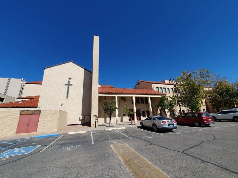
First United Methodist Church Albuquerque Marker
| 1 ► New Mexico, Bernalillo County, Albuquerque — First United Methodist Church Albuquerque — |
| Near 4th Street Southwest north of Coal Avenue Southwest, on the right when traveling north. | |||
| 2 ► New Mexico, Bernalillo County, Albuquerque, Downtown — Villa Mathias — (E. J. Marchant House) — |
| On Brother Mathias Place Northwest at Granite Avenue Northwest, on the left when traveling north on Brother Mathias Place Northwest. | |||
| 3 ► New Mexico, Bernalillo County, Albuquerque, Nob Hill — SR 1868 — Immanuel Presbyterian Church — |
| On Carlisle Boulevard SE at Silver Avenue SE, on the left when traveling south on Carlisle Boulevard SE. | |||
| 4 ► New Mexico, Bernalillo County, Albuquerque, Old Town — San Felipe De Neri — |
| On North Plaza Street NW, on the right when traveling west. | |||
| 5 ► New Mexico, Bernalillo County, Albuquerque, Old Town — The Mother Church of Albuquerque — |
| On North Plaza Street NW west of San Felipe Street NW, on the right when traveling west. | |||
| 6 ► New Mexico, Bernalillo County, Albuquerque, Old Town — Welcome to Patio Escondido — |
| On San Felipe Street NW north of Church Street NW, on the right when traveling north. | |||
| 7 ► New Mexico, Bernalillo County, Albuquerque, Raynolds Addition — St. John's Cathedral — |
| On Silver Avenue Southwest at 4th Street Southwest, on the left when traveling west on Silver Avenue Southwest. | |||
| 8 ► New Mexico, Cibola County, Cubero — Pueblo of Ácoma — |
| Near Indian Service Route 30 near Interstate 40. | |||
| 9 ► New Mexico, Cibola County, Laguna — San José De La Laguna Mission — |
| On Interstate 40 at milepost 113.5, on the right when traveling east. | |||
| 10 ► New Mexico, Doña Ana County, Anthony — Butterfield Trail/Espejo's Expedition — /On the Camino Real — |
| Near Interstate 10. | |||
| 11 ► New Mexico, Doña Ana County, Doña Ana — Shalam Colony — 1884-1901 — |
| On State Road 185 at milepost 5.5 at Shalam Colony Trail, on the right when traveling south on State Road 185. | |||
| 12 ► New Mexico, Lincoln County, Fort Stanton — Chapel — |
| On Black Jack Pershing Road near State Road 220, on the right when traveling west. | |||
| 13 ► New Mexico, Lincoln County, Lincoln — 12 — San Juan Church — |
| On U.S. 380 at milepost 97.8, on the right when traveling east. | |||
| 14 ► New Mexico, Rio Arriba County, Chimayo — Santuario de Chimayó — |
| On Sanctuario Drive - County 94C, 0.2 miles west of Juan Medina Road (County Road 98), on the right. | |||
| 15 ► New Mexico, Rio Arriba County, El Rito — Welcome to the Church of San Juan Nepomuceno — |
| On State Road 554 near Placitas Road (State Road 215). | |||
| 16 ► New Mexico, Rio Arriba County, Ohkay Owingeh — Shrine of Our Lady of Lourdes — Constructed 1889-1890 — |
| On State Road 291, 0.1 miles south of State Road 74, on the left when traveling south. | |||
| 17 ► New Mexico, San Juan County, Nageezi — Chaco: A World Heritage Site — A Place the Whole World Honors — |
| 18 ► New Mexico, San Miguel County, Las Vegas — Temple Montefiore 1884 — |
| On Douglas Avenue near 6th and Douglas. | |||
| 19 ► New Mexico, San Miguel County, Pecos — Last Church — Pecos National Historical Park — |
| Near Ancestral Sites Trail near Peach Drive. | |||
| 20 ► New Mexico, San Miguel County, Pecos — Mission Churches — Pecos National Historical Park — |
| Near Ancestral Sites Trail at Peach Drive. | |||
| 21 ► New Mexico, San Miguel County, Pecos — 203 — Pecos National Historical Park — |
| On State Highway 63, 1.1 miles south of State Highway 50, on the right when traveling south. | |||
| 22 ► New Mexico, San Miguel County, Pecos — Practical Adaptations — Pecos National Historical Park — |
| Near Ancestral Sites Trail at Peach Drive. | |||
| 23 ► New Mexico, San Miguel County, Pecos — Pueblo Revolt — Pecos National Historical Park — |
| Near Ancestral Sites Trail at Peach Drive. | |||
| 24 ► New Mexico, San Miguel County, Pecos — San Antonio de Padua Catholic Church — |
| On St. Anthony's Loop east of North Main Street, on the right when traveling south. | |||
| 25 ► New Mexico, Sandoval County, Corrales — Iglesia de San Ysidro — |
| On Old Church Road, 0.3 miles west of Corrales Road (State Road 448), on the left when traveling west. | |||
| 26 ► New Mexico, Sandoval County, Santo Domingo Pueblo — 99 — The Mormon Battalion — |
| On West Frontage Road (U.S. 85), on the left when traveling north. | |||
| 27 ► New Mexico, Santa Fe County, Agua Fria Village — San Isidro Catholic Church — |
| On Agua Fria Street (El Camino Real) (County Road 66) 0.5 miles east of Lopez Lane, on the right when traveling east. | |||
| 28 ► New Mexico, Santa Fe County, Los Cerrillos — St. Joseph's Church — Built 1922 — |
| On 1st Street at East Waldo Street, on the right when traveling north on 1st Street. | |||
| 29 ► New Mexico, Santa Fe County, Nambe Pueblo — The St. Francis Women's Club — Nambe Pueblo — |
| On State Road 503, 3.2 miles east of U.S. 84, on the right when traveling west. | |||
| 30 ► New Mexico, Santa Fe County, Santa Cruz — Santa Cruz de la Cañada / Santa Cruz Plaza on the Camino Real — |
| On South McCurdy Road (County Road 583) 0.1 miles north of Santa Cruz Road (State Road 76), on the left when traveling north. | |||
| 31 ► New Mexico, Santa Fe County, Santa Fe — 1630 — |
| On East Palace Avenue east of Cathedral Place, on the right when traveling east. | |||
| 32 ► New Mexico, Santa Fe County, Santa Fe — 5 — 1680 — Commemorative Walkway Park — |
| Near Paseo de Peralta near Otero Street. | |||
| 33 ► New Mexico, Santa Fe County, Santa Fe — 1850 — |
| On East Palace Avenue east of Cathedral Place, on the right when traveling east. | |||
| 34 ► New Mexico, Santa Fe County, Santa Fe — 16 — 1960 — Commemorative Walkway Park — |
| Near Paseo de Peralta near Otero Street. | |||
| 35 ► New Mexico, Santa Fe County, Santa Fe — 18 — 1982 — Commemorative Walkway Park — |
| On Paseo de Peralta near Otero Street. | |||
| 36 ► New Mexico, Santa Fe County, Santa Fe — Barrio de Analco — |
| On Old Santa Fe Trail at East De Vargas Street, on the right when traveling south on Old Santa Fe Trail. | |||
| 37 ► New Mexico, Santa Fe County, Santa Fe — Fray Angélico Chávez — (1910 – 1996) — |
| On Washington Avenue, 0.1 miles north of East Palace Avenue, on the right when traveling south. | |||
| 38 ► New Mexico, Santa Fe County, Santa Fe — Kateri Tekakwitha — 1656–1680 — |
| On Cathedral Place at East San Francisco Street, on the right when traveling north on Cathedral Place. | |||
| 39 ► New Mexico, Santa Fe County, Santa Fe — La Castrense — † 1760–1859 — |
| On East San Francisco Street at Santa Fe Plaza, on the right when traveling east. | |||
| 40 ► New Mexico, Santa Fe County, Santa Fe — 574 — Mother Magdalen and the Sisters of Loretto (1852-1968) — |
| On East Alameda Street at Old Santa Fe Trail, on the left when traveling west on East Alameda Street. | |||
| 41 ► New Mexico, Santa Fe County, Santa Fe — San Miguel Church — |
| 42 ► New Mexico, Santa Fe County, Santa Fe — Sisters of Charity — |
| Near Interstate 25 at milepost 269,, 1.5 miles west of Waldo Canyon Road (County Road 57). | |||
| 43 ► New Mexico, Santa Fe County, Santa Fe — Site of Santa Fe’s First Chapel — Demolished 1714 — |
| On Washington Avenue at East Palace Avenue, on the left when traveling north on Washington Avenue. | |||
| 44 ► New Mexico, Santa Fe County, Santa Fe — The Labyrinth — |
| On Cathedral Place north of East San Francisco Street, on the right when traveling north. | |||
| 45 ► New Mexico, Santa Fe County, Santa Fe — The Santa Fe Trail — Santa Fe Trail National Scenic Byway — |
| Near Old Santa Fe Trail south of East De Vargas Trail. | |||
| 46 ► New Mexico, Socorro County, Socorro — 592 — Church of the Epiphany — |
| On Fisher Avenue east of Frassinet Street, on the left when traveling east. | |||
| 47 ► New Mexico, Socorro County, Veguita — Las Nutrias — |
| On State Road 304, 3.3 miles north of U.S. 60, on the right when traveling north. | |||
| 48 ► New Mexico, Taos County, Ojo Caliente — Santa Cruz — † † † — |
| On State Road 414 just west of U.S. 285 when traveling west. | |||
| 49 ► New Mexico, Taos County, Ranchos de Taos — San Francisco de Asis Church — Ranchos de Taos, New Mexico — |
| On State Road 68 at milepost 28.3 at St. Francis Plaza, on the right when traveling north on State Road 68. | |||
| 50 ► New Mexico, Taos County, Rio Lucio — Pueblo of Picuris — |
| On State Road 75 at BIA 201 (Connector Road 201 Connector Road), on the left when traveling east on State Road 75. | |||
| 51 ► New Mexico, Taos County, Taos — Guadalupe Plaza — Historic District — |
| On Camino de la Placita at Ranchitos Road, on the right when traveling south on Camino de la Placita. | |||
| 52 ► New Mexico, Taos County, Taos — Padre Antonio José Martínez — 1793 – 1867 — |
| On South Plaza at La Fonda Alley on South Plaza. | |||
| 53 ► New Mexico, Taos County, Taos Pueblo — Taos Pueblo — |
| Near Pueblo Street east of Veterans Highway, on the right when traveling north. | |||
| 54 ► New Mexico, Taos County, Trampas — Las Trampas — |
| On State Road 76, on the right when traveling east. | |||
| 55 ► New Mexico, Torrance County, Abó — A Grander Church/Una iglesia más grande — Salinas Pueblo Missions National Monument — |
| Near Abó Ruins Road (State Road 513) 0.6 miles north of U.S. 60, on the left when traveling north. | |||
| 56 ► New Mexico, Torrance County, Abó — A Kiva Here?/¿Una kiva aquí? — Salinas Pueblo Missions National Monument — |
| Near Abó Ruins Road (State Road 513) 0.7 miles north of U.S. 60, on the left when traveling north. | |||
| 57 ► New Mexico, Torrance County, Abó — Crossroads/El cruce — Salinas Pueblo Missions National Monument — |
| Near Abó Ruins Road (State Road 513) 0.7 miles north of U.S. 60, on the left when traveling north. | |||
| 58 ► New Mexico, Torrance County, Abó — New Songs/Cantos Nuevos — Salinas Publo Missions National Monument — |
| Near Abó Ruins Road (State Road 513) 0.7 miles north of U.S. 60, on the left when traveling north. | |||
| 59 ► New Mexico, Torrance County, Abó — People at Work/Manos a la obra — Salinas Pueblo Missions National Monument — |
| Near Abó Ruins Road (State Road 513) 0.7 miles north of U.S. 60, on the left when traveling north. | |||
| 60 ► New Mexico, Torrance County, Abó — Prayers and Hymns/Rezos e himnos — Salinas Pueblo Missions National Monument — |
| Near Abó Ruins Road (State Road 513) 0.6 miles north of U.S. 60, on the left when traveling north. | |||
| 61 ► New Mexico, Torrance County, Mountainair — Abo Ruins — Salinas Pueblo Misson National Monument — |
| On Abo Ruins Road. | |||
| 62 ► New Mexico, Torrance County, Mountainair — 76 — Abó Ruins — Salinas National Monument — 3/4 Mile North — |
| On U.S. 60 at New Mexico Highway 513, on the right when traveling west on U.S. 60. | |||
| 63 ► New Mexico, Torrance County, Mountainair — 684 — Gran Quivíra Ruins — Salinas National Monument — 1 Mile South |
| On Quivira Flats Road (State Highway 55 at milepost 37), on the left when traveling west. Reported unreadable. | |||
| 64 ► New Mexico, Torrance County, Mountainair — 79 — Quarai Ruins — Salinas National Monument — 1 Mile West — |
| On Manzano Quarai Road (State Highway 55 at milepost 70) at County Road B076, on the left when traveling north on Manzano Quarai Road. | |||