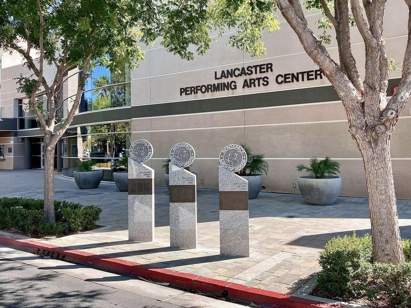
On Lancaster Boulevard east of Fern Avenue, on the right when traveling east.
Lt. Colonel Fitzhugh L. "Fitz" Fulton, Jr., USAF
Fitz Fulton flew more than
16,000 flight hours in 235 different aircraft types. He tested
most of the military bombers
and transports developed between 1950 and 1990.
Some . . . — — Map (db m278491) HM
On Lancaster Boulevard, on the right when traveling east.
This monument is dedicated to
the brave men and women that honorable served
in the Armed Forces of the United States of America
in time of peace, wars and conflict.
The freedom of this great nation is only possible
because of the sacrifice of . . . — — Map (db m66336) WM
In sacred memory of those who
made the supreme sacrifice in all wars
for the United States of America.
Sponsored by the City of Long Beach
and the United Veterans Council,
1973 — — Map (db m248235) WM
On Old Depot Plaza Road south of Devonshire Street, on the right when traveling south.
During the 50th Anniversary of the end of
WWII, we proudly dedicate this Veterans' Memorial
to all veterans who have served these magnificent
United States of America and who have preserved
the Freedom and Democracy for all people.
Dedicated on . . . — — Map (db m236989) HM WM
Near Hill Street south of 5th Street, on the right when traveling south.
To honor
General John Joseph Pershing,
1860 - 1948,
graduate West Point, Captain in
Spanish-American war, Commander Mexican Expeditionary Forces, Commander American Forces World War I, Chief of Staff and General of the Armies of the United . . . — — Map (db m231333) HM
On Los Angeles Street just west of Alameda Street, on the right.
In Honor
Homage to Our Mexican-American heroes,
veterans of America's wars.
Covered with glory, their ideals of service provide power to America, for peace and for human dignity. Long live America during this time of such power. . . . — — Map (db m153408) HM WM
On Stadium Way west of California Route 110, on the right when traveling west.
Designed as the largest enclosed structure without columns in the world by noted California architects Robert Clements & Associates, this Art Deco building, constructed between 1938 and 1941 by the WPA, is the largest and second-oldest Navy Reserve . . . — — Map (db m147662) HM
On Zelzah Avenue at Chatsworth Street, in the median on Zelzah Avenue.
This memorial is dedicated
to all Veterans who have served their country in
all branches of the
Armed Forces of the
United States of America. — — Map (db m181398) WM
Near Western Heritage Way just south of Zoo Drive, on the left when traveling south.
Before there was an Autry Museum, the current Los Angeles Zoo or Interstate 5,
this broad, flat portion of Griffith Park was an airfield, first for pioneering aviators
and later for the National Guard. This site - aircraft hangers and all - . . . — — Map (db m259092) HM
Near Haynes Street 0.2 miles west of Balboa Boulevard, on the left when traveling west.
On this site of Birmingham Hospital,
1943-1950, Veterans returning from
World War II were given renewed
confidence and hope by the dedicated
personnel who cared for them. Their legacy of pride and courage
remains here as an incentive . . . — — Map (db m192055) HM
Near San Pedro Street north of 3rd Street, on the right when traveling north.
Dedicated in honor of the Americans of Japanese heritage who gave their lives in the defense of our
Country and the freedom of other nations. May their sacrifice be honored and remembered forever.
To Forget will be Dishonor.
To Remember . . . — — Map (db m230719) WM
Near Washington Boulevard 0.1 miles east of Normandie Avenue, on the left when traveling east.
In Memoriam - U.S.S. Maine -
destroyed in Havana Harbor
February 15th 1898.
This tablet is cast from metal recovered from the U.S.S. Maine. — — Map (db m227337) HM WM
Near Mission Hills Road 0.2 miles west of Indian Hills Road.
Army - Marines - Navy - Air Force - Coast Guard
Throughout our nation's history,
Armenian-Americans have served nobly and
selflessly in the United States military. This garden
is dedicated to the sacrifices they made and
their undying . . . — — Map (db m272494) WM
Near Victory Boulevard at Cahuenga Boulevard, on the right when traveling west.
“Soldiers rest thy warfare o’er,
Dream of fighting fields no more,
Sleep the sleep that knows not breaking,
Morn of toil, nor night of waking.”
- Sir Walter Scott — — Map (db m150057) HM
On Pacific Avenue south of Meyler Road, on the right when traveling north.
Juan Rodriquez Cabrillo, exploring for Spain, discovered Alta California and named San Pedro Bay, “Bahia de los Fumos” (Bay of Smokes), October 1542. The smoke on the Bay shore came from the native Suang-Na Indian Fires. Sebastian Vizcaino named . . . — — Map (db m127129) HM
Fort MacArthur: Beginnings
1888
September 14,
Executive order by President
Grover Cleveland assigns
unnamed Military Reservation
to improve the defenses of the
Los Angeles Harbor.
1897 & 1910
Additional . . . — — Map (db m248112) HM
On April 19, 1989, a powder explosion occurred in Turret 2 while IOWA was conducting peace-time gunnery drills off the island of Viesques, Puerto Rico. Preparing to fire, the center gun's powder bags exploded before the breech was closed. The . . . — — Map (db m70263) HM
On Figueroa Street at 18th Street, on the right when traveling south on Figueroa Street.
Veterans Hideaway, Movie Set - Memorial Did It All
Patriotic Hall stands as a monument of
civic appreciation to veterans from the
Civil War to the Iraqi War, and to veterans of wars yet unfought.
It is where presidents and . . . — — Map (db m238808) HM
On State Drive 0.2 miles west of Figueroa Street, on the right when traveling east.
Widely used by the U.S. Navy and by other countries around the world, the F/A-18 Hornet is built to handle rough landings on aircraft carriers and flying in all kinds of weather. By selecting special equipment to add to the outside of the aircraft, . . . — — Map (db m215942) HM
On Lopez Canyon Road at Kagel Canyon Road, on the left when traveling east on Lopez Canyon Road.
Dedicated to the Men and Women of the United States
Armed Forces who made the
supreme sacrifice and to those
who served our Country with
Honor and Dignity.
"They Served Us Then.
We Honor Them Now." — — Map (db m181026) WM
On Sherman Way just east of Louise Avenue, on the left when traveling east.
Dedicated
to those who have served in
the Armed Forces of the
United States and to those
who gave their lives for
their country. — — Map (db m178067) HM WM
On Eisenhower Avenue just west of Bonsall Avenue, on the left when traveling west.
Established by Act of Congress, 1887, as
National Home for Disabled Volunteer
Soldiers. Area includes land from ranchos
Santa Monica y San Vincente and San Jose
de Buenos Ayres. Succeeded by U.S. Veterans
Administration in 1930. Present area . . . — — Map (db m219860) HM
On Lincoln Boulevard (California Route 1) at West Manchester Avenue, on the right when traveling north on Lincoln Boulevard.
With the vision of universal freedom for all mankind, this tree is dedicated to Col. Roosevelt Hestle and all prisoners of war and missing in action. — — Map (db m204273) HM
On Sepulveda Boulevard 0.3 miles north of Wilshire Boulevard, on the right when traveling north.
Civil War Dead
An estimated 700,000 Union and Confederate soldiers died in
the Civil War between April 1861 and April 1865. As the death
toll rose, the U.S. government struggled with the urgent but
unplanned need to bury fallen . . . — — Map (db m280704) HM
At 10:30 p.m., 29 October 1969, the first ARPANET
message was sent from this UCLA site to the Stanford
Research Institute. Based on packet switching and dynamic
resource allocation, the sharing of information digitally
from this first node . . . — — Map (db m218307) HM
Near Sepulveda Boulevard 0.3 miles north of Wilshire Boulevard, on the right when traveling north.
By direction of the President, under the Joint
Resolution of Congress approved 12 July 1862 (amended by
act of 3 March 1863, act of 9 July 1918 and act of 25
July 1963), the Medal of Honor for conspicuous gallantry
and intrepidity at risk of . . . — — Map (db m258619) HM
Near Sepulveda Boulevard 0.3 miles north of Wilshire Boulevard.
National Home
In 1887, the U.S. Congress approved funding for the Pacific
Branch of the National Home for Disabled Volunteer Soldiers
(NHDVS). Three individuals donated land for the 640-acre
site located 14 miles west of Los . . . — — Map (db m219686) HM
Drum Barracks, Officers’ Quarters, 1862 - 1868.
Supply Depot, Department of
the Southwest, U.S. Army.
In memory of the historic past of this
building and the importance of its
association with early American
history in California. . . . — — Map (db m52631) HM
On East Avenue P near 25th Street East, on the left when traveling east.
SN M-024
Date Acquired 6-27-07
From Oklahoma City
Date Displayed 6-27-07
The Hound Dog was originally designated B-77, was re-designated
GAM-77 and then became the AGM-28. North American Aviation
designed the missile so . . . — — Map (db m279793) HM
Near East Avenue P, on the left when traveling east.
Manufacturer: Northrop Grumman Corporation
Production Period: 1993 to 1997
Number Produced: 21
Production Series: Production Blocks 10, 20, and 30
Roles: Originally designed as a land-based all-weather intercontinental . . . — — Map (db m47722) HM
On East Avenue P near 25th Street East, on the left when traveling east.
Riedenauer was born in Fresno, California in
1916. Bob Riedenauer flew the F-104 we have at the
Airpark. He is the only test pilot to have flown the
U-2, the SR-71 and the F-117, highlighting a
military and civilian flight test career that . . . — — Map (db m279806) HM
On East Avenue P near 25th Street East, on the left when traveling east.
F-105
A/C SN: 62-4416
Date Acquired: August 1998
From: Loan, USAF George AFB, CA
Displayed: October 1998
Manufactured by Republic Aviation, Farmingdale NY and gained
by the USAF on 27 Nov 1963.
1964: To 4th . . . — — Map (db m279608) HM
On East Avenue P near 25th Street East, on the left when traveling east.
A/C SN: 164350
Date Acquired: October, 2006
From: Loan, US Navy
Displayed: December, 2006
Built by Grumman Corp. (now Northrop Grumman Corp.), the
F-14 Tomcat spent more than 30 years in service. The fighters
were . . . — — Map (db m279799) HM
On East Avenue P, on the left when traveling west.
James J. Stegman
1920 - 2009
Born Aug 23, 1920, in Offerle, Kansas. He was the 6th son of 18 children. In 1940, he joined the U.S. Marine Corps as a Private. As he worked up in rank to Sergeant, he also was sent to pilot school. He received . . . — — Map (db m47729) HM
On East Avenue P east of 20th Street East, on the left when traveling east.
Joseph "Joe" Potter Davies, Jr., was born in 1923 and joined the Army Air Corps in 1943. By the
time he had finished training, World War II had come to an end, but he continued his military
career. Joe married his wife, Audria, "Audie," in . . . — — Map (db m279362) HM
Near East Avenue P, on the right when traveling west.
Stanley P Butchart
1928 - 2008
After receiving primary and secondary civilian pilot training. Butchart enlisted in the U.S. Navy in July 1942. Upon his completion of flight training at Corpus Christi, Tex., he joined torpedo-bomber Air . . . — — Map (db m47723) HM
Donated by the United Veterans of the Republic to
El Monte Cemetery on July 2, 1929 during the Patriotic
4th of July Program, in tribute to the war veterans
buried there, The 7-inch trench siege mortar was obtained
from Benica Arsenal. It was . . . — — Map (db m131648) HM
On Mission Drive near Santa Anita Street, on the right when traveling north.
Be it known by all who read these words that this Veterans War Memorial is dedicated to those men and women from San Gabriel who so gallantly served their country in times of national peril.
Dedicated April 24, 1963, The Fiftieth . . . — — Map (db m66584) WM
Near U.S. 101 0.2 miles south of Alexander Avenue, on the right.
This is a memorial to every one who ever sailed out of the Golden Gate in the service of their country - in the Navy, the Marine Corps, the Coast Guard, the Merchant Marine.
A ship heading for sea passes directly by this spot at the northern . . . — — Map (db m69495) WM
Built in 1911, this concrete barracks building could house 686 men. By WW II, Fort McDowell has quarters for about 4,500 soldiers, including fourteen additional wooden barracks that once stood between the baseball field and this 600-man barracks. . . . — — Map (db m69276) HM
The Post Exchange, or PX, was built in 1910 to be a “one stop shopping place” for soldiers at Fort McDowell. Soldiers purchased clothing toiletries, and other supplies here. The PX also offered a restaurant, soda fountain, barbershop, . . . — — Map (db m69279) HM
Completed in 1911, the Administration Building was Fort McDowell’s clerical headquarters. This is where all “official mail” was distributed and personnel paperwork was processed.
The Pay Section, Discharge Officer, and Sergeant Major’s offices . . . — — Map (db m203627) HM
Fort McDowell’s North Garrison was built in 1942 on the area below following the 1941 attack on Pearl Harbor. North Garrison included several barracks, a 1600-man mess hall, an infirmary, a guard house, and a post exchange. It also included the . . . — — Map (db m70259) HM
On Perimeter Road, on the left when traveling north.
Construction for this 70-bed hospital began in 1911. The hospital treated soldiers returning from overseas for discharge. In 1918, the hospital annex was added to care for men with lingering illnesses.
During the Nike Missile period . . . — — Map (db m316223) HM
On Main Street (State Highway 1), on the right when traveling south.
Established in this vicinity June 11, 1857 by 1st Lieutenant Horatio Gate Gibson, 3rd Artillery, later Brigadier General, US Army. Named by Gibson in honor of his former company commander, Braxton Bragg, later General, C.S.A. Abandoned in October . . . — — Map (db m10585) HM
On North Franklin Street, on the right when traveling north.
The last remaining structure and once the original quartermaster’s storehouse and commissary of Fort Bragg Military Post 1857-1864, then located near Laurel and Redwood Avenues. — — Map (db m10586) HM
Opened in 1941 as Army Air Corps Basic Flying School, its mission was pilot and aircrew training. In 1943 it was renamed Merced Army Airfield, and in 1948 the base was again renamed to Castle Air Force Base after Brigadier General Frederick W. . . . — — Map (db m219440) HM
Dedicated
To those men of the
First Marine Division – FMF
Who gave their lives
in the service of
their County
World War II, Korea, Vietnam
Southwest Asia — — Map (db m38742) HM
These trees are dedicated to the memory of those United States Submariners who made the ultimate sacrifice, so that we might live in freedom. — — Map (db m38981) HM
On N Street at West Main Street, on the right when traveling south on N Street.
Merced Army Airfield, later Castle Air Force Base, opened it’s first office in this building on October 15, 1941.
Commanding Officer: Colonel Joseph Bailey
Plaque placed during the celebration of the 50th anniversary, October 6, . . . — — Map (db m259598) HM
On Bridge Street at Mail Street, on the left when traveling west on Bridge Street.
Monument marks site of old Fort Bidwell military post, established in August, 1865, to protect pioneer settlers of this vicinity from marauding bands of Indians. Abandoned as an Army post in 1892. — — Map (db m240313) HM
Near Main Street (State Highway 395) at School Street.
Presented to the town of Bridgeport by J. S. Cain in 1914. Built in 1881 by J. Renault, machinist for the Standard Co. of Bodie, Calif. This cannon was never fired. — — Map (db m10323) HM
On South Tufa Entrance Road just north of State Road 120, on the right when traveling north.
During the Cold War, Mono County was home to one of many remote facilities used by the US Military to test new weapons and weapons systems. A "secret military installation" operated by the US Navy was located along the south shoreline of Mono . . . — — Map (db m20739) HM
Soldiers once guarded this shoreline against sea-borne attack, but one force proved too powerful to stop. Coastal erosion, the wearing away of these bluffs and beaches by ocean waves, has been steadily moving the coastline inland here since sea . . . — — Map (db m157374) HM
Soldiers once guarded this shoreline against sea-borne attack, but one force proved too powerful to stop. Coastal erosion, the wearing away of these bluffs and beaches by ocean waves, has been steadily moving the coastline inland here since sea . . . — — Map (db m157375) HM
Four miles of beaches and nearly 1000 acres of coastal dunes became part of the California State Parks system in 2007, after superfund cleanup activities were completed on this section of the former Fort Ord Military Reservation. Army use preserved . . . — — Map (db m68884) HM
The American Legion was chartered by Congress in 1919 as a patriotic veterans organization. Focusing on service to veterans, servicemembers, and communities, the Legion evolved from a group of war-weary veterans of World War I into one of the most . . . — — Map (db m143558) HM
This old Spanish fort began as eleven guns behind a crude parapet of logs overlooking the anchorage of Monterey Bay in 1972. The battery was strengthen and enlarged over the years and served as the principal fort in Monterey for both the Spanish and . . . — — Map (db m63107) HM
Erected in memory of Roger Stanley Fitch
Colonel United States Army, Retired. Founder and president 15 years of the Monterey History and Art Assn, LTD. Commanding Officer, Presidio of Monterey, 1928-1930, Fort Ord, 1941-1943. Member of Rough . . . — — Map (db m196676) HM
Spanish:
La Armada Argentina
A traves de los estudiantes pretenecientes al consejo Argentino de intercambio estudiantil – CADIE recuedrdan el 161 aniverdario en que el capitan de navio Dn. Hipolito Bouchard hizo flamear el . . . — — Map (db m63074) HM
On Stillwell Avenue, on the left when traveling north.
Dedicated to the memory of
Brigadier General John Weckerling
1896 - 1989
John Weckerling, the founder of the Defense
Language Institute, had a long and distinguished
career of service to the nation, he joined
the Army in 1917 during . . . — — Map (db m235931) HM
Dedicated to the memory of
Judge John Fujio Aiso
1909-1987
Aiso was the first director of academic training of the military
intelligence service language school (MISLS), predecessor of
the Defense Language Institute. He was born in . . . — — Map (db m283146) HM
The first Filipino Infantry Regiment was activated July 13, 1942 at the Salinas California Rodeo Grounds. The Second Filipino Infantry Regiment was activated November 22, 1942 at Fort Ord. Personnel were Filipinos living in the United States then . . . — — Map (db m28040) HM
On Bank Street west of Bennett Street, on the right when traveling west.
Last on duty at Fort Point on San Francisco Bay. Grass Valley Women’s Improvement Club arranged with the U.S. War Department for donation to be placed in City Square, now Dow Alexander Park. Transferred from Benicia Arsenal to here in 1911. Only . . . — — Map (db m48675) HM
Cannon have long been used to memorialize military campaigns. Purely commemorative, the two cannon flanking town square are permanently sealed, never having been fired in battle. Dating from the 19th century, these once belonged to the French . . . — — Map (db m290002) HM
The Air Base was one of the largest of its kind in the nation. It was activated in February of 1942. Pilots trained here for Europe and the Pacific during World War II. — — Map (db m58598) HM
Near Brookhurst Street near Heil Avenue, on the right.
Navy purchased the land in 1943. Fixed wing planes used the airstrip into the 1950's. In 1952 Marine Helicopter pilots practiced take-offs and landings at this site up through the Vietnam era. — — Map (db m59761) HM
On June 27, 1943,
near this site, a
P-38 fighter plane
on a training
mission from March
Air Force Base
crashed on the beach,
killing four children
and injuring dozens
of others.
With this marker we pay tribute to both the Silva and . . . — — Map (db m215822) HM
The opening of the U.S. Marine Corps Air Station, El Toro,
forever changed The Irvine Ranch. From March 17, 1943
until the summer of 1999, the station trained military aviators
to serve the nation in war and
peace.
The progression . . . — — Map (db m244151) HM
Near Trabuco Road 0.3 miles north of El Toro Road, on the right when traveling north.
With grateful recognition for all who have served the cause of freedom in the armed forces of the United States. The flag flies in memory of El Toro Memorial Park — — Map (db m210731) WM
Near 25751 Trabuco Road 0.3 miles north of El Toro Road, on the right when traveling north.
The Trustees of the Orange County Cemetery District hereby dedicate this section of the El Toro Memorial Park to all veterans of the armed forces who have served our country with honor, dignity and pride.
"...Let no wanton foot tread rudely on . . . — — Map (db m214018) WM
The City of Mission Viejo
honors as a distinguished resident
Colonel Aaron Bank,
who is widely acknowledged as the
founder of the U.S. Special Forces,
having convinced the Army of the
meed for an elite fighting wait of this
kind and having . . . — — Map (db m215658) HM
The City of Mission Viejo honors and Recognizes the brave and dedicated service provided by the U.S. Armed Forces and in support of their efforts Mission Viejo proudly adopts the men, women, and families of the Headquarters Battalion First Marine . . . — — Map (db m215656) WM
Dedicated to the valiant members of the historic Mormon Battalion who stopped here on March 20, 1847, as they marched from San Diego to Los Angeles. A division of the U.S. Army of the West, these brave soldiers, trusting in God, overcame incredible . . . — — Map (db m50351) HM
In 2003, the citizen of Newport Beach adopted the 1st Battalion, 1st Marines, 1st Marine Division. The city dedicates this memorial in honor of the men and women of 1/1 who paid the ultimate price in defending and preserving our nation and our . . . — — Map (db m196757) WM
On Rocklin Road, on the right when traveling south.
This memorial is dedicated in memory
of all the men and women from the
Rocklin area who made the sacrifice
to protect our lives and property
while serving in the Armed Forces
of the United States of America.
We stand in deep . . . — — Map (db m22992) HM
In Memory of Our Heroic Dead
Manfred W. Astill • George W. Baker • Joseph A. Bews • Gerald F. Bush • Alyn W. Butler • Gregory Collins • Thomas W. Dorsey • William Ely • Joaquin M. Gayaldo • James R. Goddard • Charles W. Gray • Claude . . . — — Map (db m91370) WM
Near Hobsonway Road, on the left when traveling east.
Blythe Army Air Base was constructed during 1942 to train heavy bomber crews.
127 officers and men recevied orders in February 1943, to form 4 squadrons of the 390th Bombardment Group (H).
The 390th B-17s joined the 8th Air Force in England . . . — — Map (db m78572) HM
Near Chiriaco Road near Summit Road, on the right when traveling west.
The way Leonardo da Vinci saw it, the problem with cannons of the time was that they took far to long to load. His solution to that problem was to build multi-barreled guns that could be loaded and fired simultaneously.
This idea forms the . . . — — Map (db m99299) HM
Near Chiriaco Road near Summit Road, on the right when traveling west.
It was in 1346 that the English first used cannons which, propelled by exploding gunpowder, fired stone balls. Despite this, progress in that area of military weaponry was not fast, and it was here Leonardo's particularly applied his thinking. This . . . — — Map (db m99298) HM
Near Chiriaco Road near Summit Road, on the right when traveling west.
The basic design of the catapult had been in use for hundreds of years before da Vinci embarked on improving it. He actually came up with different models. This particular design used a double leaf spring to produce an enormous amount of energy in . . . — — Map (db m99294) HM
Near Chiriaco Road (Business Interstate 10) just north of Summit Road, on the left when traveling east.
The D.T.C was established by Major General George S. Patton Jr. in response to a need to train American combat troops for battle in North Africa during World War II. The camp, which began operation in 1942 covered 18,000 square miles. It was the . . . — — Map (db m50700) HM
On Chiriaco Road near Summit Road, on the right when traveling west.
There are several designs for horse-drawn scythed chariots among Leonardo's sketches.
The first involved the use of four large scythes which were mounted in a manner similar to helicopter blades. Leonardo was a peaceable man who despised war, . . . — — Map (db m99297) HM
Near Chiriaco Road north of Interstate 10, on the left when traveling east.
[This is a four sided monument displaying three different markers:]
Desert Training Center
Camp Young
Maj. Gen. George S. Patton Jr., U.S. Army, selected Camp Young as headquarters site for the Desert Training Center in . . . — — Map (db m32139) HM
On Rice Road (Route 177) at Coxcomb Monument Road, on the left when traveling south on Rice Road.
The Palen Pass Maneuver Area was the largest training zone within the Desert Training Center/California-Arizona Maneuver Area. Various exercises occurred, including the mock battles of Palen Pass and Southern California, which involved two Divisions . . . — — Map (db m172166) HM WM
On California Route 111 at Eldorado Dr, on the right when traveling west on California Route 111.
The Eisenhower Walk of Honor allows all of us to recall the debt of gratitude owed to ordinary people for extraordinary acts of patriotism and courage. Men and women doing their duty for their country, honorably and with integrity.
This tribute . . . — — Map (db m114773) HM WM
On North Gene Autry Trail, on the left when traveling north.
The Distinguished Flying Cross
Authorized by Act of Congress 2 July, 1926
"Wall of Honor"
Dedicated on November 11, 2004
Awarded to any person who, while serving in any capacity in the Armed Forces of the United States, . . . — — Map (db m206322) WM
11832 entries matched your criteria. Entries 401 through 500 are listed above. ⊲ Previous 100 — Next 100 ⊳