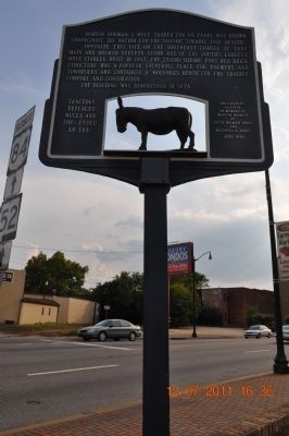
A mule trader for 65 years, was known throughout the nation for the slogan,"'Tolable' fair dealer". Opposite this site, on the southeast corner of East Main and Holman Streets stood one of the south's largest mule stables. Built in 1917, the . . . — — Map (db m83784) HM
Taylor, one of the area's oldest communities, became a small town
around 1870. Billy Taylor, son of James and Wealthy Taylor,
established the post office and was appointed the first postmaster.
Thus Taylor derived its name from the first . . . — — Map (db m179475) HM
(side 1)
The History of Paint Rock, Alabama
Originally Camden circa 1830, the post office was renamed Redman in 1846 and became Paint Rock on May 17, 1860. After the Memphis and Charleston Railroad Co. built a depot and water . . . — — Map (db m69756) HM
Robert T. Scott, born in 1800 into a prominent North Carolina family who originally settled in Maryland, founded the Alabama town that bears his name. Between 1848 and 1858, he acquired 1,240 acres of choice land in the heart of Jackson County. . . . — — Map (db m166957) HM
Bright Star
In 1907, Greek immigrant Tom Bonduris invested his savings and opened a small cafe with only a horseshoe shaped bar at First Avenue and 21st Street in Bessemer, Alabama. Outgrowing three locations, the Bright Star moved to this . . . — — Map (db m83797) HM
This house was built in 1906 by architect William E. Benns for H. W. Sweet at a cost of $10,000. The house uniquely blended the Queen Anne and Neo-Classical architectural styles, featuring two identical pedimented entrance porticos supported by . . . — — Map (db m27024) HM
The Fourth Avenue "Strip" thrived during a time when downtown privileges for blacks were limited. Although blacks could shop at some white-owned stores, they did not share the same privileges and services as white customers, so they created tailor . . . — — Map (db m26985) HM
The arrival of two railroad lines in Jones Valley opened nearby deposits of iron ore, limestone, and coal to commercial development and helped make Birmingham one of the great industrial cities of the post Civil War South.
In 1871, the year of . . . — — Map (db m69018) HM
Built 1913, 310 18th St. N.
The Alabama Penny Savings Bank, founded by Sixteenth Street
Baptist Church pastor Rev. William R. Pettiford, was Alabama's
first Black-owned bank and the second-largest Black bank in the
country by 1907. He . . . — — Map (db m188950) HM
Red Mountain, where you are standing, and Jones Valley, which stretches before you, were sites of human activity long before Birmingham's founding in 1871.
Native American presence
Recorded history and archaeological evidence indicate the . . . — — Map (db m83805) HM
The Corey Land Company, a group of prominent local businessmen headed by Robert Jemison, Jr., developed Belview Heights as a neighborhood for the professional employees of U.S. Steel in the 1910's. Extending the grid system being used in Ensley over . . . — — Map (db m24351) HM
The availability of seemingly limitless mineral resources was the key to the success of the Birmingham District, an area defined by geologic deposits that span five counties (Jefferson, Shelby, Tuscaloosa, Walker and Bibb). Some of the minerals . . . — — Map (db m69026) HM
In 1884, when Birmingham was
scarcely a decade old, the L&N
Railroad laid the first tracks for
its mineral railroad, to begin
hauling ore from Red Mountain
mines to furnaces, mills, and
rail connections in Jones Valley.
By the early 1900s, . . . — — Map (db m189284) HM
Side A The Elyton Land Company, which had founded the city of Birmingham in 1871, established a subsidiary, the Birmingham Water Works Company in 1887. Dr. Henry M. Caldwell, President of the Elyton Land Company, contracted with Judge A. O. . . . — — Map (db m83806) HM
The economic center of the Black retail district was on nearby Fourth
Avenue North. This historic area also served as the main cultural, social
and religious center of Black Birmingham. Blacks felt more relaxed
among their own people in and . . . — — Map (db m187761) HM
The Process
The boiler was the source of power for most of Sloss. The boilers burned blast furnace gas to provide the heat necessary for converting water into steam. The steam produced here powered the blowing engines and turbo-blowers, the . . . — — Map (db m43728) HM
The Brock building was established in 1915, located at the intersection of Fourth Avenue and 18th Street North, was built while the area was residential. The three-story building housed a hotel upstairs that catered to professional musicians and . . . — — Map (db m26723) HM
Side 1 - Building the Park
In the mid-1930’s, civic leaders worked to move Vulcan to a place of honor on Red Mountain. The park was built through the combined efforts of several groups: the Kiwanis Club of Birmingham, the Birmingham Parks . . . — — Map (db m83807) HM
The Process
The technology of casting molten iron into bars called pigs changed dramatically over the years. Prior to 1931 casting at Sloss took place inside the cast shed. Men cut molds into the sand floor of the shed, allowing the . . . — — Map (db m69083) HM
Rev. Bevel gave Birmingham children a chance to play important roles in
the struggle for equality. As their field marshal, he turned hundreds of
recruits into an effective non-violent army that “Project C" unleashed
on the retail district. Images . . . — — Map (db m187767) HM
This building was constructed in 1908 by Louis V. Clark (1862-1934), who also built the historic Lyric Theater located nearby on 18th Street. The Clark Theater on Caldwell Park is named in honor of Mr. Clark’s generosity to the Birmingham Little . . . — — Map (db m27515) HM
The two commercial buildings on this corner lot are some of the earliest surviving business houses in Birmingham. The Dewberry building appeared on the corner about 1881, and it housed the first and longest surviving drug store in the city, starting . . . — — Map (db m36740) HM
This neoclassical structure was built in 1905 for James W. Donnelly, "the father of the Birmingham Library System."
Donnelly moved to Birmingham from his native Cincinnati, Ohio after retiring from Proctor and Gamble. A much respected . . . — — Map (db m26740) HM
Constant mistreatment by a brutal police force, a racist state government
and a White community that was either hostile or unconcerned pushed
many Blacks in Birmingham to the breaking point. Many were stuck in
low-paying, low-level jobs. Most . . . — — Map (db m187785) HM
This neighborhood developed in the 1880s as one of Birmingham's first streetcar suburbs. It was the Town of Highlands from 1887 to 1893, when it became part of the City of Birmingham. The heart of the neighborhood was Five Points Circle, a major . . . — — Map (db m83829) HM
Built 1939, 1901 3rd Ave. N.
The F. W. Woolworth department store was one of the first sites
targeted for the ACMHR and SCLC's economic boycotts and lunch
counter sit-ins of “Project C” during the April - May 1963 mass
demonstrations in . . . — — Map (db m188183) HM
Originally Sloss Furnaces had 120 beehive coke ovens on site,
each twelve feet in diameter. (similar to photo)
They were called 'beehive' as they had domed ceilings,
were built close together to maximize the benefits
of their collective heat, . . . — — Map (db m173373) HM
Prior to 1900 a "black business district" did not exist in Birmingham. In a pattern characteristic of Southern cities found during Reconstruction, black businesses developed alongside those of whites in many sections of the downtown area. . . . — — Map (db m174706) HM
The Fraternal Hotel Building was built in 1925. Some of the businesses that were located in this building included:
1925 - 1980 Fraternal Hotel
1925 - 1970 Fraternal Café
1950 - 1966 Monroe Steak House
1985 - 1994 Grand Lodge Knights of . . . — — Map (db m27518) HM
Businesses that occupied this building between 1908 - 1970
1908 - 1913 Southern Bell Telephone Company Stockroom
1915 - 1926 OK French Dry Cleaning Company
1927 - 1938 George Kanelis Billiards
1940 - 1945 Alex’s Steak House
1946 - . . . — — Map (db m27521) HM
Unfair laws forced Birmingham Blacks to create their own distinctive
world of economic and social self-reliance. The historic Black business
district extended several blocks around Kelly Ingram Park and contained
a concentration of Black-owned . . . — — Map (db m187760) HM
Despite being dominated by black labor the industrial workplace was rigidly segregated
until the 1960's. Men punched separate time clocks and bathed in separate bath houses. Following the implementation of desegregation laws in the 1960's the black . . . — — Map (db m173370) HM
Heavy industry, the reason for Birmingham’s founding, is still an economic force here today. Foundries and pipe plants dot the landscape, the railroad runs through the city’s center, and steam rises periodically in the distance from the quenching of . . . — — Map (db m69019) HM
The Industry That Built A City
The minerals needed to make iron-iron ore, coal, and limestone-are abundant in the Birmingham area, and for ninety years men turned these materials into pig iron at Sloss. Sloss pig iron was sold to foundries, . . . — — Map (db m43973) HM
Dr. Martin Luther King, Jr. replaced his initial reluctance to using
"children as foot soldiers' with approval. Thousands of newly recruited
child foot soldiers successfully marched toward the retail district, with
hundreds arrested for the . . . — — Map (db m187773) HM
Built 1934-35 (remodeled into science center 1997), 216 19th St. N.
The Loveman's Department Store (originally Loveman, Joseph, &
Loeb), was a high-and retail store targeted for economic boycotts, pickets. "Project C" coordinators . . . — — Map (db m188173) HM
The railroad trestle support wall across the road is a remnant of L&N's 156-mile Mineral Railroad, the backbone of the local iron industry. This segment ran along the north edge of Vulcan Park on its route around the Birmingham District, linking . . . — — Map (db m83831) HM
The Kiwanis Vulcan Trail follows the bed of
the old Birmingham Mineral Railroad, where
trains hauled iron ore from Red Mountain
mines to furnaces and foundries in
Birmingham. Some remnants of those
mines still remain today. The opening to
Lone . . . — — Map (db m189283) HM
Created 1972 by the Jefferson County Historical Commission, the district is based on this avenue. Morris Avenue was named for one of the founders of Birmingham, Josiah Morris, who paid $100,000 for 4,157 acres of the original site of the city in . . . — — Map (db m27156) HM
On October 1, 1886, the North Birmingham Land Company was formed to develop a planned industrial and residential town on 900 acres of land, formerly part of the Alfred Nathaniel Hawkins plantation north of Village Creek. The plan included sites for . . . — — Map (db m26700) HM
The original log structure was built c. 1820 - 1830, with the board and batten addition dating to as late as the 1860s. The log cabin was at first one and one-half stories and is believed to be the oldest structure in Shades Valley. Members of the . . . — — Map (db m26697) HM
First blast furnace in Jefferson County erected near this site (1863) by Red Mountain Coal and Iron Co. Destroyed (1865) by Federal troops: rebuilt (1873) and second furnace added. Successful experimental run made in Furnace No. 2 (1876) using . . . — — Map (db m27280) HM
Birmingham's first public school was named for Colonel James R. Powell, the city's first elected Mayor. This energetic promoter also served as the first President of the Elyton Land Company (now Birmingham Realty), which founded the city in 1871. . . . — — Map (db m83835) HM
Racial Terrorism and Convict Leasing. Thousands of black people were the victims of lynching and racial violence in the United States between 1877 and 1950 Lynching was
a form of racial terrorism that went beyond only hanging, . . . — — Map (db m173372) HM
Built 1937, 301 19th St. N.
The S. H. Kress store was another site of economic boycotts
and lunch counter sit-ins during the student-led protests of
Miles College students and their leader Frank Dukes in 1962 and
“Project C” in 1963. Retail . . . — — Map (db m188176) HM
White businessmen failed to integrate their stores and remove "Colored”
signs from water fountains and dressing rooms as promised in 1962. As
a result, Miles College students led by Frank Dukes organized a boycott
against the stores. They . . . — — Map (db m187758) HM
The mass demonstrations of “Project C” forced White Birmingham's
elite business leaders and downtown merchants back to the bargaining
table in May 1963. Once again, leaders of Black Birmingham's power
structure presented a list of demands in . . . — — Map (db m187828) HM
In addition to making iron the furnace produced a molten waste called slag. Workers drained off the slag periodically through the cinder notch, a hole at the base of the furnace. After processing, the slag was sold for use in road building and in . . . — — Map (db m83839) HM
The crossing of railroads in 1872 adjacent to this site gave rise to the industrial city of Birmingham. In 1881 Alabama railroad magnate and entrepreneur James Withers Sloss, capitalizing on the unusual coincidence of coal, iron ore and limestone in . . . — — Map (db m23498) HM
This residential area was carved from the Joseph Riley Smith plantation, a 600 acre antebellum farm, one of the largest in 19th century Jefferson County. Smithfield lies to the west of Birmingham's city center on the flat land & hills north of . . . — — Map (db m26990) HM
Construction of the stock trestle/tunnel complex was part of the extensive modernization that Sloss carried out between 1927 and 1931. Much of the work focused on mechanizing the charging operations and equipment—the stock trestle/tunnel . . . — — Map (db m69077) HM
Temple Wilson Tutwiler, II
“Tutwiler Green”, this section of Birmingham Green was so named in a resolution passed by the Birmingham City Council to honor the life and work of Temple Tutwiler II, who contributed greatly to the . . . — — Map (db m27525) HM
This row of buildings from 2009 to 2017 Second Avenue dates from the early years of the 20th century and has undergone a variety of changes and modernizations over the years. Originally part of a larger building that burned in 1944 (now the site of . . . — — Map (db m38563) HM
In the blast furnace the combination of iron ore, flux (limestone and/or dolomite), coke, and hot air produced molten iron and two waste products: molten slag and blast furnace gas. The molten products collected in the bottom of the furnace and . . . — — Map (db m69078) HM
The blast furnace required a tremendous amount of air - about two tons for every ton of iron produced. These three rooms, known collectively as the blower building, house the equipment used to pump air to the furnaces. Workers called this blast of . . . — — Map (db m43628) HM
John Valentine Coe, president of Birmingham Lumber and Coal Company, commissioned this two-story Craftsman-Tudor Revival style house in 1908. Coe, who had previously been a lumber merchant in Selma, moved his family and business to Birmingham at the . . . — — Map (db m83858) HM
Rev. Bevel and his team worked with popular disc jockeys "Tall Paul”
Dudley White and Shelley “The Playboy" Stewart, whose jive talk on the
radio was actually a secret code that told young foot soldiers when it
was time to "move out.” Despite . . . — — Map (db m187770) HM
Built 1925, 1616-1622 4th Ave. N.
Located in the Historic Fourth Avenue Business District next to
the taxi stand and Colored Masonic Temple, this building
housed one of Birmingham's few hotels for Black travelers. It
also housed restaurants . . . — — Map (db m188186) HM
The Gas System
Gas produced in the furnace as a by-product of the ironmaking process was used in the plant as fuel. A large pipe called the downcomer carried gas from the top of the furnace to the gas cleaning equipment, which removed the . . . — — Map (db m43669) HM
At the turn of the 20th century, Birmingham was a small town of two and three story buildings with a few church steeples punctuating the skyline. During the industrial boom from 1902 to 1912 which made Birmingham the largest city in the state. Four . . . — — Map (db m27500) HM
The giant, cast iron statue you see towering above you is Vulcan, the Roman god of metalwork and the forge. The 56-foot tall statue was commissioned by Birmingham leaders to represent their new, growing city at the 1904 St. Louis World's Fair. After . . . — — Map (db m26297) HM
You are standing in front of the entrance to Lone Pine Mine Number 3. This mine is one of over one hundred ore mines on Red Mountain that were active between 1860 and 1960.
In the early twentieth century, iron ore was extracted from this . . . — — Map (db m83859) HM
By the end of April 1963, the national media and local Whites were
losing interest in “Project C.” Fewer Blacks volunteered to be arrested at
downtown stores and lunch counters. So, Rev. James Bevel, a field
Secretary with the SCLC, turned to a . . . — — Map (db m187765) HM
The raw materials for making iron—iron ore, limestone and dolomite, and coke—came to Sloss by railroad and were stored in the stock bins below. An inclined, steam-driven "skip hoist" carried the stock to the top of the furnace and . . . — — Map (db m83861) HM
Designed by William C. Weston and erected in 1902, the Title Building was the second skyscraper built in Birmingham. It was the first building to supply its tenants with electric power with its own power-generating plant and the water supply was . . . — — Map (db m27501) HM
On March 3, 1899, the United States Pipe and Foundry Company was incorporated consolidating 14 iron and steel foundries in 9 states. One of these foundries, the Howard-Harrison Iron Company of Bessemer, was founded in 1889. In 1911, the Dimmick Pipe . . . — — Map (db m27526) HM
When it was first proposed in 1905 that Vulcan be placed on Red Mountain, the time was not right for such a move. But by 1935 when the idea for Vulcan Park was proposed, iron ore mining had ceased here, the mineral railroad had been abandoned and . . . — — Map (db m95335) HM
Gen. James H. Wilson, USA, having crossed the Tennessee River with a large force of well equipped cavalry, grouped them here at Elyton.
Their mission: to destroy Alabama's economic facilities for supporting the War.
From these headquarters he . . . — — Map (db m24358) HM
Mt. Zion Baptist Church began burying here in the mid-1800s. On June 2, 1970, New Grace Hill Cemetery, Inc., a subsidiary of the Booker T. Washington Insurance Company in Birmingham, purchased this cemetery and officially named it Zion Memorial . . . — — Map (db m35602) HM
In response to oppressive jobs and livelihoods such as sharecropping and tenant farming during post-Civil War Reconstruction, large numbers of African American and poor families from the Black Belt regions began to migrate towards northern, more . . . — — Map (db m220602) HM
Son of a Swedish ironmaster, Linn built Birmingham's first industry, Birmingham Car & Foundry Company (Linn Iron Works); the first bank, The National Bank of Birmingham; and the City's first park, called Linn Park.
When the population was less . . . — — Map (db m216140) HM
Lynching In America.
Thousands of black people were the victims of lynching and racial violence in the United States between 1877 and 1950. The lynching of African Americans during this era was a form of racial terrorism intended to intimidate . . . — — Map (db m101159) HM
(side A)
Brookside's Unique Heritage
Originally settled by the Samuel and Mary “Polly” Fields family in the 1820s, Brookside enjoyed a quiet life as an agricultural community until industrialists discovered rich coal . . . — — Map (db m43223) HM
The town of Cardiff, Alabama has a long, rich history. Situated
along the winding picturesque banks of Five Mile Creek, the area
of present-day Cardiff was originally settled in the 1830s by the
Crocker family. According to historian Martha . . . — — Map (db m153234) HM
Black Creek Park, part of the Five Mile Creek Greenway Partnership, encompasses the Fultondale Coke Oven Park development. The Fultondale Coke Oven Park preserves the environment and history of the old mining communities of north Birmingham, . . . — — Map (db m50823) HM
Virgil Allen Howard, who was born in South Carolina in 1859, came to Alabama in 1884 seeking employment with the Alabama Waterworks. He and Ollie Grace Hogan were married on July 15, 1903 and made their first home in Gardendale on property they . . . — — Map (db m39221) HM
(side A)
In the latter 1800s and early 1900s, the city of Graysville was called Gin Town. Because Graysville had the only cotton gin for miles around, the town and community grew. As the community grew, the need for businesses and houses of . . . — — Map (db m43221) HM
In the early 1900's, among the many craftsmen who migrated south to build the booming industrial cities was Swedish brick mason A. G. Hallman. Hallman moved from the Lake Michigan area and purchased an acre of farmland along the north side of Oxmoor . . . — — Map (db m26986) HM
Clyde Nelson, born in Columbiana, Alabama, was only 26 when he began development of the Town of Hollywood in 1926. With a sales force of 75 and the slogan "Out of the smoke zone, into the ozone" his beautiful community soon took shape. Homes were . . . — — Map (db m27091) HM
In 1858, the State of Alabama, wanting to develop coal and iron industries in Jefferson County, Had John T. Milner survey Shades Mountain for the most practical route for the South and North Railroad to cross. He selected Brock's Gap, named for . . . — — Map (db m26773) HM
The City of Hoover has grown rapidly since its incorporation in 1967 from a small four block area west of this site. A metal shed behind Employers Ins. Co. became the first fire station and “city hall.” A bank, grocery, hardware, drug . . . — — Map (db m28448) HM
In 1858 James Taylor Ross, a Scotchman, migrated to the South, acquired land and homesteaded in what is now Shades Valley. He provided land for the construction of a railway, including a bridge spanning Ross Creek. After the Ross family moved . . . — — Map (db m27302) HM
The story of “steel drivin’ man” John Henry is one of America’s most enduring legends. The strong ex-slave became a folk hero during construction of the Columbus & Western Railroad between Goodwater and Birmingham. He drilled holes for . . . — — Map (db m22207) HM
This historic roadway, originally connecting to Eastern Valley Road, was a much-traveled access route to the John Wesley Hall Gristmill beginning in 1867.
During the Civil War, this route was used by the 8th Iowa Cavalry to attack the Tannehill . . . — — Map (db m215727) HM
The John Wesley Hall Grist Mill & Cotton Gin operated on this site from 1867 to 1931, was successor to one of Alabama's earliest grist mills located a mile west on Mud Creek.
Burned during the Civil War, Hall's Mill was moved to this location . . . — — Map (db m107515) HM
James Monroe "Jim" Williams married Martha Evaline George.
Mr. Williams was a farmer and a coal miner at Gray Hill in Bibb County, Alabama.
They raised ten children, of which seven were born in this house.
Donated by Mrs. Audry . . . — — Map (db m107511) HM
In 1955, Ervin Jackson and Newman H. Waters developed the first office park in the United States.
Since 1871 office buildings had been located in downtown Birmingham so the concept of thousands of workers coming to a suburban work-place was a . . . — — Map (db m83252) HM
In 1821 the first settlers came to this area, later called Waddell. Large numbers of people first migrated here in 1863 with the construction of the Irondale Furnace. Destroyed in the Civil War, the furnace was rebuilt and operated from 1867 to . . . — — Map (db m26769) HM
Robert Jemison, Jr. (1878-1974)
The Father of Mountain Brook
A man of great vision, dreams and enthusiasm, Robert Jemison, Jr. was by far the greatest real estate developer of Birmingham’s 20th century. The Post-Herald newspaper . . . — — Map (db m83922) HM
Wallace S. McElwain (1832-1888)McElwain trained in a gun factory in New York and in a foundry in Ohio before moving to Holly Springs, MS, where he operated Jones, McElwain and Company Iron Foundry. He was well known in the Southeast for his . . . — — Map (db m26266) HM
This cemetery is owned by St. John Baptist Church in Edgewater and operated by Scott-McPherson Funeral Home, Inc. US Steel Corporation previously owned the area and it is historically associated with the Edgewater Mining Camp community established . . . — — Map (db m37221) HM
Pinson, one of Alabama’s oldest communities, was settled by General Andrew Jackson’s soldiers in the early 1800s, after victory at Horseshoe Bend during the War of 1812. The community was originally known as Hagood’s Crossroads for settler . . . — — Map (db m88406) HM
Front:
A pipe foundry was established in 1912 by the following founders, A. H. Ford, F. M. Jackson, E. E. Linthicum, Charles Green and Charles Day. Originally the main office was located approximately 100 yards west of this building. The . . . — — Map (db m83928) HM
Operated on this site under the ownership of seven companies to produce foundry pig iron. Supplied pig iron during World War 1. Closed for the last time in the Spring of 1919. Dismantled in 1933, and the land sold in 1935 for a Federal Housing . . . — — Map (db m26229) HM
Trussville was settled between 1816 and 1819 by a few settlers from the Carolinas prior to Alabama becoming the 22nd state in December 1819. The First Baptist Church, Cahaba, was organized in 1821. Trussville’s first postmaster in 1833 was Arthur . . . — — Map (db m34338) HM
Vestavia Hills Baptist Church Vestavia Hills Baptist Church, constituted May 6, 1957, first met at Vestavia Hills City Hall. The church purchased the George Ward estate in 1958. On the property was Ward’s home, “Vestavia,” a replica . . . — — Map (db m83931) HM
Side 1
In April 1886, railroad prospectors were traveling up the Butahatchie Valley in Lamar County, Alabama, Moscow beat, and securing right of way for a railroad to be built that would connect Birmingham, Alabama and Memphis, . . . — — Map (db m96472) HM
About one mile west of here is the site of the Globe Cotton Factory which was erected on Cypress Creek in 1840. By 1857 its operations included three cotton mills, a flour mill, and two corn mills, all powered by the use of three dams. By 1860 the . . . — — Map (db m83938) HM
Widely known and admired both for his success in business and for his philanthropy. Charles C. Anderson was one of only 12 individuals in the United States to receive the Horatio Alger Award in 2014. — — Map (db m219339) HM
519 entries matched your criteria. Entries 201 through 300 are listed above. ⊲ Previous 100 — Next 100 ⊳