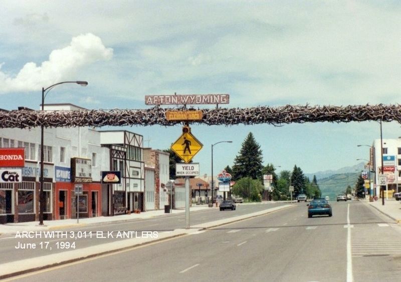
On East 2nd Avenue, on the right when traveling east.
Noble, Generous, Kind and True to All
Pioneer of 1847
Born at Kilsythe, Scotland Sept. 2, 1814
Died in Salt Lake City, Ut. Feb. 8, 1902
This monument has been erected as a tribute to him in remembrance of his accomplishments as a mill . . . — — Map (db m276488) HM
On Jefferson Street near East 3rd Avenue, on the left when traveling south.
First Mormons of record in the valley were 40 emigrants, miners from England, employed in 1858 by F.W. Lander to work on the Lander Cut-Off of the Pacific Wagon Road. By 1870 Church cattle were summer pastured in the valley. In 1879 the Church . . . — — Map (db m90526) HM
On State Highway 241 near Dry Creek Road (County Route 146), on the right when traveling north.
Dry Creek, later called Mt. Pleasant, was settled in 1886. The first public building erected in this area, 1891, was a log schoolhouse also used as a church. Students furnished their own desks and stools. George Hardman, teacher. Osmond Ward, . . . — — Map (db m90525) HM
On Jefferson Street near East 3rd Avenue, on the left when traveling south.
In the spring of 1879 a group of pioneers from Bear Lake settled here. Moses Thatcher explored the area, dedicated it as a home for the Latter Day Saints, calling it Star Valley. Freedom and Auburn settled in 1879 and Afton in 1885. The first public . . . — — Map (db m90548) HM
On U.S. 89 near River Circle, on the right when traveling north.
Here in Sept. 1812, the returning Astorians led by Robert Stuart were attacked by the Indians and their horses stolen.
Dedicated July 4, 1939, to commemorate the opening of the Snake River Canyon Road.
Built by Civilian Conservation Corps. . . . — — Map (db m90550) HM
On Stump Creek Road, on the right when traveling west.
Beginning in 1843, emigrants traveled across the continent along what became known as the Oregon Trail. Increased traffic during the 1850's resulted in the first government road construction project in the west. The 345 mile Central Division of the . . . — — Map (db m286161) HM
On U.S. 30 at milepost 11 near East Main Street (Wyoming Highway 232), on the right when traveling north.
Cokeville is situated at the confluence of the Bear River and Smiths Fork valleys. Between 1812 ad 1865, these valleys were the domain of American Indians, fur trappers and traders; during the 1830s and 1840s, they became a well traveled pathway of . . . — — Map (db m90480) HM
On Dempsey Road 1 mile west of Farm Field Road, on the left when traveling west.
Many camping areas were used by the pioneers on their way west after making the Ham's Fork Crossing. This "Emigrant Springs" camping area became a favorite spot for the emigrants to spend the night. Abundant fire wood, livestock feed and good water . . . — — Map (db m179621) HM
On U.S. 30 near Wyoming Highway 89, on the right when traveling west.
Two plaques are mounted on this monument.
Wyoming
Golden Anniversary 1940
Admitted to Statehood
July 10, 1890
Idaho
50 Years of Statehood
1940
Admitted July 3, 1890 — — Map (db m90484) HM
On U.S. 30 near Wyoming Highway 89, on the right when traveling west.
In 1847, The Oregon Trail passed by this point where Highway 30 now crosses the Idaho-Wyoming Statelines. Here lies the northern most bend of Bear River in Wyoming before it crosses into Idaho. Skirting wet lands to the north and the south, ruts . . . — — Map (db m90483) HM
On East Main Street at Park Street, on the left when traveling west on East Main Street.
The state boundaries of Idaho, Utah, and Wyoming share one corner approximately 7.3 miles southwest from where you're standing.
Two corners were surveyed and marked in the 1870's. U.S. Astronomer and Surveyor Daniel G. Major and a party of 11 men . . . — — Map (db m90482) HM
On U.S. 89 near Etna-Forest County Road 112 (County Route 169), on the left when traveling north.
Oldest surviving house in Star Valley is this two room dwelling built in 1889 by Anna Eliza Baker and her 12 year old daughter May. The logs are hand-hewn on four sides and dovetailed at the corners. It was the first home in this area to have a . . . — — Map (db m90565) HM
On Farm Field Road 2 miles east of Dempsey Road, on the right when traveling east.
Within this fence lie the graves of five or six pioneers who lost their lives while traveling to the gold fields of California and the fertile Willamette Valley of Oregon.
Alfred Corum and his brothers John, Herod, and Simeon left Cooper County, . . . — — Map (db m179620) HM
On U.S. 30 5.3 miles west of U.S. 189, on the right when traveling west.
Fossil Butte is a 50 million year old lakebed and one of the richest fossil resources in the world. It is part of the Green River Formation, a layer of rock composed of laminated limestone, mudstone, and volcanic ash. Complete paleo-ecosystems are . . . — — Map (db m36624) HM
On Farm Field Road 1 mile east of Dempsey Road, on the right when traveling east.
In April, 1852, four brothers, Wesley, Samuel, James and Steven Hill, together with their families, 62 persons in all, left Paris, Monroe County, Missouri, for California.
Their were two deaths along the Platte River and here on the Hamsfork . . . — — Map (db m179619) HM
Almost all we know of life in Fossil Lake came from quarries on Cundick Ridge, Fossil Butte, Fossil Ridge, and nearby sites.
Commercial fossil fish mining began in the last decades of the 19th century. Some specimens were sold as souvenirs, and . . . — — Map (db m270073) HM
On Pine Avenue (U.S. 189), on the right when traveling north.
This bell was used at the
Kemmerer Grade School
Built in 1901 and used
until 1926.
Tower Donated by the
K/D 1990 Centennial Committee
and the Kemmerer/Diamondville
Chamber of Commerce. — — Map (db m36654) HM
On U.S. 189 5.6 miles south of State Highway 235, on the right when traveling south.
He little knew that when he cut his name, or had it cut, in this stone, that it would be engraved in the annals of the West deeper than that of any other man. As one of the world's outstanding explorers he guided emigrants, railroads and army in . . . — — Map (db m308136) HM
On U.S. 189 near Bondurant Road, on the right when traveling south.
Names Hill is one of three prominent sites in Wyoming where travelers inscribed their names into stone along the emigrant trails. The other sites are Register Cliff and Independence Rock. After crossing a 40 miles stretch of waterless desert, wagon . . . — — Map (db m162509) HM
On U.S. 189 12.8 miles north of State Highway 372, on the right when traveling north.
To the Shoshone Indian, this river was the Seeds-Kee-Dee Agie (Prairie Chicken River). On Sept. 16 1811, the Astorians near its headwaters termed it the Spanish River. To the Spaniards, far to the south, it was the Rio Verde (Green River). Jedediah . . . — — Map (db m36659) HM
On U.S. 89 near Forest Road 100072, on the right when traveling north.
The Lander Cut-off left the Oregon Trail at Burnt Ranch on the Sweetwater River near South Pass City, WY. Frederick Lander surveyed the trail in 1857. Tens of thousands of people passed over the trail during its use. With the Transcontinental . . . — — Map (db m90520) HM
On U.S. 89 near Gomm's Pond Lane, on the right when traveling north.
Beginning in 1843, emigrants traveled across the continent along what became known as the Oregon Trail. Increased traffic during the 1850's resulted in the first government road construction project in the west. The 345 mile Central Division of the . . . — — Map (db m90521) HM
Located 4 miles east of Afton in the Salt River Range, is the largest of three natural springs in the world that is naturally turn of and on. Water flow is interrupted from anywhere between 3 to 30 minutes, generally between the months of August - . . . — — Map (db m90524) HM
On U.S. 89 near Salt River Ranch Lane, on the right when traveling north.
Look up a night and you can see why this is called Star Valley. As early as the 1870's, the Mormon Church was placing cattle here to summer graze on the lush meadows. Later, Mormon pioneers dotted the valley with small farms consisting of dairy . . . — — Map (db m90568) HM
On North Main Street (U.S. 89) near Wright Street, on the left when traveling north.
Thayne, formerly called Glencoe, was founded in 1888, a which time mail was brought into Star Valley by team and wagon and distributed to the people from a log cabin owned by Joseph Thayne. The building was one room 12 X 15 feet with a dirt floor. . . . — — Map (db m90549) HM
In 1908, led by Lydia Titensor, the women of the Relief Society of the Thayne Ward of The Church of Jesus Christ of Latter-day Saints decided they wanted a room for their quilting. When Bishop George G. Miller was approached for help, the sisterhood . . . — — Map (db m276487) HM
On U.S. 89 0.2 miles north of Strawberry Creek Road (County Route 126), on the right when traveling north.
Often termed the star of all valleys, the Shoshone Indians referred to the valley as a "heap fine hunting ground." Unusually high precipitation and topographic features make the Salt River Valley one of the most productive and diverse of all . . . — — Map (db m84594) HM
On Belfry Highway (State Highway 120) near State Highway 292, on the right when traveling south.
Several area landmarks, including Bennett Buttes, Bennett Creek, and Little Rock Creek, are now named for Captain Andrew S. Bennett and Little Rock, a Crow interpreter for the U.S. Army, who lost their lives when the Army attacked a camp of Bannock . . . — — Map (db m167161) HM
In 1877, The Nez Perce Indians of Idaho led by Chief Joseph, fled the U.S. Army. They crossed the Clark's River near this point, while trying to outrun the soldiers to Canada. — — Map (db m167145) HM
On Belfry Highway (State Highway 120) near State Highway 292, on the right when traveling south.
"The tired horses came to an abrupt stop at the Dilworth post office. The needed no whoa-ing. The wagon loaded with mail and freight had jostled in and out of ruts, up and down hills, across streams and along washed out roads." . . . — — Map (db m167159) HM
On State Highway 120 near State Highway 292, on the left when traveling south.
Three panels make up this marker.
(panel 1:)
For thousands of years the fertile Wallowa Valley was home to many Nimiipuu, or Nez Perce people. A treaty in 1855 affirmed Nez Perce ownership of this homeland. Competition for . . . — — Map (db m167146) HM
On Powell Highway (Alternate U.S. 14) near Happy Trails Road, on the left when traveling north.
On September 10th 1880, Victor Arland and John F. Corbett set up the first mercantile establishment in the Big Horn Basin on the Indian Trace that follows Trail Creek. Looking to the cattlemen for business, they moved to Cottonwood Creek in 1883, . . . — — Map (db m91138) HM
Near W Yellowstone Avenue (U.S. 20), on the right when traveling west.
Off in the distance in front of you, a large red butte lies against a much larger mountain, Rattlesnake Mountain. Flowing down the valley is Trail Creek, named for the ancient Indian trail that crosses the Shoshone River at the Indian ford in the . . . — — Map (db m87571) HM
On North Fork Hwy (U.S. 14) 1.2 miles east of Verner Road, on the right when traveling east.
This 48-inch diameter valve is one of two which were originally installed at the base of the Buffalo Bill Dam in 1922 to supply water to the Shoshone Powerplant and low level river outlet works. The two valves were operational until they were . . . — — Map (db m104003) HM
On North Fork Hwy (U.S. 14) 1.2 miles east of Verner Road, on the right when traveling east.
Ball Plug
This large wood and concrete ball plug was one of two used to halt the flow of water through the 42-inch diameter power outlet works conduits, located in the base of the dam. The balls facilitated the repair and maintenance of downstream . . . — — Map (db m104004) HM
Near Demaris Drive near West Yellowstone Avenue (U.S. 14).
Belle Drewry was born in 1867, just two years after the Civil War. Her birth place and family are unknown. It is known that she left home at an early age and changed her name. Belle was a rather attractive young woman; about five foot six inches . . . — — Map (db m91077) HM
On North Fork Hwy (U.S. 14) 0.5 miles east of Verner Road, on the right when traveling east.
Buffalo Bill Reservoir
The Shoshone Project Story
The development by the U.S. Reclamation Service of the great irrigation project in the lower Shoshone valley required sacrifice of their land by the settlers living in the upper part of the . . . — — Map (db m104001) HM
On Southfork Road (State Highway 291) near Davis Draw Road, on the right when traveling south.
John Colter, famed among the famous breed of "Mountain Men," passed this landmark late in the fall of 1807 while on business for the fur trader Manuel Lisa. Searching for Indians in order to conduct trade, he also hunted salt caves reputedly . . . — — Map (db m91010) HM
Near W Yellowstone Avenue (U.S. 20), on the right when traveling west.
Cedar Mountain, the mountain in front of you to the left of the canyon, was known to the Crow Indians as “the mountain of spirits.” Early settlers told of finding Indian tree burials on its northeast slope. Unfortunately, those sites . . . — — Map (db m87566) HM
On W Yellowstone Avenue (U.S. 20), on the right when traveling west.
John Colter, veteran of the Lewis and Clark Expedition, notably self-sufficient mountain man and indefatigable explorer, was the first white man known to have reconnoitered this locale. In 1807, possibly traveling alone but probably escorted . . . — — Map (db m86150) HM
On W Yellowstone Avenue (U.S. 20) west of Demaris Drive, on the right when traveling west.
Colter’s Hell is a large, mostly extinct, geyser basin. Today, there are a few hot springs, and vents which release sulphurous gasses along the Shoshone River. This site includes some of the world’s largest extinct geyser cones and thermal pools. . . . — — Map (db m86147) HM
On Dead Indian Hill Road (aka Crandall Road) (State Highway 296) near County Highway 103, on the right when traveling west.
This pass is the summit of Dead Indian Hill. Through this portal great herds of wild game seasonally migrant from the mountains to the plains. This high pass was the gate way for countless Indian hunting and war parties, and through this portal . . . — — Map (db m189985) HM
On Dead Indian Hill Road (aka Crandall Road) (State Highway 296) near County Highway 103, on the right when traveling west.
September 9, 1877. The Nez Perce knew that General Howard was at least a day behind the and Colonel Sturgis had moved his forces to the Stinking Water (Shoshone River).
The Nez Perce, led by Lean Elk and Joseph, sensed an opportunity to escape. . . . — — Map (db m190076) HM
On Sheridan Avenue at 8th Street, on the right when traveling west on Sheridan Avenue.
This sandstone from the Big Horn Basin is dedicated to the memory of Dr. Dewitt Dominick. It honors the lifetime work of Dr. Dominick with the Indian people of the west and his dedication as a Trustee of the Buffalo Bill Historical Center. . . . — — Map (db m305548) HM
On Powell Highway (Alternate U.S. 14) near Happy Trails Road, on the left when traveling north.
In the early 1890s, Thomas Lanchbury was hired by the Bell stage and freight line to build a stage station near Eagle's Nest Springs in Wyoming. The Eagle's Nest Stage Station was the midway point on the run between Red Lodge, Montana and Meeteese, . . . — — Map (db m91134) HM
On W Yellowstone Avenue (U.S. 20) 0.1 miles west of Demaris Drive, on the right when traveling west.
Looking west is the Shoshone Canyon, named for the Shoshoni Indians, who hunted in the region. However, most of the Big Horn Basin had been Crow territory until the Fort Laramie Treaty of 1868. West of the canyon, the north and the south forks of . . . — — Map (db m87558) HM
Near Demaris Drive near West Yellowstone Avenue (U.S. 14).
Jim White was born in Missouri in 1828. He found his way into the southwest as a young man, where he was a freighter with ox-drawn wagons.
When the Civil War broke out in 1861, Jim White served the Confederate Army as a grain buyer and wagon . . . — — Map (db m91080) HM
Near Demaris Drive near West Yellowstone Avenue (U.S. 14).
John Johnston was born of Scotch-English descent in New Jersey in 1824. Johnston, described as a 6'6", 250 pound giant, came west in the early 1840's as a trapper. He began his career in the Medicine Bow mountains of Wyoming, gradually working . . . — — Map (db m91019) HM
Near W Yellowstone Avenue (U.S. 20), on the right when traveling west.
The rocky ridge you are now crossing marks the southern edge of Lee Street, one of the original roads of Cody City. Wagon ruts, phone wires and rock cairn lot markers have been found along its path. In memory of Jerry Housel and Mary Elaine Housel . . . — — Map (db m87580) HM
On W Yellowstone Avenue (U.S. 20) 0.1 miles west of Demaris Drive, on the right when traveling west.
Buffalo Bill Cody and some business partners established the Shoshone Irrigation Co. in 1894. Work began on the Cody Canal to bring water for crop irrigation from the South Fork of the Shoshone River, around the south side of Cedar Mountain. The . . . — — Map (db m87556) HM
On Demaris Drive near West Yellowstone Avenue (U.S. 14).
On this site in 1895, Western scout and showman William F. ("Buffalo Bill") Cody laid out the original townsite of Cody, Wyoming, which he named in his honor. Today Old Trail Town preserves the lifestyle and history of the Frontier West through a . . . — — Map (db m91011) HM
On Dead Indian Hill Road (aka Crandall Road) (State Highway 296) near County Road 103, on the right when traveling west.
The ridge you are standing on was the last significant barrier for more than 600 Nez Perce Indians and their 2,000 horses as they fled the pursuing U.S. Cavalry. After the battle of the Big Hoel a month earlier, they drew knew the Army did not . . . — — Map (db m190091) HM
On Greybull Highway at Lt. Childers St., on the right when traveling west on Greybull Highway.
This memorial is dedicated to those special men and women
who served so courageously and when
called upon to do so, sacrificed without
hesitation while serving with the Office of
Strategic Services (OSS) during World War Two. — — Map (db m300813) WM
Near Demaris Drive near West Yellowstone Avenue (U.S. 14).
Phillip Henry Vetter was born February 7, 1855 near Woodstock, Shenandoah County, Virginia. He was killed by a grizzly bear on the Greybull River in Wyoming in 1892.
A few years after the Civil War, Phillip's family came West by wagon train and . . . — — Map (db m91072) HM
On Sheridan Avenue, on the left when traveling west.
The pioneer stagecoach drivers of the Old West were as fiercely independent as any men the country has ever seen. They were men of whang-leather toughness, who were accustomed to the harshness of frontier life. They never failed to laugh in . . . — — Map (db m87199) HM
On Greybull Highway at Lt. Childers Street, on the right when traveling west on Greybull Highway.
This memorial is dedicated to those who have suffered and
sacrificed as prisoners of war, and to those who are still
missing. You are not forgotten and we will never rest until you
are all returned home and accounted for. — — Map (db m300891) WM
On Greybull Highway at Lt. Childers Street, on the right when traveling west on Greybull Highway.
Powder River Let'er Buck!
The shoulder insignia, a black bucking bronco on a gray background with two
black rings, was adopted and proudly worn on the left shoulder of the uniforms
of the Wyoming troops. This insignia was designed by . . . — — Map (db m301169) HM WM
On Greybull Highway at Lt. Childers Street, on the right when traveling west on Greybull Highway.
This memorial is dedicated to the
people of the Republic of Korea who
have shown their sincere
appreciation for the service and the
sacrifices men and women from
Wyoming have made while
protecting their freedom. They have
generously supported . . . — — Map (db m300753) WM
Near Demaris Drive near West Yellowstone Avenue (U.S. 14).
Sampson E. Stilwell, better known as "Comanche Jack," was born in Kansas in 1850 and served on the frontier during his youth as a scout and hunter. He is best known for his heroic deeds at the Battle of Beechers Island on September 6 (sic), 1868. . . . — — Map (db m91074) HM
On Greybull Highway at Lt. Childers Street, on the right when traveling west on Greybull Highway.
This monument honors all war dogs and handlers: Past, Present, And Future.
K-9 teams that serve in the U.S. Military have a history of bravery and courage on thousands of unnamed foreign fields of battle. We are deeply inedited to these K-9 and . . . — — Map (db m301173) WM
On W Yellowstone Avenue (U.S. 20), on the right when traveling west.
Shoshone Canyon is a gorge cut through Rattlesnake Mountain by the wearing action of the Shoshone River. The mountain is a northwest trending uplift in the earth’s crust that rises 3700 feet above the surrounding terrain. Beds of sedimentary rock . . . — — Map (db m86154) HM
On N Fork Hwy (U.S. 20) 0.2 miles west of Spirit Mountain Road, on the right when traveling west.
The Heart Mountain Division of the Shoshone Project receives irrigation water directly from Buffalo Bill Reservoir via the Shoshone Canyon Conduit, a three-mile-long tunnel drilled through Cedar Mountain located to the left. From the conduit, the . . . — — Map (db m87589) HM
On Sheridan Avenue at 11th Street, on the left when traveling west on Sheridan Avenue.
At this spot in 1903 a rock dugout facing south,
near a fresh-water spring in the hillside, was established as
a stage "noon stop" where horses were changed and meals
served. The primitive accommodation was halfway between
Corbett Crossing on . . . — — Map (db m286144) HM
On Greybull Hwy./U.S. 85 at Lt. Childers Street, on the right when traveling west on Greybull Hwy./U.S. 85.
This monument is dedicated to honor the men women who served and sacrificed in our military services during the Second World War 1941 -1945 When called upon, they stepped forward to protect our freedom and way of life. Those who are individually . . . — — Map (db m301823) WM
Near W Yellowstone Avenue (U.S. 20), on the right when traveling west.
On both sides of the Shoshone River there are many circles made of stones built by the Indians who frequented this area. Some of the sites are simply circles with no doorways, believed to be religious symbols associated with the circle of life or . . . — — Map (db m87575) HM
This monument, erected by the Brotherhood of the American Mountain Men, is "dedicated to all Mountain Men known and unknown for their essential part in the opening of the American West." It consists of two busts and six plaques honoring four . . . — — Map (db m91017) HM
On Dead Indian Hill Road (aka Crandall Road) (State Highway 296) near County Road 103, on the right when traveling west.
As a band of Nez Perce Indians out (missing word(s)) and outmaneuver the U.S. Cavalry in the fall of 1877, newspapers picked up on the drama (missing word(s)) headlines read: "Comic Opera, Bungling of Pursuer, Salutes to a Most . . . — — Map (db m190092) HM
On W Yellowstone Avenue (U.S. 20) 0.1 miles west of Demaris Drive, on the right when traveling west.
Look to your left and you will see the canyon cut by the Shoshone River. The mountain to the left of the canyon is Cedar Mountain. To the right of Shoshone Canyon you can see Rattlesnake Mountain. The red butte (to the right of Rattlesnake Mt.) is . . . — — Map (db m87565) HM
Near Sheridan Avenue near 8th Street, on the left when traveling west.
Young Buffalo Bill Cody started his famous career with the great freighting firm of Russell, Majors and Waddell as a messenger boy. He became a spectacular Pony Express rider with the same firm and road between Red Buttes and Three Crossings, along . . . — — Map (db m91008) HM
On Greybull Highway near Lt. Childers Street, on the right when traveling west.
It cannot be inherited nor can it be purchased. You and no one alive can buy it for any price. It is impossible to rent, and it can not be lent. You alone and our own have earned it with your sweat, blood and lives. You own it forever. The Title, . . . — — Map (db m301085) WM
On Greybull Hwy. at Lt. Childers Street, on the right when traveling west on Greybull Hwy..
This Anchor was re-dedicated November 11, 2001 to the people who have served their country in the navy, Marine Corps, Coast Guard & Merchant Marine/ — — Map (db m300892) HM
Near W Yellowstone Avenue (U.S. 20), on the right when traveling west.
Here on the prairie there are still visible remnants of several old wagon trails dating back to Cody City in the late 1800’s. The first buildings of Cody City were constructed on the nearby plain to the west, although the town was supposed to be . . . — — Map (db m87586) HM
On North Fork Hwy (U.S. 14) 1.2 miles east of Verner Road, on the right when traveling east.
Upstream Cableway Winch
This cableway winch, which was used to install and remove the ball plugs, trash racks, and the bulkhead gate for the left abutment outlet works, dates to the construction of the Shoshone Powerplant in 1922. It was . . . — — Map (db m104002) HM
Near Demaris Drive near West Yellowstone Avenue (U.S. 14).
William Gallagher and his friend, Blind Bill, were killed on Meeteese Creek below the old town of Arland in mid-March of 1894. Both men, about thirty, were born during the Civil War period.
Gallagher, who was somewhat of an outlaw, was tall, . . . — — Map (db m91076) HM
Near W Yellowstone Avenue (U.S. 20) 0.1 miles Demaris Drive, on the right when traveling west.
Jan. 4, 1913 Sept. 18, 1992 Grandson of the World-Famous Colonel William F. Cody “Buffalo Bill” Bill Cody was born at Buffalo Bill’s “Scouts Rest Ranch” in North Platte, Nebraska. He died in Cody, Wyoming. He was . . . — — Map (db m87560) HM
Near Greybull Highway, on the left when traveling east.
The 300th Armored Field Artillery Battalion was federalized from 19 August 1950 to 27 September 1954 and served, along with many other Wyoming soldiers, during the Korean War. The five batteries of the 300th were from "A" -Thermopolis; "B"- Cody; . . . — — Map (db m301183) HM WM
On Greybull Highway at Lt. Childers Street, on the right when traveling west on Greybull Highway.
Fallen Comrades
Anderson, Allen G. · Barnhill, Kenneth R. · Baxter, Neil B. · Budaker, Clifford F. · Barnes, Ted U. · Budd, Malcom L. · Burt, Myron H. · Clark, Leonard W. · Clay, James E. · Cowdin, Ray R. · Davis, Courtenay C. · Dewees, . . . — — Map (db m305469) WM
On Greybull Hwy at Lt. Childers Street, on the right when traveling west on Greybull Hwy.
This memorial is dedicated to the men and women who have served or
are serving in the Wyoming National
Guard (Air Force and Army) who
stand ready to answer the call to
active service in times of emergency,"
disaster or conflict. . . . — — Map (db m300814) WM
On Sheridan Avenue, on the left when traveling west.
We the citizens of the Yellowstone gateway communities whose lives and properties were imperiled by the 1988 Yellowstone fires, hereby express our gratitude to those whose courage, skill and devotion tamed the inferno that devastated over 363,000 . . . — — Map (db m87200) HM
On Beartooth Highway (U.S. 212) 9 miles west of Crandall Road (State Highway 296), on the right when traveling west.
What's So Special About This Spot? Your feet are placed on a line that has played a key role in navigating the earth for over two thousand years! The 45th Parallel is not a visible line but a mapping tool that represents a contour halfway . . . — — Map (db m130266) HM
On NE Entrance Road (U.S. 212), on the right when traveling east.
This travertine (calcium carbonate) mound was formed more than a century ago by a hot spring. Only small amounts of hydrothermal water and hydrogen sulfide gas currently flow from this once more prolific spring. This formation is very fragile. It . . . — — Map (db m88308) HM
On Unnamed Road 0.1 miles south of North Entrance Road and upper Grand Loop Road, on the left when traveling south. Reported permanently removed.
The lifespan of most Western military posts was measured in months, or several years. Accordingly, their structures were temporary, and many have long since vanished from the landscape. Fort Yellowstone was unusual because of its permanence and the . . . — — Map (db m123155) HM
On Officer's Row 0.2 miles south of North Entrance Road - eastbound lanes, on the right when traveling north. Reported permanently removed.
Before the Army arrived in Yellowstone, the park's future was in doubt. Vandals destroyed thermal features, squatters sawed down trees and poachers decimated herds of wildlife. Perhaps the Army's greatest contribution to Yellowstone's history was . . . — — Map (db m123157) HM
On Grand Loop Road - Upper Loop 0.2 miles south of Grand Loop Road - Lower Loop & North Entrance Road, on the left when traveling south. Reported permanently removed.
Fort Yellowstone was truly a community as well as a military outpost. The small village frequently assembled to welcome new residents or bid farewell to departing neighbors. The joys of births, christenings, and marriages mingles with the sorrows of . . . — — Map (db m123156) HM
On Officer's Row 0.1 miles Mammoth Street, on the left when traveling south. Reported permanently removed.
A soldier lived with the rest of his company in the Troop Barracks (structure in front of you).
A typical day began at 5:30 am, at the stable, just behind the barracks where the horses were fed. From that time until almost noon, soldiers . . . — — Map (db m123148) HM
On Unnamed Road 0.2 miles south of North Entrance Road and upper Grand Loop Road, on the left when traveling south. Reported permanently removed.
Protecting Yellowstone's wildlife and natural wonders was the primary function of the Army. An important part of this duty was managing the growing visitation to the park and watching for "shady characters."
Park roads were once aligned so that . . . — — Map (db m123152) HM
On Officer's Row 0 miles south of Mammoth Street, on the left when traveling south. Reported permanently removed.
In 1912, President Taft in a special message to Congress said:
"I earnestly recommend the establishment of a bureau of National Parks. Such legislation is essential to the proper management of those wonderful manifestations of nature, so . . . — — Map (db m123149) HM
On North Entrance Road 0 miles east of Grand Loop Road, on the right when traveling west. Reported permanently removed.
In 1878 civilian Superintendent Philetus Norris began cutting crude wagon paths to Yellowstone's major features. However, better roads were needed, and from 1883 to 1918 the U.S. Army's Corps of Engineers built and maintained Yellowstone's roads and . . . — — Map (db m123153) HM
On Unnamed Road at North Entrance Road and upper Grand Loop Road, on the right when traveling south on Unnamed Road. Reported permanently removed.
Gathering place, site of ceremonies and parades, training ground - the drill field was the focal point of daily life at Fort Yellowstone.
Each day began with a bugler sounding Reveille. Gradually, the Fort came to life and another bugle call . . . — — Map (db m123351) HM
On North Entrance Road at Grand Loop Road - upper loop, on the left when traveling south on North Entrance Road. Reported permanently removed.
From 1886 until the creation of the National Park Service in 1916 the United States Army was responsible for the administration and management of Yellowstone National Park.
The row of buildings ahead of you is part of Historic Fort Yellowstone. . . . — — Map (db m123151) HM
On State Highway 120 at Mary Avenue, on the left when traveling south on State Highway 120.
In Memory of the World Famous Aviatrix
First Woman to Fly Across the Atlantic
June 17, 1928 and May 20, 1932
Was Building a Summer Home Near Here
When She Left to Fly Around the Earth
and Was Lost in the South Pacific
July 2, . . . — — Map (db m167162) HM
385 entries matched your criteria. The first 100 are listed above. Next 100 ⊳