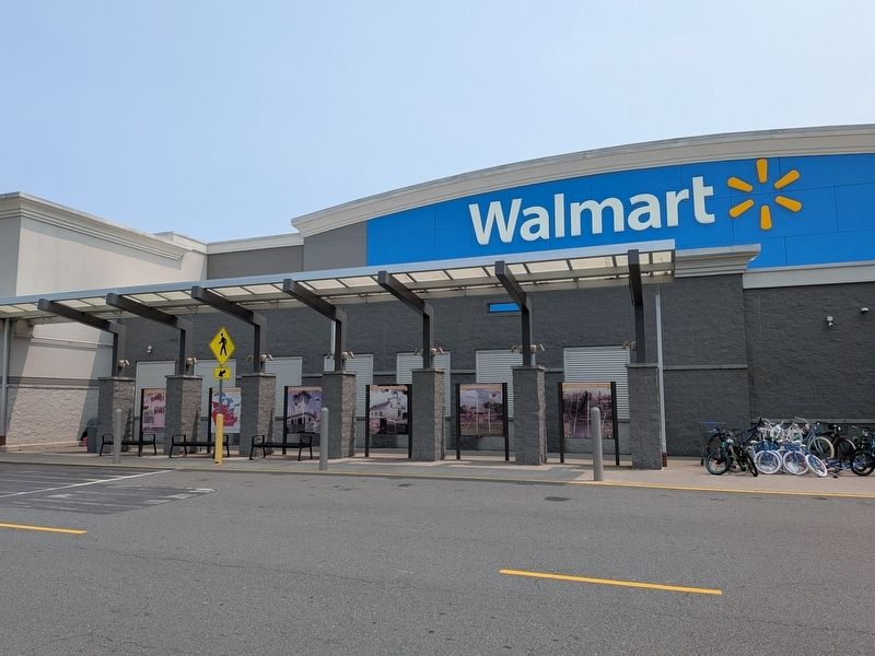
Near Twin Drive 0.1 miles north of A and K Boulevard, on the left when traveling east.
Orange County in 1734:
Rich in history, Orange County has the distinction of being the largest Virginia county ever formed. Established in 1734 and named in honor of William, Prince of the House of Orange-Nassau, the county once stretched . . . — — Map (db m307336) HM
Near Twin Drive 0.1 miles north of A and K Boulevard, on the left when traveling east.
1859 Orange County Court House:
The first court house to be located in the Town of Orange was built in 1749, followed by a new structure in 1803. When the railroad came to Orange in 1854 and laid its tracks at the court house door, county . . . — — Map (db m307339) HM
Near Twin Drive 0.1 miles north of A and K Boulevard, on the left when traveling east.
Fort Germanna:
Located where today's Route 3 crosses the Rapidan River, Fort Germanna was the first permanent English settlement west of the Tidewater. Originally consisting of 12 families from Germany, it was established in 1714 by . . . — — Map (db m307331) HM
Near Twin Drive 0.1 miles north of A and K Boulevard, on the left when traveling east.
Blue Run Baptist Church:
In the colonial era, Orange County was known for its religious tolerance and was the site of a conference at which James Madison declared his support for the religious freedom language of the First Amendment. . . . — — Map (db m307340) HM
Near Twin Drive 0.1 miles north of A and K Boulevard, on the left when traveling east.
Montpelier Hunt Races:
Montpelier hosts Orange County's premier event, the Montpelier Hunt Races, which were begun by Marion duPont Scott in 1934 and are held the first Saturday of November. The Montpelier Hunt Races continue to this day as . . . — — Map (db m307362) HM
Near Twin Drive 0.1 miles north of A and K Boulevard, on the left when traveling east.
The Mine Run Campaign 27 November 1863:
On November 26, 1863, the Union army launched the Mine Run Campaign in an attempt to drive the Confederates out of their Orange County defenses. The campaign was abandoned on December 2 in the face of . . . — — Map (db m307367) HM
Near Short Street south of East Main Street, on the right when traveling south.
In August 2, 1862, cavalrymen fought a fierce engagement here in downtown Orange. Battle raged through the streets, alleys, and across the railroad.
Early that morning 5th New York and 1st Vermont troopers drove Confederate pickets away from . . . — — Map (db m289668) HM
On Tennessee Route 160, on the right when traveling north.
The homesite and grave of Revolutionary War officer, Colonel Robert McFarland, is located two miles north at Springvale. Born in 1759 in Orange County, North Carolina, he served in the Virginia Militia from 1776 to 1781. In 1783, McFarland moved . . . — — Map (db m80442) HM
In August of 1775 a Patriot army, commanded by Virginian George Washington, lay siege to the British army in Boston; and a company of Virginia riflemen, commanded by Daniel Morgan, had joined Washington. Virginia was in turmoil as well. Royal . . . — — Map (db m290484) HM
On North Courthouse Road (Virginia Route 155) at Poindexter Road ( Route 604), on the left when traveling north on North Courthouse Road.
James Pawpaw, born likely in Africa, developed remedies for a variety of ailments while enslaved in New Kent Co. Among them was a treatment for yaws, a bacterial infection widespread in enslaved communities where poor conditions led to . . . — — Map (db m314949) HM
On Seminole Trail (U.S. 29) north of Frays Mill Road / Burnley Station Road, in the median. Reported missing.
Albemarle County. Albemarle County was formed in 1744 from Goochland County and named for William Anne Keppel, the second Earl of Albemarle, titular governor of Virginia from 1747 to 1754. A portion of Louisa County was later added to . . . — — Map (db m21585) HM
The Green family was established in Virginia when Duff McFuff Green's great-great grandfather, Robert Green, settled in Orange County in 1710. Duff McDuff Green was born in Stafford county on 2 August 1832 to Capt. Duff Green and Elizabeth Ann Payne . . . — — Map (db m76690) HM
Near Parakeet Drive 0.5 miles west of Kite Street, on the left when traveling west.
Prior to the Civil War, John and Mary Marshall, early prominent Burke area citizens, bought this land and built a family dwelling on fifty acres of land purchased in 1852. The Marshalls donated land to the Church of the Good Shepherd and to the . . . — — Map (db m198383) HM
Near West 7th Street just west of Myrtle Avenue, on the right when traveling west.
1 • Mount Vernon Red Maple Planted in honor of the Founders of the City of Sanford, Florida on February 10, 1992. This red maple has been grown from seeds collected at Mount Vernon, President George Washington's beloved home on the . . . — — Map (db m214875) HM
On Pigeon Roost Road (Kentucky Route 1714) 1.4 miles north of Caney Fork Road (County Route 1114), on the left when traveling north.
Colorful frontiersman. An ancient
headstone at grave shows he was
born 1735, died 1855. Enlisted for
three short periods in Revolution
and fought Indians and Tories in
west Carolinas and east Tennessee.
Legend tells that he was captured
by . . . — — Map (db m146107) HM
On Lakeview Parkway near Shoosmith Road, on the left when traveling north.
During the first 18 months of the Civil War, President Abraham Lincoln chose not to act upon recommendations of Frederick Douglass, and others, to enlist Black men in the Union Army in the fight against the Confederacy. After the much-needed Union . . . — — Map (db m314862) HM
On Reinbach Street 0.1 miles south of North Railroad Street, on the left when traveling east.
Bourland Jolly (a.k.a. Boling Jolley) (1766-1844) born in Dinwiddie County, Virginia where he enlisted in the VA. Militia in 1781. He was enlisted by a Captain Connelly and later served under a Col. Lucas at the Siege of Yorktown. After . . . — — Map (db m292353) HM WM
On Lakeview Parkway, on the right when traveling north.
This is the story of Orange GroveYou are standing on land that was owned by the same family for over 200 years, from colonial days to the beginning of Lake of the Woods.
Alexander Spotswood, Lt. Gov. of the Colony of Virginia 1710 - 1722, . . . — — Map (db m19156) HM
On Edgemont Circle north of Lakeview Parkway, on the right when traveling south.
Alfred Apperson was born in 1806. He married Malinda Jones in 1816 and managed a plantation until he had saved enough money to purchase 120 acres of farm land in 1846. That land would become part of Lake of the Woods 120 years later. Alfred and . . . — — Map (db m103268) HM
On Short Street just south of East Main Street, on the left when traveling north.
In 1998, The Orange Commercial Historic District was placed on the National Register of Historic Places and the Virginia Landmarks Register in recognition of the distinctive characteristics of its architecture and its association with events . . . — — Map (db m170873) HM
On Maddens Tavern Road at Youngs Lane, on the left when traveling north on Maddens Tavern Road.
Following the end of the Civil War in 1865, Willis Madden, a free black man of color, built the African Ebenezer Church. The building had a half acre around it, and it was to be "Devoted to the preaching of the Gospel, as long as the colored . . . — — Map (db m185518) HM
On Court Street at Ford Avenue, on the right when traveling east on Court Street.
The village of Stanardsville was founded by William Stanard (died 1807), of Roxbury plantation, on land that was part of his 6,000 acre inheritance from the Octonia Grant of 1729. This grant included most of what is presently northern Greene County . . . — — Map (db m22988) HM
On North Main Street (Business U.S. 29) south of Blue Ridge Turnpike (Virginia Route 231), on the left when traveling south.
This Greek Revival-style house was built about 1852 for state senator Thomas N. Welch. In 1868 James Lawson Kemper (1823–1895) purchased it from his mother in law, Mrs. Belfield Cave. Kemper, an attorney, represented Madison County in the . . . — — Map (db m8187) HM
On West Main Street (State Highway 20) at Madison Road (U.S. 15), on the right when traveling west on West Main Street.
A valiant soldier General Zachary Taylor 1784-1850 Twelfth President of the United States Born in Orange County Virginia Erected by Orange County Post No. 156 The American Legion 1934 — — Map (db m83144) HM
Near Constitution Highway (Virginia Route 20) when traveling south.
In 1716 Alexander Spotswood, Lieutenant Governor of Virginia, led an expedition of twelve members of the gentry and about 30 enslaved servants, Native American guides, and soldiers up the Rappahannock River, through the Virginia Piedmont, and into . . . — — Map (db m298142) HM
On Short Street just south of East Main Street, on the right when traveling south.
town history
Orange was born as one of Virginia's Court House villages on November 24, 1749, when the Gentlemen Justices of Orange County voted to hold County Court sessions in Timothy Crosthwait's tavern alongside "Swift Run Gap Road," the . . . — — Map (db m170689) HM
Near Greenwood Street 0.3 miles east of South Mills Avenue when traveling east.
(side 1)
Buried here are members of the Eppes and Shine families, descendants of President Thomas Jefferson, the author of the Declaration of Independence and the Statute of Virginia for Religious Freedom, and the father of the University . . . — — Map (db m93096) HM
Near North Princeville Cemetery Road 0.2 miles north of North Sumner Avenue.
This marker commemorates two Revolutionary War veterans, Phineas Bronson and John Montgomery, who lived and died in Princeville, Illinois.
Phineas Bronson was born in Enfield, Connecticut on Nov. 9, 1764. He served in the 3rd Company of the 2nd . . . — — Map (db m150577) WM
On Anthony Road at Old Trail, on the right when traveling east on Anthony Road.
Near this location, mounted Loyalists from Chatham and southern Orange counties led by Col. John Pyle, and on their way to join Gen. Cornwallis in Hillsborough, were defeated by units of Gen. Greene's American Army led by Col. Henry "Light Horse . . . — — Map (db m34718) HM
Near State Highway 86, on the right when traveling south.
The Carolinas Campaign began on February 1, 1865, when Union Gen. William T. Sherman led his army north from Savannah, Georgia, after the “March to the Sea.” Sherman’s objective was to join Gen. Ulysses S. Grant in Virginia to crush Gen. . . . — — Map (db m13972) HM
Near Memorial Drive at Morning Star, on the right when traveling west.
This cemetery lies within the Mexican Land Grant acquired by Thomas J. Chambers in 1834. Chambers died in 1865 and in 1867 his widow, Abbey, sold 3,000 acres containing this site to H.N. Duble at an estate sale held in Galveston. A portion of the . . . — — Map (db m183752) HM
On Sperryville Pike (U.S. 522) 0.1 miles west of Virginia Avenue/Colonel Jameson Boulevard, on the left when traveling west.
Virginia's third Revolutionary Convention, which met in the summer of 1775 as royal authority was collapsing in the colony, passed an ordinance establishing 16 units of minute men for the colony's defense. Recruits from Culpeper, Fauquier, and . . . — — Map (db m288426) HM
Near Constitution Highway (State Highway 20), on the right when traveling west. Reported permanently removed.
With emancipation, African-Americans found themselves in a complex situation. By law, slavery was abolished, promising freedom and citizenship, but few owned land or had resources to support themselves, and prejudice against them was widespread. . . . — — Map (db m298082) HM
On Constitution Highway (State Highway 20), on the right when traveling west.
Dr. Robert Thomas, a prominent Orange County physician, constructed Oakley in the Greek Revival style in 1843. His daughter Sarah (Sally) Thomas Browning and her husband, G. Judson Browning, later owned it. George W. Bagby (1828-1883), Southern . . . — — Map (db m22226) HM
On East Main Street (State Highway 20) at Short Street, on the right when traveling east on East Main Street.
Beginning in 1749, Orange County's successive courthouses have been located just west of here. In 1854, the Orange & Alexandria Railroad, constructed to link Alexandria with central Virginia, reached Orange and a train station was built near here. . . . — — Map (db m170870) HM
Nashville was founded as part of
the movement by British colonists
from North Carolina and Virginia
into the Cumberland Valley in the
mid to late 18th century. Richard
Henderson, a magistrate, judge,
and land speculator from
Granville County, . . . — — Map (db m207200) HM
On Stamping Ground Road (Kentucky Route 227) north of Frankfort Pike (U.S. 460), on the right when traveling north.
Col. Robert Johnson (1745-1815) of Orange County,
Virginia established Johnson's Station at Great Crossing on
North Elkhorn Creek in 1783 as the first permanent
pioneer settlement in what is now Scott County, Kentucky.
In 1785, he and his wife, . . . — — Map (db m202953) HM
Near New York State Route 17A 0.4 miles Gibson Rd (County Route 100), on the right when traveling south.
Built in the 1700’s and used continuously as a school until 1936 when purchased by Minisink Chapter, NSDAR.
N.Y. State and National Register of Historic Places — — Map (db m29728) HM
On U.S. 70 near Efland-Cedar Grove Road, on the right when traveling west.
United States Senator from Missouri, 1821-1851: Congressman; author: Jacksonian Democratic leader: was born, 1782, in this neighborhood. — — Map (db m223148) HM
On Zachary Taylor Highway (U.S. 522) at Twin Mountains Road (Virginia Route 647), on the right when traveling north on Zachary Taylor Highway.
Culpeper County. Area 384 Square Miles. Formed in 1748 from Orange, and named for Lord Culpeper, Governor of Virginia, 1680-1683. The Battle of Cedar Mountain, 1862, was fought in this county.
Orange County. Area . . . — — Map (db m23774) HM
On Spotswood Trail (U.S. 33), on the right when traveling east.
Orange County. Formed from Spotsylvania County in 1734, Orange County, a pastoral Piedmont county, was probably named in honor of William IV, the Dutch prince of Orange, who married Anne, the Princess Royal, daughter of George II of England, . . . — — Map (db m24228) HM
On James Madison Parkway (U.S. 301) at Walsingham Road, on the right when traveling south on James Madison Parkway.
James Madison, "Father of the Constitution" and fourth president of the United States, was born here at Port Conway on 16 March 1751, in a house that no longer stands. His mother, Eleanor Conway Madison, was visiting her family at their . . . — — Map (db m133748) HM
On James Monroe Highway (U.S. 15) 0.2 miles Spinks Ferry Road, on the right when traveling north.
On 26 May 1781, Brig. Gen. Anthony Wayne began moving south from PA to reinforce the Marquis de Lafayette, who was maneuvering against British Lt. Gen. Charles Cornwallis in VA. Wayne's troops, including three infantry battalions of the PA line . . . — — Map (db m303340) HM
On James Madison Highway (U.S. 15/33), on the right when traveling north.
Orange County. Formed from Spotsylvania County in 1734, Orange County, a pastoral Piedmont county, was probably named in honor of William IV, the Dutch prince of Orange, who married Anne, the Princess Royal, daughter of George II of England, . . . — — Map (db m108411) HM
On Germanna Highway (State Highway 3), on the right when traveling west.
Culpeper County. Area 384 Square Miles. Formed in 1748 from Orange and named for Lord Culpeper, Governor of Virginia, 1680-1683. The Battle of Cedar Mountain, 1862, was fought in this county.
Orange County. Area 359 . . . — — Map (db m4322) HM
On Germanna Highway (State Highway 3) 0.3 miles west of Constitution Highway (State Highway 20), on the right when traveling west.
Orange County. Formed from Spotsylvania County in 1734, Orange County, a pastoral Piedmont county, was probably named in honor of William IV, the Dutch prince of Orange, who married Anne, the Princess Royal, daughter of George II of England, . . . — — Map (db m285616) HM
On Constitution Highway (Virginia Route 20) 0.1 miles west of South Montpelier Road, on the left when traveling east.
Citizenship Granted: Reconstruction and Constitutional Amendments
Three amendments to the U.S. Constitution were ratified after the Civil War. The 13th Amendment granted citizenship to people who had been enslaved and guaranteed "the equal . . . — — Map (db m298081) HM
On Chestnut Ridge Road (County Route 61) east of Don Nehlen Drive, on the right when traveling east.
In memory of those 201st Infantry Veterans through our history from February 17, 1735 as frontier militia who defended their homes and families with honor through the George Washington campaign of 1754, the Braddock campaign of 1755, Battle of Point . . . — — Map (db m134319) HM
On Stony Hill Road at Hillsborough Road, on the right when traveling east on Stony Hill Road.
Born in Pennsylvania about 1736. Served in Virginia Provincial Forces against Indians. Vestryman of the Parish-Church Warden. Chairman County Court. Major Orange County Militia. Member North Carolina Assembly, 1760-1768. Instrumental in establishing . . . — — Map (db m286315) HM
On Seminole Trail (U.S. 29) north of Fredericksburg Road (County Route 609), on the right when traveling north.
Greene County. Formed from Orange County in 1838, this rural Piedmont county was named for Gen. Nathanael Greene, Revolutionary War military hero. The county seat of Greene County is Stanardsville. William Donoho and William B. Phillips, . . . — — Map (db m21505) HM
On Rockfish Gap Turnpike (U.S. 250) at Skyline Drive and Blue Ridge Parkway, on the right when traveling east on Rockfish Gap Turnpike.
Nelson County. Nelson County was named for Thomas Nelson, Governor of Virginia from June to November, 1871. It was formed in 1807 from Amherst County. Oak Ridge, birthplace of William Cabell Rives and later the residence of Thomas Fortune . . . — — Map (db m21701) HM
On East Central Boulevard at Court Avenue, on the right when traveling west on East Central Boulevard.
Lynching of July Perry
November 3, 1920
On Election Day, November 3, 1920, black residents in the Ocoee area who owned land and businesses were eager to vote. Despite a terrorizing Ku Klux Klan march through the streets of . . . — — Map (db m137336) HM
On East Seminole Boulevard west of North Mellonville Avenue, on the left when traveling east.
During the Second Seminole War in 1836, the U.S. Army established Camp Monroe as a staging area for unloading troops and supplies. The army built the road that eventually became Mellonville Avenue to connect the camp to the river. The camp was . . . — — Map (db m189975) HM
On Red Oak Drive at Rivervale Road, on the right when traveling east on Red Oak Drive.
The American army may have had trouble supplying its soldiers and keeping them fit for fighting, but in one way the Americans were superior: their propaganda writers were experts at whipping up anti-British feelings. An incident like the Baylor . . . — — Map (db m8474) HM
On Constitution Highway (State Highway 20) at County Route 693, on the right when traveling west on Constitution Highway.
After Dolley Madison sold Montpelier in 1844, the estate witnessed many important historic events, few more significant than those of the 1860s. Throughout the winter of 1863 and 1864, as many as 4,500 Confederate troops camped here, part of a . . . — — Map (db m31715) HM
On West Main Street just west of North Madison Road (U.S. 15), on the right when traveling west.
In honor of the men and women of Orange County, Virginia, who served in the Korean War, 1950-1953 and in memory of the seven who gave their lives
Arnold, Wallace M. •
Brown, William F. •
Clatterbuck, Roland W. •
Collier, John A. • . . . — — Map (db m170678) WM
On West Main Street just west of North Madison Road (U.S. 15), on the right when traveling west.
In honor of the men and women of Orange County, Virginia who served in the Vietnam War 1964-1975 and in memory of the seven who gave their lives
Clarke, William Mosby, Jr. •
Estes, Richard Hirum, Jr. •
Fincham, William Edward •
Hurst, . . . — — Map (db m170682) WM
On East Beverly Street (Virginia Route 254) at South Augusta Street (Business U.S. 11) on East Beverly Street.
“The beauty of a city is largely dependent upon the artistic ideas and abilities of its architects and Staunton is certainly to be congratulated on having in its midst that eminent firm of architects, T.J. Collins & Son. whose work is memorialized . . . — — Map (db m11759) HM
On North Churton Street at West Union Street, on the right when traveling south on North Churton Street.
The Reverend Robert Burwell, his wife Anna, and their two children moved from Virginia to Hillsborough in 1835. The Presbyterians, who hired him as their minister, provided the family with a house which was built around 1821 on the corner of Union . . . — — Map (db m232399) HM
On Salubria Lane south of Germanna Highway ( Route 3), on the right when traveling south.
House of Burgesses Chapter honors The Germanna Foundation for the Preservation of Salubria.
Built by the Rev. John Thompson of St. Mark's Parish for his first wife, Butlery Brayne Spotswood. Subsequent owners were Barbour, Hansbrough and . . . — — Map (db m300893) HM
On West Main Street just west of North Madison Road (U.S. 15), on the right when traveling west.
In honor of the men of Orange County, Virginia who served in the Great War and in memory of the eighteen who gave their lives
Daniel Ashby McIntosh •
Edward D'Oyley Northrop •
Bernard E. Verling •
Charles R. . . . — — Map (db m170679) WM
On Water Street at 3rd Street, on the right when traveling north on Water Street.
[ east side ]
The Newburgh
Chapter of UNICO
National
October 11, 1992
In celebration of a 500th Anniversary commemorating the vision, courage, determination and voyages of
Christopher
Columbus
And the crews of the Nina, the . . . — — Map (db m37139) HM
On Purity Street east of Holbrook Street, on the right when traveling east.
As reported in the Times and Democrat Newspaper, on Thursday, February 27, 1936, construction of the three-room Bull Swamp Negro School House commenced! The school served as a beacon of hope, preparation, and promise for all of the students who . . . — — Map (db m292416) HM
On West Main Street just west of North Madison Road (U.S. 15), on the right when traveling west.
In honor of the men and women of Orange County, Virginia who served in the Second World War and in memory of the 44 who gave their lives
Andrews, Wm. McKendree •
Beck, William Edwin •
Breeden, General Lee •
Bryant, Gordon Otto • . . . — — Map (db m170680) WM
Thin black lines indicate changes in relevance. Between each pair of lines entries are ordered geographically but all have the same relevance.
* Inflectional forms of words are their plurals, singulars, and possessives as well as gramatical tenses and similar variations.