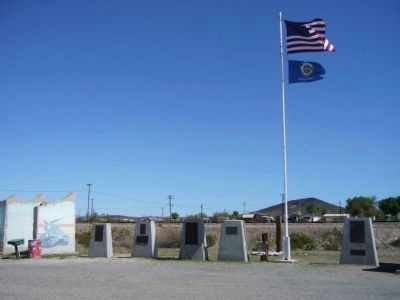
On Broadway Avenue (Arizona Route 72 at milepost 27) south of Main Street, on the right when traveling west.
Camp Bouse
September 1943 to March 1944
"The Kid Battalion"
From Normandy to the Elbe:
•Normandy
•Northern France
•Ardennes
•Rhineland
•Central Europe — — Map (db m78563) HM
On Broadway Avenue (Arizona Route 72 at milepost 27) south of Main Street, on the right when traveling west.
Dedicated to the men who gave time in their lives to serve honorably and courageously for our country. We take this moment in time to recognize their achievements which were done with pride and dignity.
* * *
Campaigns
Ardennes - Alsace - . . . — — Map (db m29160) HM
On Broadway Avenue (Arizona Route 72 at milepost 27) south of Main Street, on the right when traveling west.
Campaigns
Ardennes, Rhineland and Central Europe
The 739th Tank Battalion was activated in March 1943 at Fort Lewis, Washington. The officers were from various states, the enlisted personnel from Oklahoma, Texas and Louisiana.
The . . . — — Map (db m78558) HM
On Broadway Avenue (Arizona Route 72 at milepost 27) south of Main Street, on the right when traveling west.
The 740th tank battalion was activated at Fort Knox, Ky. on March 1, 1943. It trained at Fort Knox and at Camp Bouse, Az. as a canal defense light (CDL) unit and as a standard medium tank battalion from October 15, 1943 to April 24, 1944 then sailed . . . — — Map (db m78562) HM
On Broadway Avenue south of Main Street, on the right when traveling north.
The 748th Tank Battalion, Medium was activated on 20 August 1942 at Camp Rucker, Alabama. The Rhinos headed for Fort Knox on the 15th of April 1943 for training and on 20 April 1943 were reorganized as a special battalion equipped with CDL . . . — — Map (db m92814) HM
On Broadway Avenue (Arizona Route 72 at milepost 27), on the left when traveling west.
This building was built prior to 1912. The mercantile was known to do business with the A & C and Swansea railroads in 1916. It has been open continuously since that time. Bouse postmaster Cora L. Johnston moved the US Post Office to the store in . . . — — Map (db m39504) HM
On Bouse Avenue 0.5 miles south of Route 72, on the left when traveling south.
Thomas Bouse was born in Mendecino County, California and came here about 1889 as a prospector and built the first two rooms of his home. He ran a small store here. He brought his wife, Katherine, and infant daughter here in 1892. Three more . . . — — Map (db m29070) HM
On Broadway Avenue (Arizona Route 72 at milepost 27) south of Main Street, on the right when traveling west.
General George Patton established Camp Bouse in 1943 in the Butler Valley as the site for training over 5,500 carefully screened and qualified volunteers. These soldiers were trained to use a highly secret weapon called the Canal Defense Light. . . . — — Map (db m29165) HM
On Broadway Avenue (Arizona Route 72 at milepost 27) south of Main Street, on the right when traveling west.
Camp Bouse was established in Butler Valley 30 miles behind this monument in Sept. of 1943. It was one of twelve such camps built in the southwestern deserts to harden and train United States troops for service on the battlefields of World War II. . . . — — Map (db m78566) HM
On Broadway Avenue (Arizona Route 72 at milepost 27) south of Main Street, on the right when traveling west.
Campaigns
Central Europe Northern France Rhineland
The 701st tank battalion was activated 3/28/43 at Camp Campbell, KY. Here 553 young men and officers began their journey into history. These men began their basic training and for many saw . . . — — Map (db m78564) HM
On Broadway Avenue (Arizona Route 72 at milepost 27) south of Main Street, on the right when traveling west.
Activated 1 April, 1943 at Camp Perry, OH. Completed basic training and then sent to Ft. Knox, KY. Unit then assigned to Camp Bouse, AZ arriving there 9 November, 1943. Maintaining operation of special tanks named "Leaflets" was specific assignment. . . . — — Map (db m78557) HM
On Broadway Avenue (Arizona Route 72 at milepost 27) south of Main Street, on the right when traveling west.
United States Army
World War II
1924 – 2002
Whose dedication to the memory of his brothers in
arms, who fell in the Battle of the Ardennes, made this
historical park possible. — — Map (db m78542) HM
On Broad Street (Arizona Route 72 at milepost 27) south of Main Street, on the right when traveling west.
He was our drinking buddy
While on duty
He drank our beer
He was
Full of good cheer
And went to the nurses' quarters around the bend
And came to an untimely end,
Of the Colonel, he was unaware
That it would be the crime of all time . . . — — Map (db m78536) HM
On Broadway Avenue (Arizona Route 72 at milepost 27) south of Main Street, on the right when traveling west.
We bring to a close
We tried to find
We must now impose
Units not found
748th Tank Battalion
150th Station Hospital
538th Ordnance Company
166th Quartermaster
629th Quartermaster — — Map (db m29161) HM
On Broadway Avenue (Arizona Route 72 at milepost 27) south of Main Street, on the right when traveling west.
In honored memory of those soldiers of the battalion who trained here at Camp Bouse and gave their lives in combat to preserve the freedom of the United States and to set the Peoples of Europe free.
Headquarters Company
Donald D. . . . — — Map (db m78537) HM
Near Cibola Road at Baseline Road. Reported missing.
Gold and silver strikes in the 1860's created growth in the area. It is said Wyatt Earp served as sheriff of Cibola for one year in the 1890's. The town of Cibola formed in 1898 and construction began on a 16 mile canal to bring water from the river . . . — — Map (db m78552) HM
Ferries of various size and design once provided transportation across the lower Colorado River linking Arizona with California, Nevada and Utah.
Ferrymen plied their trade from Yuma to Pearce Ferry. The first ferry on the river was started . . . — — Map (db m78553) HM
On Ehrenberg Poston Highway north of Interstate 10.
This monument built to
perpetuate the memory of
the pioneers, trailblazers,
and adventurers that rest
in these unmarked graves.
(Arizona Highway Department, 1934)
Rededicated: April 27, 2003 (CY 6008)
By the Ancient and . . . — — Map (db m31188) HM
On Poston Road/Mohave Drive (Arizona Route 1 at milepost 3), 6 miles north of Interstate 10, on the left when traveling north.
We honor our ancestors who died violent deaths at the hands of their captors and at this concentration camp. We greet the spirits of our ancestors and embrace their strength and above all else, their will to survive this holocaust: the Hualapai . . . — — Map (db m36012) HM
On Ehrenberg Poston Highway, on the right when traveling north.
First used sometime after June 16, 1862. Some of Arizona's earliest pioneers, people of every race and moral persuasion, lie here in eternal peace. The last burial was on April 22, 1988. — — Map (db m31827) HM
On Ramada Drive at Park Drive, on the left when traveling north on Ramada Drive.
In the 1860's, Prospector Pauline Weaver discovered gold on the eastside of the Colorado River, setting off a mining rush in the area. Ore from nearby mines in the Buckskin Hills was transported by wagon down the washes to the Colorado River which . . . — — Map (db m145826) HM
On Mohave Road 11.7 miles south of Route 95, on the right when traveling north.
[ The single 30 foot concrete pillar of the monument symbolizes "unity of spirit". The hexagonal base represents a Japanese stone lantern. The 12 small pillars situated around the monument make it a working sundial. Mounted on the 30 foot pillar . . . — — Map (db m32258) HM
On Plymouth Road north of East Quail Trail Street, on the left when traveling north.
McDonnell Douglas F-4 Phantom was a multi-service aircraft, served as primary fighter with Air Force, Navy and Marine Corps during Vietnam era. Carrying a crew of two, Pilot and Weapon Systems Officer, it was capable of speeds in excess of Mach . . . — — Map (db m118796) HM
Near Hi Jolly Road 0.2 miles north of Quartzsite Boulevard.
The famous camel herd with which the name of Hi Jolly is linked constitutes an interesting sidelight of Arizona history.
Jefferson Davis (afterward president of the Southern Confederacy), as Secretary of War, approved a plan to experiment . . . — — Map (db m70566) HM
On West Main Street (Arizona Route 95), on the right when traveling east.
Established between 1899 & 1904. Existed until 1924. Overall dimensions 12' x 40', consisting of station and sleeping rooms. A breezeway separated rooms from main building. — — Map (db m7005) HM
On Plomosa Road (at milepost 10), on the left when traveling north.
Thomas P. Quinn, born in 1869 in New Jersey, had a mine near here and dug a cistern to catch water. He built a house just north of this sign and lived there until old age forced him to move to Bouse.
The remains of his cistern survive and . . . — — Map (db m29068) HM
On West Main Street (U.S. 95) 0.3 miles west of Route 95, on the right when traveling west.
Dug by hand around 1864 by a miner named Tyson. This 40-foot-deep well marked the spot around which grew the town of Quartzsite. Originally known as "Tyson's Well," "Tyson Wells," or "Tyson's Wells," the small community served as an important . . . — — Map (db m39416) HM
On West Main Street (Arizona Route 95), on the right when traveling east.
This was a stage stop between Ehrenberg and Wickenburg and points east. Travelers in the 1870's and 80's made their first stop here on eastward journeys from the Colorado River. "No grass, but good water," an early desert guide indicated . . . — — Map (db m7004) HM
On Salome Road 5 miles south of U.S. 60, on the right when traveling south.
Harrisburg was established on this site in 1886 by Captain Charles Harris, and his partner Governor Fredrick Tritle, as a mill town to process ore from the Socorro and other mines in the area. By 1887 two mills were operating here.
The post . . . — — Map (db m31821) HM
On U.S. 60 east of Center Street, on the right when traveling west.
This desert town was made famous by the humor of Dick Wick Hall, healthseeker and operator of the laughing gas station. Hall's publication the Salome Sun was filled with extravagant tales of the desert's adaptation of species. He told of his frog . . . — — Map (db m31824) HM
On Kingman Wash Access Road, on the left when traveling east.
A Memorial Tribute
to
Anson Smith
1860 - 1935
Editor and Publisher of the Mohave County Miner, acclaimed by President Herbert Hoover for his tireless efforts and support during construction of Boulder Canyon Project and the location of . . . — — Map (db m46819) HM
In honor of our Arizona fire fighting heroes from Phoenix who went to New York City on September 11, 2001 to aid in the recovery efforts at the World Trade Center.
Dedicated on Veterans Day — — Map (db m29433) HM
The Medal of Honor is the highest military decoration awarded by the United States Armed Forces to those who distinguish themselves "…conspicuously by gallantry and intrepidity at the risk of their lives above and beyond the call of duty while . . . — — Map (db m29435) HM
Dedicated on November 11, 2002 to the servicemen & women from the State of Arizona who lost their lives in all the wars and conflicts of the twentieth century. — — Map (db m29342) HM
On Arizona Route 95 at milepost 247 north of Silver Creek Road, on the right when traveling south.
Commercial steamship transportation on the Colorado River was of great importance from 1852 through 1877. It served the mining communities of Northern Arizona. Cargo was unloaded at Hardyville, 1 ½ miles south of this point, sometimes returning . . . — — Map (db m29338) HM
On Dorado Drive south of Verano Drive, on the right when traveling south.
This cemetery remains as the last vestige of the pioneer settlement of Hardyville founded in 1864 by William R Hardy, the town served as an important ferry crossing, steamboat landing, shipping point for area mines and as the Mohave County Seat . . . — — Map (db m29339) HM
On Arizona Route 95 near Colina Drive, on the right when traveling south. Reported missing.
William H. Hardy founded Hardyville in 1864. It became Mohave County Seat in 1872. Hardyville remained an important mining, shipping and river crossing center to the turn of the 20th century. Many adobe buildings, erected by Hardy, stood here when . . . — — Map (db m33135) HM
This memorial was erected in memory of the young individuals who went to war as kids and lost their youthful dreams, and some their lives, for a cause-freedom and honor-and came back as men with the horrors of war instilled in every fiber of their . . . — — Map (db m29434) HM
Near State Highway 68 south of McCormick Boulevard, on the right when traveling south.
Western anchor of a military road across Northern Arizona. Near here in 1858 Beale's camel expedition was ferried across the Colorado River on the steamer General Jessup. The fort was abandoned at the start of the Civil War. Was activated again in . . . — — Map (db m274460) HM
On Elkhart Avenue east of County Highway 125, on the right when traveling east.
Originally built in 1899 as the Arizona and Utah Railway, this short-line reached almost twenty five miles from the siding at McConnico on the Sante Fe to the White Hills. In 1904, a storm washed out much of the route. In 1905, the Sante Fe acquired . . . — — Map (db m48288) HM
Founded in 1862 with the discovery of silver, Chloride became the first mining town of the Cerbat Mountains. During it's heyday, 1900 to 1920, the population swelled to over 2000 with 75 mines in operation. Chloride was the first incorporated town . . . — — Map (db m31845) HM
On U.S. 93 at White Hills Road, on the right when traveling north on U.S. 93.
Eight miles northeast along this road are the ruins of White Hills, once a mining boom town. A six-year wonder, from 1892 to 1898 the mine produced twelve million dollars in gold and silver. The mineral discovery was one of the few credited to an . . . — — Map (db m20740) HM
On Oatman Highway (County Route 10), on the right when traveling west.
Sitting on the eastern slope of the Black Mountains, is the site of Cool Springs. An important life saving water source for the desert native tribes of Mohave and Haulapai Indians. In the 1850's Lieutenant Ned Beale and his camel brigade used this . . . — — Map (db m271274) HM
Near East Highway 66 (U.S. 66), on the right when traveling west.
You are facing southwest. Across 66 and the Santa Fe tracks and Truxton Wash lies the tiny town of Hackberry, which owes its name to the nearby Hackberry Mine, established in the 1870's. The original townsite and mill were way up the hill, adjacent . . . — — Map (db m72922) HM
On Hoover Dam Access Road, on the right when traveling west.
Hoover Dam was considered critical to the war effort because of the electricity it generated and the water stored in Lake Mead.
America’s enemies knew how significant the dam was, too. As early as 1939, a plot to bomb the intake towers by . . . — — Map (db m254652) HM
On Kingman Wash Access Road 7 miles north of U.S. 93, on the right when traveling west.
The Native American cultures of the Southwest are as diverse as they are ancient; many of their unique traditions have been practiced for thousands of years.
Most of the Indian tribes of the Southwest were displaced from their homeland by . . . — — Map (db m254653) HM
On Hoover Dam Access Road, on the right when traveling west.
There have been a lot of changes since Hoover Dam was complete in 1935.
Among those changes are a bridge that rivals the dam as an engineering achievement. But the old is as impressive as the new. Nearly a century after its builders met . . . — — Map (db m254651) HM
On North Third Street at Pine Street, on the right when traveling south on North Third Street.
This building has been placed on
The National Register
of Historic Places
By the United States Department of the Interior.
A.T.&T. Building
Built 1930
A good example of Spanish Colonial Revival style with Federal Modern . . . — — Map (db m29395) HM
On East Beale Street at N 4th Street, on the right when traveling east on East Beale Street.
On September 2, 1911, it was announced that M.I. Powers of Flagstaff based Citizens Bank was in Kingman to meet local business leaders and to survey the site at the corner of Fourth and Beale Streets where a Kingman branch bank was to be built. . . . — — Map (db m280507) HM
On Andy Devine Avenue (Business Interstate 40) at 4th Street, on the right when traveling east on Andy Devine Avenue.
This building has been placed on
The National Register of
Historic Places
By the United States Department of the Interior.
Atchinson, Topeka & Sante Fe
Railroad Depot
Built 1907
Kingman's early existence depended upon the . . . — — Map (db m29412) HM
On East Spring Street west of North 5th Street, on the right when traveling east.
This building has been placed on
The National Register of
Historic Places
By the United States Department of the Interior.
Bonelli House
Built 1916
Built by George Bonelli, prominent Kingman citizen, this is an excellent . . . — — Map (db m29407) HM
On Fort Beale Road at Wagon Trail Road, on the left when traveling north on Fort Beale Road.
This camp, established March 25, 1871 by Company F, 12th Infantry commanded by Capt. Thomas Bryne, was located at a spring used by Indians for centuries. It was named for Navy Lt. Edward F Beale who established a wagon road along the 35th parallel. . . . — — Map (db m29411) HM
On North 4th Street, on the right when traveling north.
In 1900, Henry Lovin and John Withers established Lovin & Withers Mercantile. With its main store in Kingman, and smaller stores in Oatman and other mining towns, it was the largest retailer in northwestern Arizona.
In late 1916 they began . . . — — Map (db m280511) HM
On U.S. 93 at Golden Valley Drive, on the right when traveling north on U.S. 93.
Site of Cerbat third historical Mohave County seat. Three miles from this highway in Cerbat Mountains and in canyon of the same name. It came to existence in 1860's as mining camp, and had mill, smelter, post-office, school, stores and saloons. Only . . . — — Map (db m20808) HM
Near Grandview Avenue near West Beale Street (Business Interstate 40).
Dedicated in Memory of
Charles Metcalfe
1855-1943
He deeded in perpetuity this land as a park for the use of Kingman youth. Recognized as a civic leader and land developer, He proposed development of Hualapai Mountain Park. He held . . . — — Map (db m29362) HM
On U.S. 93 at County Road 125, on the right when traveling north on U.S. 93.
Four miles east is former mining town of Chloride which was started in 1864 with discovery of few mines. In 1900, it had two thousand population. Fifty or more mines were in operation around Chloride, including Tennessee–Schuykill, large producer of . . . — — Map (db m230960) HM
An article published in October 1883 noted that the Atlantic & Pacific Railroad was about to begin construction of a large warehouse, loading platform and depot in Kingman. Work was delayed on the project, but the first depot was built in 1885.
. . . — — Map (db m278624) HM
In February of 2021, Kingman Main Street met with . Anne Butler to discuss the commissioning of a bronze sculpture of resident historian im Hinckley. From concept to casting, this project has taken just over a year to complete. This statue is the . . . — — Map (db m280505) HM
On East Spring Street east of North 5th Street, on the right when traveling west.
This building has been placed on
the National Register of
Historic Places
by the United States Department of the Interior
This adobe bungalow with low-pitched gable roofs and a partial front porch with tapered columns was the home of . . . — — Map (db m193553) HM
Near East Andy Devine Avenue (Old U.S. 66) north of Airfield Avenue, on the right when traveling north.
Trovatore is Italian for troubadour or traveler. Developer John E. Miller built the Nevada Hotel in Las Vegas, Nevada which was later named Sal Sagev (Las Vegas spelled backwards). He moved to Kingman, Arizona in 1935 after Hoover Dam was completed, . . . — — Map (db m68934) HM
On North 4th Street at East Oak Street, on the right when traveling south on North 4th Street.
This building has been placed on
The National Register of
Historic Places
By the United States Department of the Interior
Elks Lodge No.468
Built 1903 to 1904; modified 1913
The oldest lodge building in Kingman, this 1903-4 . . . — — Map (db m29405) HM
On North 1st Street at East Spring Street, on the left when traveling north on North 1st Street.
Moderne Style Structure Only Lamella Roof in Kingman Art Deco Detailing
National Register of Historic Places Plaque Donated by Heritage Crossroads 2003 — — Map (db m185213) HM
On Fort Beale Road at Wagon Trail Road, on the left when traveling north on Fort Beale Road.
In Memory of
Our Hualapai Ancestors
Who Fought Against Cultural Genocide
With Bravery and Foresight
They Sacrificed Their Lives
So The Hualapai People's
Survival May Continue
Today And Forever…
This location was a . . . — — Map (db m36013) HM
On East Andy Devine Avenue (Business Interstate 40), on the right when traveling west.
Constructed in 1909, Hotel Brunswick was built by prominent businessmen, John Mulligan and J. W. Thompson. Kingman's first three story building, constructed of local quarried tufa stone, featured 50 cowboy rooms with shared bath facilities, a dining . . . — — Map (db m29425) HM
Near Andy Devine Road (Business Interstate 40) near Grandview Avenue.
In eternal memory of all
Veterans of Kingman
Past, Present and Future
May your deeds and service never be forgotten
or taken for granted.
With the sincerest of appreciation to the following,
who made this memorial a reality: . . . — — Map (db m29359) WM
Near East Andy Devine Avenue 0.6 miles east of Stockton Hill Road.
Dedicated to Lewis Kingman, born North Bridgewater, Mass., 1845, died Mexico City, 1912.
A civil engineer who pioneered railroad location and construction in the western United States and Mexico.
During 1886-87 he supervised the . . . — — Map (db m29424) HM
On North 4th Street near East Oak Street, on the right when traveling south.
This building has been placed on
The National Register of
Historic Places
By the United States Department of the Interior.
Little Red Schoolhouse
Built 1896
Noteworthy for its age and integrity, the "Little Red Schoolhouse" is . . . — — Map (db m29422) HM
On West Andy Devine Avenue (Old U.S. 66) at North 1st Street, on the right when traveling west on West Andy Devine Avenue.
Engine 3759
Engine No. 3759, is a mighty steam engine from an era nearly 100 years ago. An era of iron horses that sped across thousands of miles; an era that has always been entwined with Kingman. But just what is No. 3759, besides one of . . . — — Map (db m194743) HM
On West Andy Devine Avenue at N 1st Street, on the right when traveling west on West Andy Devine Avenue.
Before transformation into a roadside park on U.S. 66, U.S. 93, and U.S. 466 in 1935, this was the rodeo grounds that were also used for sporting events and fairs. In March 1917, the Chicago Cubs played a game against a local team at this site. . . . — — Map (db m280603) HM
Near Andy Devine Road (Business Interstate 40) near Grandview Avenue.
Pioneer in the path of empire hero of the War with Mexico, lieutenant in United States Navy. Appointed general by the Governor of California. Commanded exploration of wagon route to the Colorado River, with the only camel train in American History . . . — — Map (db m32208) HM
On U.S. 93 at County Road 255, on the right when traveling north on U.S. 93.
Five miles northeast is site of Mineral Park mining town, county seat in 1873 – 1887 with courthouse and jail; stores, hotels, saloons, shops, doctor, lawyer, assay offices, and two stagecoach stations; all lined up few streets. It is now abandoned. — — Map (db m20809) HM
What you leave behind is not what is engraved in stone monuments, but what is woven into the lives of others. Pericles
The City of Kingman Historic Preservation Commission Proudly has recreated this "Miner's Mineral Monument" in . . . — — Map (db m278616) HM
On East Oak Street at North 5th Street, on the right when traveling west on East Oak Street.
"O Lord, thou givest us everything at the price of an effort."
Leonardo Da Vinci
1452-1519
We remember
those who gave their
lives in the Holocaust of
July 5, 1973, in Kingman
John O. Campbell • Allan Hanson • Christopher G . . . — — Map (db m29421) HM
This building has been placed on
The National Register of
Historic Places
By the United States Department of the Interior
Mohave County Courthouse
Built 1915
Built of locally quarried tufa stone, the Mohave County Courthouse has . . . — — Map (db m29401) HM
This building has been placed on
The National Register of
Historic Places
By the United States Department of the Interior
Mohave County Jail
Built 1910
Noteworthy as one of the first cast-in-place concrete structures in . . . — — Map (db m29404) HM
On East Andy Devine Avenue at N 3rd Street, on the right when traveling west on East Andy Devine Avenue.
The Old Trails Garage dates to 1915. It was built by J.W. Thompson for M.G. Wagner who had operated the original Old Trails Garage on South Front Street, now Topeka Street. It is one of the oldest remaining auto repair facilities in Kingman and . . . — — Map (db m280594) HM
On East Andy Devine Avenue west of N 3rd Street, on the right when traveling west.
This Original Historic 1940's Neon sign was located on the front of the building that was known as the Desert Drug store, located on corner of 3rd street and Andy Devine.
Special thanks goes to Teddy Ronchetti and the Henderson family for . . . — — Map (db m280599) HM
Near West Andy Devine Avenue, on the right when traveling east.
Construction of the powerplant commenced in 1907. The oil-fired generators went online in July 1909 sparking a dramatic change throughout Mohave County. In mid-December 1911, a major expansion of the facility included the delivery and . . . — — Map (db m280793) HM
On East Spring Street west of North 6th Street, on the right when traveling west.
Built 1897
This Queen Anne
style cottage
has been placed on the
National Register
of Historic Places
by the United States
Department of the Interior — — Map (db m193555) HM
The Running Hare is a manifestation of Donald Gialanella's creative imagination and his talents as an internationally acclaimed artist specializing in the design and fabrication of public art. While an artist-in-residence at the Arthub he became . . . — — Map (db m280588) HM
On East Spring Street at North 6th Street, on the right when traveling west on East Spring Street.
This building has been placed on
the National Register of
Historic Places
by the United States Department of the Interior
This is the largest and best preserved example of the Craftsman bungalow style in Kingman. The design employs . . . — — Map (db m193554) HM
On Andy Devine Avenue (Business Interstate 40), on the right when traveling west.
Presented to the city of Kingman as an historical monument in 1967 by the Santa Fe Railway Company.
This "Mountain Type" coal-burning steam locomotive was built in 1927 by the Baldwin Locomotive Works. It was rebuilt and converted to oil fuel . . . — — Map (db m29360) HM
On North 5th Street at East Spring Street, on the right when traveling north on North 5th Street.
This building has been placed on
The National Register of
Historic Places
By the United States Department of the Interior
St. John’s
United Methodist Church
Built 1917
Constructed of locally quarried tufa stone, this is the . . . — — Map (db m29408) HM
On East Spring Street east of North 3rd Street, on the right when traveling west.
This building has been placed on
The National Register of
Historic Places
By the United States Department of the Interior
St. Mary’s Catholic Church
Built 1906 – 1907
Constructed of locally quarried tufa stone, this Mission . . . — — Map (db m29397) HM
On West Andy Devine Avenue (Old U.S. 66) west of North 1st Street, on the left when traveling west.
The Powerhouse, Arizona's oldest known reinforced concrete industrial building, generated electricity from 1909 to 1938. After serving as a substation and later a recycling center, it was renovated to its current use and condition in 1997 by the . . . — — Map (db m193159) HM
On North 4th Street south of East Oak Street, on the right when traveling north.
This building has been placed on
The National Register of
Historic Places
By the United States Department of the Interior.
U.S. Post Office
Built 1935
A monument to massive federal building programs during the 1930's, . . . — — Map (db m29409) HM
Near Andy Devine Road (Business Interstate 40) near Grandview Avenue.
Established Camp Beale's Springs about one mile north, March 25, 1871. For the protection of settlers and travelers on northern route. Served as Hualapais Indian Agency. Military Camp abandoned April 6, 1874. — — Map (db m29358) HM
Near Andy Devine Road (Business Interstate 40) near Grandview Avenue.
Surveyed by Lt. Edward F. Beale 1857 - 1858. Followed by railroad survey, 1858 – 1859. Route of Atlantic and Pacific Railroad built across Arizona 1882 – 1883. Tracks reached Kingman, spring, 1883. U. S. Highway 66 closely follows . . . — — Map (db m29357) HM
On East Andy Devine Avenue, on the right when traveling east.
In about 1910 these water tanks, painted black, were installed to accommodate new larger steam engines as part of an Atchison Topeka & Santa Fe Railroad infrastructure upgrade. They became a dominate feature of the city's skyline.
By 1953, . . . — — Map (db m280501) HM
On County Route 145 at U.S. 93, on the right when traveling east on County Route 145.
Formerly known as Indian Secret Mining District or Silverado, the White Hills Mining Camp started in the 1890's. The mines were rich producers of silver, especially horn silver, also called chloride silver. This large community was devastated by a . . . — — Map (db m31880) HM
On East Spring Street east of North 5th Street, on the right when traveling west.
Historic adobe home built in the Colonial Revival (Federalist) style by Judge William Blakely circa 1887. William Blakely was a territorial judge, attorney, pastor, and miner among other occupations. He and his family lived here between the years . . . — — Map (db m193552) HM
The “Wish You Were Here” mural was designed by artist JC Amberlyn in cooperation with the Powerhouse Visitor Center as a partnership with Arizona@Work Mohave County. It was completed by four young local artists working under Amberlyn’s . . . — — Map (db m281583) HM
Near Beachcomber Boulevard west of Kiva Drive, on the right when traveling west.
Site #6, now officially known as Lake Havasu Auxiliary Field #6, was acquired by the Army Air Force during World War II as an emergency landing field for the Kingman Army Air Field's Yucca Aerial Gunnery Range. The emergency field was established . . . — — Map (db m145825) HM
On McCulloch Boulevard 0.1 miles south of Route 95, on the right when traveling south.
"We are now friends with England and with all Mankind."
Written by Benjamin Franklin, American Peace
Commissioner in Paris, following the signing of the peace treaty ending the American Revolution
September 1783
With American and . . . — — Map (db m31843) HM
249 entries matched your criteria. The first 100 are listed above. Next 100 ⊳