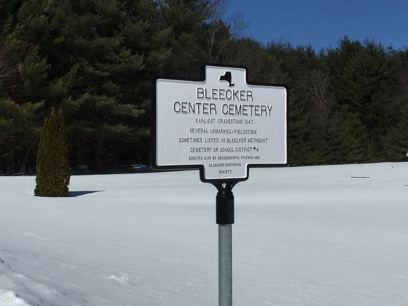
On New York State Route 309 0.2 miles south of Lilly Lake road and 112 (County Route 112), on the left when traveling north.
Earliest gravestone 1852
Several unmarked/fieldstone
Near site of first tannery c. 1840 in Bleecker, NY
A.k.a. School District #3 Cemetery — — Map (db m131497) HM
On Bowlers Hill Road at Lily Lake Road when traveling west on Bowlers Hill Road.
Site of last water powered saw mill in Fulton County. Last operated by Ernst family, 1939. Nearby Bowler Saw Mill Site, built 1845. Bicentennical Fulton Co. 1975 — — Map (db m224722) HM
On County Road 125 (County Route 125) 0.2 miles east of Bowlers Hill Road, on the left when traveling east.
Earliest gravestone 1811
Several unmarked/fieldstone
Named for early Bleecker settler, c. 1795
A.k.a. Upper Bleecker or Grant Cemetery — — Map (db m176628) HM
On County Route 112 0.1 miles south of Gutha Road, on the right when traveling north.
Earliest gravestone 1862 Several unmarked/fieldstone Church built 1866, closed in mid 1930's Reopened 1945 as Bleecker Community Church — — Map (db m131495) HM
On South 2nd Ave 0.1 miles south of West Main Street (County Road 155), on the left when traveling south.
Route of a toll road from
Amsterdam to Fish House. It
linked the rural economy of
the Sacandaga Vly to rail
& canal access in Amsterdam
— — Map (db m47115) HM
On North Main Street at West Main St & Saratoga Ave., on the right when traveling north on North Main Street.
This Side of Street Leveled
On January 21st. Sixteen
Businesses Were Destroyed.
It was an Economic Tragedy,
With No Loss of Life.
Broadalbin Historical Society — — Map (db m75110) HM
On Benedict Loop north of South Shore Road (County Route 110), on the right when traveling north.
This road led to the former
hamlet of Benedict, a small
community with its own
school. Was flooded by the
Sacandaga Reservoir in 1930. — — Map (db m190526) HM
On West Main Street near Center Street, on the right when traveling west.
Lest We Forget To the eternal memory of the men and women
of Broadalbin who served in the armed
forces of the United States
during World War Two
Forever in the Annals of Glory
Will shine their starry claim
The angels know their . . . — — Map (db m136569) WM
On Mill Street at Maple Street, on the right when traveling west on Mill Street.
Also known as Fox Hollow. Site of c.1808 Grist-Mill. Mills here provided lumber, textiles & food, creating a center for commerce and trade — — Map (db m57349) HM
In 1810 Duncan McMartin on this creek built a saw, grist, and woolen mill.
He was surveyor, lawyer, judge court common pleas 1813, Later elected State Senator — — Map (db m30962) HM
On County Route 110, on the right when traveling north.
Named by Sir Wm Johnson after a fishing trip with John Conye who fell out of the boat and nearly drowned.
Hans being the name for John — — Map (db m30963) HM
In Honor of the men and women who served in the armed forces of the United States during World War II In memory of those who made the supreme sacrifice Michael Barna – Paul Borysink Fenton Brown – George Formire Richard Fraker . . . — — Map (db m131494) WM
On Main Street near Saratoga Street, in the median.
In Honor of the valiant men who during the dark days of civil conflict realized that through Union alone could this nation survive and not counting the cost, laid their all on the altar of their country. Through their sacrifice the nation . . . — — Map (db m131492) WM
On New York State Route 29, on the right when traveling east.
Sir William Johnson (1715-1774), Indian trader, statesman, diplomat and colonial empire builder. In 1763 he built Johnson Hall, the center of his estate and the scene of many Indian conferences.
Coming from Ireland in 1738, Johnson traded with . . . — — Map (db m57406) HM
1805 home of Col. Tiffany Brockway. War of 1812 veteran abolitionist. Used as a stop on the underground railroad for fugitive slaves going North. — — Map (db m30959) HM
On County Route 110 at Route 109 on County Route 110.
Built 1815, site Sir Wm Johnson's Fish House by David Marvin, Conn. Rev. soldier; his son Dr. L.I. Marvin, Assemblyman 1840 from Fulton Co. House moved 1929 — — Map (db m31516) HM
On South Shore Road (County Route 110) at Fish House Road, on the left when traveling east on South Shore Road.
This road led to the center
of Fish House where 5 roads
converged amid hotels homes
and stores. Flooded by the
Sacandaga Reservoir in 1930 — — Map (db m190495) HM
On County Route 110 near Benedict Loop, on the right when traveling south.
World Record
Northern Pike Caught Near
Benedict Bay On 9-15-1940
By Angler Peter Dubuc
52.5" Long / 46 Lbs. 2 Oz.
GSL Fisheries Federation Inc.
— — Map (db m97313) HM
J.B. McKean Post G.A.R. first met here February 23, 1891.
R.L. Walsh Post Am. Leg. first met here September 19, 1919.
108 years serving America. — — Map (db m30955) HM
Near New York State Route 10 0.4 miles north of Route 10A, on the left when traveling north.
This trail named in honor of William (Doc) Charles, who organized the first Ski Patrol at Royal Mountain and was the first patrol leader for 15 years.
Doc was a combat infantryman with the 10th Mountain Division in WWII, and saw action in . . . — — Map (db m298404) HM WM
The people of the Town of Caroga humbly dedicate this memorial to those veterans, past and present, living or dead, who fought for the freedom of the United States of America. — — Map (db m137013) WM
On New York State Route 29 at Route 10 on New York State Route 29.
Rechtor Home
Site of home of Nicholas
Rechtor built about 1773.
Revolutionary War soldier
and Captain of Militia in
Tillaborough — — Map (db m132318) HM
On New York State Route 29 at Valley Road, on the right when traveling west on New York State Route 29.
On this creek once stood E. Young's grist & saw mill, L. Stahl Saw Mill, Stahl & Benjamin Paper Mill, making this a prosperous hamlet. — — Map (db m131483) HM
On New York State Route 10 at Co. 140 and Woods Road (County Route 140), on the right when traveling south on New York State Route 10.
Built by Peter Schram in early 1800. Established as Apollo Ballroom, eatery with stabling. Visited by Governors Rockefeller, FDR — — Map (db m131591) HM
On South Shore Road (County Route 110) at Fish House Road (County Route 109), on the right when traveling south on South Shore Road.
Erected 1818, by state, at Fish House over Sacandaga River. D. Stewart, builder. Jacob Shew, Assemblyman. Torn down 1930. 2000 Ft. North — — Map (db m44404) HM
On County Road 110 west of Seneca Avenue, on the right when traveling west.
First settler Fish House under Sir Wm. Johnson, 1762 Sons, John, Stephen, Jacob captured in Tory & Indian raid June 3, 1778. Taken to Canada — — Map (db m46497) HM
On South Shore Road (County Route 110) 0.2 miles north of Old Fish House Road, on the right when traveling north.
Built 1784 by Godfrey Shew
and his sons John, Stephen
and Jacob after their return
from Canada as prisoners of
Col. Ross on June 3, 1778 — — Map (db m174867) HM
On June 3, 1778 Godfrey Shew stationed his son Jacob to report approach Tory and Indian raiders under Col. Ross. Later family made prisoners. — — Map (db m46498) HM
On Harrison St., on the left when traveling north.
Opened July 12, 1906
Home of N.Y.S. League Jags
Host to Future HOF Players,
MLB, Negro League, Semi-Pro
& Industrial Baseball Teams
Dedicated October 13, 2013
— — Map (db m76527) HM
On East Fulton Street (New York State Route 29A) west of Route 30A, on the right when traveling west.
On this site in Aug 1950, the volunteer dept. was established by 50 men who
dedicated countless hours protecting their community. In 2013 the BFD relocated and
continues serving their community. — — Map (db m176634) HM
On East Fulton Street (New York State Route 29A) west of Route 30A, on the left when traveling west.
Common school district #5
built 1869 - 2 rooms
1938 -1 room addition
closed 1969- torn down 2010
Consolidated with G.E.S.D. 1969. — — Map (db m176637) HM
On Kingsboro Ave at Academy Place, on the right when traveling south on Kingsboro Ave.
Site Of
Kingsborough Academy
Built 1831 Demolished 1900
Private School 1831 - 1863
Public Elementary School
1863 - 1900
Bicentennial
Fulton Co. 1976
— — Map (db m66548) HM
For over one hundred years, baseball has been played on the Parkhurst Field grounds. Opened in July 1906 as the A.,J.&G. Baseball Park and home of the professional New York State League's JAGs (Johnstown-Amsterdam-Gloversville), the Park once . . . — — Map (db m304569) HM
On Harrison Street at Industrial Parkway, on the right when traveling south on Harrison Street.
Little League® Baseball and Softball in Gloversville was the brainchild of local businessmen James Del Negro & John Kline back in 1954. At that time, Little League® Baseball was only 15 years old and had approximately 300 chartered leagues across . . . — — Map (db m189216) HM
On West Fulton Street, on the right when traveling west.
Trail Station Park
[Text on the Back]
This Monument Erected 1996 Marks the Site of the Gloversville Passenger Station and Main Offices of the Fonda, Johnstown and Gloversville Railroad It is Dedicated to those who Migrated . . . — — Map (db m68346) HM
On County Route 138 at Union Mills Road, on the right when traveling south on County Route 138.
This 19th c. hamlet had 4
creek-run mills, a printer,
hotel, general store & P.O.
Paper, pegs, lumber and a
weekly paper were produced. — — Map (db m148081) HM
Sent to the Province of New York in 1737, by his uncle Sir Peter Warren for the purpose of supervising landed property in the Mohawk Valley, William Johnson engaged in trade with settlers and Indians.
Prospering in mercantile enterprises, he . . . — — Map (db m52124) HM
Hostilities of the Seven Years' War having commenced, Colonel William Johnson was commissioned a Major General of Provincial Forces and assigned to command the Crown Point Expedition against the French, in 1755. After the failure of the other . . . — — Map (db m52121) HM
On Johnson Ave., on the right when traveling north.
Battle of Johnstown fought
Oct. 25, 1781. American
forces led by Col. Willett
British forces under Maj.
Ross and Capt. Butler.
Bicentennial
Fulton Co. 1975
— — Map (db m58940) HM
On North Market Street near West Main Street ( Route 29/67), on the right when traveling north.
Pioneer For Women's Rights
Was Born in Cady Home Located
On This Site
Erected By New York State Education Department
And Johnstown Chapter, D.A.R.
1937
Rededicated Sep. 18, 1975
— — Map (db m59062) HM
On South William Street, on the right when traveling south.
The History of Woman Suffrage in Four Volumes is the documentary masterpiece from 50 years of co-operative teamwork between Elizabeth Cady Stanton and Susan B. Anthony. Both were outstanding leaders in the campaign for . . . — — Map (db m50238) HM
On S. Perry Street at E.Montgomery Street on S. Perry Street.
This structure was built in 1772 as the Tryon County Jail. It was placed on the highest ground in the village in case of Indian attack or war. It was considered one of America's strongest buildings for defense, with massive stone walls impervious to . . . — — Map (db m55351) HM
In efforts to develop great land holdings, he surveyed and laid out the village of Johnstown, built the first public school, and after Tryon County was set off in 1772, ensured the location of the county seat here. Interested in learning, he was a . . . — — Map (db m52094) HM
Grave of Sir William Johnson
Baronet
1715 - MASON - 1774
His Indian name
Warraghiyagey
"he who does much business"
Founder of
Johnstown
St. John's Episcopal Church
St. Patrick's Lodge 4 F.&A.M.
First Free School
Supt. of Indian . . . — — Map (db m54281) HM
On W.Main Street at N. Market Street on W.Main Street.
1. Johnson Hall - 1763. Baronial home of Sir William Johnson, Superintendent of Indian Affairs for the British Crown. Johnson Hall is listed as a National Historic Landmark. Prior to the Revolutionary War, the home was a Native American trade and . . . — — Map (db m209349) HM
On W. State Street at Hall Ave. on W. State Street.
A man of strong character. A colossal pioneer. One of the greatest men of his time. Sole superintendent and faithful friend of the Six Nations and their Allies. Their Warragiyaey. Founder of Johnstown. He established here the first free school in . . . — — Map (db m57754) HM
On S. Williams Street at W. Montgomery Street on S. Williams Street.
Moved here about 1788. Lot formerly Sir WM Johnson's. Village called John's Town. Younglove home 1812-1926. D.A.R. Chapter House 1926 — — Map (db m76652) HM
On North William Street (New York State Route 29) near W. Main Street ( Route 67), on the right when traveling north.
Historic New York
Johnson Hall - 1763
Johnstown
Sir William Johnson (1715-1774), Indian trader, statesman,diplomat and Colonial Empire Builder, in 1763 built Johnson Hall, the center of his estate and the scene of many Indian . . . — — Map (db m5683) HM
Johnson Hall
A man of Sir William’s position required a grand home to impress his many guests who arrived for political, financial, and diplomatic discussions. Commitments in the French and Indian War(1754-63), however, kept him from . . . — — Map (db m136523) HM
Sir William Johnson built Johnson Hall in 1763 as the center of a grand estate. He was made a British baronet for his role in the French & Indian Wars, a title his son, John, inherited upon his death in 1774.
By December 1775, rebel unrest led John . . . — — Map (db m58846) HM
In memory of the soldiers and sailors of the Civil War who fighting not for themselves but for future generations. Saved the nation. — — Map (db m49978) HM
On W. State Street at Janet Drive on W. State Street.
New York State purchased Johnson Hall in 1906. At that time, after almost 150 years of changing ownership, only 20 acres remained intact of the original 700+ acre property.
The Johnstown Historical Society, trustee of Johnson Hall in the early . . . — — Map (db m58844) HM
Commemorating the first veterans of our nation who fell in the Battle of Johnstown one of the last battles of the American Revolution October 25, 1781 — — Map (db m51705) HM
On New York State Route 10, on the left when traveling north.
Jumpin' Jack Johnston, 3X World Champion 1976-1978, freestyle aerialist skier, executed his first aerial on "The Challenge" in 1972. — — Map (db m136980) HM
On Johnson Avenue at O'Neil Avenue, on the right when traveling north on Johnson Avenue.
This tablet marks the site of
the battle fought in The War
of the American Revolution
October 25th 1781,
and was erected by
The Johnstown Chapter DAR
August 31st 1901 Charter Day
Thus we show to Succeeding generations
that we honor . . . — — Map (db m304583) HM
Gaining considerable knowledge of Indian Affairs, his area of responsibility for administration reached from Hudson's Bay Canada to the Carolinas. From the Atlantic to as far west as any Indians were known.
Appointed to deal with Indians, and . . . — — Map (db m52120) HM
On S. Williams Street at W. Montgomery Street on S. Williams Street.
Rev. War Veteran 1747-1821 expert tanner, began first glove shop behind home on this site 1808. - Founded Fulton Co. leather industry — — Map (db m68523) HM
On North William Street (New York State Route 29) near West Main Street ( Route 67), on the right when traveling south.
This is the only colonial period courthouse still in use in New York State. Tryon County was formed in March 1772 after much lobbying by Sir William Johnson. He donated most of the money needed to build a new courthouse designed by Samuel Fuller of . . . — — Map (db m51896) HM
Famous Post-Revolutionary tavern, resort of "Nick" Stoner, erected 1798 by Capt. Jean Batiste Vaumane de Fon Claire, former officer in French Army under Louis XVI — — Map (db m49975) HM
On New York State Route 29, 30A 0.2 miles north of Main Street, on the right when traveling north.
General George Izard troops encamped here in Sept. 1814 marching from Plattsburgh to Sackett's Harbour by the old state road through Johnstown. — — Map (db m49972) HM
Near Hall Avenue, on the right when traveling west.
Sir William Johnson (1715-1774) came from Ireland in 1738 to administer his uncle's lands in the Mohawk Valley. Johnson became a planter, trader, military officer, land speculator, statesman, Indian agent and churchman. He built a store to trade . . . — — Map (db m58944) HM
On North Market Street, on the right when traveling north.
Birthplace of Elizabeth
Cady Stanton, 1815 - 1902
Pioneer of Women's Rights
A Leader in the Women's
Suffrage Movement.
George E. Pataki, Governor
— — Map (db m59068) HM
On New York State Route 29 at County Route 119, on the right when traveling west on New York State Route 29.
On this corner once stood a
tavern, store, blacksmith
shop, wagon factory, built
by William Lassell who
purchased 50 acres in 1805. — — Map (db m136704) HM
On 30 at Blowers Road, on the right when traveling south on 30.
Anthonyville
Site of First Brick Home In
Town of Mayfield. Birthplace
of George T. Anthony. Quaker,
Civil War Officer, Governor
State of Kansas. 1876-1879
— — Map (db m46954) HM
On County Route 146, on the right when traveling west.
Graves of Captain Gershom Woodworth, French and Indian and Revolutionary Wars and Sergeant Selah Woodworth of Revolution: Mayfield Pioneer. — — Map (db m68208) HM
On Gilbert Road 0.2 miles north of Bushnell Road, on the right when traveling north.
This road led to the former
hamlet of Cranberry Creek.
A small community with RR
station, it was flooded by
Sacandaga Reservoir in 1930 — — Map (db m190516) HM
1074 entries matched your criteria. The first 100 are listed above. Next 100 ⊳