On West University, on the right when traveling east.
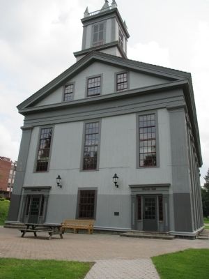
built 1890-1891 by volunteers of A.E. Crandall Hook & Ladder Co. for fire dept. and community events. Became village hall 1973. — — Map (db m171914) HM
On Action Drive, on the right when traveling north.
Dedicated October 6, 1997.
The Allen-Steinheim Museum was built between 1876 and 1890 by Alfred University's second president, Jonathan Allen. A natural history museum, the Gothic ediface was built from approximately 8,000 different specimens of . . . — — Map (db m75795) HM
On Saxon Drive 0.2 miles east of South Main Street when traveling east.
was provided through the generosity of Stephen Clarke Saunders '58 and Barbara Potter Saunders '60, and was dedicated in September 1990 as a remembrance of the heritage of Alfred University and as a memorial to the "Education King." William . . . — — Map (db m75759) HM
On North Main Street just north of Saxon Drive, on the right when traveling north.
Abigail Allen, 1824-1902. Early suffragist, reformer, & Alfred University educator declared "Be radical, radical to the core” in 1873 speech — — Map (db m171918) HM
On Hamilton Hill Rd, on the right when traveling south.
Hamlet formerly named for bridge built by Alpheus Baker, his sons & Joseph Woodruff. Original bridge constructed over Canacadea Creek. — — Map (db m172142) HM
On Petrolia Road 0.1 miles east of Stony Lonesome Hollow Road, on the right when traveling west.
Driller & contractor from PA, who earned nickname of "Dry Hole Ben" by seldom promoting successful oil wells. His continued faith in paying quantities of oil in Allegany County let him drill many historical wells. Including the "Wildcat Well" on . . . — — Map (db m65539) HM
On East Main Street 0.2 miles east of Peacock Hill Road, on the right when traveling west.
Site gift of Church family, 1801; First burial, 1803; among noted men of Allegany Co. Buried here are; Major M. Van Campen, Capt. P. Church, Judge M. Grover and Rev. C. Fairbank — — Map (db m65538) HM
On Park Circle at E Main Street, on the right when traveling east on Park Circle.
Original Court House
Allegany County
Erected 1819
Bricks made on the square in front. Angelica Court House, 1858, by Act of Legislature, was to be disposed of And County Seat moved to Belmont. 1860 county divided into two jury districts. 1861 . . . — — Map (db m159376) HM
On Park Circle at East Main Street (County Road 16), on the right when traveling east on Park Circle.
Founded 1805 by Judge Phillip Church; named for his
mother Angelica Schuyler Church, a sister-in-law of
Alexander Hamilton. Judge Church designed the Park
Circle with public buildings on the perimeter and the
Town Park in the center. Angelica . . . — — Map (db m159374) HM
On Main Street (New York State Route 19) at East Hughes Street (County Route 26), on the left when traveling south on Main Street.
[front] In honor of our soldiers, the defenders of the Union. Civil War 1861-1865. [base] Gettysburg
[right] Sixth New York Cavalry
1st Lieut. John Muldoon; Lieut. Franklin Saunders
93rd. New York Infantry
Capt. John Sherwood . . . — — Map (db m75785) WM
On Main Street (New York State Route 19) at Merton Avenue, on the left when traveling south on Main Street.
We dedicate this memorial to those who served in World War II, Korean Conflict and Vietnam, especially those who died for our freedom. — — Map (db m75787) WM
On Hughes Street close to Loftis Road, on the left when traveling west.
Built by 1856 for use on Genesee Valley Canal, approx. 124-mile-long canal in use until 1878. Railroad later followed canal route. — — Map (db m288808) HM
On Willets Avenue (New York State Route 19) at Park Place, on the left when traveling north on Willets Avenue.
(front)
Erected
by the
citizens of Amity
1861-1865
(right)
In memory
of the men
of the township
(rear)
who offered
their lives
to their country
(left)
in order
that their country . . . — — Map (db m75782) WM
Near Main Street (New York State Route 120) at Bartlett Road, on the right when traveling north.
Used as a burial ground for pioneer families: Lesuer, Tyler, Cowles, Kellogg, Mead, Daniels, Beers, Davie stones date from the 1820's. — — Map (db m88284) HM
On Main Street (New York State Route 417) 0.1 miles south of Foreman Hollow Road, on the right when traveling north.
Early settler Eli Lesuer bought this property 1834. Elected 1st town assessor 1825, school commissioner 1834, and path master 1846. — — Map (db m88283) HM
On Main Street (New York State Route 417) at Liberty Street, on the right when traveling south on Main Street.
The presence of oil in this area of the Allegheny foothills has been known by white men since 1627, when a French missionary reported that the Indians used "a good kind of oil" for medicinal purposes from the nearby Seneca Oil Spring. Production . . . — — Map (db m88286) HM
On Main Street (New York State Route 70) west of S Church Street, on the right when traveling east.
Canaseraga Four Corners Historic District has been placed on the National Register of Historic Places in 2002 by the United States Department of Interior — — Map (db m151154) HM
On East Hill Road (County Route 46) 0.2 miles east of Route 19, on the right when traveling east.
1902 Flood destroyed wooden bridge
1903 Camelback Parker Truss Bridge built by Groton Bridge Works at a cost of $6,360.00.
1952 Wooden floor replaced with iron grating
1990 "Grandparents of the Future" chained themselves to the bridge in . . . — — Map (db m75913) HM
On New York State Route 19 at County Route 49, on the right when traveling north on New York State Route 19.
1902 Flood destroyed wooden bridge 1903 Camelback Parker Truss Bridge built by Groton Bridge Works at a cost of $6,360.00. 1952 Wooden floor replaced with iron grating 1990 "Grandparents of the Future" chained themselves to the bridge in protest . . . — — Map (db m75916) HM
On East River Road 0.8 miles north of McClure Hill Road, on the left when traveling north.
Here in 1782 Major Moses Van Campen, a soldier of the Revolution, captured by the Senecas, keepers of the Western Door of the Iroquois Confederacy, ran the gauntlet thirty rods west to their ancient council house, which is now preserved in . . . — — Map (db m157328) HM
On Fairview Road (County Route 36) 0.1 miles south of Freedom Road (County Route 3), on the left when traveling north.
This building was originally known as the First Presbyterian Church of Centerville. Church members purchased this lot in 1858 and began construction of the church, completing it in 1859 at a cost of $3,000. — — Map (db m75936) HM
On Orchard Street at West Main Street, on the right when traveling north on Orchard Street.
As viewed from in front of the Hotel Kinney, Cuba's Main Street was the place to be. The Cuba Baking Co. was a popular stop for school children. Then, going east, lies the Modern Beauty Salon, the Cuba Theater, owned by the Tantillo family, The . . . — — Map (db m307198) HM
On East Main Street just east of South Street (State Route 305), on the right when traveling east.
Originally built by General Calvin T. Chamberlain, in 1835, The Lafayette House was first of its class and was well known throughout the country for its charm and hospitality. It was named in honor of the Marquis de Lafayette who served the . . . — — Map (db m307199) HM
On W Main Street (New York State Route 119) at Emerald Street, on the right when traveling west on W Main Street.
On this site, the Town of Hume dedicated its World War II Honor Roll in 1943. The use of this area was donated in memory of Robert L. “Bob” and Vonda L. Sylor Bower. The History Club – 2004 — — Map (db m157323) WM
On West Main Street at Sunnyside Street on West Main Street.
Friendship Free Library
has been placed on the
National Register of
Historic Places in 2008
by the United States
Department of the Interior — — Map (db m258338) HM
On County Route 31 0.2 miles east of Moss Brook Street.
In grateful remembrance of the soldiers and sailors who died that the Union might live, Asher W. Miner presents this monument to Hatch Post, 241 G.A.R. Dedicated Aug. 25, 1885. Fraternity, Charity & Loyalty. Gratefully erected in behalf of our . . . — — Map (db m258336) WM
On Genesee St at Willard Ave., on the left when traveling north on Genesee St.
The last one of the Seneca Tribe of Indians that lived in the Town of Caneadea, N.Y. was buried here. His wife died some years before his death. He died March 23, 1864. He said he was 120 years old. — — Map (db m155771) HM
On Genesee St north of Luckey Drive, on the left when traveling north.
In gratitude to the men of Houghton College who gave their lives for god and country in World War II
1941 — 1946
Bennett, Richard T. U.S.A.A.F.
Danner, Robert M. U.S.A.
Dayton, Warren T. U.S.A.A.F.
Ferchen, Walter F. N.A.F. . . . — — Map (db m157098) WM
On Leonard Avenue at Route 19, on the right when traveling west on Leonard Avenue.
albert andrews • benjamin f. andrews • charles b. alfred • daniel blake • col. lyasander burr • fred a. burr • henry l. bigelow • hugh p. bennett • andrew banister • milford butler • crandall bacon • beerly bacon • benson bacon • columbus balcom • . . . — — Map (db m157247) WM
On Genesee Street at Willard Avenue, on the left when traveling north on Genesee Street.
Here was located
the house in which
Willard-J-Houghton
was born July 19, 1825
The foundation stones of this
house form the cross in this
memorial which was erected
by the Class of 1925, the first to
graduate from Houghton . . . — — Map (db m155776) HM
Hanging Bog is a man-made pond built by the Civilian Conservation Corps in the 1930's on then federally owned land. In 1962 Hanging Bog was transferred to New York State. The pond is referred to as Hanging Bog because of its unique mat of floating . . . — — Map (db m86561) HM
On Oil Springs Road 0.2 miles east of Cuba Lake Road (County Route 50), on the left when traveling east.
1627 Seneca Oil Spring 1927 Forms the first chapter in the development of the petroleum industry in America - a gigantic world enterprise transforming modern life. 1627 Oil in American continent first recorded in this region by the Franciscan . . . — — Map (db m86604) HM
Near Main Street (New York State Route 275) at Richardson Avenue.
Stands a monument marking the site of the first commercial well in the Richburg Oil Field. Completed April 27, 1881. This marker was erected by local oil producers and the site provided by the Richburg Board of Education. — — Map (db m88333) HM
On Main Street (New York State Route 19) 0.1 miles north of Vandermark Road (County Road 10), on the right when traveling north.
The area around Scio was first settled around 1805 by Joseph Knight, a minuteman in the American Revolution. Knights Creek, which flows into the Genesee River near Scio, is named for him. Before getting its final name, Scio was called Bloods Corner . . . — — Map (db m175123) HM
On North Main Street 0.1 miles south of East Pearl, on the right when traveling south.
David A Howe, born in West Almond, was raised in Wellsville and attended Dickenson Seminary (present day Lycoming College) in Williamsport, PA. He worked in Wellsville before moving to the Williamsport area where he was involved in many business . . . — — Map (db m170713) HM
On East Pearl Street at Depot Street, on the left when traveling east on East Pearl Street.
Perhaps nothing contributed more to the growth of Wellsville than the arrival of the Erie RR in 1851. The railroad brought many new families and businesses to our area and the population almost doubled in size. The old depot was on Loder Street at . . . — — Map (db m175134) HM
On North Main Street just north of Jefferson, on the right when traveling north.
In 1832 a group of leaders met at Van Buren's Tavern to choose a name for their community. They selected "Wellsville" after Gardiner Wells who was one of the first settlers and the largest landowner. Wells built the first log house on Main Street . . . — — Map (db m175133) HM
On South Main Street at Park Avenue, on the right when traveling south on South Main Street.
Born in Stannards, NY in 1885. His family moved to Wellsville where his love of performing developed at the Baldwin Theatre. He worked on the vaudeville circuit for 25 years. Later, he appeared in many Western movies as a sidekick to stars such as . . . — — Map (db m310488) HM
On South Main Street just north of West Dyke Street, on the left when traveling north.
From 1845 to 1905, Wellsville was home to several tanneries that were reported to be the largest in the world. They provided work for hundreds of people in lumbering and tanning. Hemlock bark was used in the tanning process and was stacked in huge . . . — — Map (db m175132) HM
On South Main Street at West Fassett, on the right when traveling south on South Main Street.
On this site, in 1832, Harmon & Marinda Van Buren built a log house that developed into a hotel, bar, courthouse, and town hall. The house was replaced by the Van Burens with a substantial hotel that was destroyed by fire in 1867. In 1871, Isaac W. . . . — — Map (db m170709) HM
On North Main Street at West Pearl, on the right when traveling south on North Main Street.
William F Jones, an attorney, banker, and prominent businessman, and his wife Gertrude F. Jones will always be remembered for their generous gift, which made today's Jones Memorial Hospital, a reality. In 1920, they bequeathed their stately home for . . . — — Map (db m170717) HM
On West Main Street (New York State Route 417) at North 4th Street, on the right when traveling west on West Main Street.
Allegany Veterans Memorial
Casualties of WWI
Michael O Connell Feb 15 1918 •
Joseph Collins 27 Oct 3 1918 •
Claude Slocum Oct 19 1918 •
Pvt. Charles J Harbel 27 Nov 9 1918 •
Sgt Maurice C Briody 24 1918
Casualties of WWII . . . — — Map (db m60168) WM
On Church Road 0.1 miles south of Cherry Valley Road, on the right when traveling south.
Civil War private buried here. Died in 1863 from wounds rec'd at Chancellorsville. Subject of Walt Whitman's 1864 essay "A New York Soldier". — — Map (db m132668) HM
On Wolf Run Road 1.6 miles south of East Bank Perimeter Road ( Route 280), on the right when traveling south.
Used by former Wolf Run
community ca. 1899-ca. 1929.
Civil War veteran W. Zibble &
Carnahan family buried here.
North.4 mi near clearing. — — Map (db m248505) HM
On New York State Route 394 at Onoville Road ( Route 394), on the right when traveling east on New York State Route 394.
This memorial dedicated by the town of Coldspring to perpetuate the memory of those who made the supreme sacrifice and to honor those who served in the armed forces of the United States — — Map (db m248487) HM
On Otto-Springville Road (County Route 12) 0.1 miles north of East Flats Road, on the right when traveling north.
Building listed on the National Register of Historic Places. One of the last remaining three room school houses in the USA. Noted as an outstanding example of civic architecture. Originally grades one through ten were taught here. School was . . . — — Map (db m132991) HM
On West Washington Street (New York State Route 242) at Park Square, on the right when traveling west on West Washington Street.
Novelist, essayist, and memoirist Cheryl Strayed is an American author whose books have been published in more than 30 languages. Strayed's memoir, Wild: From Lost to Found on the Pacific Crest Trail, chronicles her 1,100-mile solo hike on the . . . — — Map (db m234564) HM
On New York State Route 242 0.1 miles west of Pittsburgh Buffalo Highway (U.S. 219), on the right when traveling west.
10/6/1815, Grove Hurlburt bought lot 57, 150 acres for $525.00, built a log house, the first dwelling in Ellicottville, New York — — Map (db m175141) HM
On Buffalo-Pittsburgh Highway (U.S. 219) 0.2 miles south of Lindberg Road, on the right when traveling south.
The Hinman Valley Wetland Complex consists of 100+ acres of open water, deep marsh, shallow marsh, wet meadow, and forested wetland habitats. The site originally contained over 60 acres of regulated wetland. In 2008, the New York State Department of . . . — — Map (db m104945) HM
On Jefferson Street at West Washington Street ( Route 242) on Jefferson Street.
In Memory of Those from Ellicottville who served in World War I and World War II and especially the following who paid the supreme sacrifice
Egbert L. Barnhard •
William N. Burton •
Douglass D. Dineen •
Alton G. Eastman •
Irvin T. Ebert • . . . — — Map (db m60153) HM
On Jefferson Street (U.S. 219) 0.2 miles south of Martha Street, on the left when traveling south.
Jefferson Street Cemetery has been placed on the National Register of Historic Places in 2012 by the United States Department of the Interior — — Map (db m89102) HM
On Salamanca Sugartown Road (County Route 98) 0.1 miles east of Cadiz Road (Route 69), on the left when traveling west.
The first settlers arrived here in 1806 and this area was called Conrad's Mills. Later the name was changed to Cadiz. Dairy farming was the main occupation in this tiny hamlet within the Township of Franklinville. The famous Ontario Knife Company . . . — — Map (db m86625) HM
On Park Square at Chestnut Street, on the right when traveling east on Park Square.
[left plaque] In memory of those who died in the service of their country. WWI Harry Alger, Gilbert Brown, George Button, George Carson, Claude Domes, Vernal Farrington, William Gavin, Clifford Guthrie, Harmon Hall, Henry Howard, Leighton . . . — — Map (db m86612) WM
On Salamanca Sugartown Rd (New York State Route 98), on the right when traveling west.
Believed to be route on Underground RR. Freedom seekers rafted here, then hidden by stationmasters. Conducted north by Alfred Rice. — — Map (db m182080) HM
On New York State Route 16 / 98 0.2 miles south of Route 98, on the right when traveling north.
Born in Somerset County, New Jersey in 1793, and moved to Farmersville, New York in 1816, with his home near this cemetery. Peter T. Tenbroeck and his immediate family are buried in this plot. Peter T. Tenbroeck was a successful farmer, was a . . . — — Map (db m86627) HM
On New York State Route 98 at Galen Hill Road, on the right when traveling east on New York State Route 98.
Salem Welsh Church built 1855 has been listed in the National Register of Historic Places by the United States Department of the Interior — — Map (db m86649) HM
On Freedom Road (County Route 23) at Osmun Road, on the right when traveling east on Freedom Road.
Welsh Settlement circa 1840, immigrants from Wales settled in Freedom and nearby towns and contributed to the economic, religious, and social life of the area. — — Map (db m86648) HM
On South Water Street 0.1 miles south of West Main Street (U.S. 62), on the left when traveling south.
Thomas Jefferson Parker came from a long military tradition His father, Henry, was a captain of Dragoons in the War of 1812, and his grandfather, Jonathan, was Quartermaster of a Connecticut cavalry troop in the American Revolution. He was regarded . . . — — Map (db m217369) HM
On Salamanca-Sugartown Road (New York State Route 98) at Humphrey Road, on the right when traveling north on Salamanca-Sugartown Road.
Built ca 1856 at junction of Ellicottville-Great Valley Plank Road & road to Franklinville. Served as hotel, livery & post office — — Map (db m95789) HM
On Rock City Road (New York State Route 16) 0.5 miles east of Knapp Creek Road, on the left when traveling east.
The Settlement of Knapp Creek, formerly known as Knapps Creek, was a genuine boomtown in the early days of the Bradford Oil Field, beginning about 1877. It was on a narrow gauge railroad and later an electric street car line. The town boasted a . . . — — Map (db m60154) HM
On U.S. 62 at Cherry Hill Creek Road (County Route 6), on the right when traveling south on U.S. 62.
[left panel] Honor Roll World War I Richard Cooper, Harlow Millman, Rolland Ackler, Clifford Waite, Frank Colleton, Mark J. Hall, Gleason Sheldon, E.W. Cooper (Gold Star), Robert Dow, Alva Baker, Elton Cooper, John Little, Joseph Hare, Milan . . . — — Map (db m133039) WM
On U.S. 62 0.1 miles north of Cherry Creek Hill Road (County Route 6), on the right when traveling south.
Leon Grange has been placed on the National Register of Historic Places in 2014 by the United States Department of the Interior — — Map (db m133013) HM
On U.S. 62 at Cherry Creek Hill Road (County Route 6), on the right when traveling south on U.S. 62.
Leon United Methodist Church has been placed on the National Register of Historic Places in 2000 by the United States Department of the Interior — — Map (db m133018) HM
On Erie St. (New York State Route 353) at N. Ninth St., on the right when traveling north on Erie St..
Cattaraugus County Fair first held here ca. 1854. Promoted agriculture & household mfg. NY Gov. Theodore Roosevelt spoke here August 31, 1899. — — Map (db m171446) HM
On Court Street at 8th Street, on the right when traveling west on Court Street.
"In commemoration we rededicate this historic bell which was transferred from the Court House in Ellicottville, New York to the Courthouse in Little Valley New York in the year 1863. After surviving the fire of April 7, 1946, was placed here for . . . — — Map (db m133040) HM
On Court Street at 7th Street, on the right when traveling east on Court Street.
Bldg. dedicated Sept. 7, 1914 to honor the nearly 3,500 Cattaraugus County citizens who served in the Army and Navy during the Civil War. — — Map (db m132670) WM
On North Center Road 0.1 miles north of Palmer Road, on the left when traveling north.
The North Lyndon school was built ca. 1844 and remained in use until 1947. The school still retains many of its original features. — — Map (db m86611) HM
On Roszyk Hill Road (County Route 16) 0.2 miles east of Maple Avenue (County Route 62), on the left when traveling east.
Dedicated to our Revolutionary War Veterans and The Early Residents buried in Gulf Cemetery Nelson Lingenfelter 1821 1842; Charles Lingenfelter 1822 1841; Darius C. Brace; Amanda Chatfield 1767 1829; Hannah Brown 1727 1809 ; Andrew . . . — — Map (db m133041) HM WM
3507 entries matched your criteria. The first 100 are listed above. Next 100 ⊳