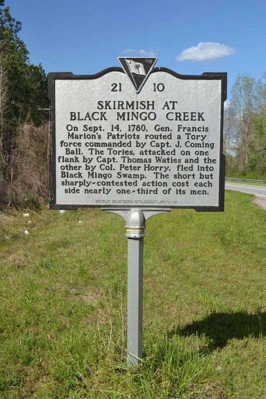
On County Line Road (State Highway 41/51), on the left when traveling north.
On Sept. 14, 1780, Gen. Francis Marion's Patriots routed a Tory force commanded by Capt. J. Coming Ball. The Tories, attacked on one flank by Capt. Thomas Waties and on the other by Col. Peter Horry, fled into Black Mingo Swamp. The short but . . . — — Map (db m27319) HM
On South Island Drive (Local Highway S-22-18) at Wright Skinner Drive, on the right when traveling south on South Island Drive.
In 1711 the Lords Proprietors granted Winyah Barony to Robert Daniel, who sold it to Thomas Smith. By 1787 Retreat had been carved from the 12000-acre grant. — — Map (db m17011) HM
On Browns Ferry Road (State Highway 51), on the right when traveling north.
Prince George Winyah Parish (1721). Early settlement in this area near the Black River, based primarily on the Indian trade and the production of naval stores, prompted the creation of Prince George Winyah Parish in 1721. When the first Anglican . . . — — Map (db m17008) HM
On South Fraser Street (U.S. 17), on the right when traveling north.
To our Guardsmen and Families of the 1 BN 178 FA: In appreciation for your sacrifices, bravery and loyalty during Operation Iraqi Freedom (2004-2005) From the Citizens of Georgetown County — — Map (db m31642) WM
On Front Street at King Street, on the right when traveling south on Front Street.
Cast by the Hughes Foundry near Havre de Grace, Maryland about 1800. The Defense Act of 1794 authorized 180 similar guns to be manufactured. This gun is one of three known to exist today. Two similar guns are in Savannah, Georgia. This gun is . . . — — Map (db m30411) HM
On Front Street 0.1 miles east of King Street, on the left when traveling west.
Heritage Site 2005
923 Front Street
Built 1892 H. Kaminski
H. Kaminski Wholesale Gro.
1892 - 1952
Divided into 913 - 1915 - 917 in 1952 — — Map (db m270853) HM
On Church Street (U.S. 17) at Screven Street, on the right when traveling west on Church Street.
Antipedo Baptist Church In the plan of Georgetown, laid out by 1730, this one acre lot was reserved for Antipedo Baptist by Elisha Screven. A brick building built before the Revolution for the Baptists, Presbyterians, and independents housed the . . . — — Map (db m4889) HM
On Ocean Highway (U.S. 17), on the right when traveling south. Reported missing.
On January 24, 1781, Capts. Carnes and Rudulph, by orders from Gen. Marion and Col. Lee, surprised the British garrison at Georgetown and captured Col. Campbell. Upon Gen. Marion’s second approach, June 6, 1781, the British evacuated the town. . . . — — Map (db m21860) HM
Belle Wilcox Baruch, with great love and foresight for Hobcaw Barony, provided a plan that enables generations of people to understand and learn from Hobcaw's forests, marshes, and beaches.
In 1936, Bellefield Plantation became Belle's winter . . . — — Map (db m39643) HM
On Beneventum Road at Kingsbury Place, on the right when traveling east on Beneventum Road.
(front)
The main house at Beneventum dates to ca.1755. It was likely commissioned by William Fyffe, a surgeon and Scottish emigrant who acquired 500 acres from James Coachman in 1754. Fyffe's plantation was known as The Grove. . . . — — Map (db m202215) HM
On Broad Street east of Church Street / Ocean Highway (U.S. 17), on the left when traveling west.
This cemetery, established ca. 1772, is the second oldest Jewish cemetery in the state and serves a community which has been significant here since well before the American Revolution. Abraham Cohen and Mordecai Myers, who opened stores in the town . . . — — Map (db m4857) HM
On Broad Street at Duke Street, on the right when traveling west on Broad Street.
This African Methodist Episcopal Church was the first separate black church in Georgetown County. It was established by the Rev. A.T. Carr shortly after the 1863 Emancipation Proclamation which freed the slaves. The church purchased this property . . . — — Map (db m7244) HM
On Wood Street south of Highmarket Street, on the right when traveling south.
Organized shortly after the Civil War with Rev. Edward Rhue as its first pastor, Bethesda Baptist Church purchased this site by 1867. Construction of this sanctuary began in 1922 during the pastorate of Rev. A.W. Puller and was completed and . . . — — Map (db m7859) HM
On Rose Hill Road (Local Route 6) at China Grove Lane (private road), on the left when traveling south on Rose Hill Road.
Birthplace of Jeremiah John Snow. China Grove was the birthplace of the Reverend Jeremiah John Snow (1836–1892), a son of the third James Snow who lived here. He entered the Methodist Conference in 1863, and was a chaplain in the Third . . . — — Map (db m16513) HM
On Front Street at King Street, on the right when traveling south on Front Street.
September 17, 2005, the City of Georgetown, South Carolina celebrated two events: The Tricentennial of the first King's Grant in present Georgetown County on September 15, 1705, and the Bicentennial of Georgetown's incorporation in 1805. The . . . — — Map (db m31611) HM
On Ocean Highway (U.S. 17) south of Hobcaw Road, on the right when traveling south.
President George Washington on his southern tour traveled southward over this road, April 27-30, 1791. While in this vicinity the day and night of April 29, he was the guest of Captain William Alston on this plantation, Clifton, which was originally . . . — — Map (db m4877) HM
On Luvan Boulevard 0.5 miles east of Ocean Highway (U.S. 17), on the right when traveling east.
(side 1)
Many Waccamaw Neck planters summered at the seashore from late May to early November to escape the malarial swamps of the rice fields. DeBordieu and Pawleys Islands were favorite destinations. Summer cottages were usually built on . . . — — Map (db m153440) HM
On Front Street at Broad Street, on the left when traveling west on Front Street.
After graduating from the University of South Carolina, C. Spencer Guerry began his law enforcement career on March 1, 1979, by joining the Georgetown Police Department. He rose through various positions of increasing responsibility until attaining . . . — — Map (db m7764) HM
Elisha Screven. Elisha Screven, founder of Georgetown, was a younger son of William, who owned and lived his final years on these Wynyah lands. To promote settlement here, Elisha planned a town, to be called Georgetown, which reserved lots . . . — — Map (db m7604) HM
On Highmarket Street at Cleland Street, on the right when traveling east on Highmarket Street.
This congregation, founded in 1794 and long known as Antipedo Baptist Church, was the first separate Baptist congregation in Georgetown. Baptists had worshipped in the area as early as 1710, sharing the Black Mingo Meeting House with . . . — — Map (db m7953) HM
To the honor and glory of Francis Marion and his men who under extreme hardships did such valued service for the independence of their country in the War of the American Revolution. — — Map (db m23551) HM
On Palm Street south of Rutledge Street, on the left when traveling north.
(side 1)
Friendly Aid Society
The Christian Friendly Aid Society (CFAS), an African American benevolent society, built a lodge here c.1947. The Society began in the early 20th century among neighborhood families descended from people . . . — — Map (db m184675) HM
On Whites Bridge Road north of Highmarket Street (Alternate U.S. 17), on the left when traveling north.
When Capt. John Nelson, sent by Gen. Marion, Jan., 1781, to the Sampit Road to reconnoitre, met Capt. Barfield and his Tories near White’s Bridge, a sharp fight ensued. Lieut. Gabriel Marion, nephew of Gen. Marion, was captured and inhumanely shot . . . — — Map (db m16365) HM
On Highmarket Street (Alternate U.S. 17) just west of West Virginia Road, on the left when traveling west.
Volunteer aide-de-camp to Gen. Beauregard in April 1861, mustered into Confederate service at White’s Bridge near here on July 19, 1861, as Colonel of the 10th Regiment, S.C. Infantry, promoted Brigadier General on April 26, 1863, wounded at the . . . — — Map (db m16378) HM
Near Front Street at Broad Street, on the right when traveling south.
Ships and boats have loaded and unloaded cargo at the Sampit River near Front Street since the founding of Georgetown, ca. 1729. In 1732 Georgetown became an official port of entry, shipping naval stores rice, indigo, pork and animal skins. In . . . — — Map (db m202220) HM
On Highmarket Street (U.S. 521) west of Screven Street, on the left when traveling east.
Georgetown, the third oldest town in the state, was laid out in 1729 by Elisha Screven on land granted to John and Edward Perrie, Sept. 15, 1705, and deeded by him, Jan. 18, 1734, to George Pawley, William Swinton, and Daniel La Roche, Trustees. It . . . — — Map (db m7422) HM
On Screven Street at Prince Street, on the right when traveling south on Screven Street.
This courthouse, designed by prominent architect and
South Carolina native
Robert Mills (1781–1855),
was built in 1823–24 to replace a courthouse which had been damaged by two hurricanes. Mills himself,
who also designed the . . . — — Map (db m7634) HM
On Front Street at Broad Street, on the left when traveling west on Front Street.
Monument:
Dedicated to the memory of
those who made the supreme
sacrifice and in honor of
all who served their
country in time
of need
Footer stone:
Sponsored by
American Legion
Post 114 Post 173 Post . . . — — Map (db m39646) HM
Near Front Street, on the right when traveling south.
Georgetown Steel Corporation converts iron ore imported from South America and Canada in to premium-grade steel wire rod that ultimately is used in the manufacturing of radial tires, pre-stressed concrete strand and dozens of commercial and . . . — — Map (db m31641) HM
Near King Street at Front Street, on the left when traveling south.
Georgetown’s Industrious Past
Port of Georgetown
Indigo was first introduced to the area around the 1740's and served as Georgetown's first principal cash crop. Taking advantage of British bounties for indigo, highly prized as a clothing dye in . . . — — Map (db m100768) HM
The 17,500-acre Hobcaw Barony is one of the few remaining undeveloped tracts of land on the Waccamaw Neck. Once part of a 1716 land grant, its name comes from Hobcaw, the Native American word meaning between the waters, and . . . — — Map (db m102745) HM
On Hobcaw Road at Ocean Highway (U.S. 17) on Hobcaw Road.
In 1718 the Lords Proprietors granted
12,000 acres on Hobcaw Point, the
southern portion of Waccamaw Neck,
to John, Lord Carteret. The barony was
subdivided beginning in 1766, creating
several large rice plantations which
flourished until . . . — — Map (db m16288) HM
Thomas Lynch, Jr., signer of the Declaration
Of Independence, was born here Aug. 5, 1749.
He was elected from St. James Parish, Santee,
to 1st Provincial Congress, Dec. 19, 1774; to
2nd Provincial Congress, Aug. 7-8, 1775; to
the Continental . . . — — Map (db m16299) HM
On Duke Street at King Street, on the left when traveling east on Duke Street.
After purchasing this land January 1, 1866, Georgetown Colored Academy built a school here. By 1908 the old building had been torn down and a new school built, its name changed to Howard. The elementary department moved into a new structure on . . . — — Map (db m7864) HM
On 231 King Street just south of Highmarket Street, on the right when traveling south.
In the 1870's, this was the home of James Alfred Bowley (c.1844-1891). Born enslaved in Maryland, Bowley was the great nephew of Harriet Tubman (c.1822-1913). In 1850, Tubman and Bowley's free father organized a plan to free Bowley and his mother . . . — — Map (db m184592) HM
On Front Street at St. James Street, on the right when traveling east on Front Street.
This house, one of Georgetown’s earliest, was built ca. 1737 by John and Mary Perry Cleland. Mrs. Cleland inherited the property from her father John Perry, who had been granted a large tract in 1705 including the site of present-day Georgetown. . . . — — Map (db m7863) HM
On Front Street at King Street, on the left when traveling west on Front Street.
The Joseph H. Rainey House is a historic house at 909 Prince Street in Georgetown. Built in the 1760s, it was the home of the first elected Black representative in the United States Congress, Joseph Hayne Rainey. Rainey was born a slave in 1832 in . . . — — Map (db m269791) HM
On Front Street at King Street, on the right when traveling east on Front Street.
Born to slave parents in 1837, Joseph escaped to Bermuda during the Civil War. After, he returned to Georgetown and became a Republican delegate to South Carolina's 1868 constitutional convention and was later elected to the state senate. In . . . — — Map (db m300911) HM
On Prince Street east of King Street, on the right when traveling east.
This National Historic Landmark was the family home of Joseph H. Rainey, the first African American elected to the US House of Representatives, 1870–1879. Born in Georgetown County in 1832, Rainey, it is said, made blockade-running trips during the . . . — — Map (db m7528) HM
This park was dedicated in 1993 to the memory of Georgetown native Joseph Hayne Rainey, the first African American to serve in the U.S. House of Representatives. Born to slave parents in 1832, Rainey escaped to Bermuda when the War Between the . . . — — Map (db m31640) HM
On Front Street near King Street, on the left when traveling west.
This house, probably built between 1750 an 1800, was for many years the home of Harold Kaminski (1886–1951), Georgetown County commissioner, mayor 1930–35, and U.S. Navy officer, and his wife Julia Bossard Pyatt (d. 1972). The house was originally . . . — — Map (db m98297) HM
Dating back to the 1700s, the Kaminski House contains one of the finest collections in English and American antiques and furnishings in South Carolina. The original structure with beaded clapboard siding was built around 1769 by Paul Trapier, a . . . — — Map (db m6855) HM
On Front Street, on the right when traveling west.
Overlooking the Sampit River, the Kaminski House Museum is pre-Revolutionary War and one of over 60 antebellum landmarks in the Georgetown Historic District. The house was built by Paul Trapier, a prominent local merchant, considered to be one of . . . — — Map (db m66371) HM
A lover of liberty, Lafayette left Bordeaux, France, March 26, 1777, “to conquer or perish” in the American cause, and arrived at Benjamin Huger’s summer home near here, June 14, 1777, where he spent his first night in America. He . . . — — Map (db m4872) HM
On Front Street near King Street, on the right when traveling south.
This Tablet Commemorates the 175th
Anniversary Of The Landing Of The
Marquis de Lafayette
at North Island on Winyah Bay
June 13, 1777
and the First Day Issue of the
Lafayette Memorial Stamp
in Georgetown, South Carolina . . . — — Map (db m65915) HM
On Belle Isle Road (County Route S22-295), on the right when traveling south.
Lest We Forget In memory of the Confederate soldiers who served at Battery White during the War Between the States 1861 - 1865 Erected by Arthur Manigault Chapter United Daughters of the Confederacy May 25, 1929. — — Map (db m31645) HM
Near Harborwalk, on the left when traveling north.
Georgetown is blessed with deep navigable rivers that historically served as the city's safest and easiest routes for trading. Four rivers flow together to form Winyah Bay: Sampit, Waccamaw, Pee Dee, and Black. Each river's name, with the . . . — — Map (db m102544) WM
On Front Street at Screven Street, on the right when traveling west on Front Street.
This tablet commemorates the 150th anniversary of the first landing of Marquis de Lafayette accompanied by Baron de Kalb on North Island, Georgetown County, S. C. June 13, 1777. He came to draw his sword for the young republic in the hour of her . . . — — Map (db m7717) HM
On Orange Street south of Highmarket Street, on the right when traveling south.
William Wayne, nephew of Revolutionary General Anthony Wayne, was converted here by Bishop Francis Asbury on February 24, 1785, and a Methodist congregation was formed later that year. Woolman Hickson was appointed minister. This is the site of an . . . — — Map (db m7854) HM
On East Bay Street south of River Road, on the right when traveling east.
Historically Significant
A strategic site of protection for the city and harbor.
Presently
This beautiful public park offers excellent vistas of upper Winyah Bay's marshes, beaches, waterways, and harbor. . . . — — Map (db m300886) HM
On Duke Street at Wood Street, on the right when traveling east on Duke Street.
This church was founded in 1866 by Rev. James Smalls, its pastor for many years. The congregation, which built its sanctuary here on land owned by the Gospel Harp Society, grew to more than one hundred members by 1903. In 1914 trustees S.B. Belin, . . . — — Map (db m7873) HM
On Kent Road at Porter Road, on the right when traveling west on Kent Road.
(front)
Bishop Francis Asbury first arrived in Georgetown in Feb. 1785 and would return in 1786, at which time he established a slave mission at Boone Plantation on the Sampit River. Asbury would return many times over the years and his . . . — — Map (db m202218) HM
On Front Street east of Queen Street, on the right when traveling east.
The Old Market Building was constructed in 1842, replacing an earlier wooden structure that was torn down the previous year. The lower story arched area was used as an open-air market and the upper story as the town hall. It was there that the . . . — — Map (db m300914) HM
On Highmarket Street at North Fraser Street (U.S. 17), on the right when traveling west on Highmarket Street.
From the 1880's to the 1930's the block bordered by Highmarket, Dozier, Duke and Church streets served as a cemetery for criminals, the indigent and the unknown. These types of cemeteries were located in many towns and communities and were . . . — — Map (db m184660) HM
On Highmarket Street (U.S. 521) east of Broad Street, on the left when traveling east.
Parish founded 1721. Present church erected about 1750. Aided by the Society for the Propagation of the Gospel in Foreign Parts, London. Occupied by British forces during the Revolution. — — Map (db m7421) HM
On Highmarket Street (U.S. 521) east of Broad Street, on the left when traveling east.
Prince George’s Parish, Winyah, was created March 10, 1721, and the parish church erected on Black River, 1726, at the present Brown’s Ferry. After Prince Frederick’s Parish was formed from Prince George’s, April 9, 1734, the parish church was . . . — — Map (db m82442) HM
On Ocean Highway (U.S. 17) south of Arcadia Plantation Drive.
On his tour south to inspect the defenses of the Atlantic coast, President Monroe reached Prospect Hill, Col. Benjamin Huger’s residence, April 21, 1819. During his stay, April 21-24, he was lavishly entertained by his host and by the citizens and . . . — — Map (db m4870) HM
On Prince Street, on the right when traveling north.
Has Been Designated A
National
Historic Landmark
This site possesses national significance
in commemorating the history of the
United States of America — — Map (db m102552) HM
Rice was introduced to the area as early as 1690, but did not become a major crop until after the Revolutionary War. Local planters made large fortune cultivating rice - Carolina Gold - in the area's low-lying river estuaries. This crop required . . . — — Map (db m102545) HM
On Front Street north of King Street, on the right when traveling north.
The Robert Steward House was built between 1740 and 1770 by Robert Stewart (d.1776), planter and militia captain; it was acquired in 1787 by Daniel Tucker (d. 1797), prominent Georgetown merchant. When President George Washington arrived in . . . — — Map (db m4856) HM
Here are buried William Screven (1624–1713) and other members of his family. A native of England, he migrated to Kittery, Me., and was persecuted by New England authorities for non-conformity. He and other members of the Kittery Church came to . . . — — Map (db m7612) HM
On North Frazer Street (Alternate U.S. 17) at Indigo Avenue and Anthuan Maybank Drive, on the right when traveling north on North Frazer Street.
Here Sgt. McDonald bayoneted the fleeing Maj. Gainey, following the defeat of the Tories under Major Gainey by the Americans under Col. Peter Horry. This bloody skirmish took place, January, 1781, between the Sampit and the Black River roads. — — Map (db m7474) HM
On Front Street east of Broad Street, on the right when traveling east.
Ship's propeller from the 1905 wreck of the Norwegian steamship Leif Eriksson
Courtesy of Senator Stephen Goldfinch & Kent Rogerson — — Map (db m300938) HM
(Front) In early 1865 the USS Harvest Moon, a 193-foot, 5-gun side-wheel steamer, was the flagship of Adm. John A. Dahlgren of the South Atlantic Blockading Squadron, U.S. Navy. It arrived off Georgetown and anchored nearby on . . . — — Map (db m48346) HM
On Prince Street west of Cannon Street, on the right when traveling east.
The live oak between houses 513 and 515 Prince Street is registered with The American Forestry Associates as a State Champion – South Carolina. In 1940 the tree was estimated to be over 500 years old, and it measured 23 feet in circumference, . . . — — Map (db m7662) HM
Founded in 1729, Georgetown is the third oldest city in South Carolina and was named for George, Prince of Wales, who later became King George II. Settled by migrating families from Charleston, the colonial residents made their livelihood as . . . — — Map (db m9971) HM
Near Orange Street at Front Street, on the left when traveling south.
Port of Georgetown
South Carolina's Third Oldest City
It is believed that the Spanish first settled an outpost on Winyah Bay in 1526. Allegedly, this settlement only lasted six months and no remains have ever been found. Georgetown was formally . . . — — Map (db m100767) HM
On Winyah Street east of G Street, on the right when traveling east.
In 1897, members of Bethel African Methodist Episcopal (AME) Church, led by Rev. Washington P. Carolina (1864-1939), obtained 1/2 ac. of land at this site and founded St. Stephen AME Church. Tradition holds that members met beneath a brush arbor . . . — — Map (db m300882) HM
On Harborwalk south of Front Street, on the left when traveling south.
The original Charters of Freedom are on display in The Rotunda at the National Archives in Washington, D.C.
The Declaration of Independence was adopted July 4, 1776.
The United States Constitution was adopted September 17, . . . — — Map (db m300912) HM
On King Street north of Front Street, on the left when traveling north.
In Memory of Walter Wilbert Manigault
Walter Wilbert Manigault (1910-1968) a native of South Carolina, was a prominent mortician, civic activist, humanitarian and businessman in Georgetown County for several decades. Mr. Manigault and William . . . — — Map (db m300913) HM
136 entries matched your criteria. The first 100 are listed above. The final 36 ⊳