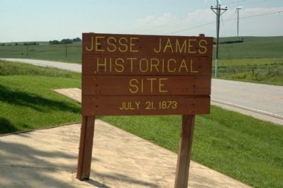
On 5th Street at Broad Street, on the right when traveling north on 5th Street.
Dedicated in honor and memory of those who served in the World War
These made the supreme sacrifice
*Magarrell, Melvin W., killed in action ·
*John Wesack ·
*Farrell, William ·
*Grimes, Edward ·
*Schmidt, Ernest ·
*Wedemeyer, . . . — — Map (db m236310) WM
On South 1st Street just north of Southeast Kent Street (State Route 92), on the right when traveling north.
This property is a contributing building to the Greenfield Public Square Historic District National Register of Historic Places by the United States Department of the Interior — — Map (db m193876) HM
On North 1st Street at Public Square, on the right when traveling north on North 1st Street.
Founded 1875 by Daniel Heaton Presidents: Daniel Heaton 1875-1907; E. H. Bickford 1907-24; Ethel B. Foster 1924-48; Jay E. Howe 1948-61; T. N. Howe 1961-78. — — Map (db m193968) HM
On South 1st Street north of Southeast Kent Street (State Route 92), on the right when traveling north.
This property is a contributing building to the Greenfield Public Square Historic District National Register of Historic Places by the United States Department of the Interior — — Map (db m193877) HM
On Public Square just east of North 1st Street, on the right when traveling west.
This property is a contributing building to the Greenfield Public Square Historic District National Register of Historic Places by the United States Department of the Interior — — Map (db m193970) HM
On the Public Square at East Iowa Street, on the left when traveling north on the Public Square.
In grateful appreciation this monument is dedicated to the Veterans of Adair County who served their country in times of war and peace. — — Map (db m72442) WM
On the Public Square at 1st Street, on the left when traveling east on the Public Square.
Thank You Veterans For Our Freedom
Our debt to the heroic men and valiant women of our country can never be repaid. They have earned our undying gratitude. America will never forget their sacrifices.
President Harry S. . . . — — Map (db m72443) WM
"A grass plant is small and humble, lost in the multitude, and unnoticed. Hardly one person in a hundred thousand realizes what is going on in the growth of grass. But for the protection of the soil, grass is just as important as trees - and for . . . — — Map (db m86940) HM
The Garden Pond Is In Memory Of
Our Great Grandfather
Jasper James
And His Family
They moved to Adair County in 1892 by covered wagon with their young children herding the livestock. They settled on a farm two and a half miles . . . — — Map (db m86929) HM
When the first settlers arrived in Iowa, nearly 30 of this state's 35 million acres were blanketed with tallgrass prairie. In less than 150 years, 99.9% of this vast, lush grassland disappeared under the plow. The prairie before you contains some . . . — — Map (db m86930) HM
On School Street (State Highway 25) south of Division Street, on the right when traveling north.
Determined and authenticated by
the Historical Department of Iowa, 1911.
This monument was erected in 1917 by
the Iowa Daughters of the American Revolution
in memory of the pioneers who followed
this trail and its tributaries.
We cross . . . — — Map (db m86922) HM
On Broad Street south of 1st Street, on the right when traveling south.
This flag display has been erected by the Bank of Memories Museum in proud and grateful memory of American soldiers, sailors, marines and airmen and especially those who laid down their lives in all quarters of this earth, that other peoples might . . . — — Map (db m86925) WM
On Front Street, on the right when traveling east.
Built: 1879, In operation until 1960's
Put on National Historic Register in 1980
Renovated: 1997 - 2015
Now: Community Center & Historic Artifacts Displays — — Map (db m304270) HM
On Benton Avenue at 10th Street, on the right when traveling north on Benton Avenue.
The Adams County House of History served as county Jail House and Sheriff's Quarters from 1877 to 1955. The stones that were used to build the jail house were hauled from St. Joseph, Missouri, by oxen and wagon. The effort to purchase and renovate . . . — — Map (db m86668) HM
On 6th Street west of Adams Street, on the right when traveling west.
Remembering Our Heroes
———————
Our Liberties We Prize
and
Our Rights We Will Maintain
———————
John Thuman - KIA WWII
Billy Cooper - KIA Korea . . . — — Map (db m86994) WM
On 34th Infantry Division Highway (U.S. 34) at Mulberry Avenue, on the left when traveling east on 34th Infantry Division Highway.
Formed in France by Etienne Cabet, this group comprised of many talented and well-educated persons. All possessions surrendered to a common fund, all worked for common good.
Landed in New Orleans in 1848 all applied for citizenship, same . . . — — Map (db m291323) HM
On Grove Avenue at 10th Street, on the left when traveling north on Grove Avenue.
This bell first rang in the Congregational Church which was built on this site in 1871. A new church building was constructed here in 1900, and it included a tower for the bell. The Congregational Church federated with the Presbyterian Church in . . . — — Map (db m86999) HM
On 12th Street at State Street, on the right when traveling south on 12th Street.
Albert I. Lodwick (pictured at the top of the mural) was born in Mystic, Iowa on March 4, 1904. On July 10, 1938, due in large part to Albert Lodwick's organizational skills as his flight operations manager, Howard Hughes set a record by . . . — — Map (db m90374) HM
On West North Street east of Myra Lane, on the right when traveling east.
Mine cars hauled coal from the depths of the mineshaft to the surface, where it was loaded onto trucks. There were two types of mines in Appanoose County - slope mines and shaft mines. Slope mine cars were usually pulled by Shetland ponies or . . . — — Map (db m276231) HM
In the late 1940's, the local Booster Club and the American Legion post held community fund raising events to secure the $400 needed for Moravia's first fire siren. The emergency siren was placed on top of the Masonic Building and put into . . . — — Map (db m276239) HM
The Fairview School opened its door to the first class of students in the fall of 1873. On hundred forty-three years later, this treasured little country schoolhouse was moved to the Wabash Depot Historical Complex to begin its second life as an . . . — — Map (db m276233) HM
On West North Street east of Myra Lane, on the left when traveling east.
The Interurban Depot was built at the beginning of the 20th century. Circa 1902 the operation was electrified, starting with 3 motor cars. And by 1914 the Interurban Depot fulfilled Moravia's dream of being the best small-town center of . . . — — Map (db m276229) HM
Author James Floyd Stevens wrote short stories about the legendary, larger than life lumberjack Paul Bunyon and Babe the Blue Ox, based on tall tales he had heard in the logging camps of his youth. Stevens was born near Iconium, Iowa and moved to . . . — — Map (db m276252) HM
After a tornado destroyed both the Fairview Methodist and Antioch churches, area families joined forces in 1884 to build what later became known as the Main Station Church. Located just east of the current Rathbun Lake, it was adjacent to the . . . — — Map (db m276251) HM
On East Chariton Street at William Street, on the right when traveling east on East Chariton Street.
In the winter of 1846, the first Mormons crossed the Mississippi River, traveling west near the areas that later became Unionville, Moravia and Iconium. Three years later, in 1849, the Moravians traveled by schooner following the same route . . . — — Map (db m276172) HM
Outhouses were used before modern bathrooms existed. Every homestead had one located some distance from the house. Most were designed for one individual, although some could accommodate two. Toilet tissue was often a luxury, so substitutes such . . . — — Map (db m276241) HM
On West North Street east of Myra Lane, on the right when traveling east.
The section car transported workmen by rail when tracks needed repair. A hand crank was used to propel the early models. Section gangs of six to eight men worked on an assigned track section of 4-5 miles, and they used these cars to get tools and . . . — — Map (db m276230) HM
A summer kitchen was the most multi-functional part of any farmstead during the 19th and early 20th centuries. Cooking, canning, laundry, smoking meats, making soap, rendering lard, and many more tasks which produced a great deal of heat and . . . — — Map (db m276242) HM
On West North Street east of Myra Lane, on the right when traveling east.
In 1903, the Wabash Depot was built on the north side of West North Street, using Queen Anne style architecture. When the Wabash Railroad donated the depot to the Moravia Area Historical Society in 1975, it was relocated to the south side of the . . . — — Map (db m276232) HM
Underneath Rathbun Lake, where the south branch of the Chariton River ran, lies the remains of most of the village of Griffinsville. At the turn of the century it was a thriving little inland hamlet with several houses, a general store, Barney . . . — — Map (db m85505) HM
On South Main Street (U.S. 69) south of West Washington Street, on the right when traveling south.
Dedicated to all Clarke County veterans who gave their last full measure of devotion
Civil War
Alloway, Nelson ·
Avery, Philo ·
Babington, George ·
Bare, Ira A. ·
Bare, Thompson ·
Barnes, George ·
Barrows, Thomas J. · . . . — — Map (db m235827) WM
Near Interstate 35 south of Iowa Highway 34, on the right when traveling south.
The Mormon Trail The Mormons of Nauvoo, Illinois, forced from their homes following the murder of their prophet, Joseph Smith, Jr., began their trek across Iowa in 1846 on the way to the Great Salt Lake Valley. From their first permanent . . . — — Map (db m237260) HM
Near Interstate 35 at milepost 32, 2.9 miles north of Elk Street, on the right when traveling north.
From the late 1840s through the 1860s, an exodus of more than 70,000 Mormons passed by here on their way to their "New Zion" in Utah. Starting from Nauvoo, Illinois in February 1846, the first group of at least 13,000 Mormons crossed into Iowa to . . . — — Map (db m235830) HM
On East Franklin Street at South Washington Street (U.S. 63), on the right when traveling west on East Franklin Street.
Visible for miles across the prairie, the Second Empire style Davis County courthouse has captivated admirers for more than 150 years. Completed in 1877, at a cost of $45,201, this crown jewel is surmounted by the 9 foot tall, blind "Goddess of . . . — — Map (db m276096) HM
On Washington Street (U.S. 63) south of Jefferson Street, on the right when traveling south.
Built in 1877 at a cost of $45,201, the Davis County courthouse is an outstanding example of Second Empire architecture with its distinctive mansard roof and dormer windows. The structure measures approximately 97 by 87 feet with walls made of . . . — — Map (db m90341) HM
On South Madison Street north of Franklin Street, on the right when traveling north.
With the faith and courage of
their forefathers who made
possible the freedom of these
United States
The Boy Scouts of America
dedicate this replica of the
Statue of Liberty as a pledge
of everlasting fidelity and
and . . . — — Map (db m276116) HM
On South West Street 0.3 miles south of Karr Avenue, on the left when traveling south.
Site of
The Confederate Invasion of Iowa
12th Day of October 1864.
This monument marks the northern most point of incursion into Iowa by Confederate Forces. On October 12, 1864, Lieutenant James “Bill” Jackson led twelve heavily . . . — — Map (db m36092) HM WM
On North Washington Street at Weaver Street (U.S. 63), on the right when traveling north on North Washington Street.
As you gaze across the highway, imagine there is no road. Instead the stately, brick home you see is sited in the midst of three acres including Weaver Park where you are standing. The home is surrounded by native maple and elm trees, and there . . . — — Map (db m276035) HM
On Main Street just west of Jefferson Street, in the median.
What turns a trip of a few weeks into a grueling journey that lasts months? For the Mormon pioneers, it was prairie grass. The Iowa prairie was winter-bare when Brigham Young and the first group of Latter-day Saints fled Nauvoo in February 1846. . . . — — Map (db m291801) HM
On Main Street at Washington Street, in the median on Main Street.
The Davis County Freedom Rock was completed in the spring of 2016 and painted by artist Ray “Bubba” Sorensen II. The Freedom Rock Tour created by Sorensen aims to spread the message of thanking our veterans while providing a unique Freedom Rock for . . . — — Map (db m291600) HM
Near Interstate 35 north of County Highway J52, on the right when traveling north.
The Mormon Trail The Mormons of Nauvoo, Illinois, forced from their homes following the murder of their prophet, Joseph Smith, Jr., began their trek across Iowa in 1846 on the way to the Great Salt Lake Valley. From their first permanent . . . — — Map (db m224588) HM
On Linden Street south of Main Street (U.S. 69), on the right when traveling south.
Graceland College began classes here on September 17, 1895 with 18 students and 3 faculty. The college moved to the campus on "the hill" upon completion of the Administration Building in January, 1897. — — Map (db m86719) HM
On Main Street north of 1st Street (Iowa Highway 2), on the left when traveling north.
1850 • Decatur County was organized
1853 • County seat moved from
Decatur City to Independence
1855 • Town name change from
Independence to South Independence
to Leon
1871 • Chicago, Burlington & Quincy
Railroad arrives in Leon . . . — — Map (db m89356) HM
On Main Street south of 3rd Street, on the left when traveling south.
With the faith and courage of
their forefathers who made
possible the freedom of these
United States
The Boy Scouts of America
dedicate this replica of the
Statue of Liberty as a pledge
of everlasting fidelity and
loyalty . . . — — Map (db m72390) HM WM
On 1st Street (U.S. 69) at Church Street (U.S. 69), on the right when traveling west on 1st Street.
From the late 1840s through the 1860s, an exodus of more than 70,000 Mormons passed by here on their way to their "New Zion" in Utah. Starting from Nauvoo, Illinois in February 1846, the first group of at least 13,000 Mormons crossed into Iowa . . . — — Map (db m72391) HM
On South Main Street at Division Street, on the right when traveling north on South Main Street.
No. 3003This S-4 Hudson class passenger locomotive was the fourth engine produced by the Baldwin Locomotive Works for the Chicago, Burlington and Quincy Railroad (CB&Q). In 1930 when the steam engine was built it was considered to be . . . — — Map (db m238371) HM
On North 4th Street just south of Washington Street, on the left when traveling south.
At this site, on the 26th day of September 1864, the Donahue and McCosh Marble Shop put on display the first Civil War Monument west of the Mississippi River. It is now located at the Kossuth Cemetery east of Mediapolis Iowa. — — Map (db m238379) HM
On Jefferson Street west of North 4th Street, on the left when traveling west.
This property has been placed on the National Register of Historic Places by the United States Department of the Interior Hedge's Building 1881 — — Map (db m238376) HM
On Washington Street at North 6th Street, on the right when traveling west on Washington Street.
Built in 1894, Burlington, Iowa’s Snake Alley is unbelievably crooked — boasting five half-curves and two quarter-curves that span 275 feet!
The street rises over 58.3 feet at a 21% grade and has 1100 degrees of turns!
Ripley’s Believe It . . . — — Map (db m175883) HM
Near Main Street 0.1 miles north of Mediapolis Road (County Road H38), on the left when traveling north.
[east side]
To the memory of our
brave soldiers from Yellow Spring Township who died in the service of their country, and their comrades. Dedicated July 4, 1866 [north side]Co. C 30th Iowa Inf. Wm. F. Long • Mort E. . . . — — Map (db m181888) WM
On Main Street (County Road H38) at South Curve Street, on the right when traveling east on Main Street.
☆ Jimmie Howard, a Marine Corps SSG, served in Viet Cong and Korea. He was awarded the Medal of Honor for his actions on Hill 488, along with many additional honors. ☆ The Iowa Army Ammunition Plant has been an important asset . . . — — Map (db m181877) HM WM
On North Broadway Street south of East Broad Street, on the left when traveling south.
Commitment to Educational Excellence Born August 23, 1846, Bell Babb Mansfield moved to Mount Pleasant — known as “the Athens of Iowa” — in 1860. At Iowa Wesleyan University, she earned the B.A. in 1866, M.A. in 1870, and LL.D. in 1872. . . . — — Map (db m177823) HM
On West Courtland Street at Hickory Avenue, on the right when traveling west on West Courtland Street.
With the assistance of Senator James Harlan, the War Department authorized a military training camp at Mount Pleasant in October of 1861. The first recruits began arriving that September at Camp Harlan, which was designated as a cavalry training . . . — — Map (db m92519) HM
On West Courtland Street at Hicakory Avenue, on the right when traveling west on West Courtland Street.
This marks the site of
Camp Harlan
used as a training camp by
the 4th Iowa Cavalry and
the 25th Iowa Infantry
during the Civil War
Dedicated by
Belle Coddington Tent No. 34
Daughters of Union Veterans
of the
Civil War . . . — — Map (db m92520) HM
Near North Main Street north of East Pearl Street, on the right when traveling north.
Established by the Southwest German Conference of the Methodist Episcopal Church in affiliation with Iowa Wesleyan College for the theological training of German Methodist ministers to serve area German-speaking churches Historical marker erected in . . . — — Map (db m177879) HM
On East Washington Street (Business U.S. 34) just east of South Main Street, on the right when traveling east.
In honor of those who served In tribute to those who perished In gratitude to those now serving Avenue of Flags of Henry County Iowa Veterans Memorial[south side]Medal of Honor Recipients from Henry County Charles A. Swan USA . . . — — Map (db m240483) HM WM
On North Jefferson Street at West Madison Street, on the right when traveling north on North Jefferson Street.
Home of James Harlan, 1857-1873 Pres., Iowa Wesleyan University, 1853-1855 United States Senator, 1855-1865; 1867-1872 Secretary of the Interior, 1865-1866 — — Map (db m177889) HM
Near North Broadway Street south of East Broad Street, on the left when traveling south.
Iowa Wesleyan College Founded 1842 Pioneer Building Erected 1843 In commemoration of the first college west of the Mississippi River This tablet is dedicated by the James Harlan Chapter Daughters of the American Revolution Mt. . . . — — Map (db m177855) HM
On West Broad Street at North Main Street, on the right when traveling west on West Broad Street.
Harlan moved to Iowa in 1845, and was elected state superintendent of public instruction two years later. He became President of Iowa Wesleyan University in 1853, and was elected to the U.S. Senate in 1855. After winning a second term, President . . . — — Map (db m33116) HM
Near North Broadway Street south of East Broad Street, on the left when traveling south.
January 21, 1869 The P.E.O. Sisterhood was founded in Old Main’s second floor music room by seven Iowa Wesleyan University female students. P.E.O. is a philanthropic educational organization motivating women to achieve their highest . . . — — Map (db m177812) HM
On East Washington Street (Business U.S. 34) just east of South Main Street, on the right when traveling east.
With the faith and courage of their forefathers who made possible the freedom of these United States The Boy Scouts of America dedicate this copy of the Statue of Liberty as a pledge of everlasting fidelity and loyalty The Crusade to . . . — — Map (db m177111) HM
On North Broadway Street south of East Broad Street, on the left when traveling south.
Belle Babb Mansfield, first U.S. woman attorney 1869. Elected Pres., Iowa Woman Suffrage Convention 1870. Taught at IW 1873-1881. — — Map (db m177820) HM
On West Main Street at South Maple Street, on the left when traveling west on West Main Street.
Railroad Crossing Signs A number sign under the crossbuck indicates the number of tracks beyond the sign. Angle Bar Wrench Used to take bolts out of angle bars holding the rail in place. Angle bars are placed at the joints between the . . . — — Map (db m238899) HM
On James Avenue at Park Street, on the right when traveling south on James Avenue.
Dedicated to the Swedish immigrant ancestors who settled in southeast Iowa and to Sandra Harris who has so generously supported the Swedish Heritage Society. September 17, 2014 — — Map (db m238981) HM
On Avenue H (Business U.S. 61) west of 4th Street, on the right when traveling west.
Near this location a government trading post, or factory, was established in 1808 for the use of Sac, Fox, Ioway and Des Moines River Sioux. Initially a temporary facility, christened Fort Madison, in the spring of 1809 and garrisoned by a . . . — — Map (db m229237) HM WM
On Riverview Drive, on the right when traveling west.
Presented to the City of Fort Madison by the Atchison Topeka & Santa Fe Railway April 1960
Placed on display through stock purchases in the Fort Madison Short Line Railroad Built - January 1944
Retired October 1955 — — Map (db m229274) HM
Near Prum Strasse at Riverview Drive, on the left when traveling south.
These brass "James" Cannon, named for their designer, were manufactured only in 1858 and 1859.
They were the first U.S. Army cannon provided with rifling along the bore, a feature added to improve the accuracy of their projectile trajectory. . . . — — Map (db m229272) WM
414 entries matched your criteria. The first 100 are listed above. Next 100 ⊳