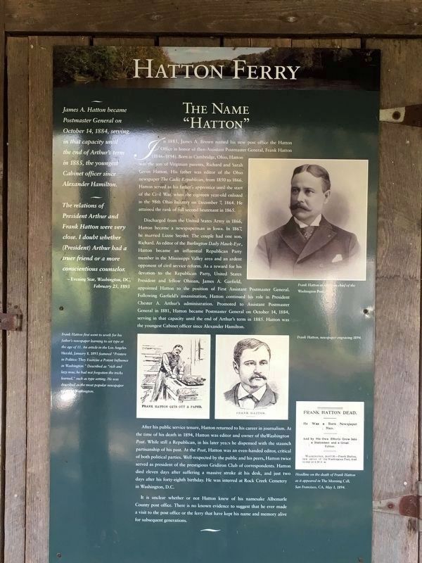
On Hatton Ferry Road 0.5 miles south of Hatton Ferry Lane.
History of Hatton Ferry.
The Hatton Ferry began operation in 1870, when Buckingham County authorities issued a court order to construct a public ferry across the James River to the Albemarle County lands of Thomas P. Gantt (ca. 1846-1896), a . . . — — Map (db m99392) HM
Near George Collins Parkway (Virginia Route 305) 0.9 miles north of West Old Cross Road ( Route 211), on the left when traveling north.
The monument in front of you was originally erected in front of the Albemarle County Court House in Charlottesville, Virginia, in 1909. The monument was paid for by the United Daughters of the Confederacy, Albemarle County, and the City of . . . — — Map (db m248127) HM
On Rockfish Gap Turnpike (U.S. 250) east of Afton Mountain Road ( Route 6), on the right when traveling west.
Albemarle County. Albemarle County was formed in 1744 from Goochland County and named for William Anne Keppel, the second Earl of Albemarle, titular governor of Virginia from 1737 to 1754. A portion of Louisa County was later added to . . . — — Map (db m4030) HM
On Thomas Nelson Highway (U.S. 29) east of State Route 6, on the right when traveling west.
Nelson County. In the foothills of Virginia’s Piedmont,
Nelson County was formed in 1807 from Amherst County. The county was named for Thomas Nelson, Jr., governor of Virginia from June to November 1781. The county seat is Lovingston. The . . . — — Map (db m44042) HM
On Blue Ridge Tunnel Trail 0.1 miles west of Afton Depot Lane, on the right when traveling west.
At the close of the eighteenth century, Virginia stretched from the Atlantic Ocean to the Ohio River. The coastal plain, Piedmont, Blue Ridge Mountains, and Alleghany Mountains lay between, with the James River running east to west. From the . . . — — Map (db m170607) HM
On Patrick Henry Highway (Route 151) north of Warrick Barn Road, on the right when traveling south.
Nelson County. In the foothills of Virginia's Piedmont, Nelson County was formed in 1807 from Amherst County. The county was named for Thomas Nelson Jr., governor of Virginia from June to November 1781. The county seat is Lovingston. The . . . — — Map (db m295854) HM
On James River Road (State Highway 56), on the right when traveling north.
Buckingham County. Buckingham County was formed from Albemarle County in 1761. The county seat is Buckingham, originally known as Maysville. In 1822 a courthouse, Virginia's first temple-form porticoed courthouse, was constructed there based . . . — — Map (db m31757) HM
On Seminole Trail (U.S. 29) north of Frays Mill Road / Burnley Station Road, in the median. Reported missing.
Albemarle County. Albemarle County was formed in 1744 from Goochland County and named for William Anne Keppel, the second Earl of Albemarle, titular governor of Virginia from 1747 to 1754. A portion of Louisa County was later added to . . . — — Map (db m21585) HM
On James River Road (Virginia Route 742) 0.2 miles east of Warren Ferry Road, on the right when traveling east.
Just to the south was Mount Warren, the home of Wilson Cary Nicholas. He served in the Continental army, represented Albemarle County in the General Assembly (1784–1789, 1794–1799), and was a delegate to the Virginia Convention of 1788 . . . — — Map (db m19406) HM
Memorial in honor of Col. Joshua Fry Born c. 1700 in England
1731 • Professor of mathematics at William and Mary College, Planter in Albemarle County, Virginia, Member of House of Burgesses, First presiding judge of Albemarle County, . . . — — Map (db m187084) HM
Near College Drive just west of Scottsville Road ( Route 20), on the right when traveling west.
Citizens of central and western Virginia have contributed significantly to national defense and to the U.S. Army throughout its 200-year history.
During the Revolutionary War, Virginians fought valiantly as members of the militia and the . . . — — Map (db m21890) HM
On Earlysville Road 0.2 miles south of Woodlands Road, on the right when traveling south.
Legacy of Hugh Carr
The Ivy Creek Natural Area was once the home of Hugh Carr, born into slavery around 1840 in Albemarle County. The end of the Civil War in 1865 was for Hugh the start of a new life founded in freedom.
In 1870, Hugh . . . — — Map (db m170172) HM
On Hatton Ferry Road 0.5 miles south of Hatton Ferry Lane, on the right when traveling south. Reported missing.
Ferries In Virginia
The James, York, Rappahannock and smaller rivers were the primary means of commercial transportation in Virginia until the advent of railroads in the mid-1800’s. In most locations ferries provided the only way to cross . . . — — Map (db m14527) HM
On Bypass U.S. 250 near John W. Warner Parkway and McIntire Road, on the right.
Dedicated to the lasting memory of all who served our country in Vietnam and Southeast Asia.
And especially those from the Charlottesville and Albemarle area who gave their lives in that service.
Champ Jackson Lawson, Jr. — 04 November . . . — — Map (db m102781) HM WM
On Louisa Road (Virginia Route 22) 0.1 miles west of Whitlock Road ( Route 616), on the left when traveling west.
Albemarle County. Albemarle County was formed in 1744 from Goochland County and named for William Anne Keppel, the second Earl of Albemarle, titular governor of Virginia from 1737 to 1754. A portion of Louisa County was later added to . . . — — Map (db m22780) HM
On East Market Street west of 5th Street NE, on the right when traveling east.
George Nicholas, Albemarle County’s Virginia General Assembly delegate in 1783, built a stone house here in 1784. James Monroe occupied it 1789-1790, while improving the dwelling at his nearby farm, later the site of the University of Virginia. Here . . . — — Map (db m19830) HM
On East High Street at Park Street, on the right when traveling east on East High Street.
On 4 June 1781, John “Jack” Jouett Jr. arrived at the Albemarle County Courthouse to warn the Virginia legislature of approaching British troops. The state government under Governor Thomas Jefferson had retreated from Richmond to . . . — — Map (db m18549) HM
On James Monroe Highway (Virginia Route 205) 0.2 miles north of Old Road, on the right when traveling north.
James Monroe's public service career, the most extensive of any President of the United States, took him far from his Westmoreland County birthplace.
As a student at the College of William and Mary in Williamsburg, Monroe was inspired to . . . — — Map (db m176506) HM
On James Monroe Highway (Virginia Route 205) north of Old Road, on the right when traveling north.
"The Birthplace of a Nation"
Lying between the Rappahannock and Potomac rivers, the Northern Neck provided fertile land that supported production of tobacco, the first great cash crop of the Virginia colony.
Six counties were formed . . . — — Map (db m176507) HM
On Rotunda Drive west of Hospital Drive, on the right when traveling west.
As it enters its third century, the University of Virginia remembers the enslaved people whose labor and talents made possible the construction and operation of the Academical Village. Forced labor, incalculable suffering, and the struggle to . . . — — Map (db m256889) HM
Near 68th Street at Beechtree Drive, on the right when traveling south.
Author of the Declaration of Independence and the Statute of Virginia for Religious Freedom, third president of the United States, and founder of the University of Virginia — voiced the aspirations of a new America as no other individual of his era. . . . — — Map (db m292003) HM
Author of the Declaration of Independence and the Statute of Virginia for Religious Freedom, third president of the United States and founder of the University of Virginia - voiced the aspirations of a new America as no other individual of his . . . — — Map (db m179400) HM
Near 45th Street South just south of 15th Avenue South, on the right when traveling south.
Author of the Declaration of Independence and the Statute of Virginia for Religious Freedom, third president of the United States, and founder of the University of Virginia — voiced the aspirations of a new America as no other individual of his . . . — — Map (db m238198) HM
Near Western Avenue South north of 45th Street West, on the left when traveling north.
Author of the Declaration of Independence and the Statute of Virginia for Religious Freedom, third president of the United States, and founder of the University of Virginia — voiced the aspirations of a new America as no other individual of his era. . . . — — Map (db m251574) HM
On Krause Road at Iron Bridge Road ( Route 10), on the right when traveling north on Krause Road.
Before the start of the American Revolution, free Black men were enrolled in local county militias across Virginia. When the war began, these men often volunteered to enlist in Virginia's Continental battalions. Hundreds of Black patriots, including . . . — — Map (db m289579) HM
On Tazewell Street at East North Street, on the left when traveling west on Tazewell Street.
Meet Thomas J. Boyd
Thomas Jefferson Boyd, known as the "Father of Wytheville," was born on June 15, 1804, in Albemarle County. After graduating in the first class of the University of Virginia Law School, he moved to Wytheville to . . . — — Map (db m209000) HM
Many people look at Mount Rushmore, carved in the Black Hills of South Dakota, as a monument to four Presidents, but land surveyors see it as "three surveyors and one other guy." Washington, Jefferson, and Lincoln all were land . . . — — Map (db m48744) HM
On 1st Avenue SE (Business U.S. 64) at South Jefferson Street, on the left when traveling east on 1st Avenue SE.
In memory of COLONEL JAMES LEWIS Born April 6, 1756 Albemarle County Virginia Died February 21, 1849 Franklin County Tennessee Served with distinction in the Revolutionary War. Participated in the Battles of White Plains, Trenton, . . . — — Map (db m31647) HM
Near Hydraulic Road (County Road 743) at Hydraulic Ridge Road, on the left when traveling north.
On 3 Sept. 1963, nine years after the U.S. Supreme Court declared racial segregation of public schools unconstitutional, 26 African-American students formerly enrolled at all-black schools desegregated Albemarle High School, Stone-Robinson . . . — — Map (db m170167) HM
On Tyree Lane at Bowles Alley, on the left when traveling west on Tyree Lane.
During initial planning of the Belvedere Neighborhood in late 2004, awareness of the existence of buildings and other sites, including a possible family cemetery, associated with the historically African American community of Free State raised . . . — — Map (db m289042) HM
On Court Street at Ford Avenue, on the right when traveling east on Court Street.
The village of Stanardsville was founded by William Stanard (died 1807), of Roxbury plantation, on land that was part of his 6,000 acre inheritance from the Octonia Grant of 1729. This grant included most of what is presently northern Greene County . . . — — Map (db m22988) HM
On Blue Ridge Tunnel Trail 0.4 miles west of Afton Depot Lane, on the right when traveling west.
Chief engineer Claudius Crozet divided the Blue Ridge Railroad into sixteen construction sections, but not all at once. Section one was the Blue Ridge Tunnel and 1,000 feet beyond each portal. Sections two, three and four moved east from Nelson . . . — — Map (db m170628) HM
Near Earlysville Road 0.3 miles south of Woodlands Road, on the right when traveling south.
1975: Red Flags
For years, Elizabeth (Babs) Conant had canoed the relatively new South Fork Rivanna Reservoir and enjoyed its abundant wildlife. Then one autumn day in 1975, she rounded a bend and saw something ominous. Survey stakes . . . — — Map (db m170170) HM
On Rockfish Gap Turnpike (U.S. 250) west of Crozet Avenue / Miller School Road ( Route 240), on the right when traveling east.
The Rothwell Family of Albemarle County Virginia.
Claiborne one of the first of the Rothwells to live in this county, was born about 1741 as reported in The Virginia Advocate, Saturday Oct. 11, 1828 and “died on Oct. 6 in his 87th . . . — — Map (db m3996) HM
On Belvedere Boulevard east of Free State Road, on the right when traveling east.
Shadrach Battles, a free person of color born probably in Albemarle County, was a Revolutionary War soldier. By June 1775 he had joined the Albemarle Independent Company, a local militia unit. In Dec. 1776 he enlisted in the 10th Virginia Regiment . . . — — Map (db m288504) HM
On Miller School Road (County Route 635) close to Dick Woods Road (County Route 637), on the left when traveling south.
A bequest of Samuel Miller (1792–1869) provided funds to found the Miller School in 1878. Miller, a Lynchburg businessman born in poverty in Albemarle County, envisioned a regional school for children who could not afford an education. The school . . . — — Map (db m21699) HM
On East Main Street at 1st Street South, in the median on East Main Street. Reported permanently removed.
Welcome to Historic Charlottesville
Charlottesville's rich historic legacy creates the City's unique sense of place and represent one of its primary economic and cultural asset. The City's character-defining historic resources include the . . . — — Map (db m170659) HM
On Rose Hill Drive at Henry Avenue, on the left when traveling north on Rose Hill Drive.
The City of Charlottesville and Albemarle County opened Jackson P. Burley High School in Sept. 1951 to serve nearly 550 African American students. The 26-classroom building reflected an effort to provide "separate but equal" facilities in an era . . . — — Map (db m246901) HM
On Courthouse Tavern Lane (Virginia Route 300) just east of Old Buckingham Road ( Route 13), on the left when traveling east.
The Courthouse Tavern
Steeped in Powhatan history this large building evolved from the story and a half frame portion on the right which dates to the late 18th century. The impressive brick portion with the double galleries was completed in . . . — — Map (db m180217) HM
On Earlysville Road (County Route 743) just south of Advance Mills Road (County Route 663), on the left when traveling north.
Earlysville Union Church is a rare surviving
early-19th-century interdenominational church
constructed in Albemarle County. Built in
1833, this frame structure served as a
meetinghouse for all Christian denominations
on land deeded by John . . . — — Map (db m21650) HM
On James Madison Highway (U.S. 15) at County Route 687, on the right when traveling south on James Madison Highway.
Buckingham County. Located in the geographical center of Virginia, Buckingham County, the only county in the United States to bear that name, was formed in 1761 from Albemarle County. It is not known for which of the many Buckinghams in . . . — — Map (db m31358) HM
On 6th Street Southwest 0.1 miles north of Cherry Street, on the right when traveling south.
Benjamin Ellis Tonsler (1854-1917) grew up enslaved by the Burnley family of Albemarle County. As a youth, he attended the Freedmen's School. Encouraged by his teachers, he attended and graduated from Hampton Institute in 1874, where he met his . . . — — Map (db m170142) HM
On Park Street at East Jefferson Street on Park Street.
To the memory and service of three Presidents of the United States
Thomas Jefferson, James Madison and James Monroe
associated with this courthouse in Albemarle County, Virginia — — Map (db m170128) HM
On James Madison Highway (U.S. 15) just south of Three Notch Road (U.S. 250), on the right when traveling south.
Louisa County. Located in the heart of the Virginia Piedmont, this rural county was named for Louisa, a daughter of George II. It was formed from Hanover county in 1742, the county seat is Louisa. Among the county’s historic resources is the . . . — — Map (db m17751) HM
Near James Monroe Highway (Virginia Route 205) 0.3 miles north of Old Road, on the right when traveling north.
It is only when the people become ignorant and corrupt, when they degenerate into a populace, that they are incapable of exercising their sovereignty. (James Monroe, 1801)
Built circa 1770 by John Dickey of Ireland, via Albemarle County, Virginia. Original site located on Quinn's Road, Tryon, North Carolina. Now called Wilson Chapel Road, Bullock Creek Township, York County, South Carolina.
Home of Richard Sherer . . . — — Map (db m50846) HM
Near Natchez Trace Parkway (at milepost 385.9), 0.2 miles north of Summertown Highway (Tennessee Route 20), on the left when traveling north.
In 1809, renowned explorer Meriwether Lewis traveled up the Old Natchez Trace on his way to Washington, D.C. He stopped here at an inn called Grinder’s Stand, and died during the night.
What is a Compass Rose?
A compass rose is a symbol . . . — — Map (db m84631) HM
Near South Rhodes Street just north of East Cemetery Street, on the right when traveling north.
Thomas Martin epitomized what is meant by “Good Citizen.” With others of his time, Martin was recognized for energy, perseverance, integrity, liberality and enlarged views of public policy. He left an impression for good on each . . . — — Map (db m151139) HM
On Grand Cavern Road west of South River Road, on the left when traveling west.
The Creation of Shenandoah National Park
This stone chimney was placed here to honor the people of the Blue Ridge Mountains who lost their homes, land and livelihood when Shenandoah National Park was formed in the 1930s. The memorial . . . — — Map (db m308045) HM
On East Main Street at 7th Street Northeast, on the right when traveling west on East Main Street.
Fifth President
of the United States
Member
Albemarle County Bar
Governor
of Virginia
Co-Negotiator
of Louisiana Purchase
Proclaimer of
Monroe Doctrine — — Map (db m246917) HM
On West Market Street at First Street, on the right when traveling west on West Market Street. Reported permanently removed.
Lee and Jackson Parks contain two of Charlottesville's fine examples of public sculpture, gifts of benefactor Paul Goodloe McIntire (1860-1952). The Thomas Jonathan "Stonewall" Jackson statue was dedicated in 1921,the Robert E. Lee statue in 1924. . . . — — Map (db m497) HM
On Park Street at Jefferson Street, on the left when traveling north on Park Street.
Lynching in America. Thousands of African Americans were the victims of lynching and racial violence in the United States between 1877 and 1950. During this era, racial terror lynching of African Americans emerged as a stunning form of . . . — — Map (db m166184) HM
On Rose Hill Drive just north of Henry Avenue, on the left when traveling north.
With reverence and steadfast hearts, we honor the memory of our beloved Burley High School and Mr. Jackson P. Burley. Minds were molded and shaped by the dedicated administrators, teachers and staff who guided us. The legacy of this grand . . . — — Map (db m246956) HM
On North Villa Louis Road north of West Blackhawk Avenue, on the left when traveling north.
Courtney was born enslaved circa 1812 in Albemarle County, Virginia. Captain John Spotswood Garland took Courtney from her family when she was about seven and brought her to the Northwest Territory, where slavery was illegal.
Courtney served . . . — — Map (db m303024) HM
On Grand Cavern Road west of South River Road, on the left when traveling west.
"There was just worlds of people lived back in that mountain."
— Rufus Cline, 1902-1986, New Hope, Augusta County
From the Shenandoah National Park Oral History Collection, James Madison University
Near Constitution Avenue Northwest (U.S. 50) east of 19th Street Northwest, on the right when traveling east.
In Congress, July 4, 1776.Unanimous Declaration of the thirteen united States of America.And for the support of this Declaration,
with a firm reliance on the protection of Divine Providence,
we . . . — — Map (db m137039) HM
On North George Street north of East 10th Avenue, on the right when traveling south.
Two dozen African American Civil War veterans rest in peaceful Lebanon Cemetery, established on August 26,
1872. For the first two years of the Civil War, Black men were forbidden to serve in the Union Army. But the January 1, 1863, Emancipation . . . — — Map (db m247928) HM
On Richmond Road (U.S. 250) at Louisa Road ( Route 22), on the right when traveling west on Richmond Road. Reported permanently removed.
The land was patented in 1735. The old house was built in 1790; the new in 1828. Here lived Thomas Mann Randolph, governor of Virginia 1819–1922, who married Martha, daughter of Thomas Jefferson. — — Map (db m17335) HM
On Preston Avenue at McIntire Road, on the left when traveling south on Preston Avenue.
In honor of the men and women
from the City of Charlottesville
and the County of Albemarle
who served in the Armed Forces of our country
in World War I and World War II
Erected by
Post 74 The . . . — — Map (db m246903) HM WM
Near Kenneth Jones Drive just west of Montgomery Avenue, on the left when traveling west.
"I give and bequeath to my beloved wife Ann M. Peyton...four negro men and four negro women to be selected by herself from all I may own..." Will of John Howe Peyton
Remembering their Humanity
The dehumanizing nature of . . . — — Map (db m282982) HM
Thin black lines indicate changes in relevance. Between each pair of lines entries are ordered geographically but all have the same relevance.
* Inflectional forms of words are their plurals, singulars, and possessives as well as gramatical tenses and similar variations.