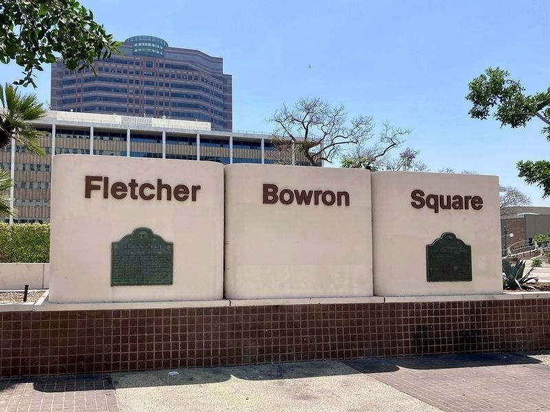
On North Main Street north of Temple Street, on the right when traveling north.
Southern California's first newspaper, The Los Angeles Star, was founded in this block on May 17, 1851 and for many years exerted a major influence upon this part of the state. Suspended temporarily from 1864 to 1868, it continued later as an . . . — — Map (db m125413) HM
On North Main Street north of Temple Street, on the right when traveling north.
Near this spot stood the Bella Union Hotel, long a social and political center. Here, on October 7, 1858, the first Butterfield Overland Mail stage from the East arrived 21 days after leaving St. Louis. Warren Hall was the driver, and Waterman . . . — — Map (db m59812) HM
Near North Highland Avenue south of California Route 101, on the left when traveling south.
One-half of this structure, then in use as a barn, was rented by Cecil B. DeMille as the studio in which was made the first feature-length motion picture in Hollywood, “The Squaw Man”, in 1913. It was originally located at the corner of Selma and . . . — — Map (db m118836) HM
Norman Morgan was from a dairy family from Snohomish, Washington. He moved to California and settled in Southern California. He met his wife Leona at Chafee College. They opened Morgan’s Ice Cream plant in 1939 on Valley Boulevard in Rosemead. Their . . . — — Map (db m152642) HM
He is ranked among the representative citizens of Los Angeles County. He left Missouri in 1849 and settled in Santa Clara County. He came to Southern California in 1869 and purchased 325 acres of the old Dalton Tract, near El Monte. His family . . . — — Map (db m152637) HM
On Sierra Highway 0.7 miles north of Foothill Boulevard, on the right when traveling north. Reported missing.
[This site was designated California Historical Landmark No. 1006 on May 11, 1992.
There are three rock and concrete bases which had displayed four different markers. The markers are now missing. The following marker was never placed:] . . . — — Map (db m184724) HM
Exposition Park, originally named Agricultural Park, was developed in 1876 as a showground for agricultural and horticulture fairs. The property became state land in 1880, the same year USC was founded, but during the 1890s, it fell into private . . . — — Map (db m218541) HM
On The Old Road south of Henry Mayo Drive, on the right when traveling south.
Approximately one-half mile south of this point was the adobe headquarters of Rancho San Francisco, originally built about 1804 as a granary of Mission San Fernando. The rancho was granted to Antonio de Valle in 1839. Here, in January 1850, William . . . — — Map (db m30667) HM
On South Knott Avenue, on the right when traveling north.
For more than half a century, the Pacific Electric Railway served Southern California. The system was established by Henry Huntington in 1895 and linked Los Angeles, Orange, Riverside, and San Bernardino counties with over 1,000 miles of service and . . . — — Map (db m101471) HM
On Knott Avenue, on the right when traveling south.
For more than half a century, the Pacific Electric Railway served Southern California. The system was established by Henry Huntington in 1895 and linked Los Angeles, Orange, Riverside, and San Bernardino counties with over 1,000 miles of service and . . . — — Map (db m101472) HM
On Holder Street, on the right when traveling north.
For more than half a century, the Pacific Electric Railway served Southern California. The system was established by Henry Huntington in 1895 and linked Los Angeles, Orange, Riverside, and San Bernardino counties with over 1,000 miles of service and . . . — — Map (db m101470) HM
On Lincoln Avenue, on the right when traveling east.
For more than half a century, the Pacific Electric Railway served Southern California. The system was established by Henry Huntington in 1895 and linked Los Angeles, Orange, Riverside, and San Bernardino counties with over 1,000 miles of service and . . . — — Map (db m101467) HM
On Moody Street, on the right when traveling south.
For more than half a century, the Pacific Electric Railway served Southern California. The system was established by Henry Huntington in 1895 and linked Los Angeles, Orange, Riverside, and San Bernardino counties with over 1,000 miles of service and . . . — — Map (db m101468) HM
On Valley View Street, on the right when traveling north. Reported missing.
For more than half a century, the Pacific Electric Railway served Southern California. The system was established by Henry Huntington in 1895 and linked Los Angeles, Orange, Riverside, and San Bernardino counties with over 1,000 miles of service and . . . — — Map (db m101469) HM
On Trask Avenue, on the right when traveling east. Reported missing.
For more than half a century, the Pacific Electric Railway served Southern California. The system was established by Henry Huntington in 1895 and linked Los Angeles, Orange, Riverside, and San Bernardino counties with over 1,000 miles of service and . . . — — Map (db m101475) HM
On West Cerritos Avenue, on the right when traveling east.
For more than half a century, the Pacific Electric Railway served Southern California. The system was established by Henry Huntington in 1895 and linked Los Angeles, Orange, Riverside, and San Bernardino counties with over 1,000 miles of service and . . . — — Map (db m101473) HM
Near Little Tujunga Canyon Road 5 miles north of U.S. 210.
In dedication to the Firefighters who heroically defended Wildlife Waystation throughout the entire December 2017 Creek Fire. Our eternal gratitude for their selfless act of bravery - Cal Fire, Contra Costa County Fire, Los Angeles County Fire Dept, . . . — — Map (db m138093) HM
A Walk Through Los Angeles History
The Los Angeles Historic Paseo Walkway
was created by LA Plaza de Cultura y
Artes and the County of Los Angeles as an
educational pedestrian thoroughfare that
guides visitors through the city's . . . — — Map (db m261702) HM
Near Wilshire Boulevard west of South Curson Street.
Chester Stock, Ph.D., January 28, 1892 - December 7, 1950. Paleontologist. Chief Curator of Science - Los Angeles County Museum, Chairman of the Division of Geological Sciences - California Institute of Technology who, encouraged by the foresight . . . — — Map (db m51436) HM
On Trousdale Parkway north of Hellman Way, on the left when traveling north.
Los Angeles was a rough and tumble frontier town in the 1870s, when a group of public-spirited citizens first dreamed of establishing a university
in the region. Led by Judge Robert Maclay Widney and members of the region’s
Methodist Episcopal . . . — — Map (db m130080) HM
On Exposition Boulevard 0.3 miles east of Vermont Avenue, on the right when traveling east.
From Sin to Science, A Park For The People
For decades into the 20th century, Los Angeles not only fed the world’s imagination with films and television — it fed the world’s bellies, too.
Los Angeles County prided itself on . . . — — Map (db m216967) HM
Near Escondido Canyon Road 0.5 miles east of Agua Dulce Canyon Road, on the right when traveling east.
Before you stands the beautiful "Devil's Punchbowl Wildlife" Civic Art mural, painted
by artist Aaron Morse in 2020 in collaboration with the L.A. County Arts Commission.
Originally created for Devil's Punchbowl Natural Area, a sister facility . . . — — Map (db m274903) HM
Near Van Nuys Boulevard at Oneida Avenue, on the right when traveling north.
Pacoima means “Rushing Waters”, named by the first occupants of the land: the Gabrielino Native Americans.
Pacoima’s First Elementary School, 1888.
Pacoima’s First Railroad Station, 1888.
Pacoima Flood, 1891. . . . — — Map (db m175733) HM
The Castro/Breen adobe is associated with the early development and settlement of Mexican California. The adobe is an excellent example of blended eastern and western building methods first produced in Monterey to form the Monterey Colonial . . . — — Map (db m82243) HM
Near Vetter Mountain Road 2 miles west of Angeles Crest Highway (California Route 2).
Welcome to the Vetter Mountain Fire Lookout Tower in the Angeles National Forest. As you can see from the spectacular vistas, Vetter Mountain is an ideal location for a fire lookout.
The Vetter Mountain Lookout was constructed in 1937 and . . . — — Map (db m201274) HM
On Figueroa Street north of Avenue 55, on the right when traveling north.
America’s Mother Road
U.S. Route 66, established in 1926, was one of the original highways of the United States Highway System. It originally ran from Chicago, Illinois in the east to its western terminus in Downtown Los Angeles, on . . . — — Map (db m312177) HM
On Delgany Avenue 0.2 miles north of Manchester Avenue, on the left when traveling north.
Spanish Colonial Revival style. William J. Dodd, architect. Dickinson & Gillespie, contractor. Fritz B. Burns, developer. Built 1930. Declared 2019, Historic-Cultural Monument No. 1195, Cultural Heritage Commission, City of Los Angeles. . . . — — Map (db m292144) HM
Native Presence
Eaton Canyon has been home to and/or
utilized by many diverse people since the
original Hokan speaking peoples inhabited
the area pre-7000 BCE. Displacing the
Hokan people, the Uto-Aztecan people,
now known as . . . — — Map (db m248995) HM
On McKinley Avenue at Canyon Way, on the right when traveling west on McKinley Avenue.
The Los Angeles County Fairgrounds was one of 15 temporary assembly centers established during World War II pursuant to Executive Order 9066, signed by President Franklin D. Roosevelt on February 19, 1942.
The U S. Army confined at this site . . . — — Map (db m165492) HM
Near Brea Boulevard south of Date Street, on the right when traveling south.
Born in Parsons, Kansas, twenty-one year old Ralph Barnes came to California in 1923 with this family and settled in Orange County. After a brief stint in the City of Orange, he secured a position at the First National Bank in Brea, then a small oil . . . — — Map (db m199735) HM
On Camino Capistrano north of Del Obispo Street, on the right when traveling north.
The Judge Richard Egan House was built in 1883 for one of San Juan Capistrano' most prominent citizens. Judge Egan was born in Waterford County, Ireland, in 1842, educated in New York and arrived in California in about 1866 following a trip to . . . — — Map (db m204133) HM
On Campus Drive at Holly Avenue, in the median on Campus Drive.
Elias Jackson Baldwin, founder and first Mayor of the City of Arcadia, was born into an Ohio farming family on April 3, 1828, but spent his formative years growing up in nearby Indiana where a year at Wabash College in Crawfordsville completed . . . — — Map (db m135467) HM
Near Baldwin Avenue south of Interstate 210, on the right when traveling south.
Today’s Los Angeles County Arboretum & Botanic Garden blends history and horticulture in a landscape ripe with cultural nuance, allowing history to be sampled in its native setting and savored as an integral link between humans and the land they . . . — — Map (db m143271) HM
This was one of several cottages built in the 1920s along
present-day Magic Mountain Parkway for operators of
Southern California Edison's Saugus substation. Some of
the cottages were destroyed in the 1928 St. Francis Dam
disaster. Three were . . . — — Map (db m119564) HM
On 1st Avenue South (U.S. 52/281) at 5th Street Southeast, on the right when traveling north on 1st Avenue South.
A 13-time Grammy nominee, Lifetime Achievement awards from NARAS, ASCAP, and The Society of Singers, inducted into the Songwriters Hall of Fame and earned an Academy Award nomination. — — Map (db m253731) HM
On 4th Street at South Main Street (U.S. 66) on 4th Street.
On March 24, 1933 Victor Griffin, Chief of the Quapaw Tribe was featured prominently in the commemorative festivities when paving was completed for Route 66 in Quapaw, Oklahoma. The two halves of Route 66 met in the town of Quapaw, leading to the . . . — — Map (db m186005) HM
On Santa Clara Street at First Avenue, on the left when traveling east on Santa Clara Street.
Trains were a prominent part of Arcadia for several generations from the late 19th century to the mid-1900s. With the tracks and depots of three of the most prominent and popular lines converging here, the Atchison, Topeka and Santa Fe Railway, . . . — — Map (db m207736) HM
On McKinley Avenue 0.5 miles east of Fairplex Drive.
Julius Caesar's reign over Rome was
approaching its dramatic end (44 BCE),
when this giant sequoia sprouted - the
tree providing this magnificent round.
Until felled in Tulare County by a windstorm
in 1961, this massive tree, nicknamed . . . — — Map (db m218620) HM
On West Broadway, on the right when traveling east.
The Victorian house was built in 1887 for Revered George Finley Bovard who later became the fourth President of the University of Southern California.
Milton Scott Wilson purchased the house in 1893. He served as Justice of the Peace for the . . . — — Map (db m116134) HM
Near Railroad Avenue 0.1 miles south of Magic Mountain Parkway, on the right when traveling south.
The Saugus Café, one of the most colorful and historical eating establishments in all
of Southern California and the longest operating restaurant in Los Angeles County, was
opened in 1888 by James Herbert Tolfree. The name of this historical . . . — — Map (db m208067) HM
On Green Street, on the left when traveling north.
California became a state in 1850. Settlers could lay claim to land by homestead, timber, mining and pre-emption rights. John and Amanda Brite were the first permanent settlers in the Tehachapi area, arriving in 1854 from Texas, building a mission . . . — — Map (db m134562) HM
On Wilbur Avenue just south of Nordhoff Street, on the right when traveling south.
144-65 Million Years
The Chatsworth Formation was
created close to 68 million years ago
5,000 feet below sea level. At some
point it is lifted 1,000 feet above sea
level with its upper portion eroded
away. Stoney Point is the . . . — — Map (db m249105) HM
Traveled west determined to farm the land. He purchased 250 acres from Henry Dalton located one half mile west of El Monte which he engaged in general farming.
He served as Los Angeles County Supervisor (1861-63).
He was member of a . . . — — Map (db m150764) HM
Constructed in 1827 by the Mexican government to collect custom duties from foreign shipping, a principal revenue source when Monterey was the capital of Alta California, Mexico's northernmost province. Thomas O. Larkin, US consul to Alta . . . — — Map (db m82186) HM
On Christiana Road, on the right when traveling north.
The main exhibit displays a fossil right whale skull in profile. It was recovered from the marine siltstone member of the Capistrano Formation (3.5 to 5 million years old) in the 1970's right here in Mission Viejo. It is a fossil skull from the . . . — — Map (db m72036) HM
On Green Street at E Street, on the right when traveling north on Green Street.
Golden Hills, Bear Valley Springs, Stallion Springs, Alpine Forest Park, Mountain Meadows, Sand Canyon.
Golden Hills – In early 1960s, the purchase of four ranches in the Old Town area by the Murchison Brothers of Dallas, Texas, became the . . . — — Map (db m135041) HM
On Judge John Aiso Street just north of 1st Street, on the right when traveling north.
As early as 1869, a Japanese guidebook,
based on reports from countrymen
who had tried their luck in California,
described the state's climate as mild
and its produce rich and varied. It
promised, "the person having no pennies
will become . . . — — Map (db m231218) HM
On Western Avenue at Adams Boulevard, on the right when traveling north on Western Avenue.
Paul Revere Williams
was the first registered
African-American architect
west of the Mississippi River.
In the course of a prolific and
diverse five decade career,
Mr. Williams designed over
3,000 buildings worldwide
and many . . . — — Map (db m292870) HM
Near San Gabriel Boulevard just west of Rosemead Boulevard, on the right when traveling west.
The Rio Hondo did not always look as it does today. Until the river was put into concrete channels in the 1950's, the Rio Hondo River offered extensive areas to farm, walk, ride horses, play and swim. Channeling the river did prevent the area . . . — — Map (db m228772) HM
On N. Brooks Street (State Highway 36) at W. Smith Street, on the right when traveling south on N. Brooks Street.
(South Face of Monument)
Henry Smith was born in Kentucky, May Twentieth 1788, came to Texas in 1827 and settled in what is now Brazoria County which he regarded as his home until his death. He was severely wounded in the Battle of . . . — — Map (db m90101) HM
On Lake Avenue 2.3 miles north of Interstate 210, on the right when traveling north.
Victor Ving @greetingstour
Spray paint & enamel
Production Team: Lisa Beggs, René Amy, Alec Pelsone, Leanna Viers, Ray Abary & Swank SH
The Greetings Tour is a nationwide mural project by muralist Victor Ving & photographer
Lisa . . . — — Map (db m265769) HM
Near Explorer Road 0.5 miles north of Windsor Avenue.
In Spanish, "Prieto" means dark. El Prieto Canyon references a person, not the dark shade of its
many mature oak trees. The "El Prieto" of this beautiful canyon was a man named Robert Owens.
Born into slavery in 1806, Robert Owens worked . . . — — Map (db m226463) HM
Near Slide Peak Trail 4 miles west of Old Route 99.
National Historic Lookout Register
This certificate officially recognizes
Slide Mountain Lookout,
Los Angeles County, California,
as meeting those standards of historic and cultural significance
established by the American . . . — — Map (db m272373) HM
On Whittier Boulevard at Hicks Avenue, on the right when traveling east on Whittier Boulevard.
Ruben Salazar was a prominent and award-winning journalist. He was born in Juarez,
Mexico and later moved across the river to El Paso, Texas. After attending high school
in Texas, he went on to attend the University of Texas at El Paso (UTEP), . . . — — Map (db m174943) HM
On State Street 0.2 miles north of Marengo Street, on the right when traveling north.
Placed high above the towering main entrance, nine enrobed figures stand vigil and greet visitors to LAC+USC General Hospital and half-way up the building, three classically robed figures stand atop columns in window niches.
Completed . . . — — Map (db m145460) HM
Near Charlie Sifford Drive 0.3 miles west of Western Avenue, on the left when traveling west.
Charlie Sifford was born on June 2, 1922, in Charlotte, North Carolina. Considered the Jackie Robinson of golf, Sifford made history
when, in 1961, under pressure from the California Attorney General, the PGA permitted Charlie Sifford full . . . — — Map (db m196874) HM
On Sunland Boulevard at Fenwick Street, on the left when traveling east on Sunland Boulevard.
The Verdugo Hills and Tujunga Wash
hold a surprising wealth of biodiversity.
When you look out at these areas, what do you see?
You might be looking at plants that grow in
the San Gabriel Mountains but not in the Santa Monica
Mountains — and . . . — — Map (db m198564) HM
Near South Myrtle Avenue 0.2 miles south of Interstate 210, on the right when traveling south.
As the fourth incorporated city in Los Angeles County,
Monrovia has a rich heritage of over 125 years of
representing the diverse architectural styles seen in
Southern California.
When Monrovia was established, the Victorian era
Queen . . . — — Map (db m210821) HM
For the people called "lookouts," life in a tower offered
challenges beyond being responsible for detecting fire. It
meant coping with confinement, few furnishings, long
hours and dangerous weather conditions.
During a storm, lightning . . . — — Map (db m272352) HM
This hilltop retreat was originally the home of silent film legend
William S. Hart (1864-1946). In 1920, Hart stated to a reporter, "Always,
always, my big desire has been to come back - to build the home I have
dreamed about - here in the . . . — — Map (db m297771) HM
Near Placerita Canyon Road 1.5 miles east of the Antelope Valley Freeway (California Route 14).
This historic cabin, originally built about 1920 by pioneer homesteader Frank E. Walker,
has been restored and finished as part of Placerita Canyon Natural Area's Heritage Trail.
A descriptive trail guide to the Heritage Trail is available in . . . — — Map (db m180293) HM
On 4th Street north of Pico Boulevard when traveling south.
Since 1867, California schools have been open to all. African American parents could generally find a good education for their children in Santa Monica, but there were teachers with White supremacist views who believed in the inferiority of Black . . . — — Map (db m287782) HM
On Elden Way 0.1 miles north of North Crescent Drive, on the right when traveling north.
United States Department of the Interior National Register of Historic Places.
Beverly Hills Local Landmark.
Constructed in 1911. — — Map (db m148656) HM
On 2nd Street at Main Street, on the left when traveling west on 2nd Street.
Beaux-arts style.
A.L. Haley, architect.
A.C. Martin, engineer.
Built 1910. Declared 2007,
Historic-Cultural
Monument No. 873, Cultural Heritage Commission, City of Los Angeles. — — Map (db m226438) HM
On Nanette Street at Jimeno Avenue, on the right when traveling west on Nanette Street.
The Edminster House, built 1964, 17031 Nanette Street, has been designated as historically significant to the Balboa Highlands Historic Preservation Overlay Zone under the City of Los Angeles Mills Act program. — — Map (db m307752) HM
On Figueroa Street near Avenue 60, on the right when traveling south.
A River Runs Through It
The name Arroyo Seco, Spanish for "dry stream," was given to this important
waterway by the explorer Gaspar de Portolà when his Mexico Expedition
arrived at its banks in 1770. However, when seemingly dry on . . . — — Map (db m228891) HM
Near Washington Boulevard 0.1 miles east of Normandie Avenue, on the left when traveling east.
This monument honors Los Angeles' first generation
of American settlers who were originally laid
to rest in Los Angeles City Cemetery,
located on Historic Fort Moore Hill.
Officially in use from 1853 to 1890, City Cemetery
was the first . . . — — Map (db m227593) HM
On Jefferson Boulevard west of Central Avenue, on the left when traveling west.
"Morticians of Distinction"
In A Man in Our Community, a 1937 biography
of L.G. Robinson, Baxter S. Scruggs wrote of
Robinson and other founders of Angelus Funeral
Home: "These men pledged themselves to the
task of . . . — — Map (db m229204) HM
On 34th Street just east of Hoover Street, on the right when traveling east.
Trojan Cardinal And Olympic Gold
Among the scholars who have passed
through the University of Southern California have been thousands of star athletes:
All-American football players, Hall of Fame
standouts, a future Oscar winning . . . — — Map (db m238532) HM
Near Huntington Drive west of San Gabriel Boulevard, on the right when traveling west.
Built about 1845 by Michael White or Miguel Blanco as he was
called by the native Californians. One of the early foreigners to settle
in California; sailor and soldier of fortune; a friendly, carefree man
of roving disposition; a colorful and . . . — — Map (db m144994) HM
In January 1857, a group of outlaws were terrorizing the citizens of
San Juan Capistrano committing robbery and murder. Los Angeles
County Sheriff James R. Barton formed a posse of five men and rode south.
On January 23, 1857, near this mound, a . . . — — Map (db m244100) HM
Thin black lines indicate changes in relevance. Between each pair of lines entries are ordered geographically but all have the same relevance.
* Inflectional forms of words are their plurals, singulars, and possessives as well as gramatical tenses and similar variations.