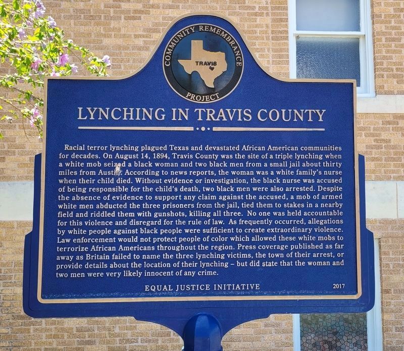
On San Bernard Street at Hackberry Street, on the right when traveling south on San Bernard Street.
Lynching in America
Thousands of black people were the victims of lynching and racial violence in the United States between 1877 and 1950. The lynching of African Americans during this era was a form of racial terrorism intended to intimidate . . . — — Map (db m205225) HM
An Arkansas native, James Euwin Edmiston came to Texas in 1835, settling near present Webberville. He was a Texas Ranger during the Texas Revolution, and took part in several Indian battles in this area. He was involved in the Woll Expedition and . . . — — Map (db m82678) HM
On Greenwood Drive at Houston Road, on the right when traveling east on Greenwood Drive.
Founded 1839, in the Republic of Texas by Rev. John Haynie (1789-1860). First church was of logs, and located a mile north, on land of Andrew Deavers Houston. This building, the third, was put up in 1907. Plaque erected by Houston . . . — — Map (db m79025) HM
On Guadalupe Street south of West 11th Street, on the right when traveling south.
Despite outstanding academic credentials, Heman Marion Sweatt, a black man, was denied admission to the University of Texas School of Law in February 1946 because of his race. In May 1946, Mr. Sweatt challenged the university's segregationist . . . — — Map (db m130372) HM
Near Avenue B north of West 41st Street, on the right when traveling north.
Elvira T. Manor Davis (1841-1918) was reared in east Travis County near present-day Manor, Texas. Named for her father, she married Blackstone H. Davis whose family owned quarry, supplied stone for the 1853 Texas Capitol. Elvira widowed and the . . . — — Map (db m185799) HM
Near State Highway 16 0.1 miles East Lewis Street.
James “Jim” Louis Baker (1829-1903) and Eleanor “Ellen” Prather Austin Baker (1839-1909) married in Travis County on June 15, 1859. Jim’s family moved to Texas from Tennessee during the time of the Republic, and Ellen’s . . . — — Map (db m155533) HM
On West Avenue at West 16th Street, on the left when traveling north on West Avenue.
The Sparks House was built in 1927 for former state treasurer Sam Sparks and his wife, Bertha May "Polly" Jones Mulkey Sparks. Austin-based firm Page Brothers, architects of many homes, schools and the 1930 Travis County Courthouse, designed this . . . — — Map (db m205244) HM
On Congress Avenue at W 11th Street, on the right when traveling north on Congress Avenue.
Legal efforts to enfranchise women in Texas can be traced to 1868, when Rep. T.H. Mundine of Burleson introduced a Woman Suffrage Bill in the State Legislature. In the following five decades Texas women formed suffrage organizations to lobby for . . . — — Map (db m25684) HM
On Mount Bonnell Road 0.2 miles south of Mount Bonnell Drive, on the right when traveling south.
Rising 775 feet above sea level, this limestone height was named for George W. Bonnell, who came to Texas with others to fight for Texas independence, 1836. Was commissioner of Indian Affairs in Republic of Texas under president Sam Houston. . . . — — Map (db m158887) HM
Historical markers like “Site of Fort Colorado” were placed around Texas in 1936 to celebrate 100 years of Independence from Mexico. The markers mostly focused on battles fought by Anglo Texans against Mexicans for Texas Independence, a war . . . — — Map (db m256458)
On Valdez Street at Felix Avenue, on the right when traveling north on Valdez Street.
Burditt's Prairie is one of Travis County's original Freedmen's communities. Its origins date back to 1844 when Jesse F. Burditt, an early Euro-American settler and supporter of the Texas Revolution, established a cotton plantation in the village . . . — — Map (db m213041) HM
On Congress Avenue near East 7th Street, on the right when traveling north.
Three double log houses built on this site in 1839 shortly after Austin was selected as the site for the capital of the Republic of Texas served as the offices for the War Department and the Adjutant General. Here Albert Sidney Johnston and . . . — — Map (db m315918) HM
On Rose Way Circle, on the right when traveling north.
Before migrating to Texas, A. J. Rose made a fortune in the 1849 California Gold Rush. In 1857 he and his wife Sallie (Austin) brought their family from Missouri to Travis County, Texas. Later they settled in San Saba County, where Rose ran a mill . . . — — Map (db m29345) HM
On Center Avenue at Austin Avenue, on the right when traveling north on Center Avenue.
Noah T. Byars (1808-1888) played an integral role in the establishment of the Baptist denomination in Texas. Born in Spartanburg, South Carolina, he arrived in Texas in the early 1830s and set up a blacksmith/gunsmith shop at . . . — — Map (db m220764) HM
On Farm to Market Road 150 at Elder Hill Road, on the left when traveling south on Highway 150.
William Barret "Buck" Travis, an American lawyer and soldier, obtained a land grant from Mexico on April 10, 1835.
The grant was located nearby and included Onion Creek, previously known as "Garrapata." Less than one year later, William B. . . . — — Map (db m205188) HM
Near Mount Olivet Cemetery 0.3 miles east of Morris Drive (County Road 1220), on the left when traveling east.
Timothy Brian Cole, born in Brenham in 1960, served in the U.S. Army and attended Texas Tech University in Lubbock. While there, Cole was accused of assaulting a fellow student in September 1986. A jury convicted him and sentenced him to 25 years . . . — — Map (db m186622) HM
Near Navasota Street north of East 14th Street, on the right when traveling north.
A native of Basthult, Barkeryd Parish, in the province of Smaland, Sweden, Swante Palm was a leader of early Swedish immigration to Texas. Influenced by his nephew, Swen Magnus Swenson, Palm came to Texas in 1844. He settled first in La Grange, . . . — — Map (db m26190) HM
Near East 11th Street at Congress Avenue, on the right when traveling west.
Nicknamed “Colossal Jack” because of his imposing stature and his oratorical skill, A.J. Hamilton was born in Alabama. He migrated to Texas about 1846. A lawyer, he served as acting Attorney General of Texas in 1850. His residence once . . . — — Map (db m25965) HM
On West 11th Street at Guadalupe Street, on the right when traveling south on West 11th Street.
Courthouse built here in 1930, 91st year of Travis County, which in early Texas was in municipality of Mina (later Bastrop) or Travis District, named for Wm. B. Travis, commander at the Alamo. Site of present-day Austin was chosen in 1839 (4th . . . — — Map (db m26691) HM
On Farm to Market Road 779 at Farm to Market Road 1799, on the right when traveling east on Road 779.
Reuben Leon Simmons and his wife Fairness (Clark) served as educators in public schools for a combined 83 years. Reuben Leon Simmons was born in 1894 in the Forest Home community (Wood Co). After the death of his father, Simmons and his family moved . . . — — Map (db m290262) HM
On Fisher Street at Laurel Street, on the left when traveling west on Fisher Street.
Industry that moved goods to build, sustain distant settlements in 18th-19th century Texas. Teamsters defied Indians, Bandits, and Texas weather to supply outlying forts and inland towns, which suffered if imports from the Gulf Coast, U. S. or . . . — — Map (db m158738) HM
Near Congress Avenue at East 16th Street, on the right when traveling south.
The first Lutheran church in Travis County. Organized Dec. 12, 1868, by Swedish pioneers under leadership of Swante Palm.
Site of first church building was 11 blocks SW; this structure was erected in 1883. It contains stone hauled in . . . — — Map (db m25891) HM
Near East Martin Luther King Jr Boulevard, on the right when traveling east.
June, 1836 - November, 1838.
Established and first commanded by
Colonel Robert M. Coleman.
Succeeded by Capt. Michael Andrews
And
Capt. William M. Eastland.
An extreme frontier outpost occupied by Texas Rangers to protect . . . — — Map (db m227723) HM
On South Avenue F south of East Elm Street, on the right when traveling north.
By the 1930s, many residents of cities across the U.S. were benefiting from the common use of electricity. However, a vast majority of rural areas lacked electric service, which compounded depression-era problems for farmers whose crop returns were . . . — — Map (db m126764) HM
On West 11th Street at Congress Avenue, on the right when traveling west on West 11th Street.
Austin became the capital of Texas on January 19, 1840, and this hill was platted as Capitol Square. A limestone statehouse built here in the 1850's soon developed structural flaws. The Constitutional Convention of 1876 set aside 3,000,000 acres of . . . — — Map (db m307885) HM
On Comanche Trail at Monte Castillo Parkway, on the right when traveling west on Comanche Trail.
At Austin’s founding in 1839, Native American groups already living here included Apache, Waco (a branch of the Wichita) and Tonkawa. The dominant tribe was called Comanche; they called themselves Nʉmʉnʉʉ ("the people"). They . . . — — Map (db m236607) HM
On Congress Avenue at W 10th St, on the left when traveling north on Congress Avenue.
Pat Crow (1943-2017) was a founding member of Texas Women's Political Caucus and made an indelible mark on the Austin community as a political activist and Democratic operative. Working alongside political consultant David Butts for over 25 years, . . . — — Map (db m266887) HM
Near Farm to Market Road 2769 west of Anderson Mill Road, on the right when traveling west. Reported missing.
This small one and one-half story log house on Cypress Creek in northwest Travis County could have been built as early as 1859. John M. King bought the property from John Robey in 1879 and indicated there was a dwelling on it at that time. King . . . — — Map (db m32658) HM
On Bitting School Road south of Littig Road, on the right when traveling south.
The town of Littig was laid out in 1883 along the route of the Houston & Texas Central Railway on land donated by former slave Jackson Morrow, and was named for A.B. Littig, who surveyed the townsite. In 1891, Thomas B. and Mary E. Fowler sold two . . . — — Map (db m167482) HM
Reinhold Mager (1863-1930), a native of Brandenburg, Germany, came to Texas and married Franziska Krueger (1868-1951), a native of the Dessau community in nearby Travis County, Texas. The Magers donated one acre of their 150 acres of land here in . . . — — Map (db m4690) HM
On West Austin Street 0.1 miles west of North Crockett Street, on the left when traveling west.
This home was built in 1872-73 by German immigrant Heinrich Bierschwale, a teacher in the rural schools of Gillespie and Mason counties. He later served as county and district clerk in Gillespie County. The two-story stone vernacular house . . . — — Map (db m163966) HM
Marking the spot where
Josiah Pugh Wilbarger
of Austin's Colony was stabbed
and scalped by the Indians in 1832
while locating lands for the Colonies.
Born in Bourbon Co. Ky. Sept. 10, 1801
Died in Bastrop Co. Tex. April 11, 1845 . . . — — Map (db m289942) HM
On Unnamed roads within the park at Unnamed roads within the park, on the right when traveling east on Unnamed roads within the park.
Co-commander with James Bowie, siege of the Alamo. Born in South Carolina; moved with family in 1818 to Alabama, where at 19 he was admitted to the bar; came to Texas 1831. In Anahuac he joined William H. Jack and others resisting tyranny of . . . — — Map (db m117182) HM
On Cottonmouth School Road south of Dee Gabriel Collins Road, on the right when traveling south.
Established by Newton Isaac Collins, Sr. (1826-1903), an emancipated slave from
Alabama, the Collins Cemetery is the final resting place for his family. After the Civil War, Collins acquired land throughout eastern Travis County, establishing the . . . — — Map (db m166356) HM
Near Barton Springs Road 0.2 miles east of South Mo-Pac Expressway (Texas Highway 1), on the left when traveling east.
One of earliest one-room rural schoolhouses in Travis County, this cabin was built on property of Richard McKenzie in 1866. It was known as Esperanza School and served children from neighboring farms in the period before public education. In 1893 . . . — — Map (db m79395) HM
Near East 15th Street at Red River Street, on the right when traveling east.
When Edwin Waller surveyed the Austin townsite in 1839, he set aside this block, in what was then the northeast corner of the city, for a hospital. The site lay empty until 1884, when the City of Austin and Travis County jointly opened a 20-bed, . . . — — Map (db m25779) HM
On Farm to Market 1325 north of Merrilltown Drive, on the right when traveling north.
This burial ground has served the surrounding area since the early 1850s. Most of those interred here lived in the Merrilltown community, which Captain Nelson Merrell (d. 1879) established when he settled here in 1837. He operated the post office . . . — — Map (db m81116) HM
On Farm to Market Road 2732 10 miles south of U.S. 190, on the left when traveling south.
Archibald Johnson (A.J.) Rose was born in 1830 in Caswell County, North Carolina. Shortly after his birth, the family left North Carolina in a covered wagon for Missouri. At the age of 18, Rose traveled to California during the Gold Rush and found . . . — — Map (db m263536) HM
On Hamilton Avenue east of Lincoln Street, on the right when traveling east.
Born in the Pleasant Valley community in Bastrop County to Gentry Overton Sr. (1877-1920) and Elizabeth "Lizzie" (Franklin) Overton Waters (1876-1939), Richard Arvin Overton gained notoriety as the oldest World War II veteran and living man in the . . . — — Map (db m303736) HM
On Congress Avenue near West 5th Street, on the right when traveling south.
Veteran Travis County official and historian Frank Brown (1833-1913) erected this structure in 1886. Southwestern Telegraph & Telephone Company bought and restyled the building in 1898. Architect A.O. Watson designed the ornate façade. Previously . . . — — Map (db m26544) HM
Near 11th Street east of Congress Avenue, on the left when traveling east. Reported permanently removed.
Austin became the capital of Texas Jan. 19, 1840, and
this hill was platted as Capitol Square. A modest
statehouse built here in the 1850s soon developed
structural flaws. The Constitutional Convention of
1876 set aside about 3,000,000 acres . . . — — Map (db m241007) HM
On Wooldridge Drive north of Northwood Road, on the right when traveling north.
In 1891, Thomas F. Burns bought 3 ¾ acres of the Jones and Sedwick property along the west bank of Shoal Creek. Burns, a Scottish immigrant, married Arbanna J. Nelson in Travis County in 1876. Property records and lumber marked “Sutor & . . . — — Map (db m83096) HM
Near Nameless Road south of Nameless Ranch Road, on the right when traveling south.
First surveyed in the 1850s, this area attracted numerous settlers by 1868. A community grew up, and in 1880 townspeople applied for a post office. After postal authorities rejected six names, the citizens replied in disgust, “Let the post office . . . — — Map (db m26161) HM
Near Eanes School Road 0.1 miles west of Camp Craft Road.
The establishment of this cemetery in 1874 provided for the burial of travelers and residents of eastern Travis County who did not have a family graveyard. The land was donated by early Eanes settlers William and Sophia Teague, who also deeded . . . — — Map (db m25854) HM
On King Court at East FM Road 1431, on the right when traveling west on King Court.
The cabooses were built by the International Railway Car Company for the Norfolk & Western Railroad. Each weighs 54,000 pounds and went into service in 1969 (Red), 1970 (Green), and 1976 (Yellow). The three different heralds painted on the sides . . . — — Map (db m110803) HM
Near Locust Street at Main Street (Business U.S. 82).
During the 4 years, 4 months after secession, Texas sent 18 lawmakers to the Confederate capitols. Her delegates to the Provisional Congress, Feb. 1861 to Feb. 1862, were John R. Gregg, Freestone County; John Hemphill, Travis County; Wm. B. . . . — — Map (db m96899) HM
Near Creeks Edge Parkway north of Cliffs Edge Drive, on the right when traveling north.
In the 1860s, the Roberts and Teague families came to the Bee Cave area where, for generations, their skills as farmers, ranchers, cedar choppers, coal kiln burners, and homemakers helped to shape its development and culture. It is said that this . . . — — Map (db m158898) HM
On Newton Street at West Annie Street, on the right when traveling north on Newton Street.
Travis County native Robert S. Stanley (1863-1941), an African-American stonemason and laborer, built this home for his wife Francis and their children in 1895. He later built a stone building on West Mary Street (1927) which his second wife . . . — — Map (db m180964) HM
On Wells Lane just west of Wells School Road, on the right when traveling west.
Travis County landowner Peter Carr Wells (1856-1913) donated a plot of land on his ranch to the Willow Ranch School District in 1894. Four years later, a school was established on this site. Most of those who attended were the children of Swedish . . . — — Map (db m216454) HM
On Ninth Avenue at 25th Street, on the right when traveling west on Ninth Avenue.
Noted musician Harry Henry Choates, whose career was shortened by an early death, was born in Louisiana in 1922. During the 1930s, he moved with his mother to Port Arthur, where as a child he began to develop and shape his gift of music. Known for . . . — — Map (db m151960) HM
On Market Street at North Oak Street, on the right when traveling west on Market Street.
The son of an early Sabine County family,
William Franklin Goodrich graduated in the
first class of the University of Texas Law
School in 1886. The next year, he wed Bertha
Sutor of Travis County and returned to
Hemphill, where he was a lawyer, . . . — — Map (db m221464) HM
On Harthan Street north of West 6th Street, on the left when traveling north.
Built 1875-1876 by A.J. Jernigan, Travis County Treasurer, 1873-1888 and 1894-1896; of handmade, sun dried brick in transitional style between Greek Revival and Victorian period, 1880's-1890's.
Name - meaning “the windows” - is for . . . — — Map (db m25691) HM
On Congress Avenue at West Cesar Chavez Street (Route 343), on the right when traveling south on Congress Avenue.
In his original 1839 plan for the capital city, Edwin Waller, signer of the Texas Declaration of Independence and Austin’s first Mayor, designed Congress Avenue as Austin’s most prominent street. Known for many years as “The Avenue”, . . . — — Map (db m101557) HM
On Heritage Loop Trail north of Firebush Drive, on the right when traveling north.
Gottlieb William Bohls (1878-1961), the oldest of Heinrich and Julie Schroeder Bohls’ ten children, was born on his family’s farm near this site. In 1906, G.W. married Bertha Timmerman (1883-1967), and five years later they purchased a 95-acre . . . — — Map (db m25629) HM
On State Highway 127 at U.S. 83 on State Highway 127.
Worked in the 1860's. Had vast deposits of bat guano, which by natural decay became saltpetre, chief ingredient of gunpowder used in the Civil War. As mixed with small parts of charcoal and sulphur, saltpetre from here powered Confederate cannon and . . . — — Map (db m189346) HM
On Martin Luther King Junior Boulevard at Wyatt Street, on the right when traveling east on Martin Luther King Junior Boulevard.
After emancipation, freedmen Richard (c. 1848–1926) and Sylvia (Gibbons) Sweatt (d. 1928) settled in Waxahachie. Despite difficult circumstances, they became landowners and sent their son, James (1869–1954), to Prairie View Normal Institute. James . . . — — Map (db m310034) HM
These ruins are all that remain of the first gristmill in southeast Austin. A wooden structure stood atop the stone foundation.
Harnessing the Creek
Behind you at Lower Falls, thick iron rods stick out of the creek bed. These are the . . . — — Map (db m287651) HM
On West Pecan Street west of 5th Street South, on the right when traveling west.
German immigrants arrived in Northeast Travis County in 1849. Education was highly valued, starting with lessons in the home. In 1872, a one-room school opened on the Henry Lisso farm. The school later moved to the Carrington Ranch. This and . . . — — Map (db m146853) HM
On Cameron Road south of Jesse Bohls Drive, on the left when traveling south.
The Richland School was created as a means to educate the children of the Richland community in northern Travis County. During the 1860s, many Germans settled the area and began farming. An early immigrant, Franz Schmidt, took an interest in . . . — — Map (db m166446) HM
On North Robinson Street at East 3rd Street, on the right when traveling north on North Robinson Street.
In 1883, young black evangelist Dr. I. Benjamin Toliver held a tent revival in a grassy field at this site. In 1886, Dr. Toliver officially organized Mt. Aria Baptist Church work on a permanent sanctuary began that year and was completed in 1904. . . . — — Map (db m210579) HM
On Pearl Retreat Drive west of Lucida Lane, on the right when traveling west.
The Oertli family owned and operated dairy farms in Travis County for 78 years, from 1923-2001. Fridolin ‘Fritz’ Oertli was born in Ennenda, Switzerland and immigrated to Travis County in 1904 with his wife, Margaretha Schwendeler, and their first . . . — — Map (db m150870) HM
On Round Mountain Road 0.1 miles north of Big Sandy Drive, on the left when traveling north.
In the early 1870s, the northwest Travis County community of Round Mountain expanded efforts to educate local children. A one-room log school was constructed in an area bounded by Long Hollow Creek and Big Sandy Creek. Teachers included Minnie . . . — — Map (db m297703) HM
Trustees of the Methodist Episcopal Church
of Mount Salem purchased three acres here in
1882 for a sanctuary and a cemetery. The
building served as the central point for
religious, educational and social activities
for the Walnut Creek . . . — — Map (db m184142) HM
Thin black lines indicate changes in relevance. Between each pair of lines entries are ordered geographically but all have the same relevance.
* Inflectional forms of words are their plurals, singulars, and possessives as well as gramatical tenses and similar variations.