Pennsylvania, Main Street Gettysburg Historical Markers
The Gettysburg Wayside Marker Walking Tour comprises some 50 locations distributed across major downtown streets and public squares. They have been installed throughout the historic district since 1999, and serve as vital educational tools, offering insights into the town’s rich history through narratives, maps, and photos.
In 2024, Main Street Gettysburg launched a campaign to replace and refurbish its iconic wayside markers.
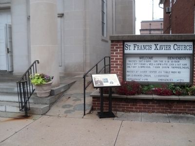
On West High Street west of Washington Street, on the right when traveling west. Reported permanently removed.
Erected in 1853, this church served as a field hospital during and after the Battle of Gettysburg in 1863. While the church was substantially altered in 1925, much of the original Civl War era structure remains intact. Within its walls some 200 . . . — — Map (db m65783) HM
On Carlisle Street (Business U.S. 15) at Chambersburg Street (U.S. 30), on the right when traveling south on Carlisle Street. Reported permanently removed.
On the afternoon of June 26, 1863, Confederate cavalry dashed up Chambersburg Street and into the square. Shocked and frightened citizens fled the streets. Sara Broadhead recorded in her diary: "They came with such horrid yells that it was enough . . . — — Map (db m32437) HM
On North Washington Street at Delap Alley, on the right when traveling south on North Washington Street. Reported permanently removed.
"We will close…you know nothing about the lesson anyhow." With those words, Pennsylvania College Professor Michael Jacobs reluctantly gave in to the distraction of mounting cannon and musketry fire on the morning of July 1, 1863, and dismissed . . . — — Map (db m32375) HM
On Chambersburg Street (U.S. 30) west of Lincoln Square (U.S. 30), on the right when traveling west. Reported permanently removed.
In 1863 this building was the home of the John and Martha Scott family, and Martha's sister, Mary McAllister. On the morning of July 1st, Mary McAllister went across the street to the Christ Lutheran Church to volunteer as a nurse. During the . . . — — Map (db m18117) HM
On West High Street at South Washington Street, on the right when traveling east on West High Street. Reported permanently removed.
The students of Rebecca Eyster's Young Ladies Seminary were studying in this "old Academy Building" on June 26, 1863. One of those students, Tillie Pierce, described the arrival of the Confederate troops from Seminary Ridge in her book, At . . . — — Map (db m12003) HM
On Baltimore Street (Business U.S. 15) at West Middle Street, on the right when traveling south on Baltimore Street. Reported permanently removed.
Four years after Gettysburg became the county seat in 1800, the first Adams County Courthouse was placed in Lincoln Square (one block to your right). In 1859 this larger building was erected to serve the growing populace.
The arrival of the . . . — — Map (db m19251) HM
On Baltimore Street (Business U.S. 15) at West Middle Street, on the right when traveling south on Baltimore Street. Reported permanently removed.
On July 8, 1863, the U.S. Sanitary Commission commandeered the three story Fahnestock Bros. buildings as their "stone house" for food and other supplies. From here these critical provisions were distributed daily to the many field hospitals in . . . — — Map (db m32509) HM
On Chambersburg Street (U.S. 30) just east of South Washington Street, on the right when traveling east. Reported permanently removed.
Completed in 1836, Christ Evangelical Lutheran Church's building is the oldest in Gettysburg used continuously for religious worship. During the battle of Gettysburg it became a haven for serving humanity. When the first wounded appeared along . . . — — Map (db m18121) HM
On West Middle Street (State Highway 116) at South Washington Street, on the right when traveling west on West Middle Street. Reported permanently removed.
This building was the Professor Michael Jacobs residence which remained in the family from 1834 until 1901. One of the town's leading citizens, Professor Jacobs was a member of the Gettysburg College faculty from its foundation in 1832 until his . . . — — Map (db m168189) HM
On York Street (U.S. 30) at Carlisle Street (Business U.S. 15), on the right when traveling west on York Street. Reported permanently removed.
On July 1, 1863, Gettysburg's center square was the eye in the storm of panic and confusion that swirled in the town's streets and alleys as the routed Union 1st and 11th Corps fled toward the safety of Cemetery Hill. Some Union soldiers rallied . . . — — Map (db m32458) HM
On Steinwehr Avenue (Business U.S. 15) 0 miles north of Culp Street, on the right when traveling north. Reported permanently removed.
The rare image reproduced at right, courtesy of William A. Frassanito, Gettysburg Then & Now (Thomas Publications), is one of only 9 photos known to have been taken of the dedication ceremonies in Gettysburg on Nov. 19, 1863, during which . . . — — Map (db m19064) HM
On York Street (U.S. 30) at Carlisle Street (Business U.S. 15), on the right when traveling west on York Street. Reported permanently removed.
This was the site of the GLOBE INN, one of Gettysburg's oldest hotel-taverns, originally owned and operated in 1798 by townfounder James Gettys, and traditionally the unofficial headquarters for the local Democratic party. Such political . . . — — Map (db m32474) HM
On Lefever Street at Baltimore Street (Business U.S. 15), on the right when traveling north on Lefever Street. Reported permanently removed.
Here was the yard and the site of the Samuel McCreary house, along the extreme advance of the Confederate skirmish line before Cemetery Hill. The 1863 McCreary residence, along with its architectural twin, the Winebrenner house (standing to your . . . — — Map (db m66435) HM
On Carlisle Street (Business U.S. 15) at Racehorse Alley, on the right when traveling north on Carlisle Street. Reported permanently removed.
During the retreat on July 1st by the Union 11th Corps, this area was a mass of demoralized troops and military vehicles frantically trying to escape pursuing Confederate rifle fire. Captain Fred Winkler, 26th Wisconsin Regiment, stood here and . . . — — Map (db m32436) HM
On Steinwehr Avenue (Business U.S. 15) 0 miles north of Culp Street, on the left when traveling north. Reported permanently removed.
On July 1-4, 1913, the 50th Anniversary of the Battle of Gettysburg was celebrated with the first joint reunion for all Union and Confederate veterans, many of whom fought here in 1863.
53,407 veterans attended. 44,713 Union and 8,694 . . . — — Map (db m19063) HM
On Baltimore Street (Business U.S. 15) at High Street, on the right when traveling north on Baltimore Street.
Following the retreat of Union forces to Cemetery Hill on the afternoon of July 1, 1863, the Confederates occupied the town of Gettysburg until early morning, July 4th. The main Confederate battle line facing the Union forces on Cemetery Hill ran . . . — — Map (db m18129) HM
On South Washington Street at High Street, on the left when traveling north on South Washington Street. Reported permanently removed.
In 1863 this was the home of James and Catherine Foster and their daughter, Catherine. Prior to the battle the town was cut off from communications, and rumors of approaching “Rebels” and the whereabouts of the Union army prompted the younger . . . — — Map (db m16353) HM
On Baltimore Street (Pennsylvania Route 97) when traveling north.
On the morning of July 1st, Gettysburg resident Jennie Wade and her family fled their town home to this brick double house shared by her sister Georgia McClellan, to distance themselves from the fighting. The Union retreat to Cemetery Hill soon . . . — — Map (db m37616) HM
On East High Street west of S Stratton Street, on the left when traveling east.
The High Street or “Common” School was Gettysburg’s first consolidated public school building. Prior to its erection in 1857 classes were held in individual buildings, often the home of the teacher. Like the rest of the town’s public facilities . . . — — Map (db m65781) HM
On Baltimore Street (Business U.S. 15) at Breckenridge Street, on the right when traveling south on Baltimore Street. Reported permanently removed.
This building was the home of the James Pierce family during the Battle of Gettysburg. Tillie Pierce, a 15 year old school girl at the time, provided a vivid account of events from those days.
The alarm that “The Rebels Are Coming!” caused a . . . — — Map (db m155307) HM
On Baltimore Street (Pennsylvania Route 97), on the left when traveling north.
This building was constructed in 1869 as a dormitory for “The National Homestead at Gettysburg,” a school for soldiers’ orphans established in 1866 in the brick building to your right. Among its first students were Alice, Frank and . . . — — Map (db m37620) HM
On South Stratton Street at York Street (U.S. 30), on the right when traveling south on South Stratton Street. Reported permanently removed.
Members of the beaten Union 11th Corps fled pursuing Confederates along this portion of Stratton Street in the late afternoon of July 1, 1863, seeking the protection of friendly lines on Cemetery Hill, a quarter mile beyond the crest in the . . . — — Map (db m255448) HM
On York Street (U.S. 30) at Stratton Street, on the right when traveling west on York Street. Reported permanently removed.
In 1863 one of Gettysburg's earliest weatherboarded buildings stood at this corner, the home of Judge Samuel Russell.
After the battle the body of an unidentified soldier was found in the side yard to its left clutching a photograph of three . . . — — Map (db m307698) HM
On York Street (U.S. 30) at North Stratton Street, on the left when traveling east on York Street.
Eddie Plank
The present building housed the automobile garage of Eddie Plank in the early years of the 19th century. Plank was a native son who pitched for the Philadelphia Athletics (1901-1914) and is enshrined in the Baseball Hall of . . . — — Map (db m316581) HM
On Baltimore Street (Business U.S. 15) south of West Middle Street, on the right when traveling south.
Four years after Gettysburg became the county seat in 1800, the first Adams County courthouse was placed in Lincoln Square (one block north). In 1859, this larger building was constructed to serve the growing populace.
The arrival of the . . . — — Map (db m316504) HM
On Steinwehr Avenue (Business U.S. 15) north of South Washington Street, on the left when traveling north.
In 1776, Reverend Alexander Dobbin, a Presbyterian minister from northern Ireland and one of the community's leading citizens, built this two-story Georgian stone home on a 300-acre tract. Known as both a school and a gathering place for major . . . — — Map (db m316437) HM
On Baltimore Street at Breckenridge Street, on the right when traveling north on Baltimore Street. Reported permanently removed.
Confederate sharpshooters in this area built a barricade across Baltimore Street at the intersection with Breckenridge Street to gain an open field of fire towards the Federal troops on Cemetery Hill. From behind this barricade and from windows of . . . — — Map (db m65779) HM
On Baltimore Street (Business U.S. 15) south of Lefever Street, on the right when traveling north.
At noon on July 1, 1863, Union troops advanced along Baltimore Street to the fields north of the town. A few hours later they were routed by the Confederates and fled toward Cemetery Hill.
Anna Garlach watched this mob scene from her house . . . — — Map (db m316489) HM
On Lefever Street at Baltimore Street, on the right when traveling north on Lefever Street. Reported permanently removed.
At noon on July 1, 1863, Union troops advanced along Baltimore Street to the fields north of the town. A few hours later they were routed by the Confederates, and fled toward Cemetery Hill.
One half block north of this point, Anna Garlach . . . — — Map (db m288283) HM
On Baltimore Street (Business U.S. 15) south of Brckenridge Street, on the right when traveling north.
The Confederates established a skirmish line along Breckenridge Street facing their Union adversaries on Cemetery Hill. They built a barricade across Baltimore Street at this point to gain an open field of fire towards the Federals who were . . . — — Map (db m316484) HM
On Steinwehr Avenue (Business U.S. 15) north of culp Street, on the right when traveling north.
On the afternoon of July 1, 1863, the Union Army retreated from positions behind you to Cemtery Hill, the high ground in front of you.
By early evening, Union pickets along this area of the Emmitsburg Road were being harassed by Confederate . . . — — Map (db m316427) HM
On Steinwehr Avenue (Business U.S. 15) 0 miles north of Culp Street, on the right when traveling north. Reported permanently removed.
On the afternoon of July 1, 1863, the Union Army retreated from positions behind you to Cemetery Hill, the high ground in front of you. By early evening Union pickets along this area of the Emmitsburg Road were being harassed by Confederate fire. . . . — — Map (db m19062) HM
On York Street at Carlisle Street, on the right when traveling west on York Street.
On July 1, 1863, Gettysburg's center square was the eye in the storm of panic and confusion that swirled in the town's streets and alleys as the routed Union 1st and 11th Corps fled toward the safety of Cemetery Hill.
Some Union soldiers . . . — — Map (db m280374) HM
On Chambersburg Street (Route 30) west of South Washington Street, on the left when traveling west.
Completed in 1815, the Chambersburg Turnpike was one of ten key roads leading to Gettysburg during the Civil War. These routes, like spokes on a wheel, connected the town to surrounding communities. It was this network that brought the armies to . . . — — Map (db m316522) HM
On Chambersburg Street (U.S. 30) east of South Washington Street.
Completed in 1836, Christ Lutheran Church was the oldest church building in Gettysburg still used for religious worship.
During the Battle of Gettysburg, it became a large hopsital. When the first wounded appeared along Chambersburg Street, . . . — — Map (db m316510) HM
On Baltimore Street (Business U.S. 15) south of Locust Avenue, on the right when traveling south.
The well and a nearby spring were the first sources of municipal water service provided to the town of Gettys burg.
In 1822, the Gettysburg Water Company acquired this property along with the well and spring, and channeled the water to its . . . — — Map (db m316493) HM
On West High Street at South Franklin Street when traveling west on West High Street.
On this corner stood the only building constructed for the sole purpose of educating the Black children of Gettysburg. In 1834, Pennsylvania mandated public education. On September 19th of that year, citizens of Gettysburg met and chose six . . . — — Map (db m316854) HM
On West High Street at South Franklin Street, on the right when traveling west on West High Street. Reported permanently removed.
On this corner stood the only building built for the sole purpose of educating the Colored children of the Borough of Gettysburg. In 1834 Pennsylvania mandated public education. On September 19, 1934, citizens of Gettysburg met and chose six . . . — — Map (db m75467) HM
On High Street at Stratton Street, on the left when traveling east on High Street.
The original German Reformed Church (now Trinity United Church of Christ) located here beginning in 1814 served as a “Union brick church” with the town’s Lutheran congregation until 1848. The core of the present building (greatly altered since . . . — — Map (db m308755) HM
On North Washington Street north of Constitution Avenue, on the left when traveling north.
"We will close…you know nothing about the lesson anyhow." With these words, Pennsylvania College Professor Michael Jacobs reluctantly gave in to the distraction of mounting cannon and musketry fire on the morning of July 1, 1863, and dismissed . . . — — Map (db m316524) HM
On Baltimore Street (Business U.S. 15) at East Legion Alley, on the right when traveling north on Baltimore Street.
This is the 1863 site of the Gettysburg Compiler newspaper office, Gettysburg's weekly "voice" of the Democratic Party, and the home of its outspoken publisher, Henry Stahle.
During the Battle of Gettysburg, Stahle took into his home . . . — — Map (db m316590) HM
On North Washington Street north of West Railroad Street, on the left when traveling north.
This building was completed in April 1884 for the new Gettysburg and Harrisburg Railroad Company. The line was established to take advantage of the rising interest in visiting the Gettysburg Battlefield. From here, travelers could ride a 2½-mile . . . — — Map (db m316523) HM
On Baltimore Street (Business U.S. 15) south of Locust Street, on the right when traveling south. Reported permanently removed.
This well and a nearby spring were the first sources of municipal water service provided to the town of Gettysburg.
In 1822 the Gettysburg Water Company acquired this property along with the well and spring, and channeled the water to their . . . — — Map (db m130289) HM
On East Middle Street, on the right when traveling east. Reported permanently removed.
This structure, built in 1822, served as the Methodist Church for nearly 50 years and still retains a portion of the original burial ground at the rear. After the battle, wounded were cared for here by the Catholic Sisters of Charity from nearby . . . — — Map (db m17461) HM
On East Middle Street west of South Stratton Street, on the right when traveling east.
This structure, built in 1822, served as the Gettysburg Methodist Church for nearly fifty years, and part of the original burial ground remains at the rear of the property. After the Battle of Gettysburg in 1863, the church sheltered wounded . . . — — Map (db m316753) HM
On East Middle Street west of South Stratton Street, on the right when traveling east.
This wayside marker is placed here by the Historic Gettysburg Adams County-HGAC Preservation Society to recognize the service of those Adams County residents who served in the United State Colored Troops (USCT) in the Civil War. The stone . . . — — Map (db m316748) HM WM
On Baltimore Street (U.S. 15) at Wade Avenue, on the right when traveling north on Baltimore Street. Reported permanently removed.
In this modest weatherboard house, constructed ca. 1820, Mary Virginia “Jennie” Wade was born on May 21, 1843. Wade, the second of six children of James and Mary Filby Wade, spent her childhood here, attending local schools and helping with her . . . — — Map (db m8169) HM
On Baltimore Street (Business U.S. 15) north of Wade Avenue, on the right when traveling north.
In this modest weatherboard house, built circa 1820, Mary Virginia "Jennie" Wade was born on May 21, 1843. The second of six children of James Wade and Mary (Filby) Wade, Jennie attended the local schools and supported her mother as a seamstress. . . . — — Map (db m316448) HM
On Long Lane at Lincoln Lane, on the right when traveling north on Long Lane.
The first half-acre of this cemetery was purchased in 1867 by a society of Black men calling themselves the "Sons of Goodwill," and for many years this place was called the "Goodwill Cemetery." The minutes of the Sons of Goodwill record that the . . . — — Map (db m316600) HM
On West Middle Street (Pennsylvania Route 116) west of South Washington Street.
This was the home of Michael Jacobs, owned by his family from 1834 until 1901. A leading citizen of Gettysburg, Jacobs served on the Gettysburg College faculty as a professor of mathematics and science form the institution's founding in 1832 . . . — — Map (db m316853) HM
On Carlisle Street (Pennsylvania Route 34) north of Race Horse Alley, on the left when traveling north.
Durign the retreat on July 1st by the Union 11th Corps, this area was a mass of demoralized troops and military vehicles frantically trying to escape pursuing Confederate rifle fire. Captain Fred Winkler, 26th Wisconsin Regiment, stood here and . . . — — Map (db m316578) HM
On West High Street east of South Washington Street, on the right when traveling east.
The students of Rebecca Eyster's Young Ladies Seminary were sutdying in this "old Academy Building" on June 26, 1863. One of those students, Tillie Pierce, described the arrival of the Confederate troops from Seminary Ridge in her book, At . . . — — Map (db m316598) HM
On Baltimore Street (Business U.S. 15) at East Legion Alley, on the right when traveling north on Baltimore Street. Reported permanently removed.
This is the 1863 site of the COMPILER newspaper office, Gettysburg's weekly "voice" of the Democratic party, and the home of its outspoken publisher Henry Stahle. During the Battle of Gettysburg Stahle took into his home a badly . . . — — Map (db m18056) HM
On Baltimore Street (Business U.S. 15) south of East High Street, on the right when traveling north.
The churches of Gettysburg were the first to offer their facilities to serve the needs of wounded soldiers borne from the battlefield on July 1, 1863. Public buildings and many private homes followed this lead in shoing care and mercy.
As . . . — — Map (db m316595) HM
On Baltimore Street (Business U.S. 15) at York Street (U.S. 30), on the right when traveling north on Baltimore Street. Reported permanently removed.
Commissioned by the Lincoln Fellowship of Pennsylvania, J. Seward Johnson, Jr.'s Return Visit is the most true-to-life statue of Abraham Lincoln ever created. An 1865 cast of Lincoln's face by Clark Mills, and an 1860 cast of Lincoln's . . . — — Map (db m32493) HM
On Lincoln Square (U.S. 30) at Baltimore Street (Business U.S. 15), on the right when traveling north on Lincoln Square.
Commissioned by the Lincoln Fellowship of Pennsylvania, Return Visit by J. Seward Johnson Jr. is considered one of the most lifelike statues of Abraham Lincoln ever produced. Johnson began with an 1865 cast of Lincoln's face by Calrk Mills . . . — — Map (db m316588) HM
On West High Street west of Court Alley, on the right when traveling west.
Built in 1853, this church served as a field hospital during and after the Battle of Gettysburg in 1863. While the church was substantially altered in 1925, much of the original Civil War era structure remains intact. Within its walls some 200 . . . — — Map (db m316599) HM
On Baltimore Street (Business U.S. 15) south of Breckenridge Street, on the right when traveling south. Reported missing.
This 1860 home was the wartime residence of George and Hettie Schriver. The cellar housed Schriver's Saloon and Ten-pin Alley.
At the time of the battle, George was away serving in Cole's cavalry. In the early afternoon of July 1st, Hettie . . . — — Map (db m89163) HM
On South Stratton Street at York Street (U.S. 30), on the right when traveling south on South Stratton Street.
Members of the defeated 11th Corps fled from pursuing Confederates along this portion of Stratton Street during the late afternoon of July 1, 1863, seeking the protection of friendly lines on Cemetery Hill, a quarter mile beyond the crest in the . . . — — Map (db m316754) HM
On South Washington Street at Breckenridge Street, on the right when traveling south on South Washington Street. Reported permanently removed.
St. Paul's A.M.E. Zion Church, erected in 1917, is the third church to be used by Gettysburg's oldest African American congregation—founded ca. 1838 in a small frame building on nearby Franklin Street. Members of this congregation have long been . . . — — Map (db m130259) HM
On South Washington Street at Breckenridge Street, on the right when traveling south on South Washington Street.
Slave's Refugee Society
St. Paul's A.M.E. Zion Church, built in 1917, is the third church to be used by Gettysburg's oldest Black congregation-founded circa 1843 in a small wooden building on nearby Franklin Street. Members of this . . . — — Map (db m316604) HM
On Carlisle Street (Business U.S. 15) north of West Stevens Street, on the left when traveling north.
This large brick structure was named for Thaddeus Stevens, a trustee of Pennsylvania College (now Gettysburg College) from 1834 to 1868. During the Civil War, Stevens served in Congress as a powerful abolitionist leader. He championed the 13th, . . . — — Map (db m316756) HM
On Carlisle Street (Pennsylvania Route 34), on the left when traveling north. Reported permanently removed.
The residence hall straight ahead of you is named after Thaddeus Stevens, a trustee of Pennsylvania College (now Gettysburg College) from 1834 to 1868. During the Civil War, Stevens was a powerful abolitionist Congressman. He led efforts to pass . . . — — Map (db m88727) HM
On Lincoln Square at Baltimore Street (Business U.S. 15), on the right when traveling east on Lincoln Square.
During the Battle of Gettysburg, this Federal-style building—constructed in 1817—served both as Professor Martin Stoever's family residence and John L. Scick's general store. On July 1, 1863, as the battle erupted, the Stoever home was converted . . . — — Map (db m316508) HM
On Baltimore Street (Business U.S. 15) at East High Street, on the right when traveling north on Baltimore Street. Reported permanently removed.
The churches of Gettysburg were the first to offer their facilities to serve the needs of wounded soldiers borne from the battlefield on July 1st. Public buildings and many private homes followed the lead in showing care and mercy. As soon as . . . — — Map (db m122379) HM
On South Washington Street south of West High Street, on the right when traveling south. Reported permanently removed.
This house (#219) belonged to John Hopkins, an African American citizen, from 1851 until his death at age 62 in 1868. His wife Julia continued to live here until she passed away in 1891.
John Hopkins enjoyed a distinguished career of janitor . . . — — Map (db m130260) HM
On East High Street west of S Stratton Street, on the right when traveling east.
As part of a deal to establish Gettysburg as county seat in 1800, James Gettys donated this lot for a county prison. This two story “bastille-like” building with its 16’ foot stone wall enclosing the prison yard was erected in 1851 to replace the . . . — — Map (db m65782) HM
On West Middle Street (Pennsylvania Route 116) west of Baltimore Street (Business U.S. 15), on the right when traveling west.
This beautifully restored Gothic Revival house, ca. 1870, was originally the home of the Rev. Luther Sieber family. Paul Sieber became Gettysburg College's first All-American football player. During World War I, the building served as the . . . — — Map (db m32511) HM
On Baltimore Street (Business U.S. 15) at Lefever Street, on the right when traveling north on Baltimore Street.
In 1834, Gettysburg established a "common school," to provide its children with a free elementary education, which evolved over the years into the current Gettysburg Area School System.
After 23 years of classes being held in multiple . . . — — Map (db m316487) HM
On York Street (U.S. 30) at Lincoln Square (U.S. 30), on the right when traveling east on York Street.
Built circa 1814, this structure is perhaps best known in Gettysburg. In 1863, it was the home of David Wills and his family.
Wills, a prominent local attorney, is traditionally given credit as being the father of the Soldiers' National . . . — — Map (db m316587) HM
On Lincoln Square at Carlisle Street, on the right when traveling west on Lincoln Square.
On the afternoon of June 26, 1863, Confederate cavalry dashed up Chambersburg Street and into the square. Shocked and frightened citizens fled the streets. Sara Broadhead recorded in her diary: "They came with such horrid yells that it was enough . . . — — Map (db m280340) HM
On Steinwehr Avenue (Business U.S. 15) north of Culp Street, on the right when traveling north.
The rare image reproduced at right, courtesy of William A. Frassanito, Gettysburg Then & Now (Thomas Publications), is one of only nine photos known to have been taken of the dedication ceremonies in Gettysburg on November 19, 1863, during . . . — — Map (db m316426) HM
On Chambersburg Street (U.S. 30) at N Washington Street, on the right when traveling west on Chambersburg Street. Reported permanently removed.
From 1834 to 1960 this site was occupied by the Eagle Hotel building. It was Gettysburg's premier hostelry for most of the 19th century. The advent of automobile and cheaper motels were the source of its downfall midway in the 20th century. . . . — — Map (db m94505) HM
On Chambersburg Street at N Washington Street, on the right when traveling west on Chambersburg Street.
From 1834 to 1960 this site was occupied by the Eagle Hotel building. It was Gettysburg's premier hostelry for most of the 19th century. The advent of automobile and cheaper motels were the source of its downfall midway in the 20th century.
It . . . — — Map (db m280335) HM
On Baltimore Street (Business U.S. 15) at Lefever Street, on the right when traveling north on Baltimore Street. Reported permanently removed.
In 1834 Gettysburg established a "common school" to provide its children with a free elementary education, which over the years evolved into the current Gettysburg Area School System.
Following 23 years of classes being held in multiple . . . — — Map (db m13266) HM
On Baltimore Street (Business U.S. 15) north of Middle Street, on the right when traveling south.
On July 8, 1863, the U.S. Sanitary Commission commandeered the three-story Fahnestock Brothers holding as its "storehouse" for food and other supplies. From here, these critical provisions were distributed daily to the many field hospitals in and . . . — — Map (db m316506) HM
On Baltimore Street (Business U.S. 15) south of Breckenridge Street, on the right when traveling south.
In 1863, the building to your right was the home and cabinetmaker's shop of Henry Garlach and his wife Catherine.
Cut off during the Union retreat to Cemetery Hill, General Alexander Schimmelfennig was able to avoid capture by hiding here . . . — — Map (db m316501) HM
On East Racehorse Alley east of Carlisle Street ( Route 34), on the left when traveling south.
Located at this site, the log and weatherboard dwelling in this photo was built by Samuel Gettys, an early Scots-Irish immigrant. His son, James Gettys, founded the town of Gettysburg in 1786.
The building would survive almost another . . . — — Map (db m316582) HM
On North Washington Street at West Railroad Street, on the right when traveling south on North Washington Street. Reported permanently removed.
This building, completed in April 1884, served the new Gettysburg and Harrisburg Railroad Company, which sought to take advantage of the growing interest in the Gettysburg Battlefield. From here visitors could continue with a 2½ mile tour across . . . — — Map (db m32373) HM
On York Street (U.S. 30) east of Lincoln Square (U.S. 30), on the left when traveling east.
This was the site of the Globe Inn, one of Gettysburg's oldest hotel-taverns. Built in 1790, it was owned and operated by town founder James Gettys, and later became the unofficial headquarters for the local Democratic Party.
During the . . . — — Map (db m316580) HM
On Steinwehr Avenue (Business U.S. 15) south of Queen Street, on the right when traveling south.
On July 1-4, 1913, the 50th Anniversary of the Battle of Gettysburg was commemorated with the first major reunion for all Union and Confederate veterans, many of whom fought here in 1863.
53,407 veterans attended: 44,713 Union and 8,694 . . . — — Map (db m316428) HM
On Chambersburg Street, on the right when traveling west.
Built in 1803, this hotel served as a popular stopping place, providing lodging and entertainment far and wide. Today, the James Gettys Hotel carried on its historic tradition with suites named after the many domestic and commercial businesses . . . — — Map (db m105491) HM
On Baltimore Street (Business U.S. 15) at Steinwehr Avenue, on the right when traveling south on Baltimore Street. Reported permanently removed.
The house on your left was constructed in 1868 for John Rupp. Described as “one of the finest on Baltimore Street, if not the town,” this Gothic Revival style “cottage” reflected the success of Rupp’s “Valuable Steam Tannery.” Located just north of . . . — — Map (db m75503) HM
On Baltimore Street (Business U.S. 15) at Lefever Street, on the right when traveling north on Baltimore Street.
Here was the yard and site of the Samuel McCreary house, along the extreme advance of the Confederate skirmish line in front of Cemetery Hill. The 1863 McCreary residence, along with its architectural twin, the Winebrenner house (standing to your . . . — — Map (db m316486) HM
On Baltimore Street (Business U.S. 15) south of Breckenridge Street, on the right when traveling south.
This building was the home of the James and Margaret Pierce family during the Battle of Gettysburg. Tillie Pierce, a 15-year-old student at the time, provided a vivid account of events from those days.
The alarm that "The Revels Are Coming!" . . . — — Map (db m316502) HM
On Baltimore Street (Business U.S. 15) at Locust Avenue, on the left when traveling north on Baltimore Street.
The house on your left was constructed in 1868 for John Rupp. Described as "one of the finest on Baltimore Street, if not the town," this Gothic Revival-style "cottage" reflected the success of Rupp's "Valuable Steam Tannery." Located just north . . . — — Map (db m316494) HM
On Chambersburg Street (U.S. 30) west of Lincoln Square (U.S. 30), on the right when traveling west.
In 1863, this building was the home of the John and Martha Scott family, and Martha's sister, Mary McAllister.
On the morning of July 1st, Mary McAllister went across the street to Christ Lutheran Church to volunteer as a nurse.
During . . . — — Map (db m316575) HM
The 1830s Stevens Log House is a fine, intact example of early 19th century village life with few amenities. From this primitive site, its residents observed the great conflict and Confederate occupation of West Middle Street during the Battle of . . . — — Map (db m75462) HM
On Chambersburg Street (U.S. 30) at Baltimore Street (Business U.S. 15), on the right when traveling east on Chambersburg Street. Reported permanently removed.
During the Battle of Gettysburg this Federal style building, erected in 1817, housed Professor Martin Stoever's family and J.L. Schick's general store. As a result of the battle the building hosted a variety of unusual events. Shortly after the . . . — — Map (db m18127) HM
On Baltimore Street (Business U.S. 15) south of South Street, on the right when traveling south.
During the afternoon of July 1, 1863, after Union troops retreated south to Cemetery Hill, this 2.5 story brick house was occupied by Confederate sharpshooters. Harvey Sweney, the owner, together with several other civilians, took shelter in the . . . — — Map (db m316499) HM
On Baltimore Street at Steinwehr Avenue, on the left when traveling south on Baltimore Street.
On July 1, 1863, when the Federal 1st and 11th Corps were routed on the fields north and west of Gettysburg, the defeated soldiers hurriedly fled towards the citadel of Cemetery Hill. They passed through the town via Baltimore, Washington and . . . — — Map (db m280432) HM
On Baltimore Street at Steinwehr Avenue, on the right when traveling north on Baltimore Street. Reported permanently removed.
On July 1, 1863, when the Federal 1st and 11th Corps were routed on the fields north and west of Gettysburg, the defeated soldiers hurriedly fled towards the citadel of Cemetery Hill. They passed through the town via Baltimore, Washington and . . . — — Map (db m75506) HM
On York Street (U.S. 30) at Baltimore Street (Business U.S. 15), on the right when traveling east on York Street. Reported permanently removed.
Erected ca. 1814, this building is the best known in Gettysburg. In 1863 it was the home of David Wills and family. Wills, a local attorney, is traditionally given credit as being the father of the Soldier's National Cemetery, for proposing . . . — — Map (db m32491) HM
On Carlisle Street (Pennsylvania Route 34) north of West Railroad Street, on the left when traveling south.
In July 1863 at the time of the Battle of Gettysburg, two warehouse buildings occupied this site. The Sheads-Buehler Building was constructed in 1858 by local merchants Robert Sheads and Charles Buehler as a warehouse for the coal, stove, and . . . — — Map (db m316579) HM
On Long Lane at Kuhn Alley, on the right when traveling north on Long Lane. Reported permanently removed.
The first half-acre of this cemetery was purchased in 1867 by a society of Black men calling themselves the “Sons of Goodwill,” and for many years this place was called the “Goodwill Cemetery.” The minutes of the Sons of Goodwill record that the . . . — — Map (db m18029) HM