86 entries match your criteria.
Former U.S. Presidents: #11 James K. Polk Historical Markers
By Mark Hilton, December 28, 2014
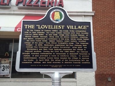
The "Loveliest Village" Marker
1 ► Alabama, Lee County, Auburn — Auburn 1865~Present / The "Loveliest Village" —  |
| On East Magnolia Avenue 0.1 miles east of North College Street (Alabama Route 15), on the right when traveling west. | |||
| 2 ► Alabama, Madison County, Huntsville — Seminole Wars / Mexican War — |
| On Monroe Street Northwest at Washington Street Northwest, on the left when traveling east on Monroe Street Northwest. | |||
| 3 ► Alabama, Morgan County, Decatur — 5 — Dancy-Polk House (circa 1829) — “A Hard Nut To Crack” — The Battle For Decatur — |
| On Church Street Northwest at Railroad Street Northwest, on the left when traveling east on Church Street Northwest. | |||
| 4 ► Arizona, Pinal County, Kearny — Kearny, Arizona — Named in Honor of Stephen Watts Kearny — Brevet Major General U.S. Army — |
| On Alden Road north of Upton Road, on the right when traveling east. | |||
| 5 ► California, San Bernardino County, Barstow — General Steven Watts Kearny — 1794-1848 — |
| On East Main Street (Business Interstate 15), on the right when traveling east. | |||
| 6 ► District of Columbia, Washington, Northwest Washington, Columbia Heights — James Buchanan — Meridian Hill Park, National Historic Landmark — National Park Service, U.S. Department of the Interior |
| Near 16th Street Northwest north of W Street Northwest, on the right when traveling north. Reported permanently removed. | |||
| 7 ► District of Columbia, Washington, Northwest Washington, Downtown — The Rodgers House — |
| Near Madison Place Northwest south of H Street Northwest, on the right when traveling south. | |||
| 8 ► District of Columbia, Washington, Northwest Washington, Georgetown — Presidential Visits to Old North — |
| Near Old North Way Northwest north of Library Walk Northwest, on the right when traveling north. | |||
| 9 ► Florida, Polk County, Bartow — F-549 — Old Polk County Courthouse — |
| On East Davidson Street east of North Broadway Avenue, on the right when traveling east. | |||
| 10 ► Florida, Putnam County, Palatka — F-828 — Bronson-Mulholland House — |
| On Madison Street west of North 1st Street, on the right when traveling west. | |||
| 11 ► Georgia, Forsyth County, Cumming — 058-3 — Colonel William Cumming — |
| On Veterans Memorial Boulevard (Georgia Route 9) south of Main Street ( Route 20), on the right when traveling south. | |||
| 12 ► Georgia, Harris County, Ellerslie — 072-5 — The Wire Road — »—→ — |
| On Warm Springs Road (Alternate U.S. 27) at Talbotton Road ( Route 315), on the right when traveling north on Warm Springs Road. | |||
| 13 ► Georgia, Polk County, Cedartown — 115-1A — Polk County — |
| On Prior Street 0 miles west of South Main Street ( Route 1), on the right when traveling west. | |||
| 14 ► Georgia, Spalding County, Griffin — 126-15 — The Fannin Avengers — |
| On Zebulon Road (U.S. 19) at Fair Road, on the right when traveling south on Zebulon Road. | |||
| 15 ► Illinois, DuPage County, Downers Grove — 1846 Blodgett House — |
| On Maple Avenue east of Lyman Avenue. | |||
| 16 ► Illinois, Kendall County, Oswego — Mexican-American War — (1846-1848) — |
| Near Main Street. | |||
| 17 ► Iowa, Polk County, Polk City — Town Square — The Bandstand — |
| Near Van Dorn Street just south of South 3rd Street, on the left when traveling south. | |||
| 18 ► Louisiana, Ascension Parish, Gonzales — The Mexican-American War — The Louisiana Connection — |
| Near South Irma Boulevard 0.3 miles north of East Worthey Street, on the right when traveling north. | |||
| 19 ► Louisiana, Ascension Parish, Gonzales — The Mexican-American War — 1846-1848 — |
| Near South Irma Boulevard 0.3 miles north of East Worthey Street, on the right when traveling north. | |||
| 20 ► Maryland, Anne Arundel County, Annapolis — Naval School — |
| Near Maryland Avenue. | |||
| 21 ► Maryland, Garrett County, Grantsville — Casselman River Bridge State Park — Bicentennial 1813-2013 — |
| Near Casselman Road 0.1 miles National Road (Route Alt-40). | |||
| 22 ► Maryland, Garrett County, Grantsville — Casselman River Bridge State Park — Bicentennial 1813-2013 — |
| On National Pike (Route Alt-40) 0.3 miles east of Patton Lane, on the left when traveling east. | |||
| 23 ► Maryland, Garrett County, Grantsville — Mountain Maryland Gateway to the West — Garrett County, Maryland — |
| On Casselman Road 0.2 miles west of National Pike (Alternate U.S. 40), on the left when traveling west. | |||
| 24 ► Maryland, Washington County, Hagerstown — Hagerstown & The National Road — |
| On West Washington Street (Maryland Route 144) just west of West Side Avenue, on the right when traveling west. | |||
| 25 ► Massachusetts, Hampden County, Springfield, Metro Center — Union House / Chandler Hotel / Edisonia Theater — Stop 5 • Springfield Experience Walk — |
| On Main Street at Crossett Lane, on the right when traveling east on Main Street. | |||
| 26 ► Minnesota, Polk County, Climax — Polk County — |
| On Highway 7 at Highway 220, on the left when traveling east on Highway 7. | |||
| 27 ► Missouri, New Madrid County, New Madrid — Fort Bankhead — |
| On Main Street at Levee Road, on the right when traveling south on Main Street. | |||
| 28 ► Missouri, Polk County, Bolivar — Polk County — |
| On East College Street at South Springfield Avenue (State Route 83), on the left when traveling east on East College Street. | |||
| 29 ► New York, New York County, Manhattan, Battery Park — The Lives of Castle Clinton: — Defense, Entertainment, Immigration, Education — [Castle Clinton National Monument] — |
| Near State Street, on the left when traveling north. | |||
| 30 ► North Carolina, Mecklenburg County, Charlotte, Charlotte center city — Thomas Polk Park — |
| On South Tryon Street at West Trade Street, on the right when traveling south on South Tryon Street. | |||
| 31 ► North Carolina, Mecklenburg County, Pineville — Cotton on the Polk Farm — President James K. Polk State Historic Site — |
| On James K. Polk Road (County Road 3640) 0.1 miles west of Lancaster Highway, on the left when traveling east. | |||
| 32 ► North Carolina, Mecklenburg County, Pineville — L-78 — James K. Polk — 1795-1849 — |
| On Lancaster Highway at James K Polk Road (County Highway 3640), on the right when traveling north on Lancaster Highway. | |||
| 33 ► North Carolina, Mecklenburg County, Pineville — James Knox Polk Birthplace — |
| On James K. Polk Road (County Road 3640) 0.1 miles east of Lancaster Highway, on the left when traveling east. | |||
| 34 ► North Carolina, Mecklenburg County, Pineville — Mecklenburg Chapter of the Daughters of the American Revolution — President James K. Polk State Historic Site — |
| On James K. Polk Road (County Road 3640) 0.1 miles east of Lancaster Highway, on the left when traveling east. | |||
| 35 ► North Carolina, Mecklenburg County, Pineville — Polk Family Cemetery — President James K. Polk State Historic Site — |
| Near James K. Polk Road (County Highway 3640) 0.1 miles east of Lancaster Highway. | |||
| 36 ► North Carolina, Mecklenburg County, Pineville — President James K. Polk S.H.S. — Little Sugar Creek Greenway — |
| On James K. Polk Road (County Highway 3640). | |||
| 37 ► North Carolina, Mecklenburg County, Pineville — The Polk Farm — President James K. Polk State Historic Site — |
| On James K. Polk Road (County Road 3640) 0.1 miles east of Lancaster Highway, on the left when traveling east. | |||
| 38 ► North Carolina, Mecklenburg County, Pineville — The President James K. Polk State Historic Site — |
| On James K. Polk Road (County Road 3640) 0.2 miles east of Lancaster Highway, on the left when traveling east. | |||
| 39 ► North Carolina, Mecklenburg County, Pineville — Tobacco in the Piedmont — President James K. Polk State Historic Site — |
| On James K. Polk Road (County Road 3640) 0.1 miles east of Lancaster Highway, on the left when traveling east. | |||
| 40 ► North Carolina, New Hanover County, Wilmington, Riverfront — Masonic Hall — 1841-42; 1907 — |
| On Market Street just west of North 2nd Street, on the right when traveling west. | |||
| 41 ► North Carolina, Wake County, Raleigh, Downtown — Presidents North Carolina Gave The Nation — |
| Near North Wilmington Street near New Bern Avenue. | |||
| 42 ► Ohio, Auglaize County, New Knoxville — 7-6 — New Knoxville: The Ladbergen Kinship — |
| On North Main Street at East Bremen Street, on the left when traveling north on North Main Street. | |||
| 43 ► Ohio, Lorain County, North Ridgeville — Mexican War — 1846 - 1848 — |
| On Bainbridge Road at Avon-Beldon Road (Ohio Route 83), on the right when traveling east on Bainbridge Road. | |||
| 44 ► Ohio, Lucas County, Sylvania — Stone Academy — |
| Near Main Street. | |||
| 45 ► Oregon, Clackamas County, Oregon City — Joseph L. Meek — Born 1810 - Died 1875 — |
| On McLoughlin Boulevard (Pacific Highway) (State Highway 99) at 6th Street on McLoughlin Boulevard (Pacific Highway). | |||
| 46 ► Oregon, Washington County, Hillsboro — Joseph L. Meek — |
| On NorthWest Victory Lane near NorthWest School Road, on the right when traveling north. | |||
| 47 ► Pennsylvania, Cumberland County, Enola, Hampden Township — The Mexican-American War — 1846 - 1848 — |
| Near Marketplace Way. | |||
| 48 ► Pennsylvania, Franklin County, Cove Gap, Peters Township — President James Buchanan — |
| On Stoney Batter Road, on the left when traveling north. | |||
| 49 ► Pennsylvania, Franklin County, Mercersburg — James Buchanan — 15th President of the United States 1857 - 1861 — |
| On S. Main Street near Seminary Street, on the right when traveling south. | |||
| 50 ► Pennsylvania, Philadelphia County, Philadelphia, Torresdale — Glen Foerd on the Delaware — City of Philadelphia, Neighborhood of Torresdale — The King's Highway Foundation — |
| Near Milnor Street at Grant Avenue, on the right when traveling east. | |||
| 51 ► South Dakota, Pennington County, Rapid City, Downtown — James K. Polk — Born 1795 • Died 1849 — |
| On 4th Street at Main Street (Business Interstate 90), on the right when traveling north on 4th Street. | |||
| 52 ► Tennessee, Davidson County, Nashville, Downtown — 3A 78, 95 — Downtown Presbyterian Church — American Presbyterian and Reformed Historical Site — |
| On 5th Ave N at Church St, on the right when traveling north on 5th Ave N. | |||
| 53 ► Tennessee, Davidson County, Nashville, Downtown — The 11th President James K. Polk — James K. Polk and Deaderick Street — |
| On Deaderick Street, on the right when traveling west. | |||
| 54 ► Tennessee, Davidson County, Nashville, North Capitol — James K. Polk — |
| On 7th Avenue North, on the left when traveling south. | |||
| 55 ► Tennessee, Davidson County, Nashville, North Capitol — James K. Polk death — |
| On 7th Avenue North, on the left when traveling south. | |||
| 56 ► Tennessee, Davidson County, Nashville, North Capitol — James K. Polk, elected President and territorial gains during the Mexican War — |
| On 7th Avenue North, on the left when traveling south. | |||
| 57 ► Tennessee, Davidson County, Nashville, North Capitol — Tomb of James Knox Polk — James Knox Polk, — President of the U.S. Born Nov. 2, 1795, Died June 15, 1849. — |
| Near Charlotte Avenue. | |||
| 58 ► Tennessee, Giles County, Pulaski — 3F 44 — Governor John C. Brown House — |
| On West Madison Street west of North 3rd Street, on the right when traveling west. | |||
| 59 ► Tennessee, Grainger County, Bean Station — Bean Station — |
| Near U.S. 25E, on the right when traveling south. | |||
| 60 ► Tennessee, Greene County, Greeneville — 1C 76 — Dickson - Williams Mansion — |
| On West Church Street, on the right when traveling east. | |||
| 61 ► Tennessee, Hardeman County, Bolivar — 4C 27 — Polk Cemetery — |
| On Matilda Street just west of South Union Street, on the left when traveling west. | |||
| 62 ► Tennessee, Haywood County, Dancyville — James K. Polk / James C. Jones — |
| On Tennessee Route 76 at Dancyville Methodist Church Road, on the right when traveling south on Tennessee Route 76. | |||
| 63 ► Tennessee, Marshall County, Lewisburg — 3G 23 — Polk's Law Office — |
| On West Commerce Street (Business U.S. 431) at South 1st Avenue, on the right when traveling east on West Commerce Street. | |||
| 64 ► Tennessee, Maury County, Columbia — James K. Polk House — For the Union — |
| On South High Street at West 7th Street (Business U.S. 412), on the right when traveling south on South High Street. | |||
| 65 ► Tennessee, Maury County, Columbia — 3D 39 — James Knox Polk — |
| On West 7th Street (State Highway 99) near South High Street. | |||
| 66 ► Tennessee, Maury County, Columbia — Jane Knox Polk Chapter — Daughters of the American Revolution — Columbia, Tennessee — |
| Near West 4th Street at North Main Street. | |||
| 67 ► Tennessee, Maury County, Columbia — 3D 21 — Polk's Boyhood Home — |
| On Nashville Highway just north of Imperial Drive. | |||
| 68 ► Tennessee, Maury County, Columbia — Site of the First Law Office of James Knox Polk — |
| On West 7th Street at North Garden Street, on the right when traveling west on West 7th Street. | |||
| 69 ► Tennessee, Maury County, Columbia — The Polk Family — |
| Near West 4th Street at North Main Street. | |||
| 70 ► Tennessee, Putnam County, Buffalo Valley — Site of Roulston Stand — |
| On Nashville Highway (U.S. 70N) 0.4 miles east of Buffalo Valley Road (State Highway 96), on the right when traveling east. | |||
| 71 ► Tennessee, Rutherford County, Murfreesboro — 3A-166 — Geographic Center of Tennessee — |
| On Greenland Drive at Old Lascassas Highway, on the right when traveling east on Greenland Drive. | |||
| 72 ► Tennessee, Rutherford County, Murfreesboro — 3A 134 — Old Bradley Academy — |
| On South Academy Street just north of East Castle Street, on the right when traveling north. | |||
| 73 ► Tennessee, Sullivan County, Blountville — 1A 33 — Old Deery Inn — |
| On Bristol Highway (State Road 126) west of Anderson Road, on the right when traveling west. | |||
| 74 ► Tennessee, Sullivan County, Kingsport — Netherland Inn / King's Boat Yard — |
| On Netherland Inn Road just east of Lilac Street, on the right when traveling west. | |||
| 75 ► Tennessee, Sumner County, Cottontown — 3B 37 — Tyree Springs — |
| On Ben Albert Road at Tyree Springs Road ( Route 258), on the right when traveling south on Ben Albert Road. | |||
| 76 ► Tennessee, Sumner County, Gallatin — 3B 35 — Trousdale Place |
| On West Main Street (Tennessee Route 25) at South Locust Avenue, on the right when traveling east on West Main Street. Reported missing. | |||
| 77 ► Tennessee, Washington County, Jonesborough — 1A 90 — Chester Inn — |
| On Main Street. | |||
| 78 ► Tennessee, White County, Sparta — 2D 35 — The Rock House — |
| Near Country Club Road (Old County Route 2200) at Bockman Way (U.S. 70), on the left when traveling south. | |||
| 79 ► Texas, Coleman County, Santa Anna — 4573 — Santa Anna, C.S.A. — |
| Near Wallis Avenue (U.S. 84) west of 2nd Street, on the right when traveling east. | |||
| 80 ► Texas, Polk County, Livingston — 16074 — Polk County — |
| On West Mill Street west of North Washington Avenue (Business U.S. 59), on the right when traveling east. | |||
| 81 ► Utah, Salt Lake County, Salt Lake City, Capitol Hill — Thomas L. Kane — |
| Near East Capitol Boulevard north of East 300 North, on the left when traveling north. | |||
| 82 ► Virginia, Alexandria, Old Town — 3 — Retrocession — City of Alexandria, Est. 1749 — Alexandria Heritage Trail — |
| On North Union Street at Queen Street, on the right when traveling north on North Union Street. | |||
| 83 ► Virginia, Arlington County, Arlington, Ronald Reagan Washington National Airport — The Hunter Family — Abingdon Plantation — |
| Near National Avenue near Smith Boulevard, on the left when traveling north. | |||
| 84 ► West Virginia, Ohio County, Elm Grove — “Monument Place” — |
| On Wheeling and Elm Grove Boulevard (West Virginia Route 88) at National Road (U.S. 40), on the left when traveling west on Wheeling and Elm Grove Boulevard. | |||
| 85 ► Wisconsin, Brown County, Green Bay — Hazelwood — Hazelwood was the home... — Fox River Trail — |
| Near South Monroe Avenue (State Highway 57) 0.1 miles north of Emilie Street, on the left when traveling north. | |||
| 86 ► Wisconsin, Brown County, Green Bay — 156 — Hazelwood — |
| Near South Monroe Avenue (State Highway 57) 0.1 miles north of Emilie Street, on the left when traveling north. | |||