By Darren Jefferson Clay, August 21, 2021
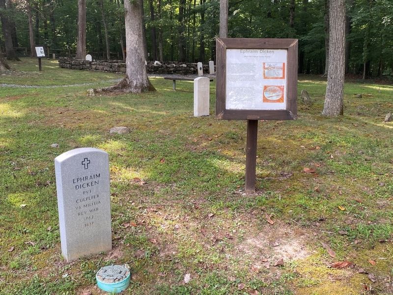
Ephraim Dicken Marker
RANKED BY RELEVANCE
Near Old Mulkey Park Road 0.2 miles west of Old Mulkey Road.
On York Road (State Road 600) at Germanna Highway (State Highway 3), on the right when traveling east on York Road.
On North Main Street (Business U.S. 15) at West Spencer Street, on the left when traveling north on North Main Street.
Near North Blue Ridge Avenue.
On Boydton Plank Road (U.S. 1) at Duncan Road (County Route 670), on the left when traveling west on Boydton Plank Road.
On Ensign Drive north of Pike Drive, on the right when traveling north.
On York Road (State Road 600) at Germanna Highway (State Highway 3), on the right when traveling east on York Road.
On Interstate 95, on the right when traveling south. Reported permanently removed.
On Main Street 0 miles 1st Street, on the right when traveling south.
Near South Cambridge Street.
On North Main Street (Business U.S. 15) at East Davis Street, on the right when traveling north on North Main Street.
Near Willis Avenue west of Hord Avenue, on the left when traveling west.
On John Mosby Highway (U.S. 50) at Hill Road / Trappe Road (County Route 619), on the right when traveling east on John Mosby Highway.
On John Mosby Highway (U.S. 50), on the right when traveling east.
On Reinbach Street 0.1 miles south of North Railroad Street, on the left when traveling east.
Paid Advertisement
On James Madison Highway (U.S. 15/29) just south of Rappahannock River, on the right when traveling north.
On York Road (State Road 600) at Germanna Highway (State Highway 3), on the right when traveling east on York Road.
Near Colvin Road 0.4 miles Rixeyville Road (Virginia Route 229), on the right when traveling west.
On Beverly Ford Road (County Route 677) at St. James Church Road (County Route 676), on the left when traveling north on Beverly Ford Road. Reported permanently removed.
On Maddens Tavern Road at Youngs Lane, on the left when traveling north on Maddens Tavern Road.
On General Winder Road (Virginia Route 657) 0.3 miles west of North James Madison Highway (U.S. 15), on the right when traveling west. Reported missing.
On General Winder Road (Virginia Route 657) 0.3 miles west of North James Madison Highway (U.S. 15), on the right when traveling west.
On Eleys Ford Road (County Route 610) at Richards Ferry Road (County Route 619), on the right when traveling west on Eleys Ford Road.
On River Road West (Virginia Route 6) at Dover Road, on the right when traveling west on River Road West.
On Snickersville Turnpike (County Route 734) at JEB Stuart Road (County Route 630), on the right when traveling north on Snickersville Turnpike.
On Unison Road (County Route 630), on the right when traveling east.
On Constitution Highway (State Highway 20), on the right when traveling west.
On Laurel Mills Road (County Route 618) at Richmond Road (County Route 729), on the left when traveling east on Laurel Mills Road.
On Lee Highway (U.S. 211).
On Newbys Shop Road (Virginia Route 673), on the right when traveling north.
On Newbys Shop Road (Virginia Route 673), on the right when traveling north.
Paid Advertisement
On Mt. Pony Road (County Route 658) just west of Blackjack Road (County Route 661), on the left when traveling east.
On John S Mosby Highway (U.S. 50) west of Dunvegan Drive, on the right when traveling east. Reported permanently removed.
On Constitution Highway (Virginia Route 20) at Zoar Road ( Route 611), on the right when traveling west on Constitution Highway.
On Viewtown Road (County Route 642), on the left when traveling south.
On Farm to Market Road 861 0.2 miles north of County Road 103, on the left when traveling north.
On Lee Highway (U.S. 211) at Waterloo Road / Wildwood Circle (County Route 613), on the right when traveling east on Lee Highway.
On US Avenue 0.2 miles east of South East Street, on the right when traveling east.
On Zachary Taylor Highway (U.S. 522) at Twin Mountains Road ( Route 647), on the right when traveling north on Zachary Taylor Highway.
Near Dove Hill Road (Virginia Route 642) 0.1 miles north of North James Madison Highway (U.S. 15), on the left when traveling north.
On York Road (Road 600) at Germanna Highway (State Highway 3), on the right when traveling east on York Road.
On York Road (State Road 600) at Germanna Highway (State Highway 3), on the right when traveling east on York Road.
On Indian Hollow Road (Virginia Route 679) at North Frederick Pike (U.S. 522), on the right when traveling west on Indian Hollow Road. Reported permanently removed.
On James Madison Highway (U.S. 15) at White Oad Road / Robinson River Road (County Route 721), on the right when traveling north on James Madison Highway.
On Germanna Highway (State Highway 3), on the right when traveling west.
On Sperryville Pike (U.S. 522) at Obannons Mill Road (County Route 650), on the right when traveling north on Sperryville Pike.
On Remount Road (U.S. 522), on the right when traveling south.
Paid Advertisement
On St. James Church Road (Route 676) at Beverly Ford Road (Route 677), on the right when traveling west on St. James Church Road. Reported permanently removed.
On Seminole Trail (U.S. 29) north of Fredericksburg Road (County Route 609), on the right when traveling north.
On Bank Road at Lee Highway (U.S. 211) on Bank Road.
On Maddens Tavern Road at Youngs Lane, on the left when traveling north on Maddens Tavern Road.
On Vint Hill Road (Virginia Route 215) at Lee Highway (U.S. 15/29), on the right when traveling north on Vint Hill Road.
On Kelly's Ford Road (Virginia Route 674) at Kelly's Ford Road ( Route 620), on the right when traveling south on Kelly's Ford Road.
On Library Road (County Road 683) at Old Mill Road, on the right when traveling west on Library Road.
On Hawlin Road (County Road 618) 0.1 miles west of Sperryville Pike (U.S. 522), on the left when traveling west.
Near North Blue Ridge Avenue, on the right when traveling south. Reported permanently removed.
Near North James Madison Highway (Route 642) 0.1 miles north of North James Madison Highway (U.S. 15), on the left when traveling north. Reported missing.
On Salubria Lane south of Germanna Highway ( Route 3), on the right when traveling south.
On Vint Hill Road (Virginia Route 215) at Lee Highway (U.S. 15/29), on the right when traveling north on Vint Hill Road. Reported permanently removed.
On Seminole Trail (U.S. 29) at Hoover Road, on the right when traveling south on Seminole Trail.
Near Fleetwood Heights Road (Virginia Route 685) at Stuart Lane, on the right when traveling east.
On Francis Thorton Valley Road (Virginia Route 231) at Nethers Road (County Route 602) on Francis Thorton Valley Road.
︽
Thin black lines indicate changes in relevance. Between each pair of lines entries are ordered geographically but all have the same relevance. * Inflectional forms of words are their plurals, singulars, and possessives as well as gramatical tenses and similar variations.
Nov. 13, 2026