By Evan Dwyer, July 27, 2026
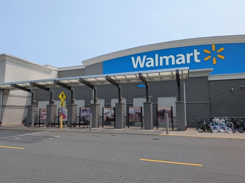
Historic Orange County, Virginia Marker
RANKED BY RELEVANCE
| Near Twin Drive 0.1 miles north of A and K Boulevard, on the left when traveling east. |
| Near Twin Drive 0.1 miles north of A and K Boulevard, on the left when traveling east. |
| Near Twin Drive 0.1 miles north of A and K Boulevard, on the left when traveling east. |
| Near Twin Drive 0.1 miles north of A and K Boulevard, on the left when traveling east. |
| Near Twin Drive 0.1 miles north of A and K Boulevard, on the left when traveling east. |
| Near Twin Drive 0.1 miles north of A and K Boulevard, on the left when traveling east. |
| On West Market Street west of Dolley Madison Road, on the right when traveling west. Reported missing. |
| Near Short Street south of East Main Street, on the right when traveling south. |
| On Tennessee Route 160, on the right when traveling north. |
| Near North Blue Ridge Avenue. |
| On North Courthouse Road (Virginia Route 155) at Poindexter Road ( Route 604), on the left when traveling north on North Courthouse Road. |
| On Caroline Street (Virginia Route 20) south of West Main Street, on the right when traveling north. |
| On Seminole Trail (U.S. 29) north of Frays Mill Road / Burnley Station Road, in the median. Reported missing. |
| Near James Ashby Parkway. |
| Near Parakeet Drive 0.5 miles west of Kite Street, on the left when traveling west. |
| Near West 7th Street just west of Myrtle Avenue, on the right when traveling west. |
| On Pigeon Roost Road (Kentucky Route 1714) 1.4 miles north of Caney Fork Road (County Route 1114), on the left when traveling north. |
| On Lakeview Parkway near Shoosmith Road, on the left when traveling north. |
| On Reinbach Street 0.1 miles south of North Railroad Street, on the left when traveling east. |
| On Lakeview Parkway, on the right when traveling north. |
| On Edgemont Circle north of Lakeview Parkway, on the right when traveling south. |
| On Short Street just south of East Main Street, on the left when traveling north. |
| On Maddens Tavern Road at Youngs Lane, on the left when traveling north on Maddens Tavern Road. |
| On Court Street at Ford Avenue, on the right when traveling east on Court Street. |
| On North Main Street (Business U.S. 29) south of Blue Ridge Turnpike (Virginia Route 231), on the left when traveling south. |
| On West Main Street (State Highway 20) at Madison Road (U.S. 15), on the right when traveling west on West Main Street. |
| Near Constitution Highway (Virginia Route 20) when traveling south. |
| On Short Street just south of East Main Street, on the right when traveling south. |
| Near Greenwood Street 0.3 miles east of South Mills Avenue when traveling east. |
| Near North Princeville Cemetery Road 0.2 miles north of North Sumner Avenue. |
| On Anthony Road at Old Trail, on the right when traveling east on Anthony Road. |
| Near State Highway 86, on the right when traveling south. |
| Near Memorial Drive at Morning Star, on the right when traveling west. |
| On Sperryville Pike (U.S. 522) 0.1 miles west of Virginia Avenue/Colonel Jameson Boulevard, on the left when traveling west. |
| Near Constitution Highway (State Highway 20), on the right when traveling west. Reported permanently removed. |
| On Constitution Highway (State Highway 20), on the right when traveling west. |
| On East Main Street (State Highway 20) at Short Street, on the right when traveling east on East Main Street. |
| Near Rep. John Lewis Way South. |
| On Stamping Ground Road (Kentucky Route 227) north of Frankfort Pike (U.S. 460), on the right when traveling north. |
| Near New York State Route 17A 0.4 miles Gibson Rd (County Route 100), on the right when traveling south. |
| On U.S. 70 near Efland-Cedar Grove Road, on the right when traveling west. |
| On West Pine Street (State Highway 89) at Hidden Valley Road, on the right when traveling east on West Pine Street. |
| On Zachary Taylor Highway (U.S. 522) at Twin Mountains Road (Virginia Route 647), on the right when traveling north on Zachary Taylor Highway. |
| On Spotswood Trail (U.S. 33), on the right when traveling east. |
| On James Madison Parkway (U.S. 301) at Walsingham Road, on the right when traveling south on James Madison Parkway. |
| On James Monroe Highway (U.S. 15) 0.2 miles Spinks Ferry Road, on the right when traveling north. |
| On James Madison Highway (U.S. 15/33), on the right when traveling north. |
| On Germanna Highway (State Highway 3), on the right when traveling west. |
| On Germanna Highway (State Highway 3) 0.3 miles west of Constitution Highway (State Highway 20), on the right when traveling west. |
| On Constitution Highway (Virginia Route 20) 0.1 miles west of South Montpelier Road, on the left when traveling east. |
| On Chestnut Ridge Road (County Route 61) east of Don Nehlen Drive, on the right when traveling east. |
| On Stony Hill Road at Hillsborough Road, on the right when traveling east on Stony Hill Road. |
| On Seminole Trail (U.S. 29) north of Fredericksburg Road (County Route 609), on the right when traveling north. |
| On Rockfish Gap Turnpike (U.S. 250) at Skyline Drive and Blue Ridge Parkway, on the right when traveling east on Rockfish Gap Turnpike. |
| On East Central Boulevard at Court Avenue, on the right when traveling west on East Central Boulevard. |
| On East Seminole Boulevard west of North Mellonville Avenue, on the left when traveling east. |
| On Red Oak Drive at Rivervale Road, on the right when traveling east on Red Oak Drive. |
| On Constitution Highway (State Highway 20) at County Route 693, on the right when traveling west on Constitution Highway. |
| On West Main Street just west of North Madison Road (U.S. 15), on the right when traveling west. |
| On Mayhurst Lane 0.2 miles north of James Madison Highway (U.S. 15), on the left when traveling north. |
| On West Main Street just west of North Madison Road (U.S. 15), on the right when traveling west. |
| On East Beverly Street (Virginia Route 254) at South Augusta Street (Business U.S. 11) on East Beverly Street. |
| On North Churton Street at West Union Street, on the right when traveling south on North Churton Street. |
| On Salubria Lane south of Germanna Highway ( Route 3), on the right when traveling south. |
| On West Main Street just west of North Madison Road (U.S. 15), on the right when traveling west. |
| On Water Street at 3rd Street, on the right when traveling north on Water Street. |
| On Watts Street at 14 Alley, on the right when traveling south on Watts Street. |
| On Purity Street east of Holbrook Street, on the right when traveling east. |
| On West Main Street just west of North Madison Road (U.S. 15), on the right when traveling west. |
Thin black lines indicate changes in relevance. Between each pair of lines entries are ordered geographically but all have the same relevance.* Inflectional forms of words are their plurals, singulars, and possessives as well as gramatical tenses and similar variations.
Nov. 13, 2026
