270 entries match your criteria. The first 100 are listed. ⊳
Erie Canal Historical Markers
Markers related to the water route that connected the Hudson River to Lake Erie, creating the first significant commercial route to the American Midwest.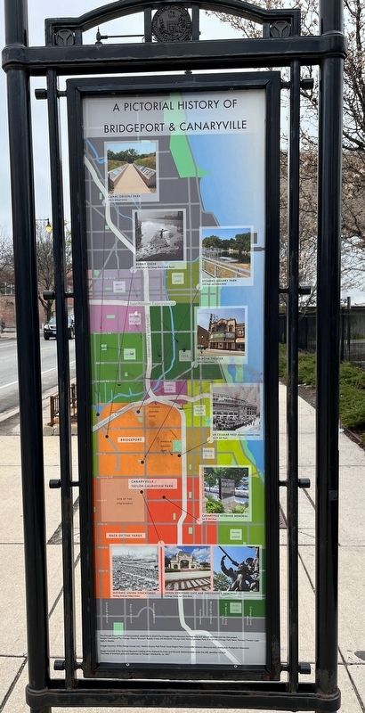
By Sean Flynn, April 1, 2024
Pictorial History of Bridgeport & Canaryville
1 ► Illinois, Cook County, Chicago, Bridgeport — Bridgeport and the Development of Chicago's Infrastructure — The Story of a Neighborhood —  |
| On South Halsted Street north of West 34th Street when traveling north. | |||
| 2 ► Illinois, Lake County, Wauconda — Andrew C. Cook House — |
| On North Old Rand Road south of North Garland Road, on the right when traveling south. | |||
| 3 ► New York, Albany County, Albany — The Erie Canal / Albany Basin — |
| On Quay Street, on the right when traveling north. | |||
| 4 ► New York, Albany County, Albany, Downtown — Erie Canal — |
| Near Quay Street. | |||
| 5 ► New York, Albany County, Cohoes — Juncta — |
| On Saratoga Street (New York State Route 32), on the right when traveling north. | |||
| 6 ► New York, Albany County, Cohoes — The Erie Canal — Power Canal Park | Cohoes NY — |
| Near North Mohawk Street, on the right when traveling south. | |||
| 7 ► New York, Albany County, Colonie — Maplewood Historic Park — |
| On 2nd Avenue (New York State Route 32) north of 26th Street, on the right when traveling north. | |||
| 8 ► New York, Albany County, Colonie — The Erie Canal — |
| On Broadway (New York State Route 32) near Federal Express Plaza, on the right when traveling north. | |||
| 9 ► New York, Albany County, Colonie — The Weighlock Building — 1850-1915 — |
| On 2nd Avenue (New York State Route 32) north of 26th Street, on the right when traveling north. | |||
| 10 ► New York, Albany County, Watervliet — 14th Street Bridge — |
| On 2nd Avenue (New York State Route 32) near 14th Street, on the right when traveling north. | |||
| 11 ► New York, Albany County, Watervliet — Erie Canal — |
| On 2nd Avenue (New York State Route 32) at 23rd Street, on the right when traveling north on 2nd Avenue. | |||
| 12 ► New York, Bronx County, Bronx, Mott Haven — Gouverneur Morris — |
| On Saint Ann's Avenue just north of La Lupe Way, on the right when traveling south. | |||
| 13 ► New York, Cayuga County, Brutus — Conduit For Ideas — The Canalway Trail — |
| Near New York State Route 31 at West Brutus Street. | |||
| 14 ► New York, Cayuga County, Brutus — The Boom Years — The Canalway Trail — |
| Near New York State Route 31 at West Brutus Street. | |||
| 15 ► New York, Cayuga County, Brutus — The Erie Canal — The Centreport Aqueduct — Centreport Aqueduct Park — |
| Near New York State Route 31 at West Brutus Street. | |||
| 16 ► New York, Cayuga County, Brutus — The Erie Canal — Historic New York — |
| On New York State Route 31 at West Brutus Street, on the right when traveling east on New York State Route 31. | |||
| 17 ► New York, Cayuga County, Montezuma — A Landmark and Pride in Our Community — Byron Lapp Memorial Trail and Montezuma Heritage Park — |
| On High Street 0.1 miles north of Erie Street, on the left when traveling north. | |||
| 18 ► New York, Cayuga County, Montezuma — Early Aqueduct — |
| On Chapman Road 0.3 miles west of High Street, on the right when traveling south. | |||
| 19 ► New York, Cayuga County, Montezuma — Montezuma Heritage Park — Mural & Historic Markers Dedication — May 4, 2013 — |
| Near High Street 0.1 miles north of Erie Street. | |||
| 20 ► New York, Cayuga County, Montezuma — Old Erie Canal — |
| On New York State Route 90 at Erie Street, on the right when traveling north on New York State Route 90. | |||
| 21 ► New York, Cayuga County, Montezuma — Opened in 1828 — Cayuga Seneca Canal — |
| On High Street at Erie Street, on the left when traveling north on High Street. | |||
| 22 ► New York, Cayuga County, Port Byron — A Metaphor for Change — The Canalway Trail — |
| Near Utica Street (New York State Route 31) 0.3 miles east of Main Street ( Route 38). | |||
| 23 ► New York, Cayuga County, Port Byron — Blacksmith Shop and Mule Shed — Port Byron / Old Erie Canal Heritage Park — |
| Near Interstate 90. | |||
| 24 ► New York, Cayuga County, Port Byron — Glaciers, Drumlins, and High Level Lakes — Port Byron / Old Erie Canal Heritage Park — |
| Near Interstate 90. | |||
| 25 ► New York, Cayuga County, Port Byron — Port Byron's Lock 52 — |
| Near Interstate 90. | |||
| 26 ► New York, Cayuga County, Port Byron — Tanner's Dry Dock — The Canalway Trail — |
| Near Utica Street (New York State Route 31) 0.3 miles east of Main Street ( Route 38). | |||
| 27 ► New York, Cayuga County, Port Byron — Tanner's Dry Dock — |
| Near Interstate 90. | |||
| 28 ► New York, Cayuga County, Port Byron — The Erie Canal — Historic New York — |
| Near New York Thruway (Interstate 90) 25.4 miles east of Ridge Road ( Route 414), on the right when traveling east. | |||
| 29 ► New York, Cayuga County, Port Byron — The Erie Canal in Port Byron — Erie Canal Heritage Park at Port Byron — Today's Canal System in New York — |
| Near Interstate 90. | |||
| 30 ► New York, Cayuga County, Port Byron — The Erie House — Port Byron / Old Erie Canal Heritage Park — |
| Near Interstate 90 near Erie Canal Heritage Site. | |||
| 31 ► New York, Chemung County, Chemung — Junction Canal — |
| On Wyncoop Creek Road (County Road 3) just south of Main Street (County Road 60), on the right when traveling south. | |||
| 32 ► New York, Chemung County, Elmira — Chemung Canal — |
| On East Water Street (State Highway 352) at Clemens Center Parkway (State Highway 14), on the right when traveling east on East Water Street. | |||
| 33 ► New York, Erie County, Amherst — A Dam on Tonawanda Creek — The Canalway Trail: Amherst — |
| Near Creekside Drive 0.1 miles west of Old Niagara Falls Boulevard. | |||
| 34 ► New York, Erie County, Amherst — The Erie Canal at Amherst — Erie Canalway Trail - Amherst — |
| On Tonawanda Creek Road at New Road, on the right when traveling west on Tonawanda Creek Road. | |||
| 35 ► New York, Erie County, Angola — Western New York — Historic New York — |
| On New York State Thruway / AMVETS Memorial Highway (Interstate 90 at milepost 443). | |||
| 36 ► New York, Erie County, Buffalo, Black Rock — "The Black Rock" |
| On Black Rock Harbor Road 0.2 miles west of Niagara Street ( Route 266), on the left when traveling west. Reported missing. | |||
| 37 ► New York, Erie County, Buffalo, Black Rock — Black Rock — |
| On Amherst Street at Niagara Street ( Route 266), on the left when traveling east on Amherst Street. | |||
| 38 ► New York, Erie County, Buffalo, Black Rock — Black Rock Harbor — June 1823 — |
| On Amherst Street east of Niagara Street ( Route 266), on the left when traveling east. | |||
| 39 ► New York, Erie County, Buffalo, Black Rock — Tow Path Park — |
| On Hertel Avenue 0.2 miles west of Niagara Street ( Route 266), on the left when traveling east. | |||
| 40 ► New York, Erie County, Buffalo, Downtown — From Frontier to Major City / Buffalo City Hall — Buffalo History and Architecture — Niagara Square West — |
| Near Niagara Square at Niagara Street. | |||
| 41 ► New York, Erie County, Buffalo, Downtown — Our Legacy of Abundant Water — Buffalo History and Architecture — Niagara Square South — |
| Near Niagara Square at Delaware Avenue, in the median. | |||
| 42 ► New York, Erie County, Buffalo, First Ward — Lighthouse Point Park — |
| On Fuhrmann Boulevard 1.2 miles north of The Skyway ( Route 5), on the right when traveling north. | |||
| 43 ► New York, Erie County, Buffalo, First Ward — The Early Grain Trade / Influence of the Erie Canal — The Industrial Heritage Trail — |
| On Fuhrmann Boulevard 0.2 miles south of The Skyway ( Route 5), on the left when traveling north. | |||
| 44 ► New York, Erie County, Buffalo, First Ward — The Engineers of the Grain Elevators — The Industrial Heritage Trail — |
| On Fuhrmann Boulevard 0.2 miles south of The Skyway ( Route 5), on the right when traveling south. | |||
| 45 ► New York, Erie County, Buffalo, First Ward — The First Grain Elevator / Early Grain Elevators — The Industrial Heritage Trail — |
| On Fuhrmann Boulevard 0.2 miles south of The Skyway ( Route 5), on the right when traveling south. | |||
| 46 ► New York, Erie County, Buffalo, First Ward — The Grain Industry Decline / Buffalo's Grain Legacy — The Industrial Heritage Trail — |
| On Fuhrmann Boulevard 0.2 miles south of The Skyway ( Route 5), on the right when traveling south. | |||
| 47 ► New York, Erie County, Buffalo, Riverside — Hunting and Fishing off the Porch — |
| On Niagara Street (Route 266) at Collaton Street, on the right when traveling south on Niagara Street. | |||
| 48 ► New York, Erie County, Buffalo, South Park — Improvements in Ship Design — The Industrial Heritage Trail — |
| On Fuhrmann Boulevard 0.2 miles south of Ohio Street, on the left when traveling north. | |||
| 49 ► New York, Erie County, Buffalo, Waterfront — A Changing Waterfront — |
| On Marine Drive at Commercial Street, on the right when traveling east on Marine Drive. | |||
| 50 ► New York, Erie County, Buffalo, Waterfront — Buffalo - A Network of Canals — Sail Lofts, Stables, Grain Elevators, Brothels, Saloons — |
| On Lloyd Street at Marine Drive, on the right when traveling south on Lloyd Street. | |||
| 51 ► New York, Erie County, Buffalo, Waterfront — Buffalo - An Industrial Powerhouse — Tanneries, Clothiers, Piano Makers, Saddlers and Breweries — |
| On Lloyd Street at Marine Drive, on the right when traveling south on Lloyd Street. | |||
| 52 ► New York, Erie County, Buffalo, Waterfront — Buffalo - Queen City of the Lakes — Erie Canalway National Heritage Corridor — |
| Near Marine Drive at Commercial Street. | |||
| 53 ► New York, Erie County, Buffalo, Waterfront — Buffalo Riverfront Historical Eras to 1930 — |
| On Marine Drive at Commercial Street, on the left when traveling west on Marine Drive. | |||
| 54 ► New York, Erie County, Buffalo, Waterfront — Buffalo's Birthplace — Where the Erie Canal Joins the Commercial Slip — |
| On Commercial Street at Perry Boulevard, on the left when traveling south on Commercial Street. | |||
| 55 ► New York, Erie County, Buffalo, Waterfront — Canal and Harbor — Transforming Buffalo — |
| Near Marine Drive 0.1 miles north of Lloyd Street, on the right when traveling west. | |||
| 56 ► New York, Erie County, Buffalo, Waterfront — Erie Canalway National Heritage Corridor — |
| On Marine Drive at Commercial Street, on the right when traveling east on Marine Drive. | |||
| 57 ► New York, Erie County, Buffalo, Waterfront — Harboring Hopes — |
| On Lloyd Street at Prime Street, on the left when traveling east on Lloyd Street. | |||
| 58 ► New York, Erie County, Buffalo, Waterfront — Rebirth & Renewal — |
| On Prime Street at Lloyd Street, on the left when traveling north on Prime Street. | |||
| 59 ► New York, Erie County, Buffalo, Waterfront — The Big Picture — |
| On Lloyd Street at Marine Drive, on the right when traveling south on Lloyd Street. | |||
| 60 ► New York, Erie County, Buffalo, Waterfront — The Erie Canal / Two Waterfronts — |
| On Prime Street at Lloyd Street, on the left when traveling north on Prime Street. | |||
| 61 ► New York, Erie County, Buffalo, Waterfront — The Grand Canal — |
| On Marine Drive at Commercial Street, on the left when traveling west on Marine Drive. | |||
| 62 ► New York, Erie County, Buffalo, Waterfront — The Immigrant Steps — Building Buffalo — |
| Near Commercial Street at Perry Boulevard, on the right when traveling north. | |||
| 63 ► New York, Erie County, Buffalo, Waterfront — The Industrial Heritage Trail — Monuments to the Movement of Grain — Maritime Heritage — |
| Near Erie Street 0.1 miles west of Marine Drive. | |||
| 64 ► New York, Erie County, Buffalo, Waterfront — The Ruins at Canalside — Drinking in 19th Century Buffalo — |
| On Lloyd Street 0.1 miles north of Prime Street, on the right when traveling south. | |||
| 65 ► New York, Erie County, Buffalo, Waterfront — Wedding of the Waters — The Completion of the Erie Canal — |
| Near Marine Drive at Pearl Street. | |||
| 66 ► New York, Erie County, Clarence — Niagara Frontier — Historic New York — |
| Near Governor Thomas E. Dewey Thruway (Interstate 90 at milepost 412), 10.6 miles west of Alleghany Road ( Route 77), on the right when traveling west. | |||
| 67 ► New York, Erie County, Grand Island — Strawberry Island — Past to Present — |
| On Park Road Loop at Area 3, on the right when traveling east. | |||
| 68 ► New York, Erie County, Tonawanda — City of Tonawanda — A Community Built Around Lumber — |
| On East Main Street at Longs Avenue, on the right when traveling west on East Main Street. | |||
| 69 ► New York, Erie County, Tonawanda — Engineering the Erie Canal — |
| Near Niagara Street (New York State Route 266) 0.1 miles north of Gibson Street. | |||
| 70 ► New York, Erie County, Tonawanda — Erie Canal Site — |
| Near Niagara Street. | |||
| 71 ► New York, Erie County, Tonawanda — Gastown — Erie Canalway Trail — |
| On East Niagara Street at East Avenue, on the right when traveling west on East Niagara Street. | |||
| 72 ► New York, Erie County, Tonawanda — Gateway to the West — |
| On Main Street at Young Street when traveling north on Main Street. | |||
| 73 ► New York, Erie County, Tonawanda — Lumber Capital — |
| On Young Street at Main Street, on the right when traveling west on Young Street. | |||
| 74 ► New York, Erie County, Tonawanda — The Dam — |
| On Young Street at Main Street, on the right on Young Street. | |||
| 75 ► New York, Erie County, Tonawanda — The Long Homestead — |
| Near East Niagara Street 0.1 miles west of Fillmore Avenue. | |||
| 76 ► New York, Erie County, Tonawanda — The People — Erie Canalway Trail — |
| On East Niagara Street at Longs Avenue, on the right when traveling west on East Niagara Street. | |||
| 77 ► New York, Erie County, Tonawanda — The Railroad — |
| On Young Street at Main Street, on the left when traveling east on Young Street. | |||
| 78 ► New York, Erie County, Tonawanda — Westward to Buffalo — Niagara River Greenway — |
| Near Niagara Street (New York State Route 266) 0.2 miles west of Veterans Road. | |||
| 79 ► New York, Herkimer County, Little Falls — A Bridge for Boats — The Little Falls Aqueduct — |
| On Mohawk Street, on the left when traveling south on Mohawk Street. | |||
| 80 ► New York, Herkimer County, Little Falls — Herkimer Little-Falls Area — Historic New York — |
| On Interstate 90 1 mile east of Route 169, on the right when traveling east. | |||
| 81 ► New York, Herkimer County, Little Falls — Little Falls — Water Power for Sale/A Valley Corridor/Historic Sites and Community Services — |
| On MoHawk Street at South Ann Street, on the right when traveling east on MoHawk Street. | |||
| 82 ► New York, Kings County, Brooklyn, Greenwood Heights — Governor DeWitt Clinton — |
| On Bayside Avenue. | |||
| 83 ► New York, Livingston County, Nunda — Lock 42 — |
| On North State Street (New York State Route 408) at 4th Street on North State Street. | |||
| 84 ► New York, Madison County, Canastota — Enlarging the Erie Canal — Erie Canalway National Heritage Corridor — |
| On Canal Street (County Route 76) at Commerce Street, on the left when traveling west on Canal Street. | |||
| 85 ► New York, Madison County, Canastota — The Erie Canal — Historic New York — |
| On NYS Thruway (U.S. 90) 4 miles west of N Peterboro Street ( Route 13). | |||
| 86 ► New York, Madison County, Chittenango — Canal Industry — |
| On Lakeport Road (County Route 3) north of Clay Hill Road, on the left when traveling north. | |||
| 87 ► New York, Monroe County, Brighton — Route of Original Erie Canal — |
| On Monroe Avenue (New York State Route 31) 0.1 miles north of Allens Creek Road, on the right when traveling west. | |||
| 88 ► New York, Monroe County, Brockport — Brockport and the Canal — |
| On Main Street (New York State Route 19), on the right when traveling north. | |||
| 89 ► New York, Monroe County, Brockport — Canal Commerce in Brockport — Luther Gordon, the spirit of canal commerce in Brockport — |
| On Main Street (New York State Route 19) at the south end of the Erie Canal drawbridge, on the right when traveling north on Main Street. | |||
| 90 ► New York, Monroe County, Bushnell's Basin — Bushnell's Basin |
| On Marsh Road at Pittsford-Victor Rd. ( Route 96), on the right when traveling south on Marsh Road. Reported permanently removed. | |||
| 91 ► New York, Monroe County, Bushnell's Basin — Richardson Tavern — |
| On Marsh Road at Pittsford-Victor Rd., on the right when traveling west on Marsh Road. | |||
| 92 ► New York, Monroe County, Bushnell's Basin, Pittsford — 23 — Bushnell's Basin — |
| On Pittsford-Victor Road (New York State Route 96) at Marsh Road (County Road 38), on the left when traveling east on Pittsford-Victor Road. | |||
| 93 ► New York, Monroe County, Fairport — Fullam's Basin — |
| On West Church Street (New York State Route 31F) 0.2 miles east of O'Connor Road, on the right when traveling west. | |||
| 94 ► New York, Monroe County, Fairport — New York State Canals — The Great American Canal — |
| Near O'Connor Road. | |||
| 95 ► New York, Monroe County, Fairport — Old Erie Canal — 1825-1975 — |
| Near South Main Street (New York State Route 250) just east of West Ave.. | |||
| 96 ► New York, Monroe County, Greece — Henpeck — |
| On Ridgeway Avenue 0.2 miles south of Elmgrove Road. | |||
| 97 ► New York, Monroe County, Henrietta — The Great American Canal — The Canal System — |
| Near Edgewood Avenue (County Route 102) 0.2 miles south of French Road. | |||
| 98 ► New York, Monroe County, Pittsford — Building the Great Embankment — |
| Near Marsh Road (New York State Route 38) north of Falling Creek Road, on the left when traveling north. | |||
| 99 ► New York, Monroe County, Pittsford — Cartersville — |
| On East Street just south of East Jefferson Road ( Route 96), on the right when traveling south. | |||
| 100 ► New York, Monroe County, Pittsford — Changing Alignments — The Canalway Trail: Pittsford — |
| Near Clover Street 0.2 miles west of Framingham Lane. | |||
270 entries matched your criteria. The first 100 are listed above. Next 100 ⊳