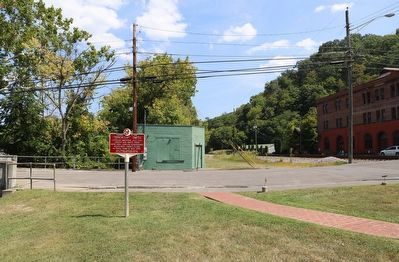
On South Monroe Street north of C O Plaza, on the left when traveling north.
African American Jazz Era singer Ada Smith, born here in 1894. Harlem Renaissance headliner, owned clubs in Paris, Rome & New York. — — Map (db m255189) HM
On 4th Avenue North at 17th Street North, on the right when traveling west on 4th Avenue North.
The Fourth Avenue "Strip" thrived during a time when downtown privileges for blacks were limited. Although blacks could shop at some white-owned stores, they did not share the same privileges and services as white customers, so they created . . . — — Map (db m26985) HM
In Honor of Our River Forest Village Presidents Who Have Provided Leadership and Vision
Timothy Kirk, 1880-1881 • Herman H. Scharenberg, 1882-1887 • Felix J. Griffen, 1888 • George L. Thatcher, 1889 • Jacob A. Cost, 1890-1893 • Robert S. Odell, . . . — — Map (db m256304) HM
On University Avenue at West 170th Street, on the left when traveling north on University Avenue.
High Bridge, Bronx
The greatest engineering challenge in constructing the Old Croton Aqueduct was designing the best method for bringing the water across the Harlem River. To accomplish this, the engineers built the High Bridge, the most . . . — — Map (db m283188) HM
Near Bradhurst Avenue just north of West 145th Street, on the left when traveling north.
What was here before?
Before the pool and play center were introduced to the park, the rugged terrain of glacial rock outcroppings and mature shade trees served the Harlem Heights community as a place of respite and passive recreation. . . . — — Map (db m228707) HM
On 1st Avenue at East 112th Street, on the right when traveling north on 1st Avenue.
What was here before?
This park in which this pool is located was planned and named by the Board of Aldermen in 1894, though the land for it was not purchased until 1897. The park opened on October 7, 1905 to provide organized play to the . . . — — Map (db m242852) HM
On West 155th Street near Frederick Douglass Boulevard, on the right when traveling west. Reported permanently removed.
Holcombe Rucker (1926-1965) is remembered here for the major basketball tournaments he founded at this court, and for the generations of players that emerged under his wing. Born and raised in Manhattan and schooled at Benjamin Franklin High . . . — — Map (db m136579) HM
On West 126th Street north of Amsterdam Avenue, on the right.
This English Gothic revival-style church was designed by architect
Theodore E. Blake in the office of Carrere & Hastings and built in 1908-09.
Organized in 1823, St. Mary's is one of the oldest congregations in Harlem
and the first to abolish . . . — — Map (db m279402) HM
On South Archer Road (Illinois Route 171) 0.1 miles south of 57th Street, on the right when traveling south.
This monument is constructed of boulders brought by the glacier from Lake Superior region and deposited in this valley having traversed the route later followed by the earlier French explorers La Salle, Joliet and Father Marquette — — Map (db m258712) HM
On King Street West west of 3rd Street, on the right when traveling south.
Ace of the beloved Cubs' teams of the '60s and '70s pitched 10 seasons for Chicago spanning three decades. Fergie is the Cubs' all-time leader in strikeouts and games started. Holds the all-time single season record for the Texas Rangers with 25 . . . — — Map (db m306204) HM
On Thor Olsens gate, on the right when traveling west.
Her bodde 1967-70
Elisabet
Helsing
1940-2019
Ernæringsfysiolog og nyfeminist
Grunnla her ammehjelpen
1. oktober 1968
Sammen med 13 andre mødre
arbeidet hele livet for
mor og barns helse i Norge
og internasjonalt . . . — — Map (db m251951) HM
On 8th Steet at Chester Street, on the right when traveling east on 8th Steet.
Built in 1877, Liberty Hall embodies the many layers of West Oakland history. It is an outstanding example of mid-Victorian commercial architecture, with octagonal turrets, ornamental brackets and window hoods. It was operated as the Western Market . . . — — Map (db m72100) HM
On 22nd Street South 0.1 miles north of 11th Avenue S., on the left when traveling north.
At the time of its opening, admission prices were 40 cents for adults and 14 cents for children. In lieu of admission, children could also get in by bringing, enough bottle caps: from RC Cola or Whistle grape, orange, or strawberry sodas. The magic . . . — — Map (db m262338) HM
On St Armands Circle at John Ringling Boulevard, on the left when traveling north on St Armands Circle.
True originators in the art of perch-pole balancing, their career spanned 30 years starting in the 1940’s. Original members from Mexico were Jorge del Moral, Manuel del Moral and Mavicha Pacheco-Atayde. Upon Mavicha’s retirement, Monty Kirklan . . . — — Map (db m147353) HM
On East Seminole Boulevard west of North Mellonville Avenue, on the left when traveling east.
African Americans were first brought to the Sanford area by slave-holding families settling in the Fort Mellon area during the 1840s. Later in the nineteenth century, Henry Sanford welcomed black residents to his city when it was established in 1870 . . . — — Map (db m189978) HM
On West Bryan Street at Montgomery Street, on the left when traveling west on West Bryan Street.
First African Baptist Church (FABC) traces its roots to 1773 and the organization of a congregation at nearby Brampton Plantation by Rev. George Leile. Under the leadership of Rev. Andrew C. Marshall (3rd pastor), the congregation obtained this . . . — — Map (db m133007) HM
On Strand Avenue at Tybrisa Street, on the right when traveling north on Strand Avenue.
1933 marked the end of prohibition and the beginning of a new era for music on Tybee Island. Famous Black musicians of National and International renown preformed jazz and swing with Big Bands on Tybrisa, a trend that would last until the late . . . — — Map (db m251828) HM
Near Scotts Ferry Road (U.S. 221) just north of Apple Lane, on the right when traveling north.
Dedicated in the honor of a gentleman, who was a true friend to all children of Columbia County; a youth league organizer, coach, sportsman, and community leader. Mr. Morris had vision for the establishment of this park and through his leadership . . . — — Map (db m246026) HM
On Wisconsin Avenue north of 31st Street, on the left when traveling south.
The Berwyn Park District became a special unit of local government commonly known as a park district on May 10th 1920 when the Honorable James T. Burns, Judge of the County Court of Cook County issued Judicial Order 43897 approving a petition to . . . — — Map (db m255466) HM
On 31st Street near Home Avenue, on the right when traveling west.
The Berwyn Park District became a special unit of local government commonly known as a park district on May 10th 1920 when the Honorable James T. Burns, Judge of the County Court of Cook County issued Judicial Order 43897 approving a petition to . . . — — Map (db m255512) HM
On Roosevelt Road (Illinois Route 38) west of East Avenue, on the right when traveling east.
This property has been placed on the National Register of Historic Places
Built as a Dancehall in the early 1900s, 6615 W. Roosevelt Rd has remained a hub for Live Music and Entertainment for more than a century.
Known previously as . . . — — Map (db m272020) HM
Near Van Buren Street 0.2 miles south of Madison Street, on the right when traveling south.
Dedicated to Fred Marunde and Roberta Marunde for over fifty cumulative years of devoted volunteer service to the Altenheim; their faithful commitment to the welfare of our residents and fulfillment of the Altenheim Mission will be remembered as . . . — — Map (db m249391) HM
On Forest Ave 0.1 miles south of Washington Boulevard, on the right when traveling north.
The site of present-day River Forest was once home to prehistoric Native Americans, who constructed large effigy mounds throughout the region. Soon after the American Revolution Chippewa, Menominee, and Potawatomi Indians moved onto the landscape, . . . — — Map (db m94461) HM
On North Miro Street at Anette Street, on the left when traveling east on North Miro Street.
Fannie C Williams Pioneer in Public EducationAs one of New Orleans' premier educators in the first half of the twentieth century, Fannie C. Williams steered this school through decades of challenge and change. An active civic leader, she was . . . — — Map (db m115964) HM
On Myrtle Avenue south of Glenwood Avenue, on the right when traveling south.
African American Heritage Trail of Martha's Vineyard
celebrates the life and achievements of Dorothy West, Harlem Renaissance writer and member of this community
1907-1998
"There is no life that does not contribute to history" Dorothy . . . — — Map (db m177801) HM
On Atlantic Avenue at North North Carolina Avenue, on the right when traveling west on Atlantic Avenue.
Known to many as "Coach Elwood", this Atlantic City native and lifelong resident was a devoted football and basketball coach who worked for the Atlantic City Board of Education. Roberts coached the Atlantic City Dolphins for many years as well as . . . — — Map (db m153445) HM
On Atlantic Avenue at No. Martin Luther King, Jr. Blvd, on the right when traveling west on Atlantic Avenue.
Born in Athens, Georgia, this educator, mayor, professional athlete and longtime Atlantic City resident was affectionately known as “Big Jim.” He was a 6' 6" giant of a man who never raised his voice. Jim was a classroom teacher and . . . — — Map (db m37066) HM
On West 137th Street at St. Nicholas Avenue, on the left when traveling west on West 137th Street. Reported unreadable.
Dorrance Brooks (d. 1918) was an African American soldier who died in France shortly before the end of World War I. A native of Harlem and the son of a Civil War veteran, Brooks was a Private First Class in the 15th Infantry. In World War I, . . . — — Map (db m210006) HM
Since the early 1990s, historians and archaeologists have been working to uncover and reveal the story of Seneca Village. The historians Roy Rosenzweig and Elizabeth Blackmar were the first to study Seneca Village in detail and included it in their . . . — — Map (db m171062) HM
On Broadway just north of Beaver Street, in the median.
On November 25, 1783 at 1:00PM, the last British Flag flying in the newly independent American states, near this site at Fort George, was removed by John Van Arsdale who climbed the flag pole which had been greased by the British, removed their . . . — — Map (db m183055) HM WM
On Waverly Place east of 6th Avenue, on the right when traveling west.
The first African-American woman to write a play performed on Broadway, Lorraine Hansberry is best known for A Raisin in the Sun (1959), about a Chicago family living under racial segregation. The play’s title is taken from Langston’s . . . — — Map (db m124838) HM
On West 141st Street at Hamilton Terrace, on the right when traveling east on West 141st Street.
The Grange is believed to be the only home that Alexander Hamilton (1755-1804) ever owned. By the time he bought the land and built the Grange, he had already fought in the American Revolution, helped draft the Constitution and get it ratified . . . — — Map (db m209973) HM
On Broadway (U.S. 9) at 204th Street, on the left when traveling north on Broadway. Reported permanently removed.
Built by William Dyckman in approximately 1784, this house was once the center of a thriving farm more than 250 acres in size. Dyckman Farmhouse, along with the smokehouse and reconstructed “Hessian Hut,” has been a public museum since 1916. Jan . . . — — Map (db m41567) HM
Edward Kennedy "Duke" Ellington Residence has been designated a National Historic Landmark.
This site possesses national significance in commemorating the history of the United States of America. — — Map (db m246240) HM
On Frederick Douglass Boulevard just north of West 155th Street, on the right when traveling north.
What was here before?
This was once the site of the 8th Avenue Railroad Company, which opened in 1852. It operated services from Lower Manhattan to 51st Street and 8th Avenue and expanded to this location in the late 1800s. The M10 bus line . . . — — Map (db m228709) HM
On Frederick Douglass Boulevard north of West 155th Street, on the right when traveling north.
What was here before?
This was once the site of the 8th Avenue Railroad Company, which opened in 1852. It operated services from Lower Manhattan to 51st Street and 8th Avenue and expanded to this location in the late 1800s. The M10 bus line . . . — — Map (db m228711) HM
On West 135th Street west of Convent Avenue, on the left when traveling west.
The gatehouse was built as part of the New Croton Aqueduct water system and designed by Frederick S. Cook in the Romanesque Revival style. The gatehouse was constructed to regulate the amount of water flowing from the underground masonry aqueduct . . . — — Map (db m278431) HM
Near North Washington Street, on the left when traveling north.
An eminent canal, railway and waterworks engineer, he began his career in connection with the Erie Canal construction at Rome in 1817. He was chief engineer for the completion of the Delaware and Hudson Canal, and for the original Croton Aqueduct . . . — — Map (db m104656) HM
Near Governor Thomas E. Dewey Thruway (Interstate 87 at milepost 6), on the right when traveling north.
The rugged shore of the Hudson River and the rocky hills north of Manhattan did not encourage early settlement. Patents were issued in 1639 to Jonas Bronck (Bronx) and in 1646 to Adriaen Van der Donck (Yonkers). After the overthrow of Dutch rule in . . . — — Map (db m310620) HM
On Fancher Road at Schleppi Road, on the right when traveling west on Fancher Road.
On land owned by the William Fancher family (1810). Earliest burial 1822; currently active cemetery.
The oldest of three sections is closest to Fancher Road. Burial location of many veterans from the Revolutionary War to the present. Cemetery . . . — — Map (db m297986) HM
On Main Street at North Locust Street, on the left when traveling east on Main Street.
Grandma Gatewood. In 1953, at the age of 67, Emma Rowena “Grandma” Gatewood
became the first woman to hike the 2,050 mile Appalachian Trail
alone and in one season. The Gallia County, Ohio resident hiked
the Appalachian Trail . . . — — Map (db m122892) HM
"Soul Music Queen" Rhythm & Blues Legend The Sharon Jones story begins and ends in North Augusta. Born May 4, 1956, she lived in North Augusta during her early years. She first sang publicly as an angel in a Christmas pageant at North . . . — — Map (db m234319) HM
On Pierce Street just south of 13th Street, on the right when traveling south.
Home of Harlem Renaissance poet Anne Bannister Spencer from 1903 until her death in 1975.
Local historic district designated by the City of Lynchburg — — Map (db m179845) HM
On Wickham Avenue at 24th Street, on the right when traveling north on Wickham Avenue.
Ella Fitzgerald was born in Newport News on April 25, 1917. She later moved to New York where her singing talent was discovered at the legendary Apollo Theater in Harlem. Ella was the most popular singer in the world for more than half a century, . . . — — Map (db m167538) HM
On North Kent Street at Kern Street, on the right when traveling north on North Kent Street.
Spottswood Poles, baseball player and decorated World War I soldier, was born in Winchester and lived near here. From 1906 until 1923, a period that largely predated the Negro Leagues, he starred on all-black teams such as the Harrisburg Giants, . . . — — Map (db m148330) HM
In 1837, Joseph and Betty Kettlestrings paid $215.98 for 173 acres of land west of a nascent
Chicago. It is unlikely they could have envisioned that their settlement would evolve into the
Village of Oak Park; now a thriving community of 52,000 . . . — — Map (db m188624) HM
On North Boulevard at North Marion Street, on the right when traveling east on North Boulevard.
In 1848 the first train on the Chicago and Galena Union Railroad
came west from Chicago to a location near this spot and carried a
load of wheat back to the city, establishing a transportation link of
immense importance to Oak Park and the . . . — — Map (db m180894) HM
On Esplanade Ave at Decatur Street, on the right when traveling south on Esplanade Ave.
Sicilian Jazz. In December 1915, Nick LaRocca was playing Jass music at Canal St. & St. Charles Ave. to promote a World Championship fight. He was asked to play in Chicago. From Chicago, he went to New York and recorded music titled "Jass." . . . — — Map (db m241831) HM
On Central Road south of K Road, on the right when traveling north.
About the Freshwater Wetland
Travel along the pathway to view the Randall's Island Freshwater Wetland. This area was once part of the Little Hell Gate Channel, which divided Randall's Island Park into two separate islands: Wards Island and . . . — — Map (db m209747) HM
On Lower Main Street at Valley Street, on the left when traveling south on Lower Main Street.
Established in 1879 by Chicago industrialist William P. Rend as a coal
mining town, Rendville became a place where African Americans broke
the color barrier. In 1888, Dr. Isaiah Tuppins, the first African
American to receive a medical degree in . . . — — Map (db m122447) HM
On Esplanade Avenue at North Derbigny Street, in the median on Esplanade Avenue.
In 1869, the American Missionary Association (AMA) and philanthropist Seymour Straight partnered to found Straight University, a school where African Americans could aspire to the highest education available after Emancipation. Classes were first . . . — — Map (db m213943) HM
Kindled by his love for the Housatonic River, W.E.B. Du Bois became a champion of rivers around the world.
Harlem Renaissance writer and poet Langston Hughes composed “The Negro Speaks of Rivers” when he was only eighteen years . . . — — Map (db m149484) HM
On Jackson Avenue at F Street, on the right when traveling east on Jackson Avenue.
Commerce on the Westside was short lived, collapsing in 1905 when rival Las Vegas Townsite opened on the east side of the railroad tracks. In 1942, the Westside defined a new commercial district to serve the ethnic population of the area.
The . . . — — Map (db m51051) HM
On Pascack Road, on the right when traveling north.
“Bergen County is chiefly inhabited by Dutch people. There is a peculiar neatness in appearance of their homes, having an airy stoop supported by pillars in front, and their kitchens at the ends in the form of wings. The land is good and . . . — — Map (db m29938) HM
Near Riverside Drive, on the left when traveling north.
Rich in history, the plain of Claremont Playground has been the site of a Revolutionary War battle, a country estate, a fashionable inn, and a children’s recreation area. This was the scene of fierce combat during the Battle of Harlem . . . — — Map (db m53992) HM
On East 37th Street west of Lexington Avenue, on the right when traveling west.
The Murray Hill Historic District takes its name from the eighteenth-century estate of merchant Robert Murray and his wife Mary Murray. Speculative real estate development in the neighborhood grew in the 1850s after the creation of a grassy mall on . . . — — Map (db m157648) HM
On North Washington Street at Elm Street, on the right when traveling south on North Washington Street.
John B. Jervis, 1795-1885,
built this home 1857-1858.
Engineer for Erie Canal,
NYC Croton Aqueduct and
Harlem River High Bridge. — — Map (db m152622) HM
On West Mesquite Avenue at N. Alvin Alley Street (Farm to Market Road 437), on the right when traveling north on West Mesquite Avenue.
Born to a sharecropping family in Rogers on August 8, 1935, Joseph Arrington, Jr., is considered one of the most influential, but underappreciated, innovators in rock, funk and rap music history. While at Carver High School in Baytown, Harris . . . — — Map (db m286931) HM
On West Jackson Street at South Center Street, on the right when traveling west on West Jackson Street.
Weimar native Etta Moten (1901-2004) was one of the most acclaimed African American women of the twentieth century. At an early age, she began singing in local African Methodist Episcopal churches where her father pastored. In 1916, she moved with . . . — — Map (db m263174) HM
On South Commercial Street at South Courthouse Square, on the right when traveling south on South Commercial Street.
Distinguished African American scholar and writer, John Mason Brewer, preserved African American culture with his literary and historical work in the 20th century. Born on March 24, 1896, in Goliad, Brewer's parents, J.H. and Minnie T. Brewer, . . . — — Map (db m132545) HM
On MLK Drive north of Mexico Street, on the right when traveling south.
The George Washington Carver School, formerly known as the Edna Colored School, had its first class of students graduate in 1912. Though records are hard to find for the early school years, early settlers believed the site of the first school . . . — — Map (db m270524) HM
On Pines Church Road just north of Pines Road, on the right when traveling north.
Russell Cemetery AKA Pines Cemetery. Pvt. E. Thompson served in Revolutionary War 1776-1778. Fought at Germantown & White Plains. — — Map (db m285502) HM
On South Doctor Martin Luther King Junior Drive at Eastgate Place, in the median on South Doctor Martin Luther King Junior Drive.
This bronze monument depicts a man wearing a suit made of shoe soles rising form a mound of soles. The soles, worn and full of holes, symbolize the often difficult journey from the South to the North. It commemorates all the African-American men and . . . — — Map (db m308339) HM
On 61st Street at 73rd Avenue, on the right when traveling west on 61st Street.
The MS Anti-Tank Gun in Action
The 3” ATG MS was issued only to Tank Destroyer Battalions during World War 2. These were created specifically to stop massed German tank attacks. The Anti-Tank Guns equipped about half (28) of the Tank . . . — — Map (db m258759) HM WM
The Brock building was established in 1915, located at the intersection of Fourth Avenue and 18th Street North, was built while the area was residential. The three-story building housed a hotel upstairs that catered to professional musicians and . . . — — Map (db m26723) HM
On Tuskegee Street (Alabama Route 81) at Shiloh Road, on the right when traveling north on Tuskegee Street.
Shiloh-Rosenwald School
The Shiloh-Rosenwald School, located in Notasulga, was a collaboration between educator Booker T. Washington and Julius Rosenwald, CEO of Sears. Rosenwald schools are landmarks in the history of African-American . . . — — Map (db m95109) HM
On Water Street 0.1 miles west of Commerce Street, on the right when traveling west.
On May 12, 1919, three trains with 1,451 survivors of the original 3,677 soldiers of Alabama's 167th Infantry arrived at Montgomery Union Station to parade to the Capitol. The Return from the Argonne Memorial, by sculptor James Butler, R.A., . . . — — Map (db m186356) HM WM
The town site of Cripple Creek was laid out shortly after the discovery of gold by Horace Bennett, a Denver realtor, with his partner, Julius Myers, naming the street after each of them. Bennett Avenue became the main street of the town and of . . . — — Map (db m51827) HM
On Capitol Avenue at Trinity Street, on the right when traveling west on Capitol Avenue.
In Memory Of
Col. Thomas Knowlton
Of Ashford Conn.
Who as a boy served in several campaigns in the French and Indian Wars
Shared in the siege and capture of Havana in 1762
Was in immediate command of Connecticut troops at the Battle of . . . — — Map (db m52189) HM
On U.S. 44 at Fitts Road, on the right when traveling west on U.S. 44.
This area, part of the Wabbaquasset Indian country, was deeded to Captain James Fitch of Norwich in 1684 by Owaneco, sachem of the Mohegans. An earlier one having failed to act, a new committee was appointed by the General Assembly in May, 1710 to . . . — — Map (db m93606) HM
On North Street 0.1 miles north of Bridge Street, on the right when traveling north.
A Connecticut
Minuteman’s Homestead
At 139 North Street lived Revolutionary War “Minuteman” John Downs (1745 – 1819). A “minuteman” was a patriot who, with the local militia, would respond quickly to an alarm. With . . . — — Map (db m56917) HM
On Howe Street at Crown Street, on the left when traveling north on Howe Street.
< Adam Clayton Powell, Jr. was born in 1908,
in New Haven, CT. He built a formidable
public follow-ing in Harlem through his
crusades for jobs and housing for the
poor. He won election to the New York
City Council in 1941, becoming the . . . — — Map (db m269920) HM
On T Street Northwest west of 15th Street Northwest, on the right when traveling east.
The fine rowhouses in this part of the Shaw neighborhood, such as those on this street, were once home to many of the community’s old families and most distinguished citizens.
Charles Hamilton Houston, a national leader in civil rights, . . . — — Map (db m130795) HM
On Sherman Avenue Northwest at Columbia Road Northwest, on the right when traveling north on Sherman Avenue Northwest.
The House at 3017 Sherman Avenue once was a boardinghouse for Howard University students. In 1923 a determined and talented young woman from the tiny town of Eatonville, Florida, lived here while earning an Associates Degree at Howard. In a . . . — — Map (db m130759) HM
Near E Street Southeast east of Potomac Avenue Southeast, on the right when traveling east.
Born in 1755 in Virginia, Mountjoy Bayly moved to Western Maryland in his youth. He was serving as an officer in the Maryland Militia when the Revolutionary War began in 1775. He fought in several battles in 1776, including Harlem Heights and Ft. . . . — — Map (db m266029) HM
On Southeast 7th Avenue at Southeast 9th Street, on the right when traveling east on Southeast 7th Avenue.
Soldiers built this wood-frame building in 1940-1941 as a Post Exchange for Camp Blanding in Starke. It was later the Perry Theater, Cotton Club, and Blue Note Club. William and Eunice Perryman, who owned a grocery store on East Depot Avenue . . . — — Map (db m262883) HM
On Moses Lane at Toyleise Lane, on the left when traveling south on Moses Lane.
Front
North Florida’s urban clubs and rural roadhouses, including clubs that have operated at this historic Bradfordville location, have played an important role in the history of the Gulf Coast “chitlin circuit” for touring . . . — — Map (db m79458) HM
On Northwest 9th Street at Northwest 2nd Avenue, on the right when traveling west on Northwest 9th Street.
The Lyric Theater was built in 1913 by Geder Walker, an enterprising African American businessman from Georgia who also owned and operated the theater. It quickly became the center of a thriving entertainment district of hotels, restaurants, and . . . — — Map (db m278168) HM
On East Kennedy Boulevard at People Street, on the right when traveling east on East Kennedy Boulevard.
Across from this site (on People Street) once stood the eight-room, "one story and a jump" house in which the Hurston family lived. The Rev. John Hurston was the Town's third mayor and the second pastor of the Macedonia Missionary Baptist Church. . . . — — Map (db m196783) HM
On Ogden Avenue at Wenonah Avenue, on the right when traveling west on Ogden Avenue.
Ogden Avenue was designed for automobiles when the car was king of American culture. A wide street lined with drive-through businesses and convenient parking served both travelers and residents. Drive-in restaurants, service stations, and auto . . . — — Map (db m157675) HM
On Narragansett Avenue south of Montrose Avenue. Reported unreadable.
The garden in front of you includes representative species of plants that once thrived in the Chicago [unreadable, likely "area before"] settlement began. [A few unreadable words] histories of Chicago that describe plants like these as far as the . . . — — Map (db m267935) HM
On North Halsted Street, on the left when traveling north.
James Baldwin
(Gay U.S. Author)
(1924 - 1987)
The preeminent African American intellectual of his era, James Baldwin wrote 17 books of prose, essays, plays, and poetry – works that had a profound influence on the development of a . . . — — Map (db m181284) HM
On North Halsted Street, on the left when traveling north.
Josephine Baker
Bisexual Civil Rights Activist and Entertainer
(1906 - 1975)
"Unfortunately, history has shown us that brotherhood must be learned, when it should be natural."
- Josephine Baker
Born to a humble . . . — — Map (db m181092) HM
The Riverside Historic District/Riverside Landscape Architecture District is an area recognized for its significance as one of the first planned communities in the United States. The district includes most of the Village of Riverside and is bounded . . . — — Map (db m233695) HM
On Colvin Street at E. Lexington Street, on the left when traveling north on Colvin Street.
The Goldfield Hotel once stood at the corner of East Lexington and Colvin Streets. Joe Gans, a Baltimore native and the first African American boxing champion, owned the hotel and its nightclub, which was one of the earliest integrated clubs in . . . — — Map (db m40431) HM
On Somerville Avenue at Bleachery Court, on the right when traveling east on Somerville Avenue.
Tony Lavelli's love of basketball began when his father, a contractor, put an orange crate on a pole for him in the back yard of their house at 37 Spring Street where he lived for most of his life. By 1944, when he was a senior at Somerville High, . . . — — Map (db m255132) HM
On Fair Street at Market Street, on the right when traveling east on Fair Street. Reported missing.
Lil Green was known as the Queen of the Blues in the early 1940s when her distinctive, seductive voice was highlighted on “Romance in the Dark,” “Why Don’t You Do Right?” and other blues and pop songs recorded for the Bluebird label. Born Lillie . . . — — Map (db m143094) HM
Club Ebony, which opened for business around 1948, was built over a period of years by John Jones, who purchased the property in November of 1945 with his wife Josephine. In a 1948 memoir, Jones wrote: "It is said to be the South's largest and . . . — — Map (db m104465) HM
On Old Airport Road at North Hattiesburg Avenue, on the left when traveling east on Old Airport Road.
The Hi-Hat Club, which was built at this site in the 1950s, was once an important stop on the “chitlin circuit” for African American blues and soul performers. B. B. King, James Brown, Otis Redding, Ike & Tina Turner, and many others played to . . . — — Map (db m118467) HM
On Raymond Clinton Road at Raymond Bolton Road (Mississippi Highway 467), on the left when traveling south on Raymond Clinton Road.
Joe McCoy and his brother Charlie McCoy, both born on a farm near Raymond, performed and recorded widely during the pre-World War II era, but their most important legacy may rest with the songs they wrote or cowrote. These include “Corrine . . . — — Map (db m70324) HM
On Summit Street, on the right when traveling south.
Side A Summit Street was a thriving African American business district during the era of segregation, as well as a hotbed of musical activity. Blues, jazz, and rhythm & blues bands entertained at various nightclubs, cafes, and hotels, and . . . — — Map (db m51528) HM
On East Grand Avenue 0.1 miles north of 2nd Street.
Little Milton Campbell, one of the world’s leading performers of blues and soul music for several decades, was born on the George Bowles plantation about two miles southwest of this site on September 7, 1933. Acclaimed as both a singer and . . . — — Map (db m77276) HM
On Clay Street west of Walnut Street, on the right when traveling west.
Between 1953 and 1974 the Vicksburg-based Red Tops entertained legions of dancers with their distinctive mix of blues, jazz, and pop. Under the strict direction of drummer and manager Walter Osborne, the group developed a devoted fan base . . . — — Map (db m103896) HM
On Boardwalk at So. Missouri Avenue, on the right when traveling east on Boardwalk. Reported permanently removed.
Between 1900 and the early 1950s, African-Americans were socially restricted to use the Missouri Avenue Beach Area.
Since many vacationing Black families arrived with chicken-laden hampers, the strip became affectionately named “Chicken Bone . . . — — Map (db m36900) HM
431 entries matched your criteria. Entries 201 through 300 are listed above. ⊲ Previous 100 — Next 100 ⊳
Thin black lines indicate changes in relevance. Between each pair of lines entries are ordered geographically but all have the same relevance.
* Inflectional forms of words are their plurals, singulars, and possessives as well as gramatical tenses and similar variations.