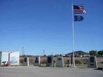
Camp Bouse
September 1943 to March 1944
"The Kid Battalion"
From Normandy to the Elbe:
•Normandy
•Northern France
•Ardennes
•Rhineland
•Central Europe — — Map (db m78563) HM
Dedicated to the men who gave time in their lives to serve honorably and courageously for our country. We take this moment in time to recognize their achievements which were done with pride and dignity.
* * *
Campaigns
Ardennes - Alsace - . . . — — Map (db m29160) HM
Campaigns
Ardennes, Rhineland and Central Europe
The 739th Tank Battalion was activated in March 1943 at Fort Lewis, Washington. The officers were from various states, the enlisted personnel from Oklahoma, Texas and Louisiana.
The . . . — — Map (db m78558) HM
The 740th tank battalion was activated at Fort Knox, Ky. on March 1, 1943. It trained at Fort Knox and at Camp Bouse, Az. as a canal defense light (CDL) unit and as a standard medium tank battalion from October 15, 1943 to April 24, 1944 then sailed . . . — — Map (db m78562) HM
The 748th Tank Battalion, Medium was activated on 20 August 1942 at Camp Rucker, Alabama. The Rhinos headed for Fort Knox on the 15th of April 1943 for training and on 20 April 1943 were reorganized as a special battalion equipped with CDL . . . — — Map (db m92814) HM
This building was built prior to 1912. The mercantile was known to do business with the A & C and Swansea railroads in 1916. It has been open continuously since that time. Bouse postmaster Cora L. Johnston moved the US Post Office to the store in . . . — — Map (db m39504) HM
Thomas Bouse was born in Mendecino County, California and came here about 1889 as a prospector and built the first two rooms of his home. He ran a small store here. He brought his wife, Katherine, and infant daughter here in 1892. Three more . . . — — Map (db m29070) HM
General George Patton established Camp Bouse in 1943 in the Butler Valley as the site for training over 5,500 carefully screened and qualified volunteers. These soldiers were trained to use a highly secret weapon called the Canal Defense Light. . . . — — Map (db m29165) HM
Camp Bouse was established in Butler Valley 30 miles behind this monument in Sept. of 1943. It was one of twelve such camps built in the southwestern deserts to harden and train United States troops for service on the battlefields of World War II. . . . — — Map (db m78566) HM
Campaigns
Central Europe Northern France Rhineland
The 701st tank battalion was activated 3/28/43 at Camp Campbell, KY. Here 553 young men and officers began their journey into history. These men began their basic training and for many saw . . . — — Map (db m78564) HM
Activated 1 April, 1943 at Camp Perry, OH. Completed basic training and then sent to Ft. Knox, KY. Unit then assigned to Camp Bouse, AZ arriving there 9 November, 1943. Maintaining operation of special tanks named "Leaflets" was specific assignment. . . . — — Map (db m78557) HM
United States Army
World War II
1924 – 2002
Whose dedication to the memory of his brothers in
arms, who fell in the Battle of the Ardennes, made this
historical park possible. — — Map (db m78542) HM
He was our drinking buddy
While on duty
He drank our beer
He was
Full of good cheer
And went to the nurses' quarters around the bend
And came to an untimely end,
Of the Colonel, he was unaware
That it would be the crime of all time . . . — — Map (db m78536) HM
We bring to a close
We tried to find
We must now impose
Units not found
748th Tank Battalion
150th Station Hospital
538th Ordnance Company
166th Quartermaster
629th Quartermaster — — Map (db m29161) HM
In honored memory of those soldiers of the battalion who trained here at Camp Bouse and gave their lives in combat to preserve the freedom of the United States and to set the Peoples of Europe free.
Headquarters Company
Donald D. . . . — — Map (db m78537) HM
Gold and silver strikes in the 1860's created growth in the area. It is said Wyatt Earp served as sheriff of Cibola for one year in the 1890's. The town of Cibola formed in 1898 and construction began on a 16 mile canal to bring water from the river . . . — — Map (db m78552) HM
Ferries of various size and design once provided transportation across the lower Colorado River linking Arizona with California, Nevada and Utah.
Ferrymen plied their trade from Yuma to Pearce Ferry. The first ferry on the river was started . . . — — Map (db m78553) HM
This monument built to
perpetuate the memory of
the pioneers, trailblazers,
and adventurers that rest
in these unmarked graves.
(Arizona Highway Department, 1934)
Rededicated: April 27, 2003 (CY 6008)
By the Ancient and . . . — — Map (db m31188) HM
We honor our ancestors who died violent deaths at the hands of their captors and at this concentration camp. We greet the spirits of our ancestors and embrace their strength and above all else, their will to survive this holocaust: the Hualapai . . . — — Map (db m36012) HM
First used sometime after June 16, 1862. Some of Arizona's earliest pioneers, people of every race and moral persuasion, lie here in eternal peace. The last burial was on April 22, 1988. — — Map (db m31827) HM
In the 1860's, Prospector Pauline Weaver discovered gold on the eastside of the Colorado River, setting off a mining rush in the area. Ore from nearby mines in the Buckskin Hills was transported by wagon down the washes to the Colorado River which . . . — — Map (db m145826) HM
[ The single 30 foot concrete pillar of the monument symbolizes "unity of spirit". The hexagonal base represents a Japanese stone lantern. The 12 small pillars situated around the monument make it a working sundial. Mounted on the 30 foot pillar . . . — — Map (db m32258) HM
McDonnell Douglas F-4 Phantom was a multi-service aircraft, served as primary fighter with Air Force, Navy and Marine Corps during Vietnam era. Carrying a crew of two, Pilot and Weapon Systems Officer, it was capable of speeds in excess of Mach . . . — — Map (db m118796) HM
The famous camel herd with which the name of Hi Jolly is linked constitutes an interesting sidelight of Arizona history.
Jefferson Davis (afterward president of the Southern Confederacy), as Secretary of War, approved a plan to experiment . . . — — Map (db m70566) HM
Established between 1899 & 1904. Existed until 1924. Overall dimensions 12' x 40', consisting of station and sleeping rooms. A breezeway separated rooms from main building. — — Map (db m7005) HM
Thomas P. Quinn, born in 1869 in New Jersey, had a mine near here and dug a cistern to catch water. He built a house just north of this sign and lived there until old age forced him to move to Bouse.
The remains of his cistern survive and . . . — — Map (db m29068) HM
Dug by hand around 1864 by a miner named Tyson. This 40-foot-deep well marked the spot around which grew the town of Quartzsite. Originally known as "Tyson's Well," "Tyson Wells," or "Tyson's Wells," the small community served as an important . . . — — Map (db m39416) HM
This was a stage stop between Ehrenberg and Wickenburg and points east. Travelers in the 1870's and 80's made their first stop here on eastward journeys from the Colorado River. "No grass, but good water," an early desert guide indicated . . . — — Map (db m7004) HM
Harrisburg was established on this site in 1886 by Captain Charles Harris, and his partner Governor Fredrick Tritle, as a mill town to process ore from the Socorro and other mines in the area. By 1887 two mills were operating here.
The post . . . — — Map (db m31821) HM
This desert town was made famous by the humor of Dick Wick Hall, healthseeker and operator of the laughing gas station. Hall's publication the Salome Sun was filled with extravagant tales of the desert's adaptation of species. He told of his frog . . . — — Map (db m31824) HM
Robson’s Mining World was originally opened by the Westley Rush Family in 1917 as the Gold Leaf Mine. Ned Creighton acquired the mine in 1924. He renamed the mine the “Nellie Meda” in honor of the two Rush daughters. The mine operated until 1942 . . . — — Map (db m158284) HM
Alchesay led his people in war and peace
Alchesay Canyon, to your right, was named for a great leader. Chief Alchesay, born around 1853, was a leader among the White Mountain Apache. Other Apaches looked up to him not only because he . . . — — Map (db m34073) HM
Apache Lake is the deepest on the entire chain of reservoir lakes on the Salt River. It was created by the construction of Horse Mesa Dam in 1927.
Apache Lake Marina will help you enjoy the Lake. Food, lodging and marina services are available. . . . — — Map (db m34063) HM
After nearly nine years of work, $430 million in construction cost, 450,000 cubic yards of concrete, and 849 miles of reinforcing steel, another vivid chapter in Arizona history has been rewritten. Modifications to Roosevelt Dam were required . . . — — Map (db m34107) HM
The construction of Roosevelt Dam involved several thousand people over the course of the project. Hiring was straightforward; a foreman would simply size up a man and decide if he could do the work. Jobs requiring diverse skills were plentiful. . . . — — Map (db m34108) HM
"The Apache Trail combines the grandeur of the Alps, the Glory of the Rockies, the magnificence of the Grand Canyon and then adds an indefinable something that none of the others have. To me, it is the most awe-inspiring and most sublimely . . . — — Map (db m34066) HM
Main Marker - Side A:
The Historic Gillespie Dam Bridge spans the Gila River on Old US 80 Highway, between the communities of Arlington and Gila Bend. Built in 1927 as a Federal Aid Project, the bridge is a unique and elegant reminder of . . . — — Map (db m54936) HM
In December 2011, as the Historic Gillespie Dam Bridge approached its 85th year of service, the Maricopa County Department of Transportation began a major bridge rehabilitation and repair effort to save one of Arizona's earliest and most significant . . . — — Map (db m69445) HM
Marker 1 - (Main Marker):
The original Verde River Sheep Bridge, also known as the Red Point Sheep Bridge, was constructed at this location in 1943 by Flagstaff Sheep Company, which had been grazing sheep in the area under a Forest . . . — — Map (db m53966) HM
The land surrounding this cemetery represents the beginning of commercial cotton growing in Arizona.
In January 1917, during World War I, the Goodyear Tire and Rubber Company founded the Southwest Cotton Company to begin producing long-staple . . . — — Map (db m34554) HM
This small plot of land was designated a cemetery by the Goodyear Tire and Rubber Company of Akron, Ohio. Goodyear owned and farmed the surrounding acreage from 1916 until 1943. Goodyear workers and their families are buried here. Local oral history . . . — — Map (db m34555) HM
Anderson Building, 1914
Chandler Historic Commercial District on the National Register of Historic Places
Built by local Chandler rancher and early business investor John Anderson, this structure was home to Curry and Frye's Pool Hall, . . . — — Map (db m72037) HM
Bank of Chandler, 1912Dr. A. J. Chandler built the original structure on this site to serve as the main office for his Chandler Improvement Company. The Bank of Chandler shared this building until 1925. Bogle Farms and other offices operated . . . — — Map (db m71000) HM
Dougherty Building, 1914
Chandler Historic Commercial District on the National Register of Historic Places
This building, constructed by Michael F. Dougherty, has been home to a number of businesses, including the Charles Karp Clothing . . . — — Map (db m71008) HM
He knew no yesterdays
His living was for tomorrow
Founder of the town of Chandler
Built the San Marcos Hotel
Arizona’s first veterinarian
Father of modern irrigation system
Pioneer rancher and developer of the southside area of . . . — — Map (db m70990) HM
John Dobson and John Anderson built the First National Bank in the Neo Classical Style. In 1925 the Bank of Chandler moved into this building, complete with its marble faced columns. In the late 1930’s, the prominent Valley National Bank took over . . . — — Map (db m100867) HM
Chandler's first physician, Dr. Kramer M. Gilbert, built this structure in order to create a permanent medical office. He practiced here for more than thirty years. On the top floor, Chandler's first dentist, Dr. William Barackman, provided services . . . — — Map (db m292136) HM
Side A:
Historic A.J. Chandler Park
The centerpiece of Dr. A.J. Chandler’s town design in 1912 was a large, rectangular central park. In the early years, this park was covered in Bermuda grass, trees, and included footbridges over . . . — — Map (db m70980) HM WM
Hotel Chandler, 1914
Chandler Historic Commercial District on the National Register of Historic Places
The second story of this building was the Hotel Chandler, an affordable alternative to the luxurious San Marcos Hotel. Starting in 1917, . . . — — Map (db m72133) HM
Monroe Building, 1912
Chandler Historic Business District on the National Register of Historic Places
Built by the Chandler Improvement Company, this building is named for merchant M. E. Monroe, who opened the Monroe Hardware Store in the . . . — — Map (db m71001) HM
Morrison Grocery, 1912
Chandler Historic Business District on the National Register of Historic Places
Ernest and Leroy Morrison opened the Chandler’s first grocery here in 1912. The building has been host to a series of grocery stores, the . . . — — Map (db m71003) HM
Price Building, 1914
Chandler Historic Commercial District on the National Register of Historic Places
Chandler's first elected Mayor, David Jacobson, built this structure. It is named for Arthur E. Price, Chandler's first attorney and . . . — — Map (db m72051) HM
Suhwaro Hotel, 1916
Listed on the National Register of Historic Places
This Spanish Mission Revival building had many uses, including a hotel, school and bowling alley. The San Marcos Hotel purchased the Suhwaro Hotel in 1924 for staff . . . — — Map (db m49867) HM
Designated Historical
as part of Downtown Chandler
Built in 1928
as the original
IOOF Hall and Armory
Remodeled in the 60’s
into a medical and
apartment complex
Restored back to it’s
original design
in 2001 by the . . . — — Map (db m100876) HM
From 1866 to 1868 this outpost of Ft. McDowell served as a departure point for military expeditions against the Tonto and Pinal Apache Indians. — — Map (db m27679) HM
Canyon Lake was formed following the construction of Mormon Flat Dam from 1923-25 by USDI, Bureau of Reclamation. Salt River Project manages the dam for water storage and power generation. Water stored in this reservoir is collected from the 13,000 . . . — — Map (db m34062) HM
This important military post protected central Arizona settlements from the Tonto Apaches during the Indian wars 1865-1886. Its function as a military post ended in 1890 and it became a reservation by executive order, September 15, 1909 as home of . . . — — Map (db m27681) HM
Greatest of the educated Apaches, this Mohave-Apache Indian was taken captive at the age of six by Pima Indians. He was sold to a white man who educated him as a physician. Dr. Montezuma had a splendid practice in Chicago and became a champion of . . . — — Map (db m27680) HM
The longest continuous running business in Gilbert is still owned and operated by the sons of Tom Clement. Tom came to Gilbert to run the garage and service station in 1934. He raised his family here and later served as the Mayor of Gilbert from . . . — — Map (db m88083) HM
This building was originally the Creed Store. The 1923 picture below is of Raymond R. Creed who served as the Mayor of Gilbert in 1925. Ethel Hoffman Lacy, shown in the center of the photo, was the postmaster at this time. Winnie Johnson, wife of . . . — — Map (db m88070) HM
For many years this site was a vacant lot. In the late 1930s Mr. Templeton converted the lot into a dance pavilion. He constructed a wood floor, added lights and surrounded it with a fence. Couples who came to dance on Saturday nights paid ten cents . . . — — Map (db m88081) HM
This is the third elementary school in Gilbert and was built in 1913. The first two schools were part of the Mesa School District. Everett Wilbur, who later became Gilbert’s first mayor in 1920, donated the land where this school was built. The east . . . — — Map (db m94589) HM
The Gilbert town hall was built in 1938 to serve the area's 1400 residents. This building consisted of a fire station with a jail behind it. The courthouse and council chambers were also in the building. On January 2, 1938, Congress approved the . . . — — Map (db m88082) HM
Eddie and Edith Dong built Liberty Market in 1936. It was a very modern store at that time. Ben Ong, a native of China, came to the United States in 1929 and began working at Liberty Market in 1936. Ben married Mae in a typical Chinese family . . . — — Map (db m88065) HM
In 1925 the well for Gilbert’s domestic water was drilled to the depth of 475 feet where a large flow of pure water was found. A six-inch pipe was sunk to bring the water to the surface. The tower and pumping station were constructed during the . . . — — Map (db m90238) HM
The Bank of Gilbert was built in 1917. One of the men instrumental in the creation of the bank was Abe Cosby (pictured below on right) who came to Gilbert to invest in land and open a real estate office. Bill Andersen, (shown of left) one of the . . . — — Map (db m88069) HM
In 1918 Timmons garage was located on this site. Mr. Timmons sold the garage to Albert Tone, an accountant and Gilbert's first mail carrier, who went into business with Charles M. Blakely repairing Model T Ford automobiles. In 1924 Blakely took the . . . — — Map (db m88067) HM
This district is listed in the
National Register
of Historic Places
By the United States Department of the Interior
Listed
September 6, 2006
This District is part of Block 9 and 16 of the Hadsell's Addition. The District is . . . — — Map (db m30498) HM
This house, which is the oldest building at Sahuaro Ranch, is believed to have been built in 1887, one year after William Bartlett started the ranch. It was constructed of adobe bricks made here at the ranch, possibly using dirt that was excavated . . . — — Map (db m40639) HM
Farm and ranch work have always been hard on machinery, making frequent repairs necessary. Throughout Sahuaro Ranch's history, most of these repairs were made here by the ranch's own employees.
This building, which is believed to have been . . . — — Map (db m40676) HM
C. L. Gillett, businessman and member of the first Glendale City Council, built this two-story brick building. The first floor was used for businesses, and the second floor was used as a meeting hall. E. J. Fiock bought the building in 1910, for his . . . — — Map (db m30438) HM
USS Arizona (BB-39)
Launched June 19, 1915
Commissioned October 17, 1916
This memorial honors the human sacrifice and courage of every military veteran who defends the freedom of all Americans, regardless of the battlefront. This is . . . — — Map (db m40586) HM
The corrals here are the remnants of the sprawling complex of corrals and pastures needed to raise the livestock that was always important to the operations of Sahuaro Ranch.
In early years, horses and mules were the primary source of power for . . . — — Map (db m40686) HM
On November 14, 1940, Tom Coury signed an agreement with building contractor, H. D. McNeely, and the Glendale Lumber Company to construct a 42' x 65' brick building at a cost of $3,911. Upon completion of the building, Smart and Final Wholesale . . . — — Map (db m30439) HM
Although some cows were probably always kept on the ranch to supply fresh milk and butter, it was not until after Richard W. Smith bought Sahuaro Ranch in 1927 that dairy cows were raised here commercially.
At first the Smith family sold only . . . — — Map (db m40662) HM
This structure was built in 1909 as the north half of the Hotchkiss building. It was a pool hall prior to 1918, when C. H. Tinker (Mayor 1918-20) purchased and remodeled it for his Security State Bank which he renamed The First National Bank of . . . — — Map (db m171615) HM
Built sometime around the turn of the 20th century, this house was the last residence to be constructed at Sahuaro Ranch.
Little is known about who lived in the house, but it appears to have been built as a residence for the employees of William . . . — — Map (db m40688) HM
This packing shed, constructed in 1891, is one of the oldest farm buildings on the ranch. It was designed by James M. Creighton, a prominent architect in territoral Arizona.
Exactly how the shed was used is not known, but presumably it was here . . . — — Map (db m40702) HM
Settled in 1892, Glendale developed its own "downtown" where residents obtained the goods and services they needed. It was also where local farmers shipped the fruits, vegetables, and livestock they raised to national markets. Glendale blossomed . . . — — Map (db m30474) HM
This property
is listed in the
National Register
of Historic Places
By the United States
Department of the Interior
Glendale High School
Auditorium
1939 — — Map (db m30481) HM
This property is listed in the
National Register
of Historic Places
By the United States Department of the Interior
Listed July 7, 1989
In 1901, a small group of pioneer women organized the Self Culture Club of Glendale with the . . . — — Map (db m30478) HM
In 1916, during World War I, patriotism was running high in our country and in the little town of Glendale. The citizens of Glendale were looking for a way to express their patriotism. Under the guidance of Mayor A. W. Bennett and town engineer, . . . — — Map (db m30473) HM
Mrs. Alice S. Hine, an agent for the Phoenix Title and Trust Company, hired a contractor by the name of Home Builders Company to build the two-story masonry structure in 1913. In 1919, Mrs. Hine added a substantial addition to the building along . . . — — Map (db m30435) HM
Brethren businessmen S. Humphrey and A. Davidson, the largest agricultural shipping agents in the area, built this single-story brick commercial building to house their dry goods business. This building shifted Glendale's commercial focus from the . . . — — Map (db m30437) HM
The water for Sahuaro Ranch came by gravity flow from the Arizona Canal, located about two miles to the north. It was carried from the canal by a ditch on 59th Avenue known as Lateral 18 and then flowed onto the ranch through smaller ditches such . . . — — Map (db m40706) HM
The large house to the right, now known as the Main House, was the home of the superintendent who managed Sahuaro Ranch for its owner, William Bartlett. The oldest section, on the right, was built in 1891 as an office. In 1895 it was expanded and . . . — — Map (db m40622) HM
This property is listed in the
National Register of Historic Places
By the United States Department of the Interior
Listed
January 11, 2006
The First United Methodist Church of Glendale was originally chartered as the Methodist . . . — — Map (db m30475) HM
Originally known as "The Park" or "City Park," Murphy Park has always been the center of downtown Glendale. The park's namesake, W. J. Murphy, established Glendale in 1892 and donated the park to the town in 1909. Residents protected the park as a . . . — — Map (db m30432) HM
The most important crops in the early years of Sahuaro Ranch were fruits and nuts. These commanded high prices, which meant they could profitably be raised here and sold to buyers across the country despite the high cost of shipping from such a . . . — — Map (db m40705) HM
Robert W. Cole bought three lots on the east side of the park in 1919. He hired J. C. Howell, a local architect to design the two-story building, and Robert Fultz was the builder. Construction started in June of 1919, and finished in September of . . . — — Map (db m30434) HM
National Register of Historic Places
Listed March 7, 1980
United States Department of the Interior
Sahuaro Ranch was one of the first farms in the Glendale area and a reminder of Glendale’s agricultural beginnings. Started by wealthy . . . — — Map (db m28088) HM
"The residence on the Ranch is not a characteristic Arizona farm houses, as it contains thirteen bedrooms, eight of which are equipped with baths. The house rambles over considerable territory and, in the summer, the lawn is a wonder of . . . — — Map (db m40636) HM
Floyd Holmes Sine came to Arizona in 1897. Sine is considered to be the father of Glendale's city water system. When he bought this site in 1910, it was the only public well and water system. He added a storage tank and supply lines to the . . . — — Map (db m30440) HM
Floyd Homes Sine, builder of the Sine Brothers Hardware Building on 58th Drive, built this distinctive two-story masonry structure in 1926. The Glendale Furniture Company was the ground floor business, and the second floor was used as meeting space. . . . — — Map (db m30436) HM
Little is known about the history of this building, which started out as a horse stable, but it almost certainly was one of the earliest work buildings to be erected at Sahuaro Ranch.
The eastern half, with the vertical wood siding, was built . . . — — Map (db m40685) HM
The barnyard was the center of activity as Sahuaro Ranch. Horses and mules were stabled, trained, and shoed here. Cattle were brought to the corrals for branding, treatment and shipment. Farm implements and wagons were stored and repaired here. . . . — — Map (db m40674) HM
791 entries matched your criteria. The first 100 are listed above. Next 100 ⊳