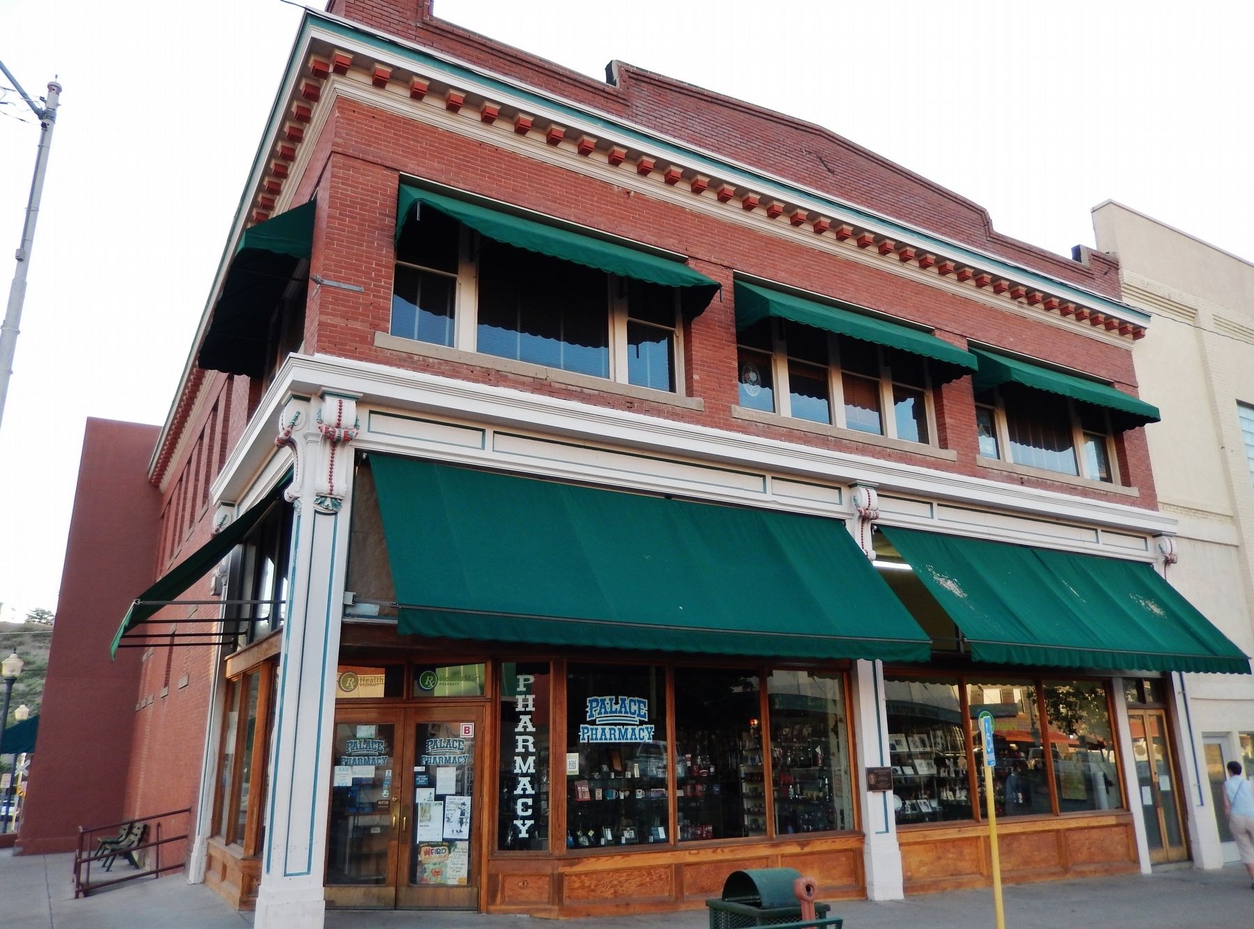
Welcome to Globe's Historic Downtown District, a designated Main Street City which once played a vital role in the saga of the Old West. We invite you to walk the steps of Historic Gila County Courthouse where you can enjoy the breathtaking . . . — — Map (db m28048) HM
You are standing next to the Cobre Valley Center for the Arts, located in the Old Gila County Courthouse. In 1905, stone masons working on Roosevelt Dam were contracted to build this imposing structure which is on the National Register of . . . — — Map (db m28193) HM
This pass was used by Kearny's Army of the West in a march to California in 1846. Guided by Kit Carson it was described in a journal of the trip as "Carson's Old Trail”. The pass led around the impassable canyon on the Gila River where . . . — — Map (db m28045) HM
George W.P. Hunt, Arizona's first Governor, arrived in Globe as a poor prospector. His first job was sweeping out a Saloon, but he eventually served four terms as Governor, beginning at Statehood in 1912. He campaigned on the back of a burro and . . . — — Map (db m67465) HM
This property
has been placed on the
National Register
of Historic Places
By the United States
Department of the Interior
Circa 1919 — — Map (db m67462) HM
Globe, Gila County, Arizona
Apache Warrior Stronghold
and Pioneer Home of
Hon. George W. P. Hunt
1859 – 1934
Member various Territorial Legislatures, President Arizona Constitutional Convention, Arizona's 1st, 2nd, 3rd, 6th, . . . — — Map (db m28047) HM
Colorful Arizona pioneer and faithful Gila County public servant. At intervals from 1885 to 1947, within the walls of three courthouses erected on this spot, he occupied various offices. His last office was Clerk of the Superior Court 1912 to 1947. . . . — — Map (db m28046) HM
Located along this road
McMillenville
Ghost Mining Camp
In 1874 native silver was discovered in what became the fabulous Stonewall Jackson Ledge. This discovery brought boom conditions that lasted less than 10 years. An Indian attack on . . . — — Map (db m36905) HM
Included in this historic copper mine are the Globe ledge silver claims. Discovered in 1873, the first to yield profitable ore in the Globe-Miami district. The Old Dominion included many other early claims. Production ceased in the 30s, due to . . . — — Map (db m67463) HM
John Henry Thompson, a noted Gila County pioneer, brought his bride, Carrie Louise Nash, to Globe to live in the house he had built on this site, one of the town's early adobe buildings. Thompson was active in mining, cattle ranching and the feed . . . — — Map (db m34119) HM
In 1916, Jakes Corner originally called Felton, started as a stage stop, on the Annie Hardt homestead.
As a pull out on the road to Globe, stages used to stop and wait as the occasional flooding Salt River receded. Annie Hardt had a vegetable . . . — — Map (db m48354) HM
In Remembrance of the Quasquicentennial of the Spanish-American War
To Spanish-American War Veterans of Gila County and the Woman's Relief Corps of Arizona who Helped in the War Effort
2023
Buckey O'Neill Camp No. 175 - AZ
Sons of . . . — — Map (db m278886) WM
This property
has been placed on the
National Register
of Historic Places
By the United States
Department of the Interior
Bullion Plaza
School
1923
— — Map (db m67493) HM
This wall is to honor the memory of all of the veterans who have served in the Armed Forces of this great nation, in war and in peace. They have placed themselves in harms way to serve a cause greater than themselves. Ensuring that the freedom we . . . — — Map (db m67472) WM
This property
has been placed on the
National Register
of Historic Places
By the United States
Department of the Interior
Soderman
Building
1917 -1921
— — Map (db m67474) HM
This historic mail trail is dedicated to the memory of the mail riders named below and unknown mail carriers that braved weather, rough terrain and the Verde River to deliver mail 52 miles from Camp Verde to Payson, Arizona from 1884 to 1914.
. . . — — Map (db m36063) HM
Dedicated
to
Firefighters
who made the
Ultimate Sacrifice
to protect our magnificent
Mogollon Rim Country
Date - Fire Name - Victim's Name - Remarks
6/15/61 - Roberts - Chuck Cochane - Pilot TBM Air Tanker
6/21/61 - . . . — — Map (db m67406) HM
In 1932 a log building named the Payson Hotel was built on this site. In 1954 it was remodeled, together with the building to the west, as the Ox Bow Inn and Saloon. The name comes from Oxbow Hill, the gateway to Payson, named when soldiers in the . . . — — Map (db m67403) HM
The Rim Country Museum complex is the site of the first headquarters for the Payson Ranger District, Tonto National Forest. The original buildings were placed here in 1907. The Ranger's family house is the second one, built in 1933. The ranger . . . — — Map (db m67407) HM
Shoofly Village Ruin is the remains of a large masonry and Jacal prehistoric community. It contains 80+ rooms and covers 4 acres. Between A.D. 1000 and 1200 as many as 250 people may once have lived inside its walls. The people made their living by . . . — — Map (db m67415) HM
On this strategic site, J.W. Boardman built a rock building and constructed a mercantile business. McLane Road, going north along the property, was the road to Pine and points north and west. The store was gutted by fire in 1938. Refrigerator . . . — — Map (db m67405) HM
The two-story Herron Hotel burned down in 1918 at this location. Subsequently a series of businesses were established on this block. Among them were Payson's first gasoline station, an ice cream parlor, barber shop, mercantile store, and finally the . . . — — Map (db m67404) HM
On June 25, 1990 a lightning caused fire entrapped ten members of the Perryville fire crew in this canyon, resulting in six fatalities. Before the fire was contained it had burned more than 24,000 acres and destroyed over 70 structures.
This . . . — — Map (db m28210) HM
The deadliest natural disaster in Arizona history occurred over Labor Day weekend in 1970 when a tropical storm named Norma swept north into Arizona and turned deadly releasing a downpour of heavy rain. One weather station measured nearly 12 . . . — — Map (db m157859) HM
These Trees Planted in Memory of the Firefighters Who Died in the Dude Fire June 26, 1990
Sandra J. Bachman • Joseph Chacon • Alex S. Contreras • James L. Denny • James E. Ellis • Curtis E. Springfield — — Map (db m28211) HM
In memory of
William H. Goettl
April 17, 1915 September 17, 1979
With his own sweat and love he restored Zane Grey's Cabin. Bill was an Arizona outdoorsman, conversationalist and pioneer in the air conditioning industry. A true man of . . . — — Map (db m157857) HM
An Ohio born dentist, Zane Grey spent many years under the Mogollon Rim, writing "To the Last Man" and a dozen other westerns with Arizona settings and characters. His prolific writings popularized the American cowboy as a taciturn, romantic . . . — — Map (db m67413) HM
This historic mail trail is dedicated to the memory of the mail riders named below and unknown mail carriers that braved weather, rough terrain and the Verde River to deliver mail 52 miles from Camp Verde to Payson, Arizona from 1884 to 1914.
. . . — — Map (db m67417) HM
The Pine Community Center Historic District is listed on the National Register of Historic Places. The historic buildings of the district are the LDS (Latter Day Saints/Mormon) Ward Chapel, built in 1915-1916, the Cultural Hall, completed in 1931, . . . — — Map (db m67416) HM
Veteran of the Civil War and for twenty years a leader of Scouts for the U.S. Army in Arizona Indian troubles. Was killed on this spot February 19th, 1907 by a rolling rock during construction of the Tonto Road. His body is buried in the cemetery at . . . — — Map (db m34114) HM
The Salt River begins high in the White Mountains as runoff from melting snow, finding its way into streams and creeks that eventually form the White and Black rivers. The confluence of the two rivers marks the beginning of the Salt.
Early . . . — — Map (db m34110) HM
Before dam modifications could begin, a $21.3 million bridge was built to relocate traffic off the top of Roosevelt Dam. Roosevelt Lake Bridge is the longest two-lane, single-span, steel-arch bridge in North America. The bridge, spanning 1,080 feet . . . — — Map (db m134161) HM
Over six million years ago, the mountains surrounding you were lifted skyward. As they rose, the land in between sank, creating the valley known as Tonto Basin.
Melting snow and summer rains drain from the vast Salt River watershed toward the . . . — — Map (db m34111) HM
Built by
The United States of America
Department of Interior
Bureau of Indian Affairs
Irrigation Service
Calvin Coolidge
President of the United States of America
Roy O. West Secretary of the Interior • Hubert Work Secretary of . . . — — Map (db m81530) HM
The Strawberry School is listed on the National Register of Historic Places. Built by pioneers in 1885, this one-room cabin provided elementary instruction to students until 1916. The building represents the effort to teach the "Three Rs" in rural . . . — — Map (db m35837) HM
One of the West’s Longest and Bloodiest feuds took
place here and around Pleasant Valley. The Grahams and
the Tewksburys had been in the cattle business and it
seems probable that they first fell out over the division of cattle they jointly . . . — — Map (db m78742) HM
First home of the present Eastern Arizona College was Central's red-brick churchhouse located just north of this marker. Founded December 1890 The many-named school moved the next year to Thatcher. — — Map (db m28054) HM
Named for the rebellious medicine man who led the Chiricahua Apaches on their last raids, to surrender, and then into exile in Florida and Oklahoma. Their descendants lived in Eastern Arizona again. This was also the site of original Camp Thomas, . . . — — Map (db m28050) HM
Melvin Jones was born on January 13, 1879, near this site in Fort Thomas. He lived here for the first eight years of his life, during the Indian Wars here. In 1917, Melvin Jones formed Lions Clubs International with 20 delegates representing 27 . . . — — Map (db m28051) HM
A well-known Tucson architect, H. O. Jaastad, designed this imposing neo-classical revival structure in 1920. Snell & Harvey of Phoenix erected the building for around $50,000. The concrete foundation is capped by brick construction. Two terra cotta . . . — — Map (db m61511) HM
Since Graham County's formation in 1881 the courthouse had been relocated four times. It had been housed in an adobe structure in Safford, two sites in Solomonville, and the Rig's Building on Main Street when the county seat was returned to . . . — — Map (db m287408) HM
In Memory Of
Horatio Harris Merrill
Born January 3, 1837
And his daughter
Eliza Ann Merrill
Born July 27, 1881
Who, while traveling by team and wagon from Pima, Arizona to Clifton, Arizona, were . . . — — Map (db m36243) HM
In Memory of two of the
many pioneers who brought
law, order and safety to
the Gila Valley.
Lorenzo and Seth Wright
were killed 1 mile north of
this spot by Indians who
had stolen 45 horses from
early settlers.
While . . . — — Map (db m28170) HM
This monument commemorates the sesquicentennial celebration (1847 – 1997) of the Mormon pioneers' arrival into the Salt Lake Valley. The following groups are recognized for their contribution to the settlement of this Gila Valley. Native . . . — — Map (db m61509) HM
In June 1920, the State Lodge of Odd Fellows and Rebekahs announced that a home for orphans and the elderly would be built on the 13-acre Beebe Homestead in Safford. Construction started in December from plans drawn by architect William Bray of . . . — — Map (db m195857) HM
Safford City Hall started life as a school building. Safford School System bids for the North Ward School were opened in February 1898. The contract was awarded to R. A. Smith Jr. and John Morris. The new building was ready for the fall term in . . . — — Map (db m36369) HM
The Route of:
Coronado in search of the Fabled Seven Cities of Cibola. 1540
————
James O. Pattie and other famous trappers along the Gila River.
1825-26
————
Gen. Stephen W. Kearny and . . . — — Map (db m48612) HM
Gila Valley Bank, forerunner of the Valley National Bank of Arizona, was formally organized on this site December 15, 1899, opening January 16, 1900. The bank was originally housed in the northeast corner of the I. E. Solomon Commercial Company . . . — — Map (db m28060) HM
Named for Isadore Elkan Solomon, a pioneer settler, who in 1876 burned charcoal here for supplying fuel to the Lesinsky Brothers' Copper Smelter near Clifton. First Treasurer of Graham County. Early day merchant, postmaster, and one of the founders . . . — — Map (db m28059) HM
When Andrew Kimball was called to preside over the St. Joseph Stake in 1898, Church members provided ten acres on which he built this adobe and brick home in 1902. He helped make the 12,000 adobes. His son, Spencer W. Kimball, 12th President of the . . . — — Map (db m61510) HM
The Apache Trail was created by Native American tribes traveling between their summer homes in the mountains and winter homes in the desert. The Trail became a roadway in 1905, for use in hauling supplies to the construction site of Roosevelt Dam. . . . — — Map (db m145828) HM
The Bluebird Mine and Gift Shop was been known as the ghost town of Goldfield since 1947. When George (Red) Monagan reopened Goldfield by reestablishing the name and town with the Bluefield Mine Pop Stand. Red gave life to Goldfield in 1947 making . . . — — Map (db m93059) HM
During its heyday from 1893 to 1898 when $1,000,000 in gold was mined from this area about 300 people dwelt here with majestic Superstition Mtn. in the background. 300 ft. south of this sign is the old Bluebird Mine found in the gold rush of 1893. A . . . — — Map (db m93058) HM
Originally called the Superstition Mining District, this district had its heyday from 1893 to 1898.
The greatest producing mines were the Mammoth, Black Queen and Bull Dog. Their output was around a million dollars in gold and silver based on . . . — — Map (db m34059) HM
This Historical Spot
1892 to 1898
was part of the Mammoth Mine claims known as the Montezuma in 1893. Then after 1910 became known as
Calamity. In 1944 this claim became known as the Bluebird.
The Bluebird Mine was found in 1893 and first . . . — — Map (db m93130) HM
Dedicated October 1961
To the Memory of
Jacob Von Walzer
1808 – 1891
One of America's most famed legendary figures, whose exploits have stimulated the imagination of peoples everywhere by his contribution to the heritage of his . . . — — Map (db m74394) HM
On September 20, 1906 the first stone was laid in place. Over the next five years, 350,000 cubic feet of block would be cut, shaped, and fashioned into the Roosevelt Dam.
The blocks of stone were carved out of the canyon walls. They were . . . — — Map (db m34106) HM
This entrance marker is constructed of hand-hewn blocks which once made up the façade of Roosevelt Dam. They were given to the Superstition Mountain Historical Society by the United States Bureau of Reclamation. The larger blocks weigh upwards of . . . — — Map (db m34060) HM
Erected Nov. 11, 1945
In Memory of the Men
of St. Peter's Mission
Who served in World War II
* Anthony Jose USA • Felix Kayyittan USA • Leo B. Manuel USA • Leonard Pangott USA • Roger Osife USA •
Albert J Moreno USMC • Chester J . . . — — Map (db m33700) HM
James Addison Peralta Reavis was a brazen forger who claimed over 12 million acres of Central Arizona and Western New Mexico as an Old Spanish Land grant. He and his family lived here in royal style until his fraud was exposed. From the barony he . . . — — Map (db m27209) HM
The Gila River north of this site marked the international border of the United States and Mexico from 1848 to 1854. James Gadsden negotiated to purchase 38,000 sq. miles of "Wild country” for $15 million in gold. Amended to $10 million for 29,640 . . . — — Map (db m250242) HM
This fieldstone structure was built in 1927 and served as the First Presbyterian Church until 1970. Rocks used in the construction were gathered from the desert and hauled to town. Renovation of the sanctuary was accomplished in 1984 and now serves . . . — — Map (db m27208) HM
Who camped here Dec 20, 1846
in rout to Cal. War with Mexico.
Erected By
Aaronic Priesthood Mesa 3rd Ward L.D.S.C.
Troop 57 Boy Scouts of America R.C.
Hugh Dana Sp.• Joseph Moody S.M. •
F.K. Pomeroy 1st Coun • T. Elmer Hastings Asst . . . — — Map (db m27207) HM
The Park's opening in the Spring of 2019 includes 12 historic signs along with plaques detailing their significance. The Casa Grande Neon Sign Park neon on the marquee sign in front of you was repurposed from the "TOOLS" sign that was in front of . . . — — Map (db m269105) HM
In the 1700s and early 1800s, only a trickle of travelers came by the Casa Grande. First Spanish explorers, and then Mexican and American travelers wondered who built the ruin and why. More people visited after 1879 when the railroad first reached . . . — — Map (db m269157) HM
He laid the foundation of the National Park Service. Defining and establishing the policies under which its areas shall be developed and conserved unimpaired for future generations. There will never come an end to the good that he has done. — — Map (db m27206) HM
The Casa Grande is the most prominent remnant of an ancient civilization that once occupied the Salt and Gila River valleys from A.D. 300-1450. Archeologists call these people Hohokam, a Pima word meaning "those who are gone."
The Hohokam were . . . — — Map (db m32438) HM
Archeologists don't know for sure: Its original purpose remains a puzzle. Here, there are still more questions than answers.
Was it an ancient astronomical observatory? Perhaps. Why do the walls line up north-south-east-west? Unknown. We can . . . — — Map (db m269110) HM
In 1879 the Southern Pacific Mail and Stage Line Company built a one-room adobe station and mesquite corral. It was a horse changing and water stop on the route from the railroad station at Picacho for passengers going to Florence and beyond. In . . . — — Map (db m68220) HM
This Sonoran-styled adobe house was built by rancher Andronico Loroña in 1886 and it is typical of the houses built in early Florence by ranchers. The original flat roof was replaced with a pitched roof covered with tin. Loroña lived here with . . . — — Map (db m68358) HM
The first fired-brick building in Florence was built here in 1886 for William R Stone, District Court Clerk, later Territorial District Attorney. The next year Stone added an office where he and District Attorney Richard E. Sloan, later Judge and . . . — — Map (db m26804) HM
Completed in 1912, the Church of The Assumption is an example of the Mission Revival style of architecture. The third church built for Assumption Parish, it replaced the second church built on this site in 1884, which burned down in 1893. This . . . — — Map (db m26687) HM
Near this site on the evening of October 3, 1926, John "Button" Salmon, student body president and quarterback of the University of Arizona football team, was critically injured in a car accident while returning from a weekend in Phoenix with two . . . — — Map (db m26664) HM
Town founder Levi Ruggles built a store on this site in 1876. In 1882, it became Peter Will's Brewery. It was demolished for the construction, in 1915, of the C. G. Powell People's Store, a single-story, commercial building. Prominent Phoenix . . . — — Map (db m26734) HM
This American-Victorian (Queen Anne) house was built in 1889, by its owner Charles D. Henry. Henry was a building contractor who specialized in brick and built other houses in Florence of similar architecture. These probably included the . . . — — Map (db m71773) HM
This memorial is dedicated to the men and women who served our county in war and peace and to a significant era of rich local history.
Camp Florence, an army training facility, once occupied the grounds now known as "Four Parks". Beginning . . . — — Map (db m32440) HM
Built between 1886 and 1889, this Sonoran row house was the most common house type in territorial Florence. It was transformed to Spanish colonial revival in 1940. This house displays features like the stepped parapet and mission-tile canopy. . . . — — Map (db m68385) HM
This mid-1870 commercial building was built on the corner of Main and 7th streets. This Sonoran style building is the most intact of the four remaining untransformed examples of the adobe-walled, earth-roofed Sonoran traditional design which still . . . — — Map (db m26718) HM
"The Father of Arizona"
Born April 20, 1825 — Died June 24, 1902
Native of Kentucky
Elected as first Arizona Delegate
To Congress in 1864
This Monument erected by the
State of Arizona in Conjunction with
Maricopa Chapter . . . — — Map (db m26662) HM
This two-story red-brick commercial building was constructed in 1890 for Conrad Brunenkant. The bricks were locally made, and the rock-faced cut lintels and sills are from locally quarried stone. The exterior was altered in 1973 when the porch with . . . — — Map (db m26682) HM
The western portion of this adobe brick house was built for Frank and Isabella Cosgrove in 1878. It was originally constructed with dirt floors, roof and a Sonoran corner fireplace.
During the 1890s, Theophile Nicholas "Americanized" the . . . — — Map (db m26800) HM
Built in 1890, the store originally had unplastered adobe walls, a gabled roof, and a large, commercial-style glass display front. After Denier & Richmond, the building housed the C.R. Michea Store from 1897 to 1907, and then the Michea-Arballo . . . — — Map (db m26790) HM
Built in 1874 of unplastered adobe with pitched roofs, this second Edward Nye Fish mercantile store in Florence changed hands to become the, Joseph Collingwood & Co. Store and Wells Fargo office in 1877. Collingwood, Florence's first postmaster, had . . . — — Map (db m26717) HM
Edward Nye Fish, prominent Tucson merchant, and his partner/manager Joseph Collingwood, first Florence postmaster, opened Florence's first store in this building in 1868.
Building additions from 1867 to 1888 formed a U-shaped complex, and . . . — — Map (db m26708) HM
Built for Pablo and Elena Llescas in the early 1860s, this single-story row house has two exterior walls not parallel with respect to the other walls. This indicates construction prior to the 1866 Ruggles Street Grid. This building is constructed on . . . — — Map (db m26795) HM
This 1881 Sonoran/Early Transitional adobe was home to the Elmer Coker family in 1907. A prominent cattleman and lawyer specializing in land and water rights. Coker was a delegate to the Arizona Constitutional Convention and is considered the father . . . — — Map (db m26626) HM
Emma Monk came to Arizona Territory to teach school at Fort Thomas in the 1880s. She married William Guild in 1887 and taught school in Florence off and on from 1885 to 1897 and was the first Florence principal. She also taught in Red Rock, Casa . . . — — Map (db m68337) HM
This adobe building, which was designed by Levi Ruggles and built in 1878, combines Sonoran and Anglo-American architectural features typical of Territorial Arizona. It was the courthouse until 1891 and then served as a hospital, health center, home . . . — — Map (db m269160) HM
167 entries matched your criteria. The first 100 are listed above. The final 67 ⊳